-
 #188 /100
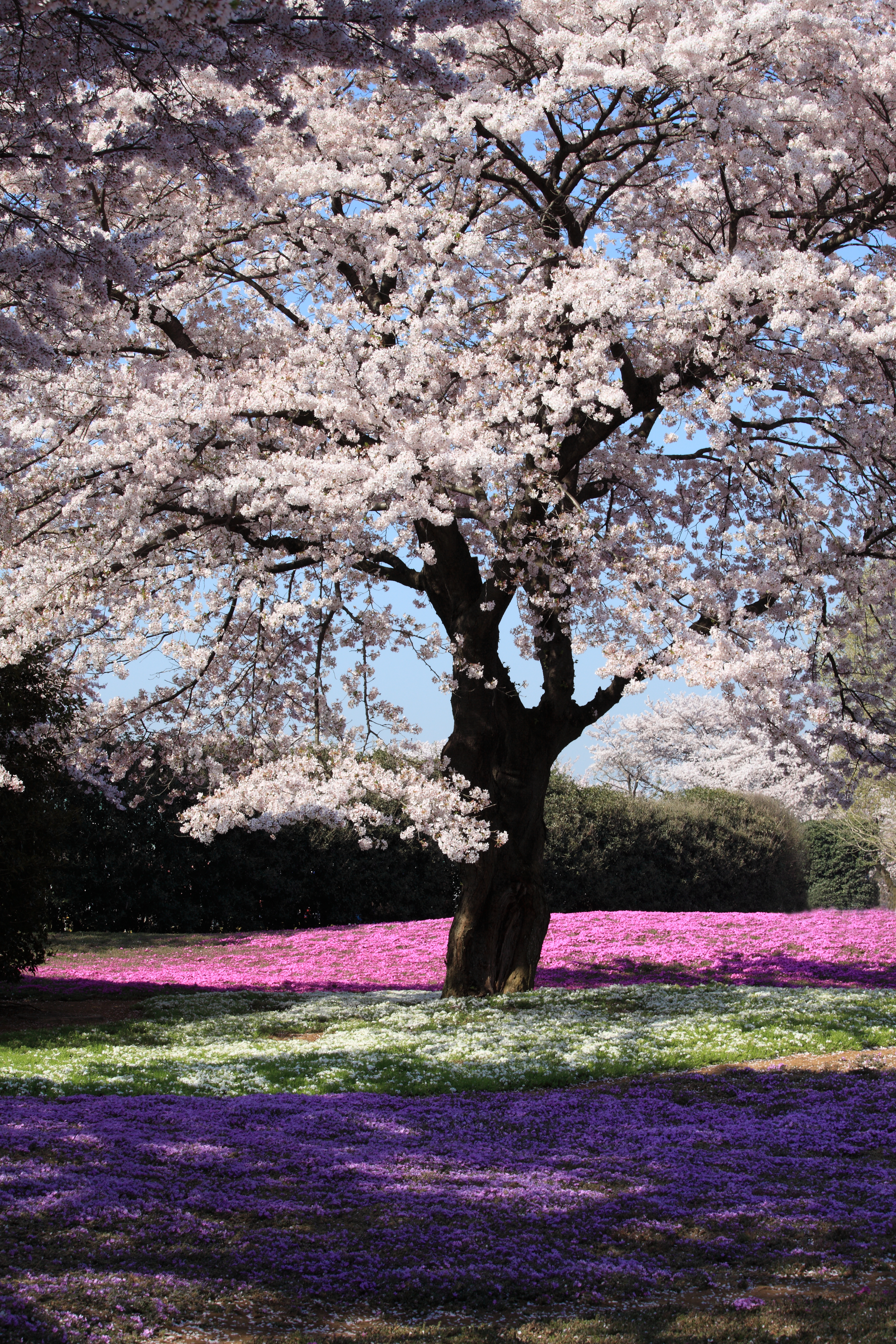
Japan's cherry blossom season, or sakura, transforms the country for a brief two-week window each spring when thousands of trees burst into pale pink and white flowers.
The most famous displays occur in Tokyo's Ueno Park, Kyoto's Maruyama Park, and along the Philosopher's Path, where petals fall like pink snow.
How does it rate
CrowdsRomanceCash RequiredDangerAccessibilityWhy you should go
The cherry blossom season is one of the most beautiful natural phenomena in the world and is deeply embedded in Japanese culture; the atmosphere under the blossoming trees is magical.
Why you shouldn't go
The season lasts only two weeks and the exact timing varies each year; popular cherry blossom spots become extremely crowded and accommodation prices spike sharply.
Plan your visit
Best time to visitLate March-early April (varies by region and year)Best time of dayEarly morning for empty pathsGetting thereVaries by specific location in JapanEntry costFree; some gardens charge a small feeTime needed2-3 hoursInsider tip — Blossom forecasts are published months ahead; plan your trip around them as the window is only about a week -
 #2
#2Rated #2 of 11
Kyoto's Arashiyama Bamboo Grove, Japan
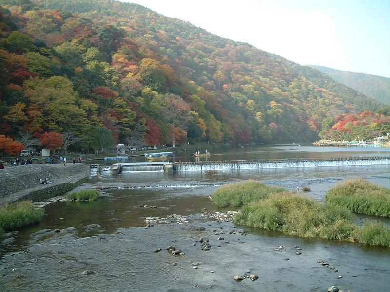
#kyoto'sarashiyamabamboogrove ◆ Natural Features84 /100The Arashiyama Bamboo Grove on the outskirts of Kyoto is one of Japan's most ethereal landscapes, where towering stalks of bamboo create a cathedral-like green canopy above the winding path.
When the wind blows through the grove, the sound is so distinctive it has been designated one of the 100 Soundscapes of Japan.
How does it rate
CrowdsRomanceCash RequiredDangerAccessibilityWhy you should go
Walking through the towering bamboo columns with light filtering through the canopy above is a genuinely otherworldly experience unlike anything else in Japan.
Why you shouldn't go
The grove is very short and becomes extremely crowded from mid-morning; visit at dawn for an atmospheric experience without the tourist hordes.
Plan your visit
Best time to visitYear-round; spring/autumn for extra colour nearbyBest time of dayEarly morning (before 8am) to avoid crowds entirelyGetting thereArashiyama Station (JR or Randen line) from KyotoEntry costFreeTime needed30-45 minutesInsider tip — Go right at opening; this is one of the most crowded spots in Kyoto by mid-morning -
 #382 /100
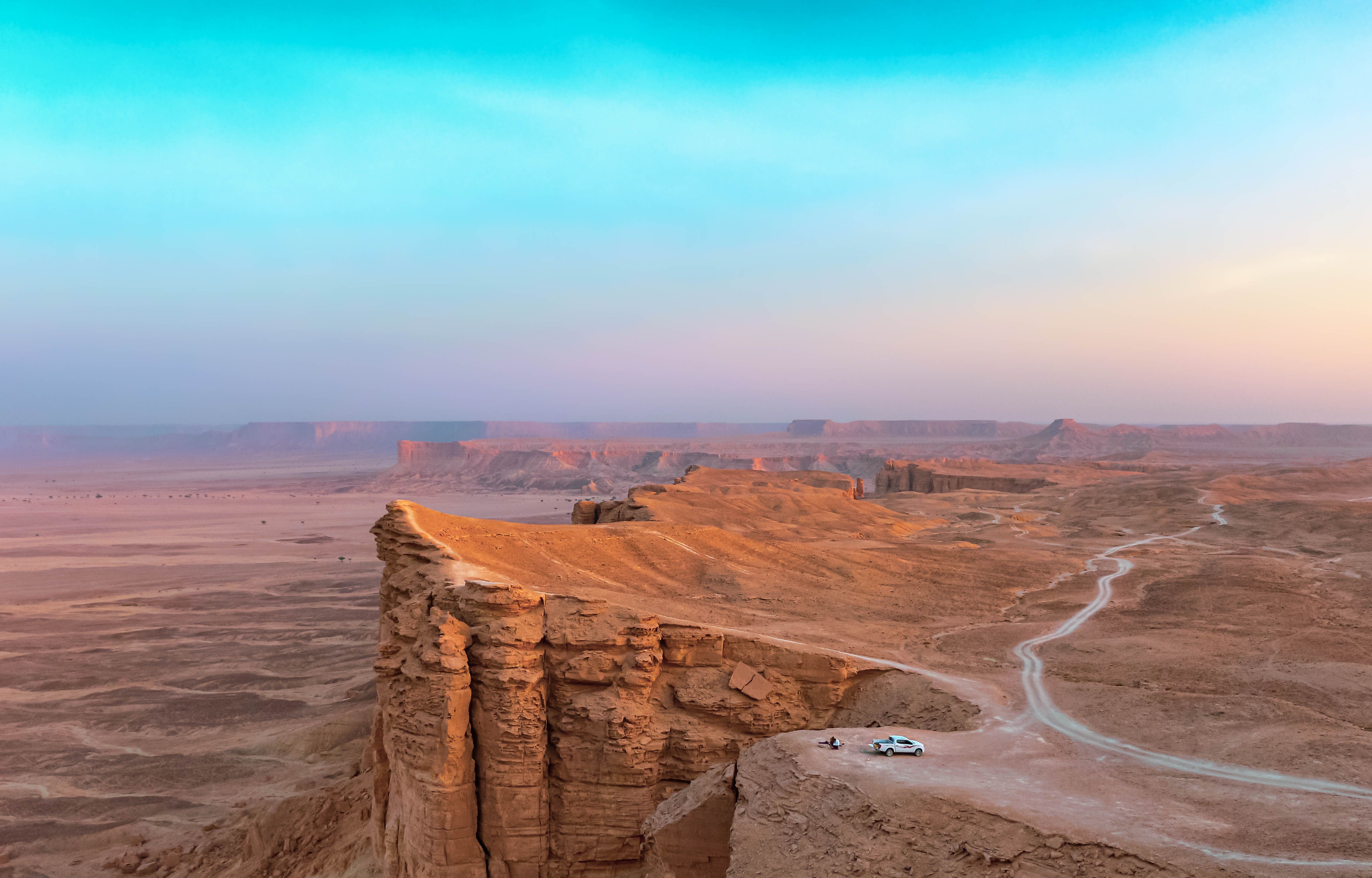
Jebel Fihrayn, known as the Edge of the World, is a sheer escarpment roughly 1,100 metres above the desert floor, part of the Tuwaiq Mountains that once formed the shoreline of an ancient sea.
A rough 4x4 track and a short walk lead to a cliff edge with no barriers, looking out over a flat desert plain stretching to the horizon, and it has become one of the most visited natural landmarks near Riyadh since the country opened to tourism.
How does it rate
CrowdsRomanceCash RequiredDangerAccessibilityWhy you should go
Standing at an unguarded cliff edge with a completely flat desert stretching to the horizon feels like reaching the literal edge of the map.
Why you shouldn't go
There are no safety barriers at the cliff edge, and the last stretch of track requires a 4x4 and an experienced driver.
Plan your visit
Best time to visitNovember–March, avoiding summer heat that makes the exposed cliff top dangerous by midday.Best time of dayLate afternoon into sunset, when the escarpment and desert plain both light up gold.Getting thereFly to Riyadh; roughly 1.5–2-hour drive northwest, the final stretch on an unpaved desert track requiring 4x4.Entry costFree; most visitors join a paid tour that includes 4x4 transport.Time neededHalf a day including travelInsider tip — Go with an organised tour rather than a rental car — the final approach track is easy to get stuck on without local knowledge. -
 #480 /100
The Yuanyang rice terraces cascade down mountainsides across thousands of stepped fields, shaped over centuries by the Hani people using a water-management system fed by cloud forest above.
Once flooded ahead of spring planting, each terrace mirrors the sky like shattered glass, especially at sunrise and sunset.
Villages of traditional mushroom-shaped thatched houses sit among the terraces, still lived in rather than preserved as a display.
How does it rate
CrowdsRomanceCash RequiredDangerAccessibilityWhy you should go
Thousands of stepped, water-filled rice terraces that mirror the sky at sunrise, shaped by the Hani people over centuries.
Why you shouldn't go
The terraces only hold their mirror-like reflection when flooded, roughly December through March; the rest of the year they're green fields instead.
Plan your visit
Best time to visitDecember-March, when fields are flooded and reflective before plantingBest time of daySunrise at Duoyishu viewpoint, or sunset at BadaGetting thereFly into Kunming; a 5-6 hour drive reaches YuanyangEntry costCombined viewpoint ticket around CNY100Time needed2 days to catch both sunrise and sunset viewpointsInsider tip — Stay overnight in Yuanyang itself rather than day-tripping from Kunming; the best light is at dawn and dusk, both awkward for a same-day round trip. -
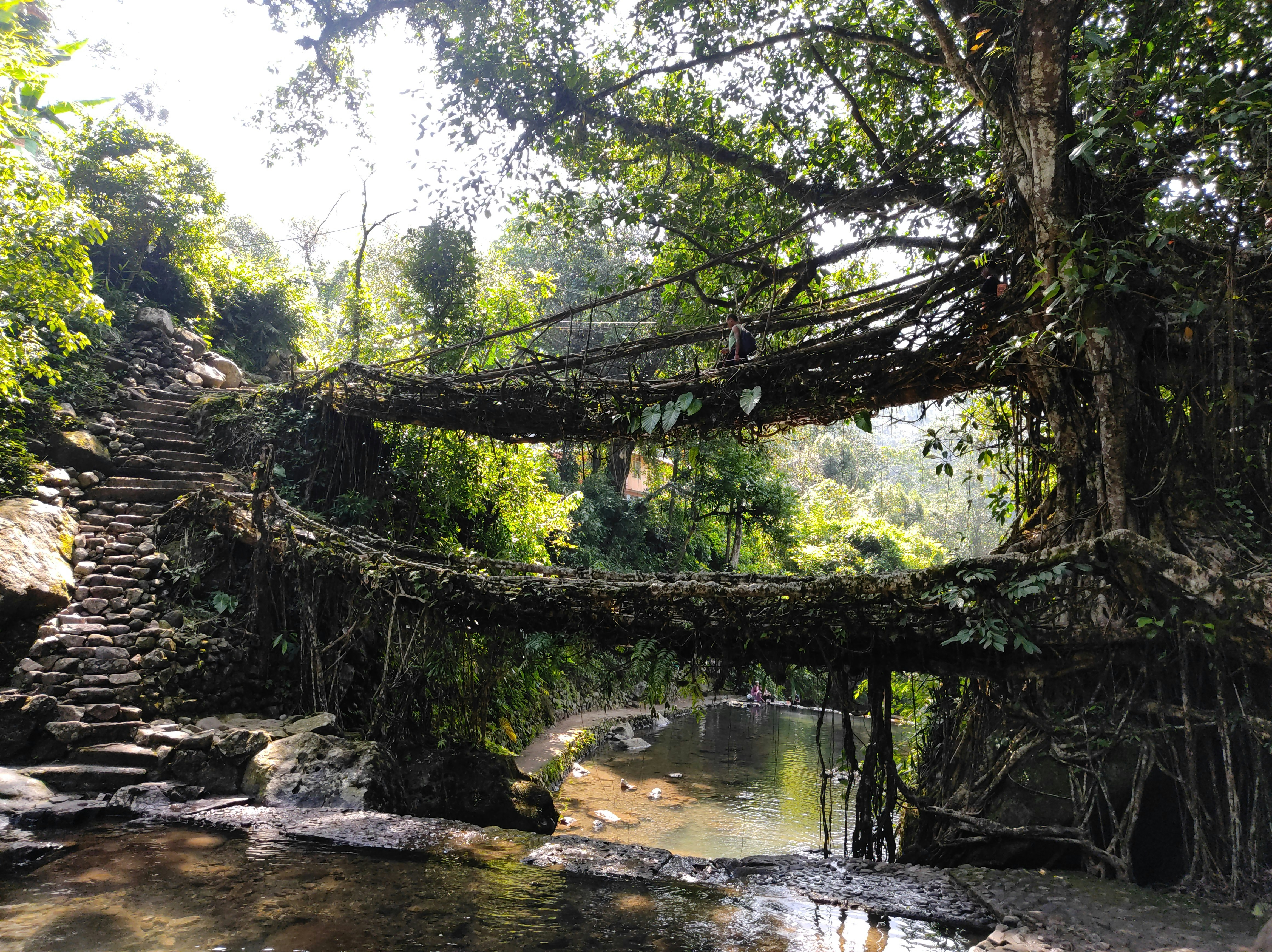 #576 /100
In the Khasi Hills near Cherrapunji, one of the wettest places on Earth, generations of the Khasi people have trained rubber fig tree roots across rivers to form living bridges, some over a century old and still growing.
The most famous, the Double Decker bridge, is reached by descending roughly 3,500 stone steps through jungle.
It's as much an engineering marvel as a natural one, since nothing about it was built so much as grown.
How does it rate
CrowdsRomanceCash RequiredDangerAccessibilityWhy you should go
Bridges grown from living tree roots over centuries, reached by a steep jungle descent.
Why you shouldn't go
The Double Decker bridge involves thousands of steep, often slippery steps down and back up.
Plan your visit
Best time to visitOctober-April, avoiding the heaviest monsoon rainsBest time of dayEarly morning start to avoid midday heat and afternoon rain on the long climb backGetting thereFly into Guwahati; a 4-hour drive reaches Cherrapunji, then a trek to the bridgesEntry costSmall village entry feeTime needed4-6 hours round trip for the Double Decker bridgeInsider tip — Hire a local guide in Tyrna village; the trail forks in places and a guide also knows which lesser-known bridges are worth the detour. -
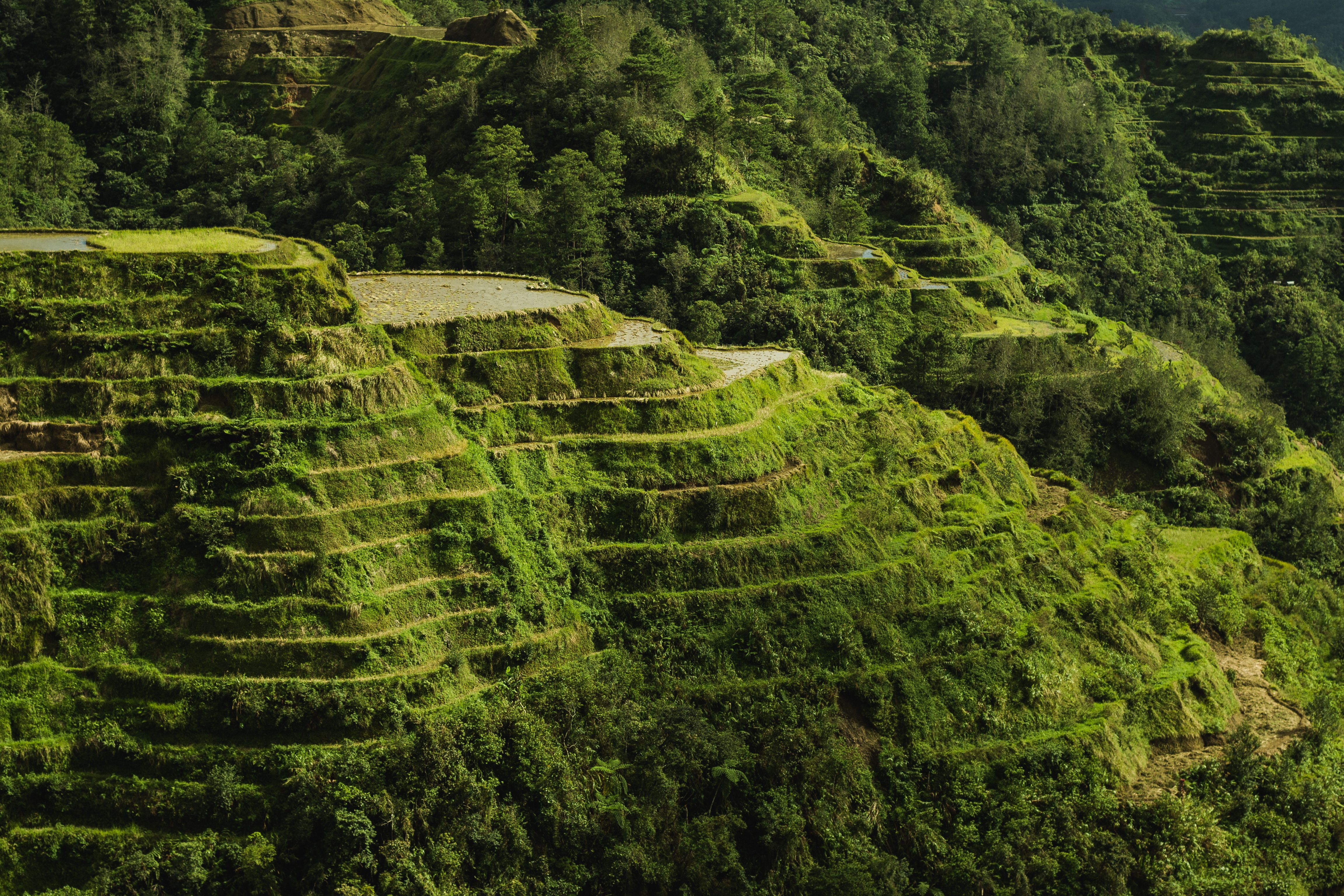 #676 /100
Carved into the Cordillera mountains some 2,000 years ago by the Ifugao people using only hand tools, these terraces climb the hillsides in contour lines that follow the land, still irrigated by an ancient engineered system fed from the forests above.
Locals still farm rice here, so the terraces are a living agricultural landscape rather than a preserved relic — often called the 'eighth wonder of the world.
'
How does it rate
CrowdsRomanceCash RequiredDangerAccessibilityWhy you should go
A 2,000-year-old engineered landscape still actively farmed the same way today.
Why you shouldn't go
The core Banaue viewpoint area is well-touristed; reaching the more dramatic Batad terraces needs a further hike.
Plan your visit
Best time to visitMarch–May for lush green terraces before typhoon season; June–September brings rain.Best time of daySunrise, when mist often sits in the valley below the terraces.Getting thereOvernight bus from Manila (about 9 hours) to Banaue town, then jeepney to the viewpoints.Entry costFree to view; small fees at specific lookout points.Time needed1–2 days, more if hiking to Batad.Insider tip — Hire a local Ifugao guide to hike down into Batad's amphitheater terraces — a far less-visited experience than the roadside Banaue viewpoint. -
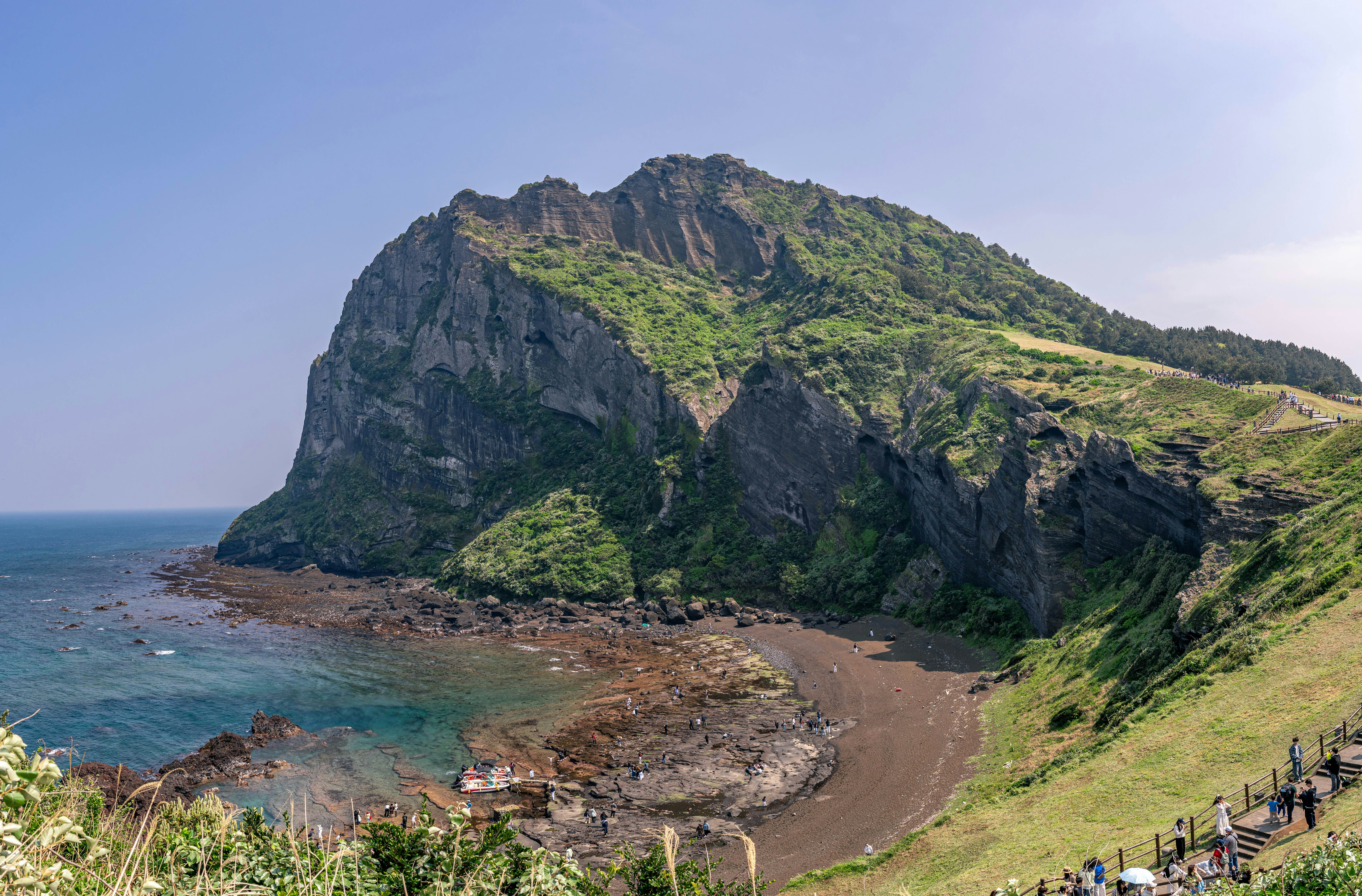 #775 /100
Seongsan Ilchulbong, or Sunrise Peak, is a tuff cone that erupted from the seabed off Jeju Island roughly 5,000 years ago, its crater rim forming a dramatic natural amphitheatre above the coast.
A well-maintained stairway climbs to the crater's edge in around 30 minutes, and the peak's name comes from its long-standing popularity as a sunrise viewpoint.
It's part of a UNESCO World Natural Heritage listing covering Jeju's volcanic features.
How does it rate
CrowdsRomanceCash RequiredDangerAccessibilityWhy you should go
A volcanic crater rim above the sea, climbed in about 30 minutes for one of Jeju's best views.
Why you shouldn't go
It's a well-known stop on Jeju itineraries, so the summit path gets busy around sunrise and midday.
Plan your visit
Best time to visitApril-June or September-November for mild weatherBest time of daySunrise, the peak's namesake viewGetting thereFly into Jeju International Airport; a 1-hour drive reaches the eastern coast siteEntry costAround KRW5,000Time needed1-2 hoursInsider tip — The nearby Seopjikoji coastal trail makes a good add-on walk before or after the climb, and is far less crowded. -
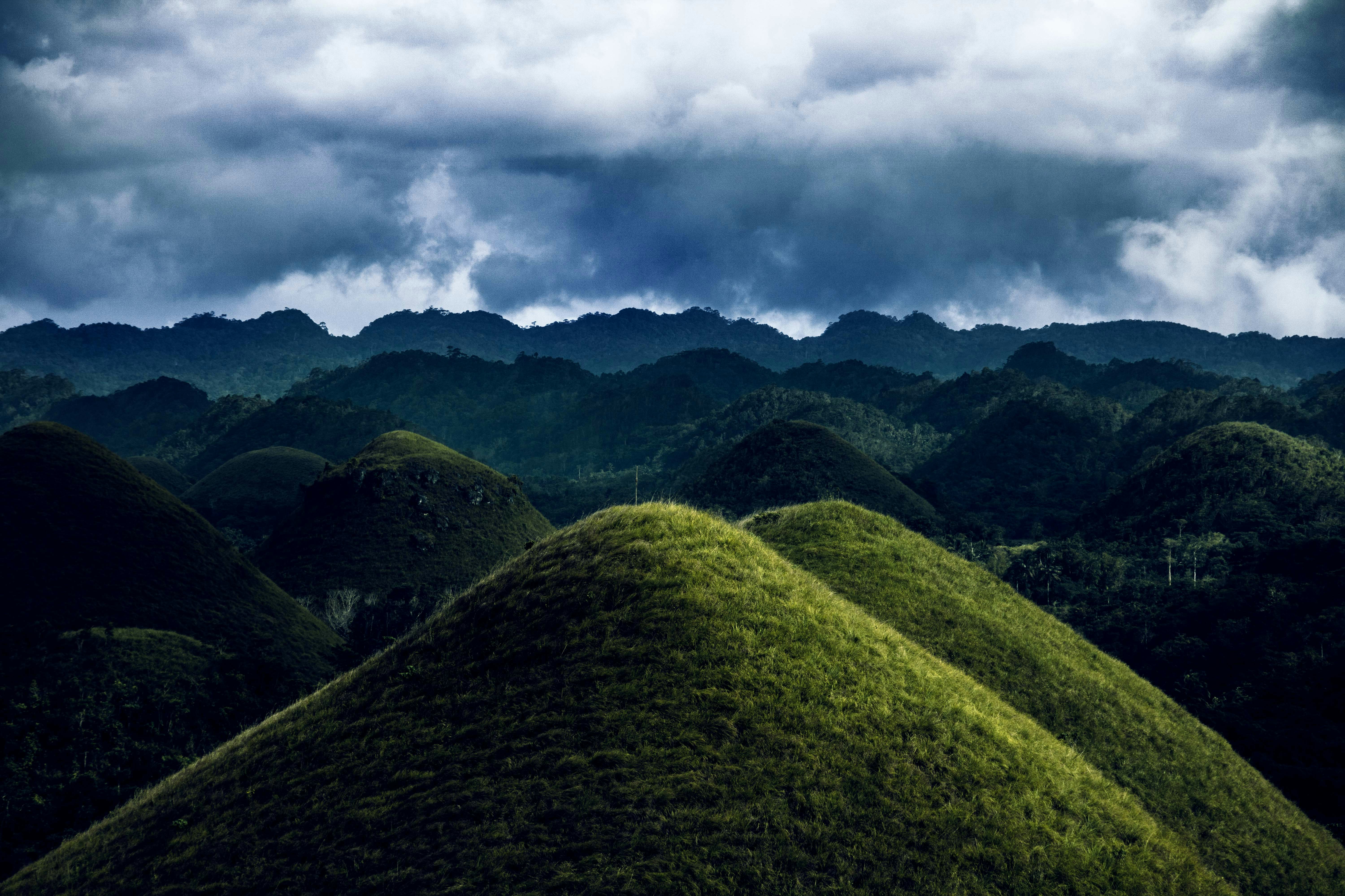 #874 /100
Over 1,200 near-perfectly conical grass-covered hills spread across Bohol island, turning chocolate-brown in the dry season.
A geological oddity of uncertain origin, best appreciated from the Chocolate Hills Complex viewing deck at sunrise or sunset.
How does it rate
CrowdsRomanceCash RequiredDangerAccessibilityWhy you should go
Over 1,200 symmetrical grassy hills that turn chocolate-brown in dry season, a geological one-of-a-kind.
Why you shouldn't go
The famous "chocolate" brown color only appears in dry season (Dec–May); green the rest of the year.
Plan your visit
Best time to visitMarch–May (dry season) for the brown hue the hills are named for.Best time of dayEarly morning for cooler temperatures and softer light on the viewing deck.Getting thereFly to Tagbilaran, Bohol; 1-hour drive to Carmen town viewing complex.Entry costPHP 50 (~$1) entrance fee.Time needed1–2 hoursInsider tip — Combine with a Loboc River cruise and the nearby tarsier sanctuary the same day. Climb the 214 steps to the deck for the full panorama. -
 #974 /100
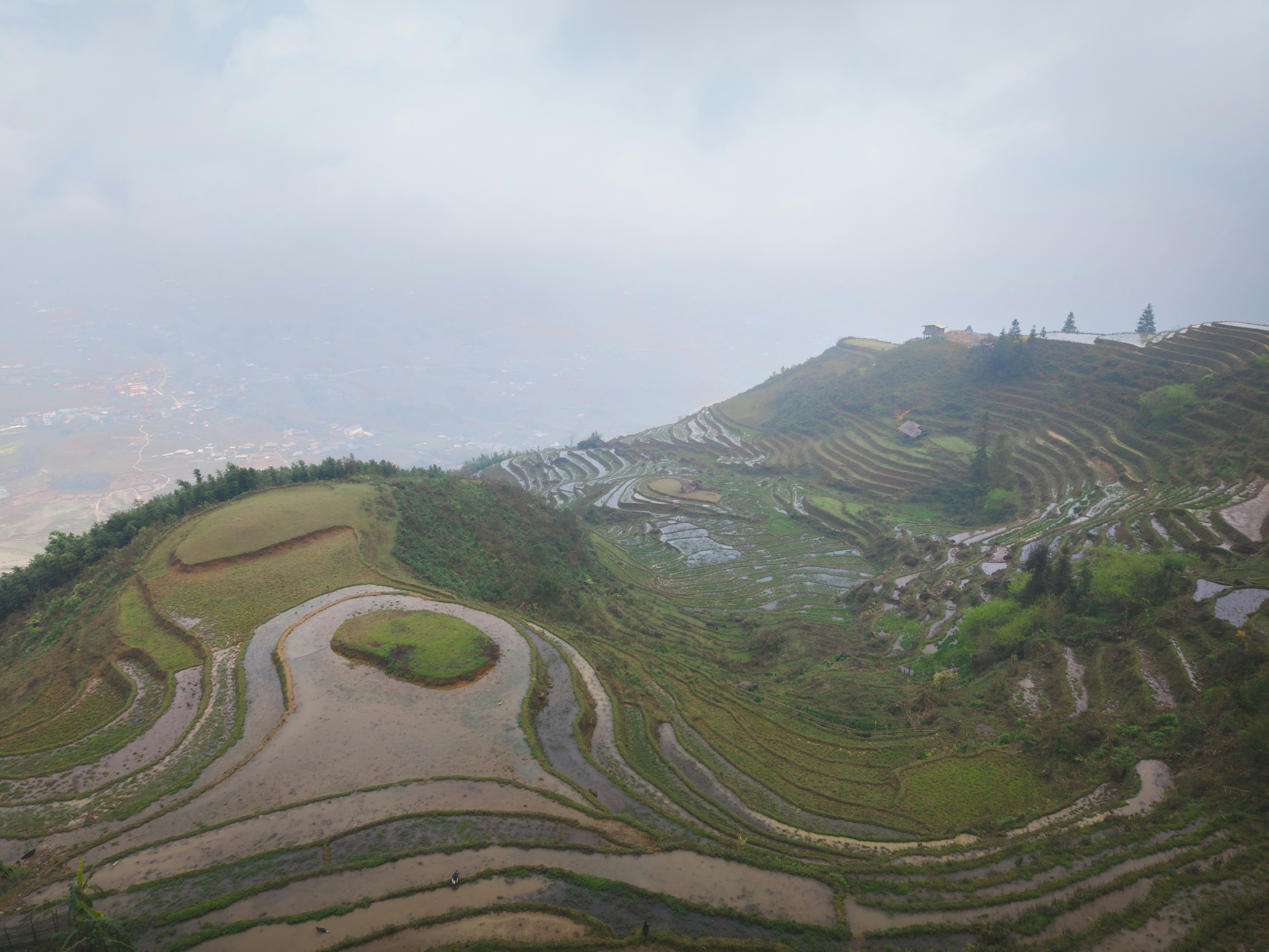
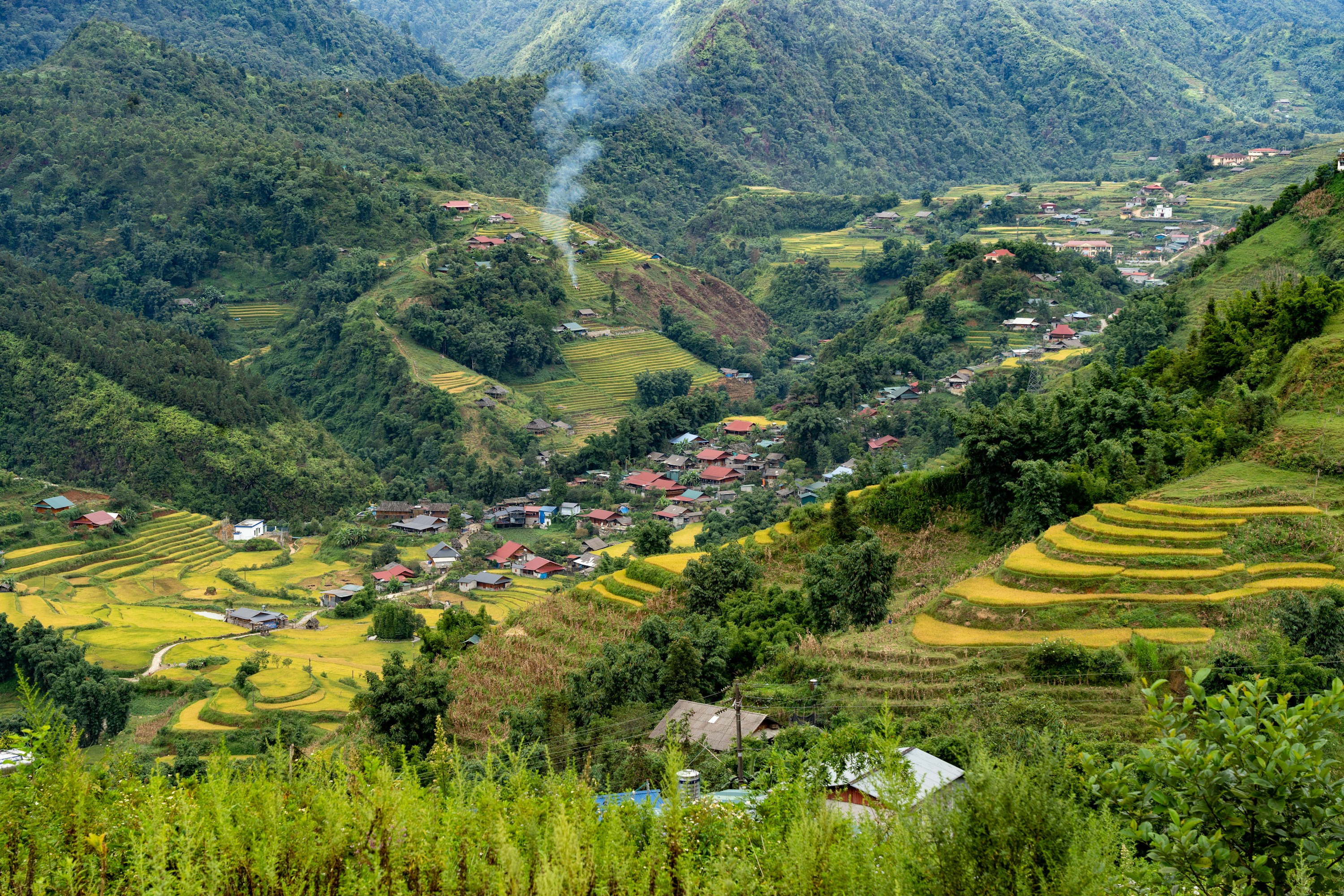
Sapa's mountainsides are carved into thousands of stepped rice terraces, farmed for generations by H'mong, Dao, and Tay communities in the Muong Hoa Valley below Fansipan, Indochina's highest peak.
The fields turn brilliant green after May planting and gold at the September-October harvest.
Most visitors trek between hilltop villages, though a cable car now reaches Fansipan's summit in minutes for those who'd rather skip the climb.
How does it rate
CrowdsRomanceCash RequiredDangerAccessibilityWhy you should go
Some of Southeast Asia's most dramatic terraced-farming scenery, walkable through working hill-tribe villages.
Why you shouldn't go
Trails get muddy and slippery in the rainy season, and the town itself has become fairly built-up and touristy.
Plan your visit
Best time to visitSeptember-October for golden harvest terraces, or May-June for flooded, mirror-like planting season.Best time of dayEarly morning, before valley mist burns off and trekking groups set out.Getting thereOvernight train or bus from Hanoi to Lao Cai, then a 1-hour transfer up to Sapa town.Entry costFree to view; guided village treks typically $20-40 per dayTime needed2-3 daysInsider tip — Hire a local H'mong or Dao guide in town rather than a Hanoi-based operator; the money stays in the villages you're walking through, and their trails avoid the busiest routes. -
 #1072 /100
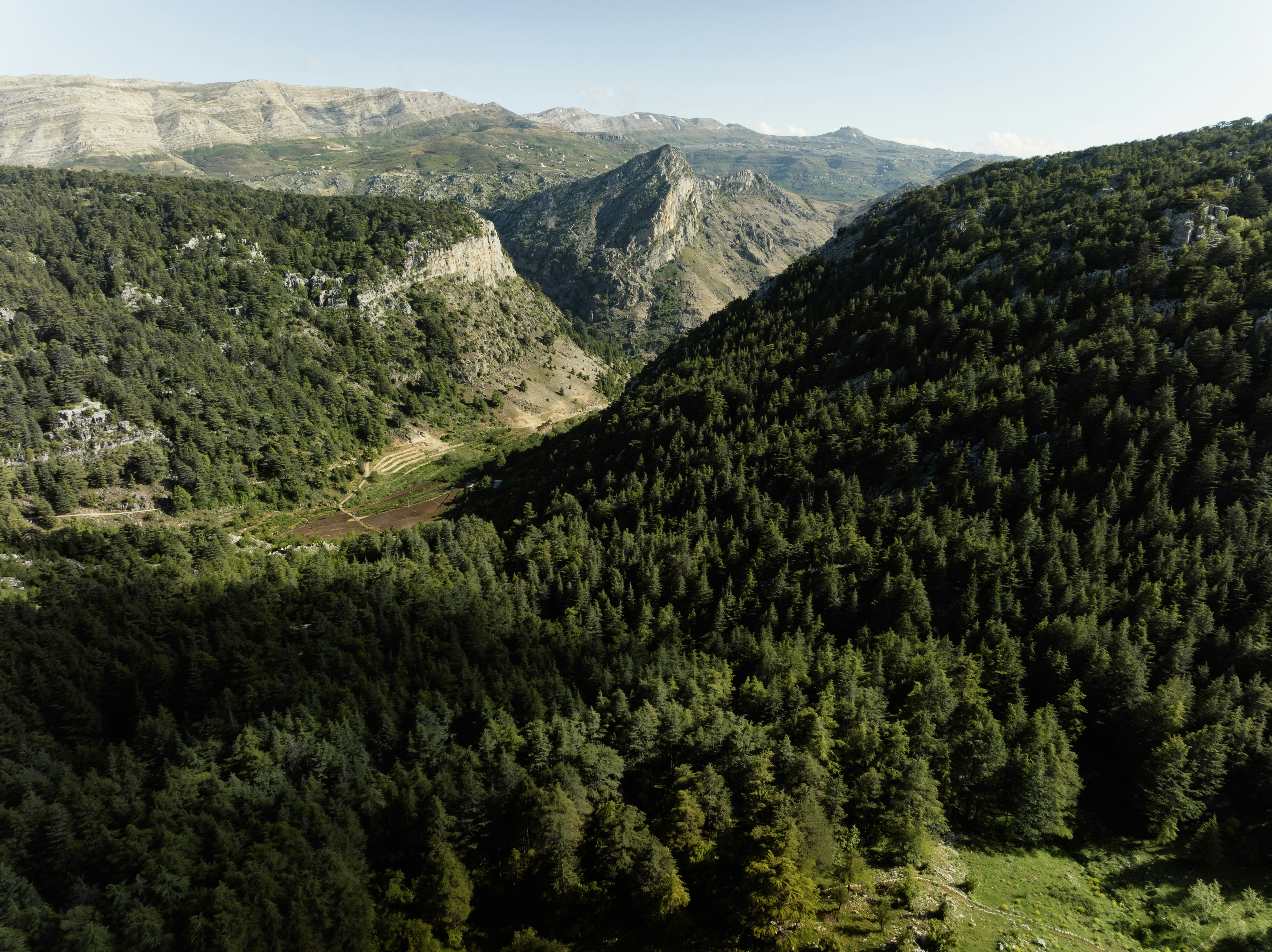
The Cedars of God is one of the last remnants of the vast forests that once covered Mount Lebanon, a small UNESCO-listed grove where some trees are reputedly over a thousand years old.
The cedar has been Lebanon's national symbol for millennia, referenced in the Bible and used for ancient Phoenician ships and temples, and this reserve is among the few places its oldest survivors still stand.
A short, flat trail loops through the grove beneath the peaks.
How does it rate
CrowdsRomanceCash RequiredDangerAccessibilityWhy you should go
A small grove of thousand-year-old cedars, the last of the forests that once covered Mount Lebanon.
Why you shouldn't go
It's a small reserve, easily seen in under an hour, so it's better as a stop than a dedicated day trip.
Plan your visit
Best time to visitMay-October, when the mountain road to Bcharre is reliably clear of snowBest time of dayMorning, for soft light through the cedar canopyGetting thereFly into Beirut; a 2-hour drive reaches the Cedars of God reserve above BcharreEntry costSmall entry donation requestedTime needed1 hourInsider tip — Look for the labelled oldest trees near the reserve's chapel; some are estimated at over 1,000 years old and are easy to miss without the small signs. -
 #1172 /100
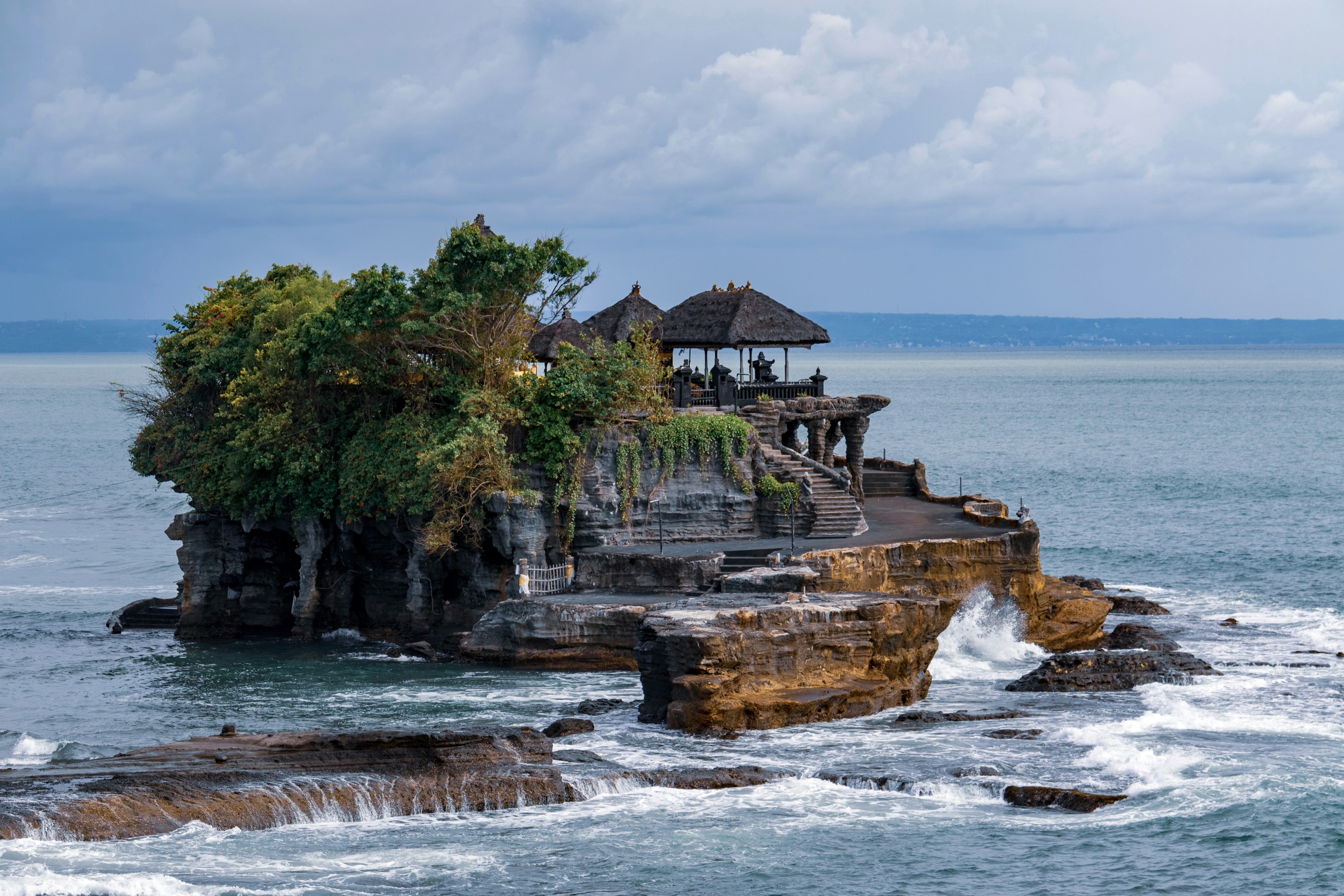
Tanah Lot's Hindu sea temple sits on a small rock outcrop just offshore, cut off from the mainland at high tide and reachable on foot when the water recedes.
Built around a natural spring the Balinese consider sacred, it's one of several coastal temples protecting Bali from sea spirits, and among the most photographed silhouettes on the island at sunset.
The temple interior is closed to non-worshippers, so the visit is really about the setting and the ritual crowds gathering for dusk.
How does it rate
CrowdsRomanceCash RequiredDangerAccessibilityWhy you should go
One of Bali's most iconic sunset silhouettes, a temple perched on a wave-battered sea rock.
Why you shouldn't go
Extremely crowded by late afternoon, and the temple itself is closed to visitors who aren't there to pray.
Plan your visit
Best time to visitDry season, April-October, for reliable sunsets; check tide tables so the rock isn't submerged.Best time of daySunset, though arriving by mid-afternoon beats the worst of the crowds.Getting there45-60 minutes by car or scooter from Denpasar/Seminyak, in Tabanan regency.Entry costIDR 75,000 (~$4.50) for adults, cash onlyTime needed1-2 hoursInsider tip — Skip the crowded main viewpoint and walk the clifftop path south past the warungs for a quieter angle on the temple silhouette at sunset.


More from Asia
-
More Natural Feature spots
How a score is built
One score out of 100, five criteria behind it
Every place is rated 1–5 on each of the criteria below, then combined into a single score out of 100. It's calculated by us, the same way every time — not an average of traveller reviews or social votes.
Crowds
How many people you'll be sharing it with, and at what time of day.
Romance
How well it suits a couple, a proposal, or a quiet moment together.
Cash required
Entry fees, permits, guides, rentals — what it actually costs to do it.
Danger
Physical risk involved, from a slippery viewpoint to genuine hazard.
Accessibility
How far off the beaten path it is, and how hard it is to actually reach.

