-
 #188 /100
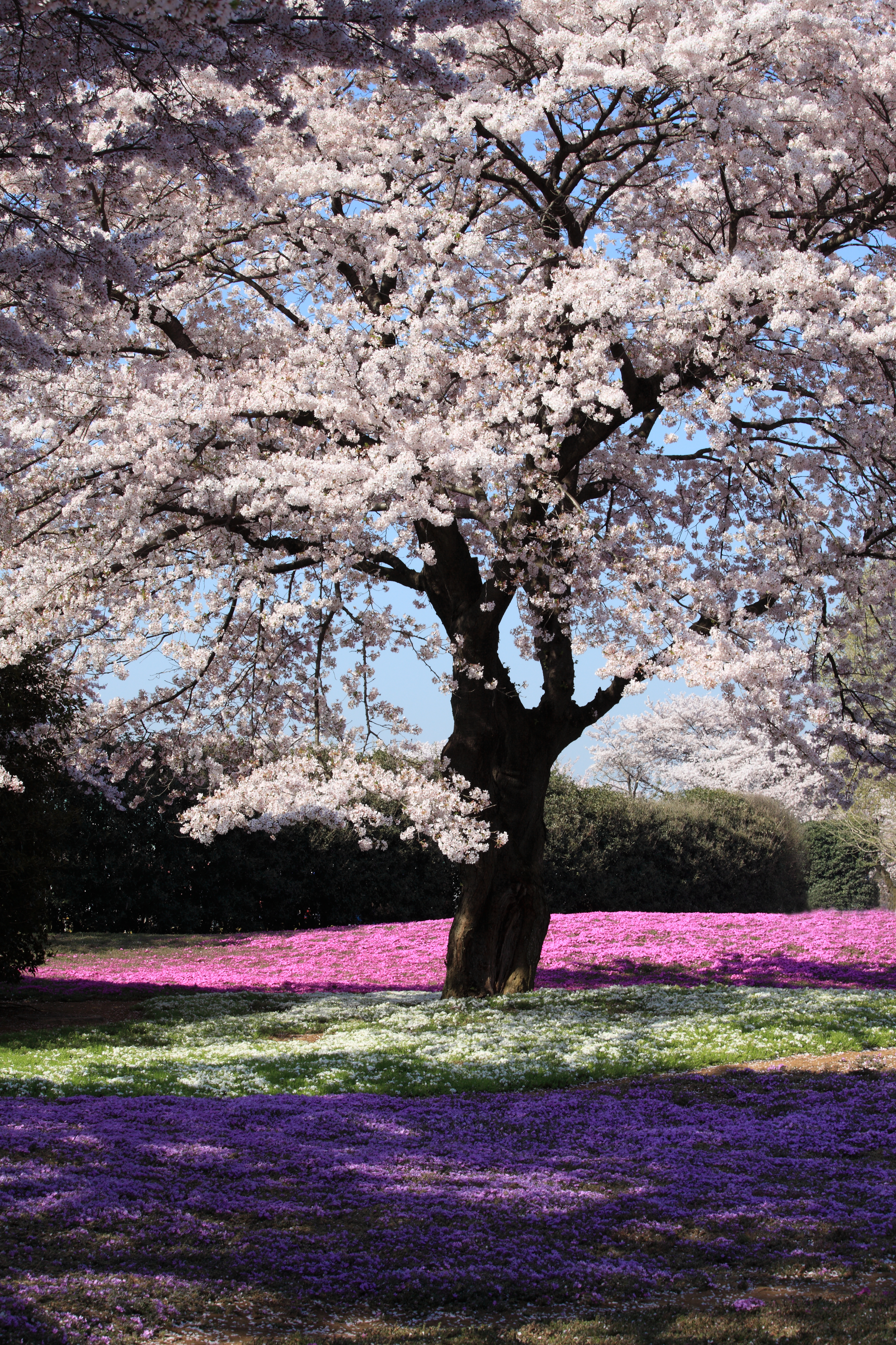
Japan's cherry blossom season, or sakura, transforms the country for a brief two-week window each spring when thousands of trees burst into pale pink and white flowers.
The most famous displays occur in Tokyo's Ueno Park, Kyoto's Maruyama Park, and along the Philosopher's Path, where petals fall like pink snow.
How does it rate
CrowdsRomanceCash RequiredDangerAccessibilityWhy you should go
The cherry blossom season is one of the most beautiful natural phenomena in the world and is deeply embedded in Japanese culture; the atmosphere under the blossoming trees is magical.
Why you shouldn't go
The season lasts only two weeks and the exact timing varies each year; popular cherry blossom spots become extremely crowded and accommodation prices spike sharply.
Plan your visit
Best time to visitLate March-early April (varies by region and year)Best time of dayEarly morning for empty pathsGetting thereVaries by specific location in JapanEntry costFree; some gardens charge a small feeTime needed2-3 hoursInsider tip — Blossom forecasts are published months ahead; plan your trip around them as the window is only about a week -
 #2
#2Rated #2 of 13
Kyoto's Arashiyama Bamboo Grove, Japan
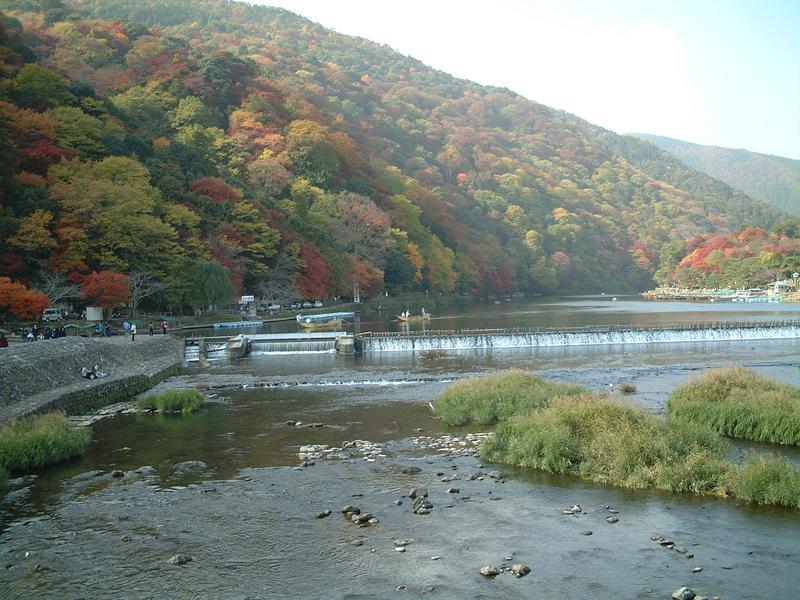
#kyoto'sarashiyamabamboogrove ◆ Natural Features84 /100The Arashiyama Bamboo Grove on the outskirts of Kyoto is one of Japan's most ethereal landscapes, where towering stalks of bamboo create a cathedral-like green canopy above the winding path.
When the wind blows through the grove, the sound is so distinctive it has been designated one of the 100 Soundscapes of Japan.
How does it rate
CrowdsRomanceCash RequiredDangerAccessibilityWhy you should go
Walking through the towering bamboo columns with light filtering through the canopy above is a genuinely otherworldly experience unlike anything else in Japan.
Why you shouldn't go
The grove is very short and becomes extremely crowded from mid-morning; visit at dawn for an atmospheric experience without the tourist hordes.
Plan your visit
Best time to visitYear-round; spring/autumn for extra colour nearbyBest time of dayEarly morning (before 8am) to avoid crowds entirelyGetting thereArashiyama Station (JR or Randen line) from KyotoEntry costFreeTime needed30-45 minutesInsider tip — Go right at opening; this is one of the most crowded spots in Kyoto by mid-morning -
 #382 /100
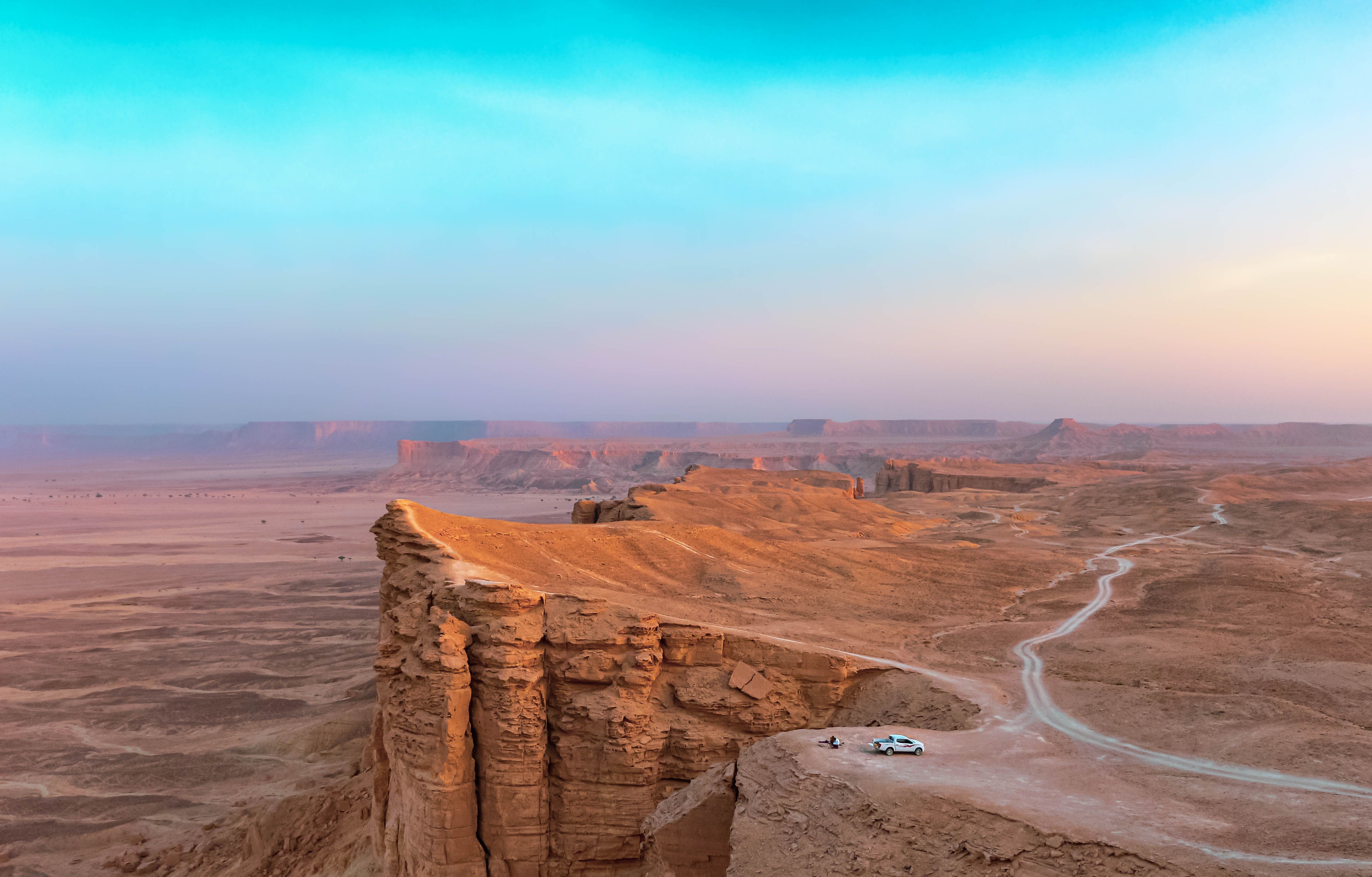
Jebel Fihrayn, known as the Edge of the World, is a sheer escarpment roughly 1,100 metres above the desert floor, part of the Tuwaiq Mountains that once formed the shoreline of an ancient sea.
A rough 4x4 track and a short walk lead to a cliff edge with no barriers, looking out over a flat desert plain stretching to the horizon, and it has become one of the most visited natural landmarks near Riyadh since the country opened to tourism.
How does it rate
CrowdsRomanceCash RequiredDangerAccessibilityWhy you should go
Standing at an unguarded cliff edge with a completely flat desert stretching to the horizon feels like reaching the literal edge of the map.
Why you shouldn't go
There are no safety barriers at the cliff edge, and the last stretch of track requires a 4x4 and an experienced driver.
Plan your visit
Best time to visitNovember–March, avoiding summer heat that makes the exposed cliff top dangerous by midday.Best time of dayLate afternoon into sunset, when the escarpment and desert plain both light up gold.Getting thereFly to Riyadh; roughly 1.5–2-hour drive northwest, the final stretch on an unpaved desert track requiring 4x4.Entry costFree; most visitors join a paid tour that includes 4x4 transport.Time neededHalf a day including travelInsider tip — Go with an organised tour rather than a rental car — the final approach track is easy to get stuck on without local knowledge. -
 #4
#4Rated #4 of 13
Lençóis Maranhenses National Park, Brazil
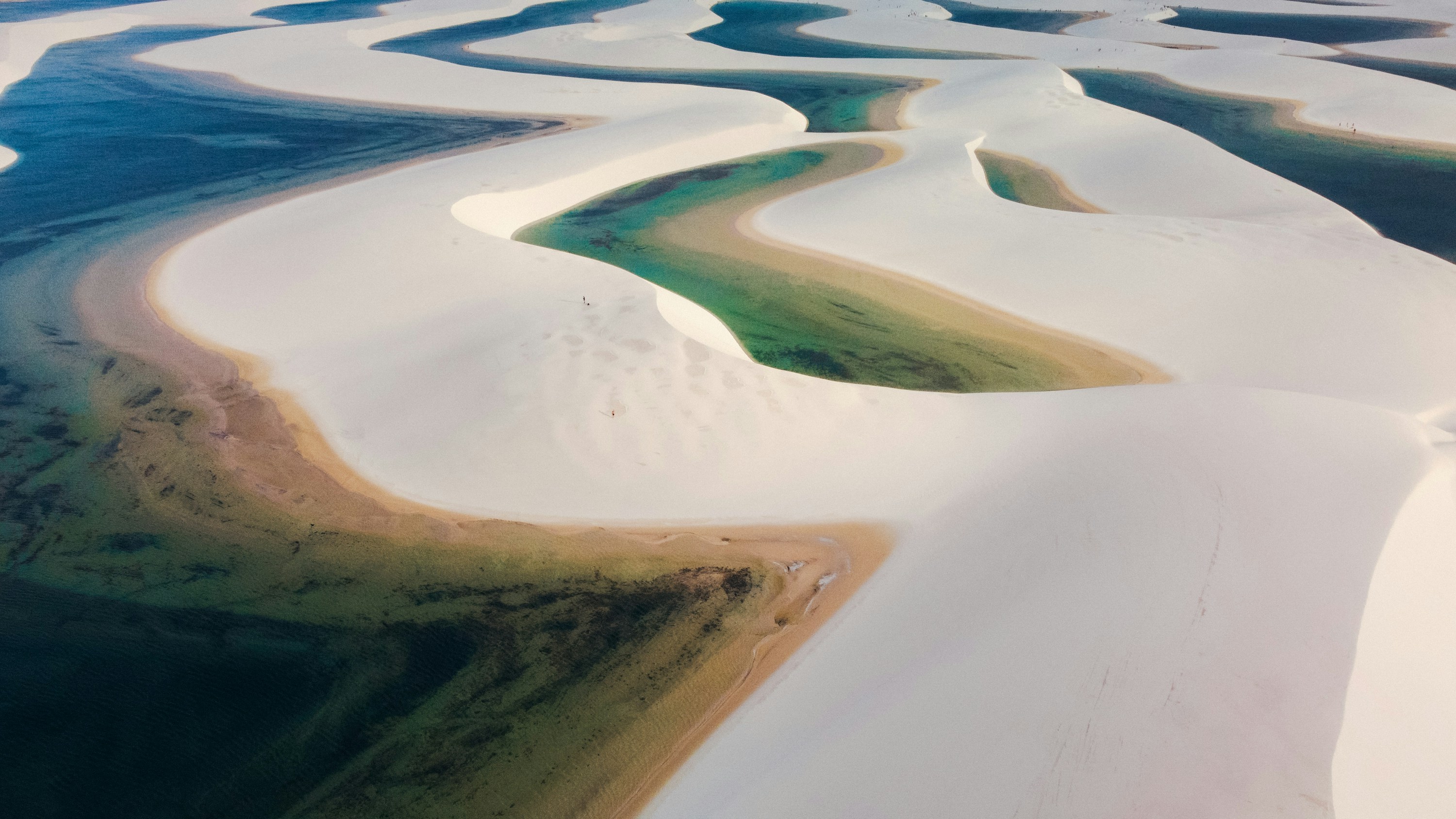
#lençóismaranhensesnationalpark ◆ Natural Features81 /100Despite the name, this isn't a desert: seasonal rains fill the valleys between hundreds of square kilometres of white dunes with clear turquoise lagoons, usually June to September.
Outside that window, the dunes stretch out bone-dry and empty.
Reaching the interior means a 4x4 or a walk across shifting sand from the gateway town of Barreirinhas, but the landscape has no real equivalent on the Brazilian coast.
How does it rate
CrowdsRomanceCash RequiredDangerAccessibilityWhy you should go
Turquoise rainwater lagoons threaded through pure white dunes, found nowhere else on the coast.
Why you shouldn't go
The lagoons only hold water roughly June-September; visit outside that window and it's just dry sand.
Plan your visit
Best time to visitJune-September, when rains fill the dune lagoons for swimming.Best time of dayEarly morning, for cooler sand and softer light before the midday heat.Getting thereFly to São Luís, then about a 4-hour transfer to Barreirinhas; onward by 4x4 or boat into the dune field.Entry costFree to enter the park; guided 4x4/boat tours from Barreirinhas cost extraTime neededFull day, or 2-3 days to see multiple dune areasInsider tip — Base yourself in Barreirinhas rather than São Luís, and get out to Lagoa Azul or Lagoa Bonita early, before the midday sun flattens the colour. -
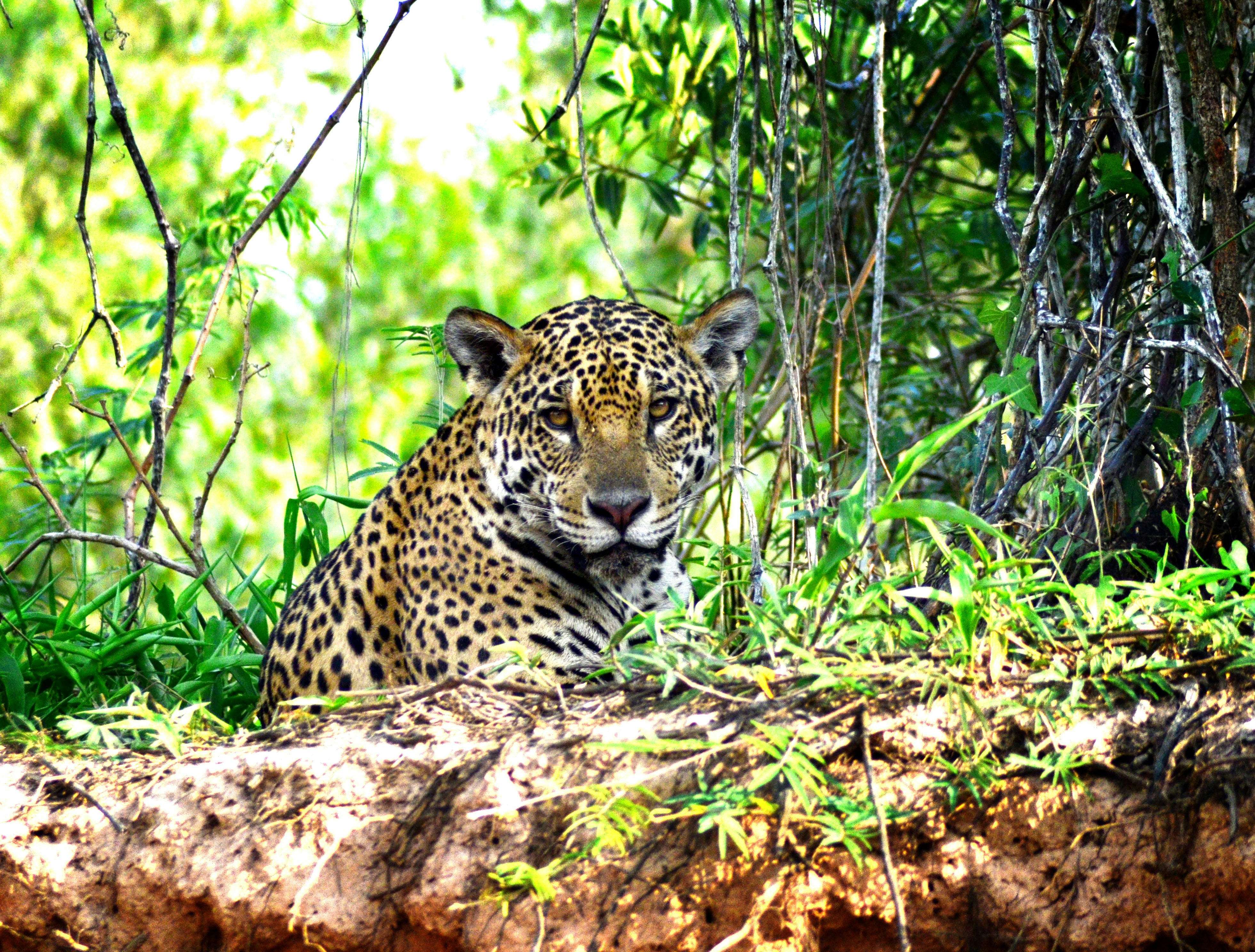 #578 /100
The world's largest tropical wetland, a mosaic of rivers, lagoons, and gallery forest holding the highest concentration of jaguars, caimans, capybaras, and macaws anywhere in South America.
Guided boat and jeep safaris reveal wildlife far more reliably than the denser Amazon rainforest.
How does it rate
CrowdsRomanceCash RequiredDangerAccessibilityWhy you should go
The world's largest tropical wetland, with the best jaguar-spotting odds and birdlife anywhere in South America.
Why you shouldn't go
Wet season (November–March) brings biting insects and flooded roads; remote lodges require real travel time.
Plan your visit
Best time to visitJune–September (dry season) for concentrated wildlife around shrinking waterholes.Best time of dayEarly morning and late afternoon safaris, when animals are most active.Getting thereFly to Cuiabá, then a 2–4 hour drive south on the Transpantaneira road to lodges.Entry costAll-inclusive lodge packages run roughly $150–300 USD per day.Time needed3–5 days minimum.Insider tip — Book a lodge with guides experienced specifically in jaguar tracking along the Cuiabá or Três Irmãos rivers. Bring binoculars, a telephoto lens, and anti-malarial precautions as advised by a travel clinic. -
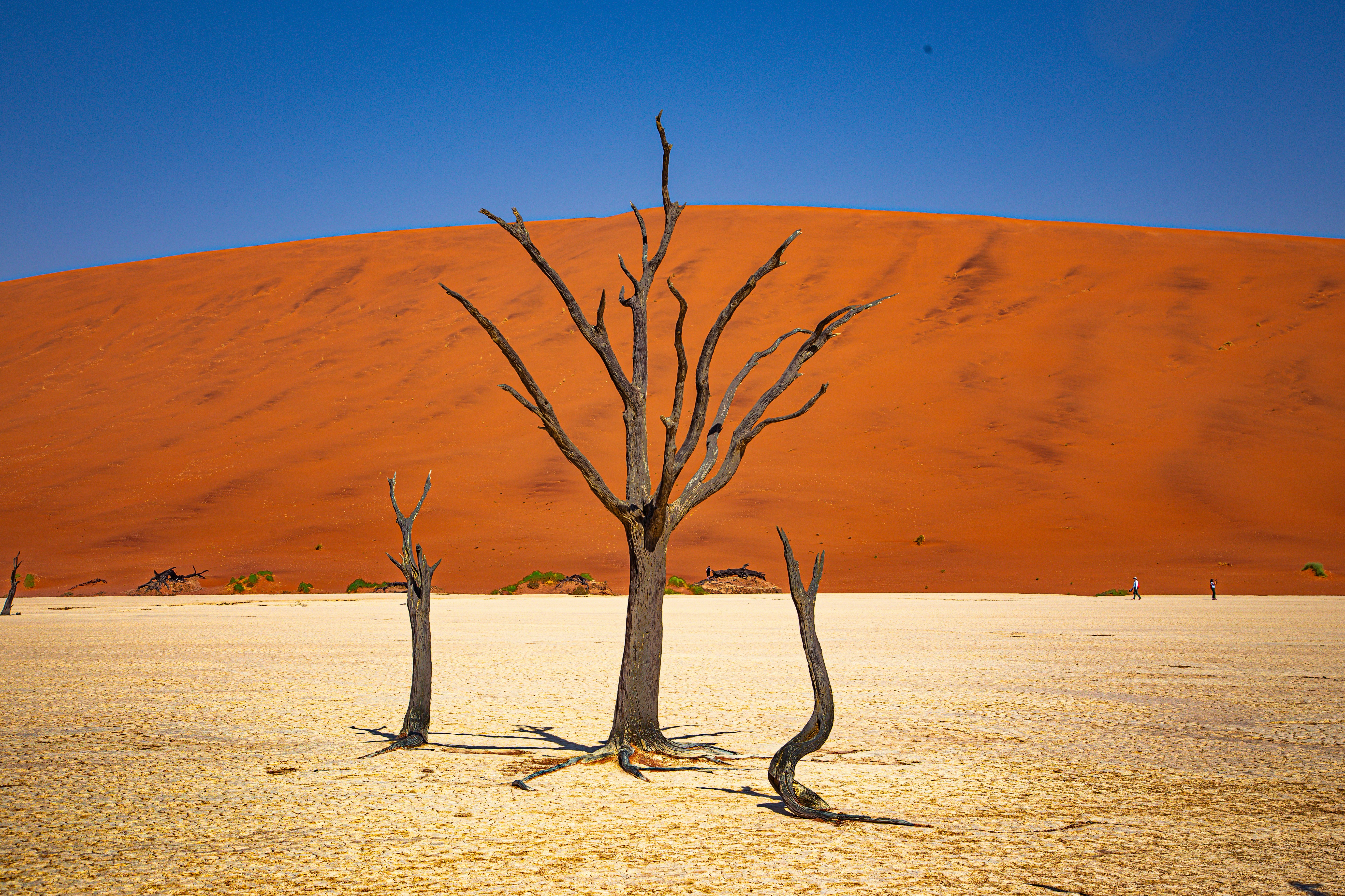 #678 /100
A cracked white clay pan sits ringed by some of the world's tallest sand dunes, its floor scattered with the blackened skeletons of camel thorn trees that died some 600-900 years ago and never decomposed in the bone-dry desert air.
The contrast of black dead wood, white clay and deep-orange dunes against a bright blue sky has made it one of Africa's most photographed landscapes, genuinely striking to stand in regardless of camera skill.
How does it rate
CrowdsRomanceCash RequiredDangerAccessibilityWhy you should go
Centuries-dead trees on a cracked white clay pan, framed by some of the world's tallest dunes.
Why you shouldn't go
Reaching the pan from the parking area requires a hot, sandy walk with no shade.
Plan your visit
Best time to visitMay–September (dry, cooler season) for more comfortable walking conditions.Best time of dayEarly morning, both for cooler temperatures and the sharpest light and shadow on the dunes.Getting thereAbout 4-5 hours' drive from Windhoek to Sesriem, then a 4x4 or shuttle to the parking area, followed by a 20-minute walk.Entry costPark entry around N$150 (~€8), plus a 4x4 transfer fee if not self-driving the final stretch.Time neededHalf a day.Insider tip — Arrive at the park gate right at opening time to beat both the heat and the crowds to the pan. -
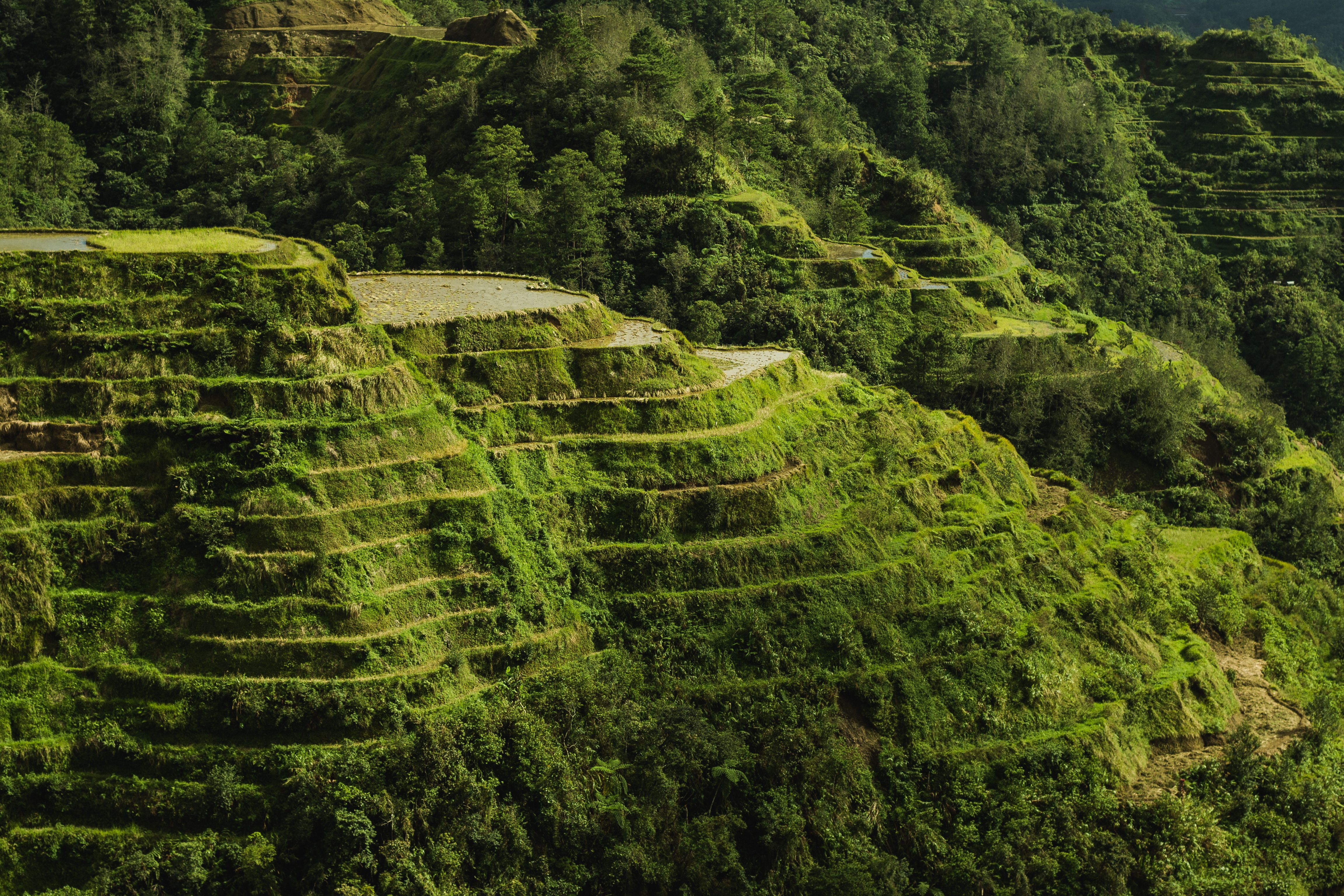 #776 /100
Carved into the Cordillera mountains some 2,000 years ago by the Ifugao people using only hand tools, these terraces climb the hillsides in contour lines that follow the land, still irrigated by an ancient engineered system fed from the forests above.
Locals still farm rice here, so the terraces are a living agricultural landscape rather than a preserved relic — often called the 'eighth wonder of the world.
'
How does it rate
CrowdsRomanceCash RequiredDangerAccessibilityWhy you should go
A 2,000-year-old engineered landscape still actively farmed the same way today.
Why you shouldn't go
The core Banaue viewpoint area is well-touristed; reaching the more dramatic Batad terraces needs a further hike.
Plan your visit
Best time to visitMarch–May for lush green terraces before typhoon season; June–September brings rain.Best time of daySunrise, when mist often sits in the valley below the terraces.Getting thereOvernight bus from Manila (about 9 hours) to Banaue town, then jeepney to the viewpoints.Entry costFree to view; small fees at specific lookout points.Time needed1–2 days, more if hiking to Batad.Insider tip — Hire a local Ifugao guide to hike down into Batad's amphitheater terraces — a far less-visited experience than the roadside Banaue viewpoint. -
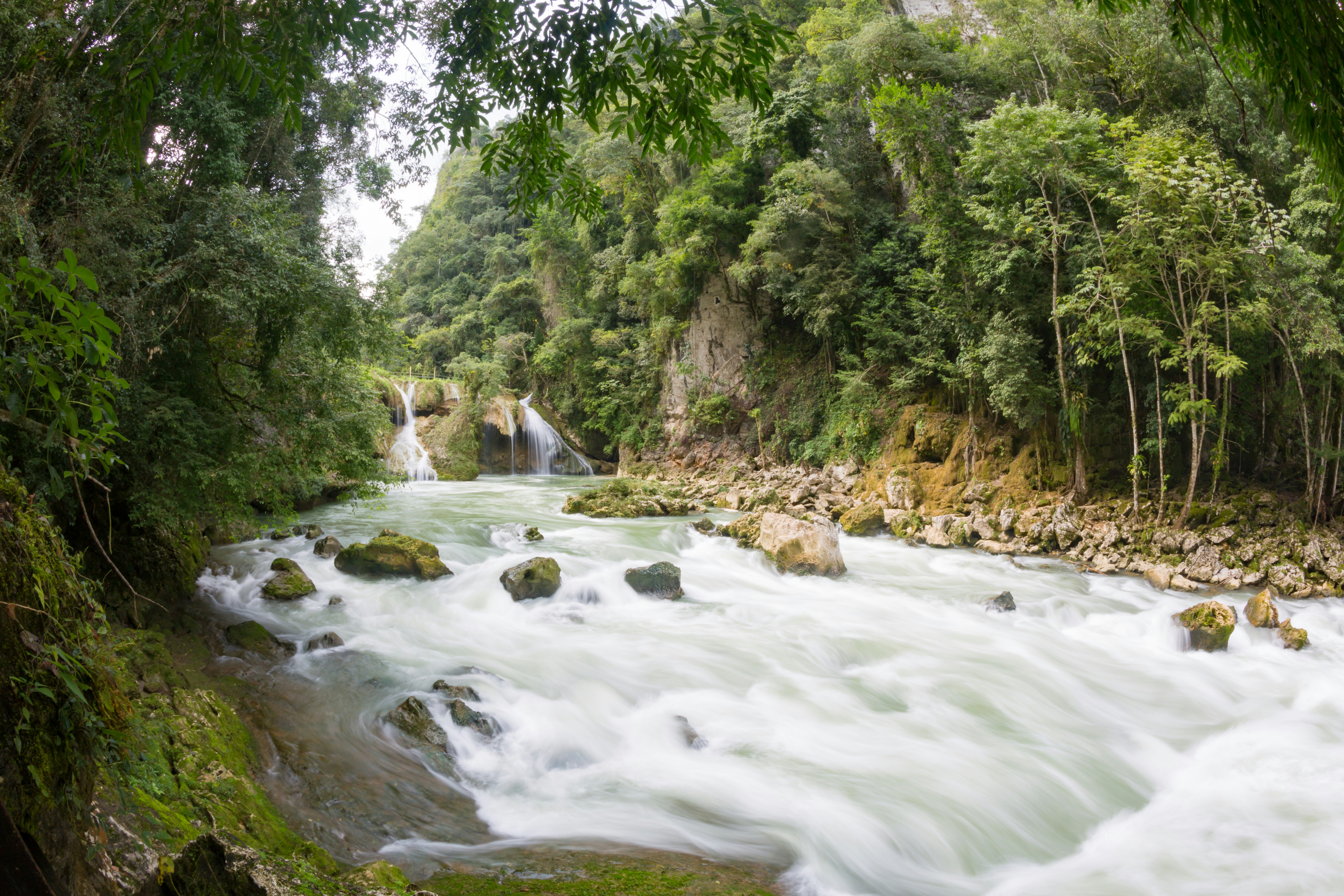 #874 /100
A series of turquoise limestone pools cascades down a natural stone bridge above the rushing Cahabón River, which vanishes underground beneath the pools before reemerging downstream.
Swimming from one pool to the next, framed by dense jungle on all sides, feels remote in a way that matches the effort of reaching it — the last stretch of road is famously rough.
A steep viewpoint hike above gives the classic aerial view of the stacked terraces.
How does it rate
CrowdsRomanceCash RequiredDangerAccessibilityWhy you should go
Stacked turquoise swimming pools on a natural stone bridge above a river that vanishes underground.
Why you shouldn't go
The final approach road is notoriously rough, and the site itself is remote from major towns.
Plan your visit
Best time to visitNovember–April, the dry season, when the river is clearer and pools less silty.Best time of dayMorning, before day-trip crowds from Lanquín arrive.Getting thereAbout 1 hour by rough road from the town of Lanquín, itself several hours from Guatemala City or Antigua.Entry costAround Q50 (~€6) entry fee.Time neededFull day.Insider tip — Climb to the El Mirador viewpoint first thing in the morning before swimming — the classic aerial photo is best in early, angled light. -
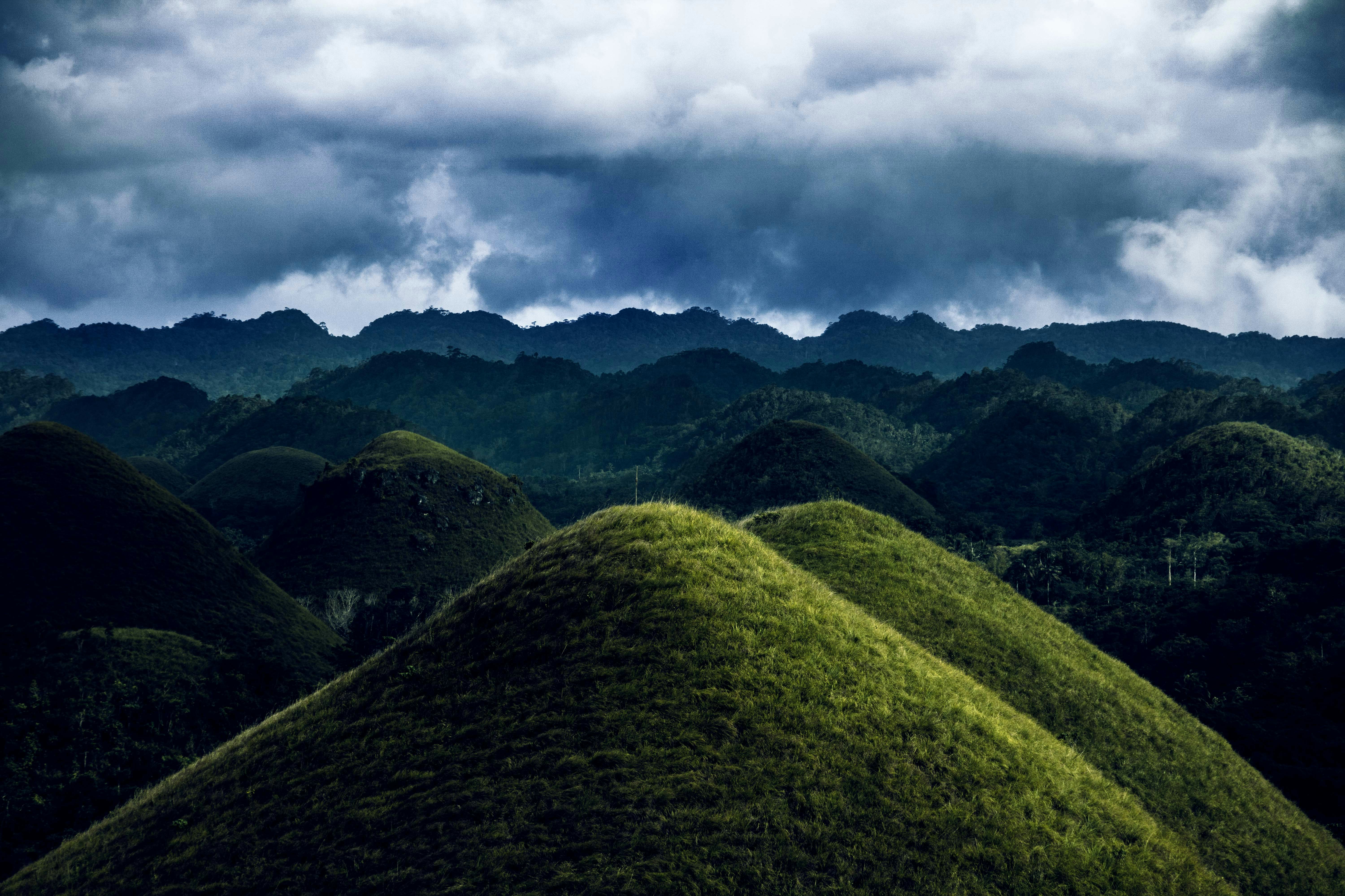 #974 /100
Over 1,200 near-perfectly conical grass-covered hills spread across Bohol island, turning chocolate-brown in the dry season.
A geological oddity of uncertain origin, best appreciated from the Chocolate Hills Complex viewing deck at sunrise or sunset.
How does it rate
CrowdsRomanceCash RequiredDangerAccessibilityWhy you should go
Over 1,200 symmetrical grassy hills that turn chocolate-brown in dry season, a geological one-of-a-kind.
Why you shouldn't go
The famous "chocolate" brown color only appears in dry season (Dec–May); green the rest of the year.
Plan your visit
Best time to visitMarch–May (dry season) for the brown hue the hills are named for.Best time of dayEarly morning for cooler temperatures and softer light on the viewing deck.Getting thereFly to Tagbilaran, Bohol; 1-hour drive to Carmen town viewing complex.Entry costPHP 50 (~$1) entrance fee.Time needed1–2 hoursInsider tip — Combine with a Loboc River cruise and the nearby tarsier sanctuary the same day. Climb the 214 steps to the deck for the full panorama. -
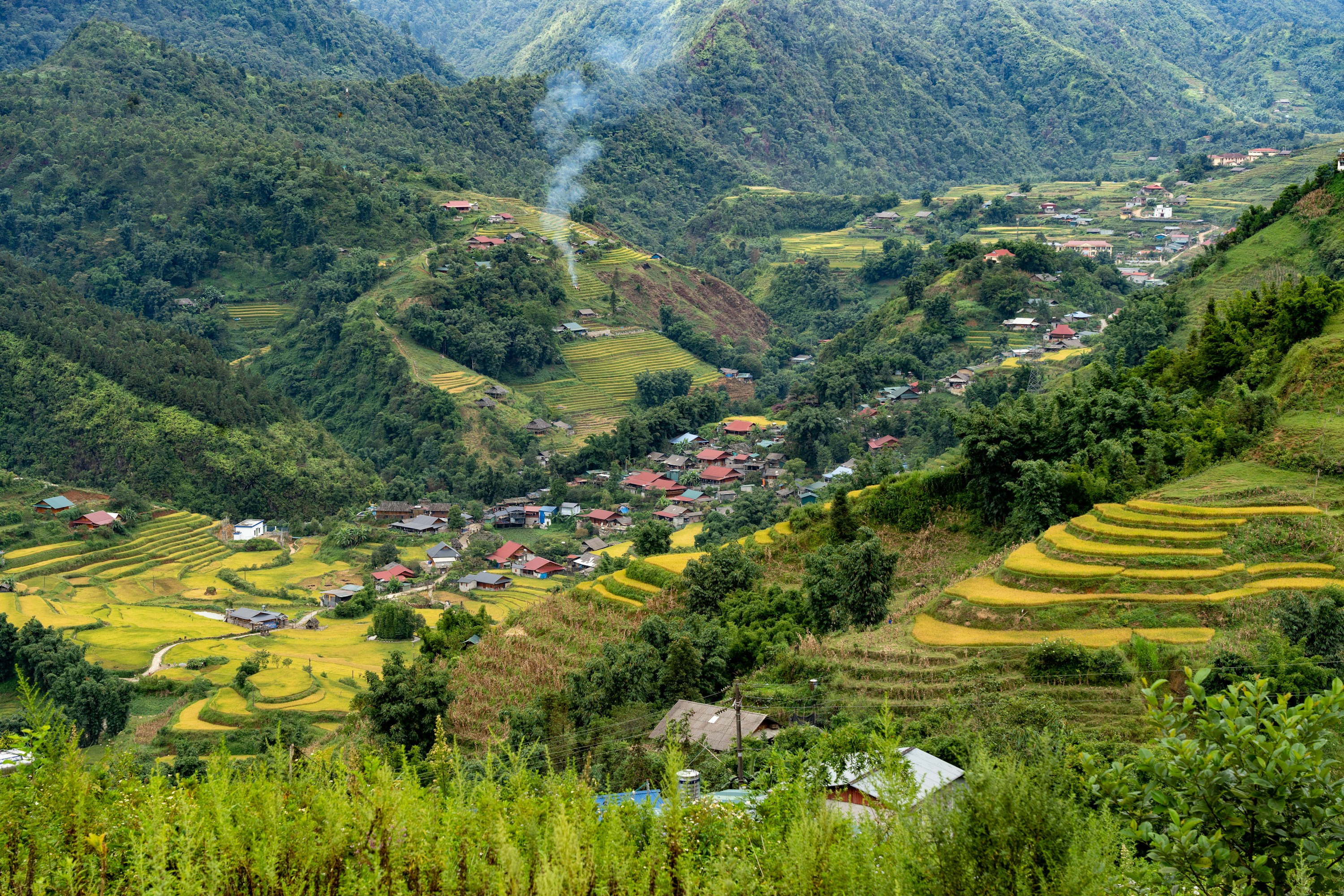 #1074 /100
Sapa's mountainsides are carved into thousands of stepped rice terraces, farmed for generations by H'mong, Dao, and Tay communities in the Muong Hoa Valley below Fansipan, Indochina's highest peak.
The fields turn brilliant green after May planting and gold at the September-October harvest.
Most visitors trek between hilltop villages, though a cable car now reaches Fansipan's summit in minutes for those who'd rather skip the climb.
How does it rate
CrowdsRomanceCash RequiredDangerAccessibilityWhy you should go
Some of Southeast Asia's most dramatic terraced-farming scenery, walkable through working hill-tribe villages.
Why you shouldn't go
Trails get muddy and slippery in the rainy season, and the town itself has become fairly built-up and touristy.
Plan your visit
Best time to visitSeptember-October for golden harvest terraces, or May-June for flooded, mirror-like planting season.Best time of dayEarly morning, before valley mist burns off and trekking groups set out.Getting thereOvernight train or bus from Hanoi to Lao Cai, then a 1-hour transfer up to Sapa town.Entry costFree to view; guided village treks typically $20-40 per dayTime needed2-3 daysInsider tip — Hire a local H'mong or Dao guide in town rather than a Hanoi-based operator; the money stays in the villages you're walking through, and their trails avoid the busiest routes. -
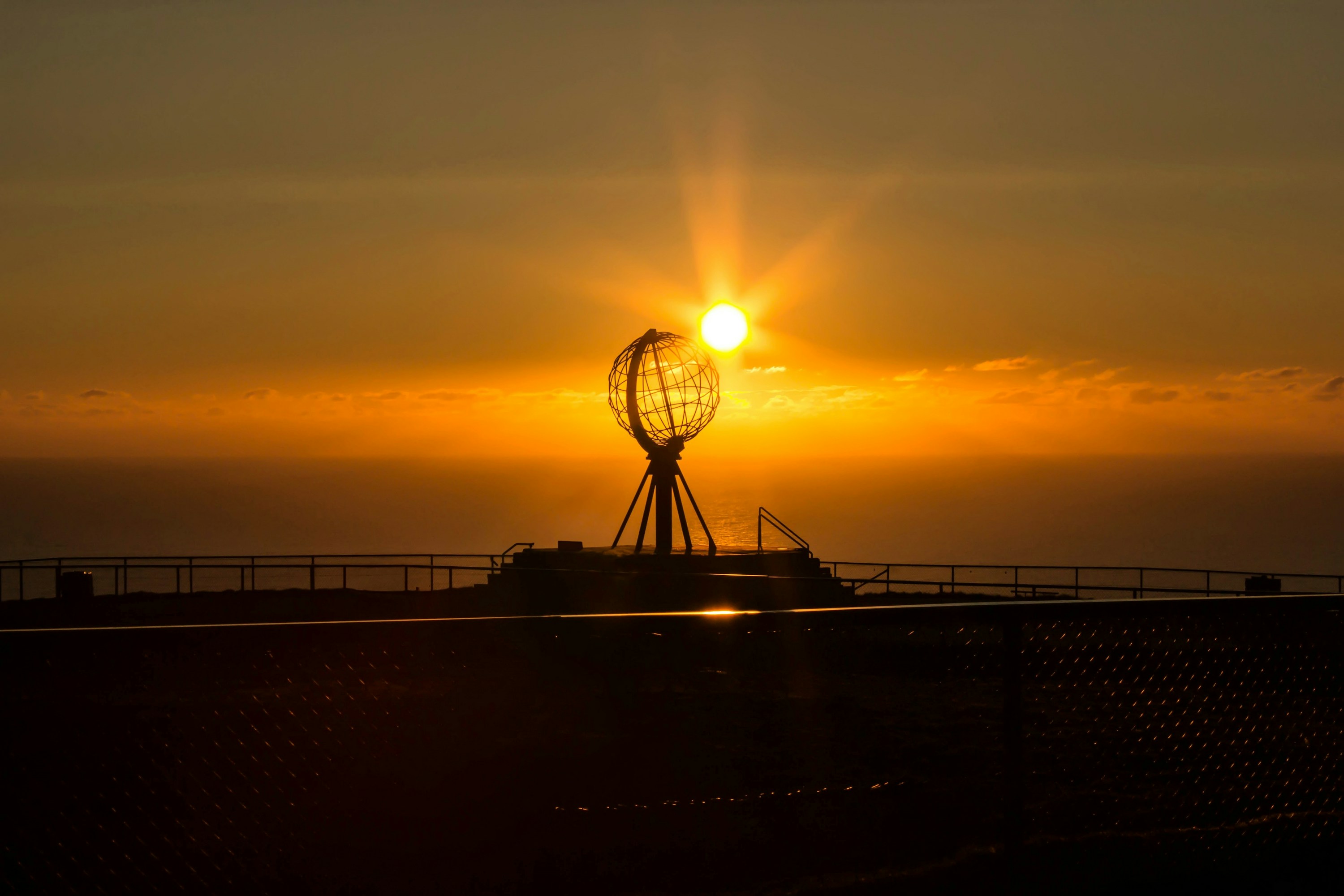 #1174 /100
North Cape is a 307-metre cliff on the northern tip of Magerøya island, marketed for two centuries as the northernmost point of mainland Europe - a technicality it doesn't quite hold, but the setting is real.
A visitor centre and a globe monument sit on the plateau above the Barents Sea, with the midnight sun visible from mid-May to late July.
The long, treeless drive across open Arctic tundra is as much a part of it as the cape itself.
How does it rate
CrowdsRomanceCash RequiredDangerAccessibilityWhy you should go
Standing on an Arctic cliff edge at 71°N with the midnight sun still up at midnight.
Why you shouldn't go
Often shrouded in fog or driving rain, and the visitor centre can feel more like a tour-bus terminus than a wild cape.
Plan your visit
Best time to visitMid-May to late July for the midnight sun; clear, calm days are never guaranteed.Best time of dayAround midnight in June-July, when the crowds thin and the sun is still on the horizon.Getting thereFly to Honningsvåg (Nordkapp Airport) or Alta; a 34km drive north from Honningsvåg to the cape.Entry costOutdoor plateau free; visitor centre entry around 320 NOK for adults.Time needed2-3 hoursBookingBook ahead →Insider tip — Walk the short St. Johannes chapel trail below the visitor centre for a quieter view of the cliffs, away from the globe-monument crowds. -
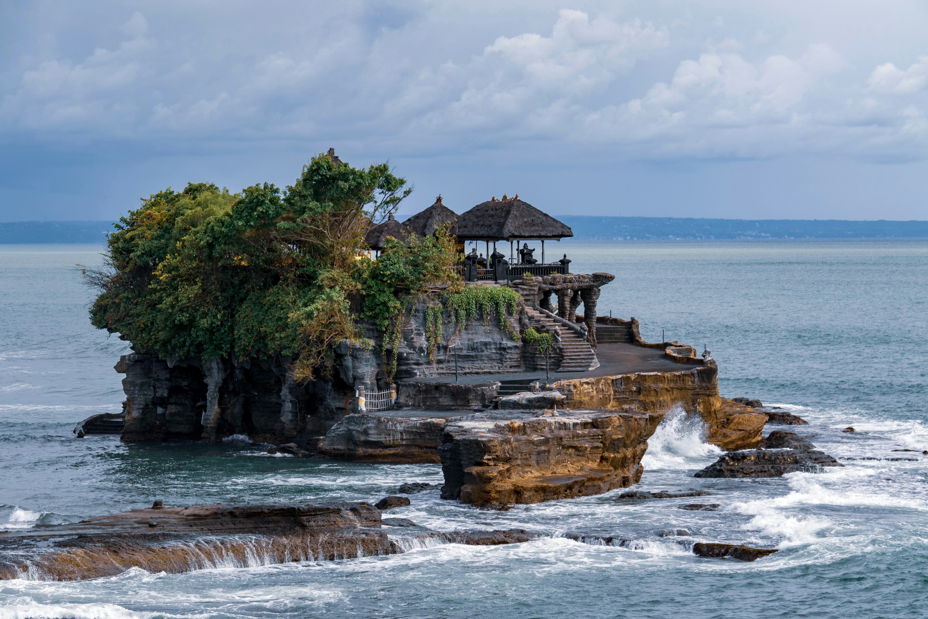 #1272 /100
Tanah Lot's Hindu sea temple sits on a small rock outcrop just offshore, cut off from the mainland at high tide and reachable on foot when the water recedes.
Built around a natural spring the Balinese consider sacred, it's one of several coastal temples protecting Bali from sea spirits, and among the most photographed silhouettes on the island at sunset.
The temple interior is closed to non-worshippers, so the visit is really about the setting and the ritual crowds gathering for dusk.
How does it rate
CrowdsRomanceCash RequiredDangerAccessibilityWhy you should go
One of Bali's most iconic sunset silhouettes, a temple perched on a wave-battered sea rock.
Why you shouldn't go
Extremely crowded by late afternoon, and the temple itself is closed to visitors who aren't there to pray.
Plan your visit
Best time to visitDry season, April-October, for reliable sunsets; check tide tables so the rock isn't submerged.Best time of daySunset, though arriving by mid-afternoon beats the worst of the crowds.Getting there45-60 minutes by car or scooter from Denpasar/Seminyak, in Tabanan regency.Entry costIDR 75,000 (~$4.50) for adults, cash onlyTime needed1-2 hoursInsider tip — Skip the crowded main viewpoint and walk the clifftop path south past the warungs for a quieter angle on the temple silhouette at sunset. -
 #1358 /100
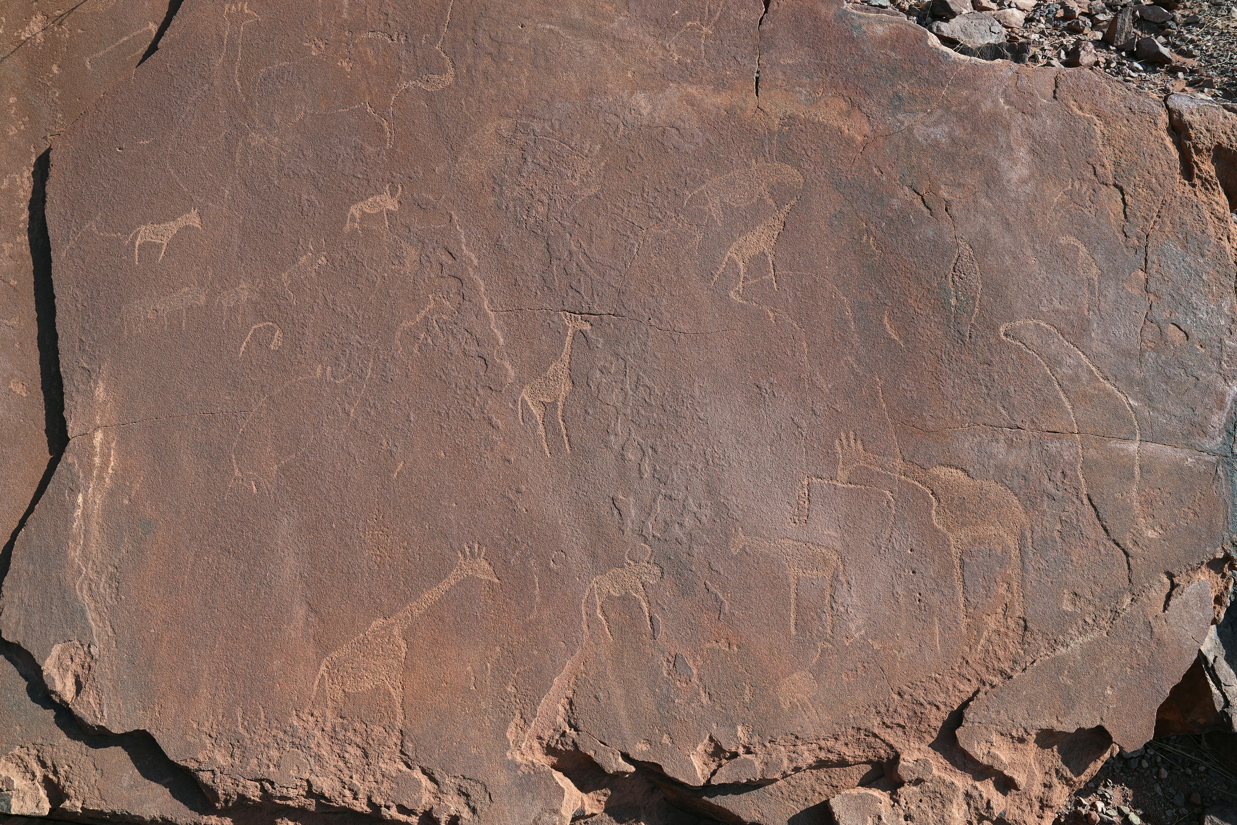
Namibia's only UNESCO World Heritage Site protects one of Africa's largest, best-preserved collections of rock engravings, with more than 2,000 petroglyphs carved by San hunter-gatherers over some 6,000 years depicting rhino, giraffe, human figures and animal spoor.
Set among rust-colored sandstone outcrops in Damaraland's desert scenery, guided walks explain the engravings' likely ritual and navigational purposes alongside the rock formations.
How does it rate
CrowdsRomanceCash RequiredDangerAccessibilityWhy you should go
One of Africa's largest collections of ancient rock engravings, set in dramatic desert sandstone scenery.
Why you shouldn't go
A required guide and the site's exposed, rocky terrain make it a slower, hotter visit than it first appears.
Plan your visit
Best time to visitMay–September (dry, cooler season) for more comfortable walking.Best time of dayMorning, before the exposed rock terrain heats up under midday sun.Getting thereAbout 5 hours' drive from Windhoek, or a stop en route between Swakopmund and Etosha.Entry costAround N$150 (~€8), including the mandatory guided walk.Time needed1–2 hours.Insider tip — Combine the visit with the nearby Organ Pipes and Burnt Mountain rock formations — often overlooked by visitors who see only the engravings.


More from The World
-
How a score is built
One score out of 100, five criteria behind it
Every place is rated 1–5 on each of the criteria below, then combined into a single score out of 100. It's calculated by us, the same way every time — not an average of traveller reviews or social votes.
Crowds
How many people you'll be sharing it with, and at what time of day.
Romance
How well it suits a couple, a proposal, or a quiet moment together.
Cash required
Entry fees, permits, guides, rentals — what it actually costs to do it.
Danger
Physical risk involved, from a slippery viewpoint to genuine hazard.
Accessibility
How far off the beaten path it is, and how hard it is to actually reach.

