-
 #193 /100
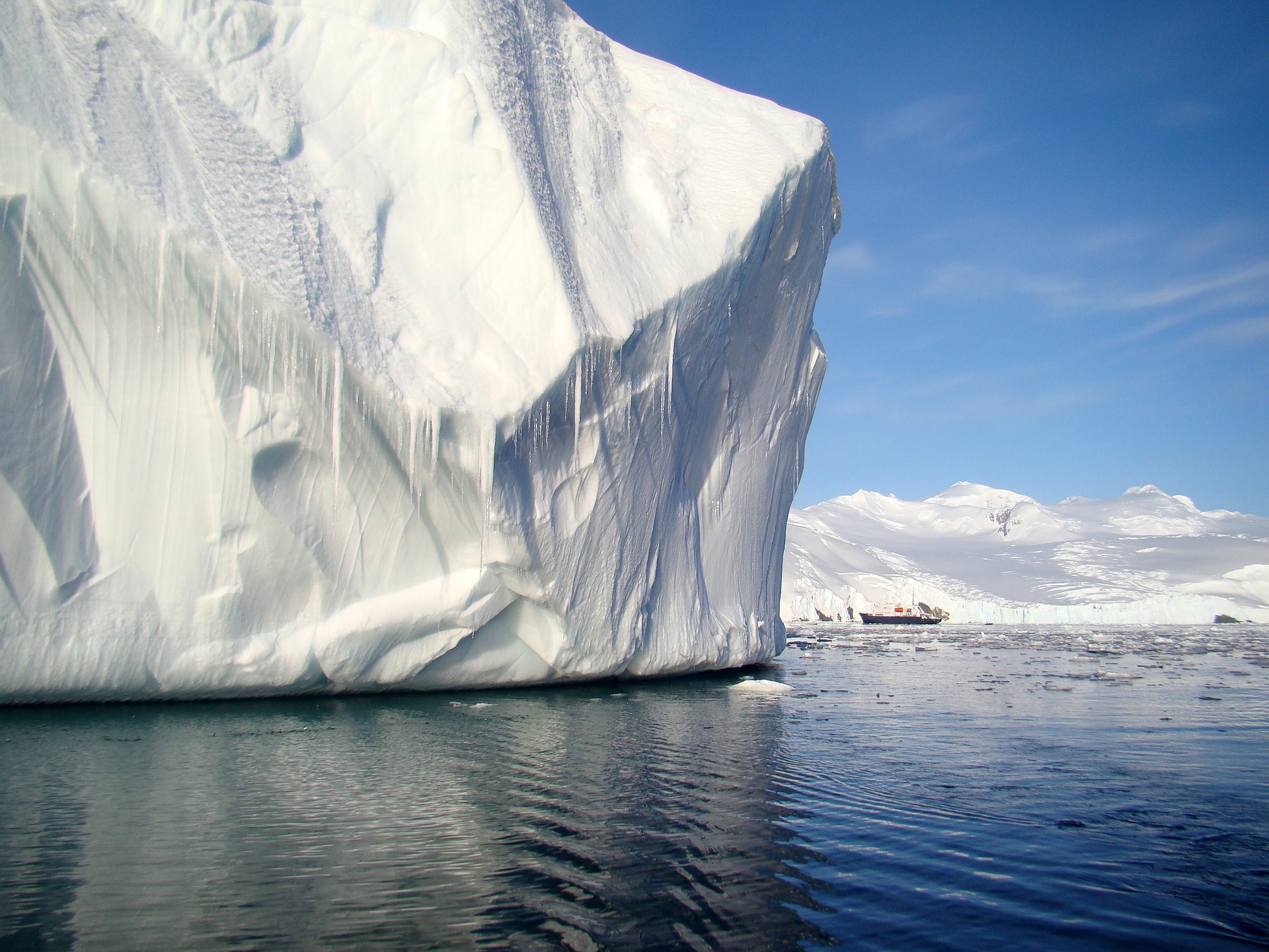
An expedition by ice-strengthened ship across the Drake Passage to a continent of blue-white icebergs, breaching whales, and penguin rookeries numbering in the thousands.
Zodiac landings put passengers ashore on the peninsula itself, among seals hauled out on ice floes.
Days run on near-24-hour summer light, and the silence between engine shutdowns is near-total.
Few journeys anywhere feel as genuinely remote.
How does it rate
CrowdsRomanceCash RequiredDangerAccessibilityWhy you should go
A genuinely untouched continent of icebergs, whales, and penguin colonies most people will never see in person.
Why you shouldn't go
The Drake Passage crossing can be rough, and the trip costs far more than a typical cruise once flights and gear are added.
Plan your visit
Best time to visitNovember to March, the only season ships sail; December-January for penguin chicks, November for pristine snow.Best time of dayMidday for Zodiac landings, when light and calm water are best for wildlife viewing.Getting thereFly to Ushuaia, Argentina, the southernmost city in the world; ships embark directly from its port.Entry costIndicative $7,000-$16,000+pp for 10-11 nights, plus flights and gearTime needed10-12 night expeditionInsider tip — Book an outside cabin and pack seasickness medication for the Drake Passage; fly-cruise options that skip the crossing cost more but save two rough sea days each way. -
 #293 /100
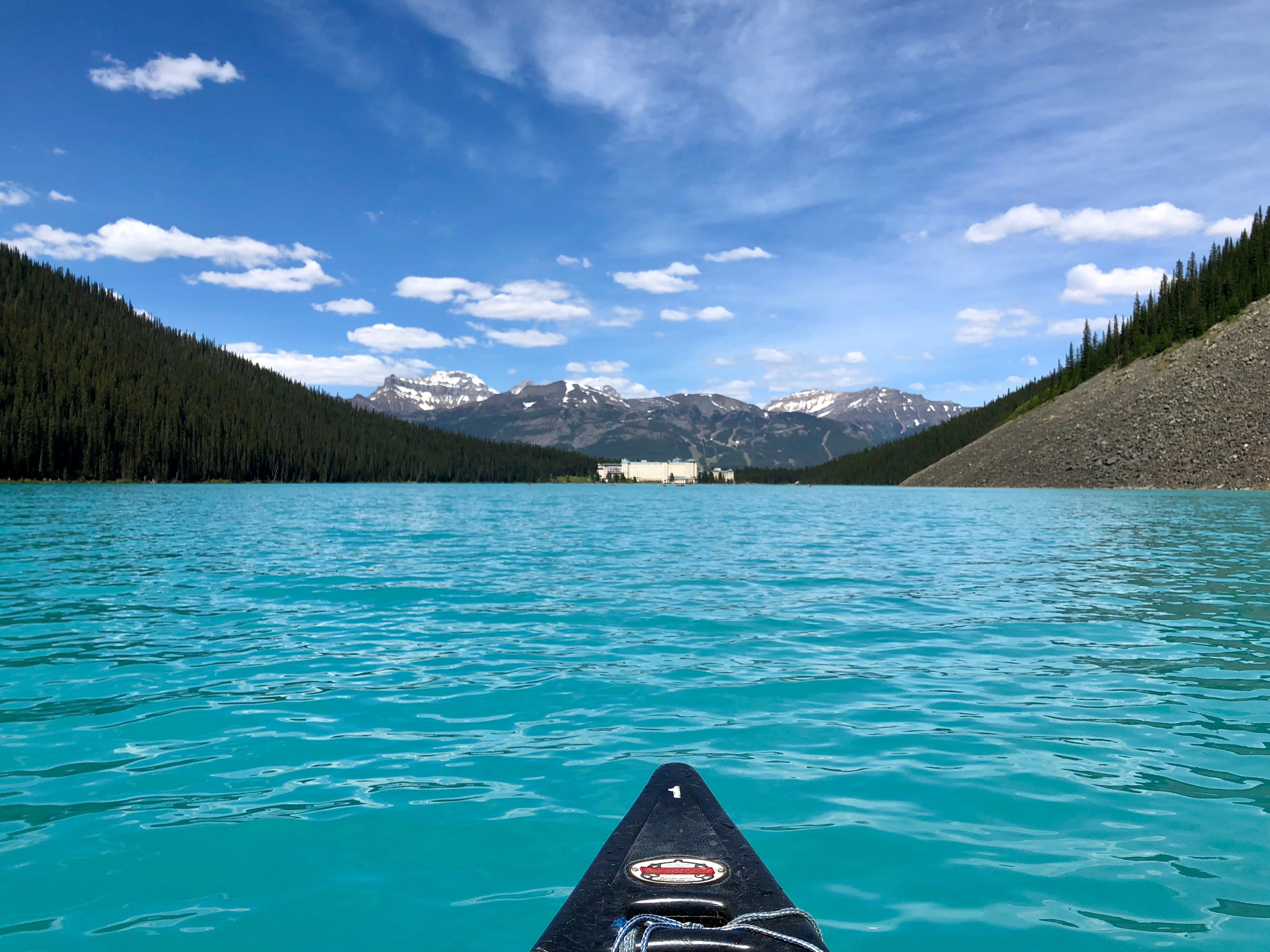
Established in 1885, Banff is Canada's oldest national park and one of the world's most spectacular.
Turquoise lakes, ancient glaciers, hot springs, abundant wildlife, and the postcard town of Banff itself make this an unmissable destination in the Canadian Rockies.
How does it rate
CrowdsRomanceCash RequiredDangerAccessibilityWhy you should go
The combination of turquoise glacial lakes, dramatic mountain scenery, and easy accessibility makes Banff one of the most photogenic national parks on earth.
Why you shouldn't go
Banff becomes very crowded in summer and key sites like Moraine Lake and Lake Louise require advance shuttle booking.
Plan your visit
Best time to visitJune-SeptemberBest time of dayEarly morning for wildlife and calm waterGetting there~1.5hr drive from CalgaryEntry costPark pass ~$10/dayTime needed3+ daysInsider tip — Get to Moraine Lake or Lake Louise before 7am in July/August or the parking lots fill and close -
 #3
#3Rated #3 of 100
Yellowstone National Park, the United States
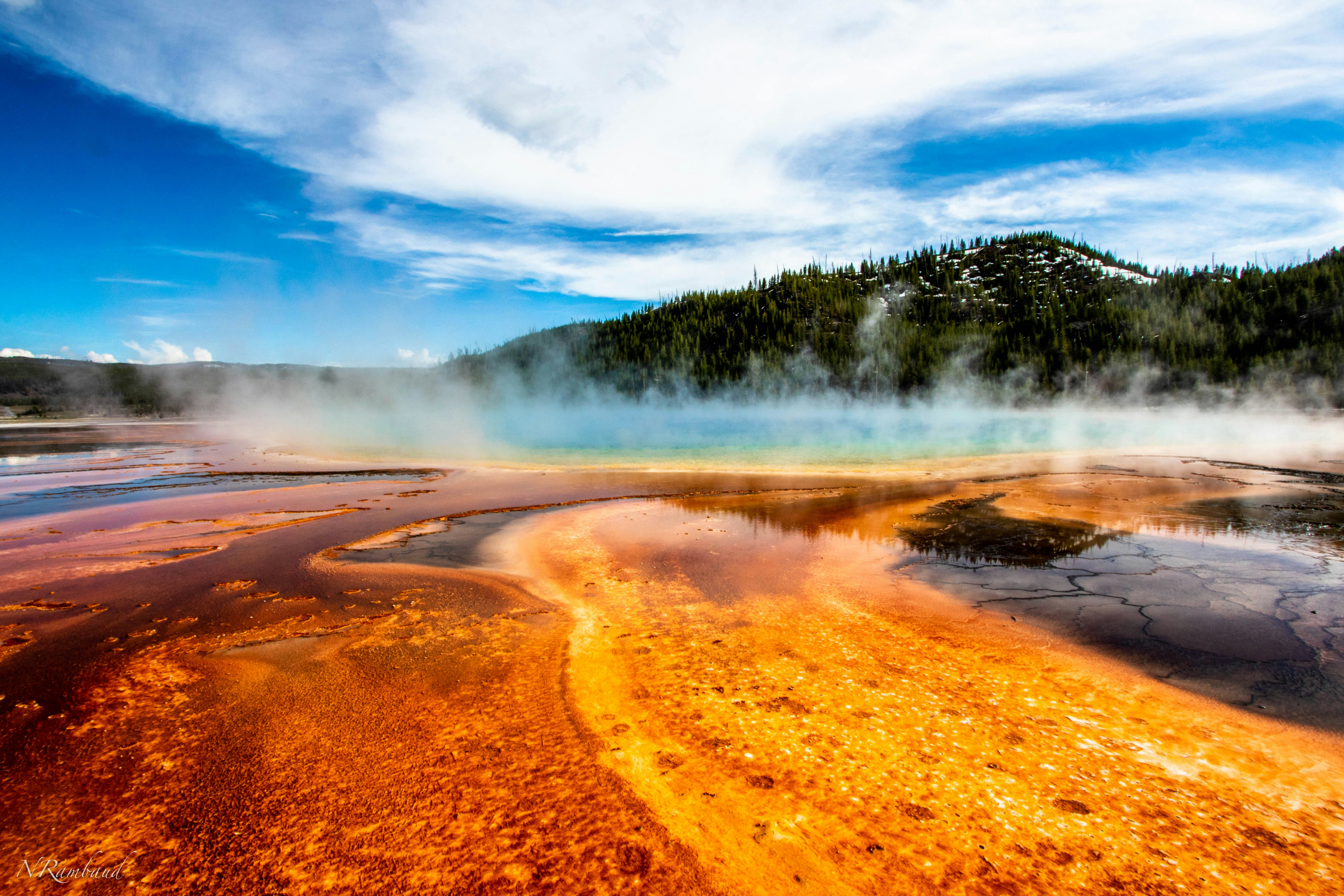
#yellowstonenationalpark ◆ National Parks93 /100Yellowstone is the world's first national park and still its strangest, sitting atop a supervolcano that surfaces as thousands of geysers, hot springs, and mudpots.
Old Faithful erupts on a near-hourly schedule, while the Grand Prismatic Spring's rainbow colours come from heat-loving bacteria.
Beyond the geothermal basins, the park holds free-roaming bison, elk, wolves, and grizzly bears across nearly 9,000 square kilometres of forest and canyon.
How does it rate
CrowdsRomanceCash RequiredDangerAccessibilityWhy you should go
Nowhere else combines a supervolcano's geysers and hot springs with free-roaming bison, wolves, and grizzly bears in one park.
Why you shouldn't go
Peak summer brings gridlock traffic and packed boardwalks at the famous geyser basins.
Plan your visit
Best time to visitLate May-June or September for wildlife and thinner crowds; many roads close in winter.Best time of dayEarly morning for wildlife viewing and quieter geyser basins before tour buses arrive.Getting thereFly to Jackson Hole or Bozeman; 1.5-3 hour drive to the nearest park entrance.Entry cost$35 per vehicle, valid 7 daysTime needed3+ daysInsider tip — Watch Old Faithful from the Observation Point trail above the boardwalk to skip the crowd at ground level. -
 #492 /100
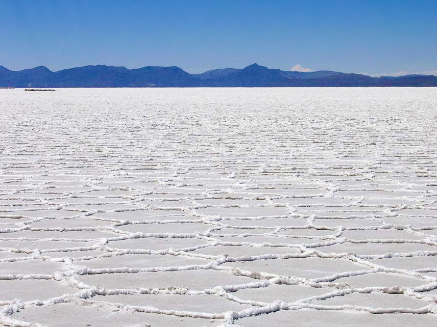
The Salar de Uyuni is the world's largest salt flat, covering 10,582 square kilometres of the Bolivian altiplano at 3,656 metres above sea level.
When covered by a thin layer of water after the rainy season, it becomes a perfect mirror reflection of the sky and one of the most surreal landscapes on earth.
How does it rate
CrowdsRomanceCash RequiredDangerAccessibilityWhy you should go
The mirror effect during the wet season, when the salt flat reflects the sky with perfect fidelity, creates photographs that look like they belong in a dream.
Why you shouldn't go
The wet season (January to March) that creates the famous mirror effect also brings heavy rains; the dry season offers a stark but less photogenic white expanse.
Plan your visit
Best time to visitDecember-April (wet season) for the mirror effect, dry season for easier accessBest time of daySunrise or sunset for the reflection and colourGetting thereFly to Uyuni via La PazEntry costGuided tour ~$100-150/dayTime needed1-3 daysInsider tip — Visit just after rain for the famous mirror effect; the wet season (Jan-Apr) is when it is most reliable -
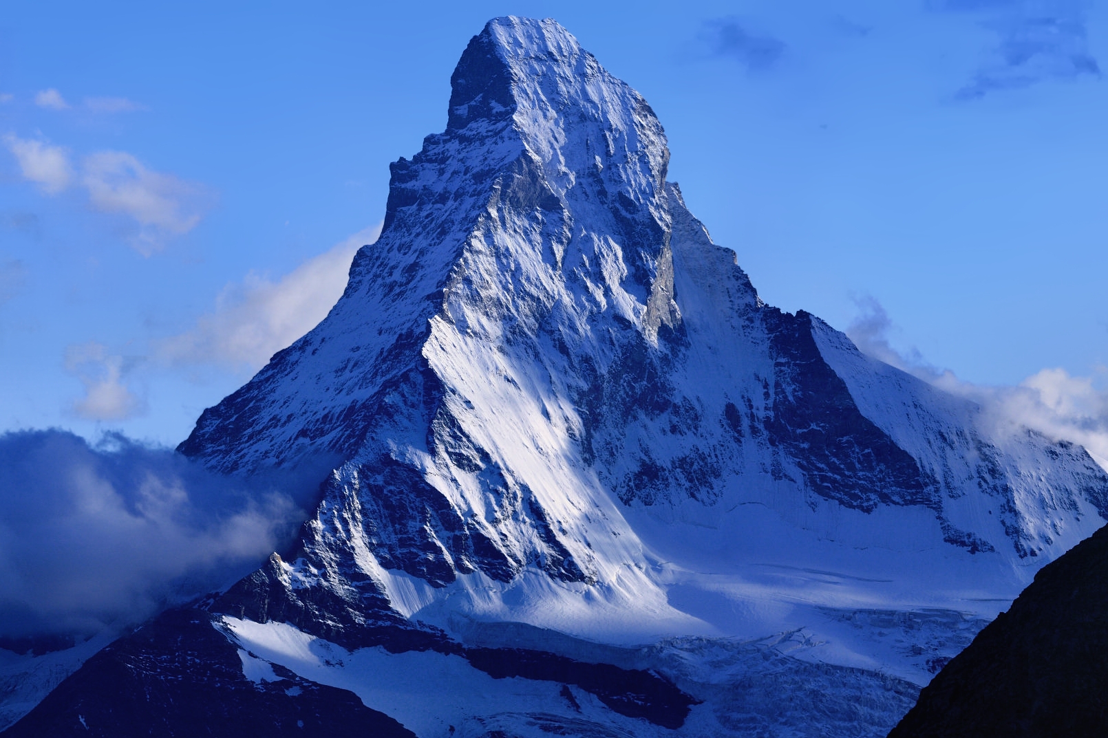 #592 /100
The Matterhorn's near-perfect pyramidal peak has made it one of the most recognised mountains in the world and the symbol of the Swiss Alps.
Rising 4,478 metres above the car-free village of Zermatt, it is reflected in the Riffelsee lake during clear summer mornings.
How does it rate
CrowdsRomanceCash RequiredDangerAccessibilityWhy you should go
The Matterhorn's symmetrical profile is spectacular from every angle and the reflection in the Riffelsee on a calm morning is one of the great Alpine photographs.
Why you shouldn't go
The mountain is notoriously cloud-covered; visiting Zermatt can be expensive and clear views are never guaranteed.
Plan your visit
Best time to visitJune-September for hiking, winter for snowBest time of daySunrise or sunset for alpenglow on the peakGetting thereTrain to Zermatt, a car-free villageEntry costFree to view; cable cars extraTime needed1-2 daysInsider tip — The reflection shot at Stellisee lake needs an early, still morning; go before 7am -
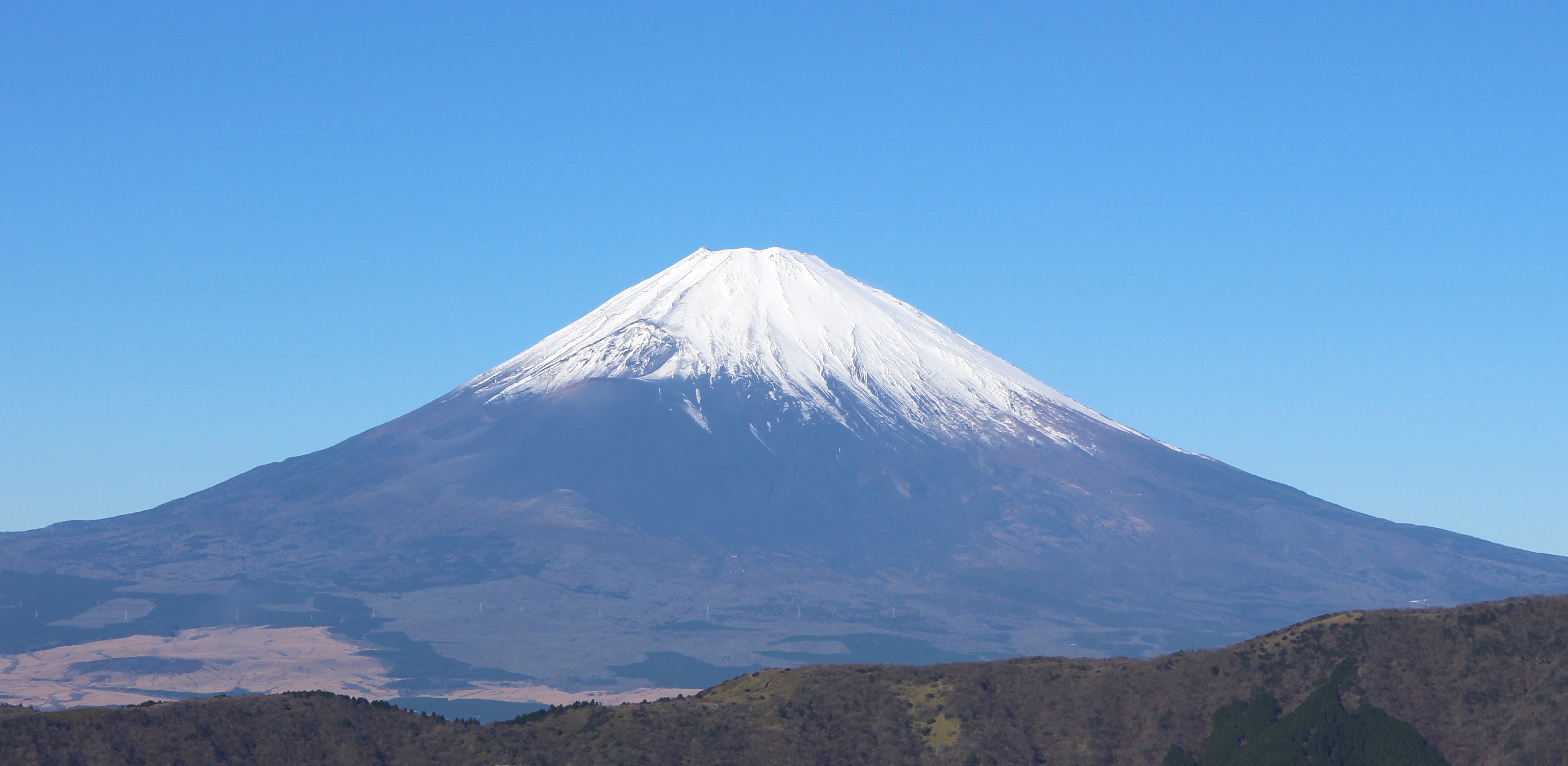 #691 /100
Japan's highest mountain and most enduring symbol rises 3,776 metres in near-perfect symmetry above Honshu's coastal plain.
The classic view of Fuji reflected in the still waters of Lake Kawaguchiko, or framed by cherry blossoms in spring or maple leaves in autumn, has inspired Japanese art for centuries.
How does it rate
CrowdsRomanceCash RequiredDangerAccessibilityWhy you should go
The symmetry and scale of Mount Fuji makes it one of the world's most instantly recognisable mountains; the spring reflection in Lake Kawaguchiko is iconic.
Why you shouldn't go
Fuji is often hidden behind cloud and the climbing season is very short; the popular Yoshida Trail is now extremely crowded and has safety restrictions.
Plan your visit
Best time to visitJuly-September for climbing; year-round for photos, especially with snow cap Oct-MayBest time of daySunrise if climbing, or early morning from Lake KawaguchiGetting thereTrain/bus to Kawaguchiko from Tokyo (~2hrs)Entry costFree to view; climbing huts/permits extraTime neededHalf day for viewing, 1-2 days to climbInsider tip — Chureito Pagoda near Fujiyoshida gives the iconic pagoda-plus-Fuji shot, especially with spring cherry blossoms -
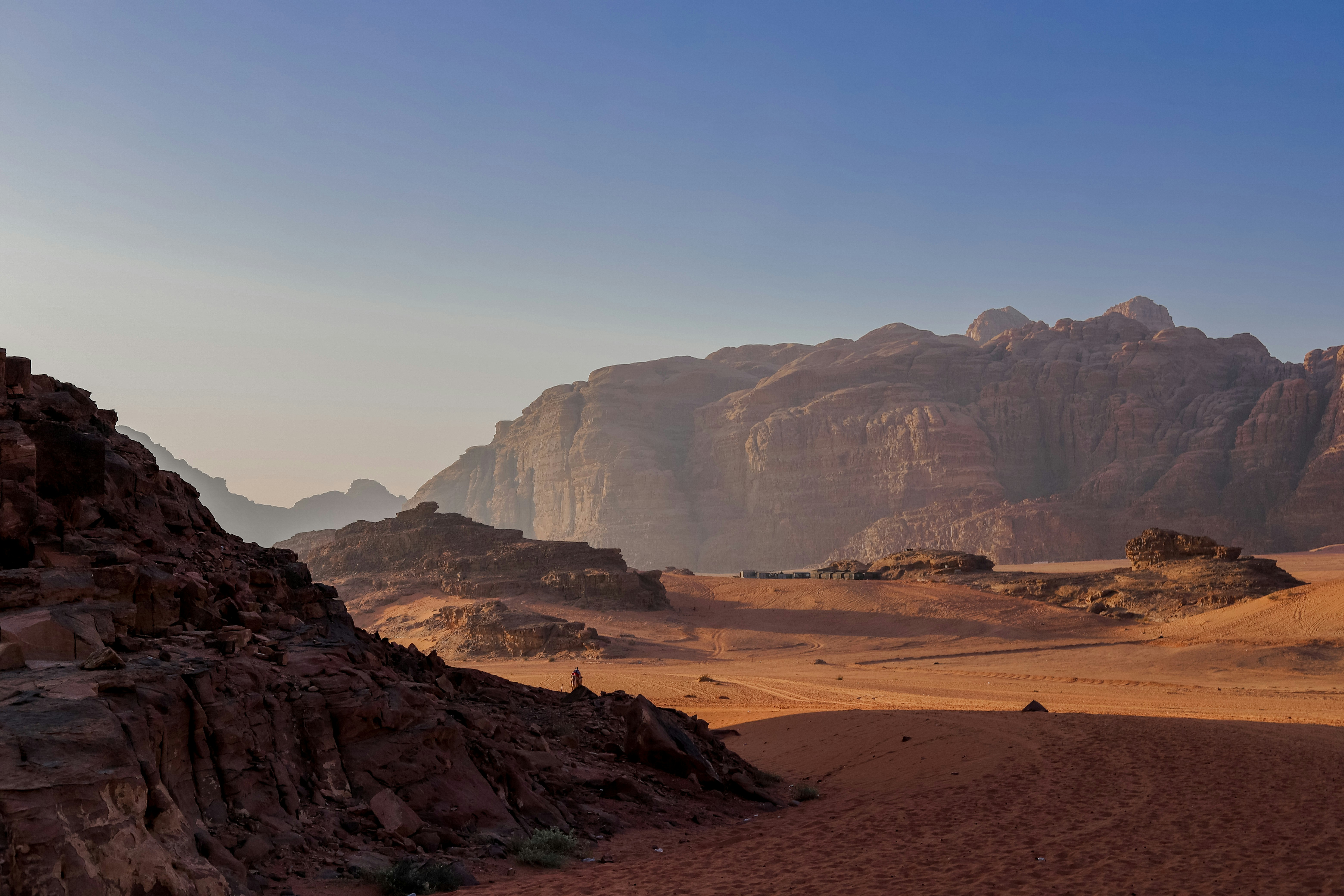 #7
#7A vast valley of red sand and towering sandstone mountains so otherworldly it has stood in for Mars in multiple films, including The Martian and The Rise of Skywalker.
Bedouin-guided 4x4 tours and camel treks weave between weathered rock arches, ancient petroglyphs, and canyons, ending most days at a Bedouin camp under some of the darkest skies in the Middle East.
The scale and silence of the place are as striking as its colour.
How does it rate
CrowdsRomanceCash RequiredDangerAccessibilityWhy you should go
Mars-red sand and towering rock formations so cinematic they've repeatedly stood in for the actual planet on screen.
Why you shouldn't go
Daytime desert heat is extreme for much of the year, and most of the site is only accessible with a Bedouin guide or 4x4.
Plan your visit
Best time to visitOctober-April for manageable daytime temperatures.Best time of daySunset, when the sandstone mountains glow deep red before the stars come out.Getting thereFly to Aqaba or Amman; Wadi Rum village is about an hour's drive from either.Entry costEntry plus a half-day 4x4 tour runs roughly 30-50 JD per person.Time neededA full day, or overnight in a desert camp.Insider tip — Book an overnight camp rather than a day trip - the night sky here, far from any city light, is the single best reason to come. -
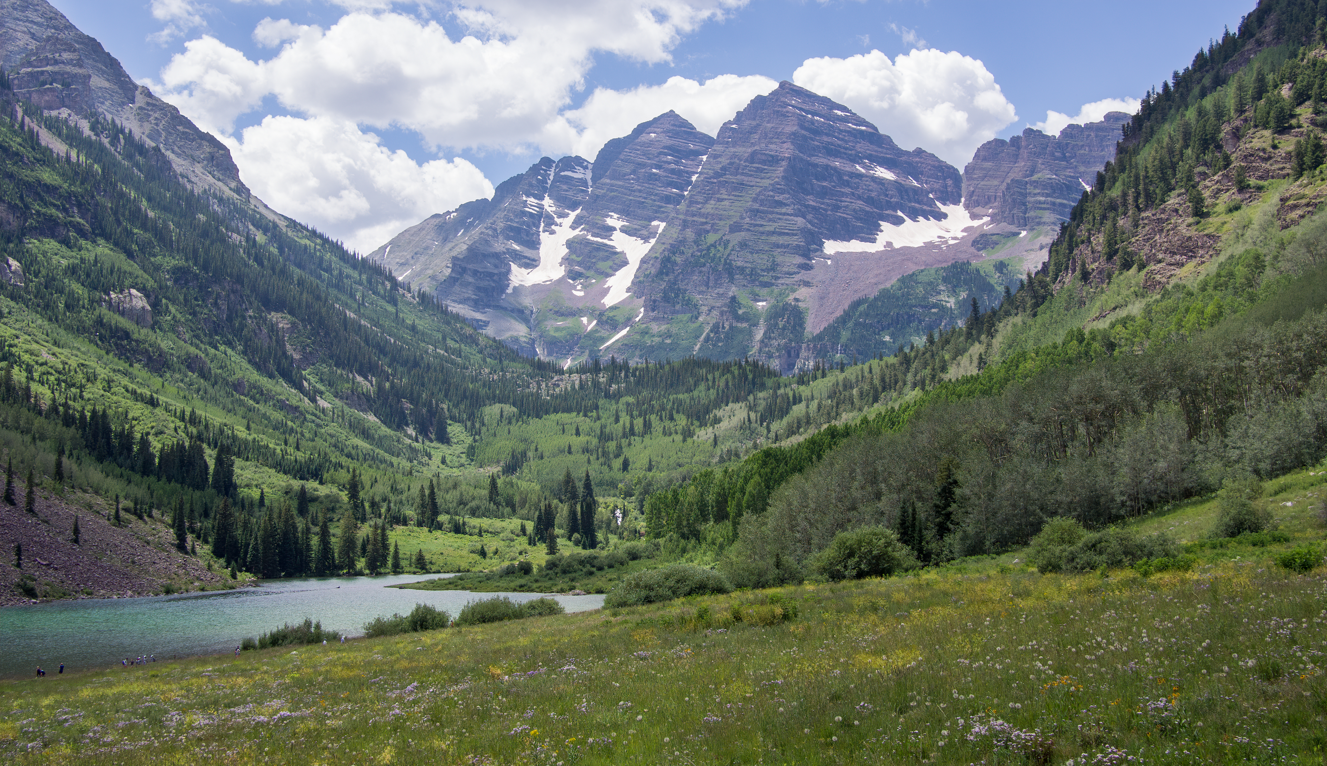 #891 /100
The Maroon Bells are two peaks — Maroon Peak and North Maroon Peak — in the Elk Mountains of Colorado, rising to 4,317 and 4,273 metres respectively.
The reflection of the burgundy-coloured peaks in the still waters of Maroon Lake, particularly in autumn when the surrounding aspen trees turn gold, is one of the classic sights of the American Rockies.
How does it rate
CrowdsRomanceCash RequiredDangerAccessibilityWhy you should go
The autumn reflection of the Maroon Bells in Maroon Lake, with the aspens turning gold around the shoreline, is one of the great landscape photographs of the American West.
Why you shouldn't go
Access by private vehicle is restricted and requires a shuttle bus from Aspen; the autumn season brings the most colour but also the most visitors.
Plan your visit
Best time to visitLate September for aspen gold, or July for wildflowersBest time of daySunrise for the reflection in Maroon Lake before wind picks upGetting thereShuttle bus required from Aspen Highlands in peak seasonEntry costShuttle/entry fee ~$10-16Time needed2-3 hoursInsider tip — Early shuttle reservations sell out; book ahead for the classic still-water reflection shot -
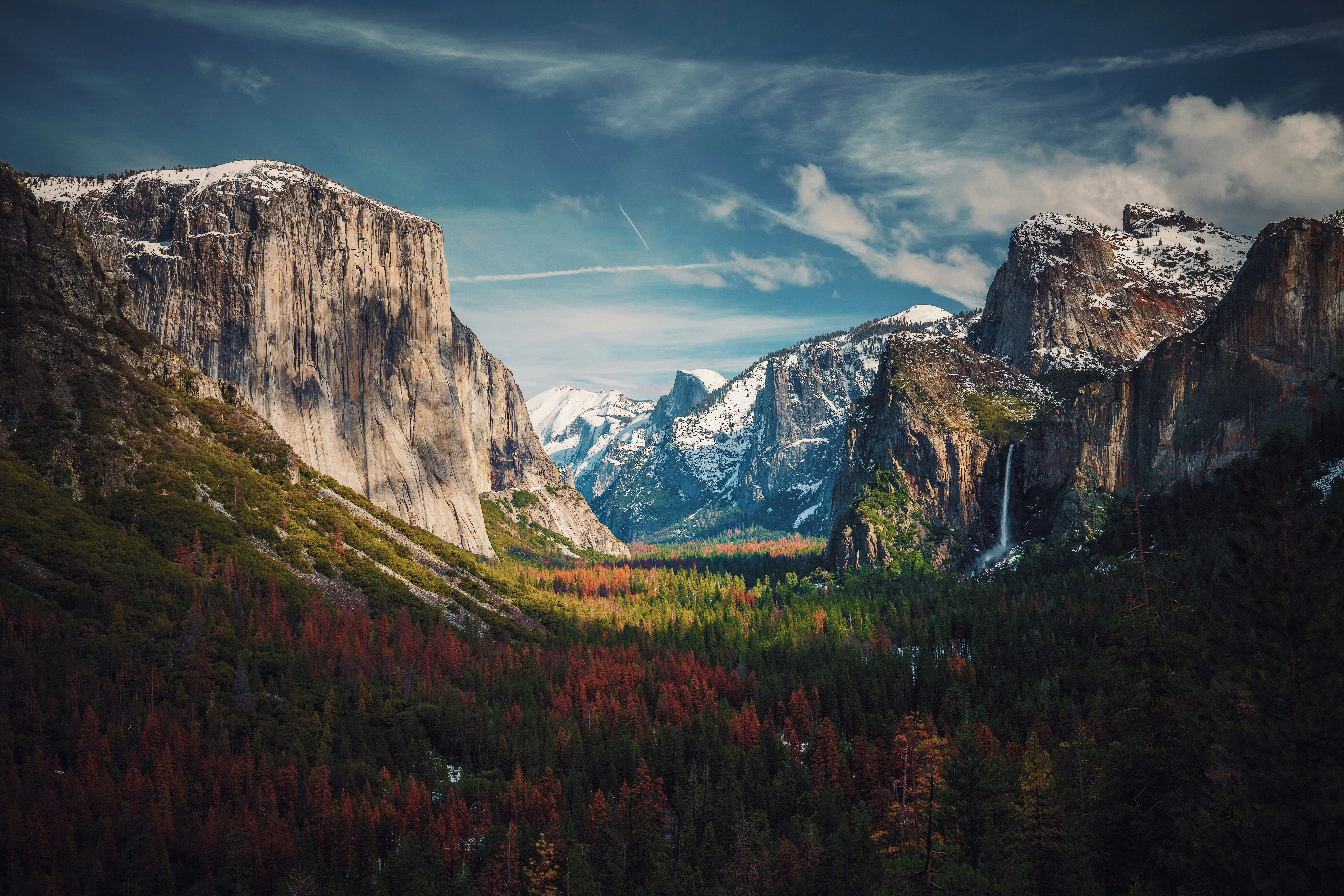 #991 /100
Yosemite Valley is a granite gorge cut by glaciers, with El Capitan and Half Dome rising thousands of feet above the valley floor and waterfalls dropping straight off the rim.
Beyond the valley, the park holds giant sequoia groves, alpine meadows, and high-country lakes reached by the seasonal Tioga Road.
It's one of the birthplaces of American rock climbing, and climbers on El Capitan's face are visible from the valley floor with binoculars.
How does it rate
CrowdsRomanceCash RequiredDangerAccessibilityWhy you should go
Few places pack granite cliffs, giant sequoias, and waterfalls into one valley visible from a single viewpoint.
Why you shouldn't go
Yosemite Valley's roads gridlock in summer, and a timed-entry reservation is often required.
Plan your visit
Best time to visitMay-June for waterfalls at full flow, or September for thinner crowds.Best time of daySunrise at Tunnel View for the valley before the roads fill up.Getting thereFly to Fresno or San Francisco; roughly 2.5-4 hour drive to the valley.Entry cost$35 per vehicle, valid 7 daysTime needed2-3 daysInsider tip — Book the free valley shuttle instead of driving once inside the park - parking fills by mid-morning. -
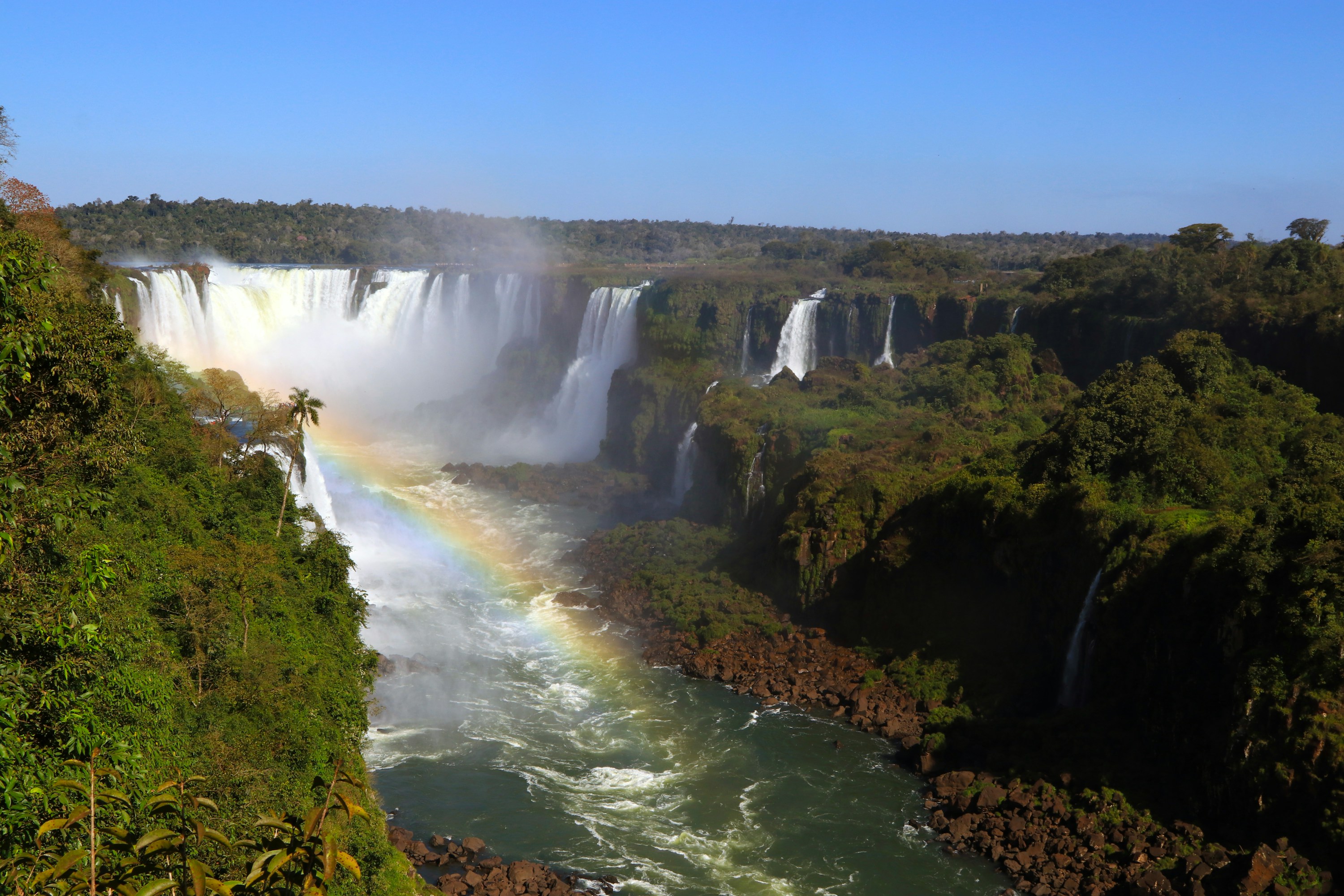 #1091 /100
The Brazilian side of Iguaçu Falls trades Argentina's up-close catwalks for one long panoramic circuit, sweeping across nearly the entire 2.
7km curtain of over 250 individual falls at once.
A short walkway leads out to a platform inside the spray of the Devil's Throat, with boat trips for those who want to get soaked.
It's compact enough to see in half a day, unlike the sprawling park across the border.
How does it rate
CrowdsRomanceCash RequiredDangerAccessibilityWhy you should go
One sweeping panoramic walkway takes in almost the entire 2.7km curtain of falls in a single visit.
Why you shouldn't go
The shuttle bus and viewing platforms queue up fast by mid-morning in high season.
Plan your visit
Best time to visitApril-September (dry season) for clearer views; wetter months bring more dramatic flow.Best time of dayEarly morning, before the tour buses arrive.Getting thereFly to Foz do Iguaçu (IGU); 25-30 min taxi/bus to the park entrance, then the park's own shuttle bus to the falls circuit.Entry cost~R$130 (~US$24) entry; boat trips extraTime needed3-4 hoursBookingBook ahead →Insider tip — Take the elevator at the end of the walkway to the upper overlook for the full-panorama view, and catch the park's first shuttle to beat the tour-bus crowds. -
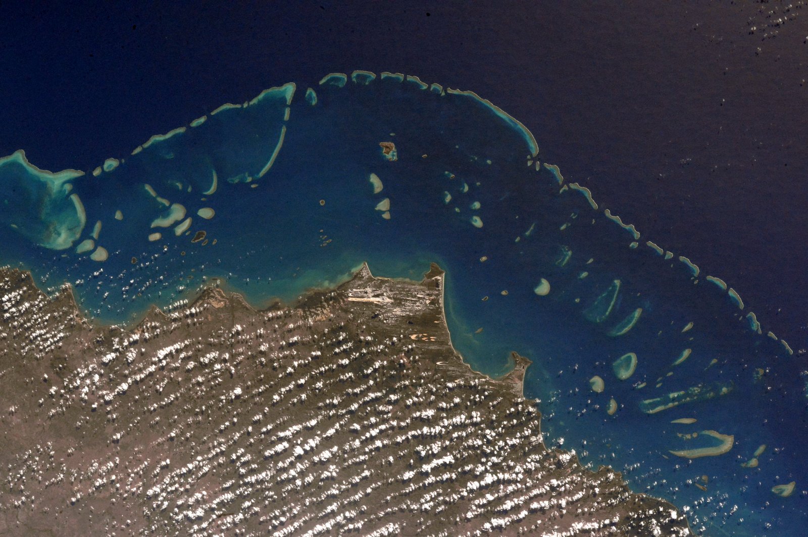 #1190 /100
The Great Barrier Reef is the world's largest coral reef system, stretching 2,300 kilometres along the Queensland coast and visible from space.
Home to over 1,500 species of fish, 4,000 types of mollusc, and 600 types of coral, it is the largest living structure on earth and a UNESCO World Heritage Site.
How does it rate
CrowdsRomanceCash RequiredDangerAccessibilityWhy you should go
Snorkelling above the coral gardens of the Great Barrier Reef, surrounded by extraordinary marine biodiversity in crystal clear water, is a genuinely transformative experience.
Why you shouldn't go
Coral bleaching caused by climate change has severely damaged large sections of the reef; the experience varies greatly depending on which section you visit.
Plan your visit
Best time to visitJune-October (dry season, best visibility)Best time of dayMorning for calmer water and better underwater lightGetting thereFly to Cairns or Airlie Beach, boat tours from thereEntry costReef tours ~$200-250 AUDTime neededFull day, ideally multi-day liveaboardInsider tip — Book a trip that visits the outer reef rather than pontoons closer to shore; coral health and visibility is much better -
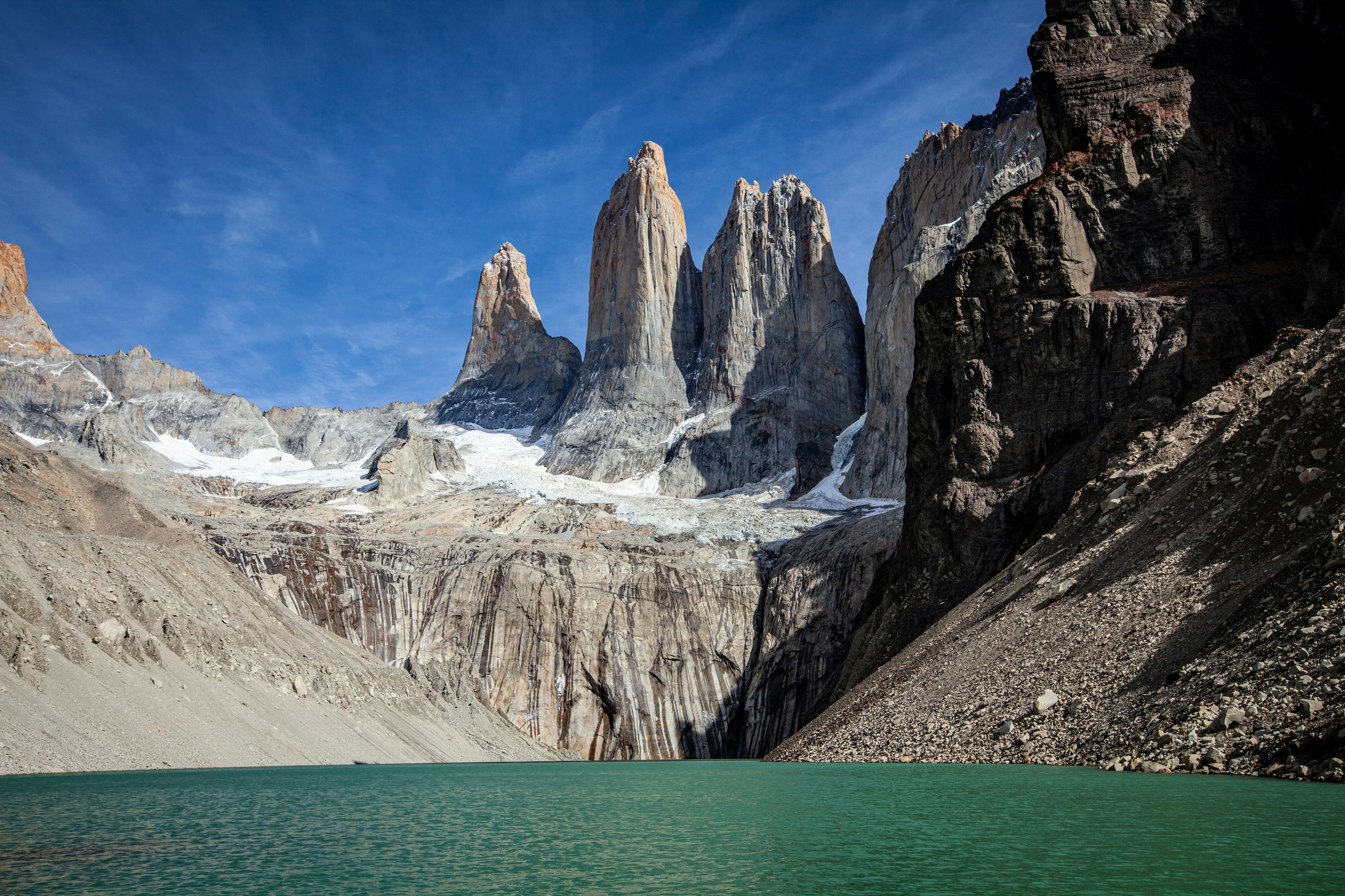 #1290 /100
Three granite towers punch straight up out of Chilean Patagonia, reflected in turquoise glacial lakes that change colour with the light.
The full W trek links the towers with glaciers, wind-battered forests and the vivid blue of the Grey Glacier over several days.
Even a single day at the base-of-the-towers viewpoint delivers one of South America's most dramatic landscapes.
How does it rate
CrowdsRomanceCash RequiredDangerAccessibilityWhy you should go
Three granite spires over turquoise glacial lakes - Patagonia's single most iconic view.
Why you shouldn't go
Patagonian wind is relentless and can shut down trails or make photography genuinely difficult.
Plan your visit
Best time to visitNovember-March, the Southern Hemisphere summer.Best time of dayEarly morning, when the wind is calmest and the towers often clear of cloud.Getting thereFly to Punta Arenas, bus to Puerto Natales, then park shuttle to Torres del Paine.Entry costPark entry fee, roughly $35-45 for foreign visitors.Time needed3-5 days for the W trek; 1 day for the base viewpointBookingBook ahead →Insider tip — Base yourself near the park for a pre-dawn start on the Base Towers trail - the final viewpoint is worth reaching before the day's cloud builds. -
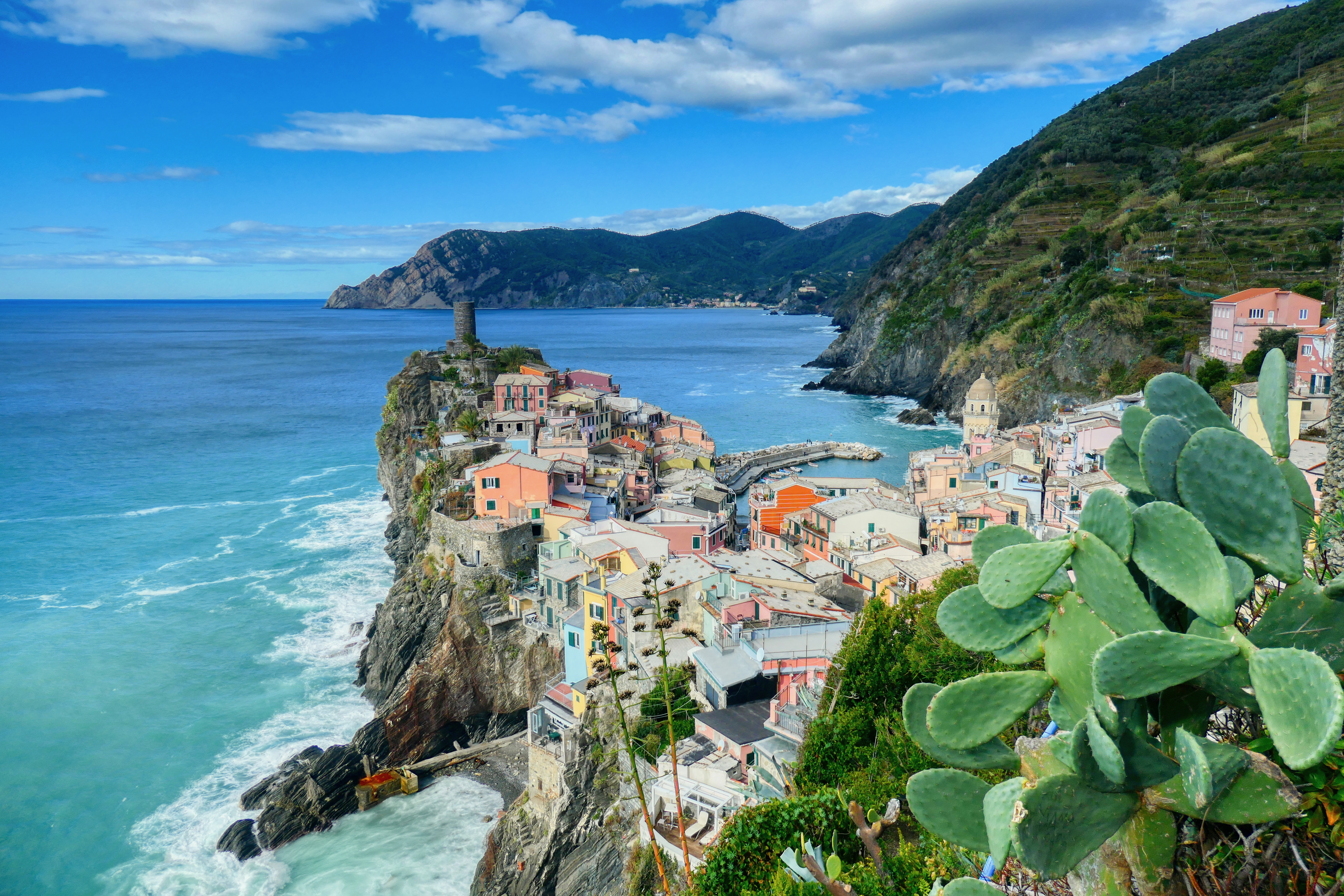 #1390 /100
Cinque Terre is a string of five centuries-old fishing villages clinging to the cliffs of the Italian Riviera, connected by scenic hiking trails above the Ligurian Sea.
Manarola, Vernazza, Corniglia, Monterosso, and Riomaggiore tumble down their respective cliff faces in a cascade of colourful buildings.
How does it rate
CrowdsRomanceCash RequiredDangerAccessibilityWhy you should go
The views from the hillside hiking trails above each village, with the colourful houses tumbling down to the sea far below, are among Italy's most beautiful.
Why you shouldn't go
Cinque Terre has become very crowded and the trails between villages are sometimes restricted due to landslip damage; accommodation in the villages is very limited and expensive.
Plan your visit
Best time to visitApril-June or September-OctoberBest time of dayLate afternoon for the coloured houses in warm lightGetting thereTrain from La Spezia or Pisa, connects all 5 villagesEntry costCinque Terre Card ~EUR18 (trains + trails)Time needed2-3 daysInsider tip — Manarola's viewpoint at dusk is the most photographed spot; get there early to claim a spot on the wall -
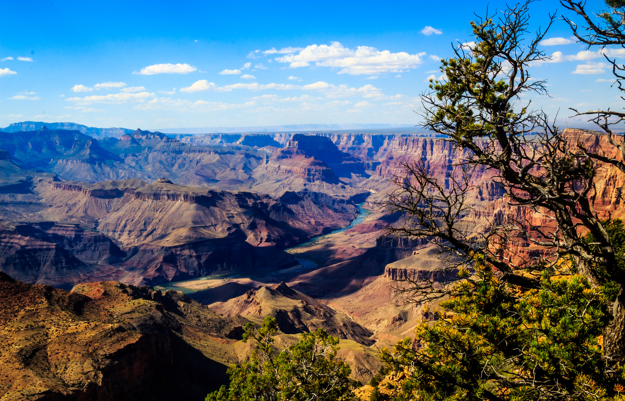 #1490 /100
The Grand Canyon is one of the world's great natural wonders — 446 kilometres long, up to 29 kilometres wide, and over 1,800 metres deep, carved over millions of years by the Colorado River.
The layered bands of red rock reveal two billion years of geological history and glow with extraordinary colour at sunrise and sunset.
How does it rate
CrowdsRomanceCash RequiredDangerAccessibilityWhy you should go
The scale of the Grand Canyon is simply incomprehensible until you stand at the rim; the light at golden hour transforms the canyon into something that seems to glow from within.
Why you shouldn't go
The South Rim is very crowded and the most dramatic inner canyon viewpoints require strenuous and potentially dangerous hikes in extreme heat.
Plan your visit
Best time to visitMarch-May or September-NovemberBest time of daySunrise or sunset for the canyon's changing coloursGetting thereFly to Phoenix or Las Vegas, then drive (~3.5-4.5hrs to South Rim)Entry cost~$35/vehicle park entryTime needed1-2 daysInsider tip — The South Rim has the easiest access; go for sunset specifically at Hopi Point -
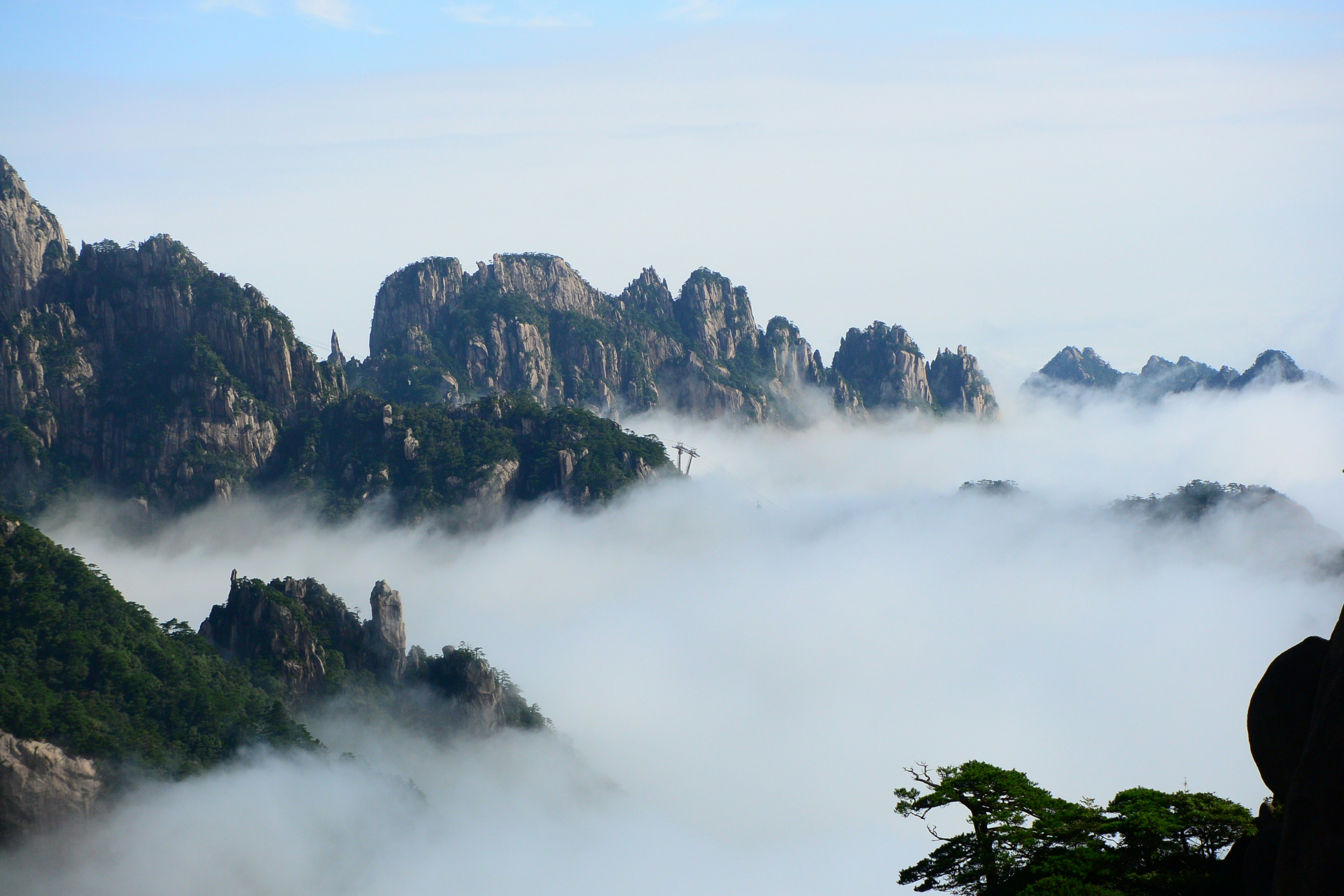 #1589 /100
Granite pillars draped in twisted pines rise out of a sea of cloud at Yellow Mountain, the landscape that inspired centuries of Chinese ink painting.
Cable cars reach several viewpoints directly, so the classic misty-peaks view doesn't require a demanding climb.
Sunrise and sunset, when the cloud sea forms below the summits, are when the mountain looks most like the paintings it inspired.
How does it rate
CrowdsRomanceCash RequiredDangerAccessibilityWhy you should go
The misty granite-peak scenery behind centuries of Chinese landscape painting, real and climbable.
Why you shouldn't go
The cloud sea that makes the famous photos isn't guaranteed - it depends entirely on weather.
Plan your visit
Best time to visitNovember-April for the best chance of a cloud sea; spring for blooming pines.Best time of daySunrise from Bright Summit Peak or Lion Peak.Getting thereHigh-speed rail to Huangshan North station, then bus to the cable car base.Entry costEntry fee plus optional cable car, together roughly $50-60.Time needed2 days, 1 night on the mountainInsider tip — Stay overnight at one of the summit hotels - the best light comes before the first cable cars of the day bring up the crowds. -
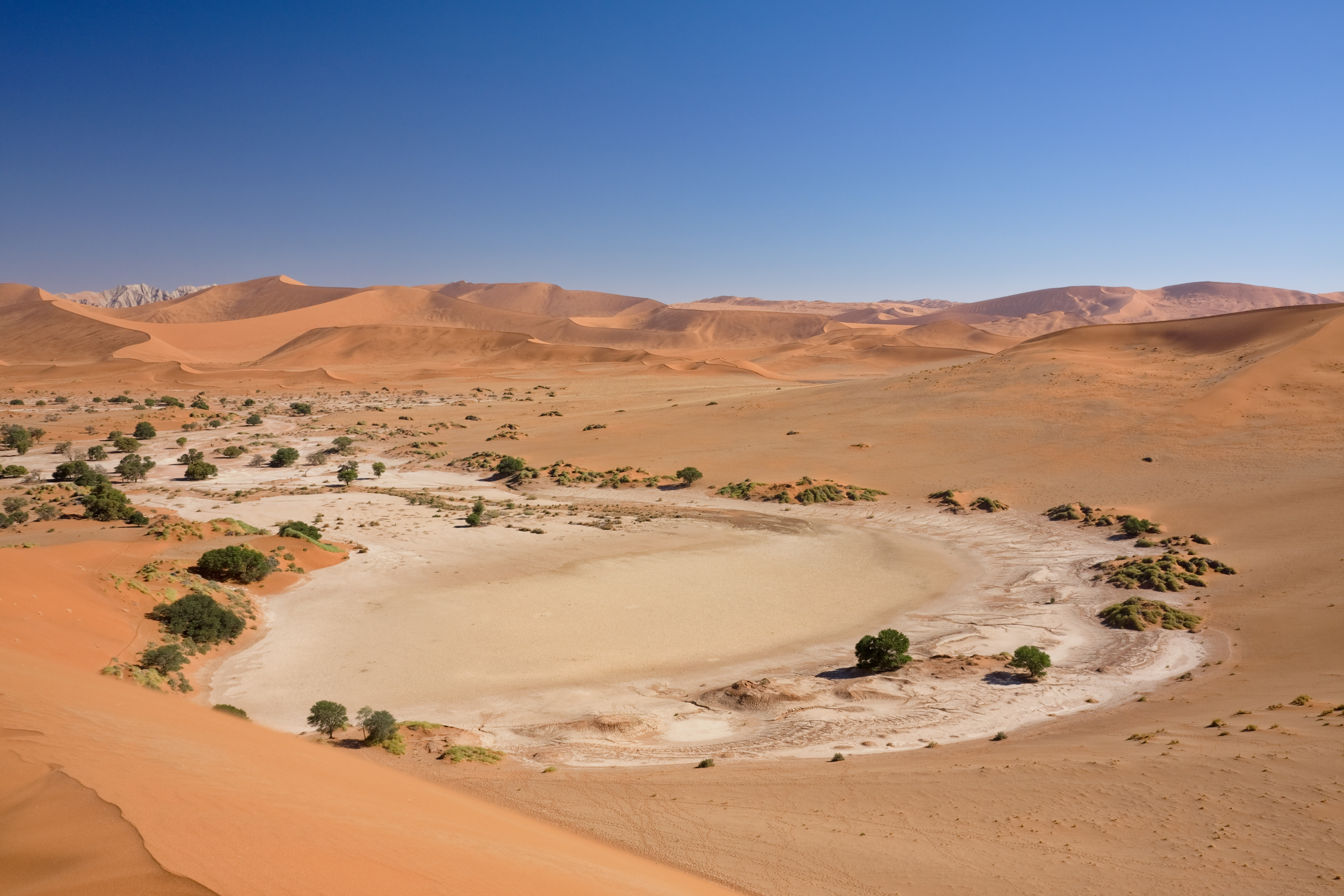 #1689 /100
Sossusvlei is a salt and clay pan in the Namib-Naukluft National Park in Namibia, surrounded by massive red sand dunes — among the tallest in the world at over 300 metres.
The dead white camelthorn trees in the Deadvlei pan, set against deep orange sand and cobalt sky, have become one of Africa's most iconic landscapes.
How does it rate
CrowdsRomanceCash RequiredDangerAccessibilityWhy you should go
The contrast between the white cracked clay pan, the black dead trees, the towering red dunes, and the vivid blue sky creates a landscape of extraordinary abstract beauty.
Why you shouldn't go
The dunes must be climbed before sunrise to avoid the intense heat; the nearest accommodation in Sesriem is basic and the site is very remote.
Plan your visit
Best time to visitMay-October (dry season, cooler)Best time of daySunrise, when the dunes cast long shadows and colours are richestGetting there~5-6hr drive from Windhoek, or fly to a nearby airstripEntry costPark entry ~N$150-350Time neededFull dayInsider tip — Get to the gate right at sunrise opening; Dune 45 and Deadvlei both photograph best in the first hour of light -
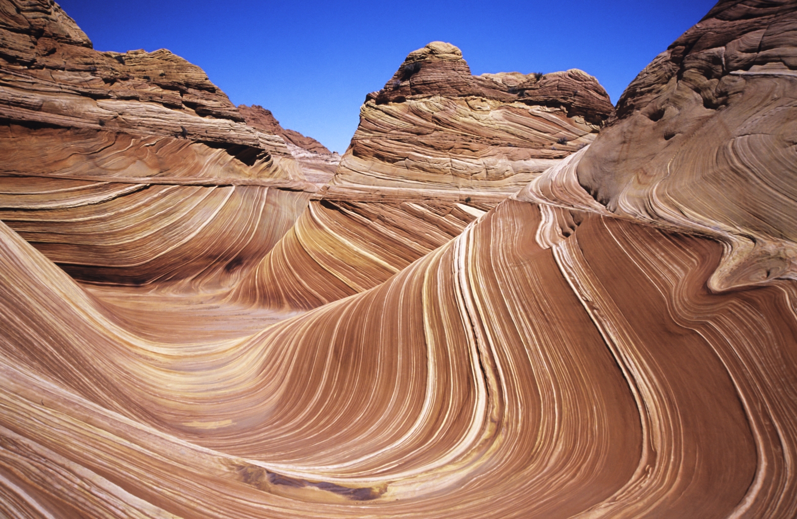 #1789 /100
The Wave is a sandstone rock formation in the Coyote Buttes area of the Paria Canyon-Vermilion Cliffs Wilderness in Arizona, famous for its colourful, undulating forms created by 190-million-year-old Jurassic sand dunes.
The swirling bands of red, orange, and pink sandstone make it one of the world's most extraordinary geological formations.
How does it rate
CrowdsRomanceCash RequiredDangerAccessibilityWhy you should go
The Wave's swirling, almost liquid-looking sandstone surface is genuinely unlike anything else on earth; photographed in good light it is one of nature's most abstract landscapes.
Why you shouldn't go
Entry is strictly limited by lottery — only 64 people per day are permitted — and most applicants do not win; the terrain requires navigation skills and has no trail markers.
Plan your visit
Best time to visitMarch-May or September-NovemberBest time of dayMidday for the light bringing out the sandstone coloursGetting thereRemote trailhead near Kanab, Utah; permit requiredEntry costPermit lottery, small feeTime needed5-6 hours round trip hikeInsider tip — Permits are extremely limited via a daily lottery; apply months ahead online -
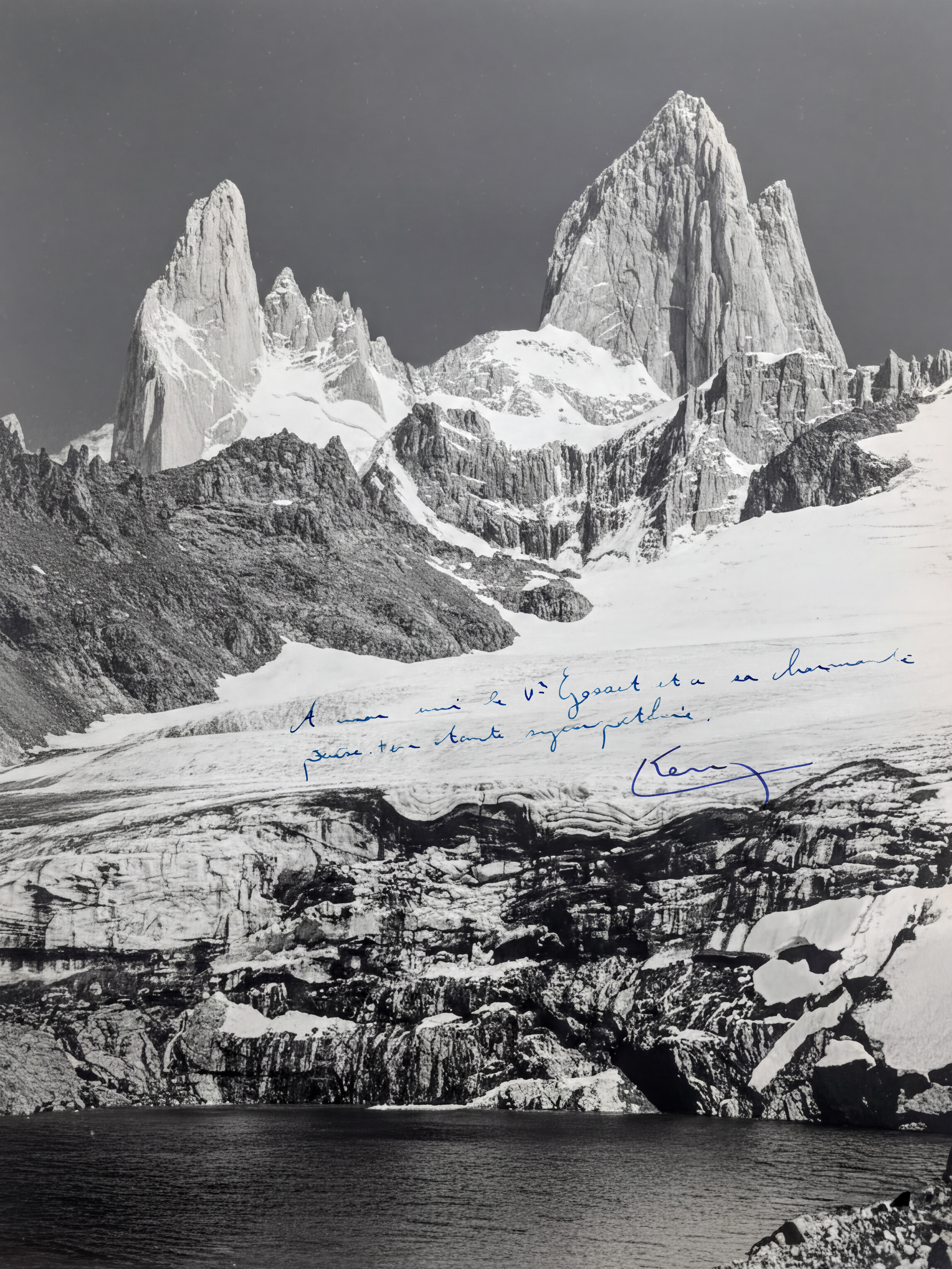 #18
#18Mount Fitz Roy is a serrated granite peak on the border of Argentina and Chile in Patagonia, rising 3,405 metres above the Patagonian steppe.
Its distinctive jagged silhouette, often wreathed in cloud, inspired the Patagonia clothing brand logo and is considered one of the most technically challenging climbs in the world.
How does it rate
CrowdsRomanceCash RequiredDangerAccessibilityWhy you should go
The view of Fitz Roy reflected in Laguna de los Tres, with the jagged granite towers rising above the surrounding ice field, is one of the most dramatic mountain scenes in South America.
Why you shouldn't go
The classic Laguna de los Tres viewpoint requires a strenuous 22-kilometre return hike with 1,300 metres of elevation gain; the peak is notoriously cloud-covered.
Plan your visit
Best time to visitDecember-February (Southern Hemisphere summer) for best weather oddsBest time of daySunrise for the "fire" effect when the peak turns redGetting thereFly to El Calafate, then bus to El ChaltenEntry costFree, no permits neededTime neededFull day hike (~10hrs round trip)Insider tip — The famous red sunrise glow depends on clear skies; the peak is often cloud-covered, so budget extra days if you can -
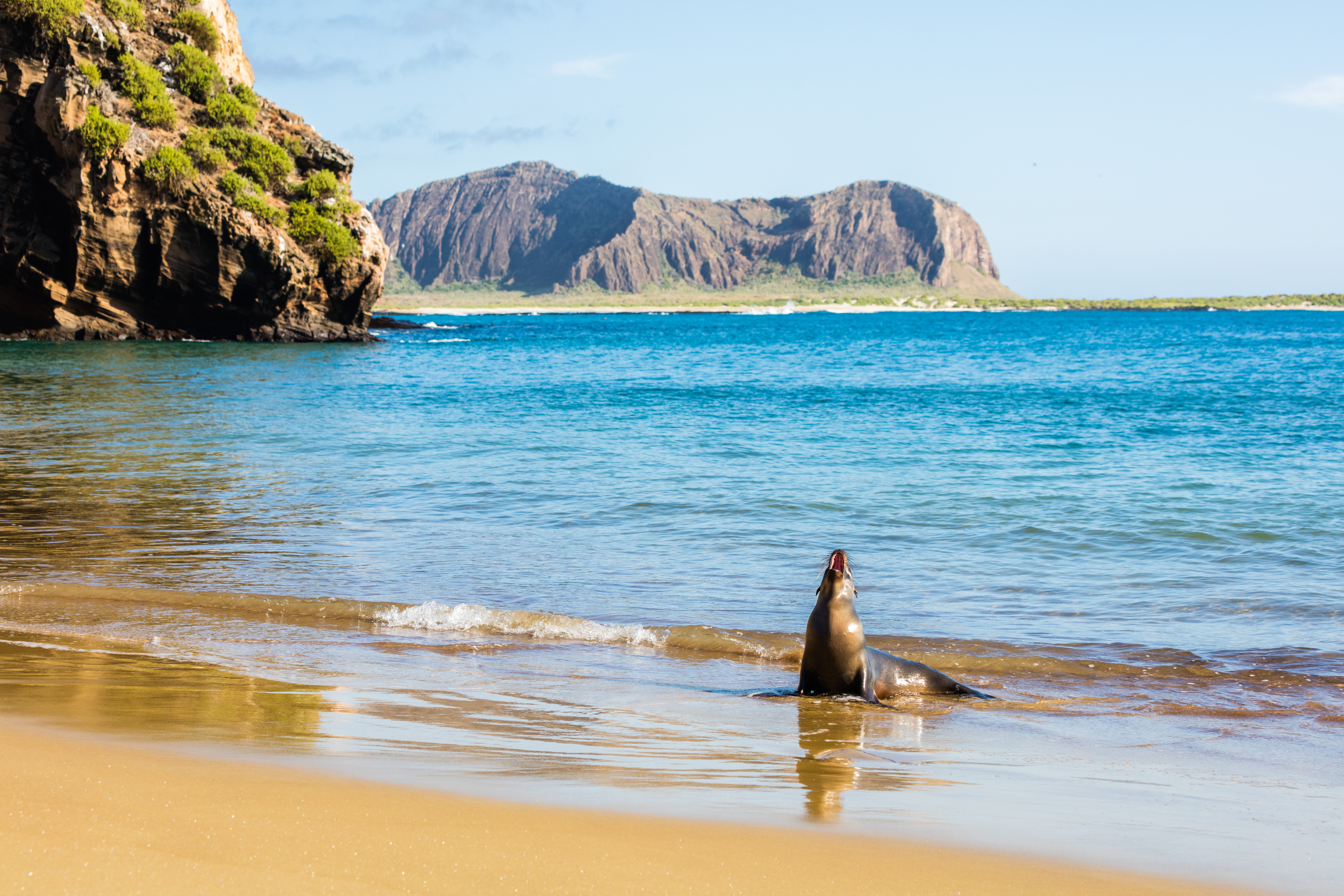 #1988 /100
Six hundred miles off the Ecuadorian coast, the Galápagos archipelago is a living laboratory of evolution where wildlife shows no fear of humans.
Charles Darwin's observations here inspired his theory of natural selection, and today visitors can snorkel with sea lions and walk alongside giant tortoises.
How does it rate
CrowdsRomanceCash RequiredDangerAccessibilityWhy you should go
Nowhere else on earth can you get so close to such diverse and fearless wildlife; the experience of snorkelling alongside marine iguanas is unlike anything else.
Why you shouldn't go
The Galápagos is one of the most expensive travel destinations in Latin America, and strict visitor regulations limit where you can go and what you can do.
Plan your visit
Best time to visitJune-November for wildlife activity and cooler seasBest time of dayMorning for wildlife viewingGetting thereFly to Baltra or San Cristobal via Guayaquil or QuitoEntry cost$200 park entry fee plus cruise/tour costsTime needed5+ daysInsider tip — A licensed naturalist guide is required by law and makes a huge difference to what you see -
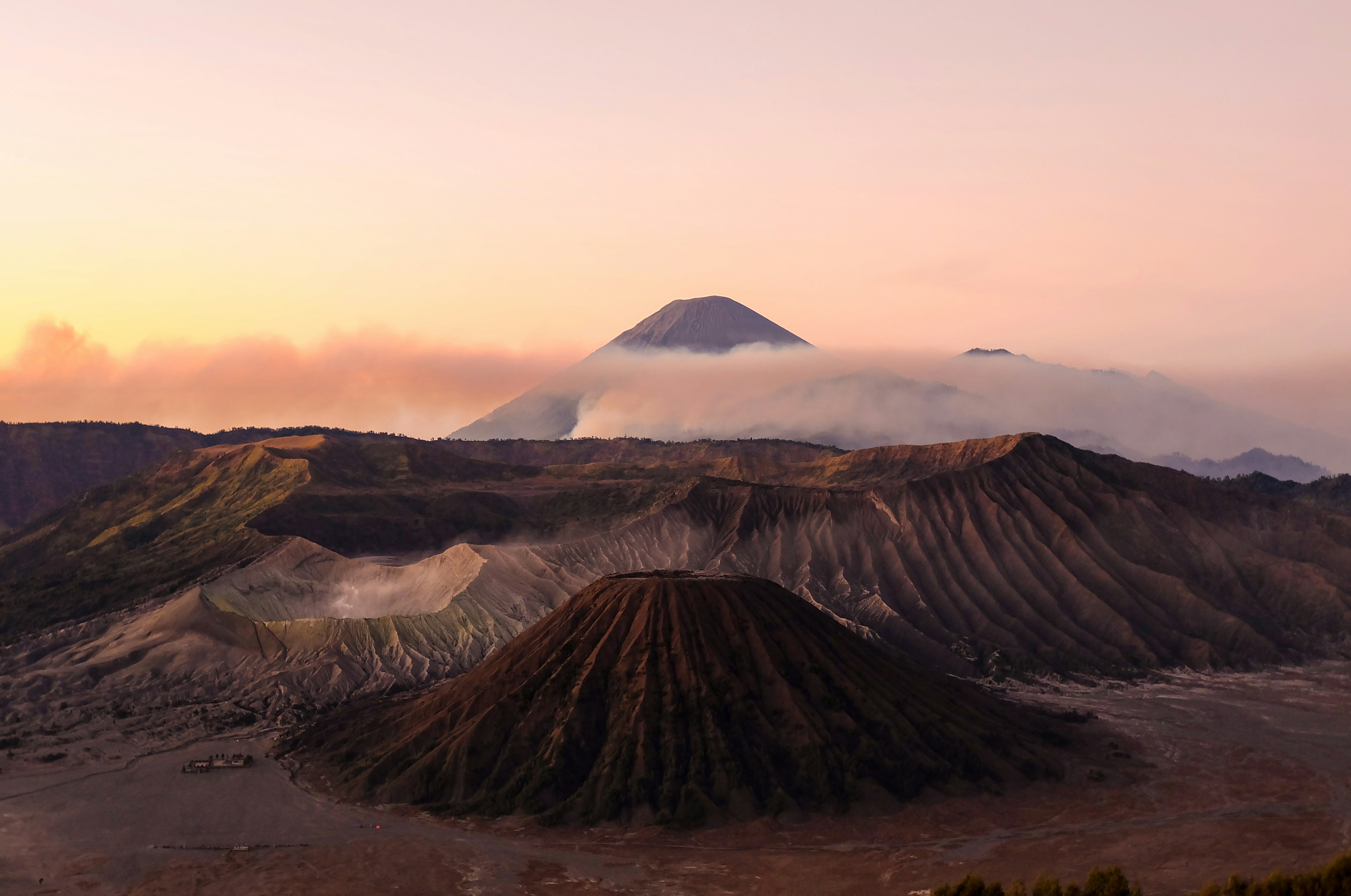 #2088 /100
An active, smoking crater rising from the middle of a vast ash-grey "Sea of Sand" caldera in East Java, ringed by the taller peaks of the Tengger massif.
The classic sunrise viewpoint at Mount Penanjakan looks out over Bromo's smoking cone and several neighbouring volcanoes at once, one of Southeast Asia's most celebrated views.
Horses and jeeps ferry visitors across the sand sea to the crater's base, from which several hundred stairs climb to the smoking rim itself.
How does it rate
CrowdsRomanceCash RequiredDangerAccessibilityWhy you should go
A smoking volcanic cone rising from an other-worldly grey sand sea, framed by a multi-volcano sunrise view few places can match.
Why you shouldn't go
The famous sunrise viewpoint gets extremely crowded with jeeps and tour groups, especially on weekends and holidays.
Plan your visit
Best time to visitApril-October (dry season) for clear sunrise views.Best time of daySunrise, from the Mount Penanjakan (King Kong Hill) viewpoint.Getting thereFly to Surabaya or Malang, then a 2-3 hour drive to Cemoro Lawang village, the main gateway.Entry costPark entry plus jeep tour typically runs 300,000-500,000 IDR per person.Time neededOvernight (arrive evening, sunrise tour, depart after).Insider tip — Book a jeep to a secondary viewpoint like Bukit Cinta or Seruni Point instead of the main King Kong Hill - same view, a fraction of the crowd. -
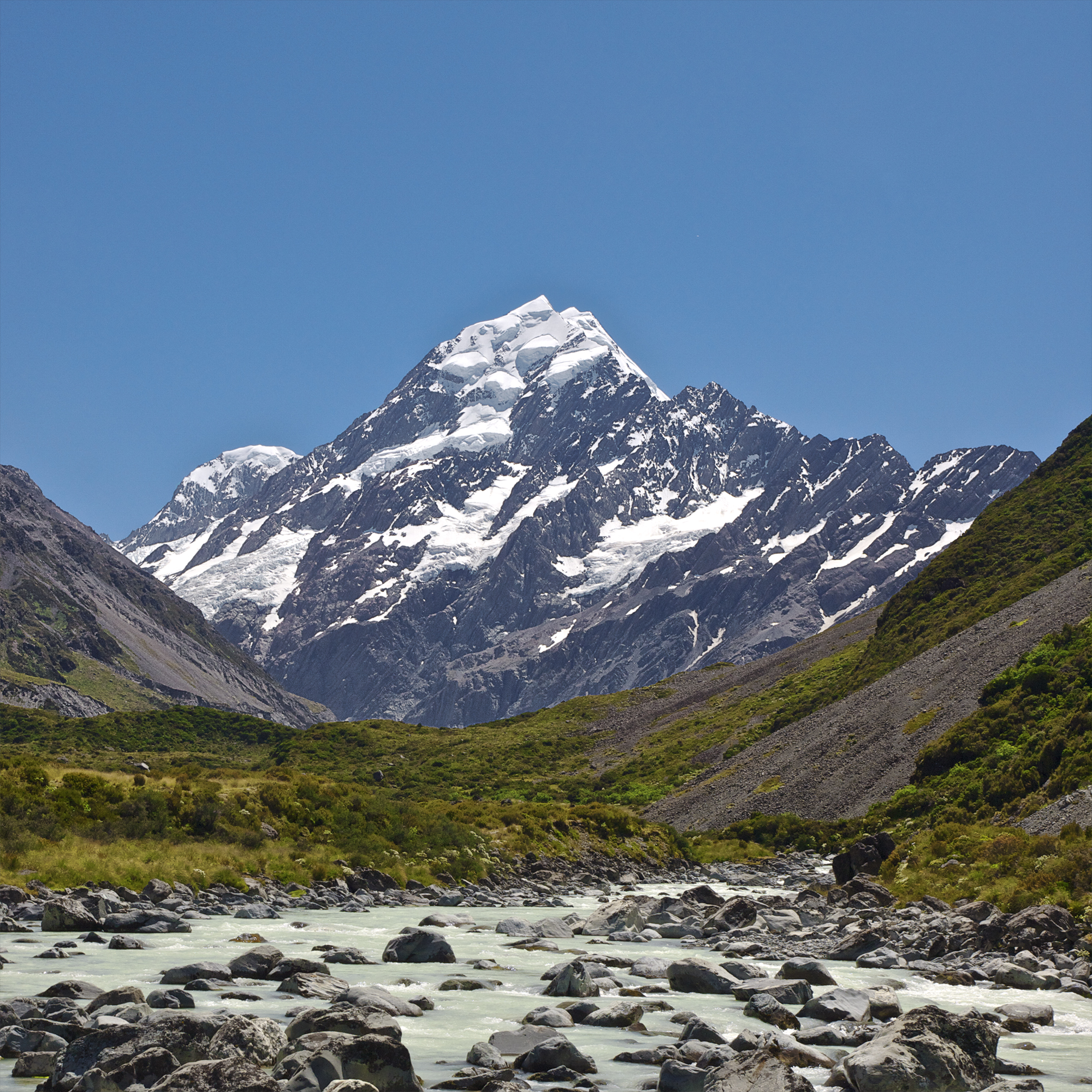 #2188 /100
Aoraki/Mount Cook is New Zealand's highest peak at 3,724 metres, rising above the Mackenzie Basin surrounded by glaciers and turquoise lakes.
The Hooker Valley Track provides one of the most accessible and rewarding walks in the country, leading to views of the mountain across three swing bridges.
How does it rate
CrowdsRomanceCash RequiredDangerAccessibilityWhy you should go
The Hooker Valley walk is achievable for most fitness levels and delivers stunning close-up views of Mount Cook and its surrounding glaciers.
Why you shouldn't go
The weather in the Southern Alps changes extremely rapidly and cloud can obscure the mountain for days at a time, especially in winter.
Plan your visit
Best time to visitDecember-March (Southern Hemisphere summer)Best time of daySunriseGetting there~4hr drive from Christchurch or QueenstownEntry costFreeTime needed1-2 daysInsider tip — Hooker Valley Track is the easiest walk with the best views of the peak -
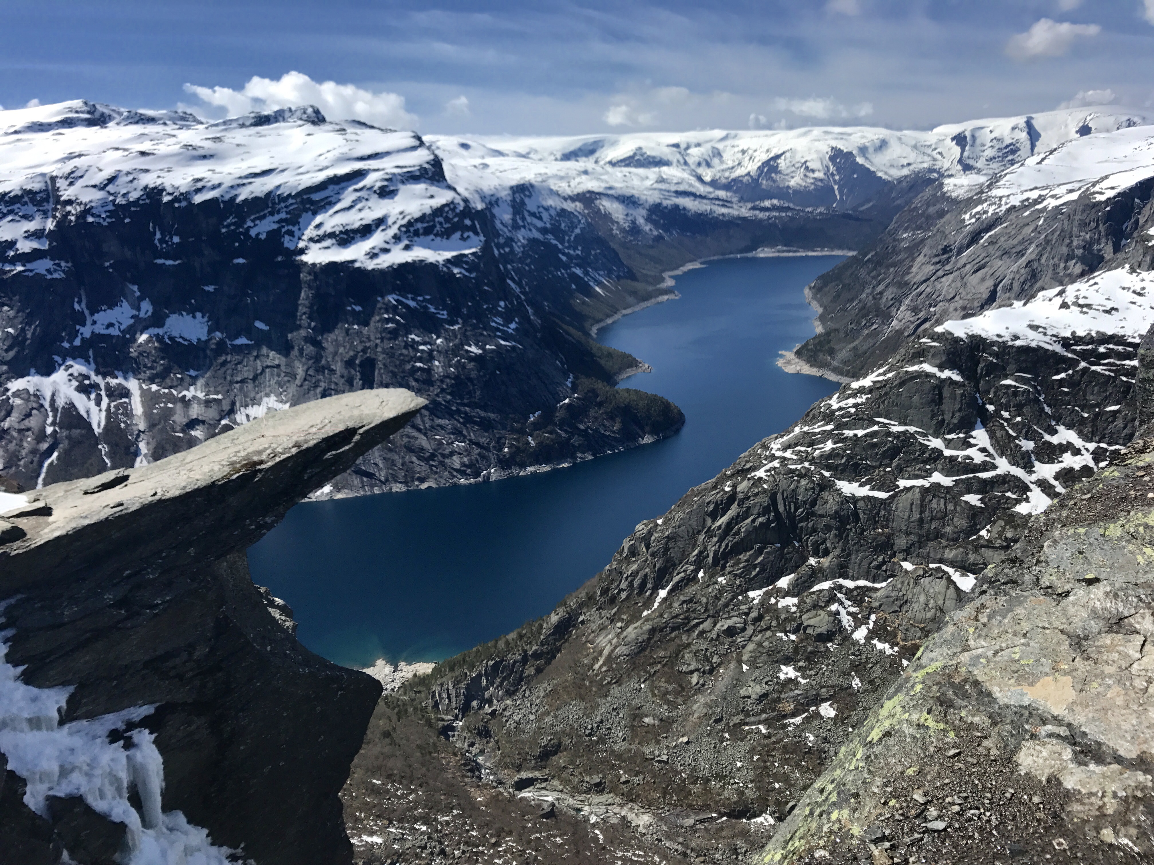 #2288 /100
Trolltunga, meaning Troll's Tongue, is a spectacular horizontal rock formation that juts 700 metres above Lake Ringedalsvatnet in western Norway.
The 27-kilometre return hike to reach it passes through some of Norway's most dramatic fjord landscape, ascending over 1,000 metres in elevation.
How does it rate
CrowdsRomanceCash RequiredDangerAccessibilityWhy you should go
The view from the edge of Trolltunga, with the lake far below and Norwegian mountains stretching to the horizon, is one of Scandinavia's most dramatic vistas.
Why you shouldn't go
The hike is 27 kilometres return with 1,000 metres of elevation gain and takes 10-12 hours; the trail is only open from June to September and weather can change rapidly.
Plan your visit
Best time to visitJune-September (trail closed/dangerous outside this window)Best time of dayEarly morning start essential; it is a long hikeGetting there~4-5hr drive from Bergen to Skjeggedal trailheadEntry costFree; parking fee appliesTime needed10-12 hours round trip hikeInsider tip — Start by 6am; this is a genuinely strenuous full-day hike, not a quick photo stop -
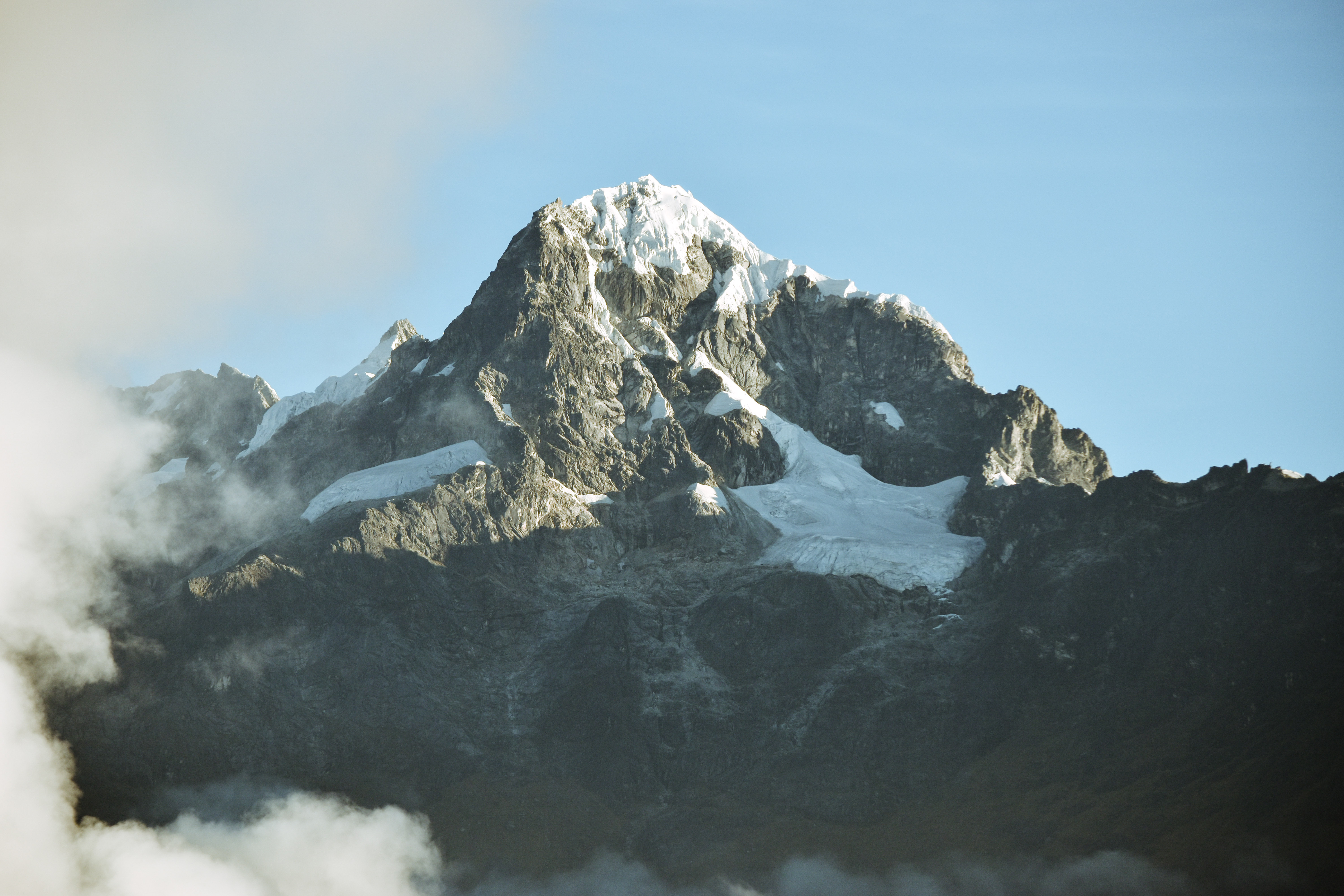 #2388 /100
A four-day trek along Inca-built stone steps, climbing over the 4,215m Dead Woman's Pass and threading cloud forest to reach ruins at Sayacmarca and Winay Wayna.
The final pre-dawn push through the Sun Gate delivers the classic first view of Machu Picchu below.
Campsites sit on terraced mountainsides ringed by snow-streaked Andean peaks.
Permits are capped at 500 a day, and a guide is mandatory.
How does it rate
CrowdsRomanceCash RequiredDangerAccessibilityWhy you should go
Arriving at the Sun Gate at sunrise for the first, unobstructed view of Machu Picchu below.
Why you shouldn't go
Permits sell out months ahead and a licensed guide is mandatory - no independent hiking allowed.
Plan your visit
Best time to visitMay-September (dry season); the trail closes every February for maintenance.Best time of dayPre-dawn start on day four to reach the Sun Gate at sunrise, before crowds arrive.Getting thereFly to Cusco; drive or train to the Km 82 trailhead via Ollantaytambo, about 2-3 hours away.Entry costFrom about $600-900 for a guided 4-day package (permit, guide, camping included).Time needed4 days / 3 nightsInsider tip — Book with a licensed operator 5-6 months ahead for June-August; permits are tied to your passport number and are non-transferable. -
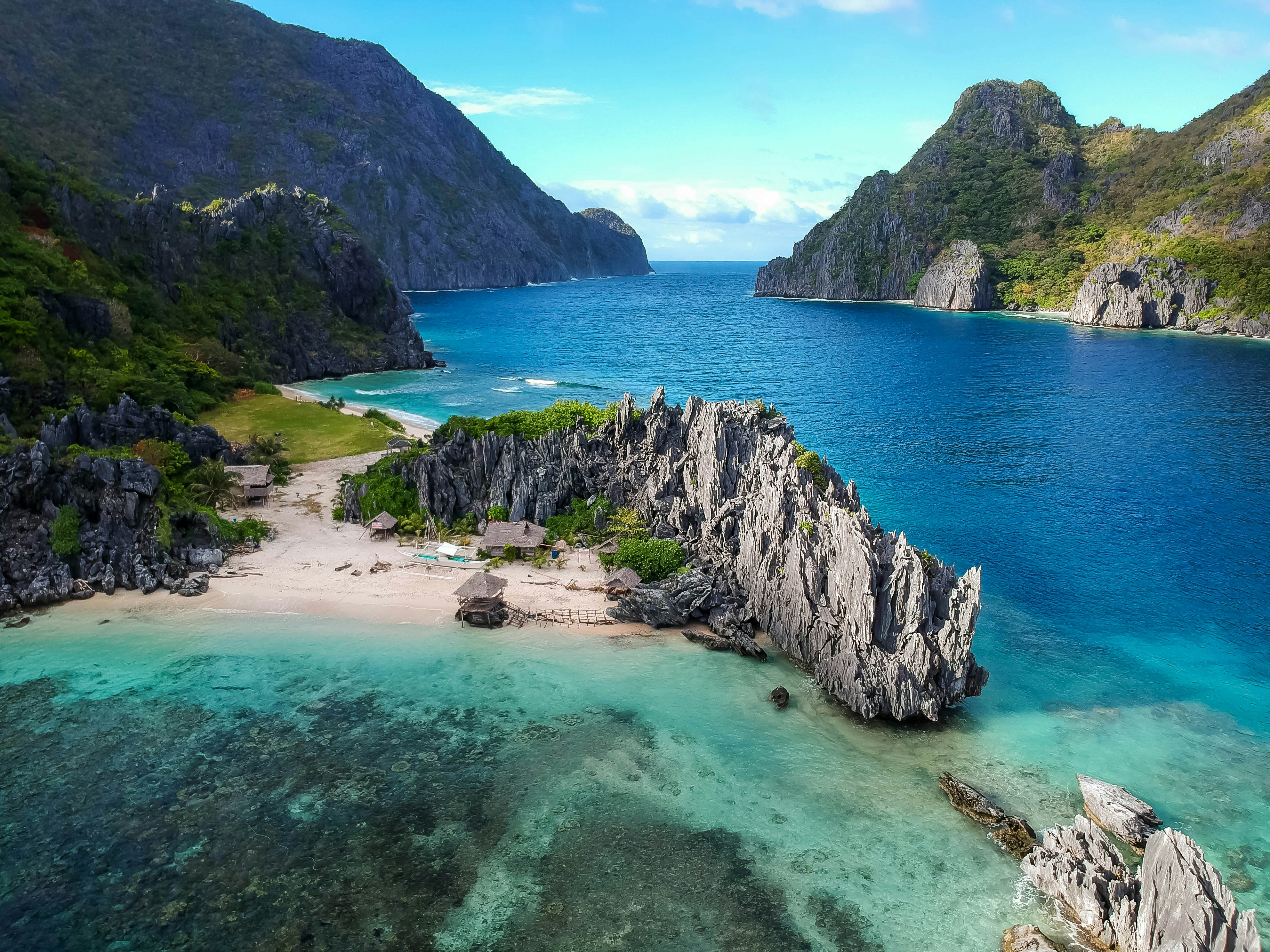 #24
#24Sheer limestone karsts rise straight out of turquoise lagoons around this Palawan town, often ranked among the world's most beautiful island landscapes.
Hidden lagoons reachable only by kayak or narrow swim-throughs open onto still, mirror-flat water walled in by cliffs.
Island-hopping boat tours string together beaches, lagoons, and reefs that are rarely anything less than spectacular.
How does it rate
CrowdsRomanceCash RequiredDangerAccessibilityWhy you should go
Some of the most dramatic limestone-karst island scenery anywhere on Earth.
Why you shouldn't go
Popular lagoons get crowded with tour boats by mid-morning.
Plan your visit
Best time to visitNovember-May, the dry season, for calm water and clear skies.Best time of dayEarly morning, before the first wave of island-hopping tour boats arrives.Getting thereFly to El Nido or Puerto Princesa airport; boats depart from El Nido town for the lagoons.Entry costEnvironmental fee applies; island-hopping tours priced separately, from around $20.Time needed3-4 daysInsider tip — Book a private or small-group tour departing before 7am to reach Big Lagoon ahead of the crowds. -
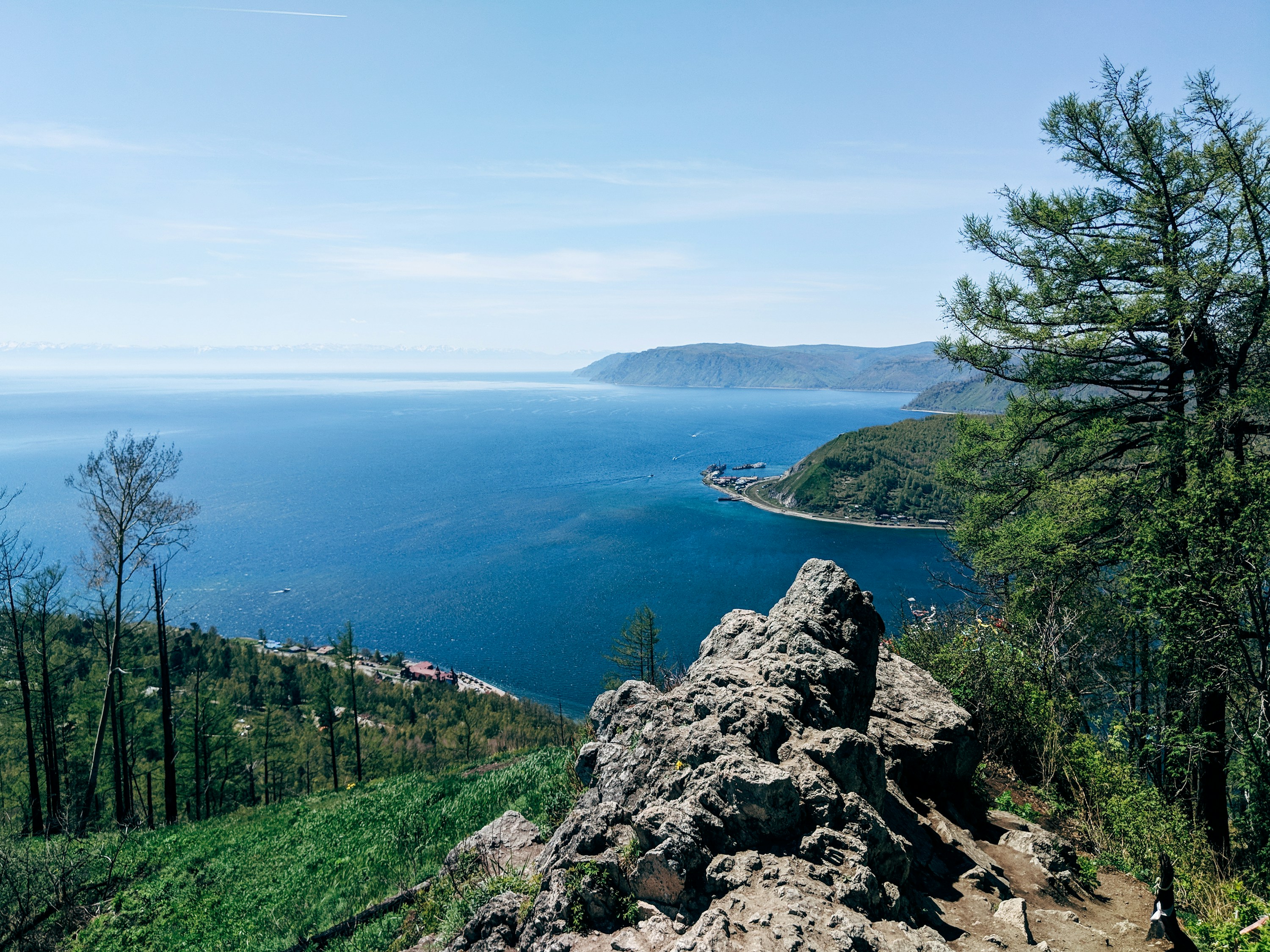 #2588 /100
Lake Baikal holds a fifth of the planet's unfrozen fresh water and is both the world's deepest and oldest lake, ringed by taiga forest and mountains in Siberia.
Its clarity lets you see many metres down in summer, while in winter the surface freezes into clear blue ice sheets thick enough to drive on.
Most visitors base themselves in Listvyanka or on Olkhon Island to explore the shoreline and villages.
How does it rate
CrowdsRomanceCash RequiredDangerAccessibilityWhy you should go
The world's deepest, oldest and clearest lake — a fifth of Earth's unfrozen fresh water in one place.
Why you shouldn't go
Deep Siberia is genuinely remote — expect a long flight connection and further travel just to reach the shore.
Plan your visit
Best time to visitLate June–August for open water and hiking; February–March for the clear ice seasonBest time of dayMorning, before wind picks up on the open water in the afternoonGetting thereFly to Irkutsk via a transit hub (no direct Western routes); Listvyanka on the shore is about an hour's bus or taxi ride from the airport.Entry costFree to view the shoreline; boat trips and excursions from around 1,500 RUBTime needed2–3 days to see the shore properly; a week or more for Olkhon Island and the ice seasonInsider tip — Skip the crowded main pier in Listvyanka and walk or taxi a few kilometres along the shore for quieter viewpoints; the Chersky Stone viewpoint above the village gives the best overview of the lake and the Angara River's source. -
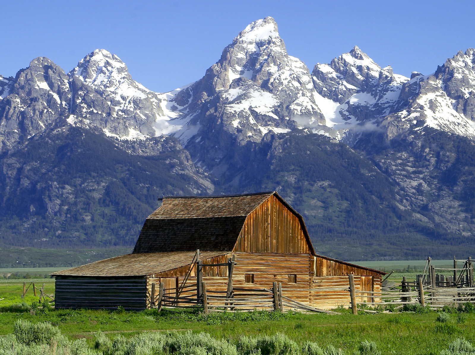 #26
#26Rated #26 of 100
Grand Teton National Park, the United States
#grandtetonnationalpark ◆ National Parks88 /100The Teton Range rises abruptly and without foothills from the flat valley floor of Jackson Hole, creating one of the most dramatic mountain frontages in the Americas.
Below it, the Snake River, a chain of glacial lakes and open sagebrush flats hold moose, elk, bison and both black and grizzly bears.
Trails range from flat lakeshore loops to serious alpine climbs within the same few miles of road.
How does it rate
CrowdsRomanceCash RequiredDangerAccessibilityWhy you should go
The Tetons rising directly from the valley floor create an unobstructed mountain wall that produces some of America's most dramatic landscape photographs.
Why you shouldn't go
Wildlife watching opportunities are excellent but not guaranteed; the park is large and distances between key viewpoints are significant.
Plan your visit
Best time to visitJune-SeptemberBest time of daySunrise at Schwabacher Landing or Oxbow Bend for reflectionsGetting thereFly to Jackson Hole AirportEntry costPark pass ~$35/vehicleTime needed2-3 daysInsider tip — Oxbow Bend at dawn gives the classic Teton reflection shot, especially with autumn colour -
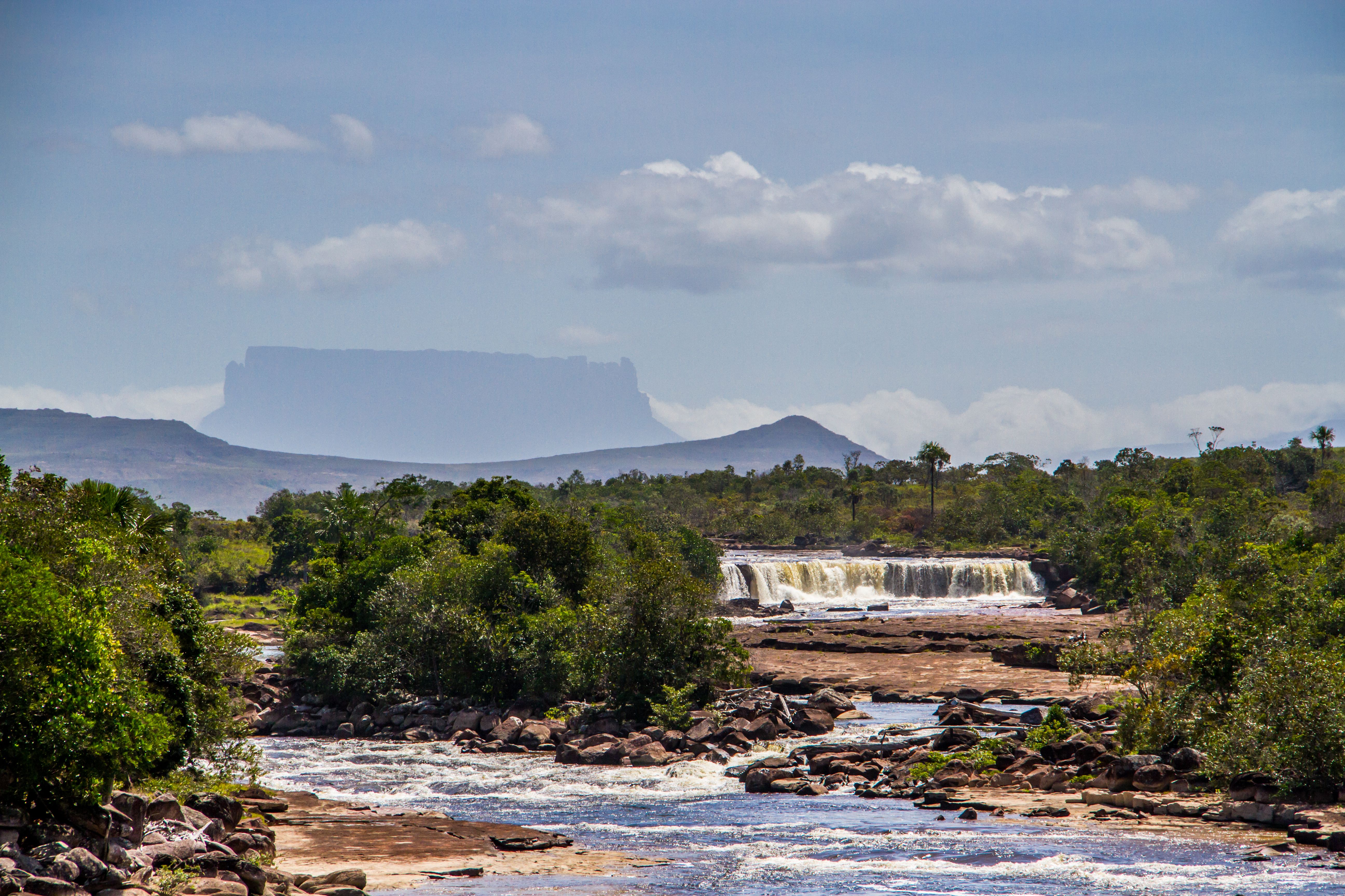 #2788 /100
Water drops 979 metres off a sheer tabletop mountain in the middle of remote Venezuelan jungle, making this the tallest waterfall on Earth by a wide margin.
The fall is so tall that much of the water disperses into mist before ever reaching the pool below.
Reaching it means days of river travel by dugout canoe through Canaima National Park, so the sheer remoteness is part of what keeps the view unspoiled.
How does it rate
CrowdsRomanceCash RequiredDangerAccessibilityWhy you should go
The tallest waterfall on Earth, dropping nearly a kilometre off an isolated jungle tabletop mountain.
Why you shouldn't go
There's no road access at all - reaching the base requires days of canoe travel and real logistics.
Plan your visit
Best time to visitJune-November, the wet season, when water volume is highest.Best time of dayMorning, before afternoon cloud typically obscures the tepui's summit.Getting thereFly to Canaima, then travel by dugout canoe up the Carrao and Churun rivers (multi-day trip).Entry costIncluded in multi-day guided tour packages; no independent access.Time needed3-5 days round trip from CanaimaInsider tip — Go in the wet season - in the dry months the river can run too low for canoes to reach the base at all. -
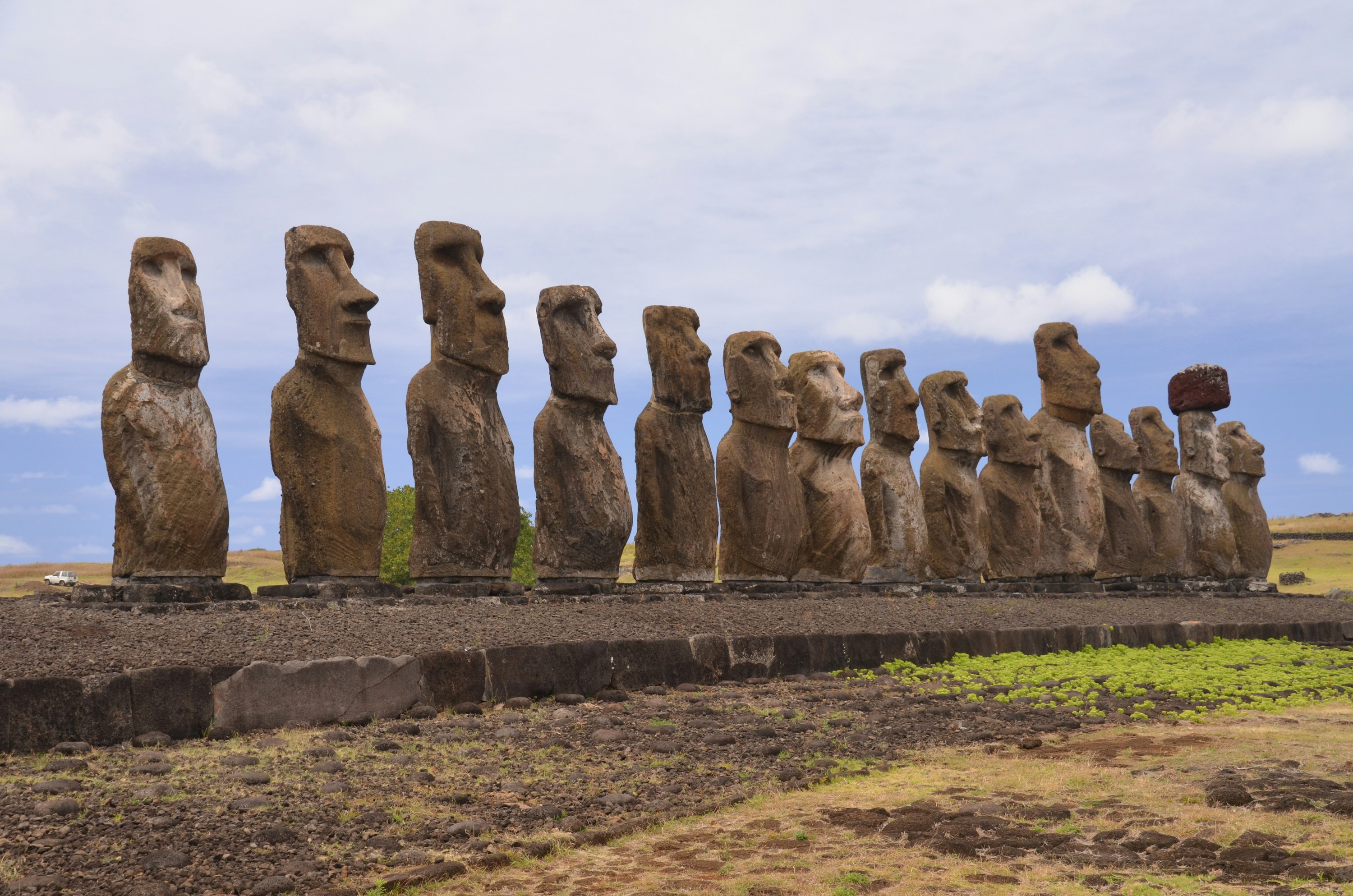 #2888 /100
Roughly 900 moai, the monumental stone figures carved by the Rapa Nui between the 13th and 16th centuries, are scattered across this small volcanic island 3,700km from mainland Chile.
The best-known cluster, fifteen restored moai at Ahu Tongariki, catches the sunrise directly behind it.
Elsewhere, the Rano Raraku quarry has dozens of unfinished statues still half-buried in the hillside where their carvers left them.
How does it rate
CrowdsRomanceCash RequiredDangerAccessibilityWhy you should go
Hundreds of monumental stone figures scattered across a landscape found nowhere else on Earth.
Why you shouldn't go
Getting there costs a small fortune and eats up two travel days each way for what's usually a 3-4 day stay.
Plan your visit
Best time to visitYear-round, mild climate; December-March is driest and warmest.Best time of daySunrise at Ahu Tongariki, when the fifteen moai are lit from behind.Getting thereFly to Mataveri Airport (IPC) from Santiago, about 5 hours; only a handful of flights operate each week.Entry costRapa Nui National Park pass ~US$80, valid 10 daysTime needed3-4 daysInsider tip — Hire a local guide for at least one day - many lesser-known ahu and petroglyph sites are unmarked and easy to walk straight past without one. -
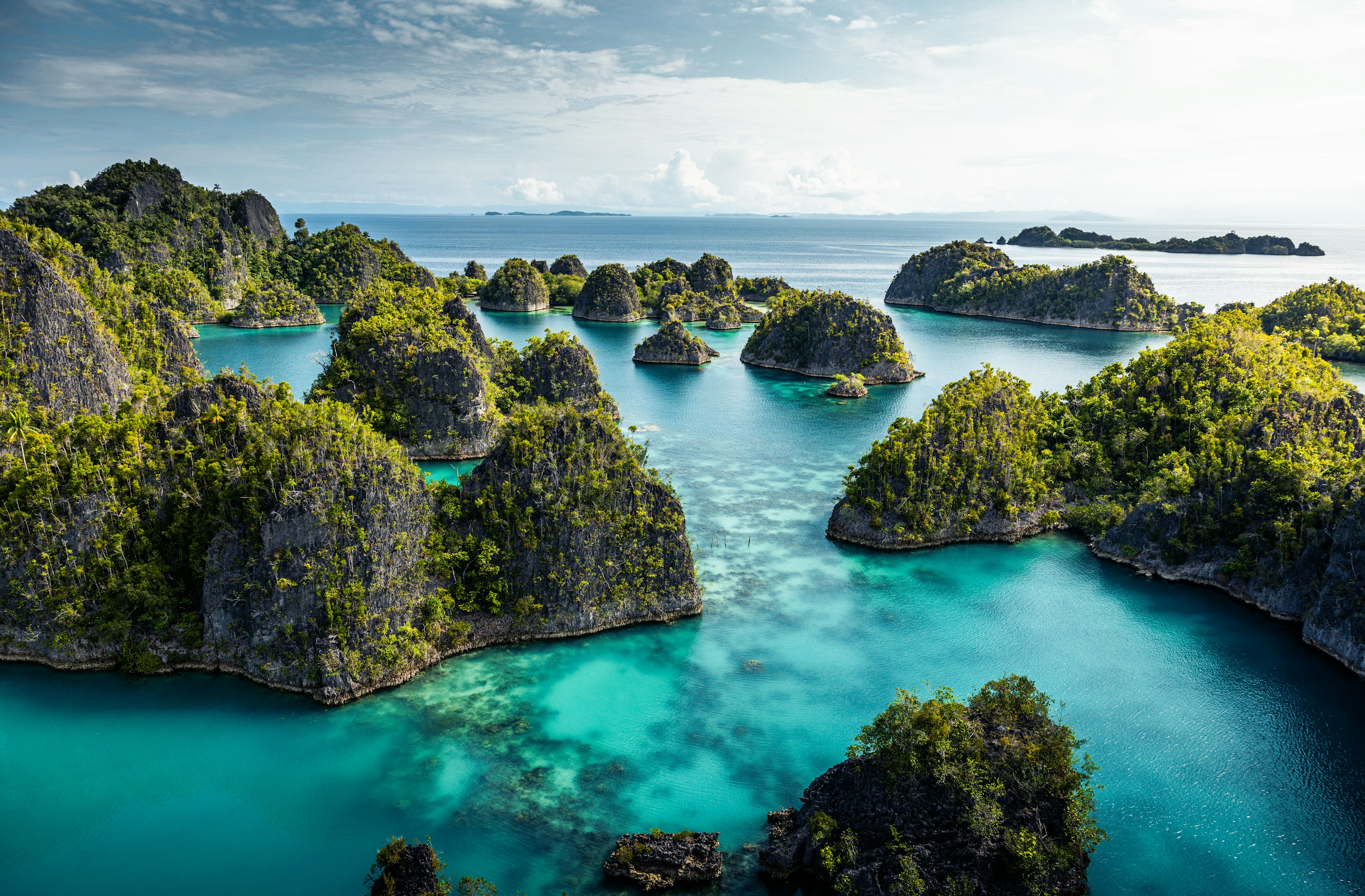 #2988 /100
Raja Ampat's four main islands and hundreds of smaller limestone islets sit at the heart of the Coral Triangle, the most biodiverse marine environment on Earth, with reefs holding far more coral and fish species than the Caribbean.
Above water, karst islands draped in jungle ring turquoise lagoons; below, divers and snorkelers find manta rays, reef sharks, and dense coral gardens largely undamaged by mass tourism.
Reaching it takes real commitment, but few marine destinations compare.
How does it rate
CrowdsRomanceCash RequiredDangerAccessibilityWhy you should go
The most biodiverse reef system on the planet, still relatively undisturbed by mass tourism.
Why you shouldn't go
Very remote and expensive to reach, with permits, flights, and boat transfers all adding up before you even dive.
Plan your visit
Best time to visitOctober-April for calmer seas and the best underwater visibility.Best time of dayMorning dives and snorkels, before afternoon winds pick up on the open crossings.Getting thereFly to Sorong via Jakarta or Makassar, then a public or chartered boat (2-4 hours) to Waisai or a resort island.Entry costMarine Park entry permit (PIN) required, roughly 500,000-1,000,000 IDR (~$30-65)Time needed4+ daysBookingBook ahead →Insider tip — Buy the marine park permit (PIN) in Sorong or Waisai before heading to the islands; it's checked on arrival and covers the whole marine park for a full calendar year. -
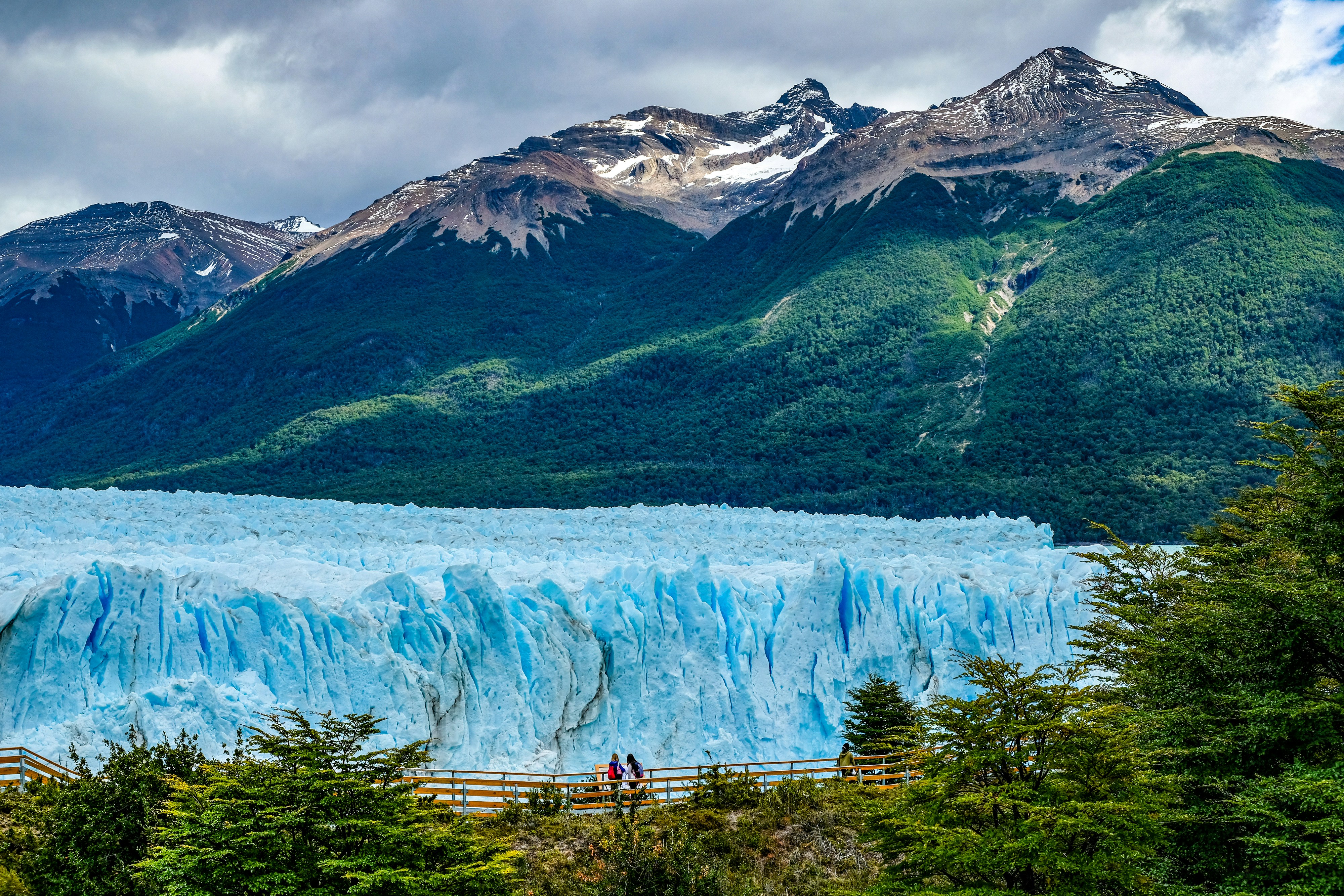 #3087 /100
A massive tidewater glacier advancing into Lago Argentino, calving house-sized chunks of ice with a thunderous crack several times a day.
One of the few glaciers on Earth still growing, its brilliant blue ice face and extensive boardwalk system make it Patagonia's signature sight.
How does it rate
CrowdsRomanceCash RequiredDangerAccessibilityWhy you should go
A colossal advancing glacier calving house-sized ice chunks with a thunderous crack, several times a day.
Why you shouldn't go
Very popular, so viewing platforms get crowded in peak season; park entrance fees are steep; weather can obscure views.
Plan your visit
Best time to visitNovember–March (Southern Hemisphere summer) for the most stable weather and longest daylight.Best time of dayAny time of day works, though morning light often shows the ice at its bluest.Getting thereFly to El Calafate, then roughly an 80km (1.5-hour) drive to Los Glaciares National Park.Entry costARS national park entrance fee (~$25 USD equivalent); optional boat tours and ice trekking $80–250 UTime needed4–6 hours including travel from El Calafate.Insider tip — Book an ice-trekking tour to actually walk on the glacier — the boardwalks are free but only offer distant views. Bring layers; the wind off the ice is cold even in summer. -
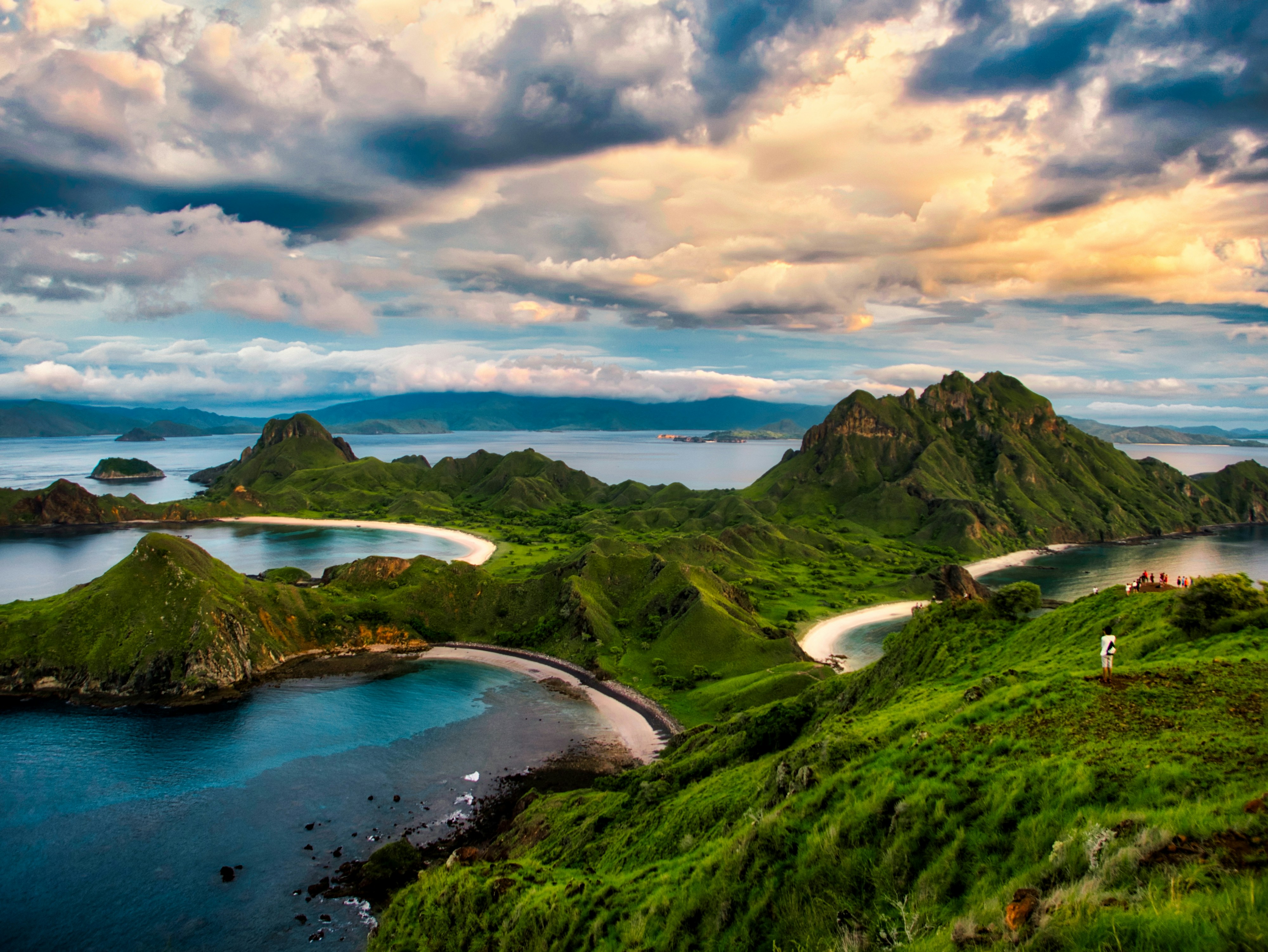 #3187 /100
Volcanic islands rise steeply out of turquoise water in this remote Indonesian archipelago, the only place on Earth with wild Komodo dragons.
Padar Island's ridge walk looks down on three separate curved bays at once, and Pink Beach takes its colour from crushed red coral mixed through the sand.
The surrounding waters are among Indonesia's best for manta rays and drift diving.
How does it rate
CrowdsRomanceCash RequiredDangerAccessibilityWhy you should go
A single viewpoint over three turquoise bays, plus the only place on Earth to see wild Komodo dragons.
Why you shouldn't go
Only reachable by multi-day boat trip or a costly speedboat charter from Labuan Bajo.
Plan your visit
Best time to visitApril-June or September-November, outside the wettest and busiest peak months.Best time of daySunrise on Padar Island, before the heat and the day-trip crowds arrive.Getting thereFly into Labuan Bajo, then join a liveaboard or day boat into the park.Entry costPark entry and conservation fees, plus boat trip costs, typically $50-150+ per day.Time needed2-3 daysInsider tip — Book a liveaboard over a single-day speedboat trip - the best light on Padar and Pink Beach both fall outside typical day-trip hours. -
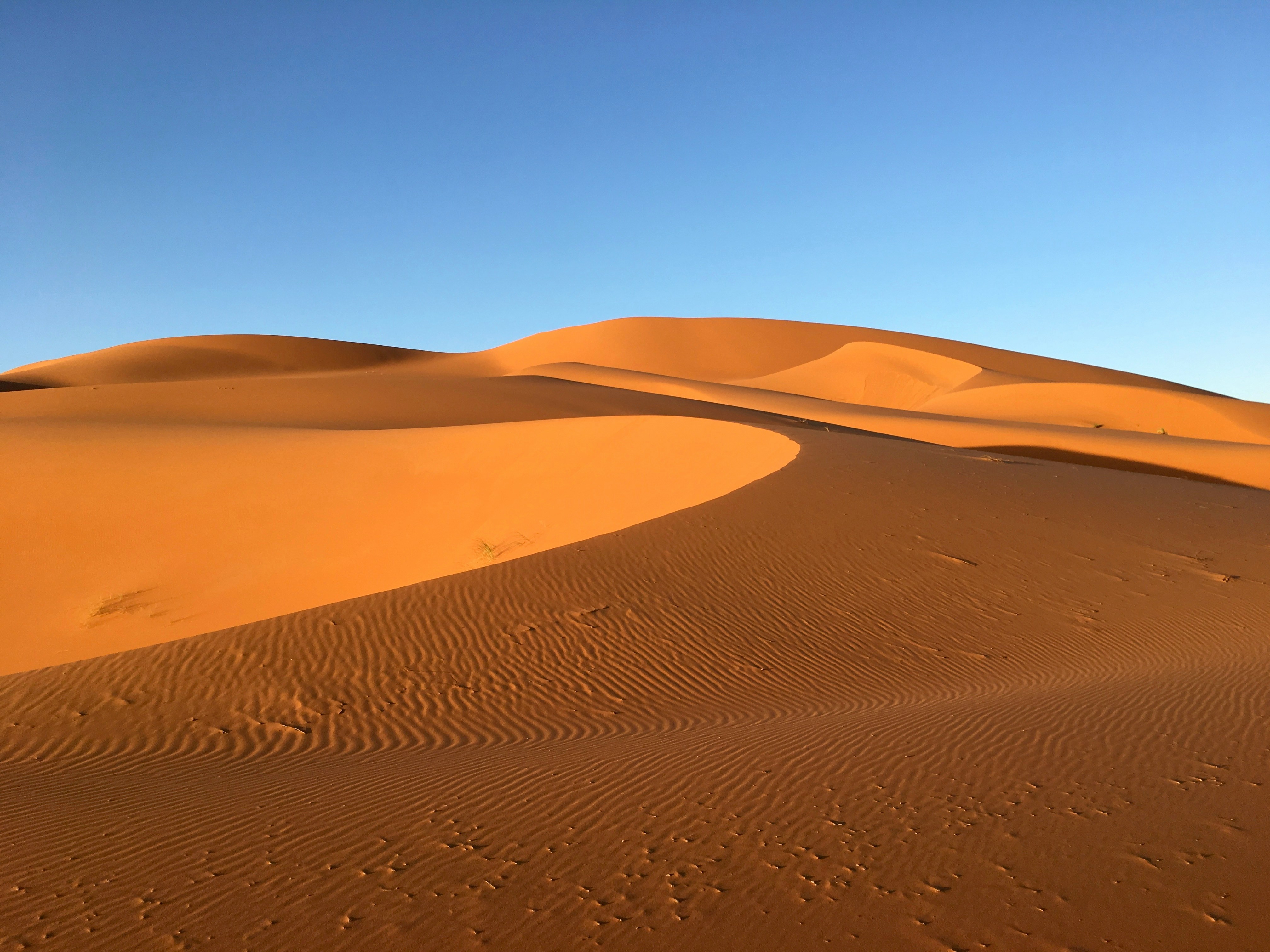 #3287 /100
A sea of orange dunes rising up to 150 metres at the edge of the Sahara, the most accessible major dune field in Morocco and the base for camel treks and overnight desert camps.
The dunes shift constantly with the wind, and sunrise and sunset turn the sand from deep gold to burnt red.
Nights in a Berber camp under an unpolluted sky are as much the draw as the dunes themselves.
How does it rate
CrowdsRomanceCash RequiredDangerAccessibilityWhy you should go
Towering orange dunes right at the Sahara's edge, with overnight Berber camps and some of the clearest night skies in North Africa.
Why you shouldn't go
Reaching Merzouga is a long drive from Marrakech (8+ hours), and sandstorms can shut down camel treks with no warning.
Plan your visit
Best time to visitOctober-April, avoiding the brutal summer desert heat.Best time of daySunrise or sunset, when the dunes shift from gold to deep red.Getting thereFly to Fes or Marrakech, then a 6-9 hour drive or organised desert tour to Merzouga.Entry costCamel trek and overnight camp packages generally run EUR40-100 per person.Time neededOvernight (1-2 days including transport).Insider tip — Book a camp further from Merzouga village - the closest ones are cheaper but suffer light pollution that ruins the stargazing. -
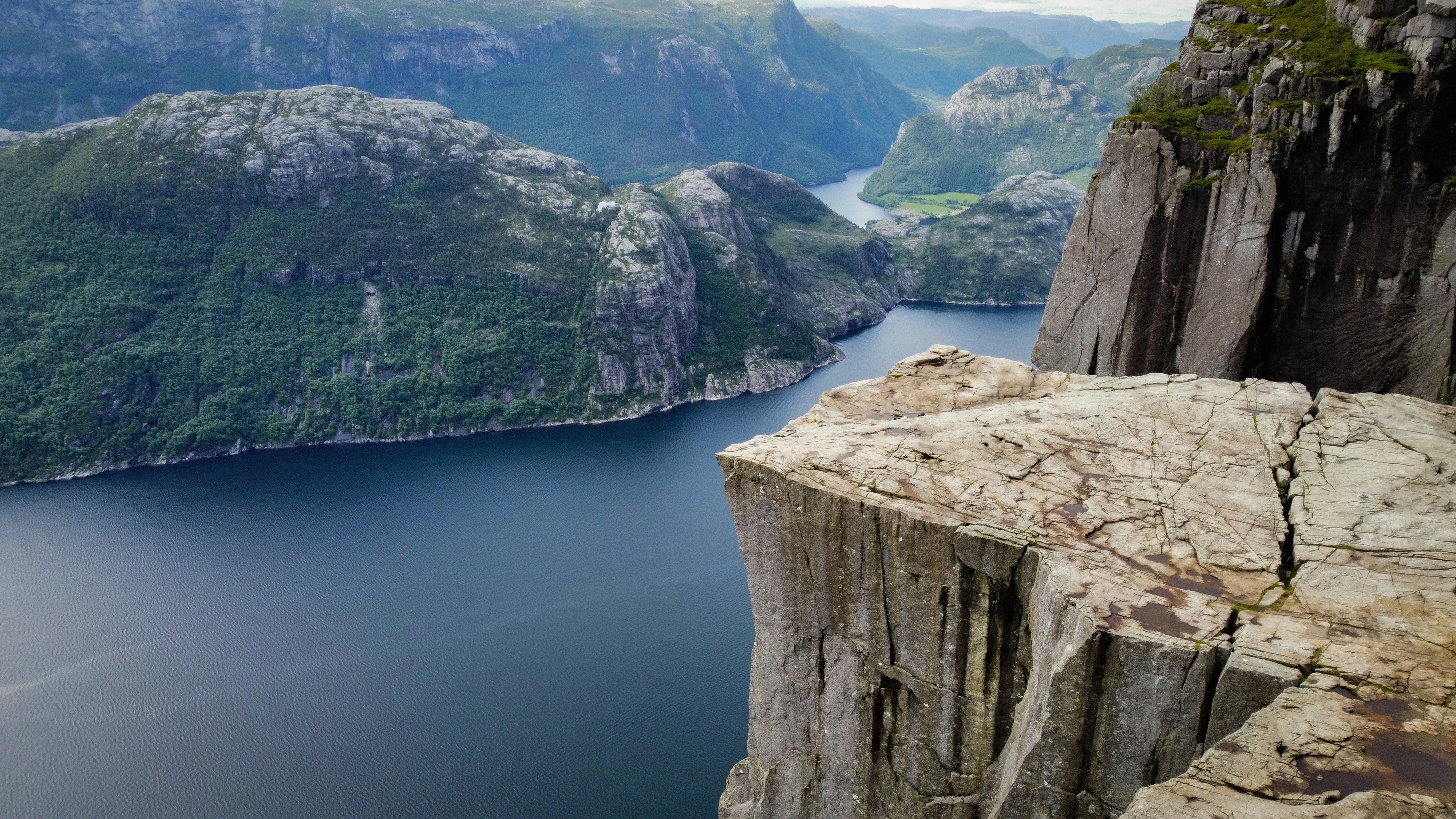 #3387 /100
A flat granite plateau juts out 604 metres above the Lysefjord, ending in a sheer drop with the fjord stretching away beyond it.
The hike climbs around 350 metres over four kilometres, steep and rocky in places but manageable for most reasonably fit walkers in a few hours.
Nothing about the scale of the drop registers properly until you are standing at the edge of it.
How does it rate
CrowdsRomanceCash RequiredDangerAccessibilityWhy you should go
A flat-topped cliff 604 metres straight above a fjord, reachable on a half-day hike.
Why you shouldn't go
There's no railing at the edge, and the plateau gets genuinely crowded in peak summer.
Plan your visit
Best time to visitMay-September, when the trail is snow-free.Best time of dayEarly morning or evening, avoiding the midday tour-group peak.Getting thereFerry from Stavanger to Tau, then bus or drive to the Preikestolen trailhead.Entry costFree hike; parking fee at the trailhead.Time needed4-5 hours round tripInsider tip — Start the hike before 8am - by midday the summit plateau is packed with cruise-ship tour groups from Stavanger. -
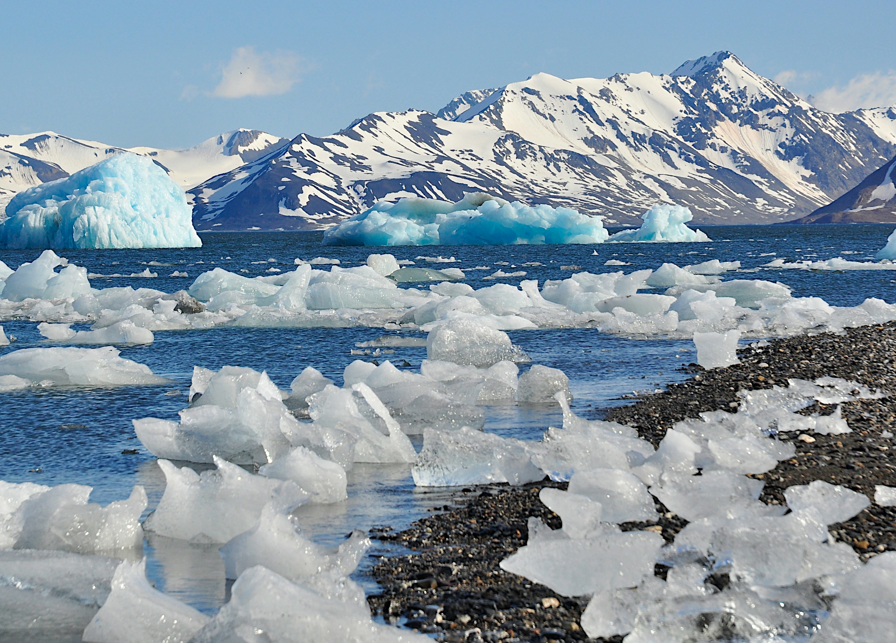 #3487 /100
Svalbard is a remote Norwegian archipelago deep in the Arctic Ocean, roughly 60% covered by glaciers and home to more polar bears than people.
Longyearbyen, the main settlement, is the base for dog-sledding, snowmobiling and boat trips past calving glaciers and drifting sea ice, with the midnight sun in summer and polar night and northern lights in winter.
Almost everything beyond town requires an armed guide, which shapes the whole experience.
How does it rate
CrowdsRomanceCash RequiredDangerAccessibilityWhy you should go
Genuine Arctic wilderness - glaciers, polar bears and sea ice - reachable on a scheduled flight, not an expedition.
Why you shouldn't go
Expensive and logistically restrictive: guided tours are compulsory for almost anything outside Longyearbyen.
Plan your visit
Best time to visitApril-August for midnight sun and easier travel; November-February for northern lights and polar night.Best time of daySeason matters more than time of day - summer light is near-constant, winter darkness is too.Getting thereDirect flights from Oslo or Tromsø to Longyearbyen, around 3 hours from Oslo.Entry costNo entry fee; guided excursions typically 500-3000+ NOK per person per day.Time needed4-7 daysInsider tip — Book glacier or fjord boat trips a season ahead in summer - the small tour operators sell out before the ice starts breaking up. -
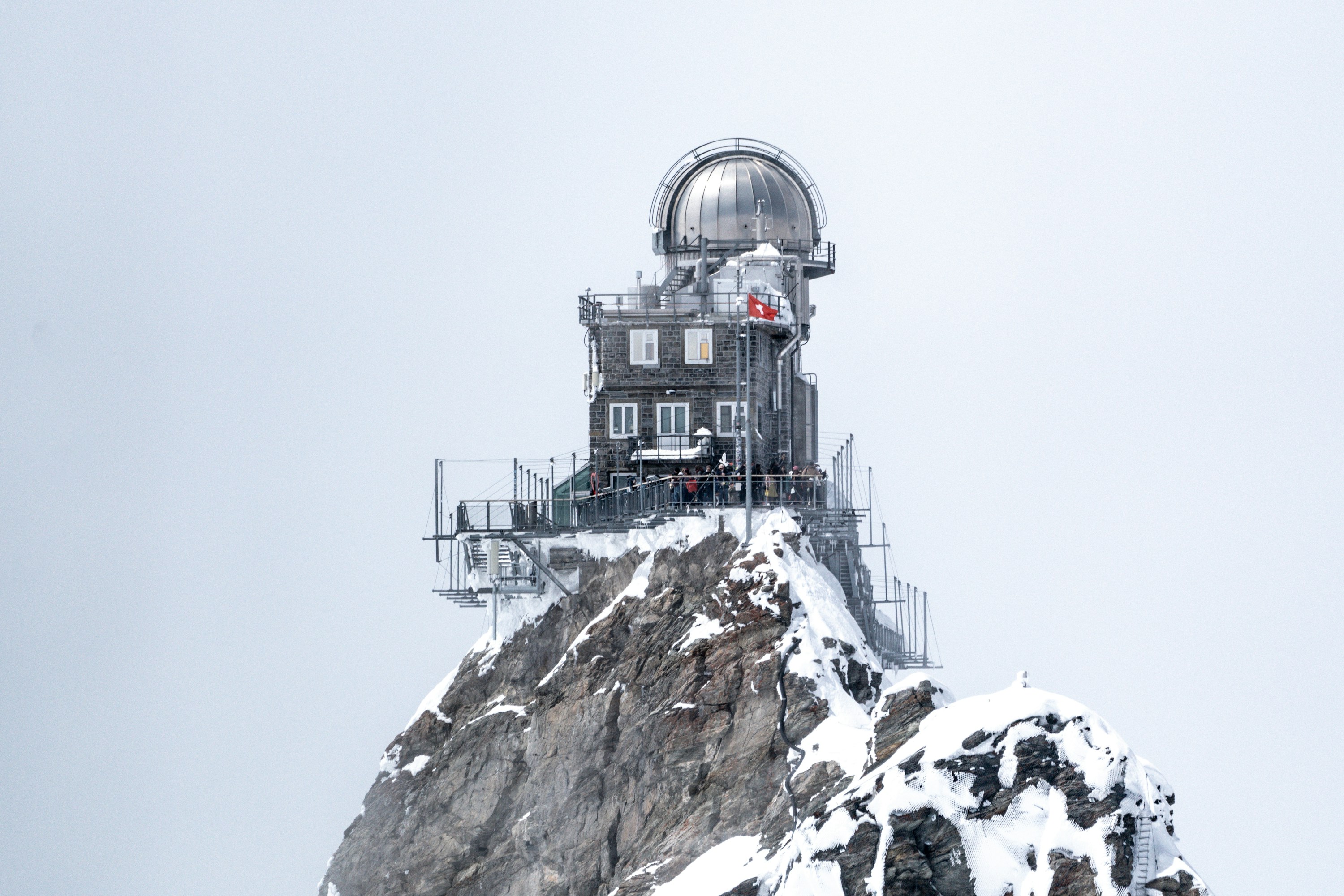 #3587 /100
A cogwheel railway climbs through solid rock to a saddle between the Eiger and Mönch, 3,454 metres up, where the "Top of Europe" station opens onto the Aletsch Glacier, the largest ice stream in the Alps.
An ice palace, observation deck, and snow terrace fill out the visit, though thin air and shifting weather can erase the view without warning.
How does it rate
CrowdsRomanceCash RequiredDangerAccessibilityWhy you should go
The Alps' most complete high-altitude experience reachable entirely by train, glacier included.
Why you shouldn't go
Among the most expensive single excursions in Switzerland, and cloud can close in and erase the view with no refund.
Plan your visit
Best time to visitMay–October for the clearest weather; book the mandatory seat reservation well ahead in summer.Best time of dayFirst train of the day, before cloud typically builds up over the peaks by midday.Getting thereTrain from Interlaken Ost via Grindelwald or Lauterbrunnen/Wengen to Jungfraujoch; no road access.Entry costRound-trip train from Interlaken roughly CHF 220–260 depending on season.Time neededHalf a dayBookingBook ahead →Insider tip — Sit on the right-hand side of the train from Interlaken for the best glacier views on the way up. -
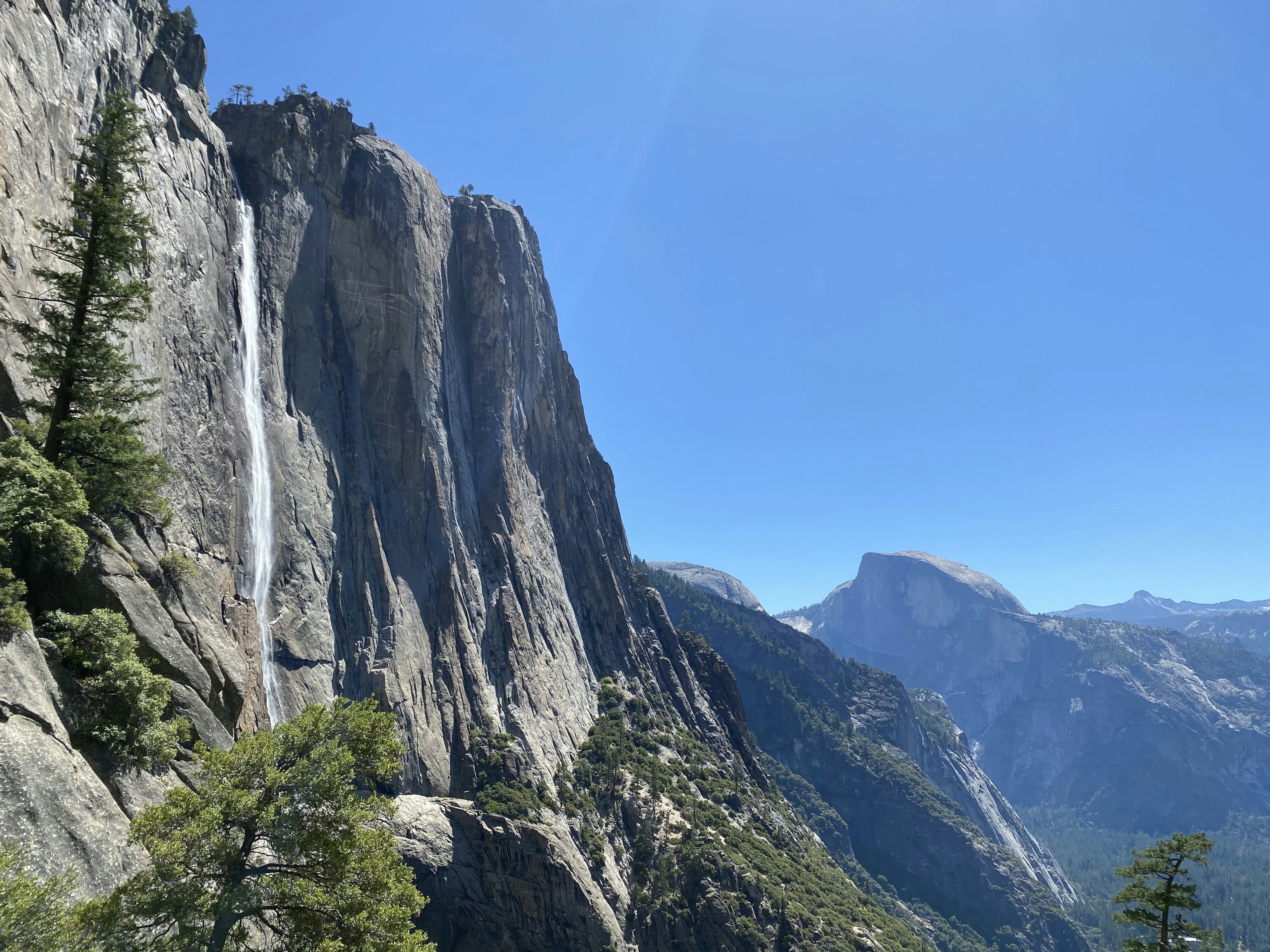 #3687 /100
North America's tallest waterfall drops in three tiers down a granite cliff face in Yosemite Valley, at its thunderous peak each spring when snowmelt sends it roaring.
By late summer it can slow to a trickle or vanish entirely, so timing genuinely changes what you see.
The valley floor meadow below offers an open, unobstructed view, with El Capitan and Half Dome in sight at the same time.
How does it rate
CrowdsRomanceCash RequiredDangerAccessibilityWhy you should go
North America's tallest waterfall, framed by two of Yosemite's other icons in a single shot.
Why you shouldn't go
The falls often dry up completely by late summer - arrive in the wrong month and there's nothing to see.
Plan your visit
Best time to visitApril-June, during peak snowmelt; often dry by August-October.Best time of dayMorning, before Yosemite Valley's parking and crowds peak.Getting thereFly to Fresno or San Francisco; drive into Yosemite Valley (no rail or bus to the park itself).Entry costYosemite National Park entry fee; the falls viewpoint itself is free.Time needed1-2 hours from the valley floorBookingBook ahead →Insider tip — Check the park's waterfall flow reports online before visiting - timing a trip around peak snowmelt matters more here than at almost any other major waterfall. -
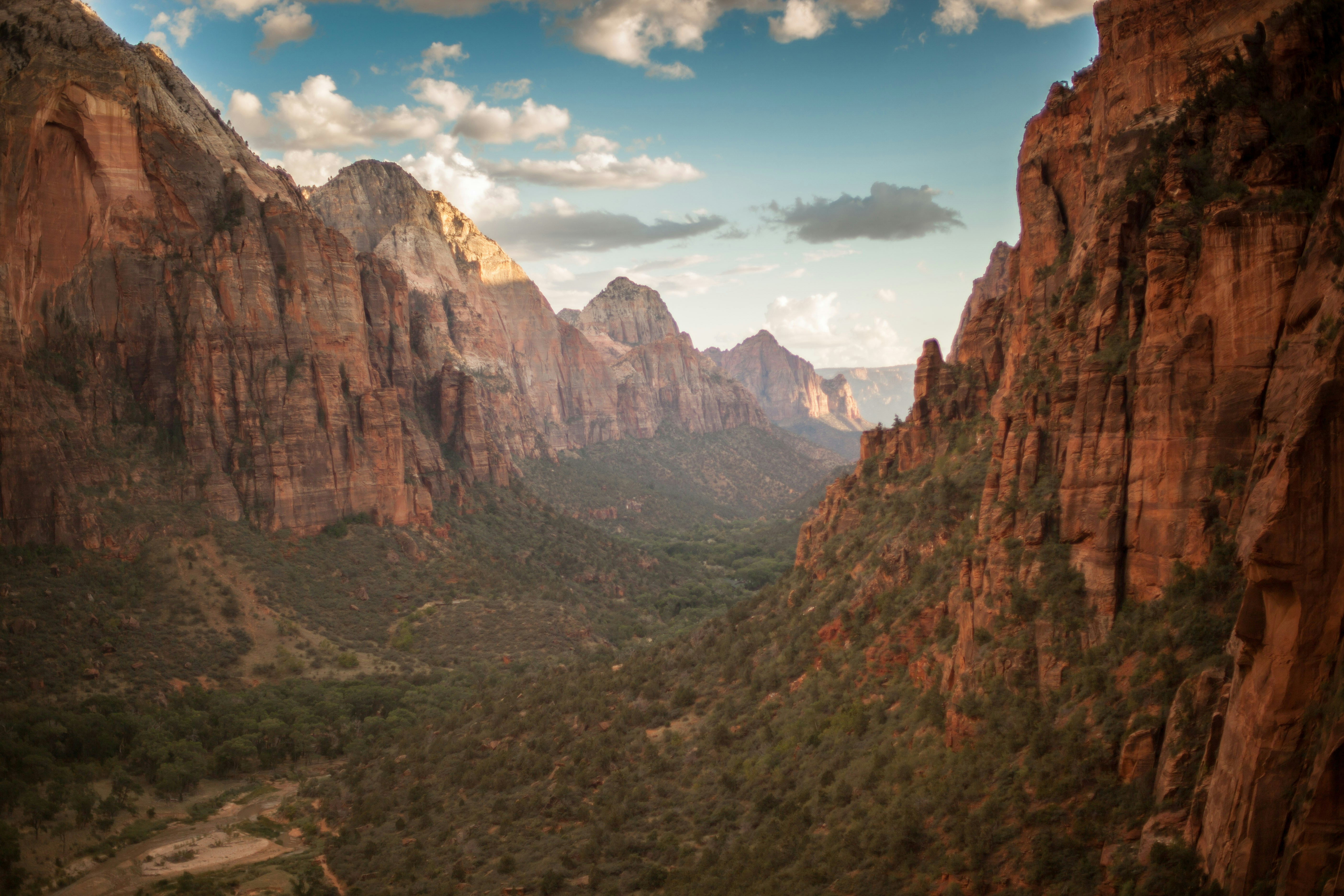 #3787 /100
Zion's main canyon is a half-mile-deep slot of red and cream sandstone carved by the Virgin River, with the Narrows letting visitors wade upriver between walls that close in overhead.
The valley floor is reached only by a free shuttle in peak season, keeping the canyon quieter than the crowded parking lots suggest.
Angels Landing's chained final pitch is the park's signature scramble, but most of the canyon is accessible on flat paved trails.
How does it rate
CrowdsRomanceCash RequiredDangerAccessibilityWhy you should go
A narrow, towering sandstone canyon you can wade straight up the middle of via the Virgin River.
Why you shouldn't go
Angels Landing needs a lottery permit, and summer flash-flood risk can close the Narrows without notice.
Plan your visit
Best time to visitApril-May or September-October, avoiding summer flash-flood season and winter Narrows closures.Best time of dayEarly morning shuttle to beat both the heat and the crowds at the canyon trailheads.Getting thereFly to Las Vegas; roughly 2.5 hour drive to the park entrance at Springdale.Entry cost$35 per vehicle, valid 7 daysTime needed1-2 daysInsider tip — Rent canyoneering shoes and a walking stick in Springdale before hiking the Narrows - the river rocks are slick. -
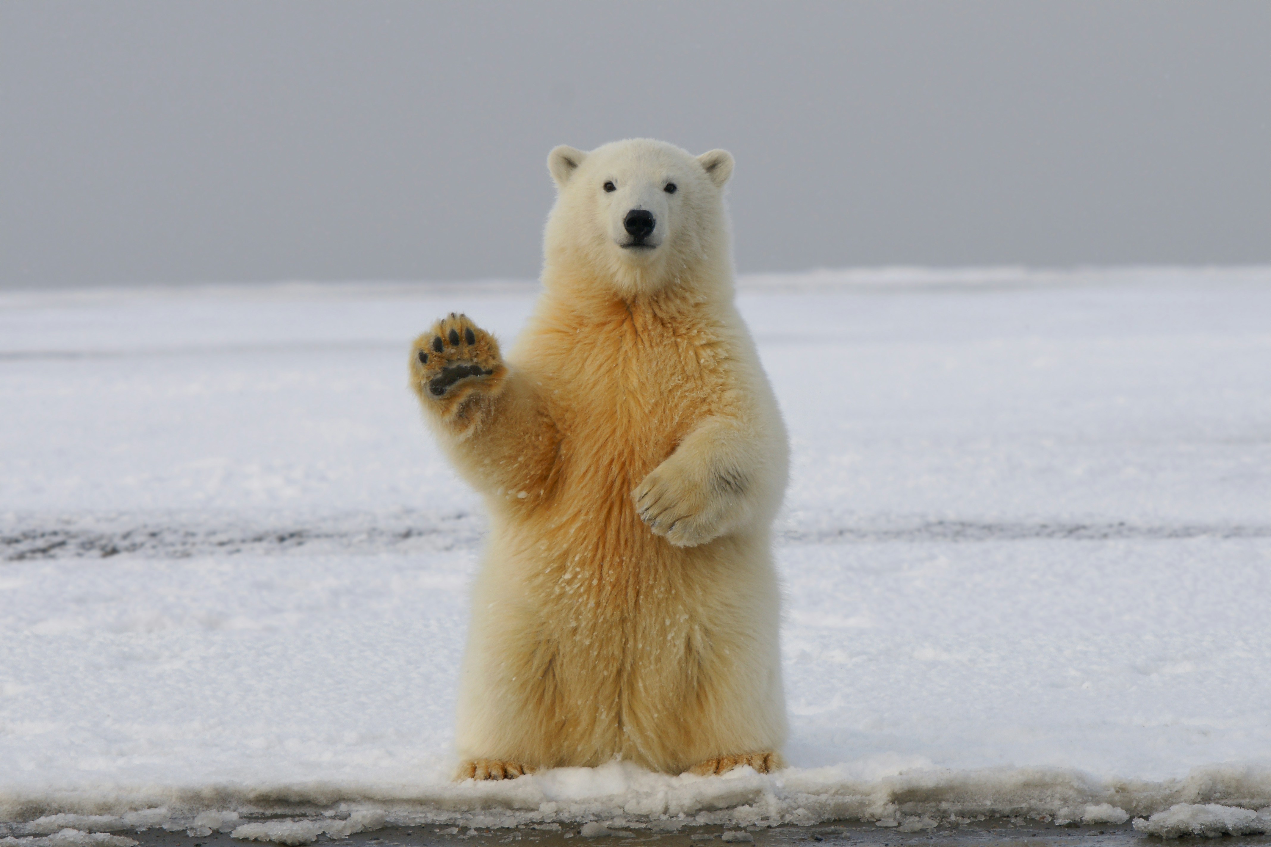 #3887 /100
A sub-Arctic town on the Hudson Bay coast known as the polar bear capital of the world, where bears gather each autumn waiting for the sea ice to freeze.
Specially built tundra vehicles bring visitors safely within metres of wild bears, and the same stretch of coast offers beluga whale watching in summer and reliable northern lights viewing in winter.
No road connects Churchill to the rest of Manitoba.
How does it rate
CrowdsRomanceCash RequiredDangerAccessibilityWhy you should go
The most reliable place on Earth to see wild polar bears up close, from the safety of a purpose-built tundra vehicle.
Why you shouldn't go
Only reachable by plane or a two-day train; peak-season tours routinely cost thousands of dollars.
Plan your visit
Best time to visitLate October to mid-November for polar bears; July-August for beluga whales; Jan-March for auroraBest time of dayDaylight hours for bear viewing; clear, moonless nights for the northern lightsGetting thereFly from Winnipeg (about 2 hours) or take the 2-day VIA Rail train; no roads connect Churchill to the rest of Manitoba.Entry costTundra buggy tours from around CA$400/day; multi-day packages often CA$3,000+Time needed3-5 days for a bear-viewing tripBookingBook ahead →Insider tip — Book tundra buggy tours many months ahead for the first two weeks of November, when bear numbers along the coast are highest; shoulder-season dates are cheaper but far less certain. -
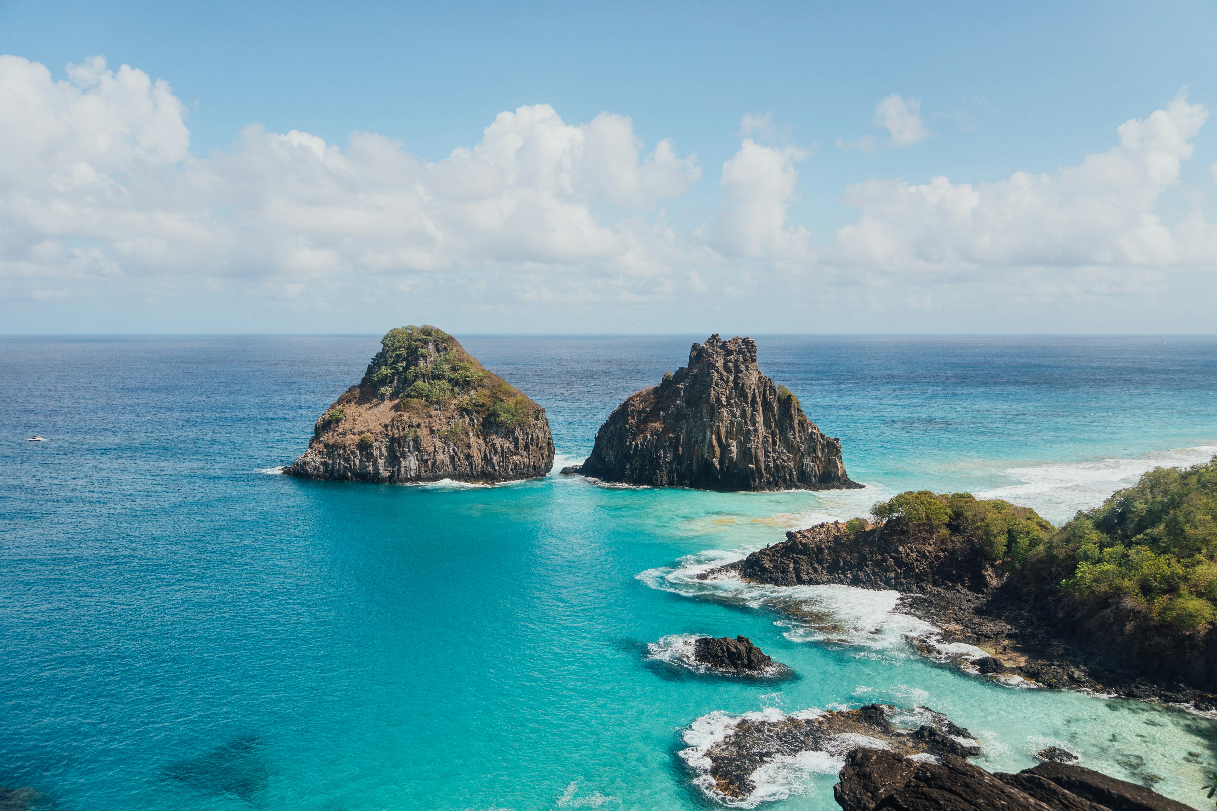 #3986 /100
A volcanic archipelago 350km off Brazil's coast, this is regularly ranked among the world's best beaches, with clear water that reveals reef sharks and sea turtles from the shoreline.
A strict daily visitor cap and environmental tax keep the beaches close to empty even in high season.
Morro Dois Irmaos, twin volcanic peaks rising from the sea, anchor the view from almost every beach.
How does it rate
CrowdsRomanceCash RequiredDangerAccessibilityWhy you should go
Regularly ranked among the world's best beaches, kept nearly empty by a strict daily visitor cap.
Why you shouldn't go
A mandatory environmental tax plus limited flights make this one of the most expensive beach trips in Brazil.
Plan your visit
Best time to visitAugust-December, the dry season, for the clearest water.Best time of dayMorning, for calm water and the best snorkelling visibility.Getting thereFly via Recife or Natal; only small aircraft serve the island's single airstrip.Entry costEnvironmental preservation tax charged per day, plus a separate national park fee for some beaches.Time needed4-5 daysInsider tip — Book flights and accommodation well ahead - the daily visitor cap means the island sells out during Brazilian holiday periods. -
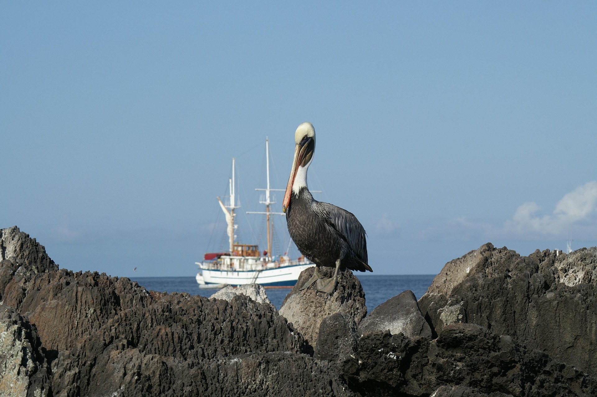 #4086 /100
A small-ship cruise through the Galapagos archipelago, landing daily by dinghy on islands where sea lions, marine iguanas, and blue-footed boobies show no fear of visitors.
Charles Darwin's living laboratory looks much as it did when he arrived, thanks to strict limits on visitor numbers and permitted routes.
Snorkeling brings penguins and hammerhead sharks within arm's reach.
Each island differs sharply from the last in wildlife and landscape.
How does it rate
CrowdsRomanceCash RequiredDangerAccessibilityWhy you should go
Close, fearless encounters with sea lions, iguanas, and giant tortoises found nowhere else on Earth.
Why you shouldn't go
Strict permit limits keep prices high, and itineraries are fixed months ahead with little flexibility.
Plan your visit
Best time to visitYear-round destination; June-November for calmer seas and marine wildlife, December-May for warmer water.Best time of dayEarly morning landings, before the heat builds and animals are most active.Getting thereFly to Quito or Guayaquil, then a short flight to Baltra or San Cristobal to board the ship.Entry costIndicative $500-$1,500pp per day depending on ship classTime needed5-8 night cruiseInsider tip — Choose an 8-day itinerary over a 5-day one to reach the outer islands with the best wildlife; pack reef-safe sunscreen only, as regular sunscreen is banned in the marine reserve. -
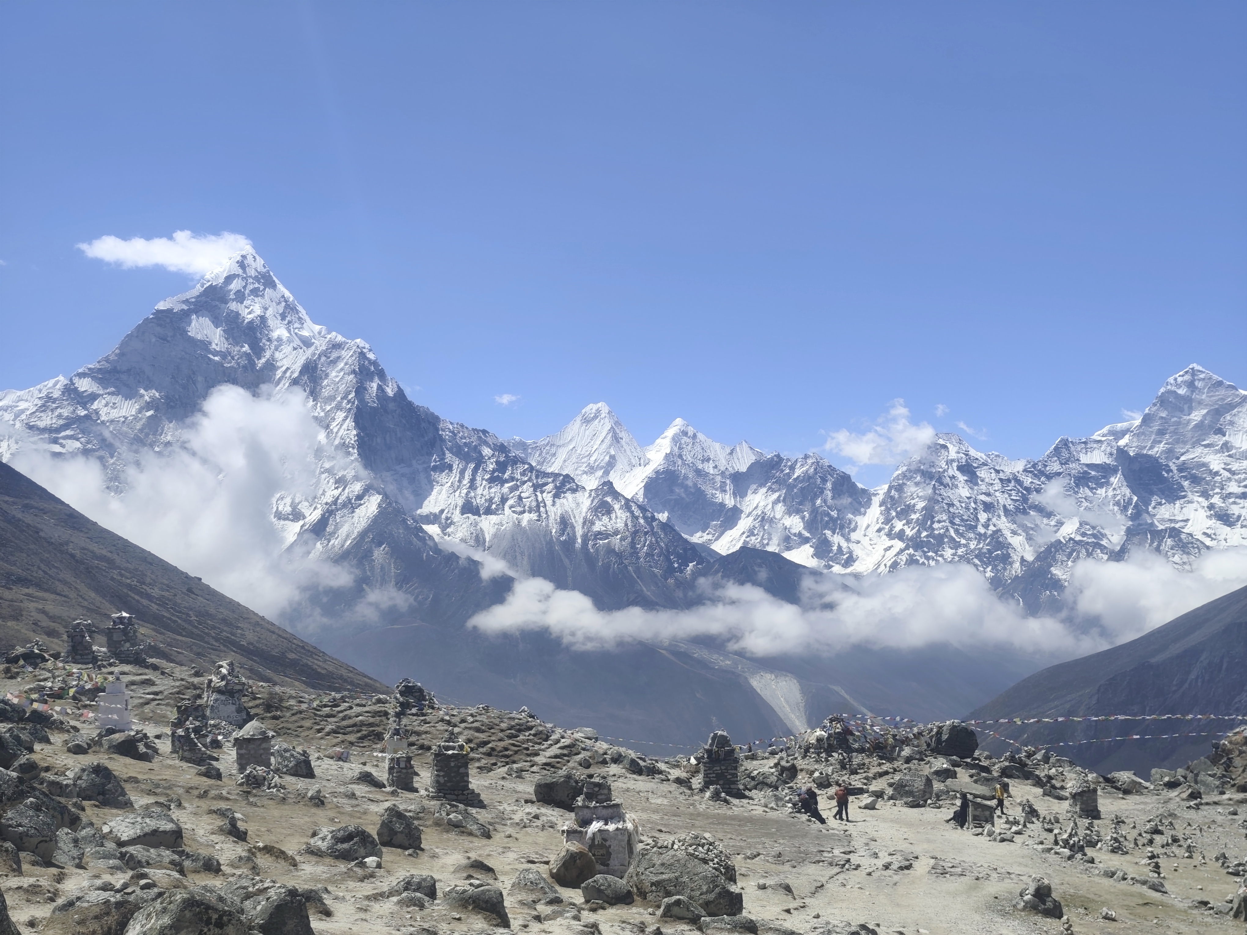 #4186 /100
A 12-14 day teahouse trek from Lukla through Namche Bazaar and Sherpa villages to Everest Base Camp at 5,364m, past the prayer-flagged memorial cairns at Thukla.
Everest itself is hidden from Base Camp, so the trek is paired with a pre-dawn climb of Kala Patthar, where the summit catches the first light above Ama Dablam and Nuptse.
Altitude, not distance, is the real challenge, so itineraries build in acclimatisation days.
How does it rate
CrowdsRomanceCash RequiredDangerAccessibilityWhy you should go
Standing at the foot of the world's highest mountain after two weeks walking through Sherpa villages to reach it.
Why you shouldn't go
Altitude sickness is a real risk above 4,000m and the Lukla flight is notoriously weather-dependent.
Plan your visit
Best time to visitMarch-May or September-November, for stable weather and clear mountain views.Best time of dayPre-dawn at Kala Patthar for sunrise light on Everest's summit pyramid.Getting thereFly Kathmandu to Lukla (2,860m); the trek starts on foot from Lukla's airstrip.Entry costSagarmatha National Park permit $30, plus Khumbu municipality permit $20.Time needed12-14 daysInsider tip — Spend the acclimatisation day in Namche hiking up high, not resting in bed - moving works better for adjusting to altitude. -
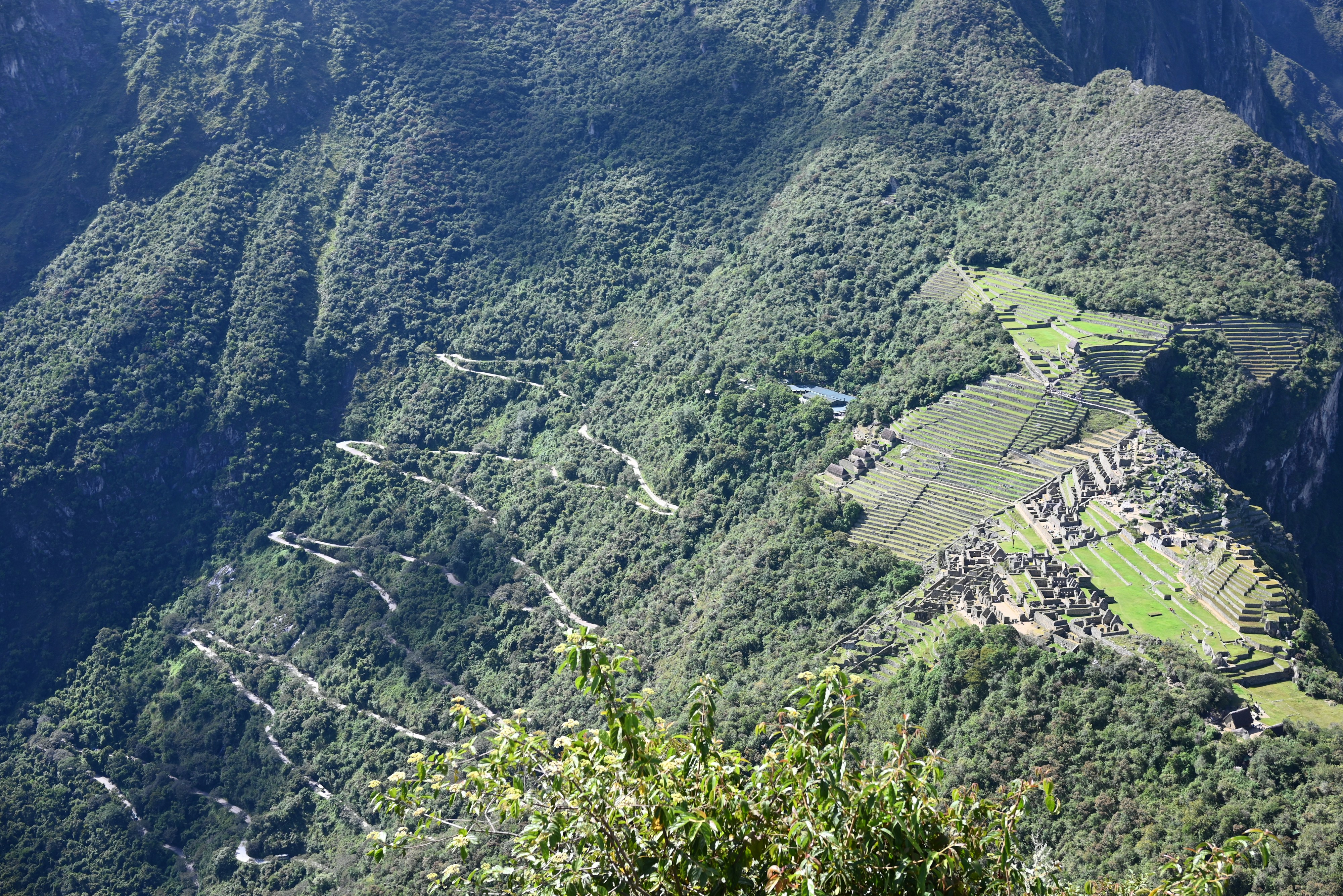 #4286 /100
The steep peak rising behind Machu Picchu is a climbable mountain in its own right, with narrow Inca-built stone steps switchbacking up its face.
From the summit the entire citadel unfolds below, terraces and all, with the Urubamba river winding through the valley beyond.
Only 200 permits are issued per morning slot, which keeps the trail genuinely uncrowded but means booking months ahead.
How does it rate
CrowdsRomanceCash RequiredDangerAccessibilityWhy you should go
The exact aerial angle over Machu Picchu that appears on every postcard, reached on foot.
Why you shouldn't go
The stone steps are narrow, steep and exposed - not a casual walk, and permits are strictly limited.
Plan your visit
Best time to visitMay-September, the dry season, for clear views over the citadel.Best time of dayFirst entry slot, 7am, for the clearest light and thinnest crowds.Getting thereTrain or trek to Aguas Calientes, then bus up to Machu Picchu; Huayna Picchu tickets are a separate add-on.Entry costRequires a separate Huayna Picchu permit on top of the Machu Picchu ticket, booked months ahead.Time needed2-3 hours for the climbBookingBook ahead →Insider tip — Book Huayna Picchu tickets 3-4 months in advance - the 200 morning permits sell out first. -
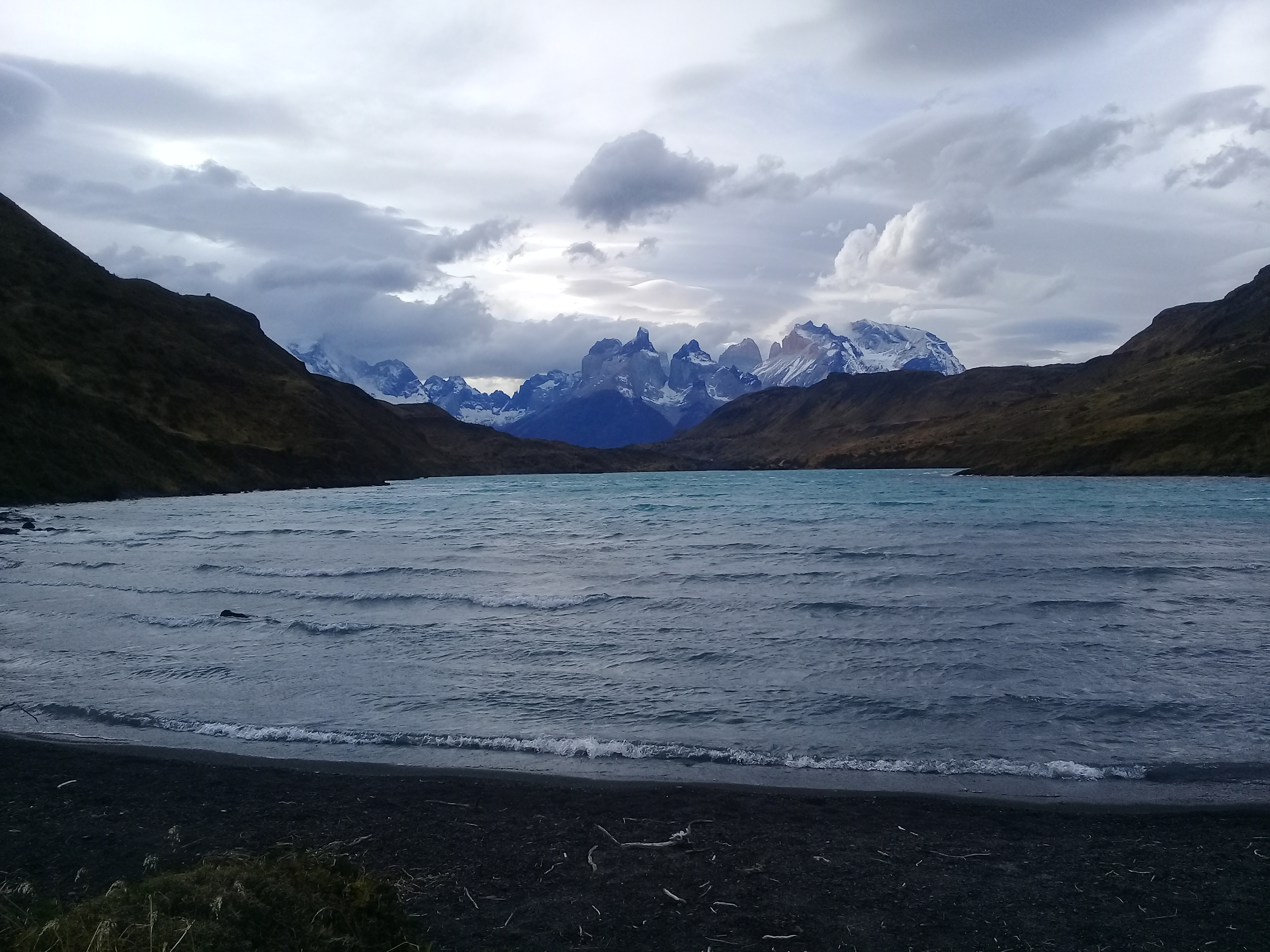 #4385 /100
A 4-5 day traverse of Torres del Paine's signature sights: the granite Torres themselves, the sheer Cuernos horns, French Valley's hanging glaciers, and Grey Glacier's blue ice.
Refugios and campsites break the route into manageable days, though Patagonian wind can turn brutal without warning.
The reward is one of the most consistently spectacular multi-day trails in South America, from lenga forest to turquoise glacial lakes.
How does it rate
CrowdsRomanceCash RequiredDangerAccessibilityWhy you should go
Four straight days of the Cuernos, Grey Glacier and the Torres themselves without a single dull stretch.
Why you shouldn't go
Notorious Patagonian wind and rain can stall a day's hike entirely, and refugio spots must be booked far ahead.
Plan your visit
Best time to visitNovember-March (Southern Hemisphere summer), when trails and refugios are open.Best time of dayEarly morning at the Base Torres viewpoint, before afternoon cloud hides the towers.Getting thereFly to Punta Arenas; bus (about 3-5 hours) to Puerto Natales, then a shuttle to the park.Entry costPark entry about $49 USD; refugio and camping packages from roughly $600-1,500.Time needed4-5 daysBookingBook ahead →Insider tip — Book refugios the moment the season opens (around April-May) - popular ones sell out for peak months first. -
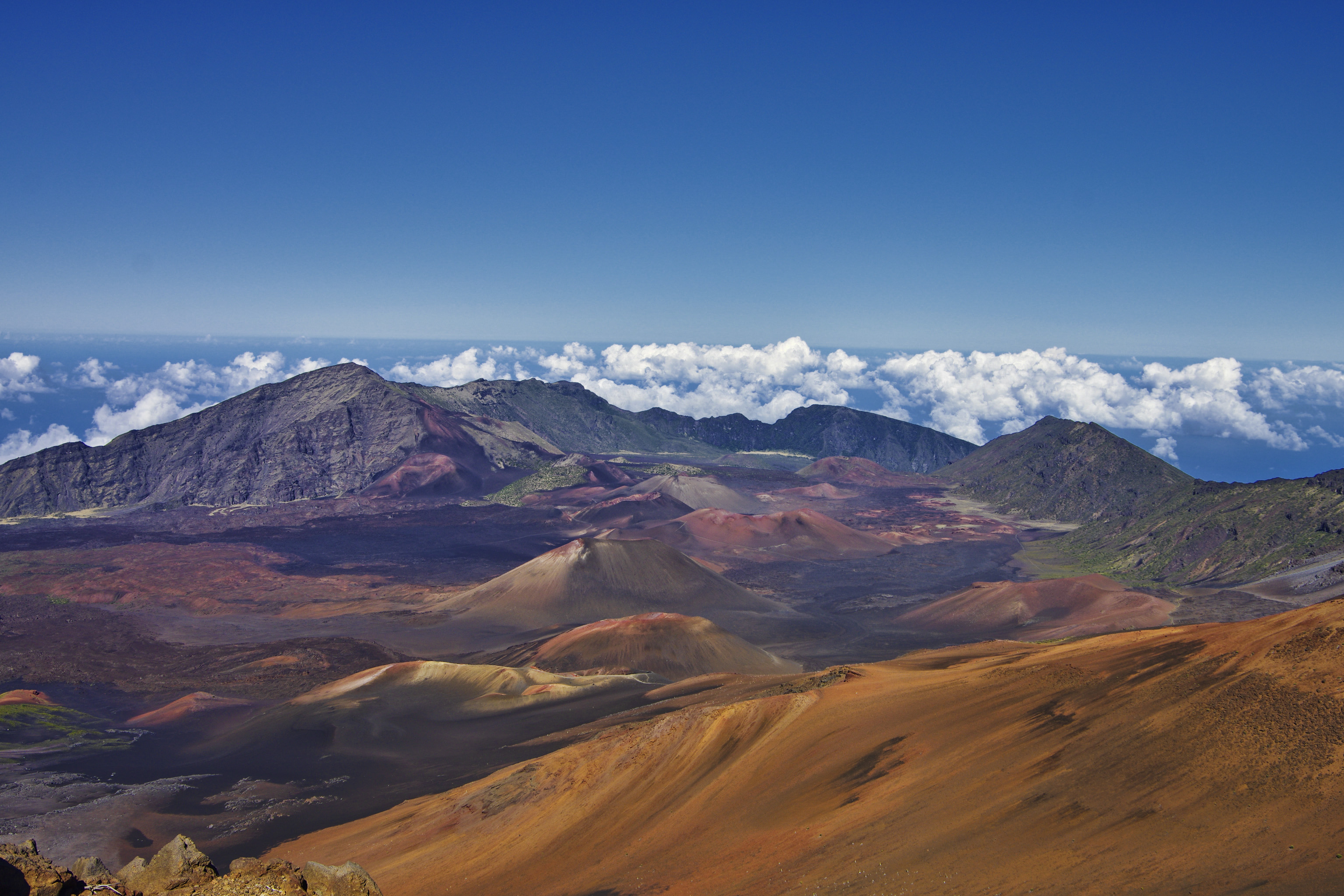 #4485 /100
Haleakala's summit on Maui sits at 3,055 metres above sea level, placing it above the clouds for one of the world's most famous sunrise experiences.
The volcanic crater contains a moonlike landscape of cinder cones and lava flows extending 11 kilometres across and 800 metres deep.
How does it rate
CrowdsRomanceCash RequiredDangerAccessibilityWhy you should go
Watching the sun rise above the clouds from the summit crater rim is a spiritual experience; the volcanic landscape below and clouds stretching to the horizon are genuinely awe-inspiring.
Why you shouldn't go
Sunrise viewing requires an advance reservation, you must drive up before 3am, and the summit is bitterly cold even in Hawaiian summer.
Plan your visit
Best time to visitYear-roundBest time of daySunrise (needs advance reservation) or sunsetGetting there~1.5-2hr drive from Kahului, MauiEntry costPark entry ~$30/vehicle, sunrise reservation ~$1 extraTime neededHalf dayInsider tip — Book the sunrise reservation weeks ahead; it sells out, and bring warm layers, it is near freezing at the summit -
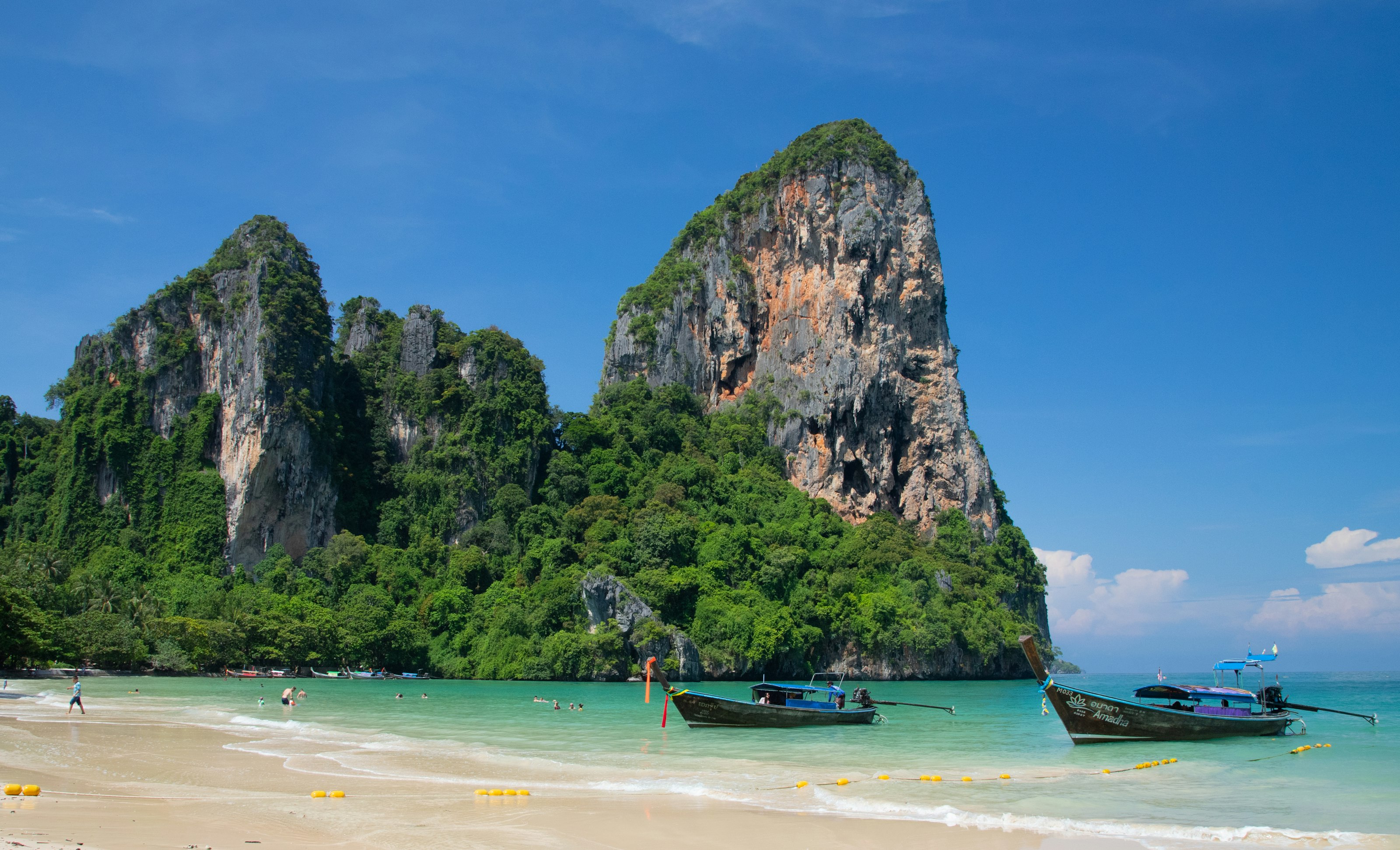 #4585 /100
Railay is a small peninsula near Krabi cut off from the mainland by sheer limestone cliffs, reachable only by longtail boat despite technically being attached to the mainland.
Towering karst formations ring beaches of soft white sand and clear water, and the cliffs themselves have made Railay one of the world's best-known rock-climbing destinations, with routes for complete beginners up to experienced climbers.
How does it rate
CrowdsRomanceCash RequiredDangerAccessibilityWhy you should go
Climbing a limestone cliff straight out of the sea, with a swim waiting at the bottom, is a combination almost nowhere else offers.
Why you shouldn't go
Everything arrives by boat, so prices for food and rooms run higher than comparable spots reachable by road.
Plan your visit
Best time to visitNovember–March, dry season with calm seas for the boat crossing.Best time of dayEarly morning for climbing before the heat, late afternoon for the beach and sunset.Getting thereFly to Krabi; 30-minute drive to Ao Nang, then a 15-minute longtail boat to Railay.Entry costFree beaches; climbing gear rental and guided routes are paid, as is the boat transfer.Time needed1–2 daysInsider tip — Book a half-day climbing course even as a complete beginner — routes right off the beach are graded easy and the setting makes it worthwhile regardless of skill. -
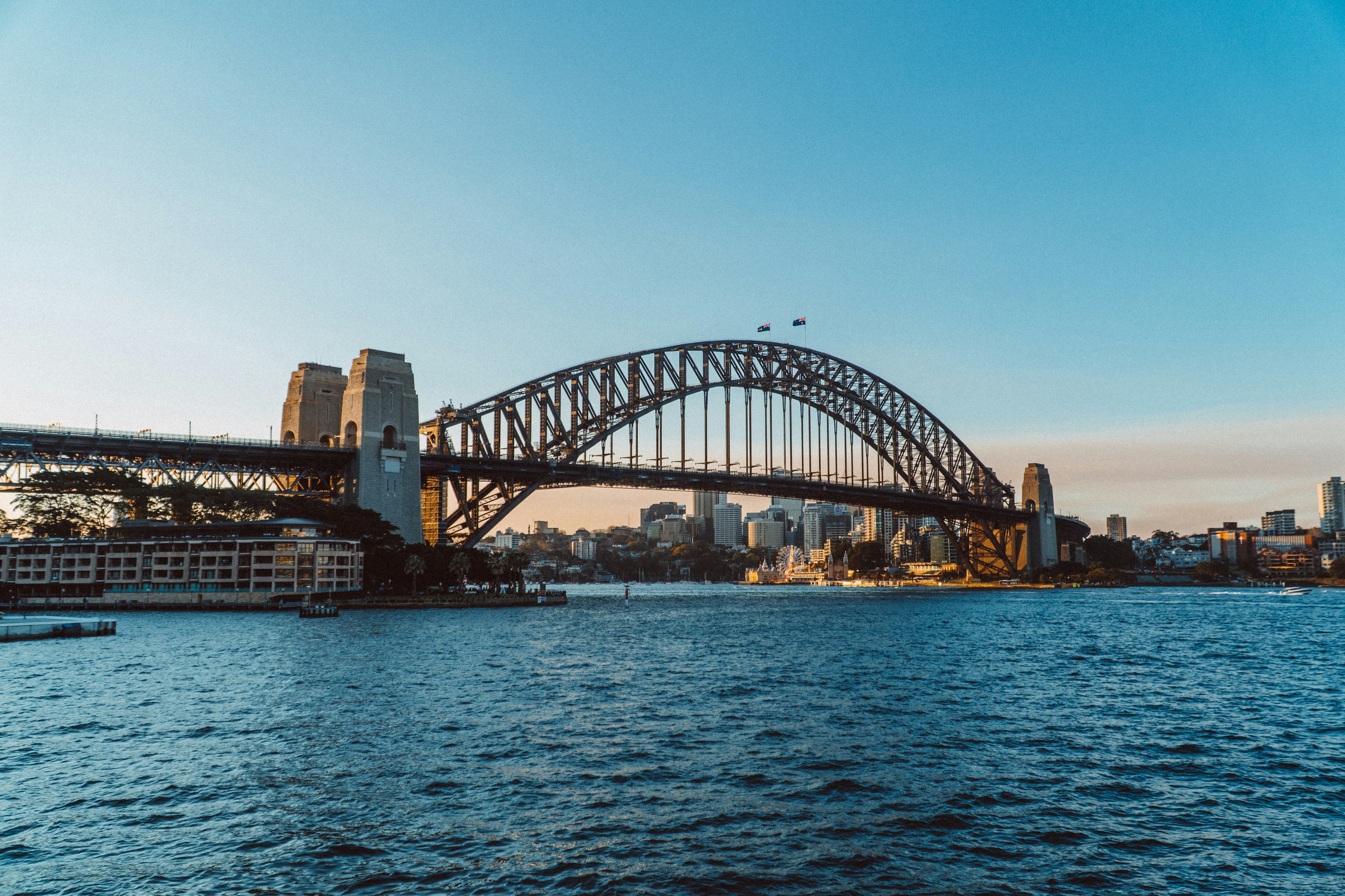 #4684 /100
The steel arch Sydneysiders call the Coathanger, carrying eight lanes, two rail tracks and a pedestrian walkway high above the harbour.
The classic view pairs it with the Opera House from Mrs Macquarie's Chair.
Climbers can walk the outer arch on a harnessed BridgeClimb, 134 metres above the water.
How does it rate
CrowdsRomanceCash RequiredDangerAccessibilityWhy you should go
You can walk the deck for nothing and still get the Opera House framed under the arch.
Why you shouldn't go
The BridgeClimb is expensive and you are not allowed to carry a camera on it.
Plan your visit
Best time to visitSeptember-November for mild weather and clear lightBest time of daySunrise from Milsons Point, or dusk when the arch lights upGetting thereTrain to Milsons Point for the north end, or Circular Quay for the southEntry costFree to walk; Pylon Lookout around AUD 27; BridgeClimb from AUD 200Time needed1-3 hoursBookingBook ahead →Insider tip — Skip the paid climb and pay a few dollars for the Pylon Lookout instead - almost the same view for a fraction of the money. -
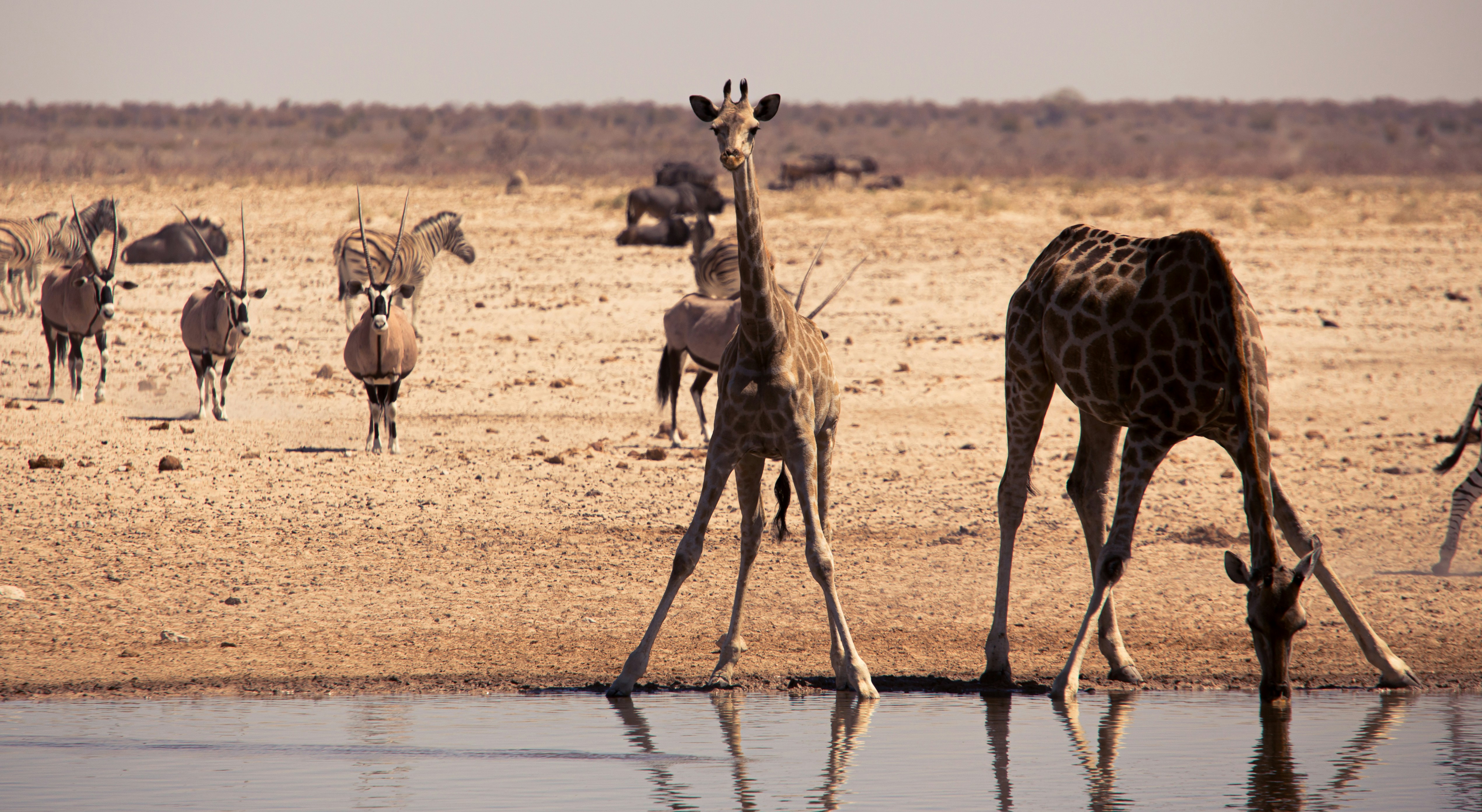 #4784 /100
A vast, shimmering salt pan visible from space anchors this national park, where waterholes along its edges concentrate wildlife in a way few other African parks match, especially in the dry season when animals converge to drink.
Self-drive visitors can park at floodlit waterholes after dark and watch elephants, rhinos and predators arrive, without needing a guide.
The pan itself is striking even without the wildlife around its rim.
How does it rate
CrowdsRomanceCash RequiredDangerAccessibilityWhy you should go
One of Africa's best self-drive safari parks, with floodlit waterholes offering wildlife viewing after dark.
Why you shouldn't go
Dry-season dust and heat are intense, and the pan itself offers little shade for extended stops.
Plan your visit
Best time to visitMay–October (dry season), when wildlife concentrates densely at waterholes.Best time of dayLate afternoon into dusk at a floodlit waterhole, as nocturnal animals begin arriving.Getting thereAbout 4-5 hours' drive from Windhoek, or fly into a nearby airstrip.Entry costPark entry around N$150 (~€8) per person per day, plus vehicle fees.Time needed2–3 days.Insider tip — Stay inside the park at a rest camp with a floodlit waterhole (like Okaukuejo) rather than outside the gates — night sightings there are the trip's highlight. -
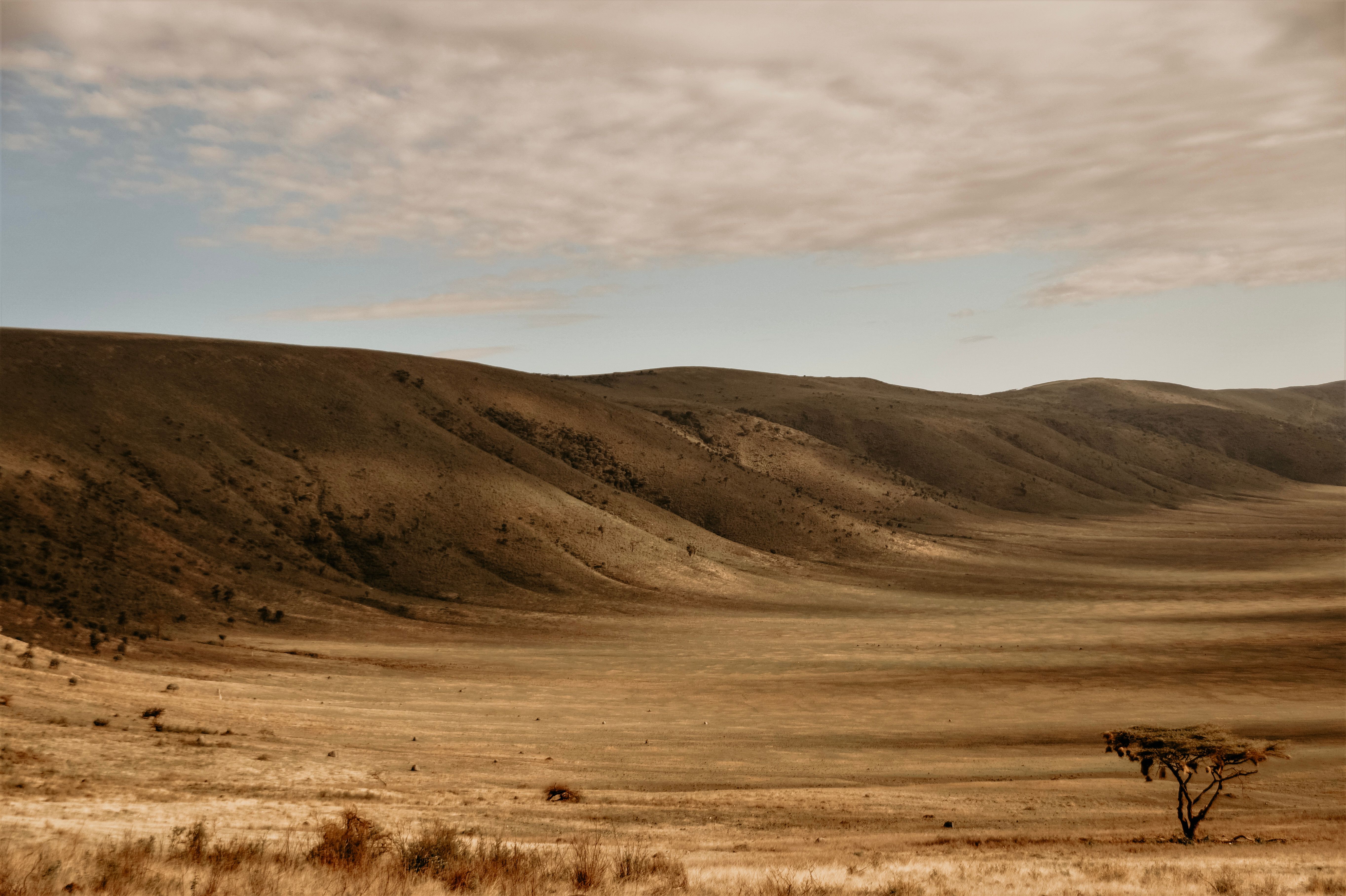 #4884 /100
The world's largest intact volcanic caldera holds an entire self-contained ecosystem within its walls, its crater floor packed with one of Africa's densest concentrations of wildlife, including the 'Big Five' all visible on a single day's game drive.
Unlike the Serengeti's open plains, animals here rarely migrate beyond the crater's rim, making sightings unusually reliable year-round.
How does it rate
CrowdsRomanceCash RequiredDangerAccessibilityWhy you should go
One of Africa's most reliable wildlife-viewing sites, with all of the Big Five often visible in a single day.
Why you shouldn't go
Vehicle numbers on the crater floor can feel congested at popular sightings during peak season.
Plan your visit
Best time to visitJune–September (dry season) for the easiest wildlife viewing and clearer roads.Best time of dayEarly morning descent onto the crater floor, when predators are most active.Getting thereDrive from Arusha, about 3.5–4 hours, often combined with a Serengeti safari circuit.Entry costConservation area fees around $70+ per person per day, typically bundled into safari packages.Time needed1 full day, or an overnight stay on the crater rim.Insider tip — Stay overnight on the rim rather than day-tripping from Arusha — it gets you onto the crater floor at first light, before day-tour vehicles arrive. -
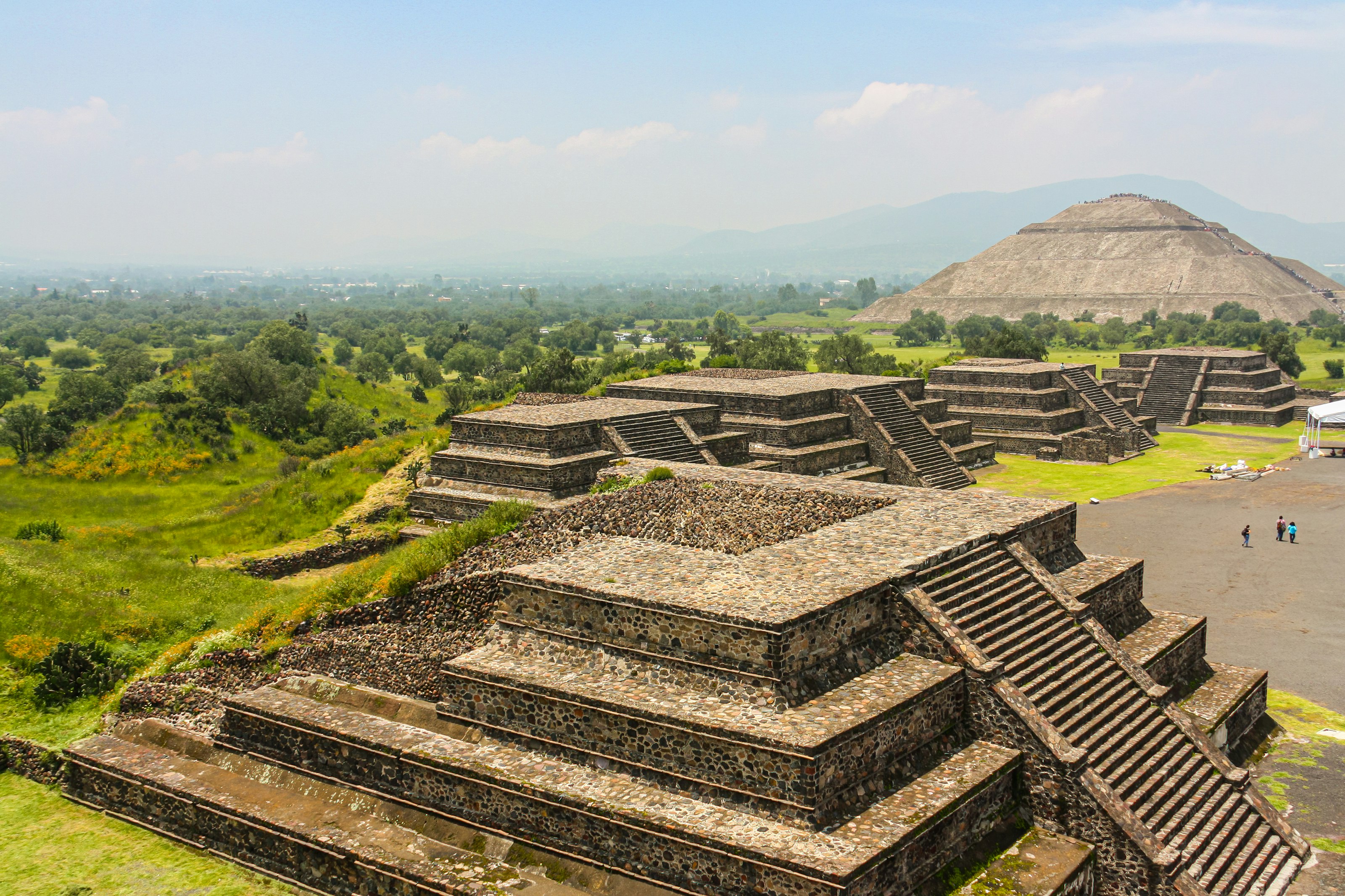 #4984 /100
Teotihuacan was one of the largest cities in the ancient world, and its two great pyramids — the Sun and the Moon — still dominate the Mexican plateau just outside the capital.
The Avenue of the Dead runs more than two kilometres between them, past palace complexes decorated with faded murals.
Both main pyramids can be climbed, and the view from the top of the Pyramid of the Sun takes in the whole site and the mountains beyond.
How does it rate
CrowdsRomanceCash RequiredDangerAccessibilityWhy you should go
Climbing the Pyramid of the Sun for a view down the full length of the Avenue of the Dead is genuinely awe-inspiring.
Why you shouldn't go
The steps up both pyramids are steep and uneven, and there's almost no shade across the whole site.
Plan your visit
Best time to visitNovember–March, dry season with cooler daytime temperatures.Best time of dayEarly morning, both for cooler climbing weather and thinner crowds.Getting thereFly to Mexico City; 1-hour drive or direct bus from the capital's Central del Norte terminal.Entry costPaid entry; extra optional hot-air balloon rides at sunrise.Time neededHalf a dayInsider tip — Enter at Gate 1 near the Pyramid of the Moon and walk the avenue toward the Pyramid of the Sun — it saves the best climb for when you've warmed up. -
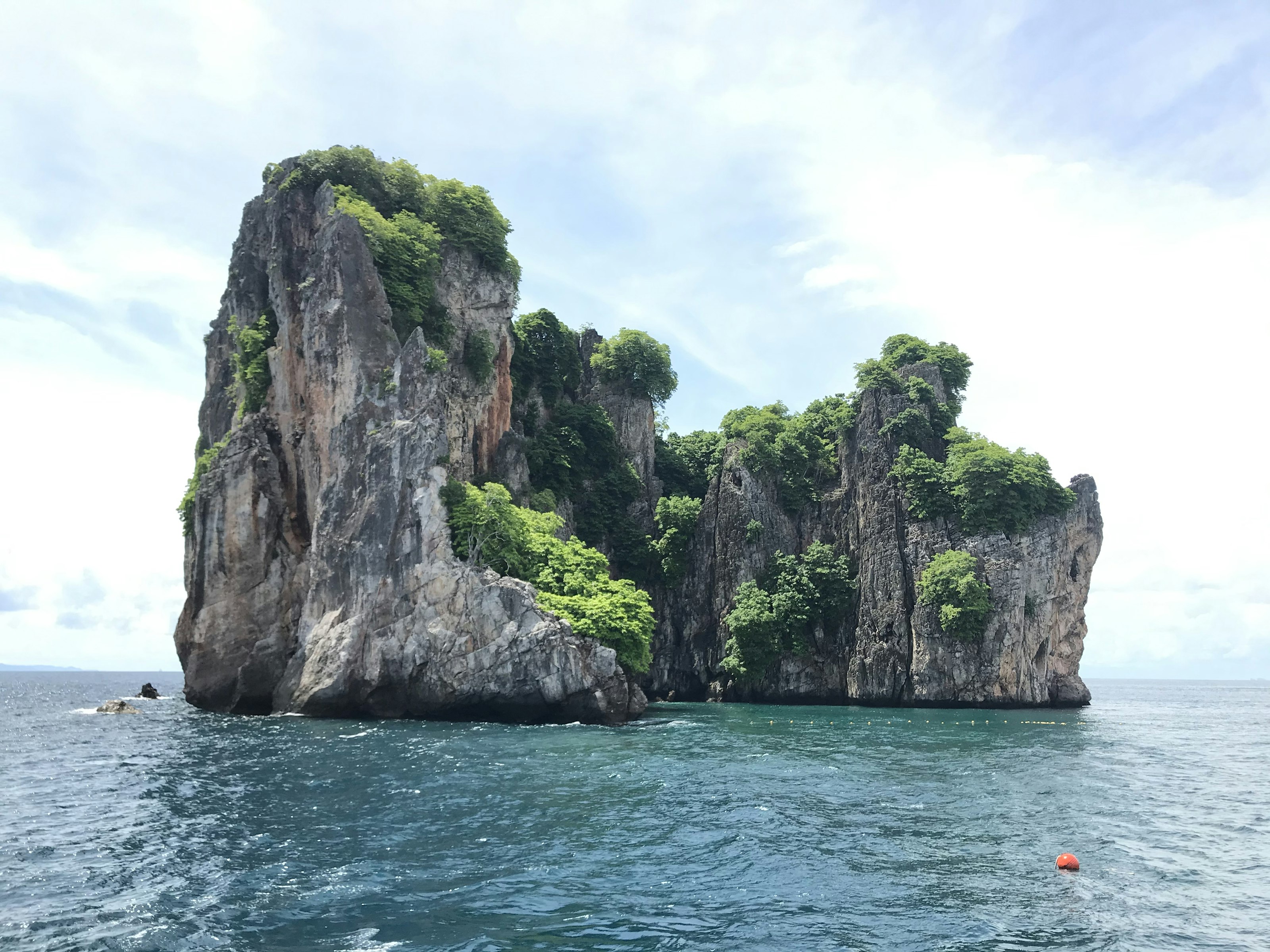 #5084 /100
Phang Nga Bay is scattered with hundreds of limestone karst towers rising sheer out of shallow emerald water, including Ko Tapu, the needle-thin rock made famous by a 1974 James Bond film.
Longtail boats and sea kayaks weave between the islands and into hidden lagoons through partly submerged caves called hongs, some passable only at certain tides, alongside mangrove-fringed fishing villages including one built entirely on stilts.
How does it rate
CrowdsRomanceCash RequiredDangerAccessibilityWhy you should go
Kayaking into a hidden lagoon through a sea cave that only opens at the right tide feels like discovering somewhere genuinely secret.
Why you shouldn't go
The bay's fame means large tour groups on bigger boats crowd the most famous spots, especially around midday.
Plan your visit
Best time to visitNovember–April, dry season with calmer seas.Best time of dayEarly morning, for calmer water and to reach the hongs before the tide and crowds shift.Getting thereFly to Phuket or Krabi; 1-hour drive to Phang Nga pier for boat tours.Entry costNational park fee plus boat tour cost, which varies by group size and boat type.Time needed1 dayInsider tip — Choose a small-group kayak tour over a big-boat day trip — it's the only way to actually get inside the hongs rather than just viewing the karsts from the water. -
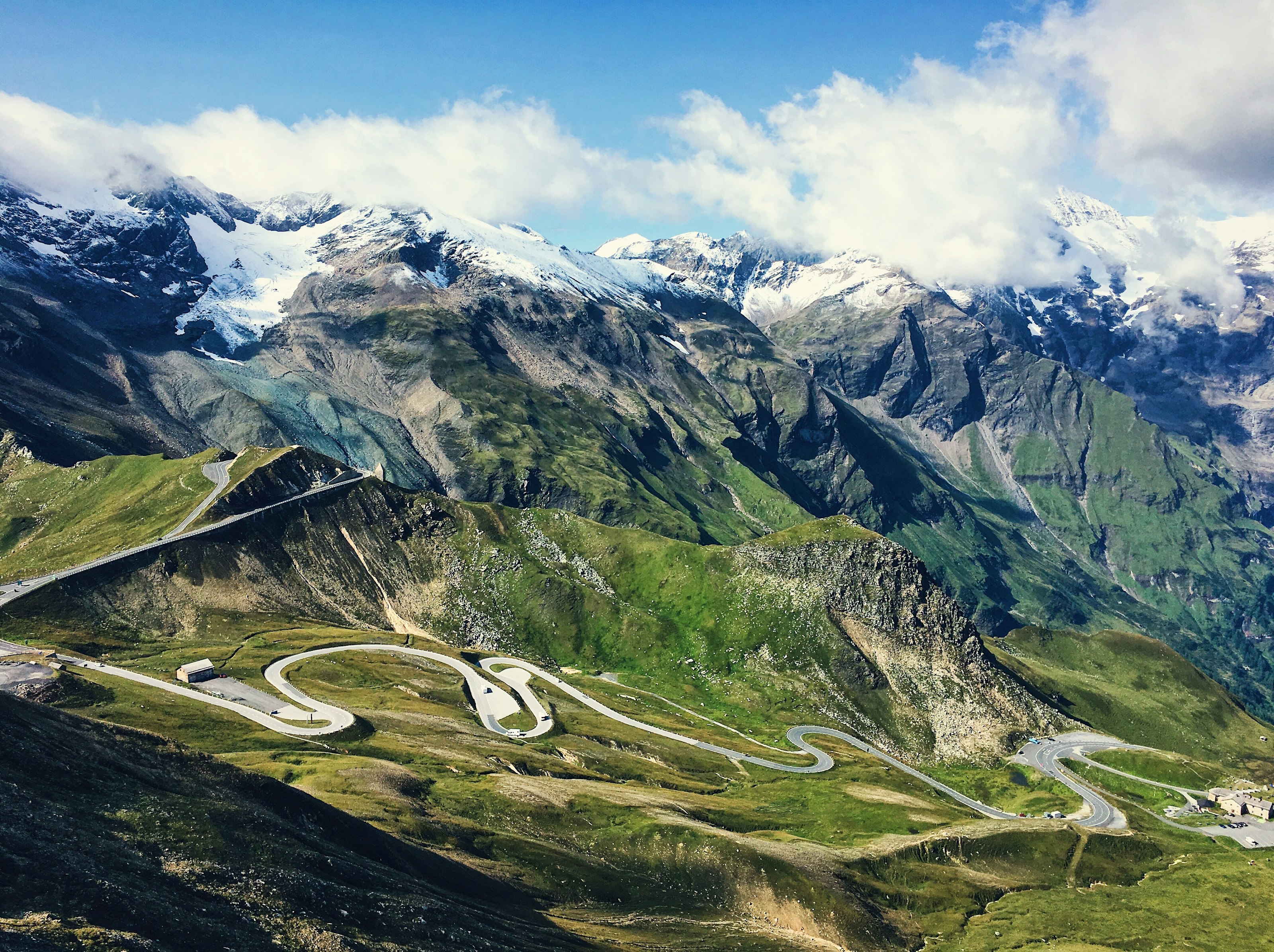 #5184 /100
The Grossglockner High Alpine Road climbs through 36 hairpin bends to over 2,500 metres, threading past Austria's highest peak and ending at a viewpoint over the Pasterze, the country's largest glacier.
Marmots and ibex are a common sight along the route, and a dozen or so panoramic pull-offs give reason to stop every few kilometres.
The road is only open from May to October, closing once snow makes the high pass impassable.
How does it rate
CrowdsRomanceCash RequiredDangerAccessibilityWhy you should go
Few drives anywhere put a country's highest peak and largest glacier both directly in view from the road itself.
Why you shouldn't go
It's a toll road only open in warmer months, and hairpin after hairpin makes it a slow, deliberate drive rather than a scenic shortcut.
Plan your visit
Best time to visitJune–September, when the road is fully open and snow has cleared from the pass.Best time of dayMorning, for clear visibility before afternoon cloud builds around the peaks.Getting thereFly to Salzburg; roughly 1.5-hour drive south to the road's northern entrance near Fusch.Entry costToll charged per vehicle.Time neededHalf a dayInsider tip — Stop at the Kaiser-Franz-Josefs-Höhe viewpoint for the best direct view of the Pasterze glacier and the Grossglockner summit. -
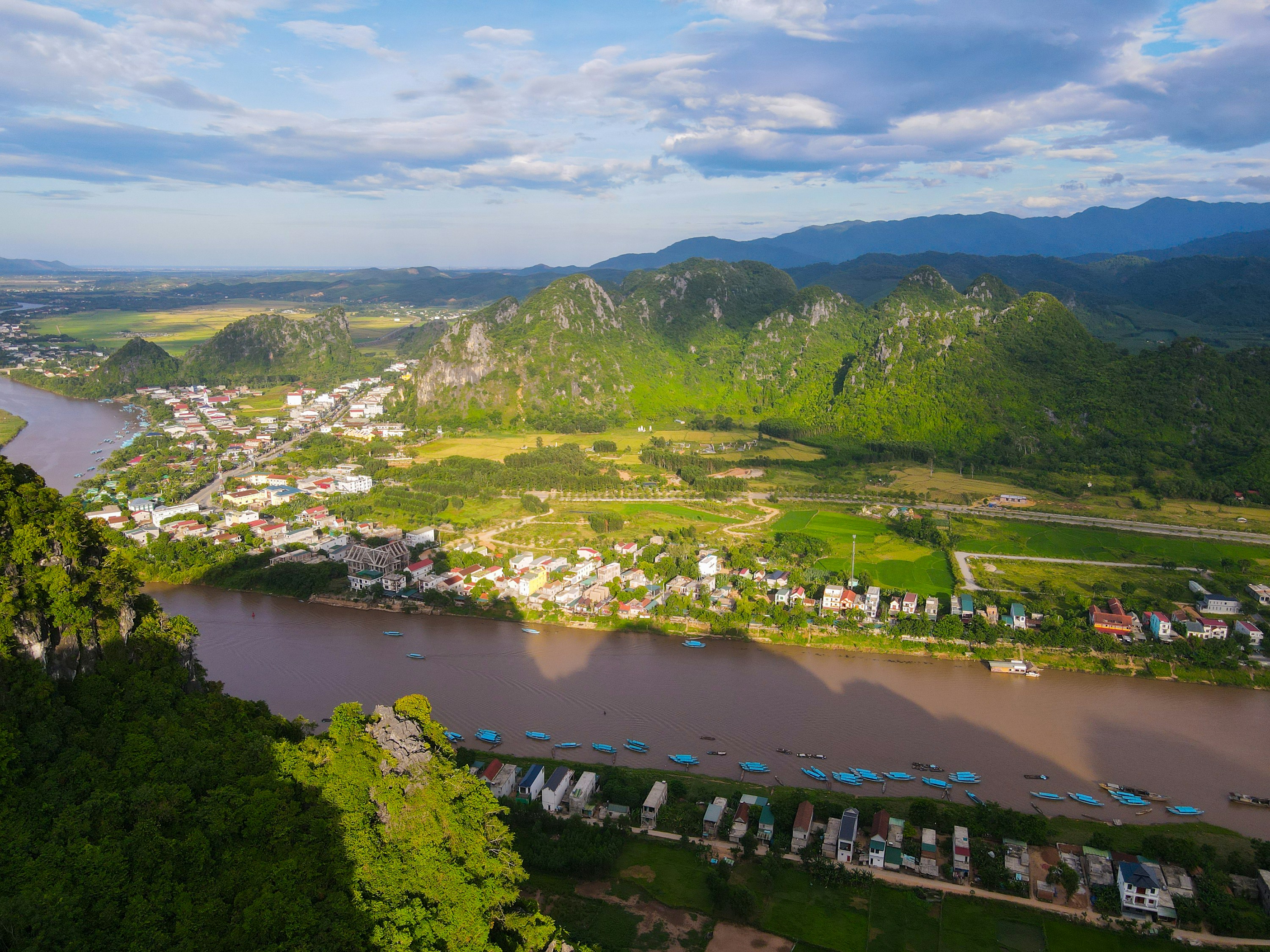 #52
#52Rated #52 of 100
Phong Nha-Ke Bang National Park, Vietnam
#phongnha-kebangnationalpark ◆ National Parks84 /100Phong Nha-Ke Bang protects one of the world's largest karst regions, its jungle-covered limestone hiding thousands of caves, including Son Doong, the largest cave passage on Earth, and Paradise Cave's vast chambers of stalactites.
Most visitors explore by boat along the Son River into Phong Nha Cave itself, or walk the lit boardwalks of Paradise Cave.
It's Vietnam's premier caving destination, still largely undeveloped outside the main sites.
How does it rate
CrowdsRomanceCash RequiredDangerAccessibilityWhy you should go
Home to some of the planet's largest and most spectacular cave systems, from boat-accessible grottoes to multi-day expedition caving.
Why you shouldn't go
The headline cave, Son Doong, requires a costly multi-day expedition booked a year ahead; day-trip caves get busy with tour groups.
Plan your visit
Best time to visitFebruary-August, dry season; avoid September-November when typhoon flooding can close the caves.Best time of dayEarly morning at Paradise Cave, before tour buses arrive mid-morning.Getting thereFly to Dong Hoi; Phong Nha town is a 45-minute drive, with cave entrances a further 20-40 minutes on.Entry costPhong Nha Cave boat trip and Paradise Cave each charge separate entry fees, roughly $8-10Time needed1 day for the main caves; Son Doong expeditions run 4-7 daysBookingBook ahead →Insider tip — Visit Paradise Cave right at opening to get the boardwalk to yourself before tour buses arrive; the boat ride into Phong Nha Cave itself is included in a single ticket and needs no separate booking. -
 #5384 /100
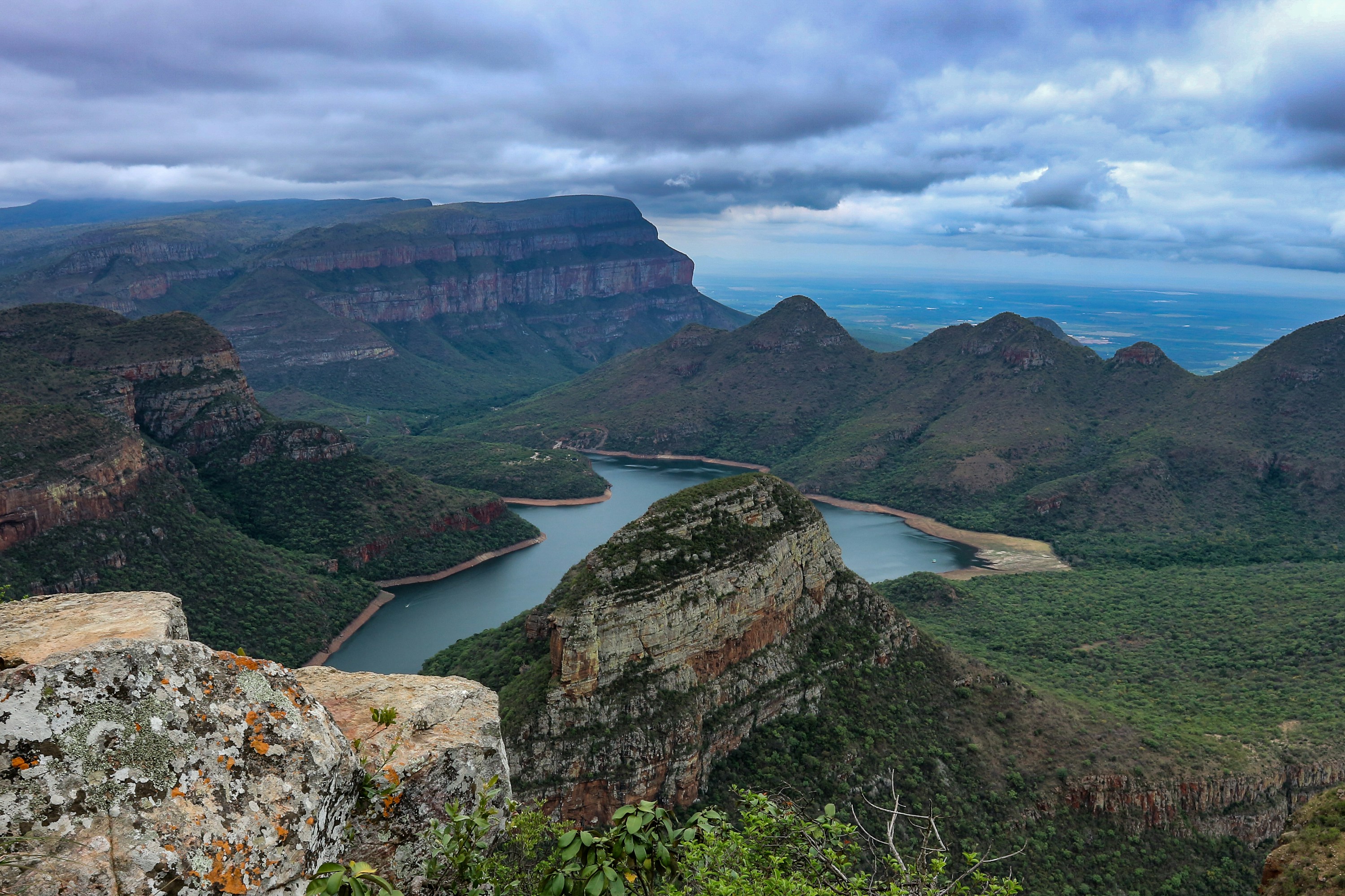
Blyde River Canyon is one of the largest canyons in the world, the centrepiece of South Africa's Panorama Route, a red-rock gorge cut through the Mpumalanga escarpment.
Viewpoints along the rim look down on the Three Rondavels rock formations and the canyon's dammed river bend, while short walks lead to Bourke's Luck Potholes and God's Window.
It is a self-drive destination best covered over a full day of short stops rather than one overlook.
How does it rate
CrowdsRomanceCash RequiredDangerAccessibilityWhy you should go
One of the world's largest canyons, with cliff-top viewpoints over the Three Rondavels and the river below.
Why you shouldn't go
Requires a full day of driving between viewpoints, and the best outlooks can be clouded out by escarpment mist.
Plan your visit
Best time to visitApril-September (dry winter) for clear long-range views; summer brings mist and afternoon storms.Best time of dayMorning, before cloud builds up over the escarpment.Getting thereFly to Kruger Mpumalanga International Airport; about 1-1.5 hours' drive to the Panorama Route viewpoints.Entry costFree to view from most roadside points; Bourke's Luck Potholes charges a small entry fee.Time neededHalf a day to a full day.Insider tip — The main Three Rondavels viewpoint gets tour-bus crowds by mid-morning - stop at God's Window or Bourke's Luck Potholes first and save the busiest lookout for later. -
 #5483 /100
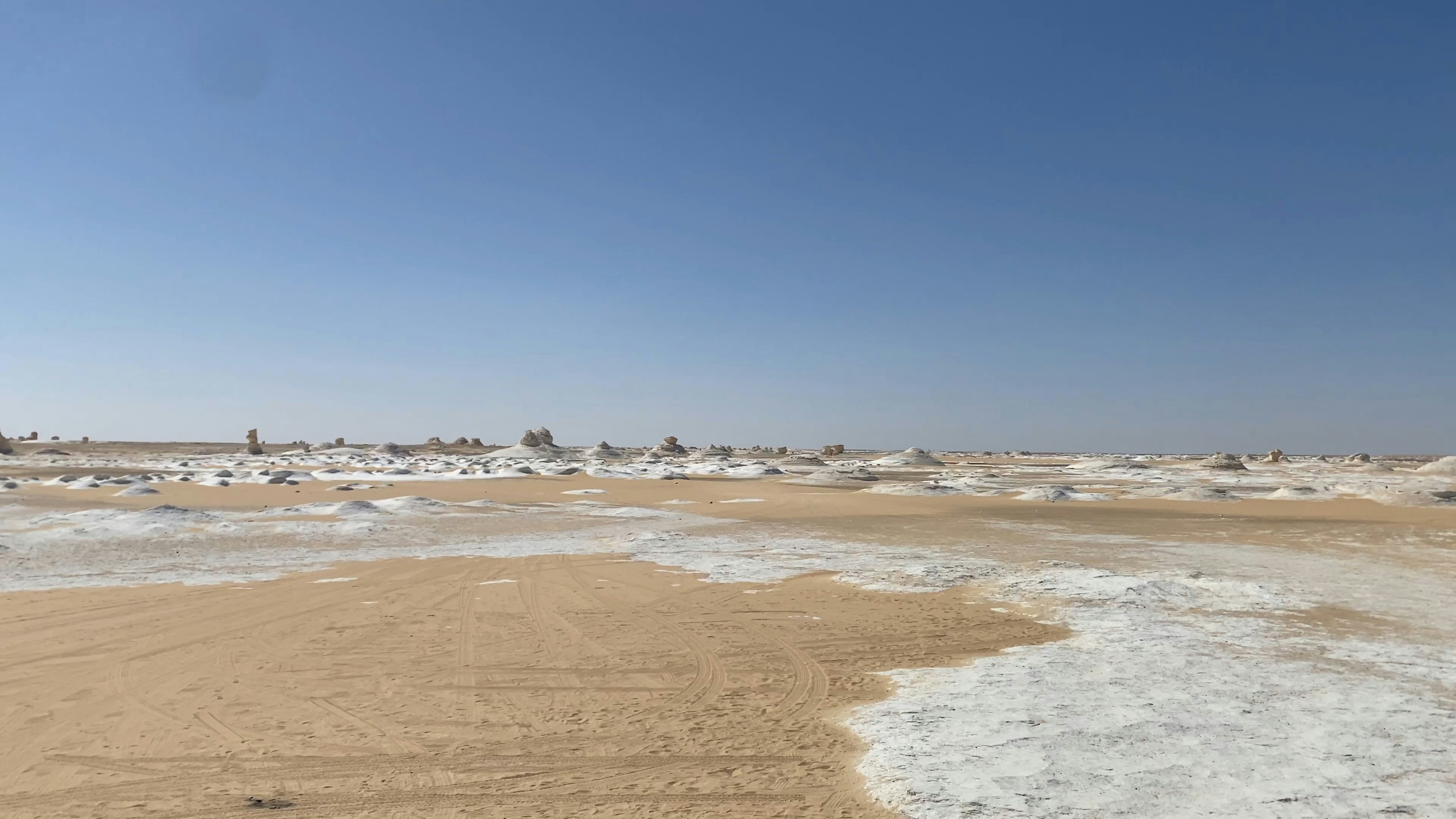
A surreal expanse of chalk-white rock formations near Farafra Oasis, carved by millennia of sand-wind erosion into shapes resembling mushrooms, camels, and icebergs scattered across pale desert sand.
Camping overnight among the formations, with no artificial light for miles, is the main way to see it - the white rock glows almost blue under a full moon.
It remains one of the least-visited major landscapes in Egypt outside the Nile corridor.
How does it rate
CrowdsRomanceCash RequiredDangerAccessibilityWhy you should go
Chalk-white rock sculptures scattered across open desert, glowing almost blue under moonlight with zero light pollution.
Why you shouldn't go
It's remote even by Egyptian desert standards - a long drive from Cairo through the Western Desert with minimal facilities en route.
Plan your visit
Best time to visitOctober-April, avoiding summer desert heat that can exceed 40C.Best time of daySunset and again after moonrise, when the white rock formations change character completely.Getting thereFly to Cairo, then a 5-6 hour drive (often via Bahariya Oasis) to Farafra and the White Desert.Entry costOvernight camping tours typically run USD50-100 per person, all-inclusive.Time neededOvernight (2-day trip typical).Insider tip — Time the trip around a full moon if possible - the white formations under moonlight are the single most photographed sight here. -
 #5583 /100
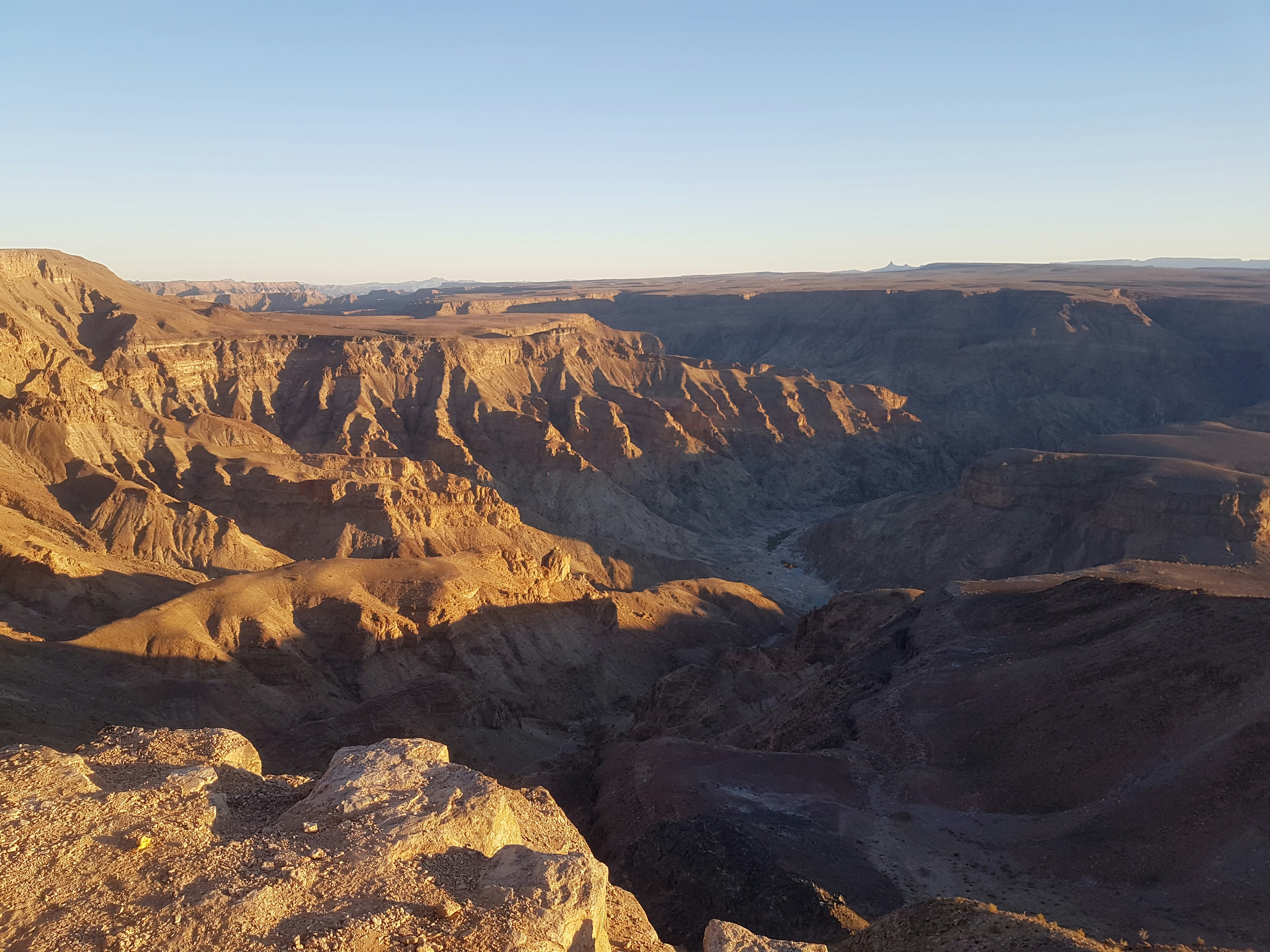
The second-largest canyon on Earth cuts a 160km gash through the Namibian desert, its layered rock walls dropping 550 metres to the seasonal Fish River below.
A multi-day hike along the canyon floor is one of Southern Africa's classic treks, but the main viewpoint at Hobas delivers the scale in a single sweeping look without any walking required.
Sunset turns the canyon's rust-red rock a deep orange.
How does it rate
CrowdsRomanceCash RequiredDangerAccessibilityWhy you should go
The world's second-largest canyon, with a sweeping viewpoint that needs no hiking at all.
Why you shouldn't go
The multi-day canyon-floor hike is only permitted May-September and requires a medical certificate to book.
Plan your visit
Best time to visitMay-September, the cooler dry season (also the only window the multi-day hike is permitted).Best time of daySunset, when the canyon walls turn deep orange-red.Getting thereSelf-drive from Windhoek (about 5.5 hours) or fly to Keetmanshoop and drive onward.Entry costPark entry fee, a few dollars per person.Time needed1-2 hours for the viewpoint; 5 days for the full hikeInsider tip — Even without doing the multi-day hike, walk 15-20 minutes along the rim from the main viewpoint for a less crowded angle. -
 #5683 /100
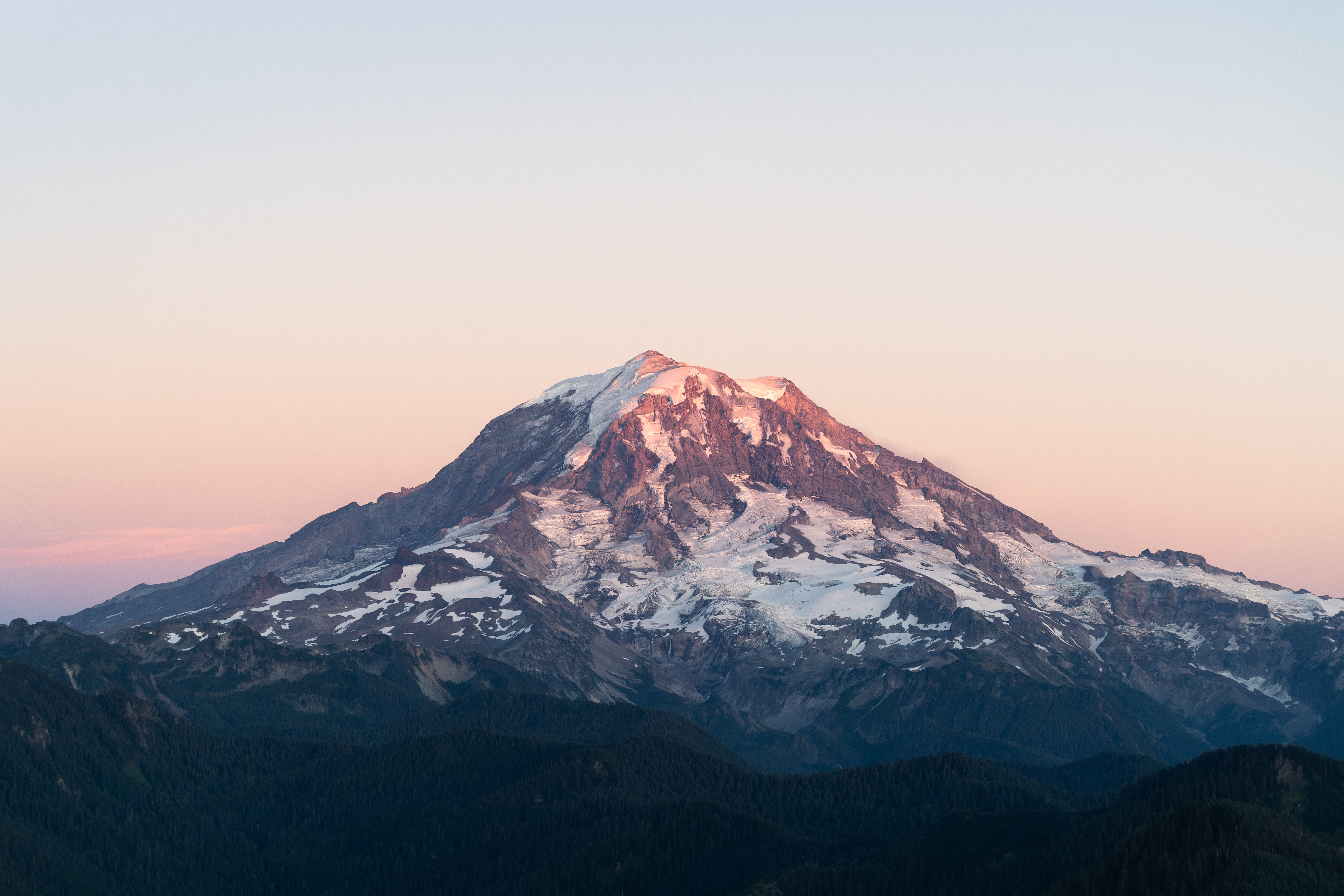
Mount Rainier is an active stratovolcano rising 4,392 metres above the Puget Sound lowlands of Washington State, making it the most topographically prominent peak in the contiguous United States.
In summer, its slopes are carpeted with wildflower meadows and it is reflected in the lakes of Paradise and Reflection Lakes.
How does it rate
CrowdsRomanceCash RequiredDangerAccessibilityWhy you should go
The wildflower meadows around Paradise in midsummer, with the glacier-clad volcano rising above, offer some of the most beautiful subalpine scenery in America.
Why you shouldn't go
Mount Rainier is frequently obscured by cloud or fog and the park roads close from October to May due to snow; summit attempts require technical mountaineering skills.
Plan your visit
Best time to visitJuly-September (wildflower season, most trails snow-free)Best time of daySunrise from Reflection Lakes for a mirror image of the peakGetting there~1.5-2hr drive from SeattleEntry costPark entry ~$30/vehicleTime neededFull dayInsider tip — Reflection Lakes needs a calm, windless morning; check conditions before making the early drive -
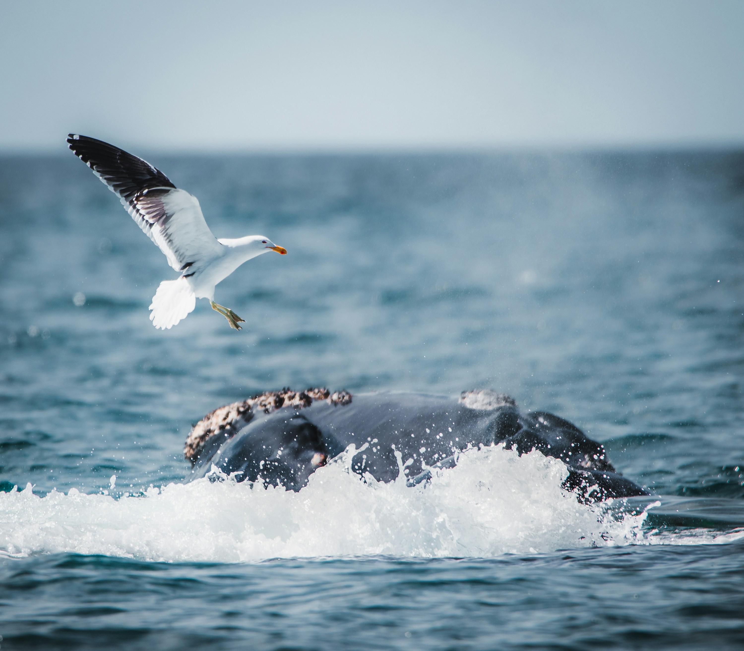 #5783 /100
Peninsula Valdes juts into the South Atlantic off Argentine Patagonia and holds one of the continent's great wildlife spectacles: southern right whales calving close to shore, orcas that beach themselves hunting sea lion pups, and colonies of elephant seals and penguins.
A UNESCO site reached from Puerto Madryn, it's linked by unpaved roads between viewing points.
Sightings are seasonal, so timing matters.
How does it rate
CrowdsRomanceCash RequiredDangerAccessibilityWhy you should go
Southern right whales come close enough to watch from small boats or even the shore, in season.
Why you shouldn't go
Wildlife is seasonal and not guaranteed outside the main months - check the calendar before booking.
Plan your visit
Best time to visitJune-December for whales (peak Sept-Nov); Oct-Nov also for orca hunting behaviorBest time of dayMorning boat trips tend to have calmer water and more active whalesGetting thereFly to Trelew or Puerto Madryn, then 1-1.5hr drive onto the peninsulaEntry costReserve entrance fee ~$20-30; whale-watching boat trips separate, ~$70-100Time neededFull day; two days to cover more viewing pointsInsider tip — Book a boat trip from Puerto Piramides itself rather than a day tour from Puerto Madryn - you get more time on the water and less time on the bus. -
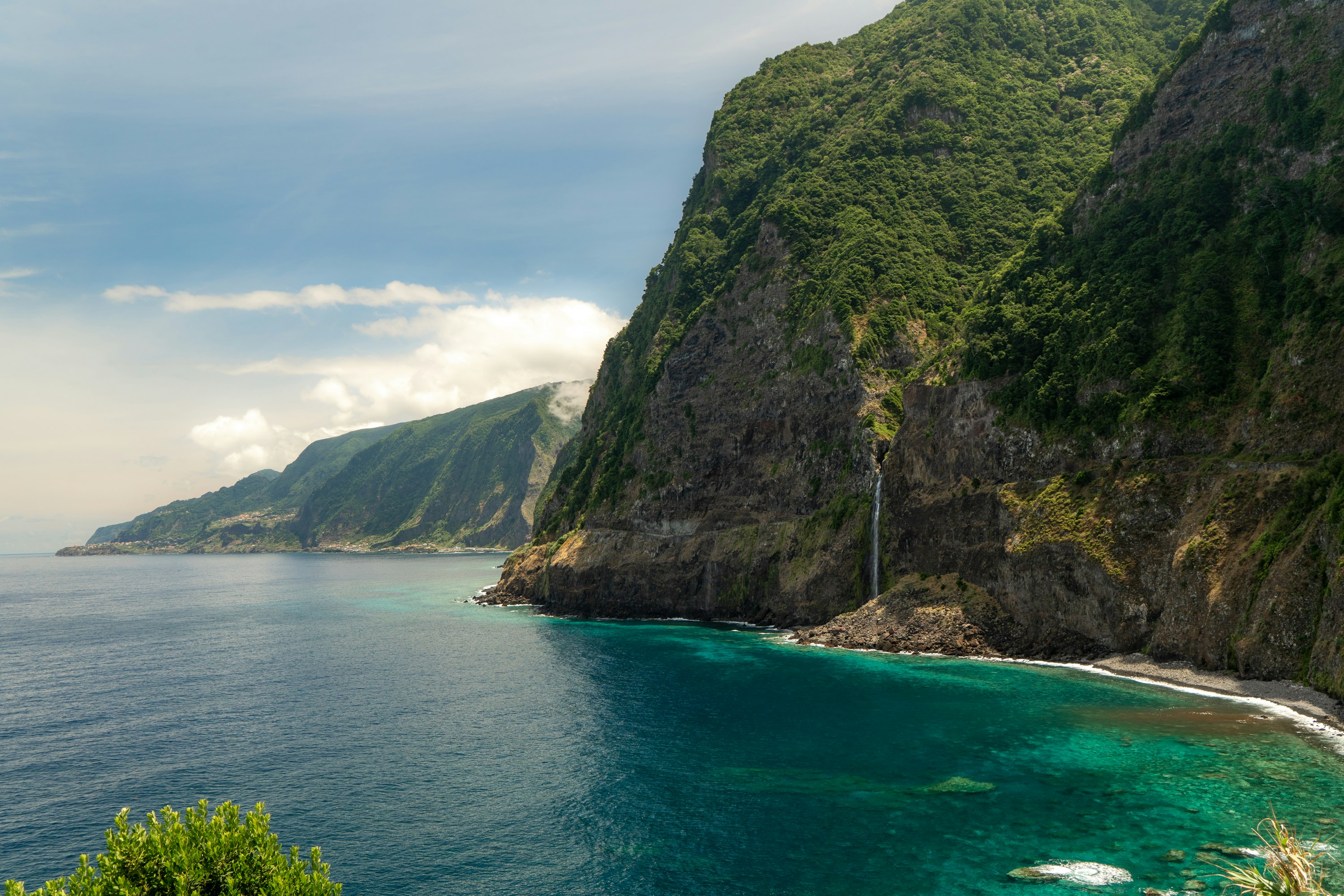 #58
#58A volcanic island in the mid-Atlantic nicknamed the "floating garden," Madeira packs cloud forest, terraced vineyards, and sea cliffs over 500 metres tall into an area smaller than greater London.
A 19th-century irrigation network of levadas laces the interior with walking trails through laurel forest and past hidden waterfalls, while a glass skywalk cantilevers out over Cabo Girão, one of Europe's highest sea cliffs.
How does it rate
CrowdsRomanceCash RequiredDangerAccessibilityWhy you should go
Levada trails, laurel forest, and dramatic cliffs pack in more landscape variety than an island this size should have.
Why you shouldn't go
Terrain is steep throughout the interior; reaching the best trails and viewpoints generally requires a rental car.
Plan your visit
Best time to visitApril–October for reliably dry trails; the mild year-round climate also suits winter breaks.Best time of dayMorning, before afternoon cloud typically rolls in over the higher levadas and viewpoints.Getting thereFly directly to Madeira Airport near Funchal; a rental car is the practical way to reach most levadas and viewpoints.Entry costFree to hike most levadas; Cabo Girão skywalk and cable cars charge a small fee.Time needed3–5 daysInsider tip — Levada do Caldeirão Verde is one of the most rewarding walks — start early to beat tour groups and have the waterfall to yourself. -
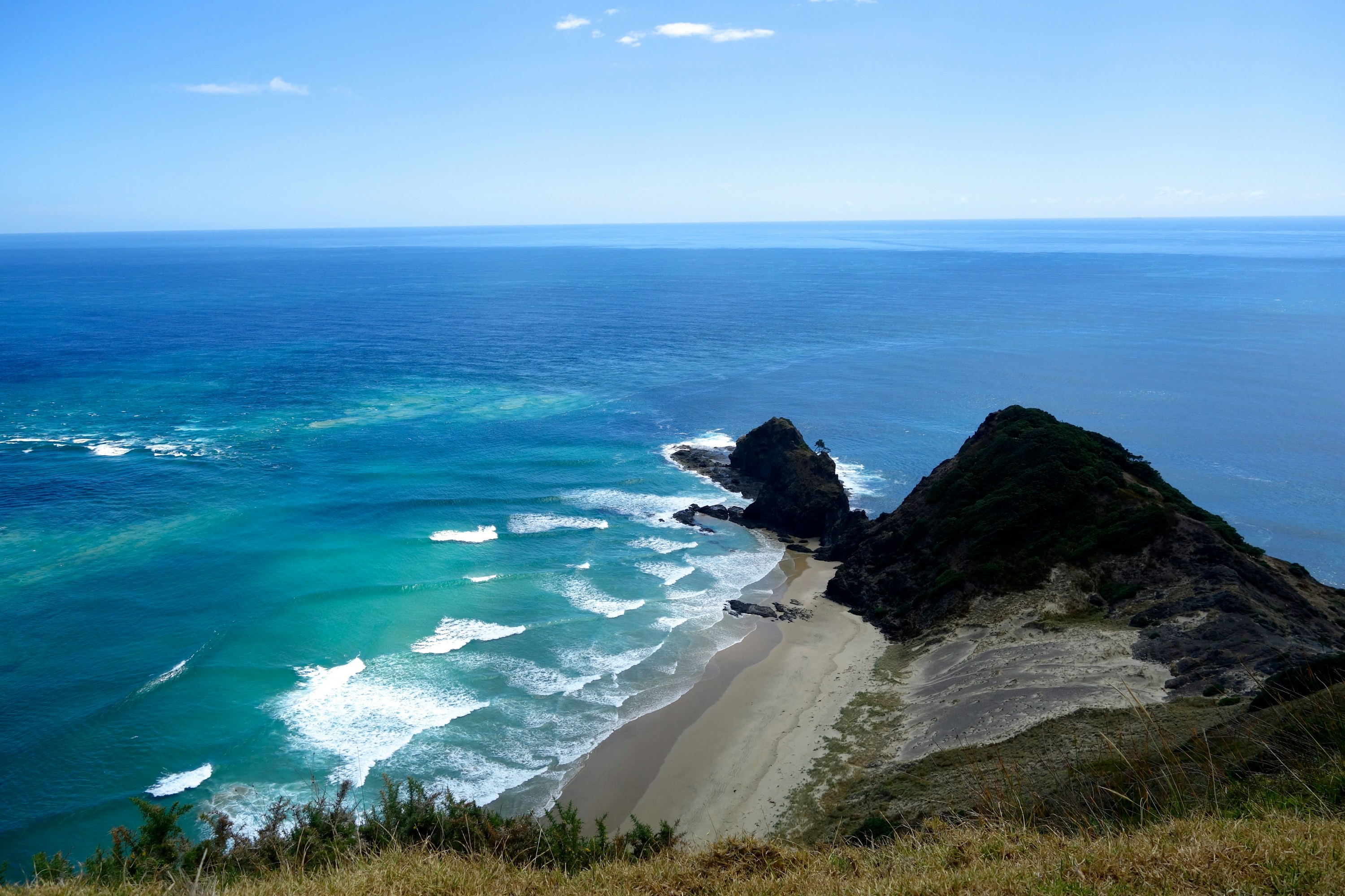 #5983 /100
Bay of Islands is a sheltered stretch of Northland coastline scattered with around 144 subtropical islands, sandy coves and clear, sailable water.
Paihia and Russell serve as bases for game fishing, dolphin cruises and trips through the natural archway at Piercy Island, and the nearby Waitangi Treaty Grounds mark where New Zealand's founding document was signed in 1840.
It rewards a slower visit by boat rather than a quick stop on shore.
How does it rate
CrowdsRomanceCash RequiredDangerAccessibilityWhy you should go
144 subtropical islands, warm sailing water and genuine national history in one bay.
Why you shouldn't go
Cruises and island stays add up quickly, and summer weekends get busy with boat traffic.
Plan your visit
Best time to visitDecember-March for warm swimming weather; shoulder months are quieter and still mild.Best time of dayMorning, when the water is calmest and cruise boats first head out.Getting thereFly to Kerikeri Airport (25 min to Paihia) or drive about 3.5 hours north from Auckland to Paihia or Russell.Entry costFree to visit the coastline; boat cruises and island tours are priced separately.Time neededA full day; 2-3 days to properly explore by boat.Insider tip — Catch the passenger ferry from Paihia to Russell instead of driving around the bay - it's cheaper and quicker, and Russell's waterfront is worth the walk. -
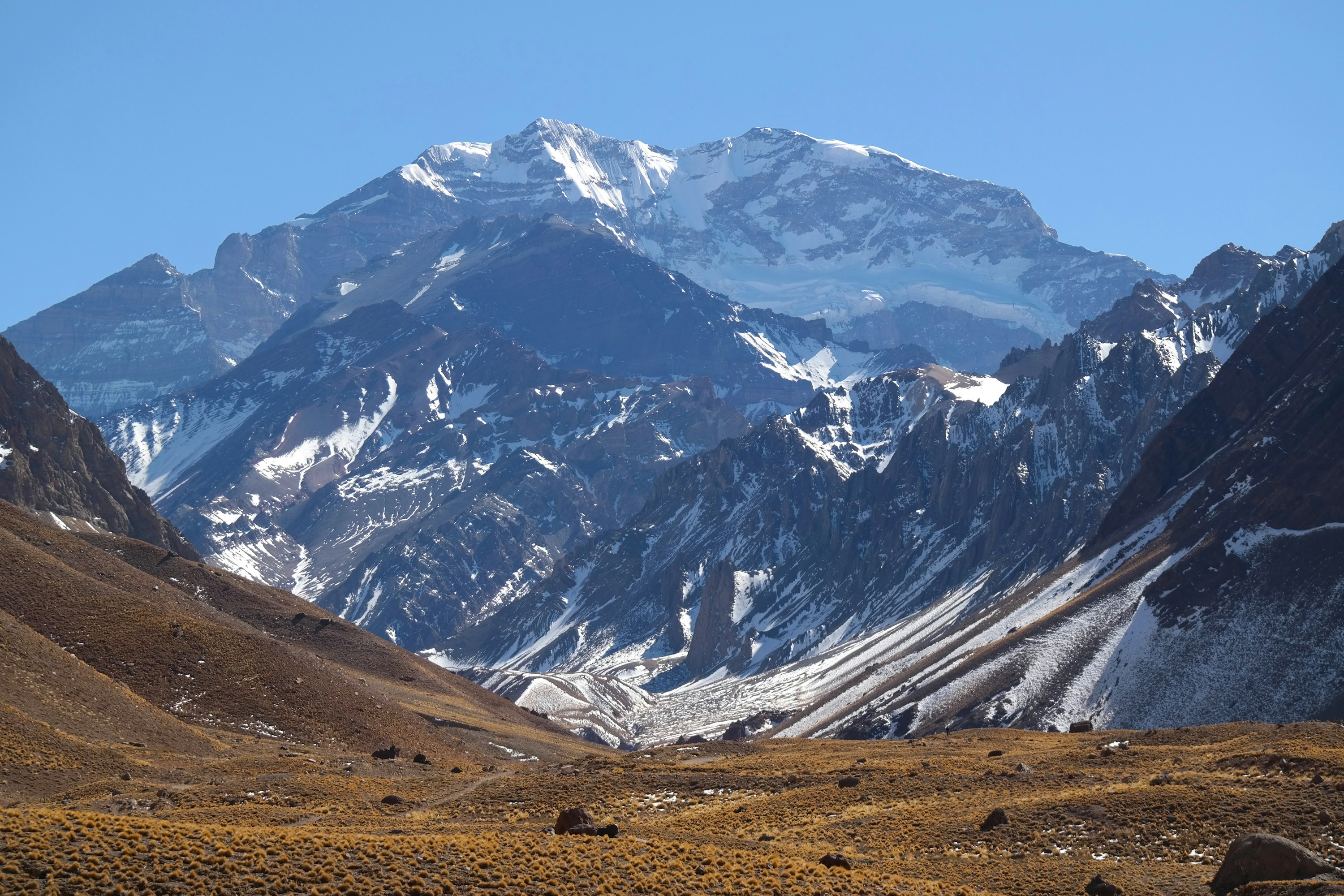 #6082 /100
Aconcagua rises 6,961 metres in Mendoza Province, the highest peak in both the Western and Southern Hemispheres and one of the Seven Summits.
Serious climbers spend two to three weeks on the standard Normal Route to the summit, but the mountain rewards a much shorter visit too: a half-day trek from the Horcones trailhead reaches Laguna de los Horcones, a glacial lake with a full view of the south face and glacier.
Aconcagua Provincial Park protects the surrounding high-altitude terrain.
How does it rate
CrowdsRomanceCash RequiredDangerAccessibilityWhy you should go
The highest mountain outside the Himalayas, viewable up close on an easy half-day trek without any climbing gear.
Why you shouldn't go
Summiting is a serious high-altitude expedition; most visitors only see the mountain from the valley trails below.
Plan your visit
Best time to visitDecember-March (Southern Hemisphere summer), when the park and climbing routes are openBest time of dayMorning, before afternoon wind picks up in the high valleyGetting thereFly to Mendoza, then about 3 hours by road to the Horcones entrance near Puente del IncaEntry costPark entry fee for the day-trek zone, a few thousand ARS; multi-week climbing permits cost several hTime neededHalf a day for the Laguna de los Horcones trek; 2-3 weeks for a summit expeditionInsider tip — The Confluencia trek (one day further in than Horcones) gets you a far closer view of the south face for only a little more effort. -
 #6182 /100
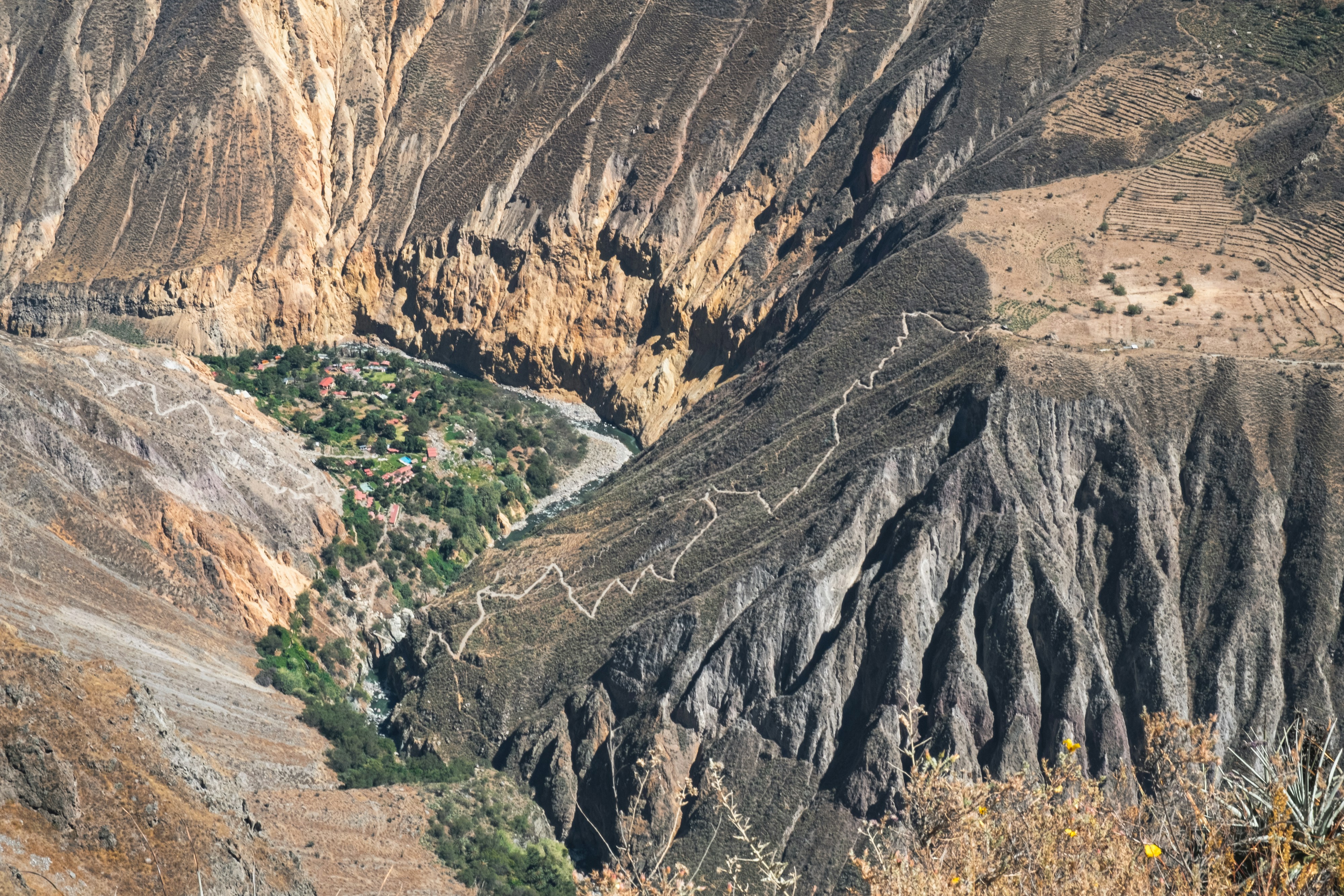
One of the world's deepest canyons slices through the Peruvian Andes, its terraced walls farmed by local communities for centuries before the Incas ever arrived.
Andean condors ride the morning thermals at Cruz del Condor, often gliding within metres of the viewpoint's edge.
Traditional villages along the canyon rim still weave and dress in pre-Columbian styles rarely seen elsewhere in Peru.
How does it rate
CrowdsRomanceCash RequiredDangerAccessibilityWhy you should go
Wild Andean condors gliding at eye level from a canyon-rim viewpoint, most mornings.
Why you shouldn't go
Condor sightings are common but not guaranteed - a bad-weather morning can mean an empty sky.
Plan your visit
Best time to visitMay-November, the dry season, for reliable condor flights.Best time of dayEarly morning, 8-10am, when thermals bring the condors up to the rim.Getting thereDrive from Arequipa (about 3-4 hours) to the canyon; most visitors join an organised tour.Entry costTourist ticket (boleto turistico) required, around $25.Time needed2 days, including an overnight in the canyonInsider tip — Stay overnight in Cabanaconde rather than day-tripping from Arequipa - the condor flights are best seen before the day-trip buses arrive. -
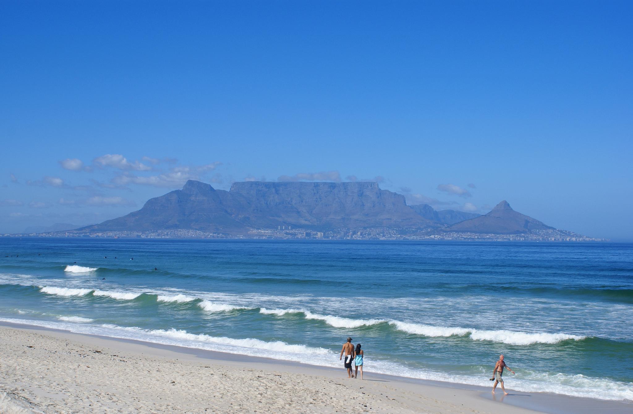 #6282 /100
Table Mountain's flat-topped summit, draped in its famous tablecloth of cloud, presides over Cape Town and offers 360-degree panoramas stretching from the Cape of Good Hope to the Winelands.
The mountain is home to an extraordinary number of endemic plant species found nowhere else on earth.
How does it rate
CrowdsRomanceCash RequiredDangerAccessibilityWhy you should go
The cable car provides easy access to the summit and the views over Cape Town, Table Bay, and the surrounding peninsula are among Africa's finest.
Why you shouldn't go
The mountain is frequently shrouded in cloud and high winds regularly cause the cable car to close; always have a backup plan.
Plan your visit
Best time to visitYear-round; check for the "tablecloth" cloud coverBest time of dayLate afternoon for the city and sunset viewsGetting thereCableway from Tafelberg Road, Cape TownEntry costCableway ~$20-25 returnTime needed2-3 hoursInsider tip — Check the cableway website first; it closes in high wind, common in summer -
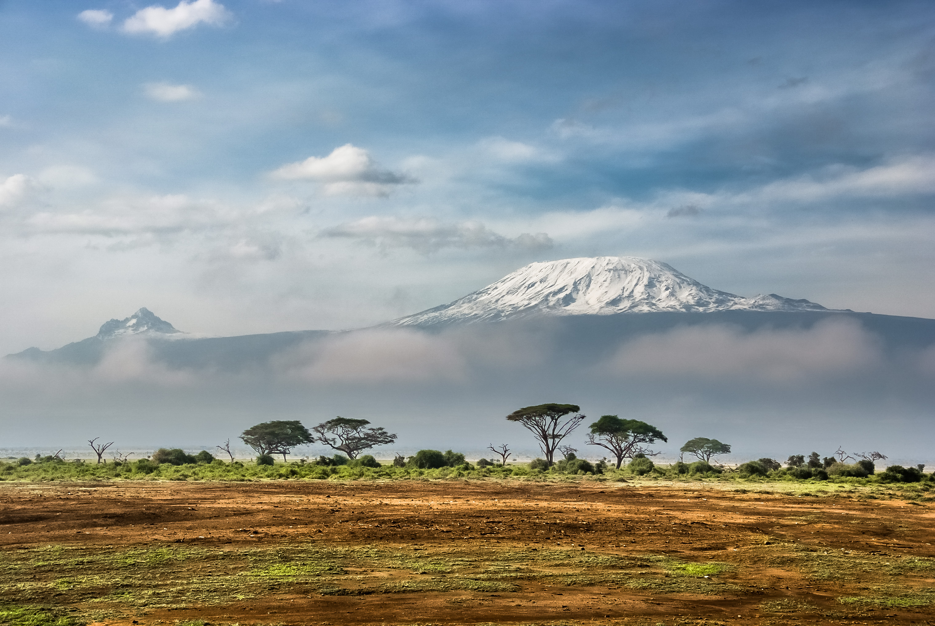 #6382 /100
Africa's highest mountain stands alone on the Tanzanian plains, rising 5,895 metres above sea level as the world's tallest free-standing mountain.
Its snow-capped volcanic summit, increasingly threatened by climate change, can be reached by non-technical trekkers via several routes through dramatically changing ecosystems.
How does it rate
CrowdsRomanceCash RequiredDangerAccessibilityWhy you should go
Reaching the Roof of Africa is an extraordinary achievement and the views from the summit at sunrise across the clouds below are unforgettable.
Why you shouldn't go
Summit success is not guaranteed; altitude sickness affects many climbers and the trek requires at least five to seven days which significantly adds to the cost.
Plan your visit
Best time to visitJanuary-March or June-October (dry seasons)Best time of daySunrise from the summit or a lower viewpointGetting thereFly into Kilimanjaro International AirportEntry costClimbing permits and guide ~$1,500-2,500 for a multi-day trekTime needed5-9 days to summitInsider tip — You don't have to climb it - Amboseli National Park in Kenya has the classic elephant-with-Kilimanjaro shot -
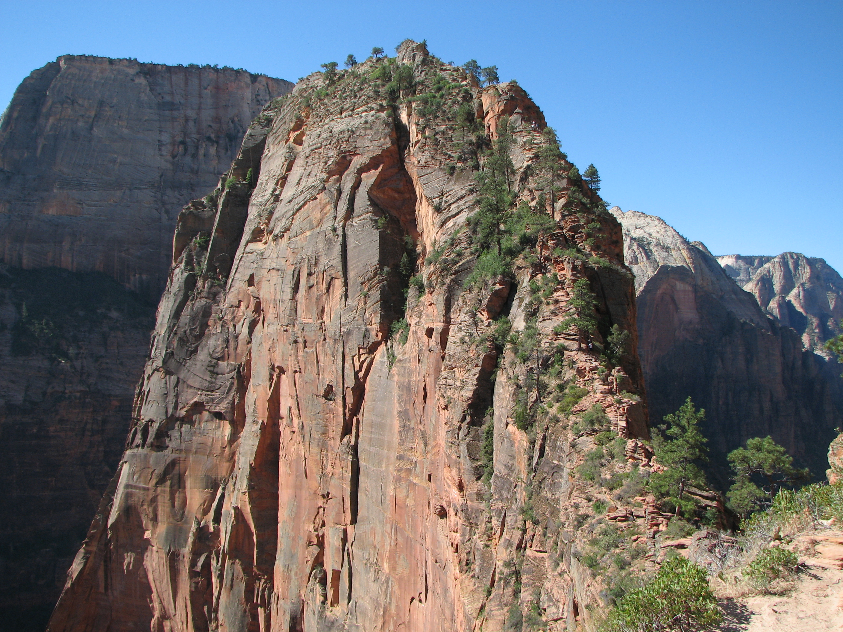 #6482 /100
A steep 2.
5-mile round trip up Zion Canyon's sandstone spine, finishing on a knife-edge ridge with chain handholds and 1,200-foot drops on both sides.
The switchbacking approach up Walter's Wiggles gives way to an exposed scramble that rewards climbers with a sweeping view down Zion Canyon.
A permit lottery now limits how many hikers tackle the chains at once, since it's not for anyone uneasy with heights.
How does it rate
CrowdsRomanceCash RequiredDangerAccessibilityWhy you should go
The payoff view straight down Zion Canyon from a narrow sandstone ridge most visitors only see from below.
Why you shouldn't go
The final chained section is genuinely exposed and has recorded fatalities; a lottery permit is mandatory.
Plan your visit
Best time to visitSpring and autumn for mild temperatures; avoid the chains in wet or icy conditions.Best time of dayEarly morning to beat both the heat and the midday permit-holder crowds on the chains.Getting thereFly to Las Vegas or St George; drive to Zion, then shuttle to the Grotto trailhead.Entry costZion entry $35/vehicle; Angels Landing permit $6 application plus $3/person if selected.Time needed3-4 hours round tripBookingBook ahead →Insider tip — Enter both the seasonal lottery and the day-before lottery - the day-before draw has far better odds. -
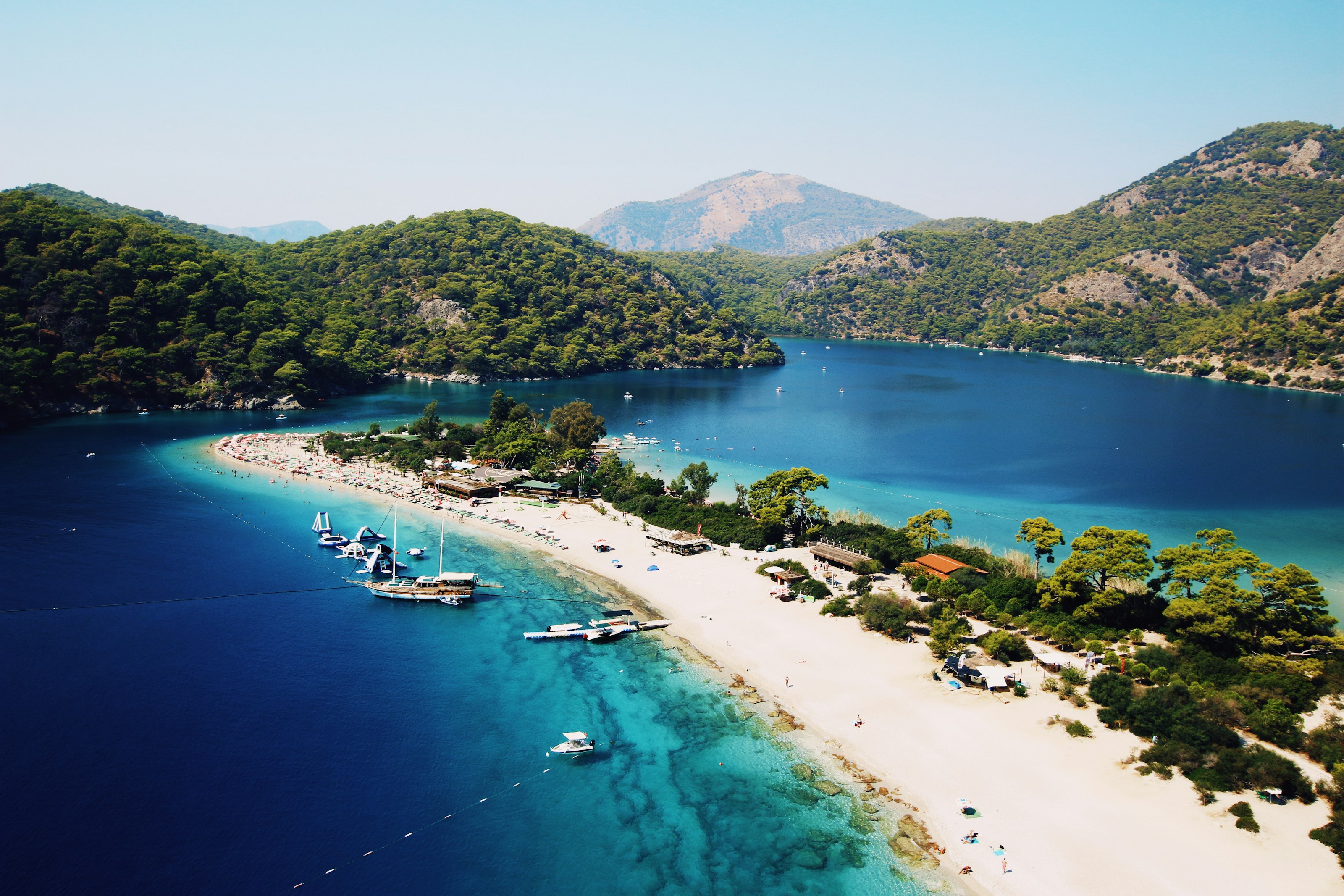 #6582 /100
Ölüdeniz's Blue Lagoon is a sheltered curve of turquoise water pinched off from the open Mediterranean by a long sand spit, backed by pine-covered mountains rising straight from the shore.
It's one of Turkey's most photographed beaches and also its paragliding capital — hundreds of tandem flights launch daily from Babadağ mountain and drift down over the bay.
The beach itself is calm and shallow, better for swimming than surf.
How does it rate
CrowdsRomanceCash RequiredDangerAccessibilityWhy you should go
Paragliding down from Babadağ and landing right on the beach is one of the most exhilarating ways to arrive anywhere.
Why you shouldn't go
The lagoon and main beach get seriously packed in July and August, with sunbeds taking up most of the sand.
Plan your visit
Best time to visitMay–June or September, for warm water without peak-season crowds.Best time of dayEarly morning for a quiet swim, or late afternoon to watch paragliders land.Getting thereFly to Dalaman; roughly 1-hour drive south to Ölüdeniz via Fethiye.Entry costSmall fee to enter the Blue Lagoon nature reserve beach; the public beach beside it is free.Time neededHalf a dayInsider tip — Book a paragliding flight for early morning — winds are calmer and the light on the lagoon is best. -
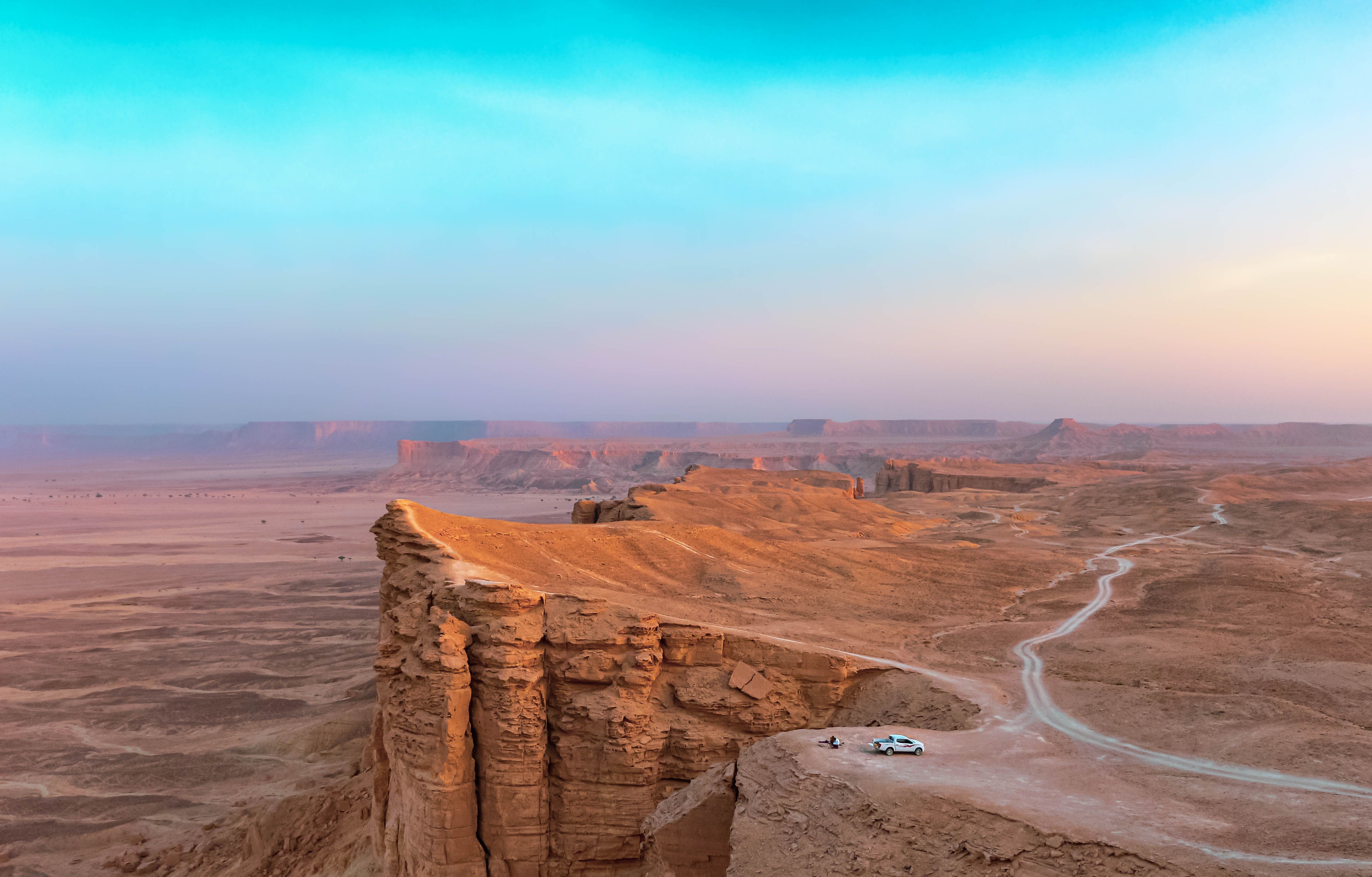 #6682 /100
Jebel Fihrayn, known as the Edge of the World, is a sheer escarpment roughly 1,100 metres above the desert floor, part of the Tuwaiq Mountains that once formed the shoreline of an ancient sea.
A rough 4x4 track and a short walk lead to a cliff edge with no barriers, looking out over a flat desert plain stretching to the horizon, and it has become one of the most visited natural landmarks near Riyadh since the country opened to tourism.
How does it rate
CrowdsRomanceCash RequiredDangerAccessibilityWhy you should go
Standing at an unguarded cliff edge with a completely flat desert stretching to the horizon feels like reaching the literal edge of the map.
Why you shouldn't go
There are no safety barriers at the cliff edge, and the last stretch of track requires a 4x4 and an experienced driver.
Plan your visit
Best time to visitNovember–March, avoiding summer heat that makes the exposed cliff top dangerous by midday.Best time of dayLate afternoon into sunset, when the escarpment and desert plain both light up gold.Getting thereFly to Riyadh; roughly 1.5–2-hour drive northwest, the final stretch on an unpaved desert track requiring 4x4.Entry costFree; most visitors join a paid tour that includes 4x4 transport.Time neededHalf a day including travelInsider tip — Go with an organised tour rather than a rental car — the final approach track is easy to get stuck on without local knowledge. -
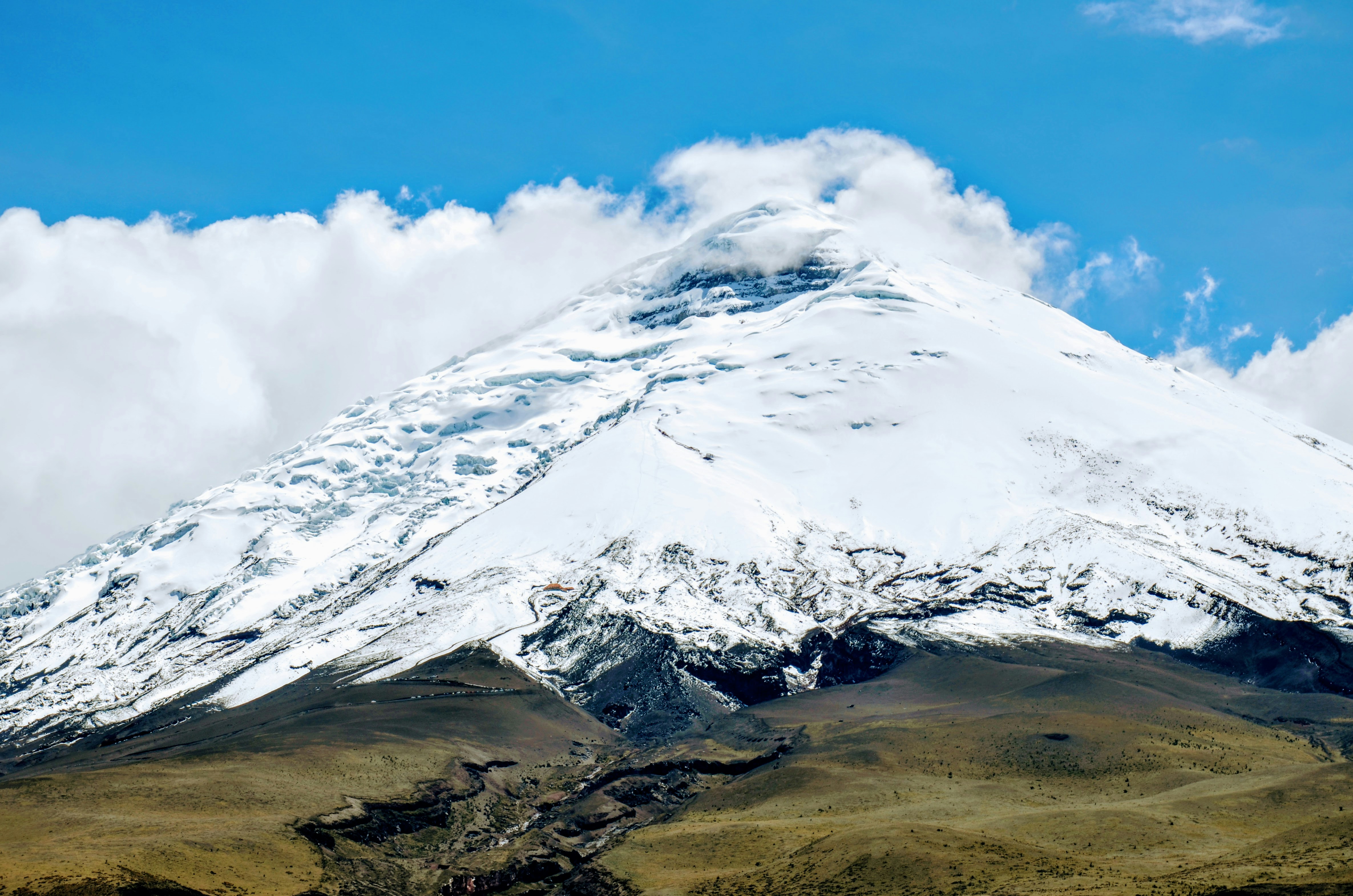 #67
#67One of the world's highest active volcanoes, a near-symmetrical glacier-capped cone rising over 5,800 metres above the Andean paramo grasslands south of Quito.
Most visitors don't summit - that requires technical mountaineering and acclimatisation - but a hike or horseback ride to the refuge at around 4,800 metres gets close enough to stand at the glacier's edge, with wild llamas often grazing the surrounding slopes.
Its perfect-cone silhouette is one of the most recognisable mountain shapes in South America.
How does it rate
CrowdsRomanceCash RequiredDangerAccessibilityWhy you should go
A near-perfectly symmetrical glacier-capped volcanic cone, reachable on a day hike from Quito without technical climbing.
Why you shouldn't go
Altitude sickness is a real risk even on the day-hike route, given the refuge sits close to 4,800 metres.
Plan your visit
Best time to visitJune-September or December-January for the clearest views of the summit.Best time of dayMorning, before afternoon cloud typically obscures the cone.Getting thereA 1.5-2 hour drive south from Quito to Cotopaxi National Park.Entry costNational park entry around USD10-12; guided day tours from Quito run USD60-90.Time neededA full day.Insider tip — Spend a night at altitude in nearby Quito or a park-adjacent lodge before the hike - even the moderate refuge trail is noticeably harder without a day or two of acclimatisation. -
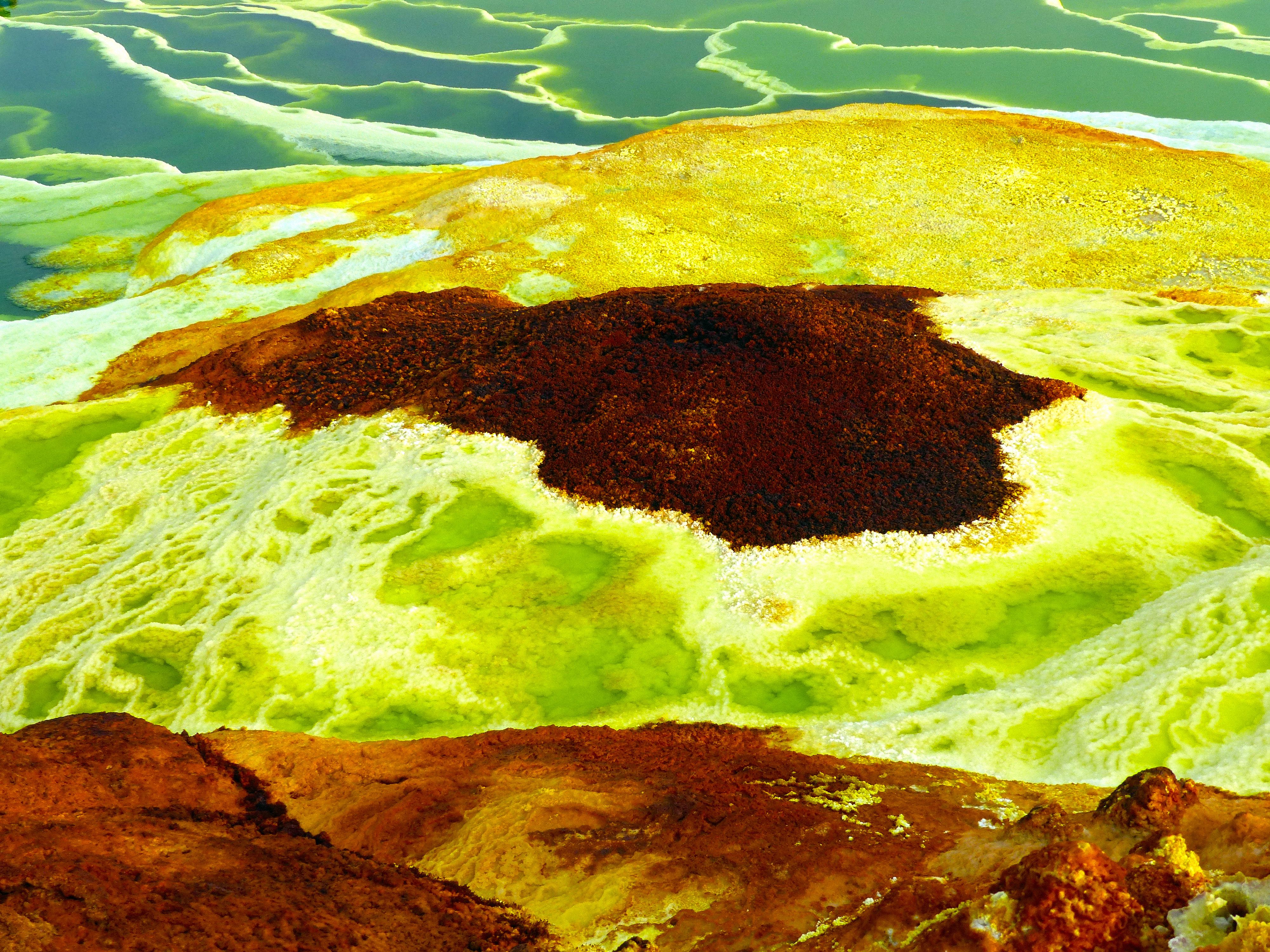 #6881 /100
One of the hottest, lowest, and strangest inhabited places on Earth, a volcanic depression over 100 metres below sea level where sulphur springs bubble in acid-yellow and electric-green pools beside the active Erta Ale lava lake.
Camel caravans still cross the adjoining Danakil salt flats to mine slabs of salt by hand, much as they have for centuries.
The colours and scale look almost entirely artificial, which is exactly why people make the brutal trip.
How does it rate
CrowdsRomanceCash RequiredDangerAccessibilityWhy you should go
Acid-yellow sulphur pools and an active lava lake in one of the most alien landscapes on the planet.
Why you shouldn't go
Genuinely dangerous and physically demanding - extreme heat, toxic gases, and a history of security incidents mean an armed local guide is mandatory.
Plan your visit
Best time to visitNovember-March, avoiding the deadliest summer heat (which can exceed 50C).Best time of daySunrise at the sulphur springs; night for the glowing Erta Ale lava lake, reached by an overnight hike.Getting thereFly to Mekele, then a multi-day 4x4 expedition with a mandatory guide and security escort into the depression.Entry costMulti-day guided expeditions typically run USD400-700+ per person, all-inclusive.Time needed3+ days.Insider tip — Only go with an established, reputable local operator - this is one of the few places where the standing caution about safety and guides genuinely matters. -
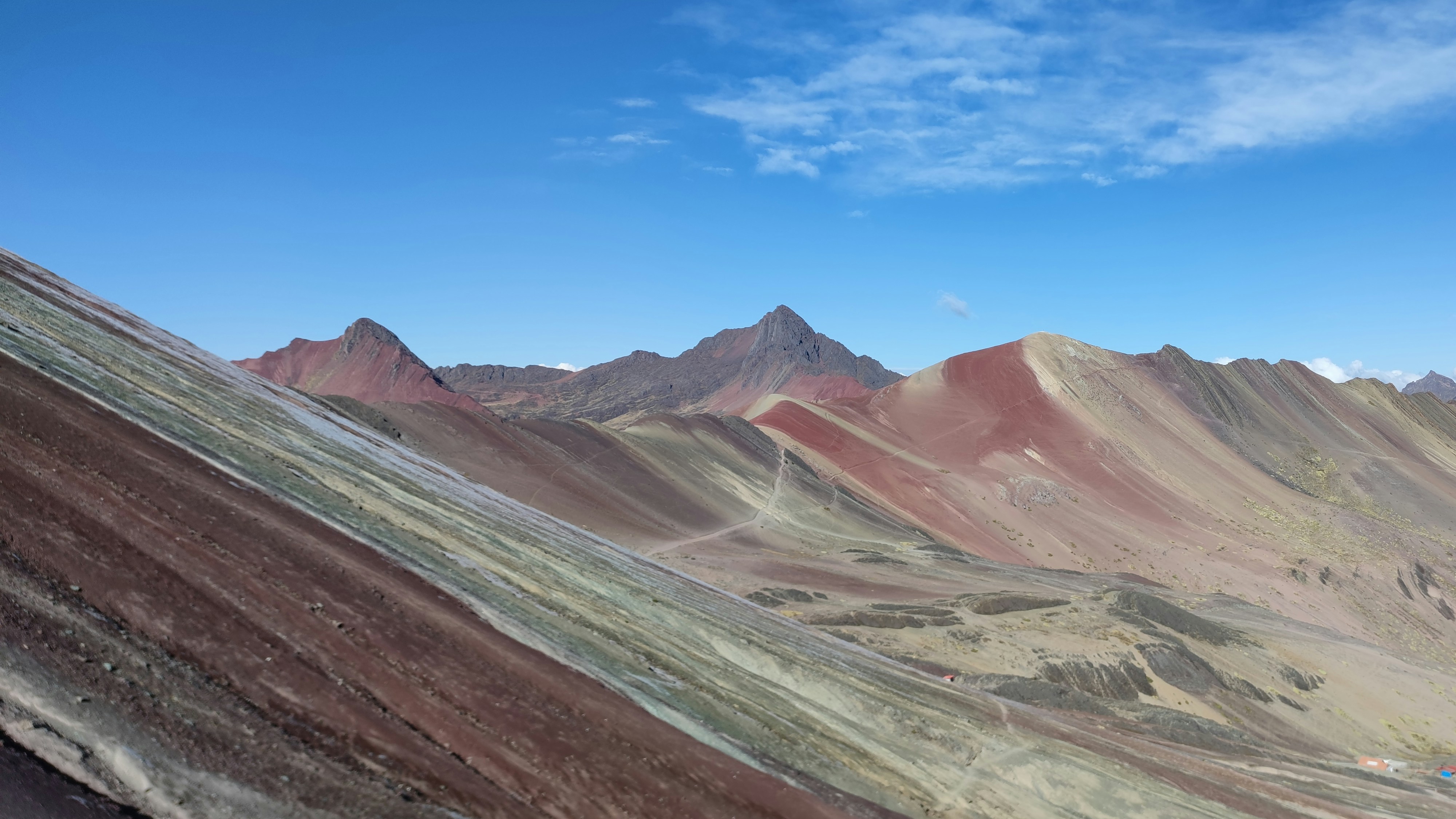 #6981 /100
Mineral bands of red, gold, turquoise and lavender stripe this Andean ridge, exposed by erosion after centuries of livestock trampling stripped the surface soil.
Sitting above 5,000 metres, the colours are more vivid in person than in most photos, especially just after rain.
Its rapid rise from local secret to must-see spot in under a decade has brought heavy foot traffic to a genuinely fragile landscape.
How does it rate
CrowdsRomanceCash RequiredDangerAccessibilityWhy you should go
Naturally striped mineral bands across an entire mountainside, unlike anywhere else nearby.
Why you shouldn't go
The altitude (over 5,000m) makes the short final walk far harder than it looks, and crowds start early.
Plan your visit
Best time to visitMay-September, the dry season, for the clearest colour and driest trail.Best time of dayEarly morning departure (around 3am from Cusco) to beat both crowds and afternoon cloud.Getting thereDrive roughly 3 hours from Cusco, then a 1-2 hour hike (or horse) to the viewpoint.Entry costCommunity entry fee, around $10-15, usually included in tour prices.Time neededFull day, including transport from CuscoInsider tip — Spend a day or two acclimatising in Cusco first - altitude sickness at 5,000m ruins more visits here than bad weather does. -
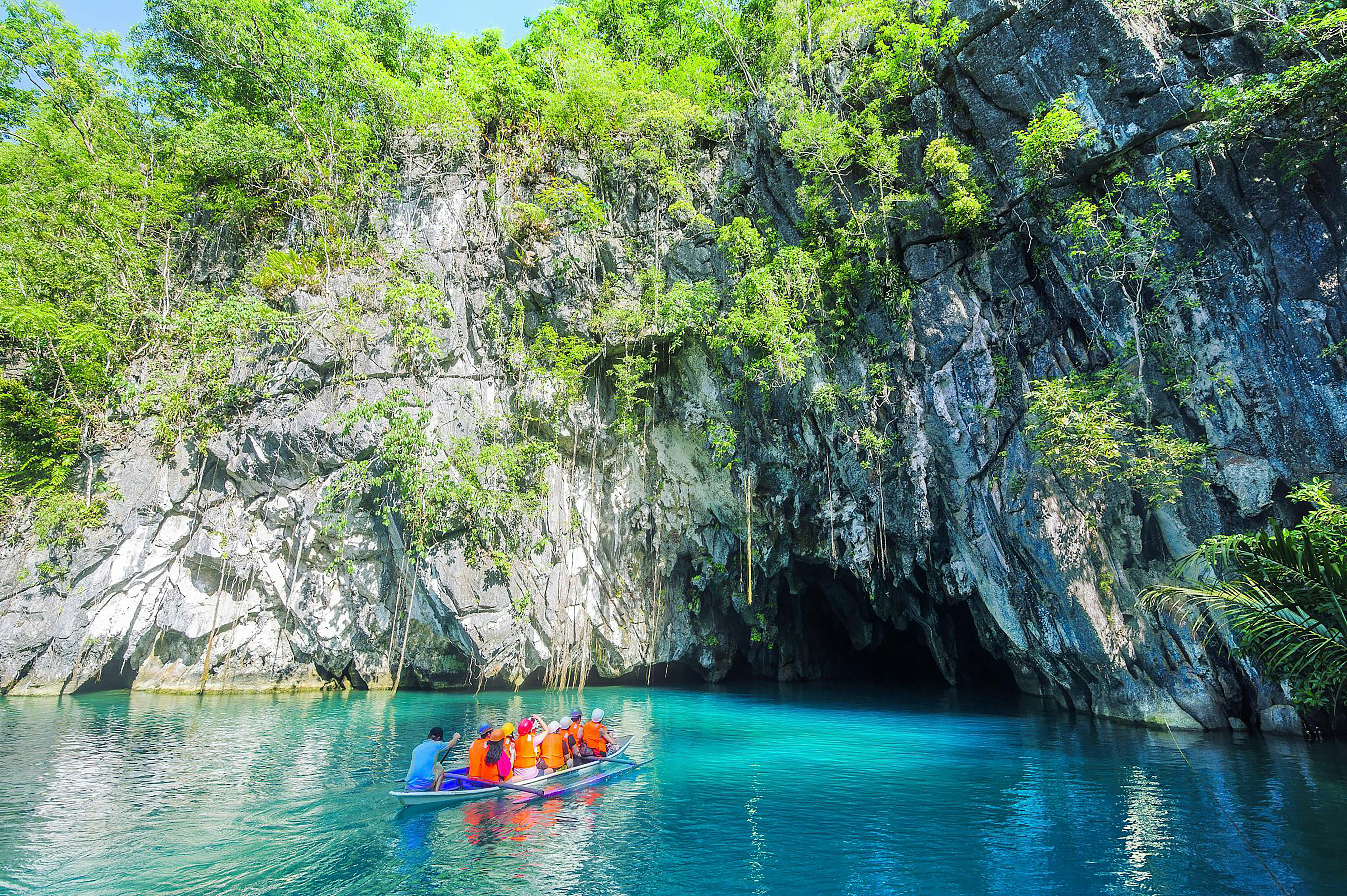 #70
#70Rated #70 of 100
Puerto Princesa Underground River, the Philippines
#puertoprincesaundergroundriver ◆ Caves81 /100A navigable underground river winds more than 8 kilometers through a limestone karst cave system before reaching the sea, its chambers hung with stalactite formations and home to colonies of bats and swiftlets.
Paddled by small boat with a guide, the first kilometer open to visitors passes through cavernous chambers where the ceiling occasionally opens into shafts of light.
Its scale earned it a spot among the New7Wonders of Nature.
How does it rate
CrowdsRomanceCash RequiredDangerAccessibilityWhy you should go
A genuinely navigable underground river through dramatic limestone cave chambers.
Why you shouldn't go
Daily visitor permits are capped, so entry requires advance booking, especially in peak season.
Plan your visit
Best time to visitNovember–May, the dry season, for calmer water and easier access.Best time of dayEarly morning for the first boat slots and to beat the day-trip crowds.Getting thereFly to Puerto Princesa, then a road and boat transfer of about 1.5–2 hours to Sabang.Entry costAround ₱440 (~€7) plus mandatory permit; usually bundled into tour packages.Time neededHalf a day including transfers.Insider tip — Book your permit through a Puerto Princesa tour operator at least a few days ahead — walk-up slots often sell out. -
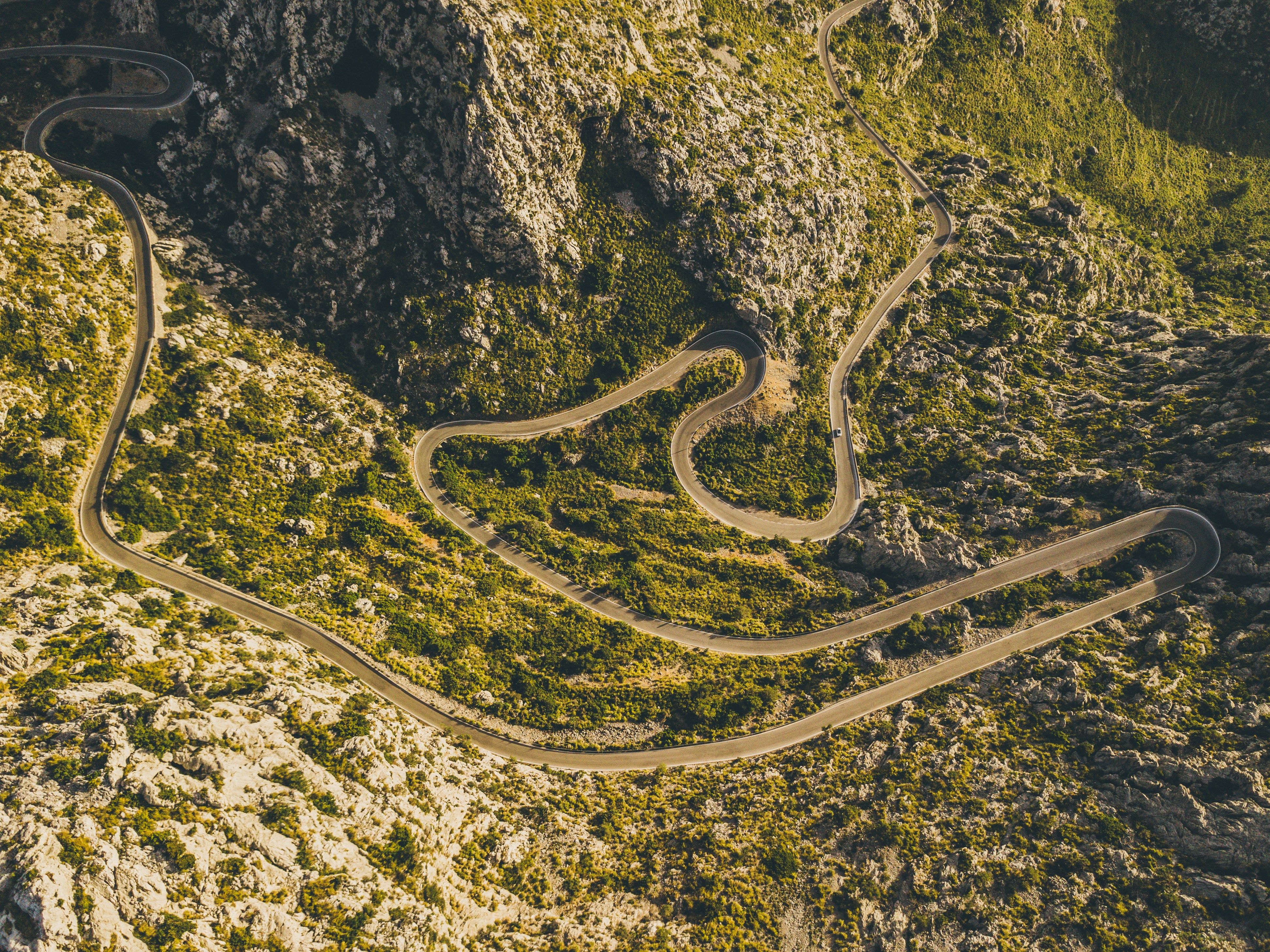 #71
#71Rated #71 of 100
Serra de Tramuntana Cycling Route, Spain
#serradetramuntanacyclingroute ◆ Cycling Tours81 /100The Sa Calobra climb switchbacks up 26 hairpins through the limestone Serra de Tramuntana, including a spiralling loop where the road passes beneath itself, before dropping to a hidden cove on Mallorca's northwest coast.
Wider routes through the range link terraced olive groves, the monastery at Lluc and the ridge-top village of Deia.
The road is a pilgrimage climb for road cyclists and one of Europe's most celebrated stretches of tarmac.
How does it rate
CrowdsRomanceCash RequiredDangerAccessibilityWhy you should go
A legendary hairpin climb through dramatic limestone mountains that road cyclists travel the world to ride.
Why you shouldn't go
Narrow, exposed switchbacks shared with tour buses and cars make the descent genuinely dangerous.
Plan your visit
Best time to visitApr-May or Sep-Oct, avoiding summer heat and the busiest cycling-season crowds.Best time of dayEarly morning start, both for cooler temperatures and lighter traffic on the hairpins.Getting thereFly to Palma de Mallorca; drive or ride roughly 90 minutes to the Coll dels Reis start point.Entry costFree to ride; road bike rental from EUR20-30/dayTime neededHalf a day for the climb and descentInsider tip — Descend to Sa Calobra cove for a swim before the climb back up, and start at dawn to have the famous spiral hairpin free of tour coaches. -
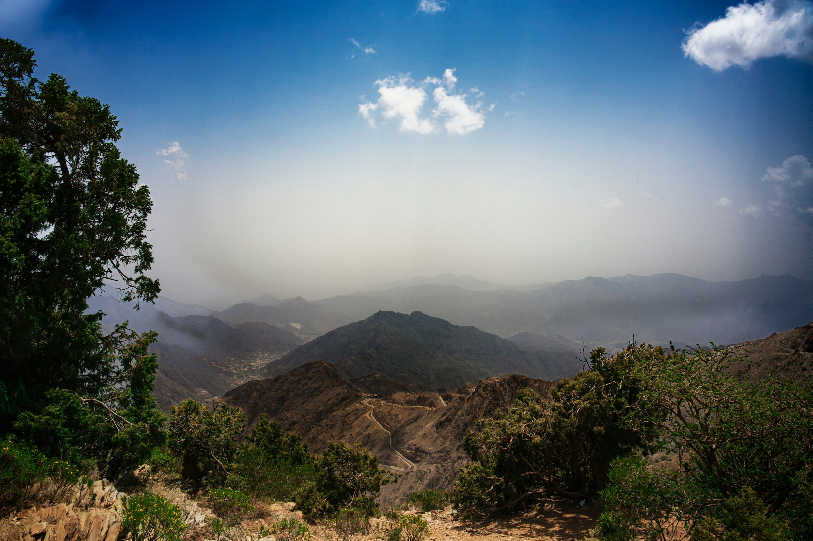 #72
#72Al Soudah sits near Jabal Sawda, Saudi Arabia's highest point, in the green, cool Asir highlands near Abha — a striking contrast to the desert most visitors expect.
Juniper forests cling to terraced mountainsides, mist regularly rolls through the valleys, and a cable car descends from the plateau edge down toward the valley floor thousands of metres below.
How does it rate
CrowdsRomanceCash RequiredDangerAccessibilityWhy you should go
Misty juniper forests and genuinely cool mountain air are the last thing most visitors expect to find in Saudi Arabia.
Why you shouldn't go
The high-altitude roads can close in poor weather, and facilities are more limited than in the country's bigger cities.
Plan your visit
Best time to visitMarch–May or September–November for mild weather and clearer mountain views.Best time of dayEarly morning, when mist often fills the valleys below the plateau edge.Getting thereFly to Abha; roughly 30–45-minute drive up into the mountains to Al Soudah.Entry costFree to explore; the cable car down the escarpment charges a fee.Time needed1 dayInsider tip — Take the cable car down toward the valley floor even just partway — the view back up at the escarpment is better than anything from the plateau itself. -
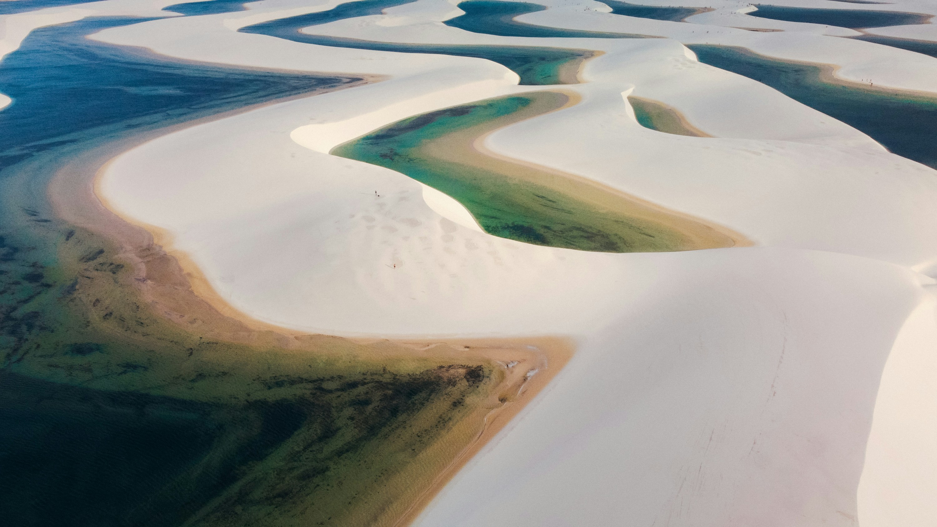 #73
#73Rated #73 of 100
Lençóis Maranhenses National Park, Brazil
#lençóismaranhensesnationalpark ◆ Natural Features81 /100Despite the name, this isn't a desert: seasonal rains fill the valleys between hundreds of square kilometres of white dunes with clear turquoise lagoons, usually June to September.
Outside that window, the dunes stretch out bone-dry and empty.
Reaching the interior means a 4x4 or a walk across shifting sand from the gateway town of Barreirinhas, but the landscape has no real equivalent on the Brazilian coast.
How does it rate
CrowdsRomanceCash RequiredDangerAccessibilityWhy you should go
Turquoise rainwater lagoons threaded through pure white dunes, found nowhere else on the coast.
Why you shouldn't go
The lagoons only hold water roughly June-September; visit outside that window and it's just dry sand.
Plan your visit
Best time to visitJune-September, when rains fill the dune lagoons for swimming.Best time of dayEarly morning, for cooler sand and softer light before the midday heat.Getting thereFly to São Luís, then about a 4-hour transfer to Barreirinhas; onward by 4x4 or boat into the dune field.Entry costFree to enter the park; guided 4x4/boat tours from Barreirinhas cost extraTime neededFull day, or 2-3 days to see multiple dune areasInsider tip — Base yourself in Barreirinhas rather than São Luís, and get out to Lagoa Azul or Lagoa Bonita early, before the midday sun flattens the colour. -
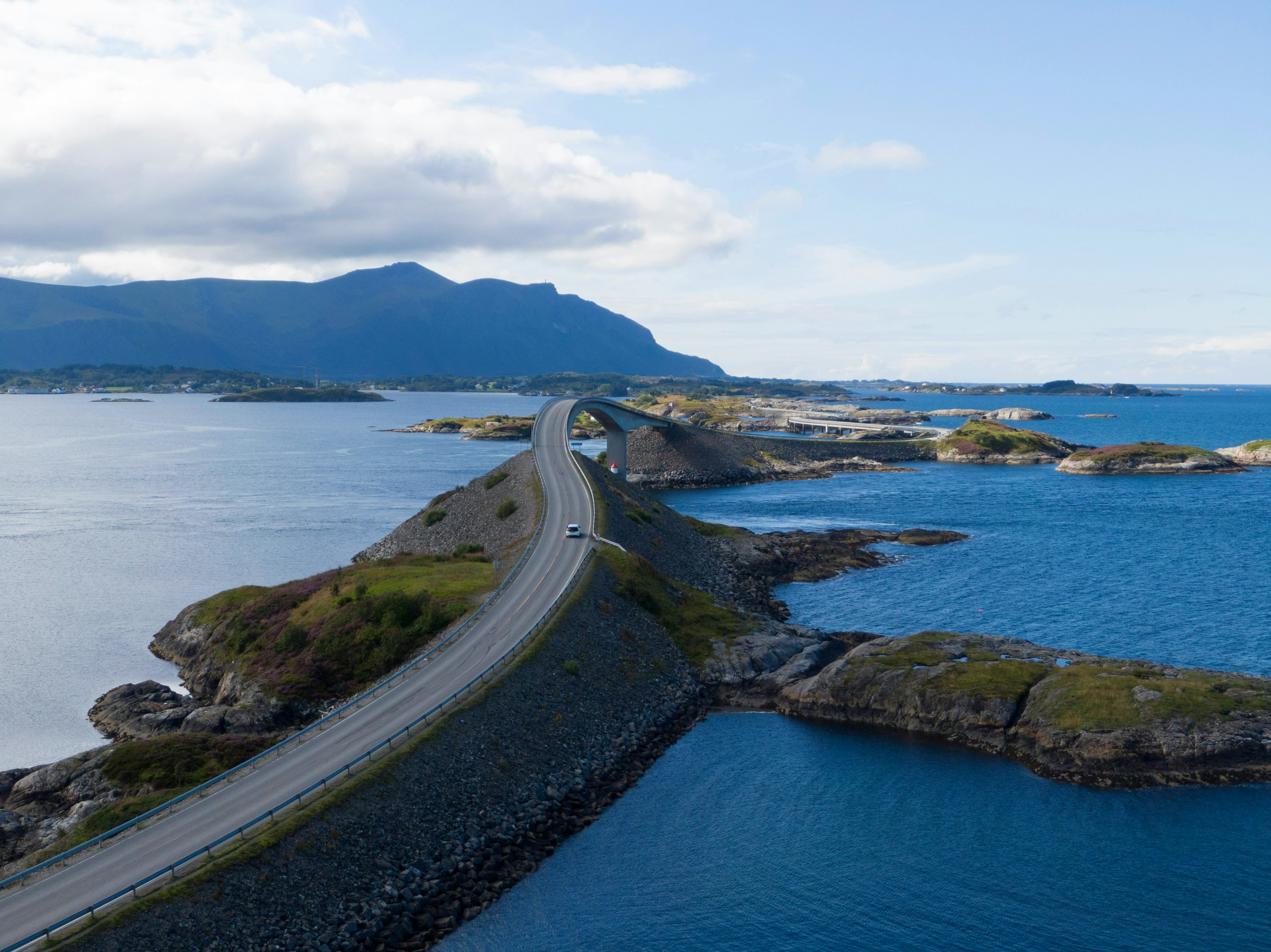 #7481 /100
The Atlantic Road links a scatter of skerries and islets off Norway's west coast on an 8km run of bridges and causeways, built to look like it dives straight into the sea.
The Storseisundet Bridge is the famous shot, but the whole stretch is a slow, low-lying drive between open ocean on both sides, with fishing hamlets and pull-offs for scrambling over the rocks.
Storms send waves over the road, which locals treat as a spectator sport in autumn.
How does it rate
CrowdsRomanceCash RequiredDangerAccessibilityWhy you should go
A short, genuinely dramatic stretch of road that seems to disappear into the open Atlantic.
Why you shouldn't go
Over almost as soon as it starts - eight kilometres, no detours, done in half an hour without stops.
Plan your visit
Best time to visitSummer for calm seas and long light; autumn storms for waves breaking over the causeways.Best time of dayGolden hour, when the low sun catches the bridge and open water on both sides.Getting thereFly to Kristiansund; a 30-40 minute drive on Route 64 to the road's western end at Kårvåg.Entry costFree; no tolls on the road itself.Time needed1-2 hours including stopsInsider tip — Park at the Storseisundet Bridge viewpoint and walk out onto the older, disused sections of road for an angle on the bridge that most drivers miss. -
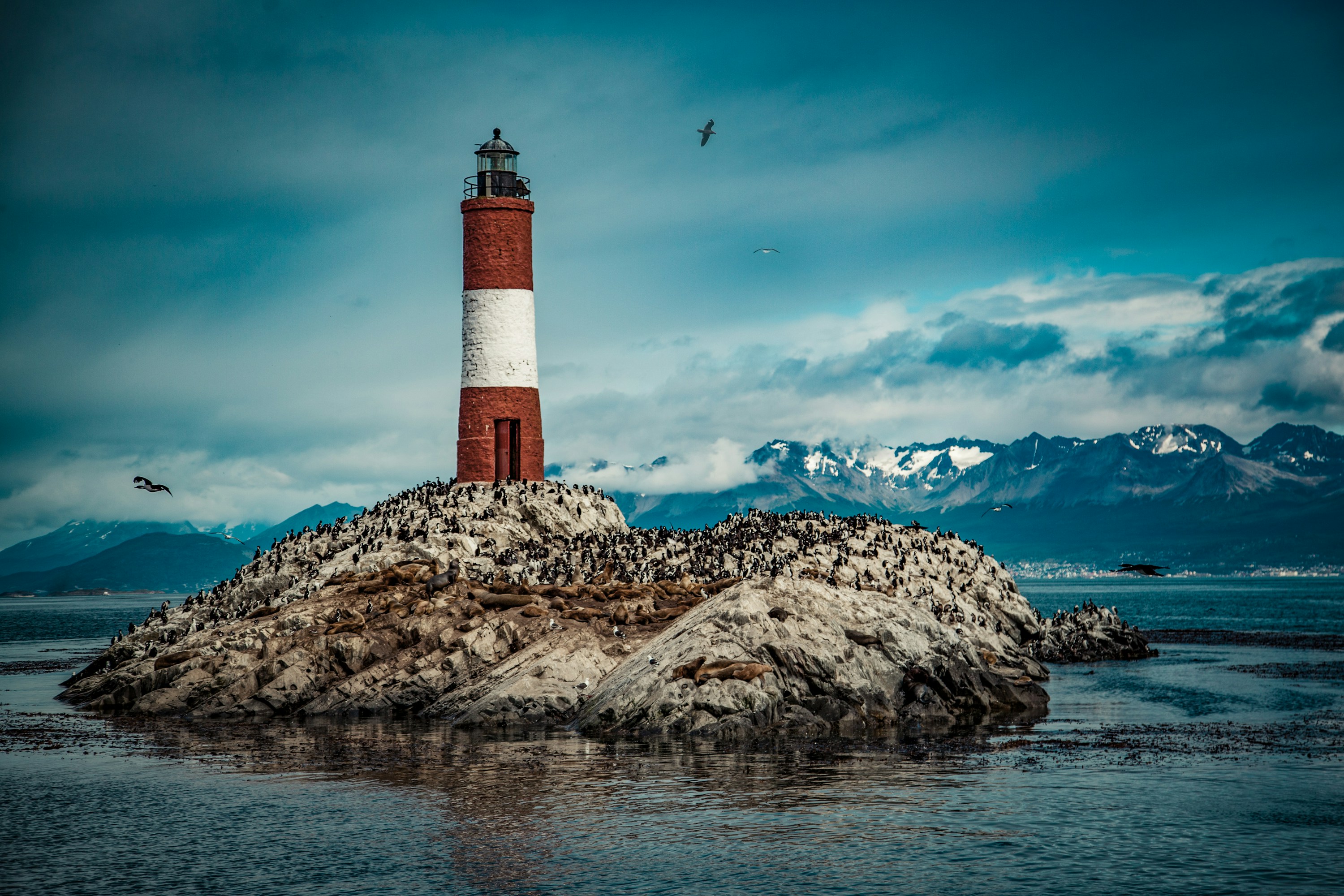 #75
#75Marketed as the southernmost city in the world, Ushuaia sits on the Beagle Channel in Tierra del Fuego, snow-capped peaks rising directly behind its harbour.
It is the main departure point for Antarctica cruises, and shorter boat trips from the same harbour pass the red-and-white Les Eclaireurs lighthouse and islands crowded with sea lions, cormorants and penguins.
Tierra del Fuego National Park lies a short drive west for subantarctic forest and coastal trails.
How does it rate
CrowdsRomanceCash RequiredDangerAccessibilityWhy you should go
The launch point for Antarctica, with wildlife-rich boat trips on the Beagle Channel available even for a day visit.
Why you shouldn't go
Weather is genuinely unpredictable year-round, and Antarctica cruises themselves cost thousands of dollars.
Plan your visit
Best time to visitNovember-March (Southern Hemisphere summer) for mildest weather and Antarctica cruise seasonBest time of dayMorning boat departures for calmer Beagle Channel watersGetting thereFly to Ushuaia (Malvinas Argentinas Airport) from Buenos Aires, about 3.5 hoursEntry costFree to walk the town; Beagle Channel boat trips from ~$60-100; Antarctica cruises from several thouTime needed2-3 days, longer if joining an Antarctica cruiseInsider tip — Book a half-day Beagle Channel boat trip even if skipping Antarctica - it reaches the lighthouse and sea lion colonies for a fraction of the cost. -
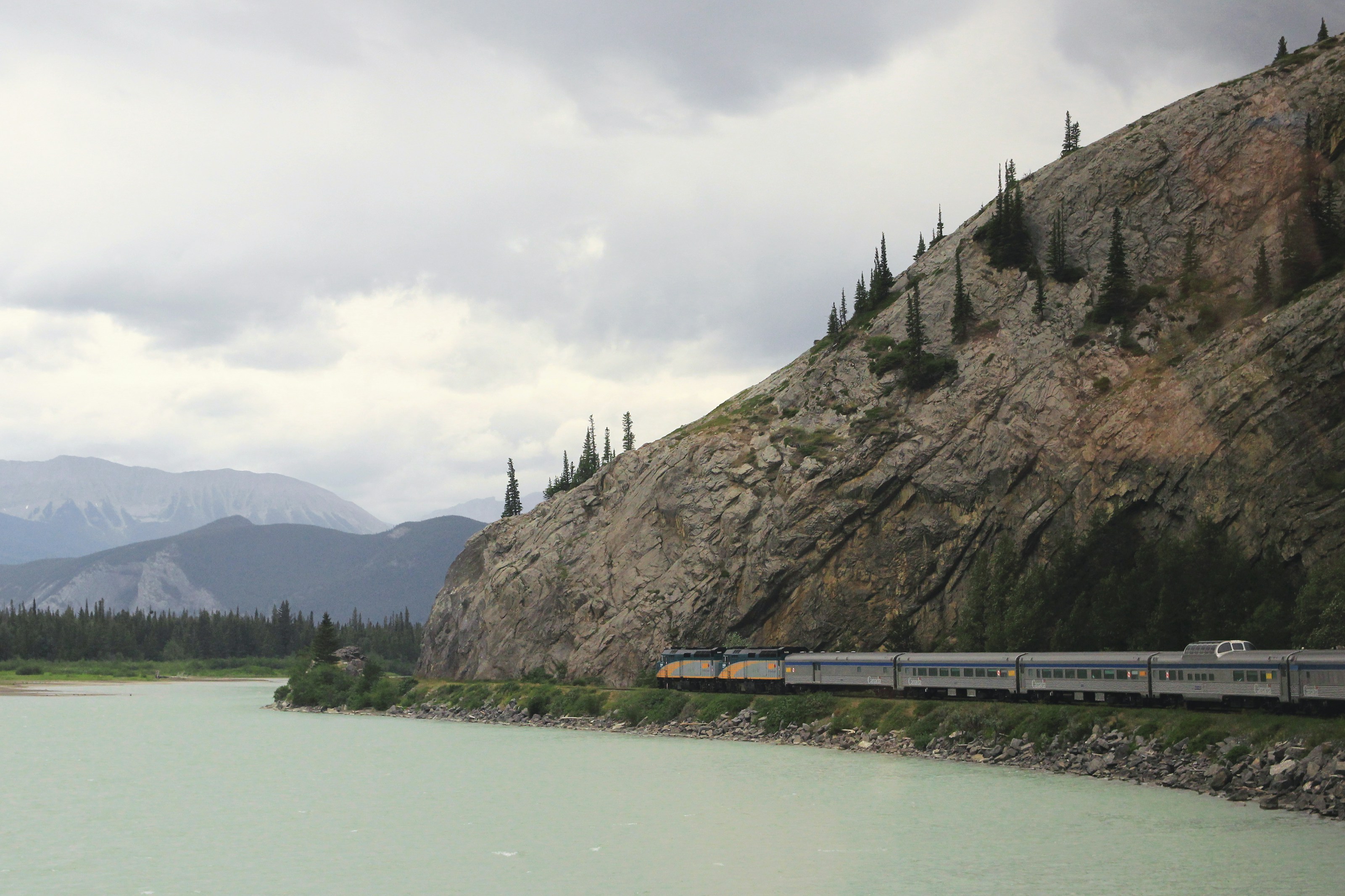 #7680 /100
VIA Rail's transcontinental flagship crosses Canada in four days aboard 1950s stainless-steel dome cars, from Toronto through the Canadian Shield and prairies into the Rockies at Vancouver.
Glass-domed Park cars let passengers watch scenery from above the roofline, and Prestige cabins include their own bathroom and picture windows.
The appeal is less one view than the sheer, unhurried scale of the country passing by.
How does it rate
CrowdsRomanceCash RequiredDangerAccessibilityWhy you should go
Four days aboard vintage stainless-steel dome cars crossing Canada coast to coast, from the Canadian Shield to the Rockies.
Why you shouldn't go
A sleeper cabin costs as much as a short-haul flight, and the multi-day prairie stretch feels repetitive to some travellers.
Plan your visit
Best time to visitMay-October for the longest daylight hours over the Rockies stretch near Jasper.Best time of dayAfternoon through Jasper and the Rockies, timed for daylight on the most dramatic mountain stretch.Getting thereBoard at Toronto's Union Station or Vancouver's Pacific Central Station, both downtown and reachable by transit from the airport.Entry costSleeper cabins from around CAD 1,500 one-way; Economy seating from about CAD 500.Time needed4 days, 4 nights end to end (Toronto-Vancouver).BookingBook ahead →Insider tip — Book a Prestige cabin on the west-facing side for sunset light over the Rockies on the final approach into Vancouver, and spend as much time as you're allowed in the glass-domed Park car at the rear of the train. -
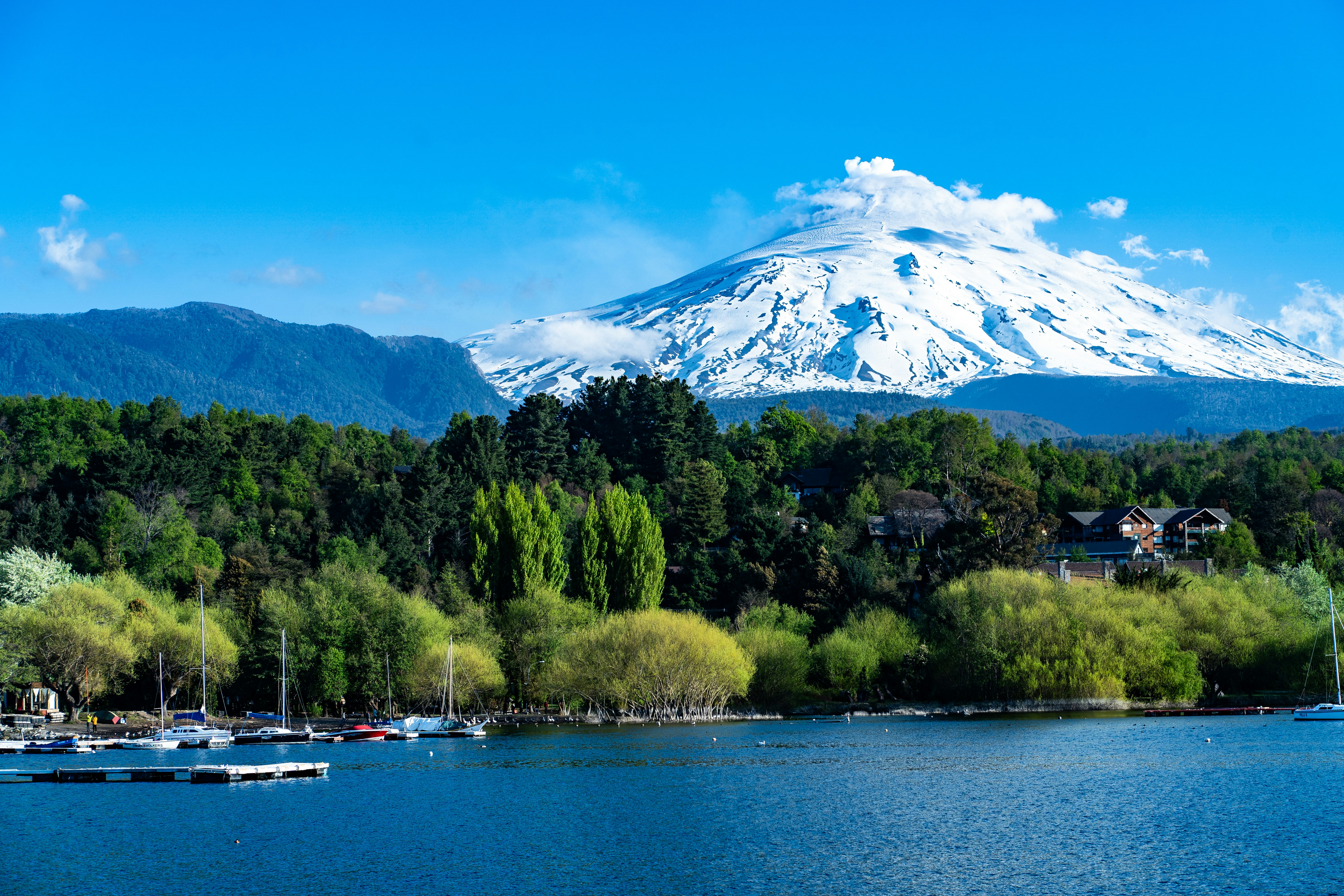 #7780 /100
One of South America's most active volcanoes, a near-perfect snow-capped cone above the lakeside town of Pucon, with a permanently active lava lake sometimes visible glowing from the crater rim on clear nights.
A full-day guided climb in crampons reaches the summit for a look directly into the smoking crater, while at night the volcano's silhouette glowing faintly red is visible from town.
Ski slopes cover its lower flanks in winter, an unusual pairing of active volcanism and alpine sport.
How does it rate
CrowdsRomanceCash RequiredDangerAccessibilityWhy you should go
A near-perfect active volcanic cone with a summit crater you can climb to and, on clear nights, watch glow from town.
Why you shouldn't go
The summit climb is a genuinely strenuous full-day trek in crampons, and eruptive activity periodically closes it entirely.
Plan your visit
Best time to visitDecember-March (Southern Hemisphere summer) for the best summit-climbing conditions.Best time of dayEarly morning start for the summit climb; after dark from Pucon for the glow, if activity is visible.Getting thereFly to Temuco, then a 1-hour drive to Pucon, the main base town.Entry costGuided summit climb tours typically run USD150-200 per person, gear included.Time neededA full day for the summit climb.Insider tip — Check with local guides on current crater visibility before booking - during periods of higher activity, tours turn back before the true summit. -
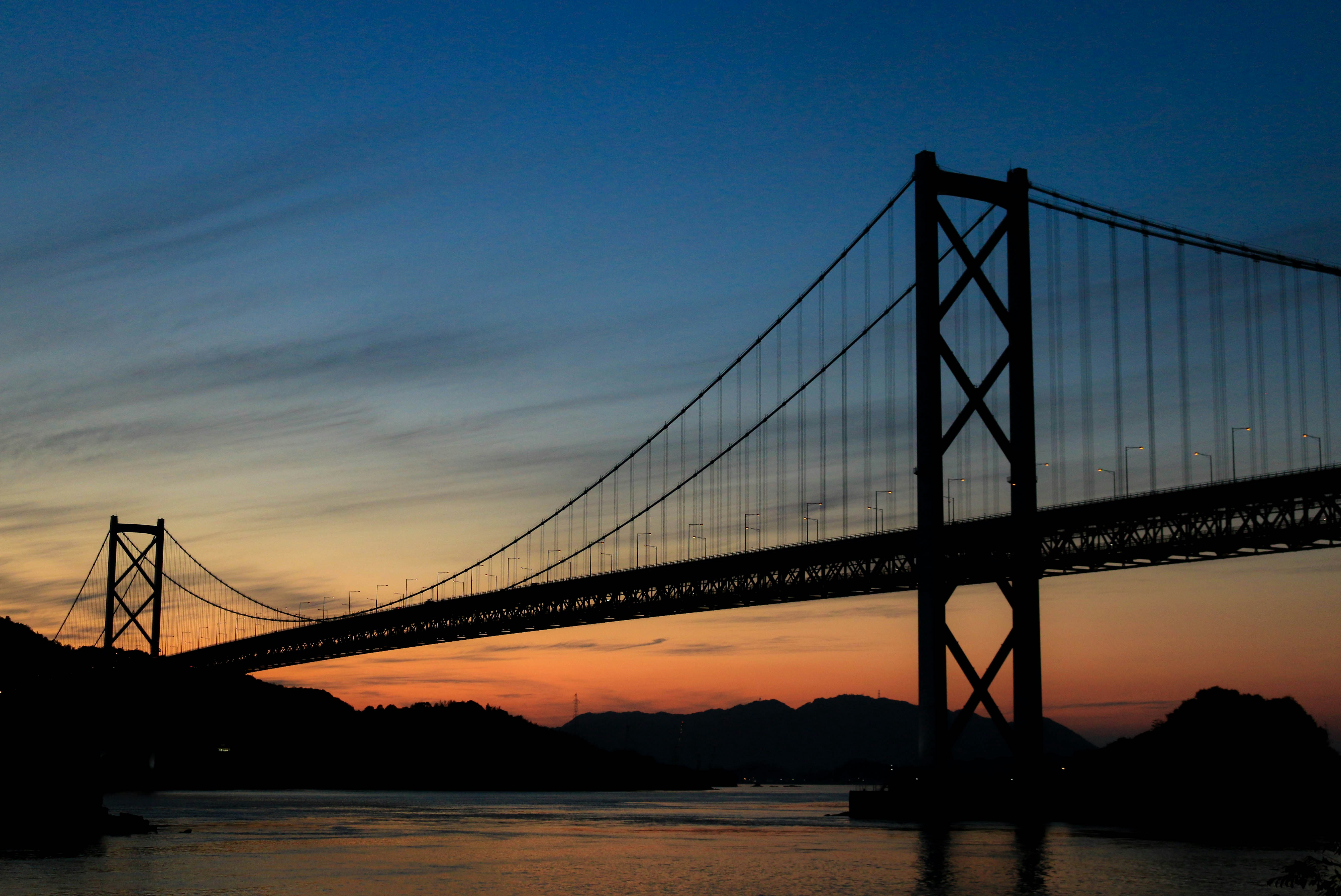 #7880 /100
A signed cycle path links Onomichi on Honshu to Imabari on Shikoku across six small islands in the Seto Inland Sea, crossing seven bridges over open water.
Riders follow dedicated blue lane markings past citrus groves, fishing harbours and turquoise straits, with the cable-stayed Tatara Bridge and the towering Kurushima-Kaikyo suspension bridge as centrepiece crossings.
Rental terminals at either end let you start and finish where you like.
How does it rate
CrowdsRomanceCash RequiredDangerAccessibilityWhy you should go
Cycling across seven bridges over the Seto Inland Sea between two islands is a ride found nowhere else on Earth.
Why you shouldn't go
The full 70km crossing is a demanding full day in the saddle, and summer humidity can be punishing.
Plan your visit
Best time to visitMarch-May or Oct-Nov for mild temperatures and clear straits views.Best time of dayEarly morning departure to finish before afternoon heat builds.Getting thereFly to Hiroshima or Takamatsu; train to Onomichi or Imabari, then collect a rental bike at the terminal.Entry costBike rental from Y3,000/day; bridge tolls Y500 total (waived through Mar 2026)Time neededFull day (4-10 hours riding)BookingBook ahead →Insider tip — Rent from a Giant terminal for one-way drop-off between Onomichi and Imabari, and stop at the Tatara Bridge rest area for the best photo of the cable stays against the strait. -
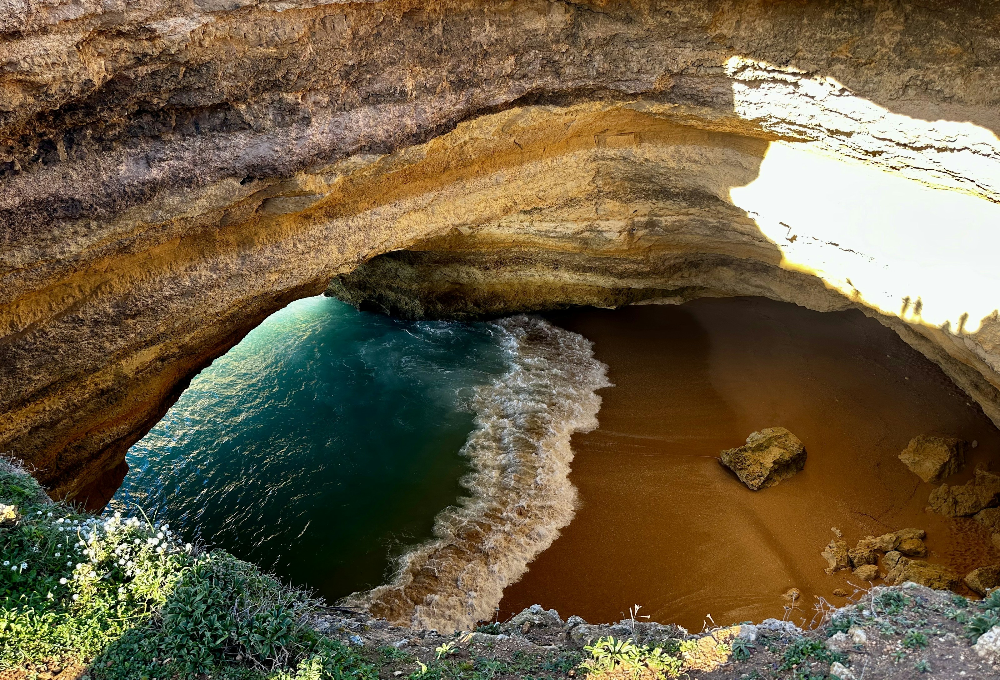 #7980 /100
A domed sandstone chamber on the Algarve coast with its own crescent of beach and a circular hole in the roof that drops a column of sunlight onto the sand.
It can only be reached from the water, by kayak, paddleboard or tour boat, since swimming across from the neighbouring beach is now restricted.
How does it rate
CrowdsRomanceCash RequiredDangerAccessibilityWhy you should go
Sunlight falling through the roof onto a private beach inside a cave, reachable only from the sea.
Why you shouldn't go
Boats queue nose to tail in high season, and landing inside the cave is no longer permitted.
Plan your visit
Best time to visitMay-June or September for calm water without the August armadaBest time of dayAround midday, when the sun drops straight through the roof openingGetting thereBoat or kayak from Benagil or Praia da Marinha, 30 minutes east of PortimaoEntry costKayak hire around EUR 25; boat tours from EUR 20Time needed2-3 hoursInsider tip — Take a kayak rather than a boat tour - kayaks can still slip inside the cave when the larger boats have to hold offshore. -
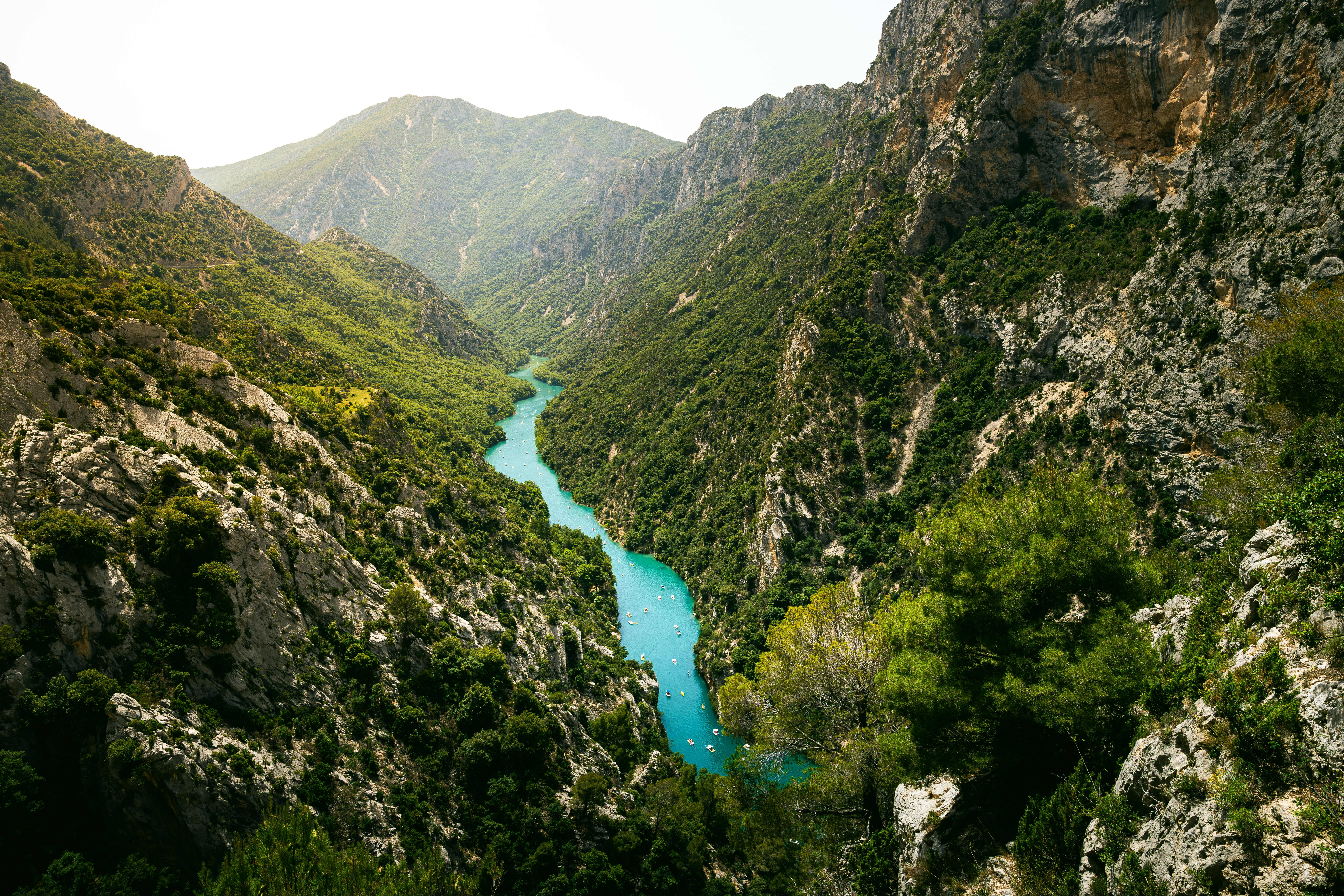 #8080 /100
Europe's deepest canyon plunges 700 meters, with the turquoise Verdon River winding through limestone walls below.
Scenic clifftop drives, hiking trails, and kayaking routes make it one of France's most dramatic natural landscapes, far quieter than the Côte d'Azur an hour south.
How does it rate
CrowdsRomanceCash RequiredDangerAccessibilityWhy you should go
Europe's deepest canyon with a turquoise river far below, stunning clifftop drives, and adventure sports.
Why you shouldn't go
Summer weekends bring heavy traffic; some viewpoints have poor parking; the rim road is narrow and winding.
Plan your visit
Best time to visitMay–June or September for pleasant weather and fewer tourists.Best time of dayMorning light softens the canyon walls; sunset along the rim road is dramatic.Getting thereFly to Nice, 2.5–3 hour drive northwest to Castellane; rental car essential.Entry costFree for rim drives; kayak tours €25–50 per person.Time neededFull day for the rim drive; 2 days to add kayaking.Insider tip — Drive the Corniche Sublime road slowly — it's narrow with sheer drops. Rent a kayak at Lac de Sainte-Croix, at the canyon's mouth, for a different perspective. -
 #8180 /100
A roughly 170km hut-to-hut circuit around the Mont Blanc massif through France, Italy and Switzerland, climbing about 10,000m of ascent past glaciers, alpine lakes and larch forest.
Val Ferret and the Aiguilles Rouges give some of the best full-on views of Mont Blanc's summit.
Most walkers take 7-11 days, staying in refuges that range from rustic to modernised.
Huts fill fast in July and August.
How does it rate
CrowdsRomanceCash RequiredDangerAccessibilityWhy you should go
Circling the entire Mont Blanc massif on foot, with a fresh angle on the summit from a different valley each day.
Why you shouldn't go
Popular refuges get overbooked in peak summer and demi-pension prices have climbed sharply since 2022.
Plan your visit
Best time to visitMid-June to mid-September, when high passes are snow-free and refuges are open.Best time of dayEarly morning starts to clear passes before afternoon thunderstorms build.Getting thereFly to Geneva; bus or train (about 1-1.5 hours) to Chamonix, the trek's usual start and end point.Entry costNo park fee; refuge demi-pension runs roughly EUR50-80 (CHF60-100 in Switzerland) a night.Time needed7-11 daysInsider tip — Reserve refuges as soon as booking opens (often January) for July-August dates, and pack layers - weather turns fast at altitude. -
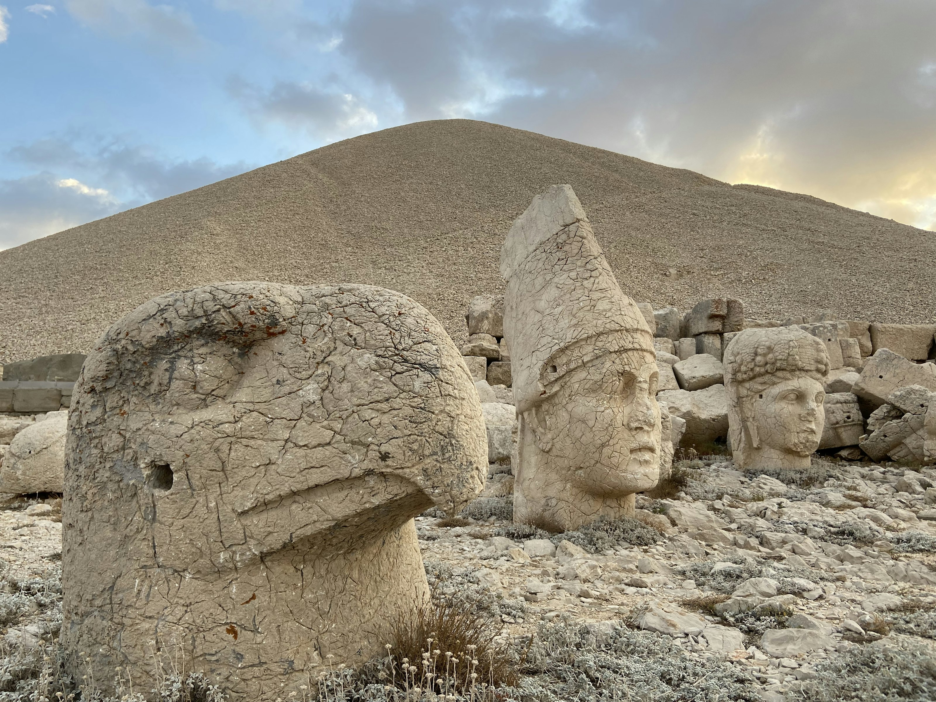 #8280 /100
At the 2,100-metre summit of Mount Nemrut, a first-century BC king built himself a burial sanctuary flanked by colossal stone heads of gods and eagles, toppled from their bodies by centuries of earthquakes but still staring out over the Anatolian plateau.
Visitors climb the last stretch before dawn to watch sunrise light hit the eastern terrace's statues one by one.
How does it rate
CrowdsRomanceCash RequiredDangerAccessibilityWhy you should go
Watching sunrise break across the row of giant stone heads is one of the more surreal moments in Turkish travel.
Why you shouldn't go
The site is remote and the pre-dawn climb in the cold puts off casual visitors — this is a dedicated detour, not a stopover.
Plan your visit
Best time to visitMay–September, when mountain roads are reliably clear and mornings aren't freezing.Best time of dayBefore sunrise — most visitors climb in the dark to catch first light on the statues.Getting thereFly to Adıyaman or Kahta; a rough 1-hour mountain road leads to the summit car park, then a 20-minute climb.Entry costPaid entry.Time needed2–3 hours including the climbInsider tip — Bring a warm layer even in summer — the summit is cold and windy well after sunrise. -
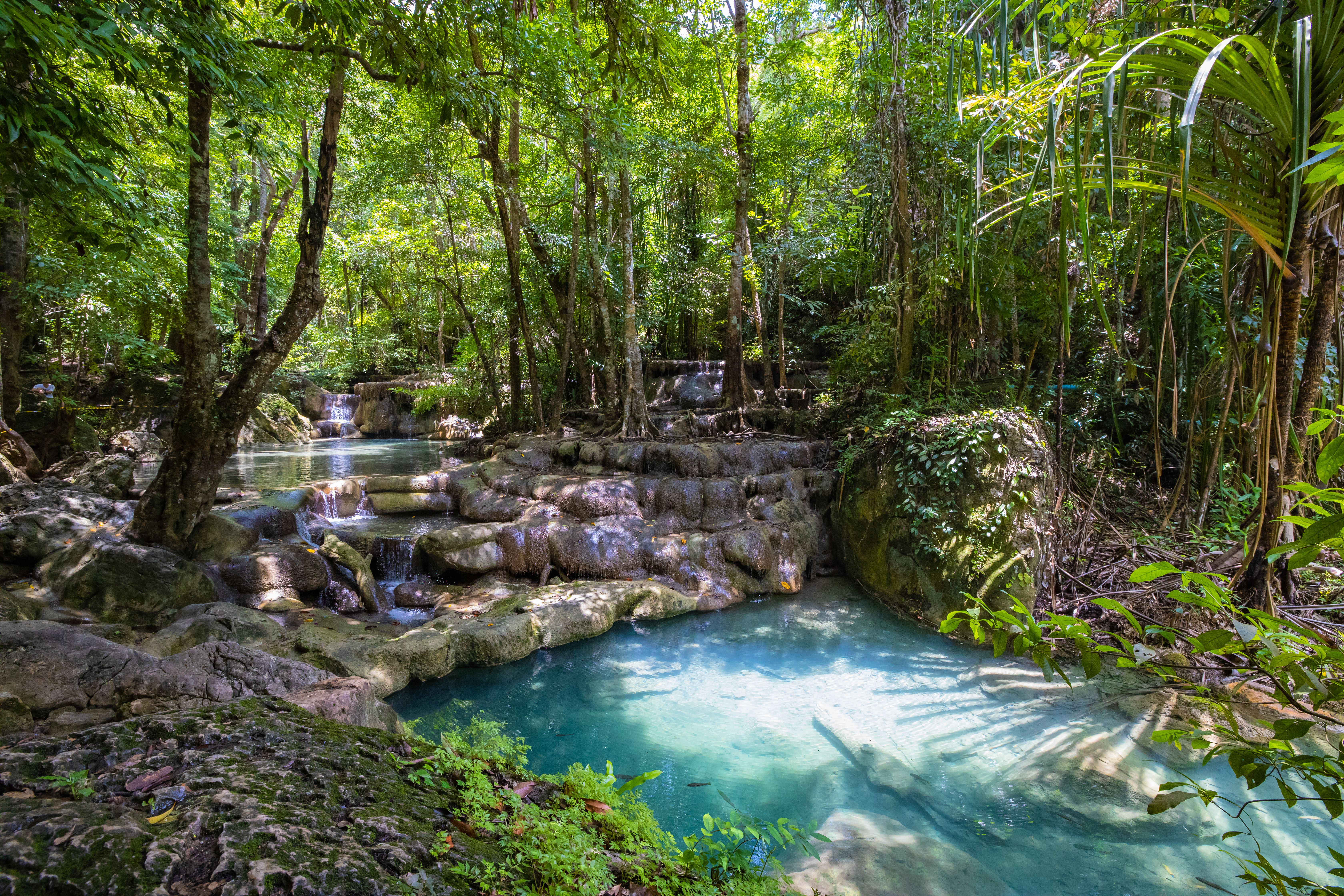 #8380 /100
Erawan Falls drops through seven tiers down a forested hillside in Kanchanaburi province, each level pooling into a turquoise swimming hole ringed by limestone and jungle.
The lower tiers are an easy walk from the park entrance, while reaching the seventh requires a scramble over rocks and tree roots that takes a couple of hours round trip.
Small fish in the pools nibble at swimmers' feet, a natural pedicure most visitors don't expect.
How does it rate
CrowdsRomanceCash RequiredDangerAccessibilityWhy you should go
Swimming your way up through seven turquoise pools, each one different, makes this one of Thailand's best waterfall hikes.
Why you shouldn't go
The climb to the upper tiers is slippery and can close after heavy rain; weekends bring large domestic tourist crowds.
Plan your visit
Best time to visitNovember–March for the clearest, most turquoise water; avoid the rainy season when falls turn muddy.Best time of dayEarly morning on weekdays, before domestic tour groups arrive.Getting thereFly to Bangkok; roughly 3-hour drive west to Kanchanaburi, then a 1-hour drive into the national park.Entry costNational park entry fee, paid at the gate.Time neededHalf a dayInsider tip — Wear water shoes with grip — the rocks between pools are slick, and bare feet make the higher tiers much harder to reach. -
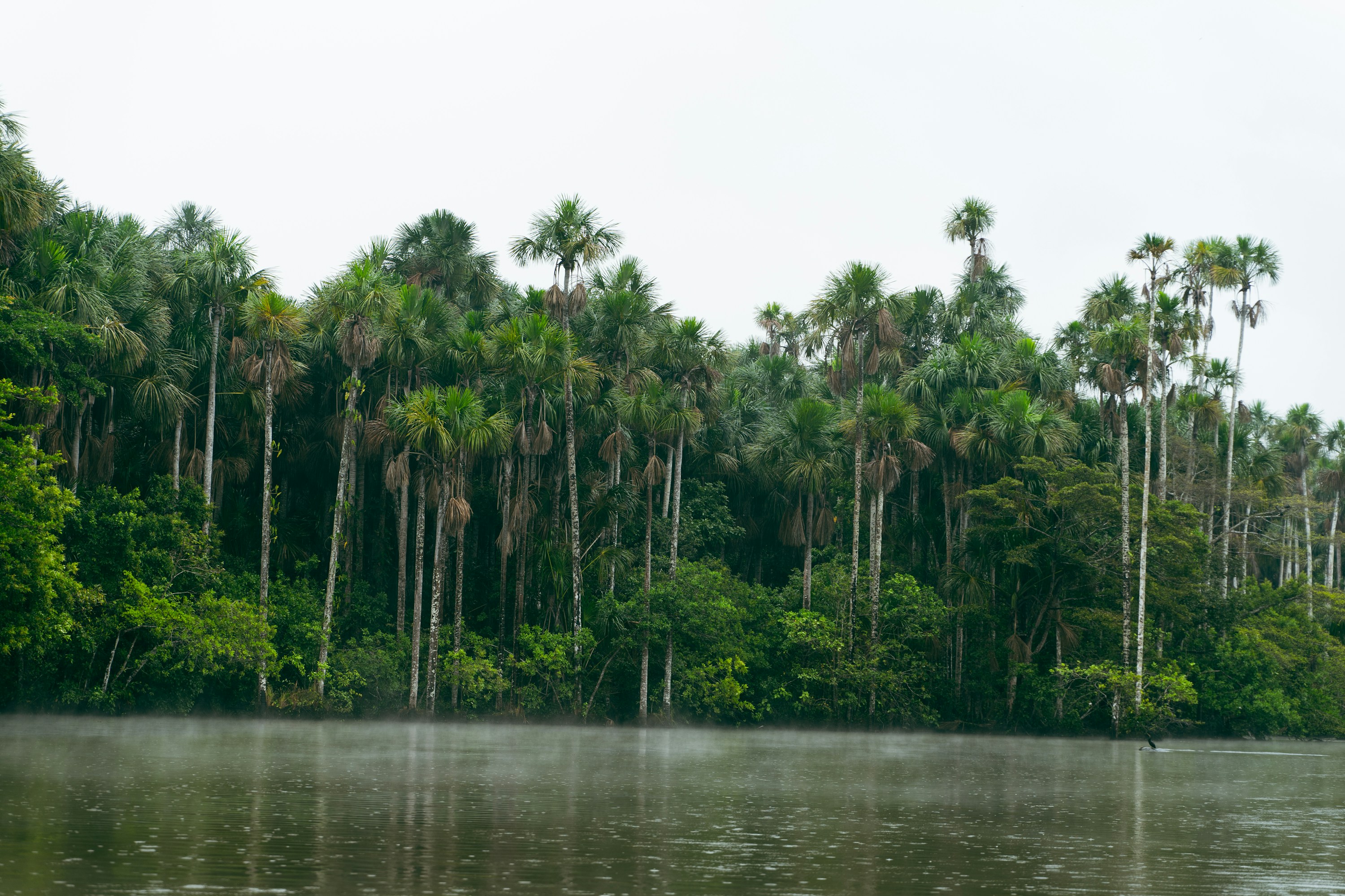 #8480 /100
Tambopata protects lowland Amazon rainforest in southeastern Peru, reached by boat from Puerto Maldonado.
Jungle lodges put visitors within reach of oxbow lakes, giant otters, and one of the Amazon's largest macaw clay licks, where hundreds of parrots gather at dawn.
Guided walks and night boat rides turn up a density of wildlife hard to match elsewhere in Peru, though it costs real time and money to reach.
How does it rate
CrowdsRomanceCash RequiredDangerAccessibilityWhy you should go
One of the Amazon's best macaw clay licks, plus genuinely high odds of otters, caimans and monkeys.
Why you shouldn't go
Getting to the good lodges means a flight to Puerto Maldonado plus hours by boat, and it isn't cheap.
Plan your visit
Best time to visitMay-October (dry season) for easier trails and reliable clay-lick activityBest time of dayDawn for the macaw clay lick; dusk and after dark for caiman and nocturnal wildlifeGetting thereFly to Puerto Maldonado, then 1-4 hours by boat depending on the lodgeEntry costReserve entry fee ~$20-30; lodge packages from roughly $250 for 3 daysTime needed3-4 days including travelInsider tip — Stay at least three nights - the clay licks aren't guaranteed daily, and lodges further upriver see far less boat traffic than those near Puerto Maldonado. -
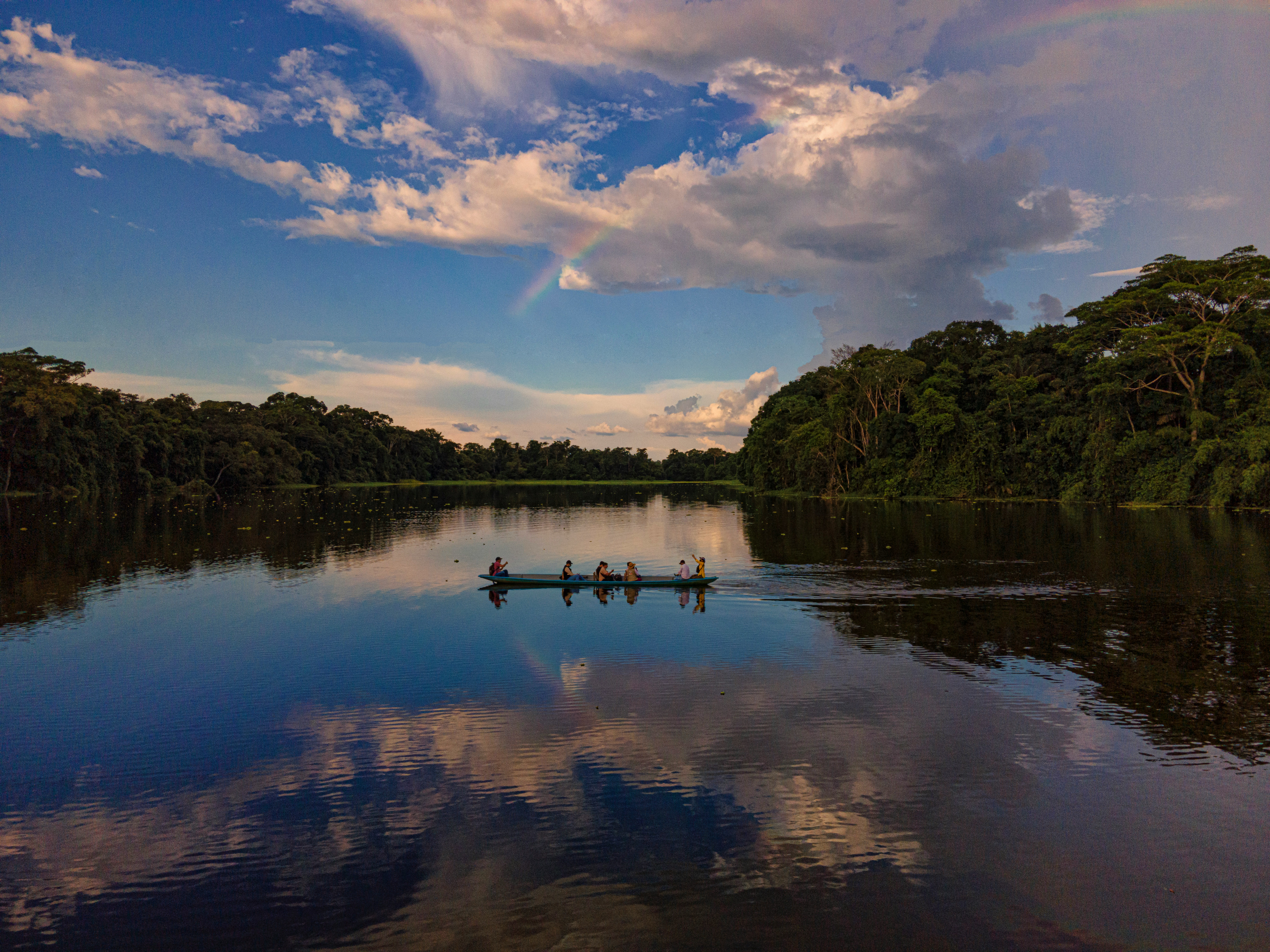 #8579 /100
Deep in the Ecuadorian Amazon, Yasuní is one of the most biodiverse places on the planet, home to more tree species in a single hectare than in all of North America, alongside jaguars, giant otters, harpy eagles and several uncontacted indigenous groups.
Jungle lodges reached by dugout canoe offer guided hikes, canopy towers and night paddles where caiman eyes reflect torchlight across blackwater lagoons.
How does it rate
CrowdsRomanceCash RequiredDangerAccessibilityWhy you should go
Among the most biodiverse places on Earth, reached only by river and largely untouched.
Why you shouldn't go
Remote access means multi-day lodge stays are expensive and require significant travel time.
Plan your visit
Best time to visitDecember–February and June–August, the drier seasons, for easier trail walking.Best time of dayDawn canoe trips, when wildlife is most active before the heat sets in.Getting thereFly from Quito to Coca, then several hours by motorized canoe to a jungle lodge.Entry costMulti-day lodge packages typically €400-900+ including transport, food and guiding.Time needed3–5 days.Insider tip — Choose a lodge with an indigenous-run canopy tower — the platform views over the unbroken jungle canopy are the trip's highlight. -
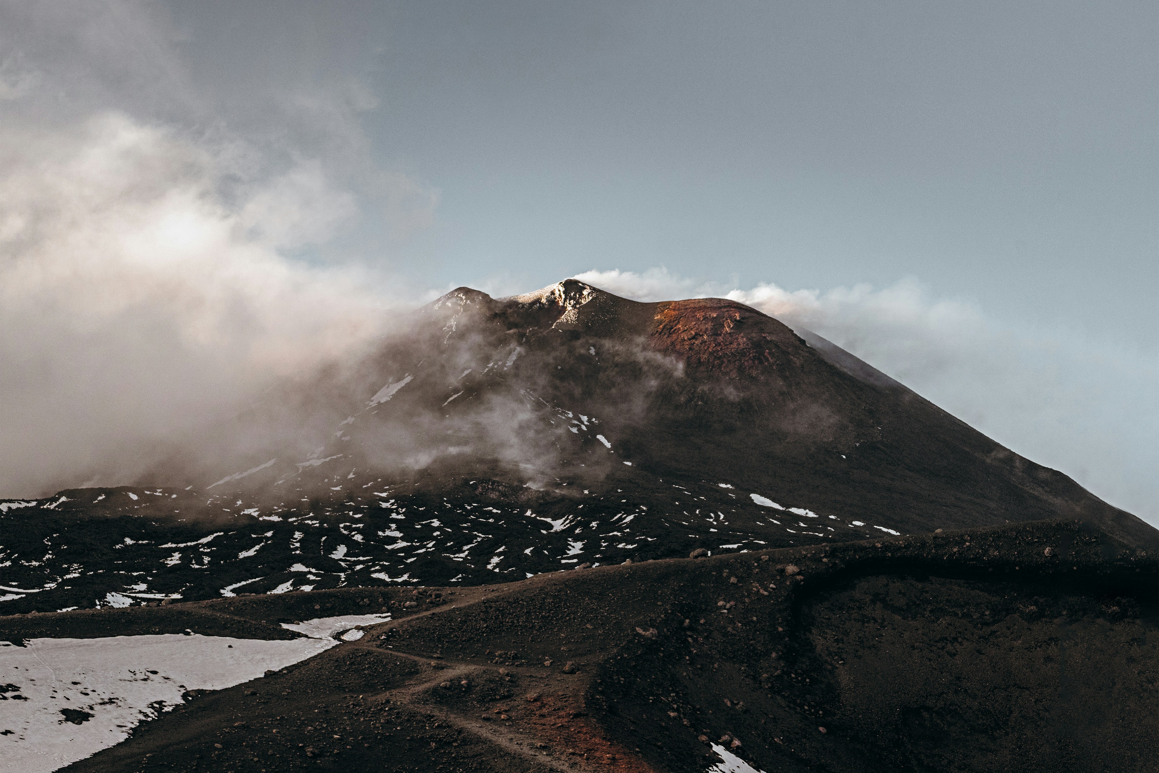 #8679 /100
Europe's tallest and most active volcano, looming over Sicily's east coast and erupting regularly enough that lava flows are a near-yearly event visible from Catania on clear nights.
Cable cars and 4x4 tours climb partway up its barren, ash-grey upper slopes, where guided hikes reach steaming craters and fields of hardened lava from past eruptions.
Vineyards ring its lower slopes, producing distinctive wines grown in volcanic soil, a striking contrast to the desolation higher up.
How does it rate
CrowdsRomanceCash RequiredDangerAccessibilityWhy you should go
Europe's most active volcano, with guided hikes reaching steaming craters and lava fields on its upper slopes.
Why you shouldn't go
Eruptions and ash activity periodically close the upper trails and cable car with little notice, so plans need flexibility.
Plan your visit
Best time to visitMay-June or September for stable weather; the summit can close in poor conditions any time of year.Best time of dayMorning, for clearer summit visibility before afternoon cloud typically rolls in.Getting thereFly to Catania; a 1-1.5 hour drive to the Rifugio Sapienza cable car station on the south side.Entry costCable car plus jeep tour to the craters runs around EUR65-70.Time neededHalf a day.BookingBook ahead →Insider tip — Book the guided upper-crater jeep tour rather than stopping at the cable car's midpoint - the higher craters are where the volcano actually looks otherworldly. -
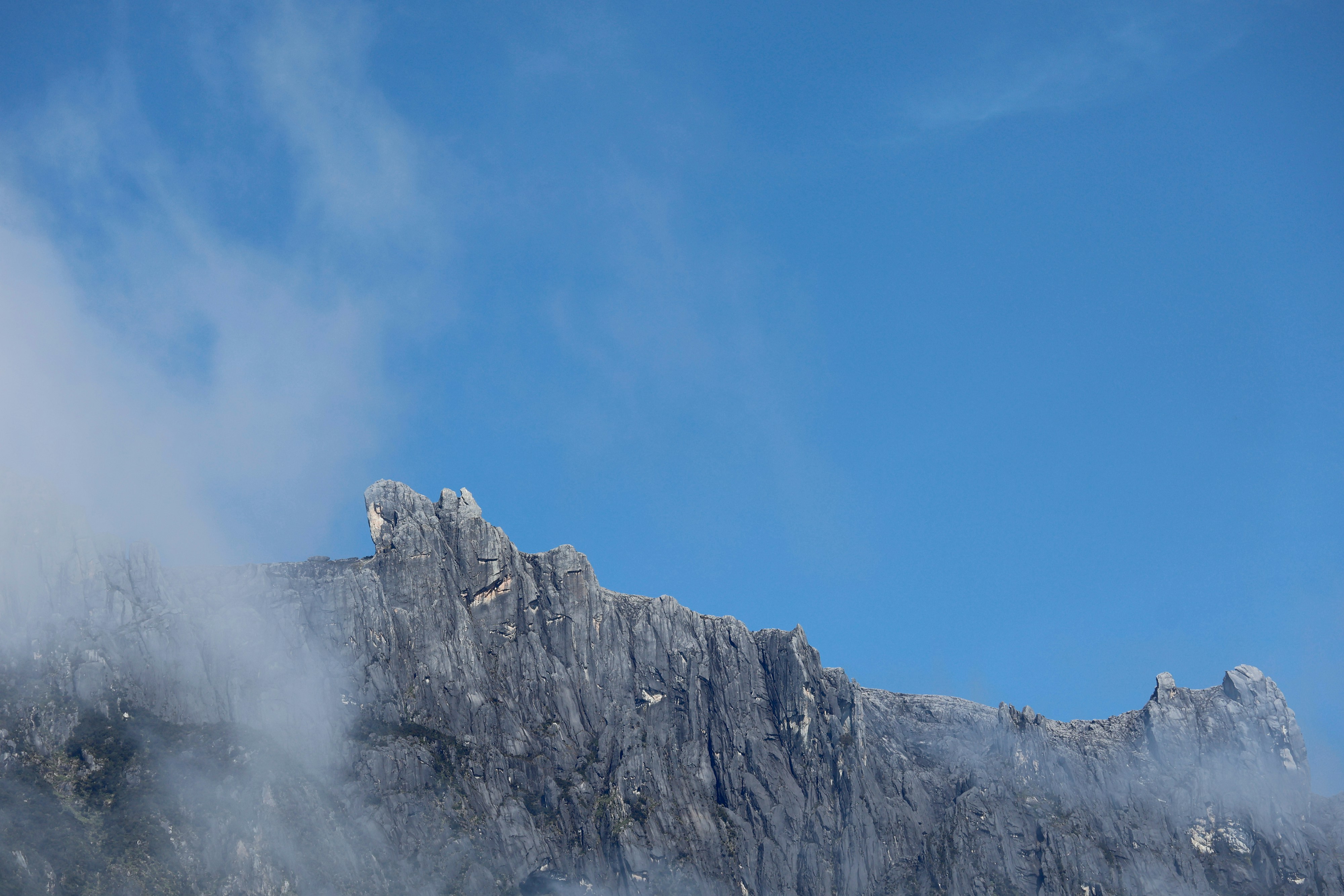 #8779 /100
Southeast Asia's highest peak rises from Borneo's jungle in a single dramatic granite massif, its bare summit plateau catching sunrise light above a sea of cloud.
The two-day climb passes from rainforest through cloud forest into an alpine, almost lunar landscape near the top.
Via ferrata routes on the summit's granite face offer a far more exposed alternative to the standard trail.
How does it rate
CrowdsRomanceCash RequiredDangerAccessibilityWhy you should go
A sunrise summit above the clouds, reached through four distinct climate zones in two days.
Why you shouldn't go
The final pre-dawn push up bare granite in the dark and cold is genuinely tough, altitude included.
Plan your visit
Best time to visitMarch-August, the driest months.Best time of daySunrise from the summit plateau, before cloud rolls in.Getting thereFly to Kota Kinabalu; 2-hour drive to Kinabalu Park headquarters.Entry costPark entry, climbing permit and mandatory guide fees required, from around $150-250 total.Time needed2 days, 1 night on the mountainBookingBook ahead →Insider tip — Book at least 3 months ahead - daily climber numbers are capped and the mountain lodge sells out fast. -
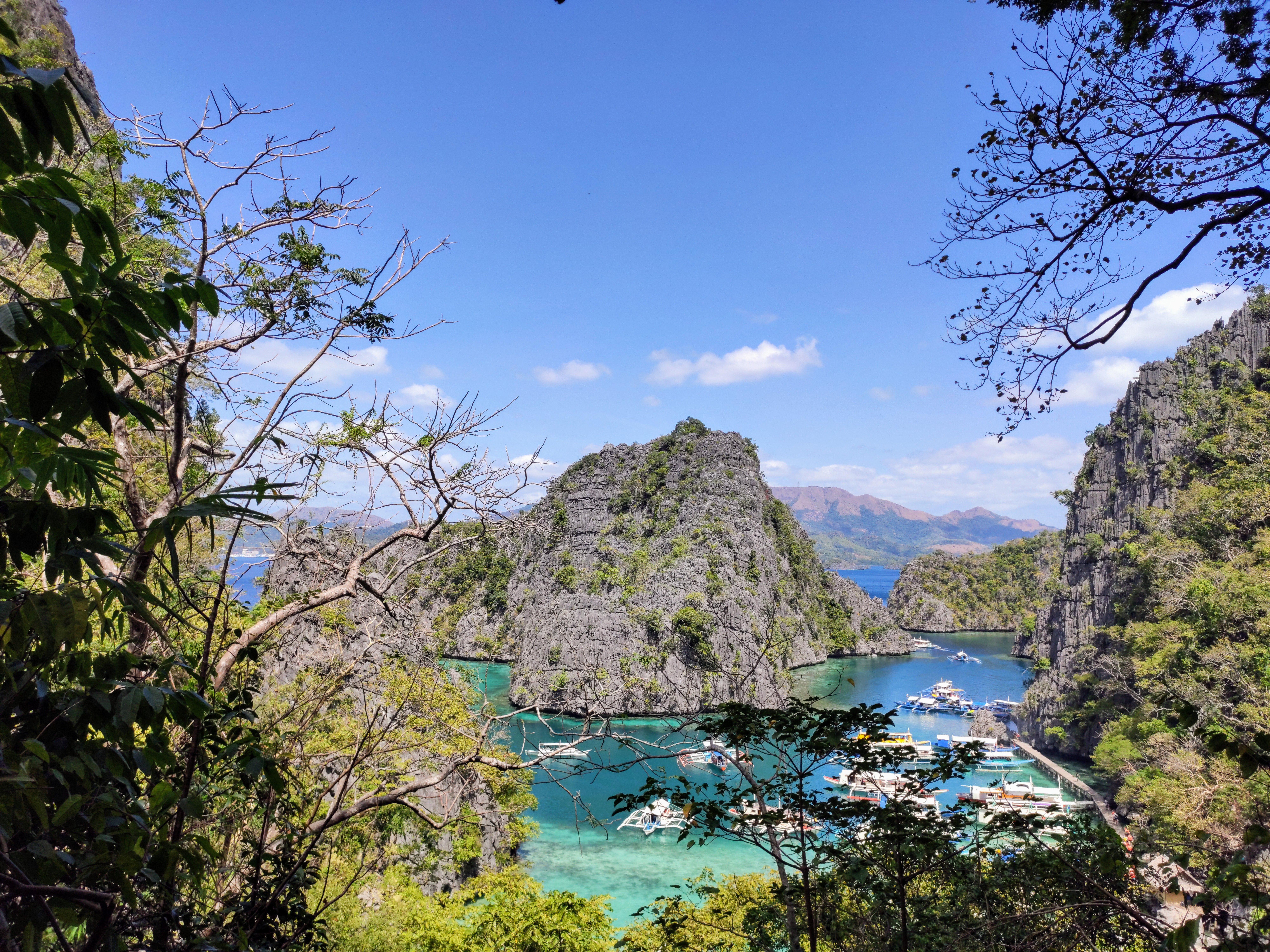 #88
#88Ringed by limestone cliffs and turquoise lagoons, Coron is best known for some of the world's best wreck diving — a dozen Japanese naval ships sunk here in a single 1944 raid now sit intact on the seabed, accessible to both certified divers and snorkelers.
Above water, Kayangan Lake's cliff-top viewpoint and the island's hot springs round out a destination built around striking limestone-and-water scenery.
How does it rate
CrowdsRomanceCash RequiredDangerAccessibilityWhy you should go
World-class WWII wreck diving alongside some of the Philippines' most striking limestone lagoons.
Why you shouldn't go
Getting around the island group requires chartering boats, which adds up over a multi-day stay.
Plan your visit
Best time to visitNovember–May, dry season, for the clearest water and calmest seas.Best time of dayEarly morning at Kayangan Lake, before tour boats arrive in numbers.Getting thereFly directly to Busuanga/Coron airport, or take a ferry from Manila or El Nido.Entry costIsland-hopping tours from around ₱1,200 (~€19); wreck diving from ₱3,500 (~€56).Time needed2–3 days.Insider tip — Book a private rather than shared island-hopping boat if diving Kayangan Lake — shared tours often rush the best viewpoint. -
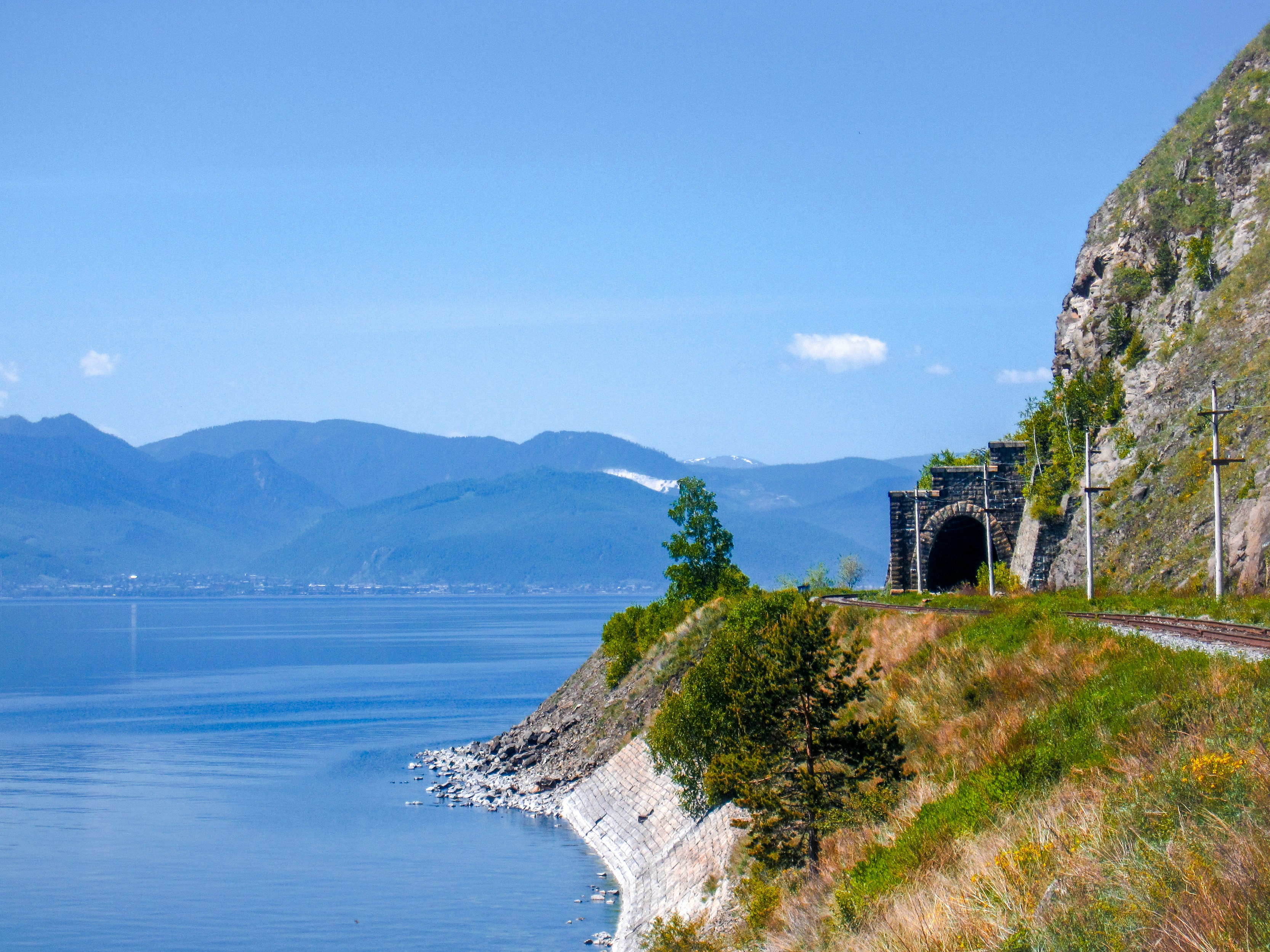 #8979 /100
The world's longest railway line runs just under 9,300km from Moscow to Vladivostok, crossing seven time zones and skirting Lake Baikal, the world's deepest lake, over a journey that can take a full week without stopovers.
Most travellers break the trip into stages, stopping in cities like Irkutsk and Ulan-Ude before rejoining a later train.
How does it rate
CrowdsRomanceCash RequiredDangerAccessibilityWhy you should go
The world's longest rail line, crossing seven time zones and nearly 9,300km of Siberian forest and steppe between Moscow and Vladivostok.
Why you shouldn't go
The full route takes the better part of a week, and current travel advisories mean this trip needs careful, up-to-date research before booking.
Plan your visit
Best time to visitMay-September for milder weather along the Siberian sections of the route.Best time of dayAny time; the journey's scale is experienced across days rather than a single moment.Getting thereBoard at Moscow's Yaroslavsky station, reachable by the Moscow Metro.Entry costFull-route tickets vary widely by class, from budget platskart bunks to private compartments.Time needed5-7 days for the full route, or shorter multi-day segments.Insider tip — Break the journey into stages with stopovers in Irkutsk for Lake Baikal, rather than attempting the full week nonstop. -
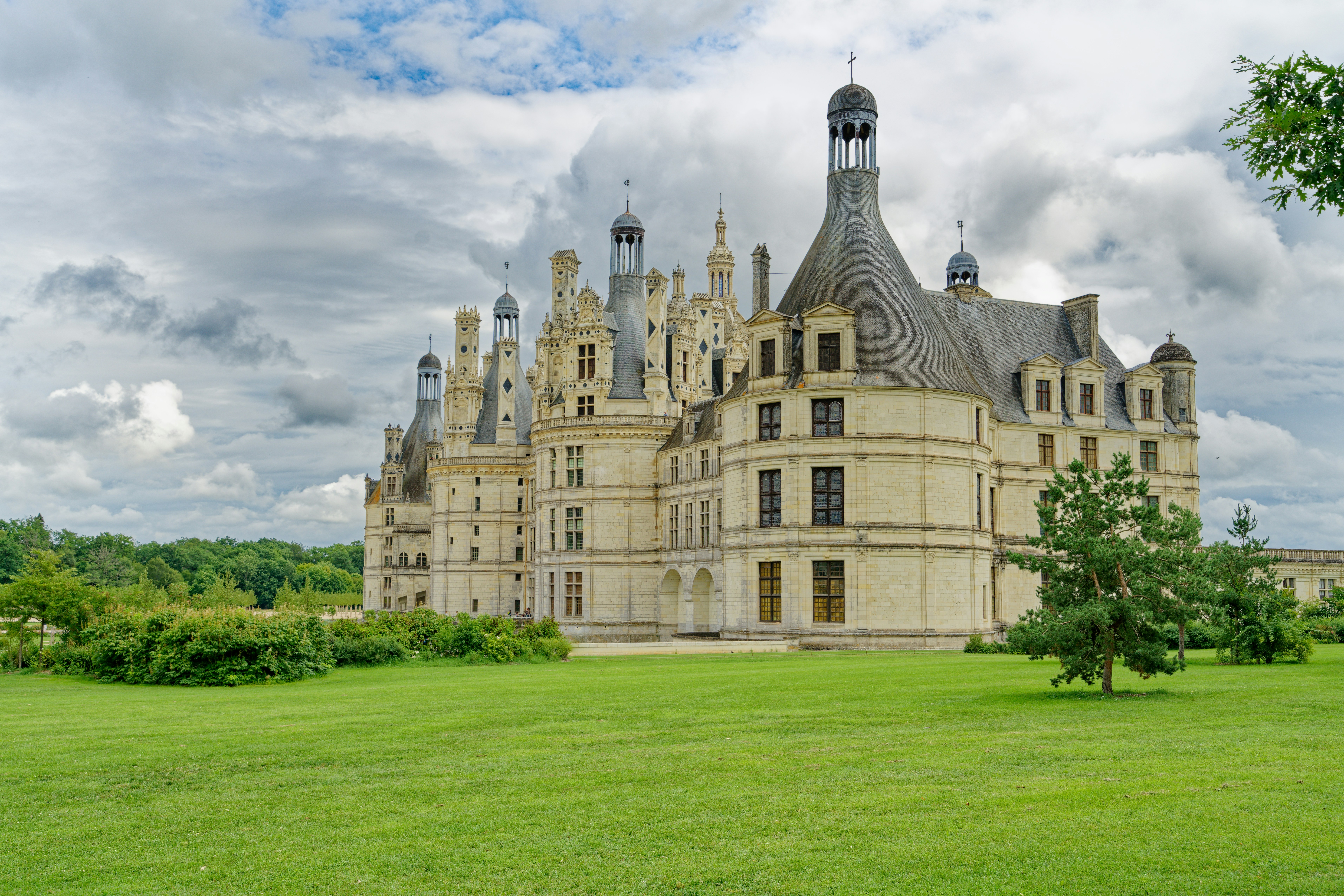 #90
#90Rated #90 of 100
Loire Valley Chateaux Cycling Route, France
#loirevalleychateauxcyclingroute ◆ Cycling Tours79 /100La Loire a Velo's flat, dedicated paths link the Loire Valley's great chateaux, threading past Chambord's fairy-tale turrets, Chenonceau's arches over the Cher and Amboise's clifftop fortress.
Riders pass through stone villages, vineyards and troglodyte cave dwellings carved into tufa cliffs along the way.
Short, modular loops between 10 and 45km make it easy to see one chateau or several in a single day.
How does it rate
CrowdsRomanceCash RequiredDangerAccessibilityWhy you should go
Flat, dedicated paths connect some of Europe's most theatrical castles without ever touching traffic.
Why you shouldn't go
Chateau entry fees add up quickly if you visit more than one or two in a day.
Plan your visit
Best time to visitMay-June or September for mild weather and thinner chateau queues.Best time of dayMorning arrival at each chateau, ahead of coach-tour crowds.Getting thereTrain to Tours or Blois from Paris (about 1.5-2 hours); bike rental available at both stations.Entry costBike rental from EUR15/day; Chambord entry EUR16, Chenonceau EUR16Time needed1-3 days depending on chateaux visitedBookingBook ahead →Insider tip — Ride the Chambord-to-Cheverny loop before 10am to see Chambord's roofline reflected in its still moat before the wind picks up and coaches arrive. -
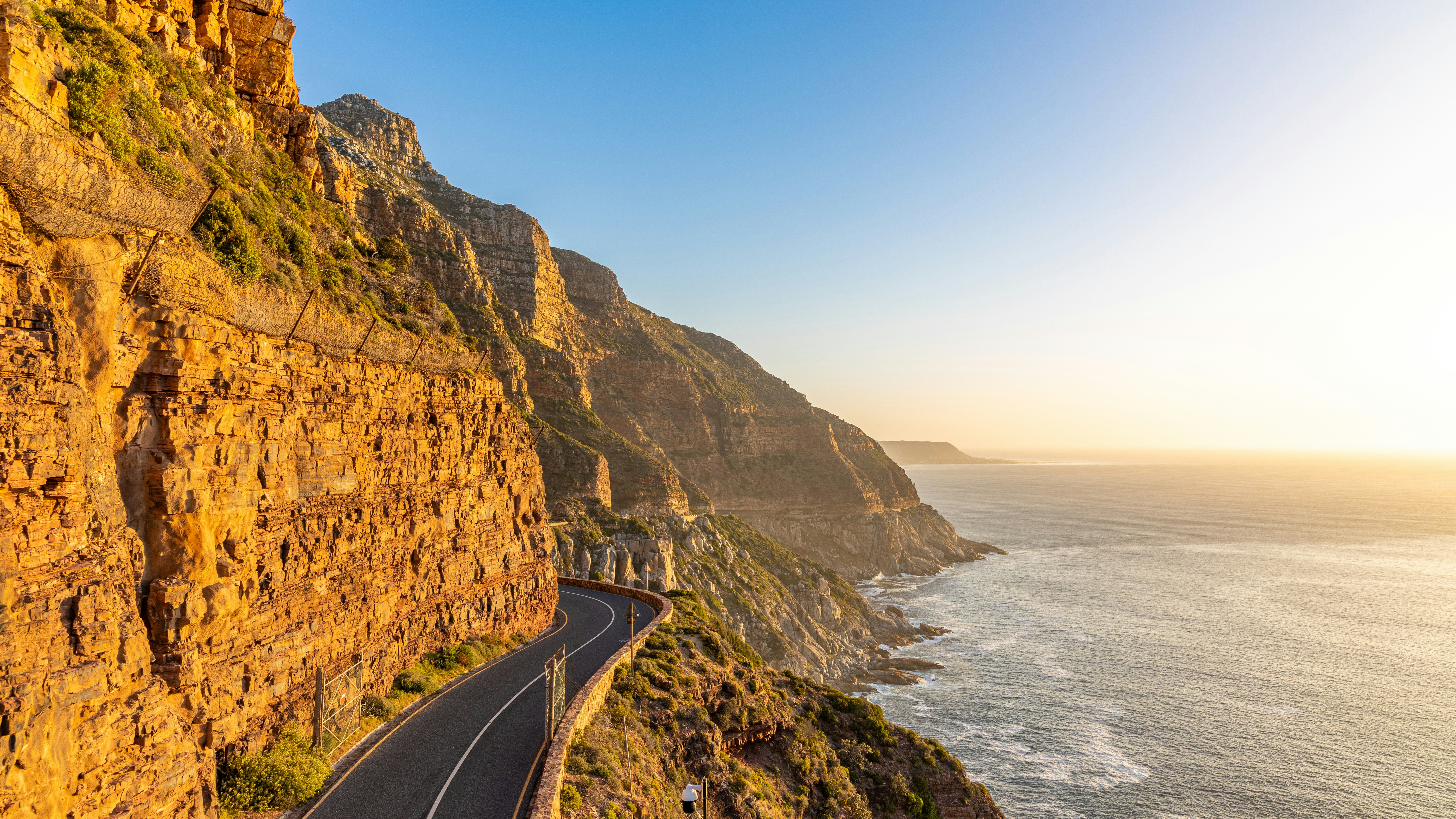 #9179 /100
Chapman's Peak Drive carves along sheer cliffs between Noordhoek and Hout Bay, the scenic centrepiece of a wider ride around the Cape Peninsula past Boulders Beach's penguins and the fynbos slopes near Cape Point.
The full loop, ridden each March by 35,000 cyclists in the Cape Town Cycle Tour, mixes ocean-cliff drama with quiet vineyard roads on the return leg.
Wind and open cliff edges make it a serious ride outside the closed-road race day.
How does it rate
CrowdsRomanceCash RequiredDangerAccessibilityWhy you should go
Few rides anywhere combine sheer ocean cliffs, penguins and vineyard roads in one loop.
Why you shouldn't go
Chapman's Peak Drive has a toll, gets strong crosswinds, and shares narrow lanes with tour traffic outside race day.
Plan your visit
Best time to visitNov-Mar for dry summer weather; the Cape Town Cycle Tour itself runs each March.Best time of dayEarly morning for calmer wind and cooler temperatures on exposed cliff sections.Getting thereFly to Cape Town; hire a road bike in the city or join a guided Peninsula tour with vehicle support.Entry costChapman's Peak toll approx ZAR 55/car (cyclists often free); bike rental from ZAR 350/dayTime neededFull day for the full Peninsula loopBookingBook ahead →Insider tip — Ride Chapman's Peak from Hout Bay toward Noordhoek for the classic tailwind direction, and check the toll road's status first, since it closes after heavy rain or rockfall risk. -
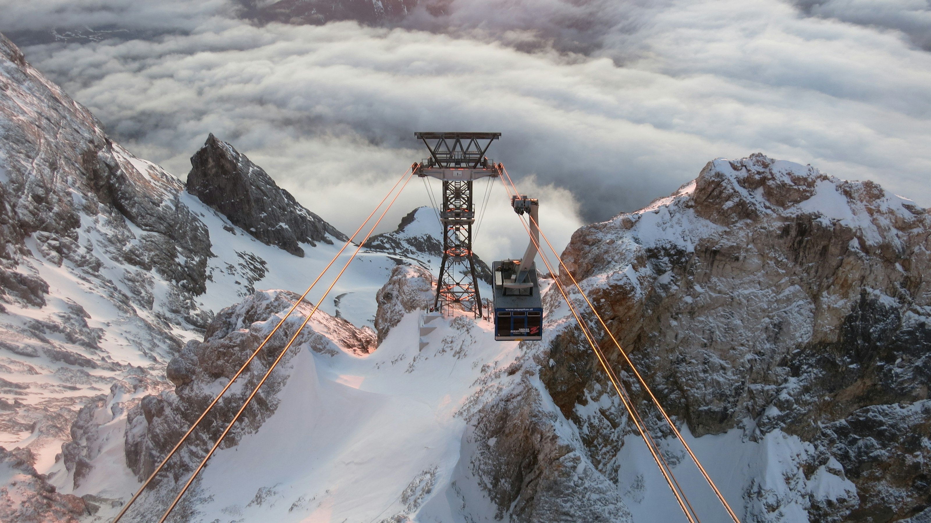 #9279 /100
The Zugspitze is Germany's highest peak, and a cable car climbs almost straight from the valley town of Garmisch-Partenkirchen to its summit, where the view on a clear day takes in more than 400 peaks across Germany, Austria, Switzerland, and Italy.
A small glacier survives near the top, along with a ski area that operates into summer, and the border with Austria runs directly across the summit platform.
How does it rate
CrowdsRomanceCash RequiredDangerAccessibilityWhy you should go
Stepping out of a cable car onto a summit with views into four countries, with zero hiking required, is hard to beat.
Why you shouldn't go
Cloud cover rolls in quickly at altitude and can cut the four-country view down to whiteout without warning.
Plan your visit
Best time to visitJune–September for the clearest summit views; winter for skiing.Best time of dayEarly morning, for the clearest air before afternoon cloud builds around the peak.Getting thereFly to Munich; 1.5-hour train or drive to Garmisch-Partenkirchen, then the Zugspitze cable car.Entry costPaid cable car ticket; prices are higher in winter ski season.Time neededHalf a dayInsider tip — Ride up the newer Eibsee cable car and come down via the cogwheel railway (or vice versa) to see the mountain from two different angles. -
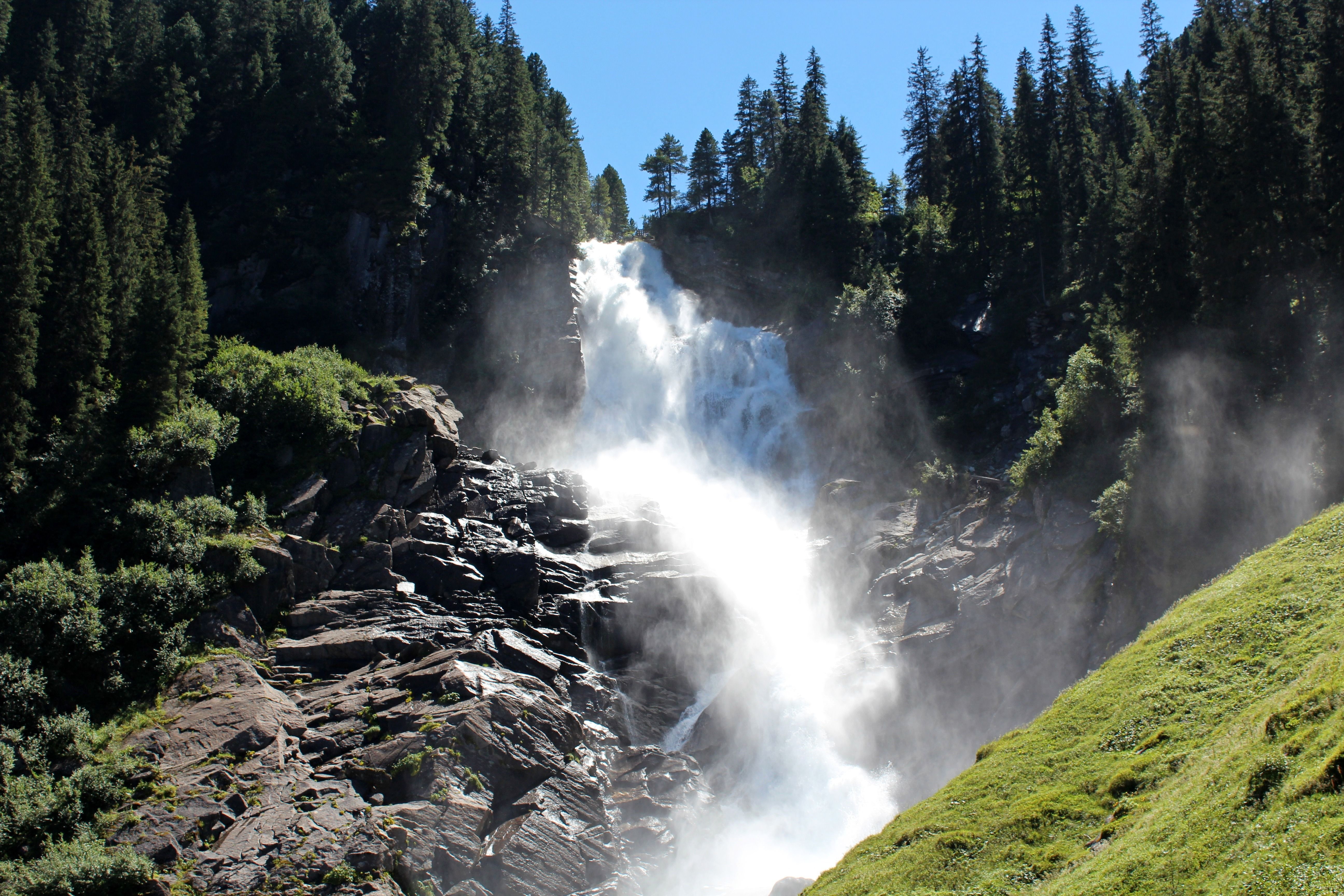 #9379 /100
The Krimml Waterfalls drop 380 metres in three tiers down a forested mountainside in the Hohe Tauern National Park, among the highest waterfalls in Europe.
A well-graded path climbs alongside the falls through spray-cooled air, with viewing platforms at each tier and a small waterfall-themed nature trail for families lower down.
On sunny mornings, rainbows form regularly in the mist at the base of the lower tier.
How does it rate
CrowdsRomanceCash RequiredDangerAccessibilityWhy you should go
Walking right alongside a 380-metre waterfall on a path built specifically to bring you close to each tier is a genuinely dramatic short hike.
Why you shouldn't go
The full path up all three tiers is a real, steady climb, and spray keeps sections of it wet and cool even in summer heat.
Plan your visit
Best time to visitMay–June, when snowmelt gives the falls their fullest flow.Best time of dayMorning, when the sun angle is more likely to catch rainbows in the spray at the lower falls.Getting thereFly to Salzburg; roughly 1.5-hour drive southwest into the Hohe Tauern National Park.Entry costPaid entry to the waterfall trail (Wasserfallweg).Time needed2–3 hours for the full trailInsider tip — The lower tier's viewing platform is the most crowded — continue up to the middle and upper tiers for quieter views and just as much drama. -
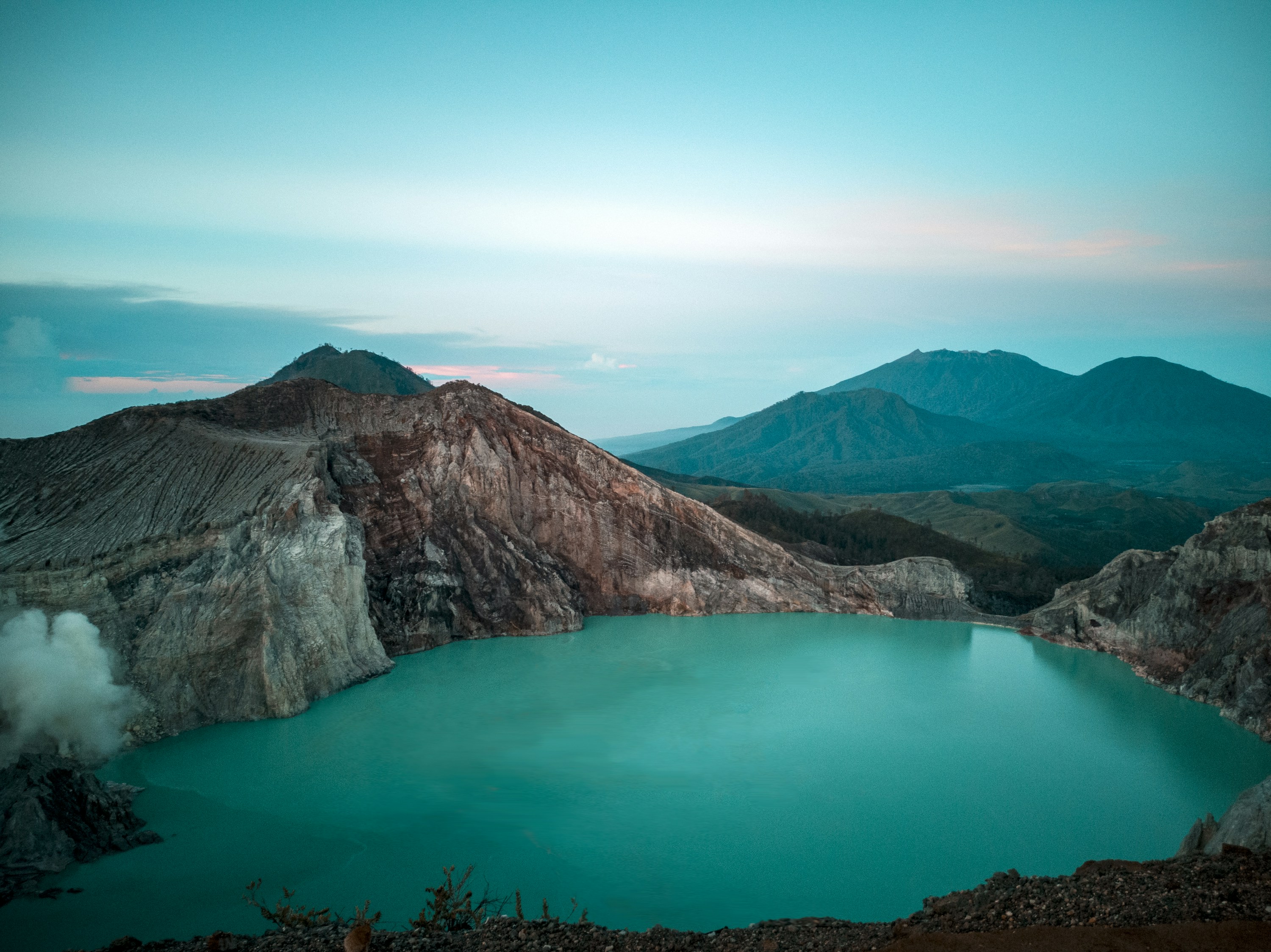 #9479 /100
Kawah Ijen's crater holds the world's largest highly acidic lake, a turquoise expanse ringed by sulfur-mining tunnels, and after dark, electric-blue flames flicker where sulfuric gas ignites on contact with air.
Miners still carry raw sulfur out by hand in baskets, a punishing job visitors pass on the trail up.
Most people climb in the dark to catch the blue fire before it fades with the sunrise, then look down into the lake itself from the crater rim.
How does it rate
CrowdsRomanceCash RequiredDangerAccessibilityWhy you should go
One of only a few places on Earth to see electric-blue volcanic flames, above the world's largest acid crater lake.
Why you shouldn't go
Sulfuric gas is genuinely hazardous; the trek is a steep, cold, 1-2am start, and gas masks only help so much.
Plan your visit
Best time to visitApril-October, dry season, for a stable trail and clearer blue-flame visibility.Best time of day1am-3am departure to see the blue fire before dawn; the flames aren't visible in daylight.Getting thereFly to Banyuwangi or Surabaya; the Paltuding trailhead is roughly 1.5-2 hours by road from Banyuwangi.Entry costAround 350,000 IDR (~$22) covering entry, gas mask rental, and basic transport on tour packagesTime needed5-6 hours round trip, including the sunrise returnInsider tip — Get a medical check certificate in Banyuwangi a few days ahead, required for the crater descent; rent a proper gas mask on-site rather than the cheap fabric ones sold at the gate. -
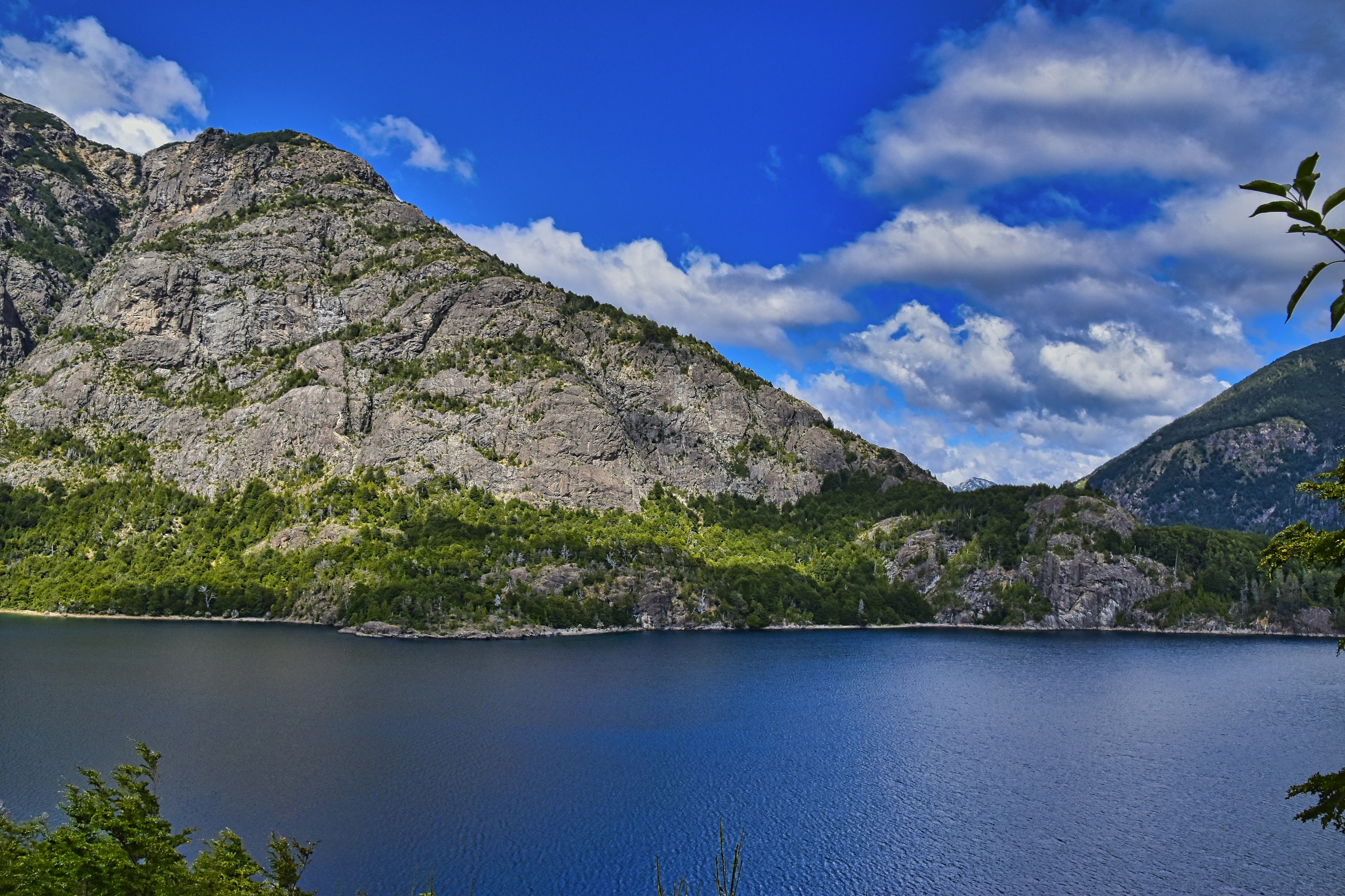 #9579 /100
San Carlos de Bariloche sits on the shore of Nahuel Huapi Lake in Argentine Patagonia, a Swiss-styled town backed by the Andes and a gateway to a national park of forested peaks and turquoise lakes.
Chocolate shops line the Centro Cívico, while the Circuito Chico drive and the Cerro Campanario cable car reach panoramic viewpoints over the lake district.
It doubles as a ski base in winter and a hiking and mountain-biking hub in summer.
How does it rate
CrowdsRomanceCash RequiredDangerAccessibilityWhy you should go
A lake-and-mountain town that works as both a Patagonian hiking base and a genuine destination in its own right.
Why you shouldn't go
Peak ski season (July) and summer school holidays (January) both bring heavy crowds and inflated prices.
Plan your visit
Best time to visitDecember-March for hiking and lake activities; July-August for skiing at Cerro CatedralBest time of dayLate afternoon at Cerro Campanario for lake views before sunsetGetting thereFly to Bariloche (San Carlos de Bariloche Airport) from Buenos Aires, about 2 hoursEntry costFree to explore town; Cerro Campanario cable car and national park activities charge separatelyTime needed3-4 daysInsider tip — Drive the Circuito Chico in the early morning to have the lakeside viewpoints to yourself before tour buses fill the pull-offs. -
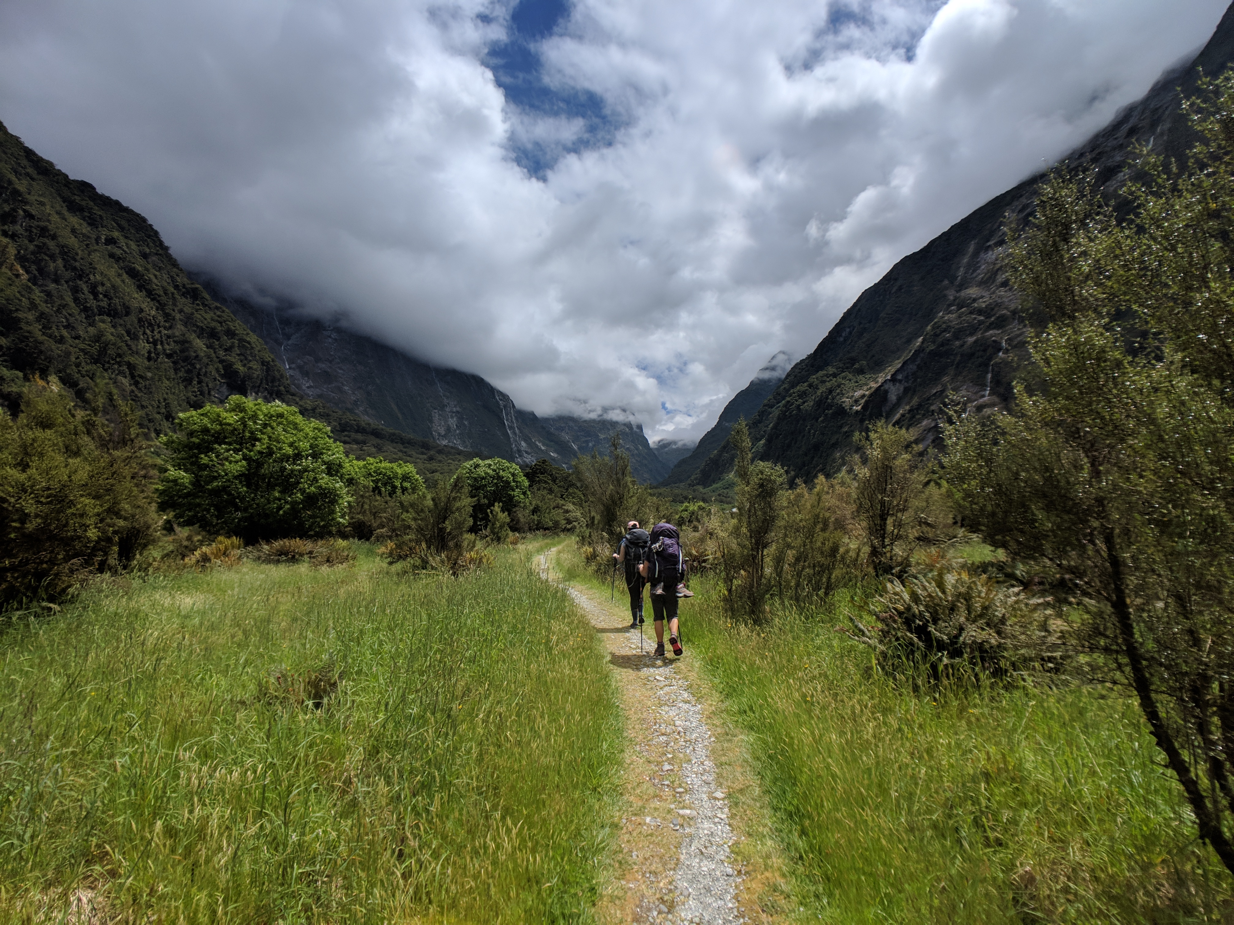 #9678 /100
New Zealand's best-known Great Walk runs 53.
5km through Fiordland from Lake Te Anau's Clinton Valley, over the alpine Mackinnon Pass, down to Milford Sound.
Along the way are hanging valleys, the country's tallest waterfall at Sutherland Falls, and dense temperate rainforest.
Only 40 independent walkers a day are allowed onto the one-way trail, and hut bookings for the season sell out within minutes.
How does it rate
CrowdsRomanceCash RequiredDangerAccessibilityWhy you should go
Crossing Mackinnon Pass with cloud pouring through the valley below, then descending rainforest to Milford Sound.
Why you shouldn't go
Booking is brutally competitive - a whole season's huts can sell out in under a minute when releases open.
Plan your visit
Best time to visitGreat Walks season, late October to April; book huts the moment reservations open.Best time of dayEarly morning at Mackinnon Pass, before afternoon cloud rolls in.Getting thereFly or drive to Te Anau; boat across Lake Te Anau to Glade Wharf, the trailhead.Entry costNZD 106-152 per hut per night (resident/non-resident rate), for 3 nights.Time needed4 days / 3 nightsBookingBook ahead →Insider tip — Be online the exact moment bookings open (around May for the following season) - popular dates vanish within a minute. -
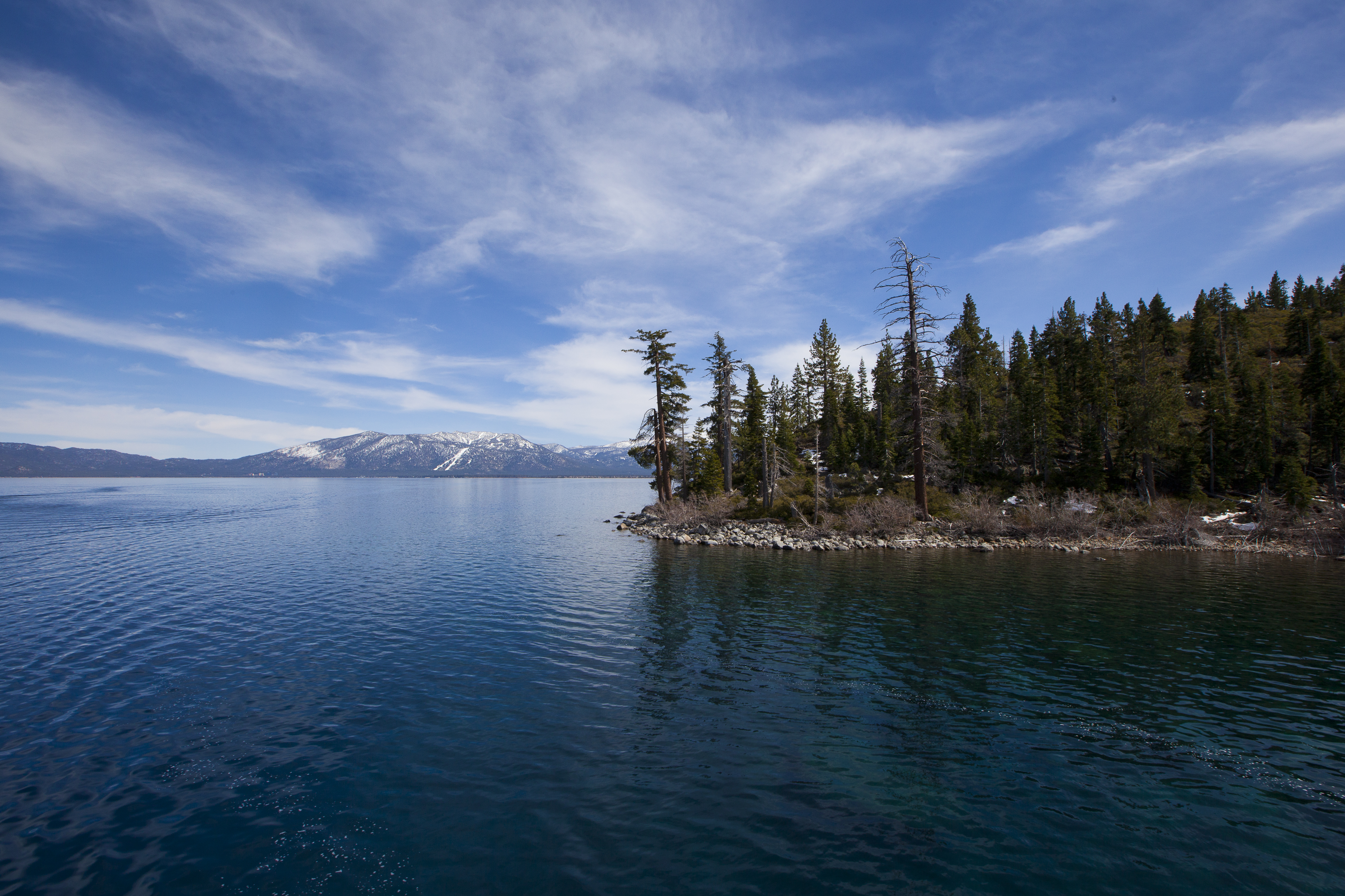 #9778 /100
Lake Tahoe straddles the border between California and Nevada in the Sierra Nevada mountains, its remarkable clarity allowing visibility to a depth of over 20 metres.
Surrounded by ski resorts, pine forests, and granite peaks, it offers spectacular hiking and water sports in summer and world-class skiing in winter.
How does it rate
CrowdsRomanceCash RequiredDangerAccessibilityWhy you should go
The clarity of Lake Tahoe's water and the surrounding mountain scenery make it one of the most beautiful alpine lakes in North America; the sunsets across the lake are spectacular.
Why you shouldn't go
The lake is heavily developed on both the California and Nevada shores; traffic congestion and parking can be severe during summer weekends.
Plan your visit
Best time to visitJune-September for swimming/hiking, Dec-March for skiingBest time of daySunrise for calm, mirror-like waterGetting there~1hr drive from Reno, ~3.5hrs from San FranciscoEntry costFree; some beaches charge for parkingTime needed2-3 daysInsider tip — Emerald Bay viewpoint is the most photographed spot on the lake; get there early for parking in summer -
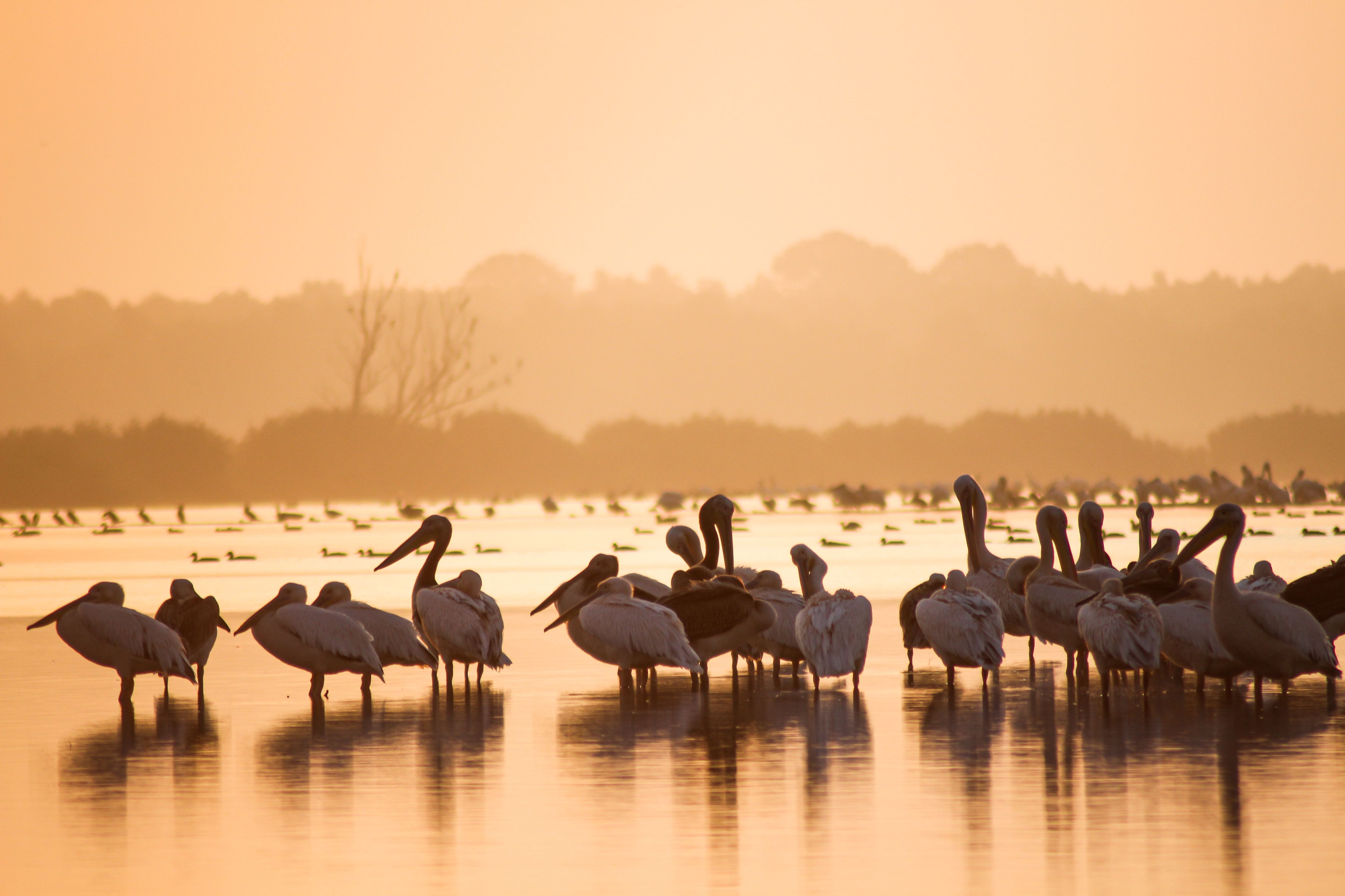 #9878 /100
Europe's largest and best-preserved river delta is a maze of reed-lined channels, lakes and marshland where the Danube meets the Black Sea.
Boat trips glide past pelicans, herons and over 300 other bird species in a UNESCO-protected wilderness.
Traditional fishing villages built on stilts add a lived-in texture to the wildlife-watching, and the sheer scale of untouched wetland is rare anywhere in Europe.
How does it rate
CrowdsRomanceCash RequiredDangerAccessibilityWhy you should go
Untouched wetland wilderness with Europe's richest concentration of birdlife.
Why you shouldn't go
Getting deep into the delta requires a guided boat and more than a day trip to do justice.
Plan your visit
Best time to visitMay–June for peak birdlife and mild weather, before summer heat and mosquitoes.Best time of dayEarly morning, when birds are most active and the water is calm.Getting thereFly or drive to Tulcea, then transfer onto a guided boat into the delta channels.Entry costFree to enter; guided boat tours from around €40 per person.Time neededFull day, or 2–3 days to explore properly.Insider tip — Book a small private boat rather than a large tour vessel — it can reach narrower channels where the wildlife actually is. -
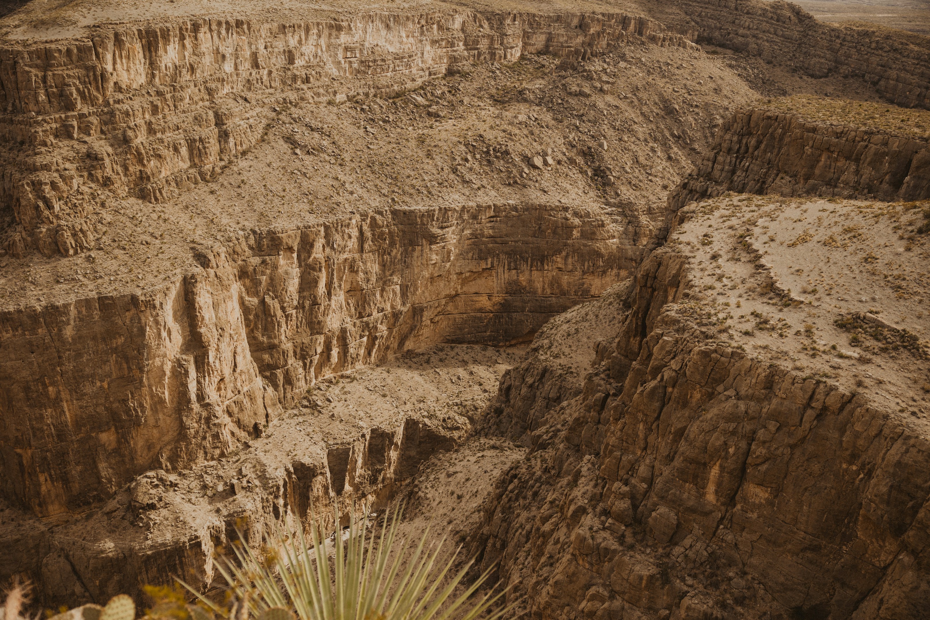 #9978 /100
Mexico's Copper Canyon is actually a network of canyons in the Sierra Madre Occidental, several deeper than the Grand Canyon, cut by rivers through pine forest and red rock.
The main way to see it is the Chepe train, which crosses 37 bridges and passes through 86 tunnels on its way between the desert lowlands and the pine-covered rim.
Small Rarámuri (Tarahumara) communities still live within the canyon system.
How does it rate
CrowdsRomanceCash RequiredDangerAccessibilityWhy you should go
The Chepe train ride itself, crossing dozens of bridges and tunnels along the canyon rim, is as much the experience as the views.
Why you shouldn't go
It's a long way from anywhere — reaching the canyon takes a full day of travel each way from most starting points.
Plan your visit
Best time to visitOctober–April, avoiding summer's heat and rainy season.Best time of dayMorning departures on the Chepe train give the best light along the canyon rim.Getting thereFly to Chihuahua or Los Mochis, then take the Chepe train, which runs between both cities through the canyon.Entry costTrain tickets and lodge stays are the main costs; viewpoints themselves are free.Time needed2–3 daysInsider tip — Book a seat on the right-hand side heading from Los Mochis to Chihuahua for the best canyon views. -
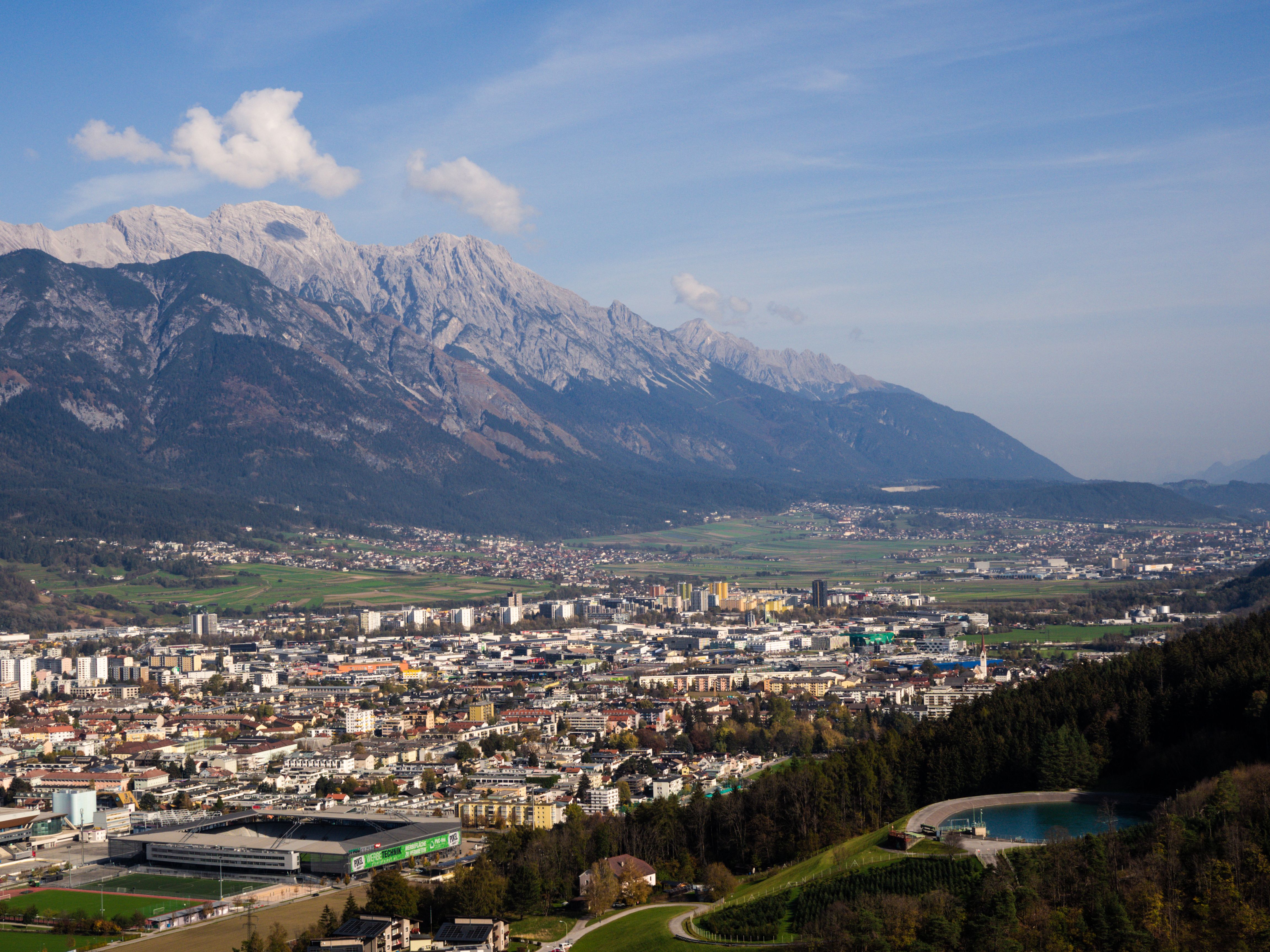 #10078 /100
The Nordkette range rises so steeply above Innsbruck that a cable car runs directly from the edge of the old town to a mountain station above 2,300 metres in under 20 minutes.
From the top, the view takes in the Alpine capital below and rows of peaks stretching into Italy and Germany, and hiking trails and via ferrata routes continue further up the ridge.
How does it rate
CrowdsRomanceCash RequiredDangerAccessibilityWhy you should go
Going from café tables in the old town to a 2,300-metre alpine ridge in under 20 minutes, without leaving the city's public transport, is remarkable.
Why you shouldn't go
The upper station can be windy and much colder than the valley floor, so pack layers even on a warm city day.
Plan your visit
Best time to visitJune–September for hiking; December–March for skiing directly above the city.Best time of dayLate afternoon, for clear light on the peaks and fewer crowds on the cable car.Getting thereFly to Innsbruck; the Nordkettenbahn cable car station is a short walk or tram ride from the old town.Entry costPaid cable car ticket; return fares are cheaper than one-way plus return.Time neededHalf a dayInsider tip — Ride the funicular partway up to Hungerburg first for city views, then transfer to the second cable car stage for the full alpine panorama.


More from The World
-
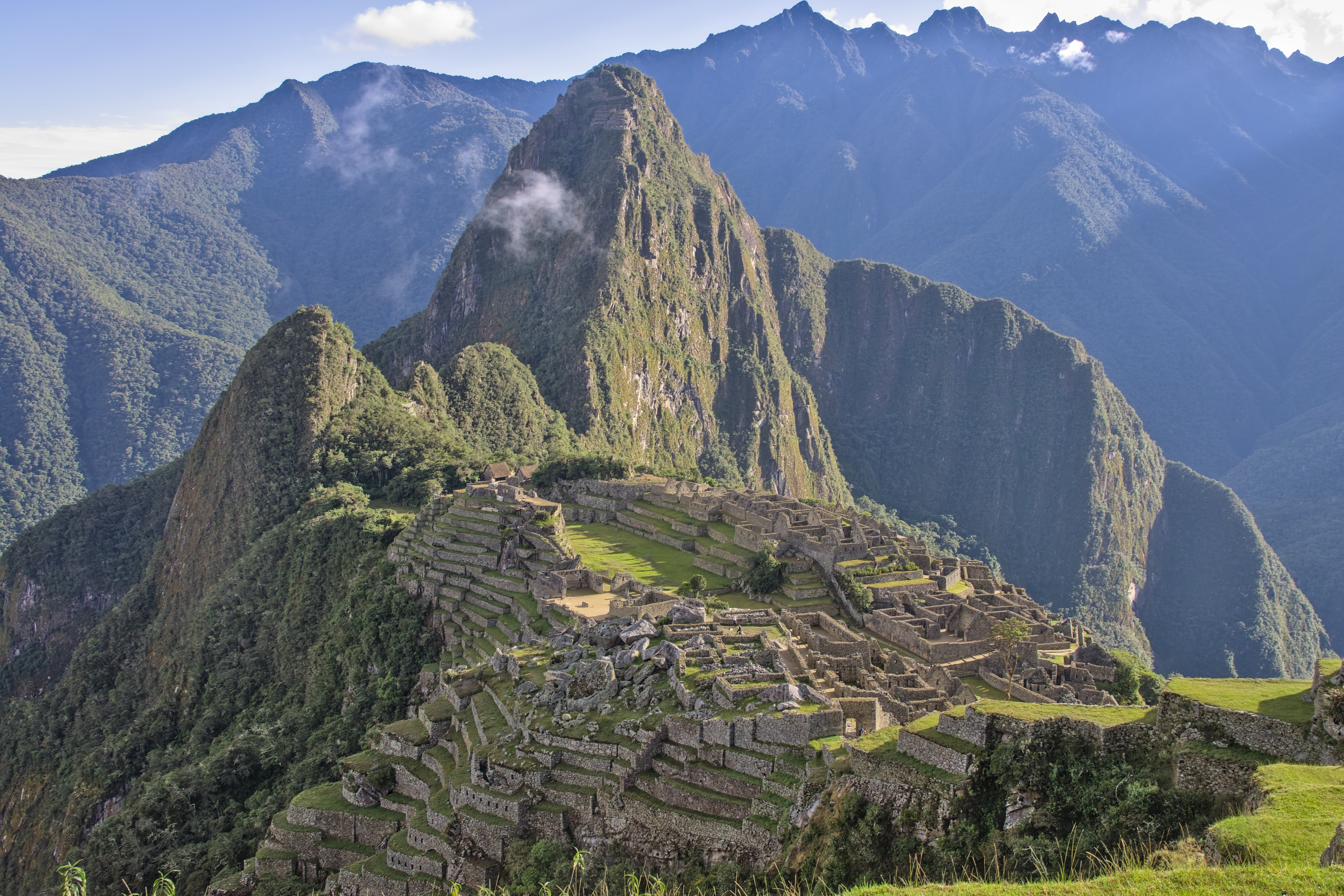
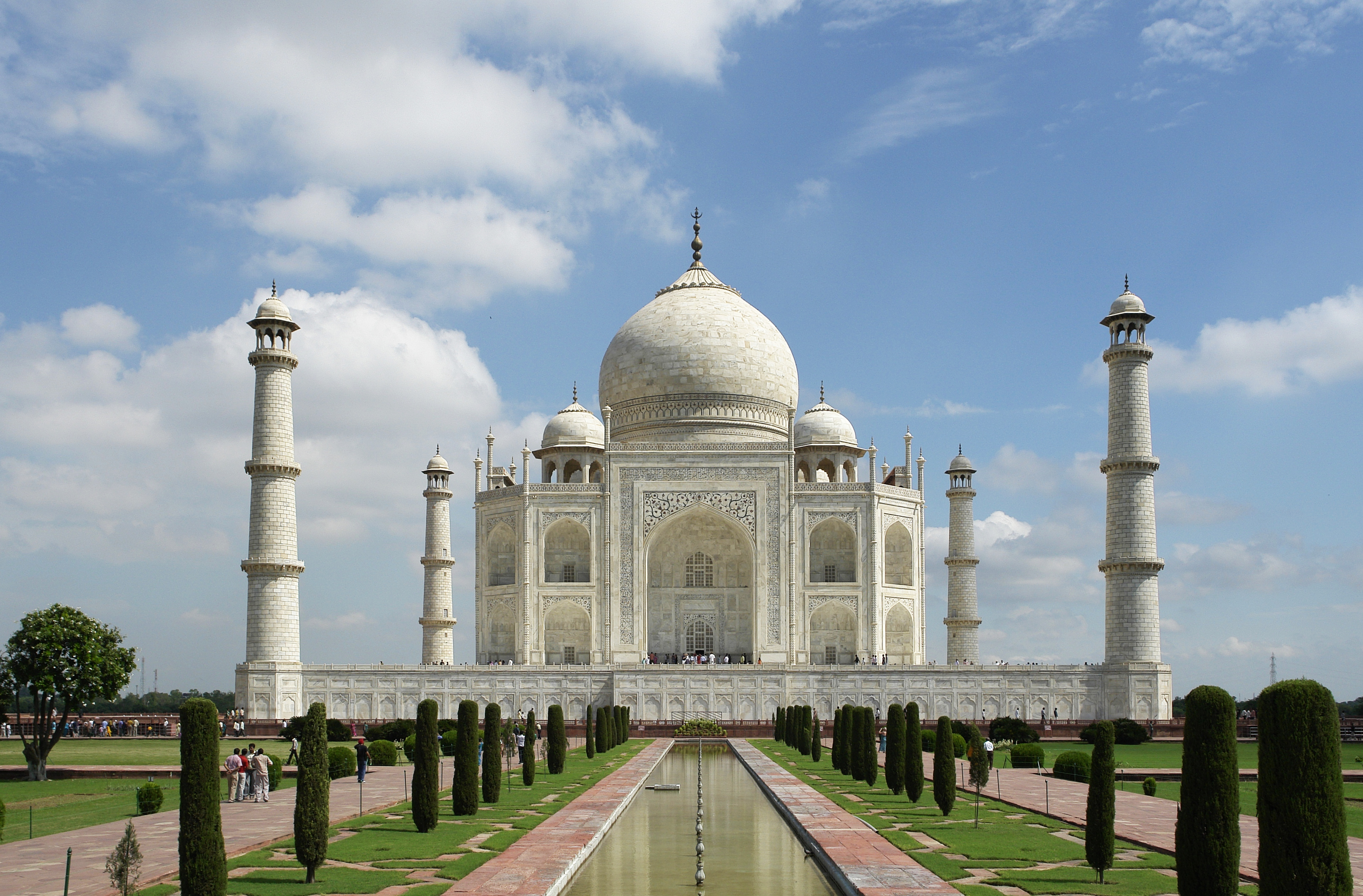
More Adventure spots
-

How a score is built
One score out of 100, five criteria behind it
Every place is rated 1–5 on each of the criteria below, then combined into a single score out of 100. It's calculated by us, the same way every time — not an average of traveller reviews or social votes.
Crowds
How many people you'll be sharing it with, and at what time of day.
Romance
How well it suits a couple, a proposal, or a quiet moment together.
Cash required
Entry fees, permits, guides, rentals — what it actually costs to do it.
Danger
Physical risk involved, from a slippery viewpoint to genuine hazard.
Accessibility
How far off the beaten path it is, and how hard it is to actually reach.

