-
 #1
#1Rated #1 of 10
Serra de Tramuntana Cycling Route, Spain
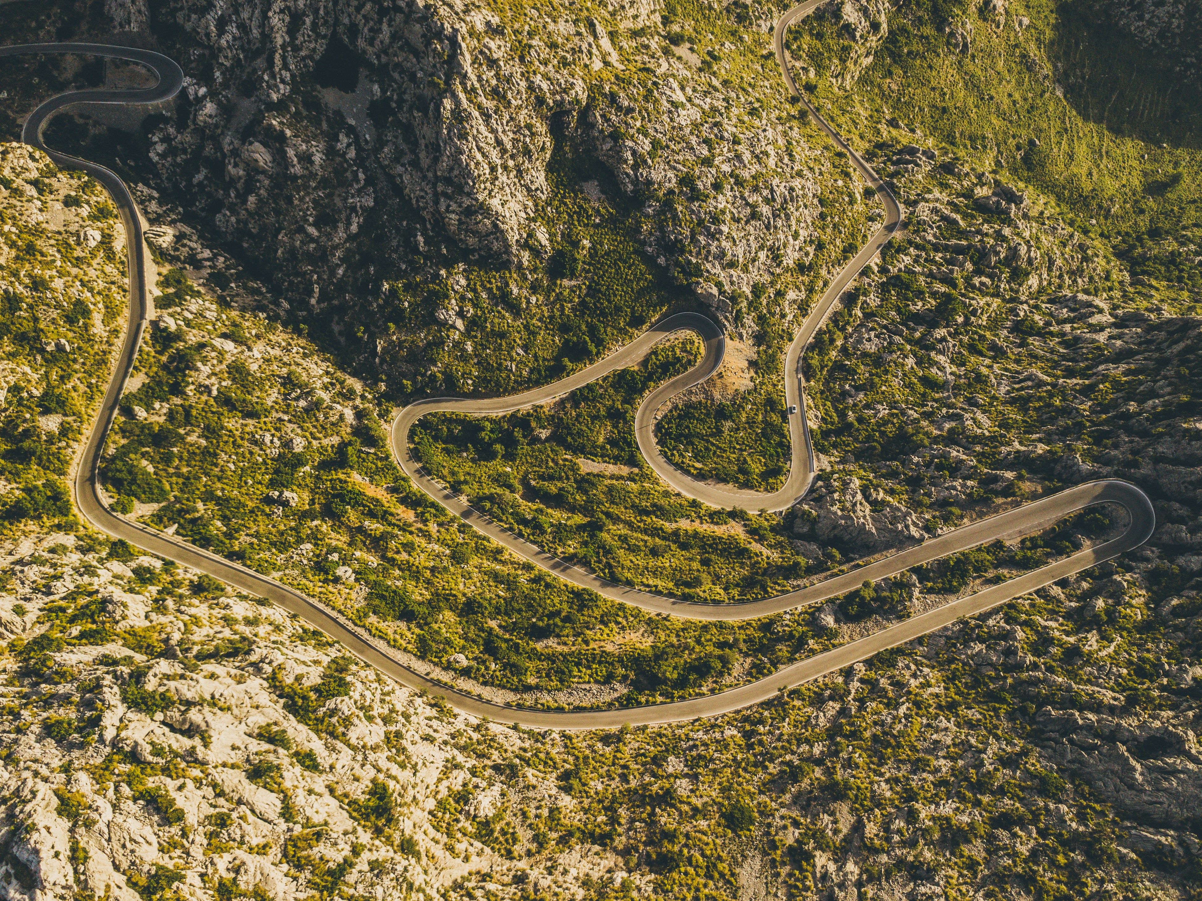
#serradetramuntanacyclingroute ◆ Cycling Tours81 /100The Sa Calobra climb switchbacks up 26 hairpins through the limestone Serra de Tramuntana, including a spiralling loop where the road passes beneath itself, before dropping to a hidden cove on Mallorca's northwest coast.
Wider routes through the range link terraced olive groves, the monastery at Lluc and the ridge-top village of Deia.
The road is a pilgrimage climb for road cyclists and one of Europe's most celebrated stretches of tarmac.
How does it rate
CrowdsRomanceCash RequiredDangerAccessibilityWhy you should go
A legendary hairpin climb through dramatic limestone mountains that road cyclists travel the world to ride.
Why you shouldn't go
Narrow, exposed switchbacks shared with tour buses and cars make the descent genuinely dangerous.
Plan your visit
Best time to visitApr-May or Sep-Oct, avoiding summer heat and the busiest cycling-season crowds.Best time of dayEarly morning start, both for cooler temperatures and lighter traffic on the hairpins.Getting thereFly to Palma de Mallorca; drive or ride roughly 90 minutes to the Coll dels Reis start point.Entry costFree to ride; road bike rental from EUR20-30/dayTime neededHalf a day for the climb and descentInsider tip — Descend to Sa Calobra cove for a swim before the climb back up, and start at dawn to have the famous spiral hairpin free of tour coaches. -
 #280 /100
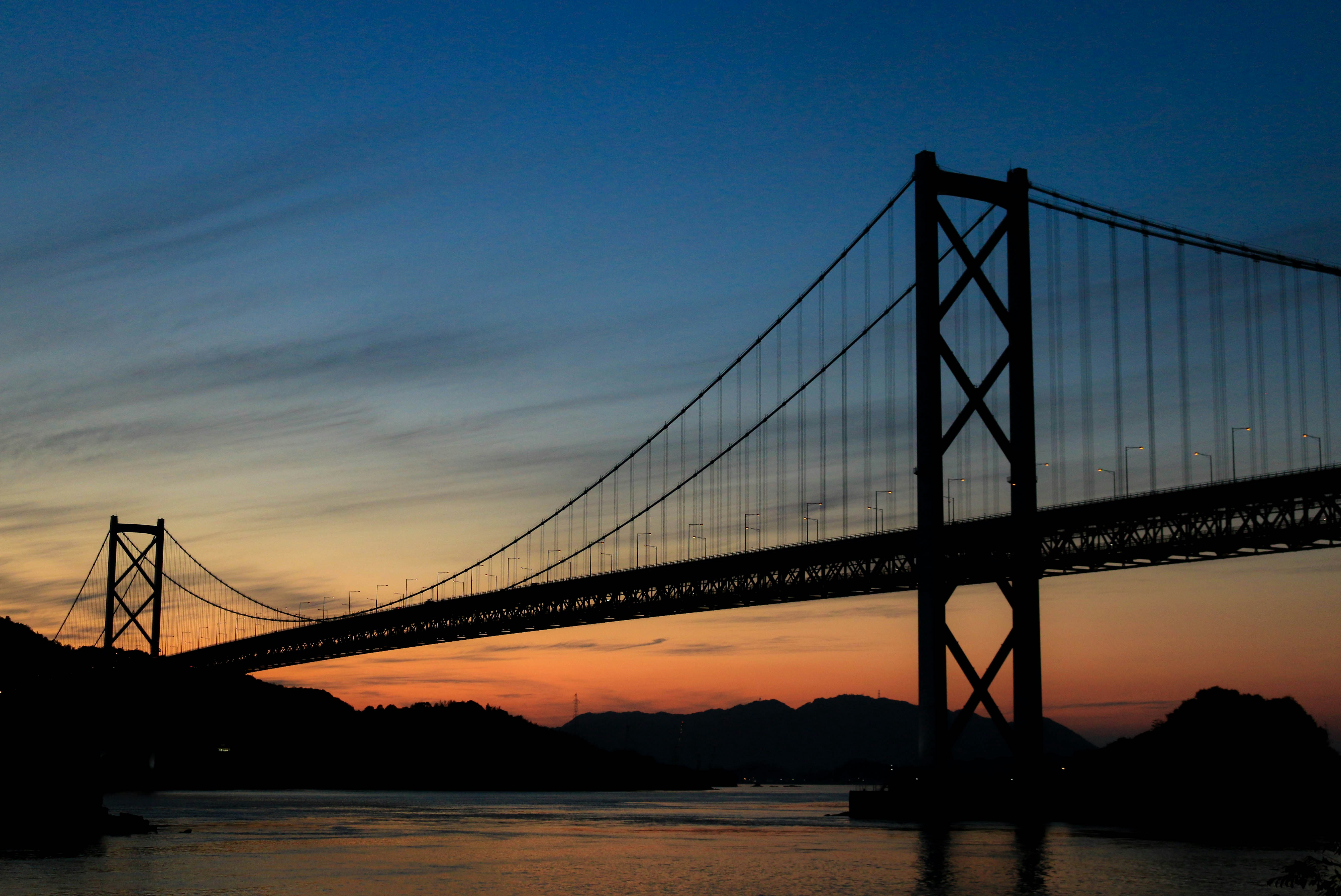
A signed cycle path links Onomichi on Honshu to Imabari on Shikoku across six small islands in the Seto Inland Sea, crossing seven bridges over open water.
Riders follow dedicated blue lane markings past citrus groves, fishing harbours and turquoise straits, with the cable-stayed Tatara Bridge and the towering Kurushima-Kaikyo suspension bridge as centrepiece crossings.
Rental terminals at either end let you start and finish where you like.
How does it rate
CrowdsRomanceCash RequiredDangerAccessibilityWhy you should go
Cycling across seven bridges over the Seto Inland Sea between two islands is a ride found nowhere else on Earth.
Why you shouldn't go
The full 70km crossing is a demanding full day in the saddle, and summer humidity can be punishing.
Plan your visit
Best time to visitMarch-May or Oct-Nov for mild temperatures and clear straits views.Best time of dayEarly morning departure to finish before afternoon heat builds.Getting thereFly to Hiroshima or Takamatsu; train to Onomichi or Imabari, then collect a rental bike at the terminal.Entry costBike rental from Y3,000/day; bridge tolls Y500 total (waived through Mar 2026)Time neededFull day (4-10 hours riding)BookingBook ahead →Insider tip — Rent from a Giant terminal for one-way drop-off between Onomichi and Imabari, and stop at the Tatara Bridge rest area for the best photo of the cable stays against the strait. -
 #3
#3Rated #3 of 10
Loire Valley Chateaux Cycling Route, France
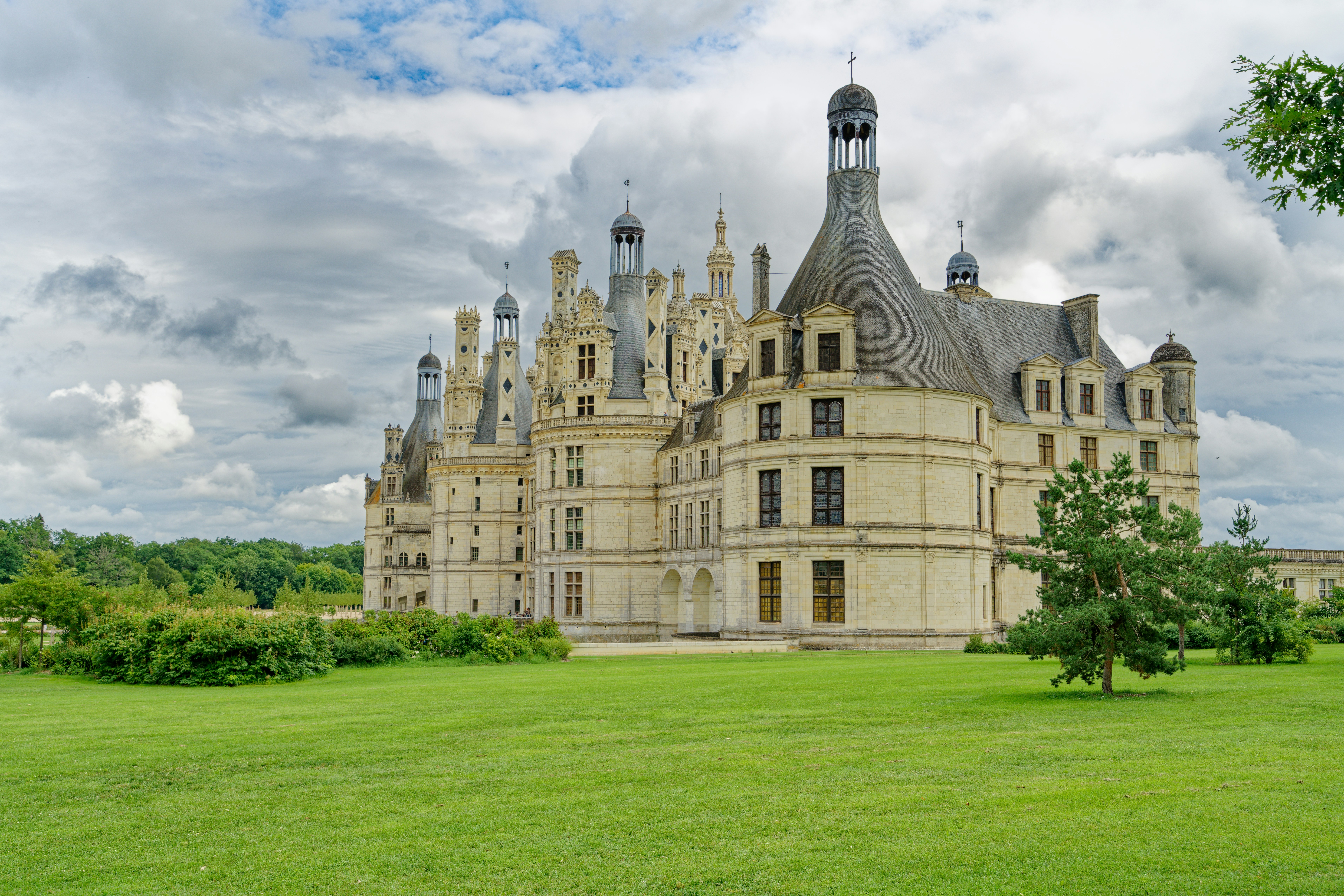
#loirevalleychateauxcyclingroute ◆ Cycling Tours79 /100La Loire a Velo's flat, dedicated paths link the Loire Valley's great chateaux, threading past Chambord's fairy-tale turrets, Chenonceau's arches over the Cher and Amboise's clifftop fortress.
Riders pass through stone villages, vineyards and troglodyte cave dwellings carved into tufa cliffs along the way.
Short, modular loops between 10 and 45km make it easy to see one chateau or several in a single day.
How does it rate
CrowdsRomanceCash RequiredDangerAccessibilityWhy you should go
Flat, dedicated paths connect some of Europe's most theatrical castles without ever touching traffic.
Why you shouldn't go
Chateau entry fees add up quickly if you visit more than one or two in a day.
Plan your visit
Best time to visitMay-June or September for mild weather and thinner chateau queues.Best time of dayMorning arrival at each chateau, ahead of coach-tour crowds.Getting thereTrain to Tours or Blois from Paris (about 1.5-2 hours); bike rental available at both stations.Entry costBike rental from EUR15/day; Chambord entry EUR16, Chenonceau EUR16Time needed1-3 days depending on chateaux visitedBookingBook ahead →Insider tip — Ride the Chambord-to-Cheverny loop before 10am to see Chambord's roofline reflected in its still moat before the wind picks up and coaches arrive. -
 #479 /100
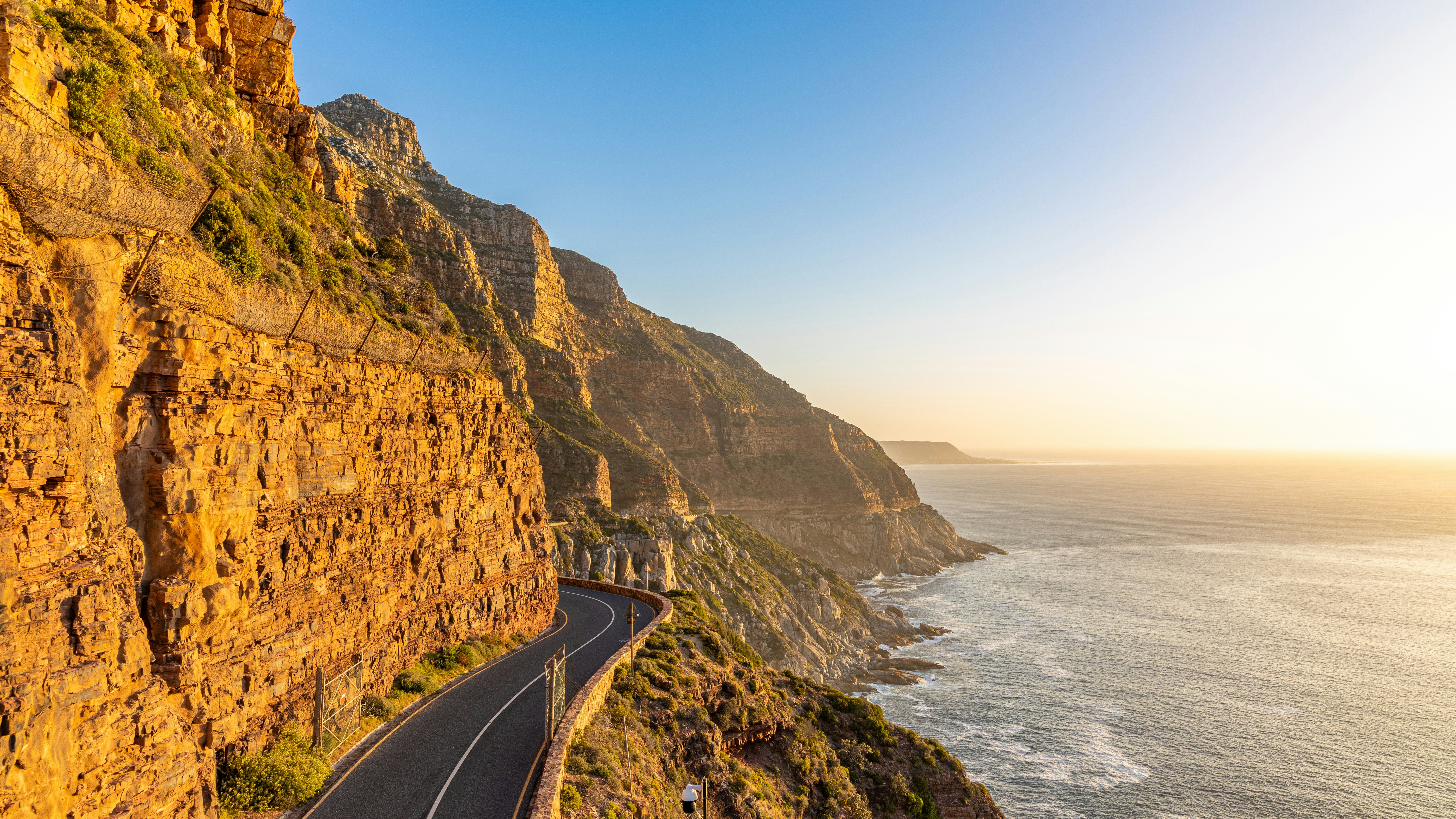
Chapman's Peak Drive carves along sheer cliffs between Noordhoek and Hout Bay, the scenic centrepiece of a wider ride around the Cape Peninsula past Boulders Beach's penguins and the fynbos slopes near Cape Point.
The full loop, ridden each March by 35,000 cyclists in the Cape Town Cycle Tour, mixes ocean-cliff drama with quiet vineyard roads on the return leg.
Wind and open cliff edges make it a serious ride outside the closed-road race day.
How does it rate
CrowdsRomanceCash RequiredDangerAccessibilityWhy you should go
Few rides anywhere combine sheer ocean cliffs, penguins and vineyard roads in one loop.
Why you shouldn't go
Chapman's Peak Drive has a toll, gets strong crosswinds, and shares narrow lanes with tour traffic outside race day.
Plan your visit
Best time to visitNov-Mar for dry summer weather; the Cape Town Cycle Tour itself runs each March.Best time of dayEarly morning for calmer wind and cooler temperatures on exposed cliff sections.Getting thereFly to Cape Town; hire a road bike in the city or join a guided Peninsula tour with vehicle support.Entry costChapman's Peak toll approx ZAR 55/car (cyclists often free); bike rental from ZAR 350/dayTime neededFull day for the full Peninsula loopBookingBook ahead →Insider tip — Ride Chapman's Peak from Hout Bay toward Noordhoek for the classic tailwind direction, and check the toll road's status first, since it closes after heavy rain or rockfall risk. -
 #5
#5Rated #5 of 10
Wachau Valley Danube Cycle Path, Austria
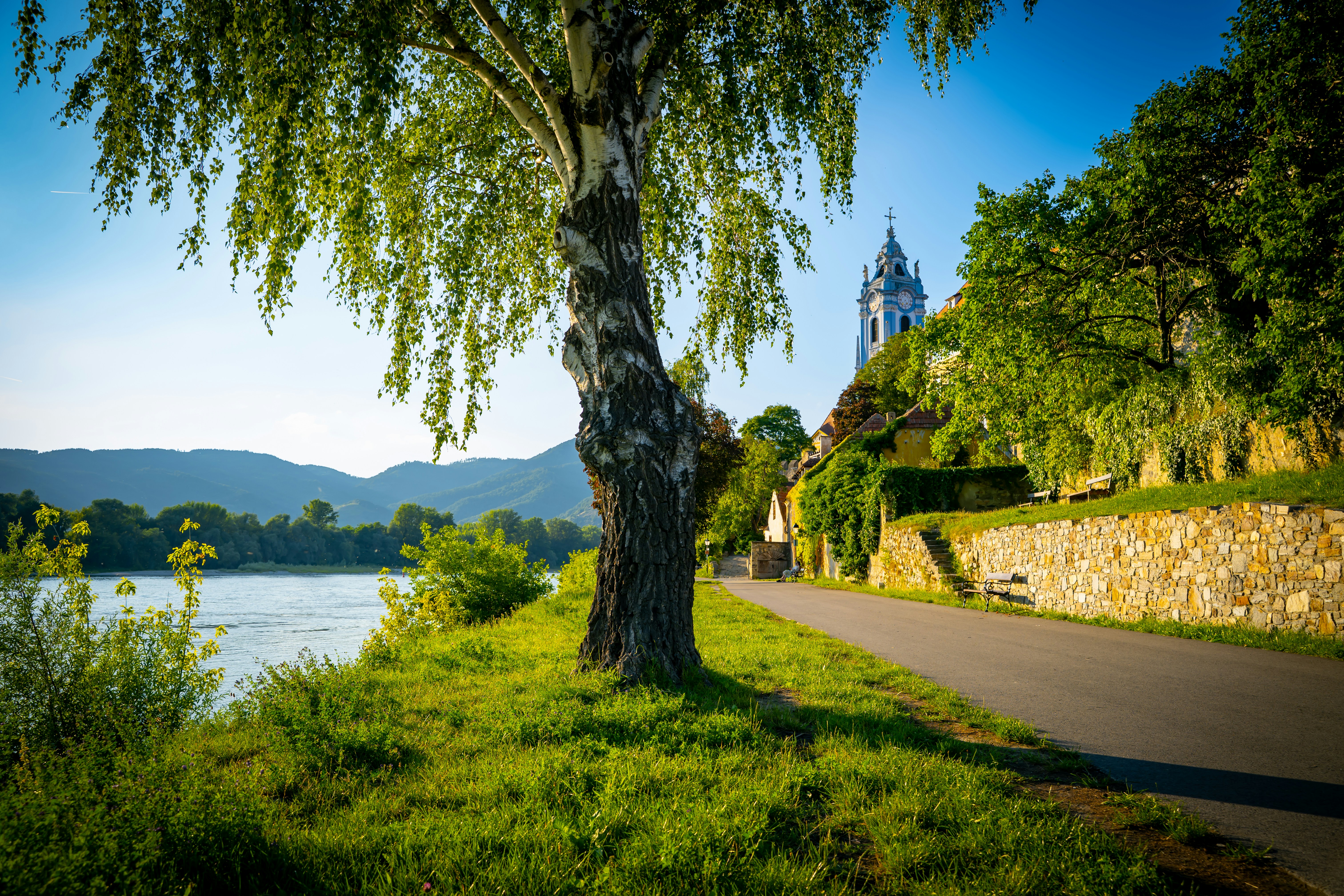
#wachauvalleydanubecyclepath ◆ Cycling Tours76 /100A flat, paved path traces the Danube's south bank through the Wachau, a UNESCO-listed valley of terraced vineyards, apricot orchards and medieval river towns between Melk and Krems.
Riders pass beneath Durnstein's ruined castle, where Richard the Lionheart was once imprisoned, while Melk's baroque abbey looms over the starting point.
The gentle downhill gradient and dedicated bike lane make it an easy half-day ride at any fitness level.
How does it rate
CrowdsRomanceCash RequiredDangerAccessibilityWhy you should go
A flat riverside ride past terraced vineyards, medieval towns and a baroque abbey with almost no effort required.
Why you shouldn't go
Peak summer weekends bring heavy path traffic between the popular towns.
Plan your visit
Best time to visitApril-May for apricot blossom, or September for the wine harvest.Best time of dayMorning start from Melk to reach Krems before lunchtime crowds.Getting thereTrain to Melk or Krems from Vienna (about 1 hour); bike rental available at both stations.Entry costBike rental from EUR15/day; the path itself is freeTime neededHalf a day (3-4 hours)BookingBook ahead →Insider tip — Ride Melk to Krems (downhill, with the current) rather than the reverse, and take the small ferry across the river to see Durnstein's castle ruins from below. -
 #6
#6Rated #6 of 10
Jatiluwih Rice Terraces Cycling Route, Indonesia
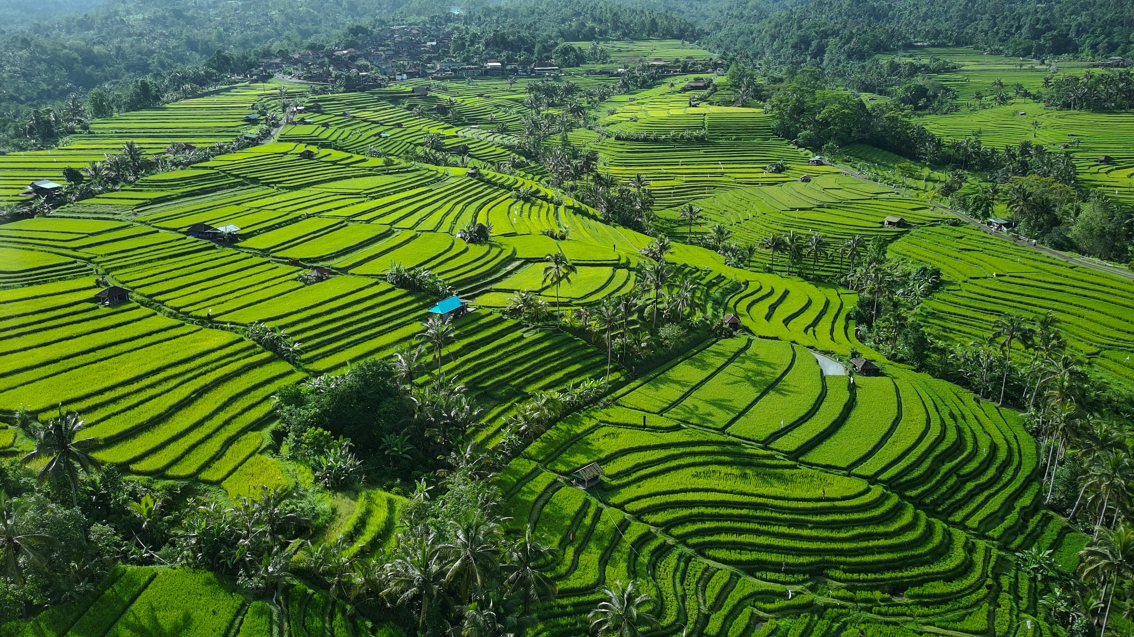
#jatiluwihriceterracescyclingroute ◆ Cycling Tours73 /100Quiet lanes and dirt tracks wind through Jatiluwih's UNESCO-listed rice terraces, a 600-hectare patchwork of paddies fed by the centuries-old subak irrigation system in central Bali.
Riders pass working farmers, fighting-cock cages and coffee laid out to dry in small villages between the terraces.
E-bikes make the gentle climbs manageable, with wide views over layered green paddies to Mount Batukaru behind.
How does it rate
CrowdsRomanceCash RequiredDangerAccessibilityWhy you should go
Riding directly through living, UNESCO-listed rice terraces gives a closer view than any roadside lookout.
Why you shouldn't go
The terraces look their best only shortly after planting; dry-season stubble fields are far less photogenic.
Plan your visit
Best time to visitFeb-Mar or Aug-Sep, when the paddies are at their most vivid green.Best time of dayEarly morning for cool temperatures, soft light and mist over the terraces.Getting thereFly to Denpasar; drive roughly 1.5-2 hours north to Jatiluwih, or join a tour with hotel pickup.Entry costTerrace entry approx IDR 40,000; guided e-bike tours from approx USD 35Time needed2-3 hoursInsider tip — Go on a weekday morning before tour-bus groups arrive at the main viewpoint, and ask your guide about the quieter western loop away from the main road. -
 #770 /100
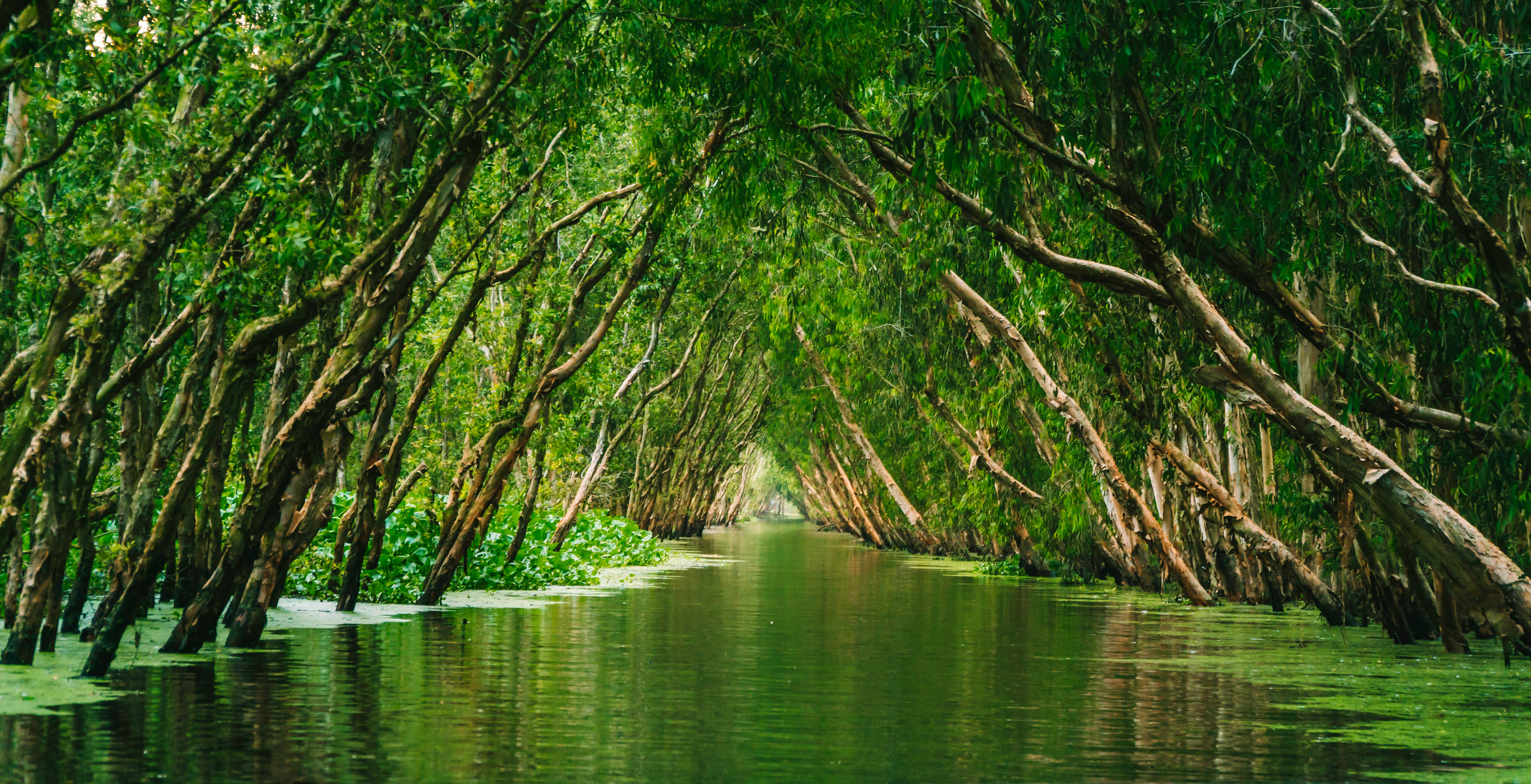
Quiet dyke-top lanes and narrow village paths thread through the rice paddies, fruit orchards and canal towns of the Mekong Delta around Vinh Long, Can Tho and Cai Be.
Riders pedal between traditional stilt houses, brick kilns and coconut-candy workshops, crossing narrow bridges and taking short boat hops between islands.
Life along the water, from floating markets to fishing boats, unfolds at close range the whole way.
How does it rate
CrowdsRomanceCash RequiredDangerAccessibilityWhy you should go
An up-close, slow-paced look at rural Vietnamese river life that's impossible to see from a bus.
Why you shouldn't go
Narrow paths, unpredictable local traffic and tropical heat and humidity demand caution and stamina.
Plan your visit
Best time to visitDec-Apr dry season, avoiding the Jun-Nov rains.Best time of dayEarly morning to catch floating markets and cooler temperatures.Getting thereFly or drive to Ho Chi Minh City; most rides start with a 1.5-2 hour transfer to Vinh Long or Cai Be.Entry costGuided day tours from USD 30-50, bikes includedTime neededFull day, or 3-5 days for a multi-stage tourInsider tip — Book a tour that visits the Cai Rang floating market by boat first thing, since it winds down by mid-morning, before switching to bikes for the villages. -
 #868 /100
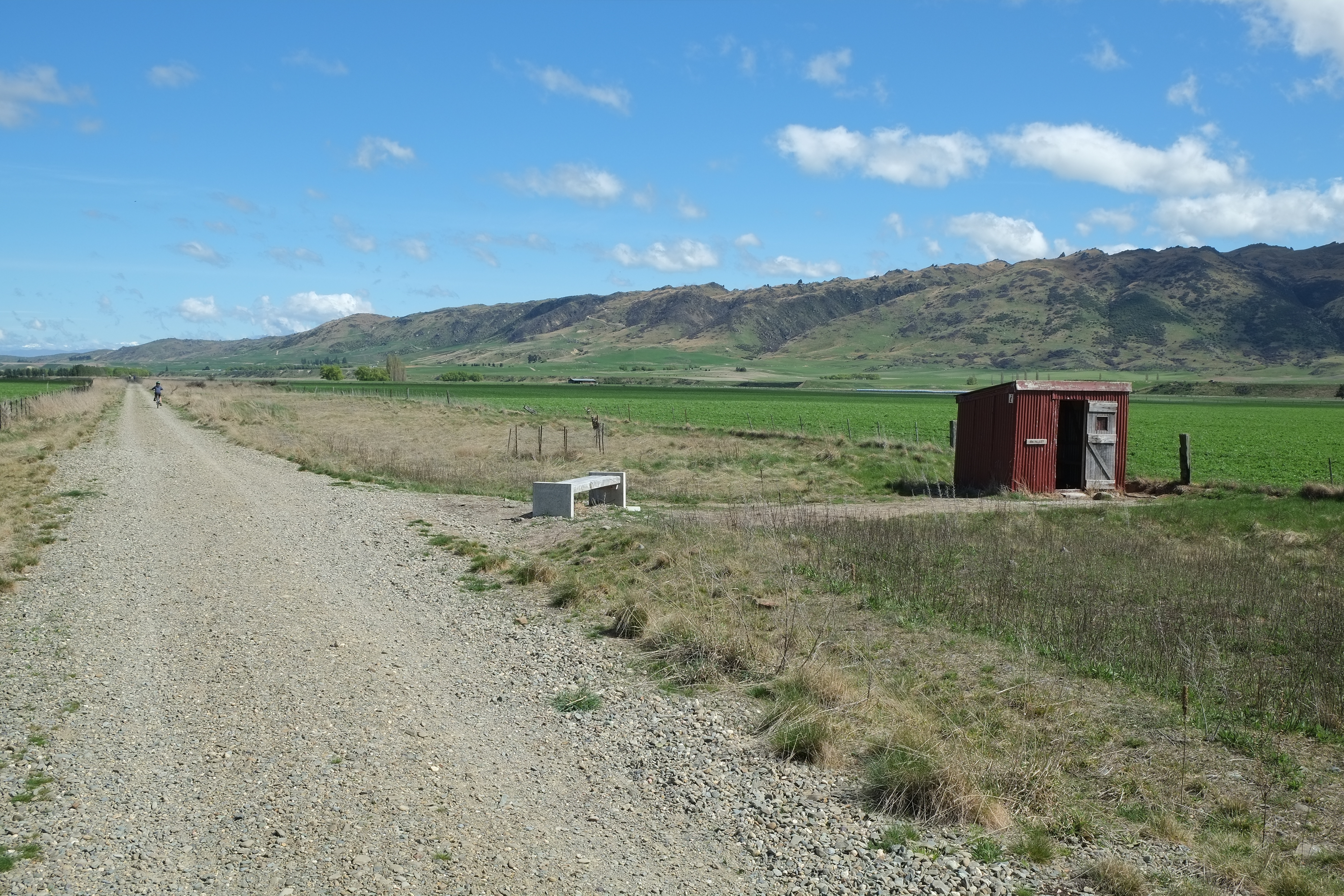
A converted 19th-century railway line runs 150km through Central Otago's high-country landscape, crossing viaducts and old tunnels between Clyde and Middlemarch.
Riders pass abandoned stone stations, schist rock outcrops and wide tussock valleys with barely another soul in sight.
Most riders spread the flat, gravel trail over four or five days, staying in small towns like Ranfurly and Naseby along the way.
How does it rate
CrowdsRomanceCash RequiredDangerAccessibilityWhy you should go
150km of gentle former railway through empty, dramatic high-country scenery with virtually no traffic.
Why you shouldn't go
Multi-day logistics -- shuttles, luggage transfers, accommodation -- add up in cost and planning.
Plan your visit
Best time to visitNov-Apr (spring to autumn); winter brings snow and closed accommodation.Best time of dayAny daylight hours; start early to avoid strong summer sun on exposed sections.Getting thereFly to Dunedin or Queenstown; shuttle transfer to the Clyde or Middlemarch trailhead.Entry costFree to ride; bike hire from NZD 40-60/dayTime needed4-5 days for the full trailBookingBook ahead →Insider tip — Ride Middlemarch to Clyde to travel with the prevailing wind at your back, and detour to the Poolburn Viaduct for the trail's best photo. -
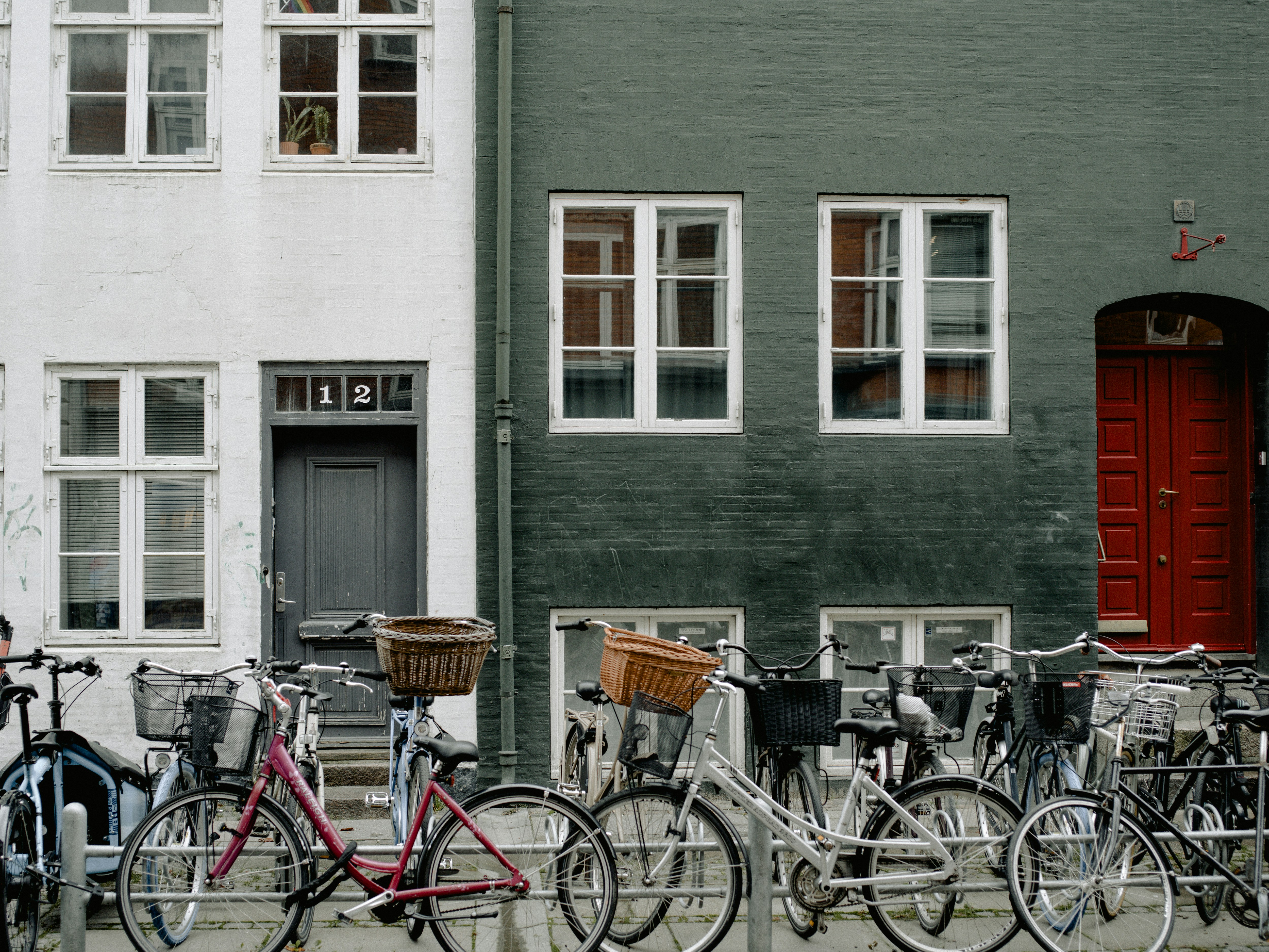 #966 /100
Copenhagen's 400km network of raised, kerb-separated cycle tracks makes riding the easiest way to see the city, from Nyhavn's canal houses to the harbour baths and Christiania.
Dedicated bicycle bridges and traffic lights timed for cyclists mean two-wheeled traffic genuinely outnumbers cars downtown.
Hotel and station bike rental is everywhere, and the flat terrain suits complete beginners.
How does it rate
CrowdsRomanceCash RequiredDangerAccessibilityWhy you should go
The world's most bike-friendly capital lets you cover its sights on dedicated, car-free lanes.
Why you shouldn't go
Rush-hour lanes are genuinely busy, and unfamiliar riders can feel intimidated by fast local commuters.
Plan your visit
Best time to visitMay-Sep for long daylight hours and mild weather.Best time of dayMid-morning or early afternoon, outside the sharpest commuter rush hours.Getting thereFly into Copenhagen Airport; 15-minute metro to the centre, where rental bikes are available citywide.Entry costBike rental from DKK 100-150/day; many hotels lend bikes freeTime neededHalf a day to explore the centreBookingBook ahead →Insider tip — Follow local etiquette -- signal turns by hand, keep right unless overtaking, and never stop suddenly in the cycle lane, since commuters ride close behind. -
 #10
#10Rated #10 of 10
Napa Valley Wine Country Cycling Route, the United States
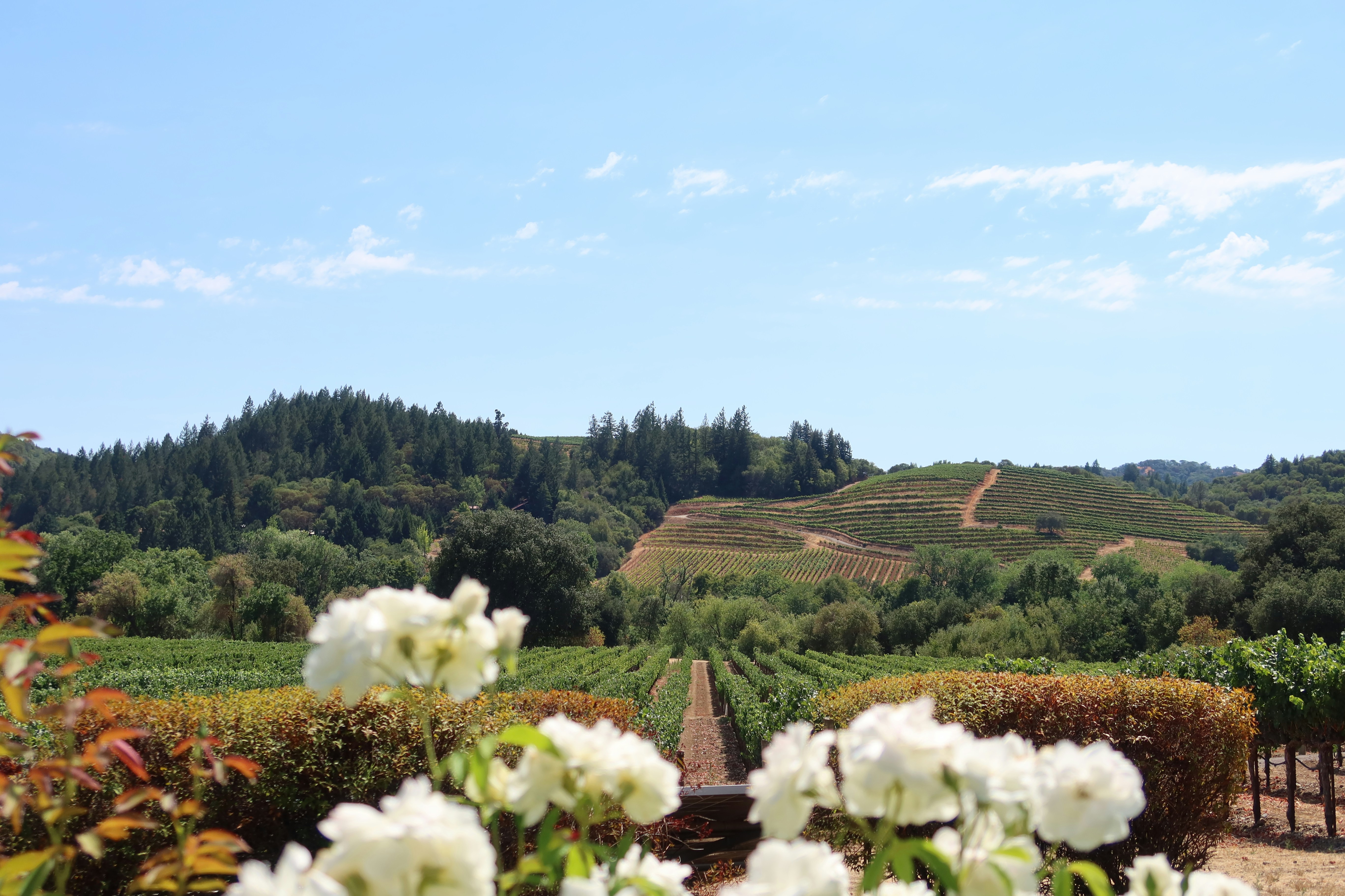
#napavalleywinecountrycyclingroute ◆ Cycling Tours62 /100The paved Vine Trail runs 12.
5 miles between downtown Napa and Yountville, weaving past manicured vineyard rows, stone wineries and oak-dotted hills.
Quieter backroads through Carneros add rolling, sheep-grazed vistas that turn yellow with wild mustard flowers each spring.
The route is flat enough for casual riders, with tasting rooms, bakeries and picnic stops built into most itineraries.
How does it rate
CrowdsRomanceCash RequiredDangerAccessibilityWhy you should go
Flat, paved trail through postcard vineyard scenery with wine-tasting stops built into the ride.
Why you shouldn't go
Summer weekend traffic on shared vineyard roads can be heavy, and tasting and rental costs add up fast.
Plan your visit
Best time to visitMar-May for mustard-flower bloom, or Sep-Oct for harvest colour.Best time of dayMorning, before afternoon heat and before tasting-room crowds peak.Getting thereFly to San Francisco or Oakland; drive or shuttle roughly 1 hour to downtown Napa.Entry costBike rental from USD 60-90/day; tastings extraTime neededHalf a day to a full dayBookingBook ahead →Insider tip — Ride the car-free Vine Trail itself, then loop back on quieter Carneros backroads instead of the busy Silverado Trail for winery views without traffic.


More from The World
-
How a score is built
One score out of 100, five criteria behind it
Every place is rated 1–5 on each of the criteria below, then combined into a single score out of 100. It's calculated by us, the same way every time — not an average of traveller reviews or social votes.
Crowds
How many people you'll be sharing it with, and at what time of day.
Romance
How well it suits a couple, a proposal, or a quiet moment together.
Cash required
Entry fees, permits, guides, rentals — what it actually costs to do it.
Danger
Physical risk involved, from a slippery viewpoint to genuine hazard.
Accessibility
How far off the beaten path it is, and how hard it is to actually reach.

