-
 #191 /100
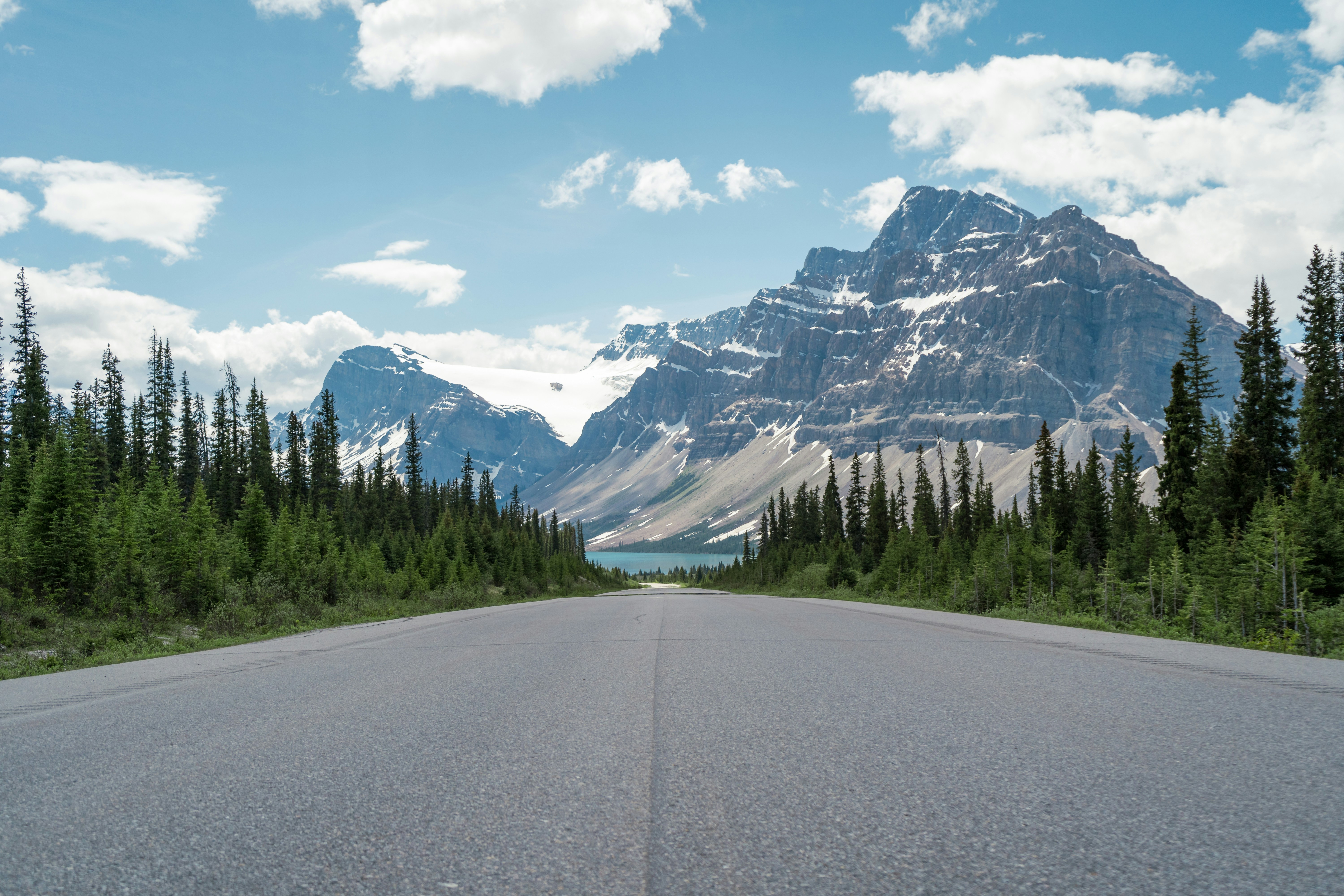
The Icefields Parkway runs 232 kilometres between Lake Louise and Jasper through the Canadian Rockies, tracing the Continental Divide past turquoise lakes, hanging glaciers, and the vast Columbia Icefield.
Peyto Lake's overlook and the Athabasca Glacier, reachable on foot or by ice-explorer vehicle, are signature stops, while roadside pullouts deliver mountain views throughout.
Bears and bighorn sheep often appear near the road at dawn and dusk.
How does it rate
CrowdsRomanceCash RequiredDangerAccessibilityWhy you should go
Turquoise glacial lakes and hanging glaciers visible almost continuously for the entire drive.
Why you shouldn't go
Requires a Parks Canada pass, and summer traffic clogs the popular pullouts and Athabasca Glacier lot.
Plan your visit
Best time to visitLate June through September, when the road is clear of snow and ice and all viewpoints are open.Best time of dayEarly morning for calm lake reflections and the best chance of spotting wildlife.Getting thereFly into Calgary, drive to Lake Louise, and pick up Highway 93 north toward Jasper.Entry costParks Canada day pass required, around CAD 22 per adultTime needed1 day drive, 2-3 with stops and hikesBookingBook ahead →Insider tip — Stop at Peyto Lake in early morning before tour buses fill the viewpoint, and check Parks Canada's site for wildlife closures before setting off. -
 #287 /100
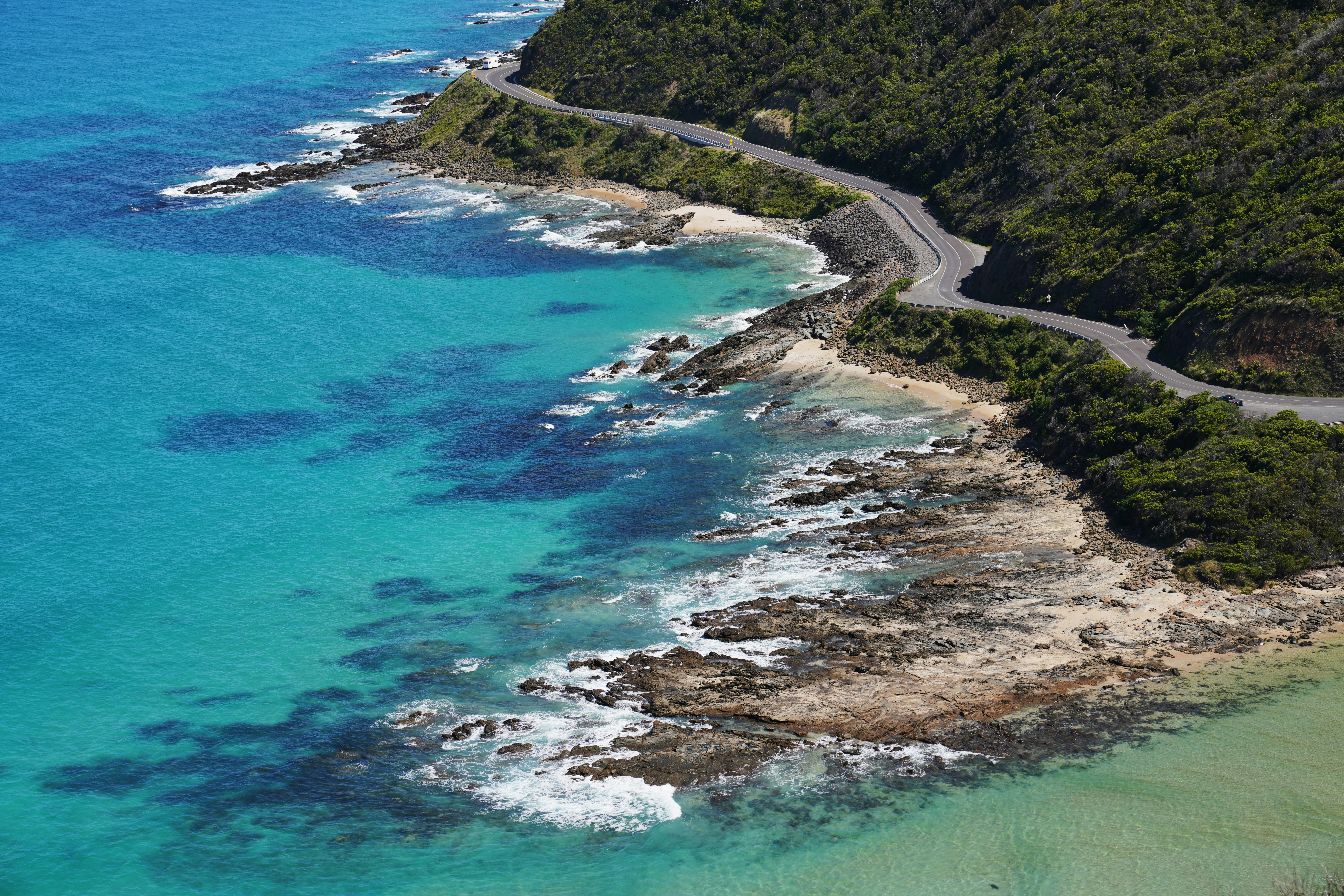
The Great Ocean Road hugs 243 kilometres of Victoria's coastline, curling past golden surf beaches, sheer cliffs, and the wind-carved limestone stacks of the Twelve Apostles.
The route swings from crashing Southern Ocean views to fern-draped rainforest in Otway National Park.
Koalas doze in roadside eucalypts near Kennett River, and small surf towns like Lorne and Apollo Bay make easy overnight stops.
How does it rate
CrowdsRomanceCash RequiredDangerAccessibilityWhy you should go
Sweeping coastal cliffs, rainforest and iconic rock stacks all on one accessible route from Melbourne.
Why you shouldn't go
Viewpoints near the Twelve Apostles get overwhelmed by tour buses in the middle of the day.
Plan your visit
Best time to visitShoulder seasons (Mar-Apr, Sep-Nov) for mild weather and thinner crowds; winter for whale watching.Best time of dayEarly morning at the Twelve Apostles, before tour coaches arrive mid-morning.Getting thereFly into Melbourne, hire a car, and drive an hour southwest to Torquay, the road's official starting point.Entry costFree to drive; rental car and fuel onlyTime needed3-4 daysBookingBook ahead →Insider tip — Detour to the Gibson Steps at dawn to see the Apostles from beach level before the crowds arrive at the clifftop lookouts. -
 #386 /100
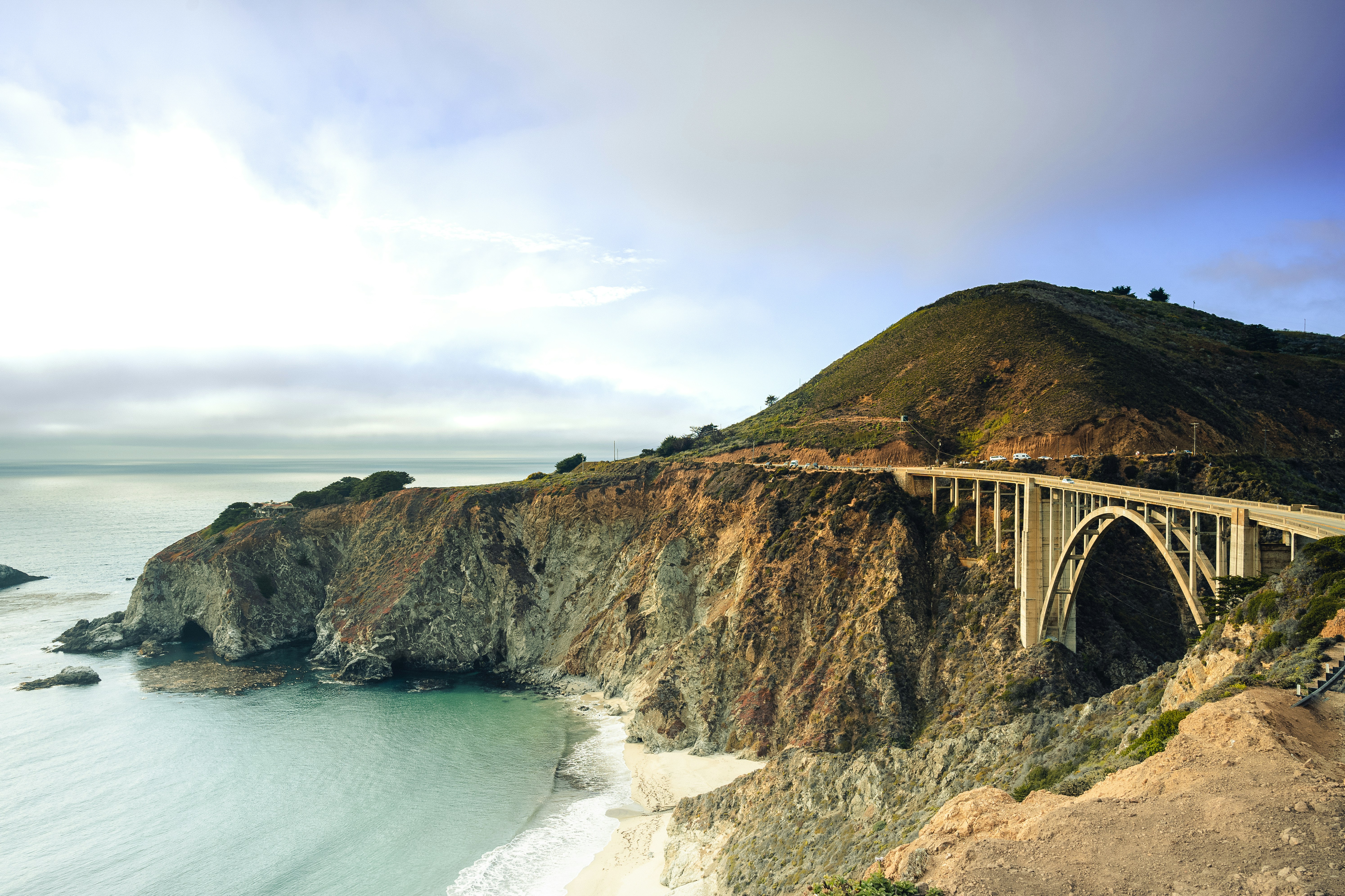
Highway 1 traces roughly 650 miles of California's Pacific edge, from Orange County's beach towns through the cliffs and redwood-backed switchbacks of Big Sur to the rugged Mendocino coast.
Bixby Bridge, McWay Falls, and pullouts over crashing surf make nearly every mile worth slowing for.
The road narrows to a single lane clinging to cliffside in Big Sur, and landslide closures are common enough that checking conditions beforehand is routine.
How does it rate
CrowdsRomanceCash RequiredDangerAccessibilityWhy you should go
Uninterrupted cliffside ocean views, with Big Sur's bridges and redwoods as the centrepiece.
Why you shouldn't go
Landslide closures around Big Sur are frequent and can force lengthy inland detours.
Plan your visit
Best time to visitSeptember-October for clear skies, fewer crowds, and reduced summer coastal fog.Best time of dayLate afternoon light along the Big Sur cliffs, an hour or two before sunset.Getting thereFly into Los Angeles or San Francisco, hire a car, and pick up Highway 1 at either end.Entry costFree to drive; some state park stops charge parking feesTime needed4-5 daysBookingBook ahead →Insider tip — Check Caltrans' QuickMap for landslide closures before you leave, and book Big Sur lodging months ahead - options are limited and fill fast. -
 #484 /100
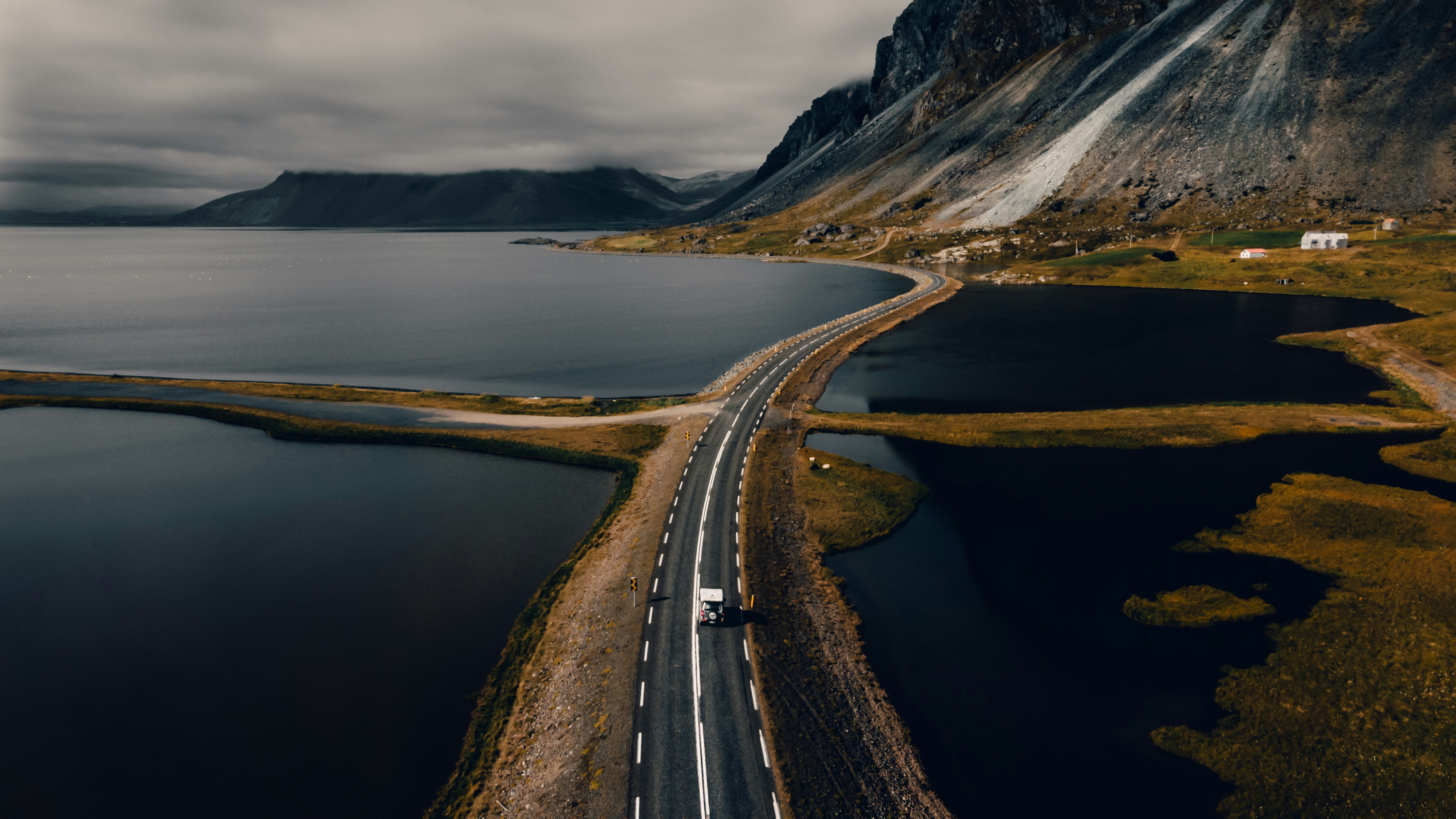
Route 1 loops 1,332 kilometres around Iceland, stringing together nearly every landscape it's famous for: black sand beaches, glacier lagoons, geothermal fields, and waterfalls beside the road.
The south coast alone delivers Seljalandsfoss, Skogafoss and the icebergs of Jokulsarlon within hours.
Further round, the route crosses lava deserts and fishing villages, then the geothermal north near Lake Myvatn, before looping back to Reykjavik.
How does it rate
CrowdsRomanceCash RequiredDangerAccessibilityWhy you should go
One road connects nearly all of Iceland's iconic waterfalls, glaciers and black-sand beaches in a single loop.
Why you shouldn't go
Long driving days between highlights, and winter conditions can close sections with little notice.
Plan your visit
Best time to visitJune-August for long daylight and reliably open roads; a 4x4 is recommended outside summer.Best time of dayMidday in winter for limited daylight; any time in summer's near-endless light.Getting thereFly into Keflavik, pick up a rental car in Reykjavik, and join Route 1 heading either direction.Entry costFree to drive; fuel, car hire and Iceland's high accommodation costs applyTime needed7-10 daysBookingBook ahead →Insider tip — Check road.is each morning before setting off - single-lane bridges, sheep, and sudden weather shifts are constant. -
 #584 /100
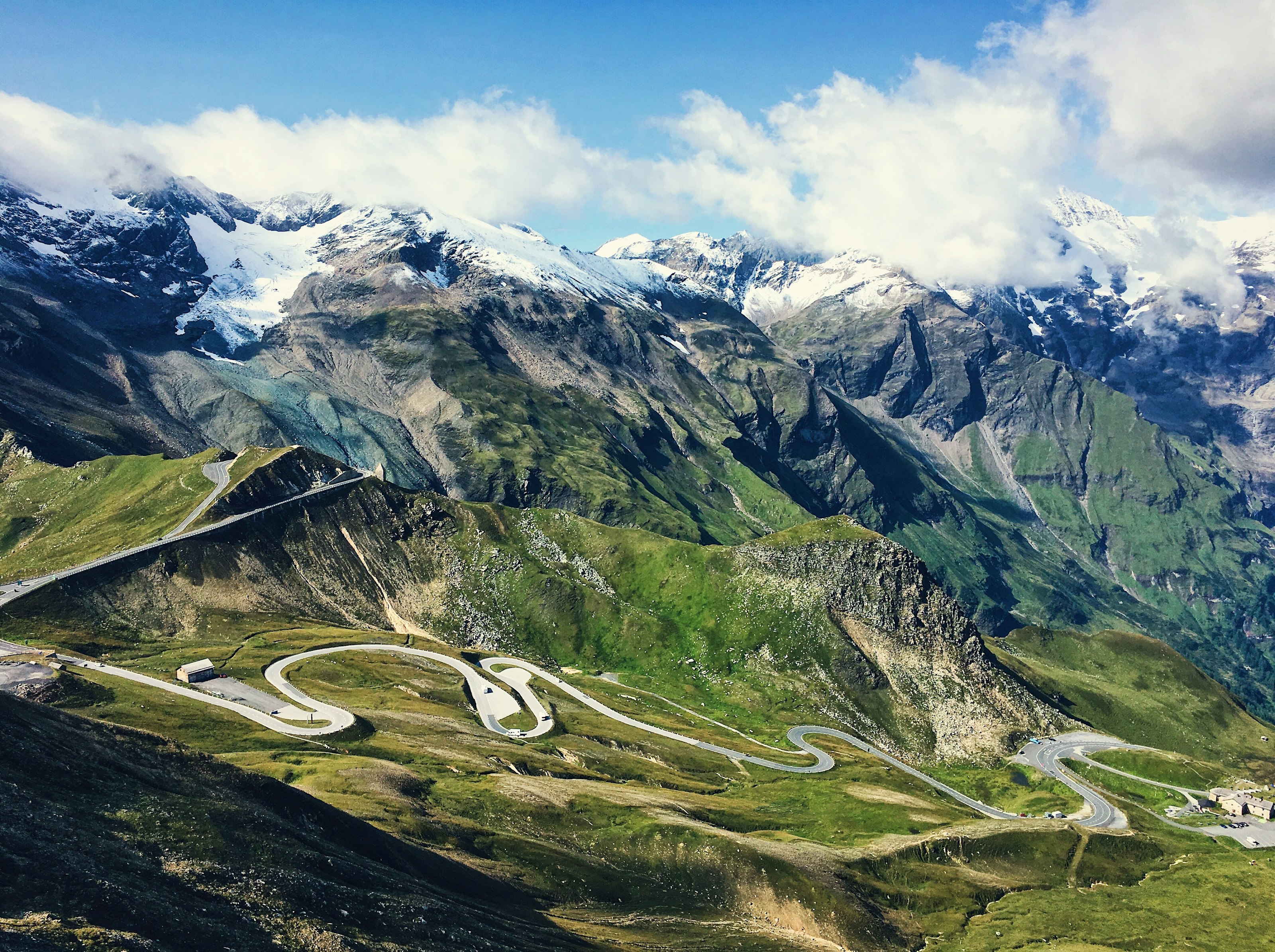
The Grossglockner High Alpine Road climbs through 36 hairpin bends to over 2,500 metres, threading past Austria's highest peak and ending at a viewpoint over the Pasterze, the country's largest glacier.
Marmots and ibex are a common sight along the route, and a dozen or so panoramic pull-offs give reason to stop every few kilometres.
The road is only open from May to October, closing once snow makes the high pass impassable.
How does it rate
CrowdsRomanceCash RequiredDangerAccessibilityWhy you should go
Few drives anywhere put a country's highest peak and largest glacier both directly in view from the road itself.
Why you shouldn't go
It's a toll road only open in warmer months, and hairpin after hairpin makes it a slow, deliberate drive rather than a scenic shortcut.
Plan your visit
Best time to visitJune–September, when the road is fully open and snow has cleared from the pass.Best time of dayMorning, for clear visibility before afternoon cloud builds around the peaks.Getting thereFly to Salzburg; roughly 1.5-hour drive south to the road's northern entrance near Fusch.Entry costToll charged per vehicle.Time neededHalf a dayInsider tip — Stop at the Kaiser-Franz-Josefs-Höhe viewpoint for the best direct view of the Pasterze glacier and the Grossglockner summit. -
 #681 /100
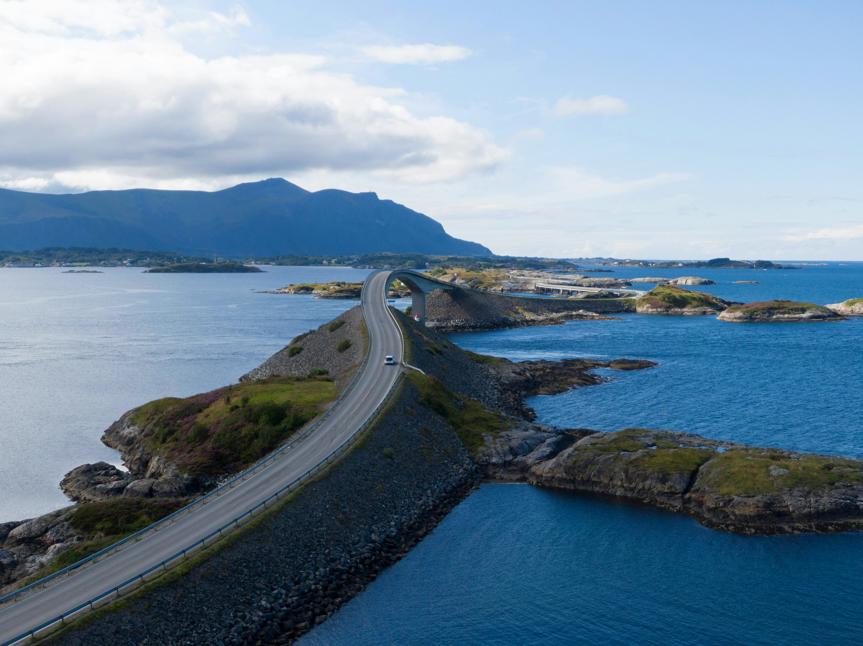
The Atlantic Road links a scatter of skerries and islets off Norway's west coast on an 8km run of bridges and causeways, built to look like it dives straight into the sea.
The Storseisundet Bridge is the famous shot, but the whole stretch is a slow, low-lying drive between open ocean on both sides, with fishing hamlets and pull-offs for scrambling over the rocks.
Storms send waves over the road, which locals treat as a spectator sport in autumn.
How does it rate
CrowdsRomanceCash RequiredDangerAccessibilityWhy you should go
A short, genuinely dramatic stretch of road that seems to disappear into the open Atlantic.
Why you shouldn't go
Over almost as soon as it starts - eight kilometres, no detours, done in half an hour without stops.
Plan your visit
Best time to visitSummer for calm seas and long light; autumn storms for waves breaking over the causeways.Best time of dayGolden hour, when the low sun catches the bridge and open water on both sides.Getting thereFly to Kristiansund; a 30-40 minute drive on Route 64 to the road's western end at Kårvåg.Entry costFree; no tolls on the road itself.Time needed1-2 hours including stopsInsider tip — Park at the Storseisundet Bridge viewpoint and walk out onto the older, disused sections of road for an angle on the bridge that most drivers miss. -
 #779 /100
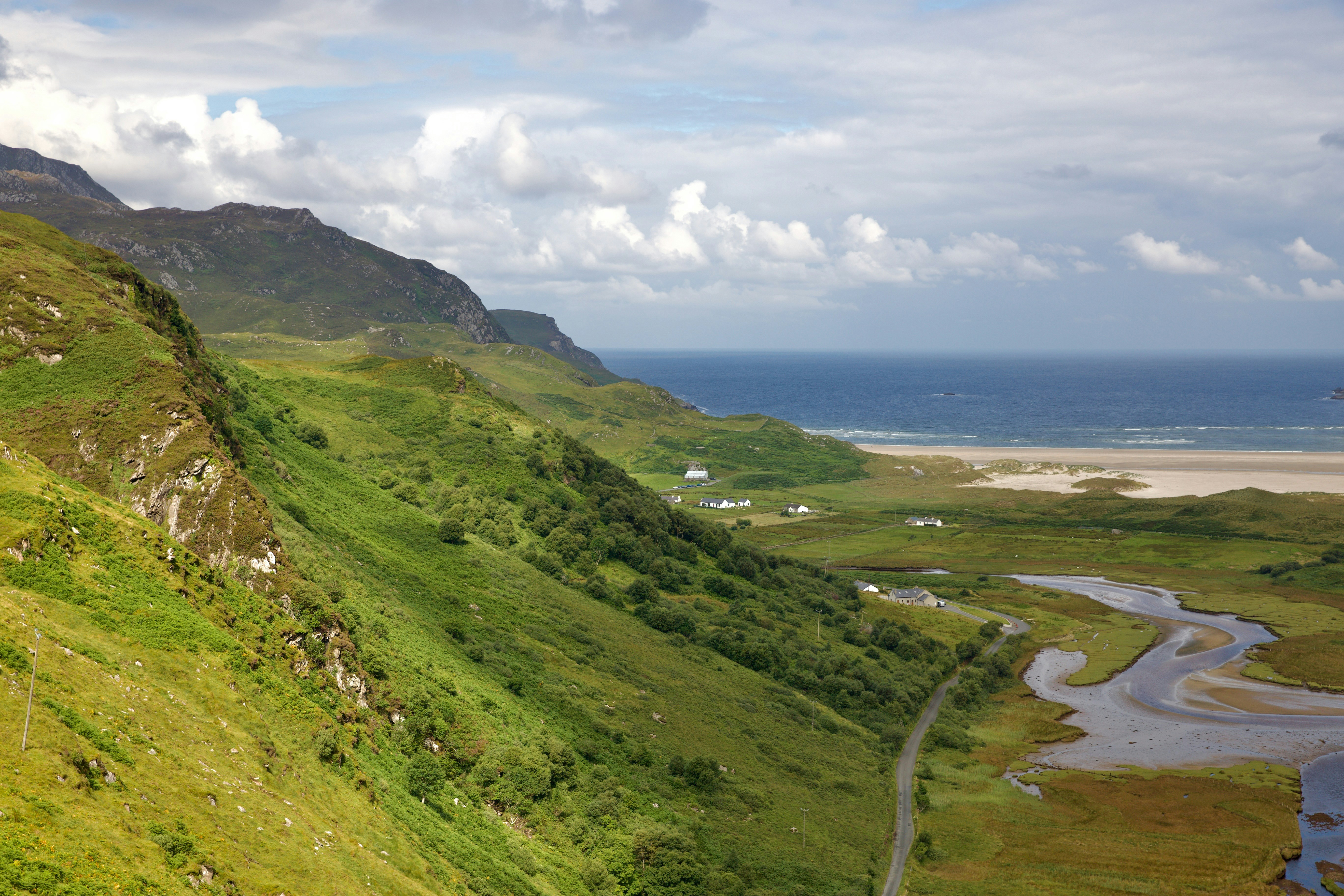
Ireland's Wild Atlantic Way follows roughly 2,500 kilometres of coastline from Donegal's Inishowen Peninsula to Kinsale in County Cork, tracing sea cliffs, white sand beaches, and stone-walled fishing villages.
The Cliffs of Moher and Skellig Michael sit along the route, alongside quieter stretches like the Sky Road near Clifden and Achill Island's beaches.
Weather turns quickly, and headlands are as often shrouded in mist as lit gold at sunset.
How does it rate
CrowdsRomanceCash RequiredDangerAccessibilityWhy you should go
Ireland's whole dramatic west coast, from towering cliffs to remote islands, on one signed touring route.
Why you shouldn't go
Rain and shifting weather are frequent companions; clear-sky days are never guaranteed.
Plan your visit
Best time to visitMay-June for the driest, sunniest conditions before peak summer traffic.Best time of dayEarly morning at the Cliffs of Moher, ahead of tour bus arrivals.Getting thereFly into Shannon, Cork, or Dublin, hire a car, and join the signed blue-and-white route at any point.Entry costFree to drive; sites like the Cliffs of Moher charge parking/entry feesTime needed7-10 daysBookingBook ahead →Insider tip — Break the drive into short daily legs - the posted route length is deceptive because coastal roads are slow and invite constant detours. -
 #878 /100
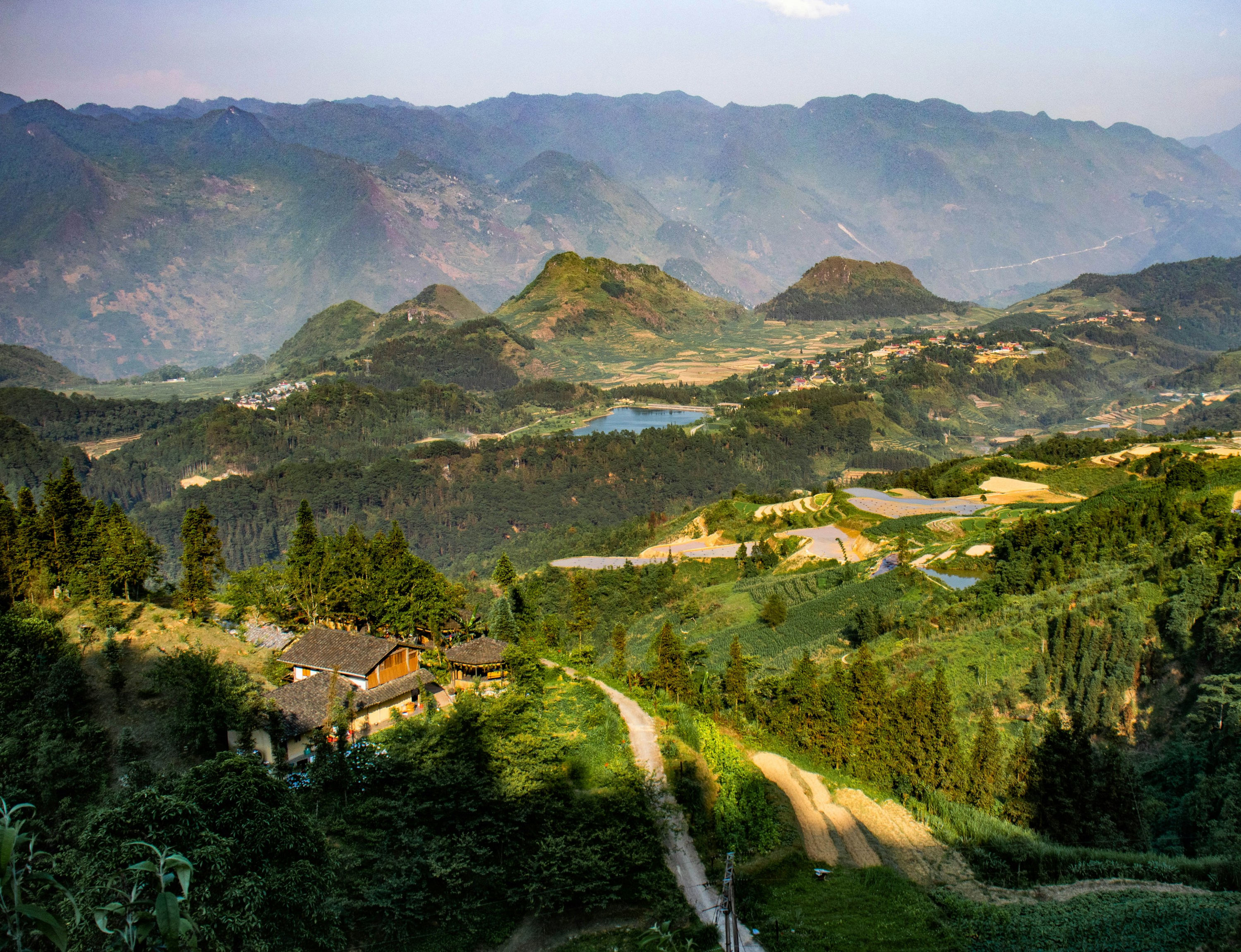
The Ha Giang Loop is northern Vietnam's classic multi-day motorbike route, threading through the limestone peaks of the Dong Van Karst Plateau past terraced fields, H'mong and Tay villages, and the Ma Pi Leng Pass above the Nho Que River.
Most riders cover the roughly 350km circuit over 3-4 days, self-driving or riding pillion with a local guide.
It's demanding and occasionally hair-raising, but consistently rated among Southeast Asia's best road trips.
How does it rate
CrowdsRomanceCash RequiredDangerAccessibilityWhy you should go
Dramatic karst mountain scenery and one of Asia's great road trips, especially the cliff-hugging Ma Pi Leng Pass.
Why you shouldn't go
Mountain roads are genuinely dangerous for inexperienced riders, and a border-area permit is required for foreign visitors.
Plan your visit
Best time to visitSeptember-November and March-May, for clear skies and dry roads.Best time of dayRide mid-morning to mid-afternoon; mountain fog and cold set in early and late.Getting thereOvernight bus or shared van from Hanoi to Ha Giang city (6-7 hours), where loop rentals and guides start.Entry costFree to ride; motorbike rental or guided tours from roughly $25-50/day, plus a border permitTime needed3-4 daysInsider tip — Arrange a border-area permit and, if you're not an experienced rider, an "easy rider" driver in Ha Giang city before setting off; the Ma Pi Leng Pass viewpoint gets busy by mid-morning with day-tour minivans from Dong Van. -
 #976 /100
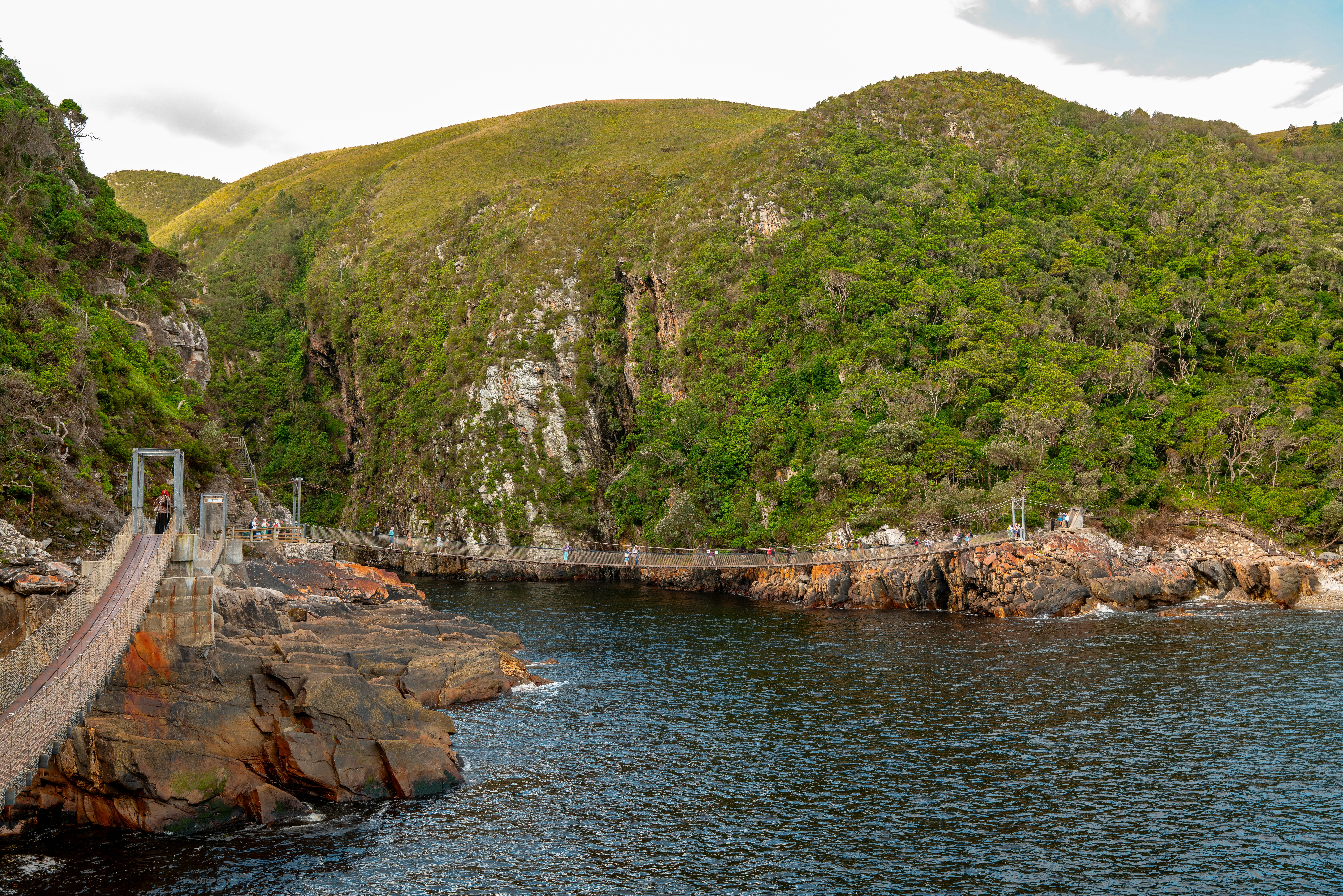
The Garden Route traces roughly 300 kilometres of South Africa's southern coast between Mossel Bay and Storms River, crossing indigenous forest, lagoons, and dramatic sea cliffs.
Knysna's lagoon and oyster shacks, Plettenberg Bay's beaches, and the canopy walkways of Tsitsikamma National Park make for constant stops.
Southern right whales gather off Plettenberg Bay for much of the year on this smooth, well-signed, easy self-drive route.
How does it rate
CrowdsRomanceCash RequiredDangerAccessibilityWhy you should go
Forests, lagoons, cliffs and whale-watching coastline packed into one easy, well-paved self-drive route.
Why you shouldn't go
Peak summer (Dec-Jan) sees the coastal towns and roads become crowded with domestic holidaymakers.
Plan your visit
Best time to visitOctober-November or February-March for good weather without peak-season crowds.Best time of dayMorning departures avoid afternoon coastal fog and leave time for stops before dusk.Getting thereFly into Cape Town or George, hire a car, and join the N2 highway heading east or west.Entry costFree to drive; Tsitsikamma and other park activities charge separate entry feesTime needed3-5 daysBookingBook ahead →Insider tip — Book a sunset oyster platter at a Knysna lagoon-front shack, and detour to Robberg Nature Reserve near Plettenberg Bay for whale sightings. -
 #1074 /100
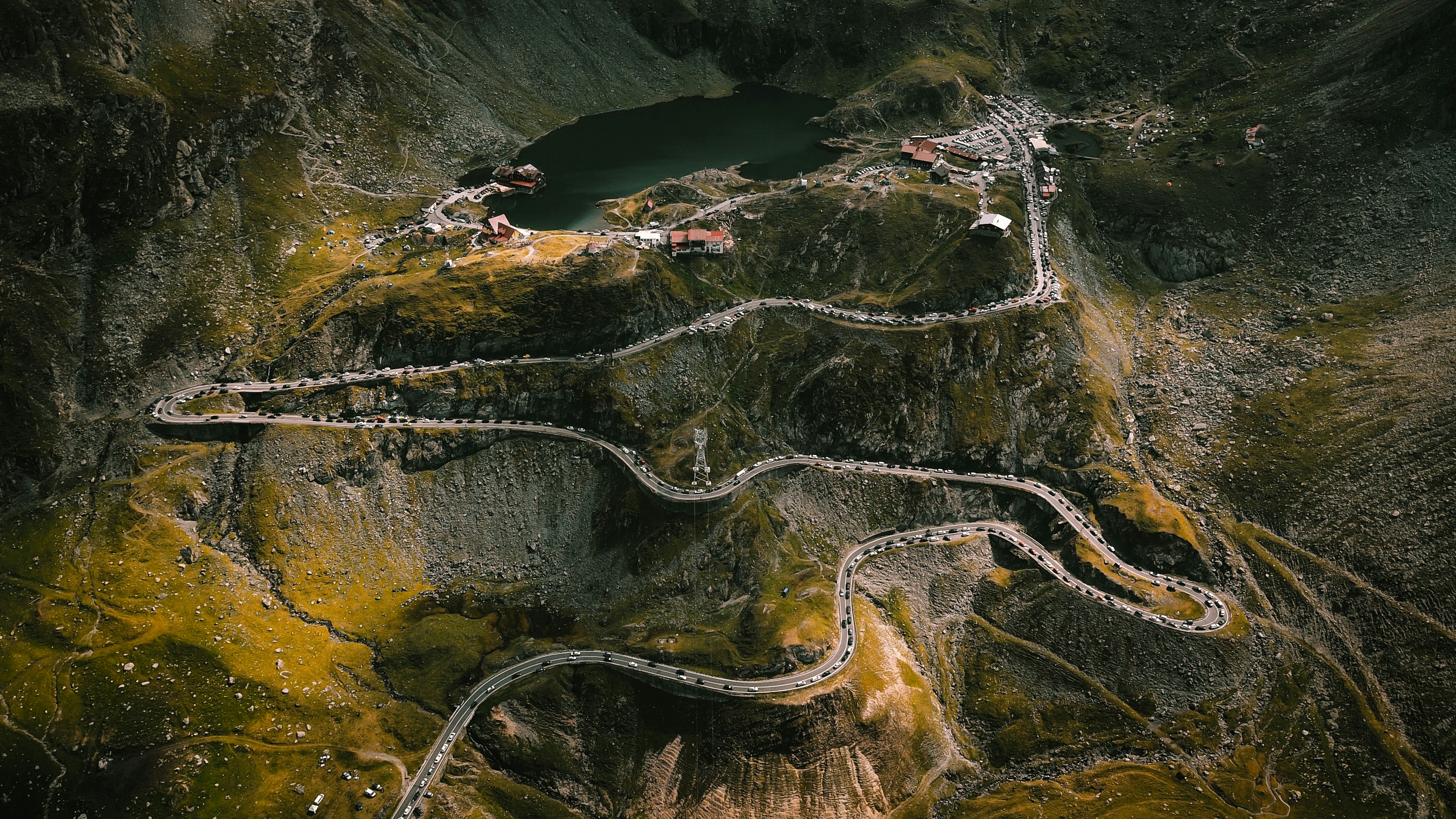
The Transfagarasan climbs 90 kilometres through the southern Carpathians, switchbacking up granite faces to Balea Lake at over 2,000 metres, beneath Romania's highest peak, Moldoveanu.
Hairpin bends, stone viaducts, and a mile-long tunnel make it a favourite of driving shows and motorcyclists alike.
Vidraru Dam and its reservoir sit at the southern approach, flanked by forest that erupts with autumn colour before the snow closes the road again.
How does it rate
CrowdsRomanceCash RequiredDangerAccessibilityWhy you should go
Widely rated one of the world's best driving roads, with hairpin switchbacks and high alpine views.
Why you shouldn't go
Only open roughly late June to October; closed by snow the rest of the year.
Plan your visit
Best time to visitJuly-August for full access and clear skies; weekdays to dodge weekend driving-enthusiast traffic.Best time of dayEarly morning for clear light over Balea Lake and quieter hairpins.Getting thereDrive from Sibiu or Curtea de Arges; both roughly 2.5-3 hours from Bucharest by car.Entry costFree; a toll applies for the Balea tunnel, plus fuelTime needed1 day, or 2 with a night at Balea LakeBookingBook ahead →Insider tip — Take the cable car up to Balea Lake if you'd rather not drive the steepest switchbacks, and watch for brown bears near the forested lower sections. -
 #1171 /100
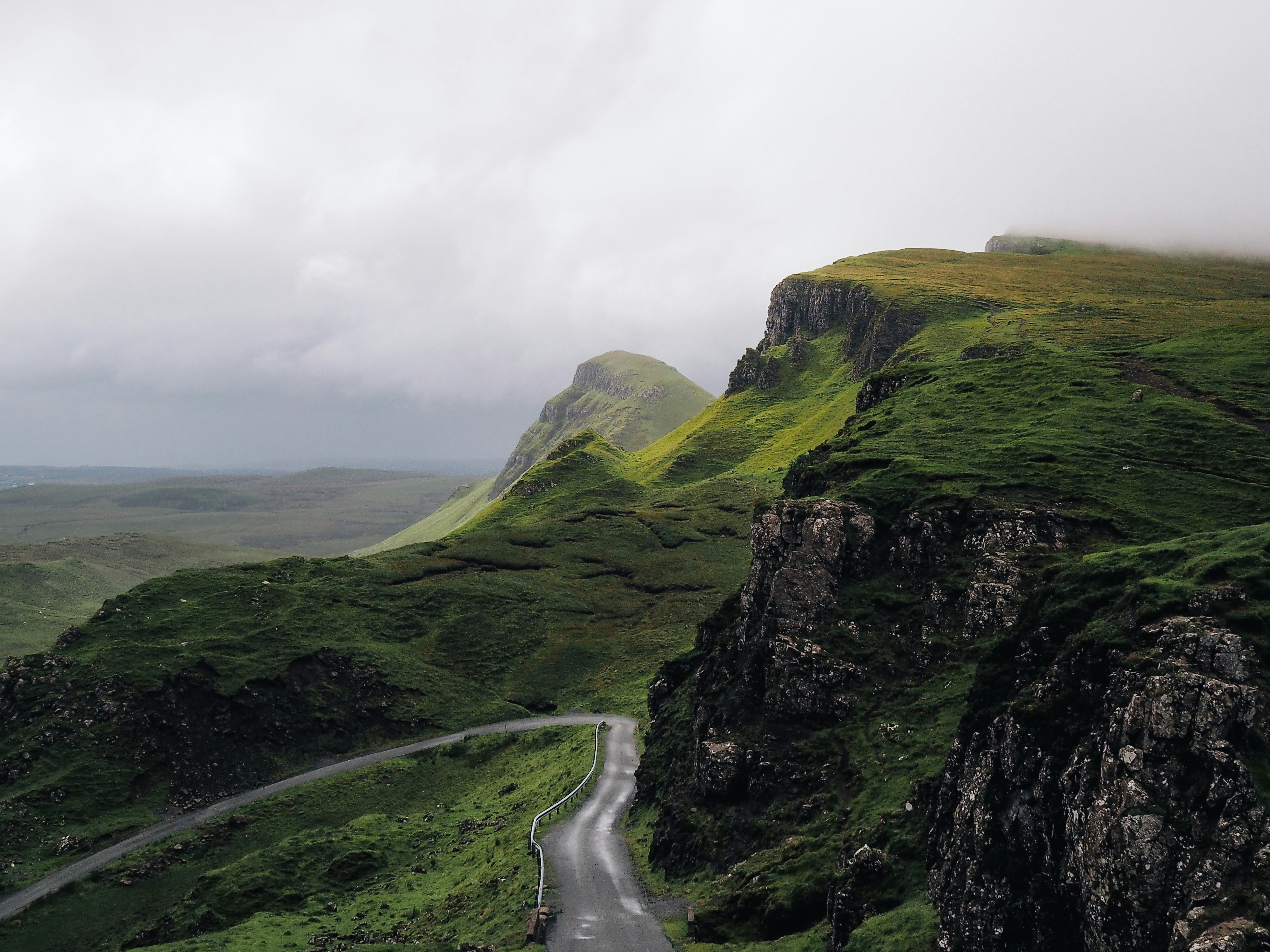
The North Coast 500 loops 830 kilometres around the top of the Scottish Highlands, starting and finishing in Inverness.
Single-track roads wind past white sand beaches at Achmelvich, the sea stacks of Duncansby Head, and ruined castles over sea lochs, with the Applecross Pass climbing to one of Britain's highest road summits.
Midges and shifting weather are part of the deal, and passing places on narrower stretches demand attentive driving.
How does it rate
CrowdsRomanceCash RequiredDangerAccessibilityWhy you should go
Beaches, sea cliffs, castles and Highland mountain passes packed into one circular route from Inverness.
Why you shouldn't go
Single-track roads get bottlenecked with summer traffic, and midges are relentless in calm weather.
Plan your visit
Best time to visitMay or September for good weather with thinner crowds and fewer midges than midsummer.Best time of dayEarly morning on single-track sections, before oncoming traffic builds up.Getting thereFly or drive into Inverness, hire a car, and join the signposted loop heading either direction.Entry costFree to drive; fuel and accommodation are the main costsTime needed5-7 daysBookingBook ahead →Insider tip — Drive clockwise to face oncoming traffic on the narrowest single-track stretches rather than being overtaken from behind. -
 #1266 /100
Officially named the Yungas Road, this narrow gravel track earned its nickname from decades as one of the world's most dangerous roads, with sheer cliff drops of up to 600 meters and no guardrails along much of its length.
Since a paved highway took over most through-traffic, the original road has become a popular mountain-biking route, descending some 3,500 meters from frigid Andean altitude into humid Yungas jungle over 64 kilometers.
How does it rate
CrowdsRomanceCash RequiredDangerAccessibilityWhy you should go
A legendary, formerly lethal cliffside road, now a spectacular guided mountain-bike descent through changing climate zones.
Why you shouldn't go
Despite guided safety measures, the exposed cliff edges are genuinely dangerous and unsuitable for inexperienced cyclists.
Plan your visit
Best time to visitMay–October (dry season) for drier, less slippery conditions.Best time of dayEarly morning start, to complete the descent before afternoon fog and traffic build.Getting thereTour operators collect riders from La Paz for the drive to the starting point at La Cumbre pass.Entry costGuided biking tours typically $80-120, including equipment and transport.Time neededFull day.Insider tip — Book with an operator using full-suspension bikes and offering a support vehicle — cheaper operators cut corners on both. -
 #1365 /100
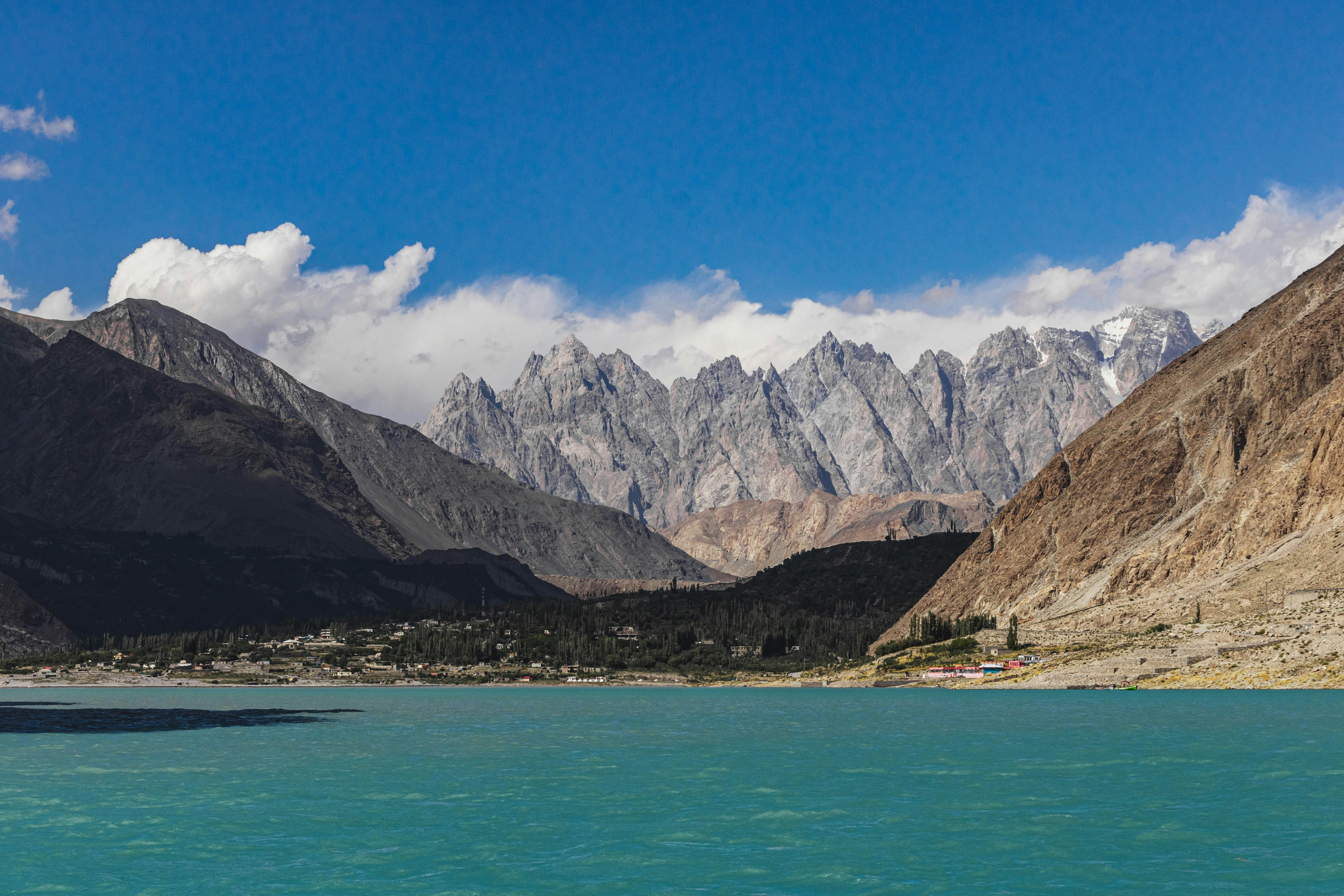
The Karakoram Highway climbs from the Indus valley through Gilgit-Baltistan to the Khunjerab Pass on the Chinese border, the highest paved international border crossing in the world.
It skirts the Karakoram, Himalaya, and Hindu Kush ranges, passing turquoise Attabad Lake and the terraced orchards of Hunza Valley beneath 7,000-metre peaks.
Landslides regularly close sections, and building it cost hundreds of lives cutting through unstable terrain.
How does it rate
CrowdsRomanceCash RequiredDangerAccessibilityWhy you should go
Some of the highest, most dramatic mountain scenery reachable by paved road anywhere on earth.
Why you shouldn't go
Landslides, altitude, and long rough stretches make this a genuinely demanding, remote drive.
Plan your visit
Best time to visitApril-May for blossom season in Hunza, or October for clear autumn colour.Best time of dayMorning, when mountain peaks are typically clear before afternoon cloud builds.Getting thereFly to Gilgit from Islamabad, or take the NATCO bus, then continue by road into Hunza.Entry costFree to drive; foreigners need a permit for areas near the China borderTime needed5-7 daysInsider tip — Stay overnight in Karimabad and walk up to Baltit Fort at sunset for views over the Hunza Valley and Rakaposhi peak. -
 #1462 /100
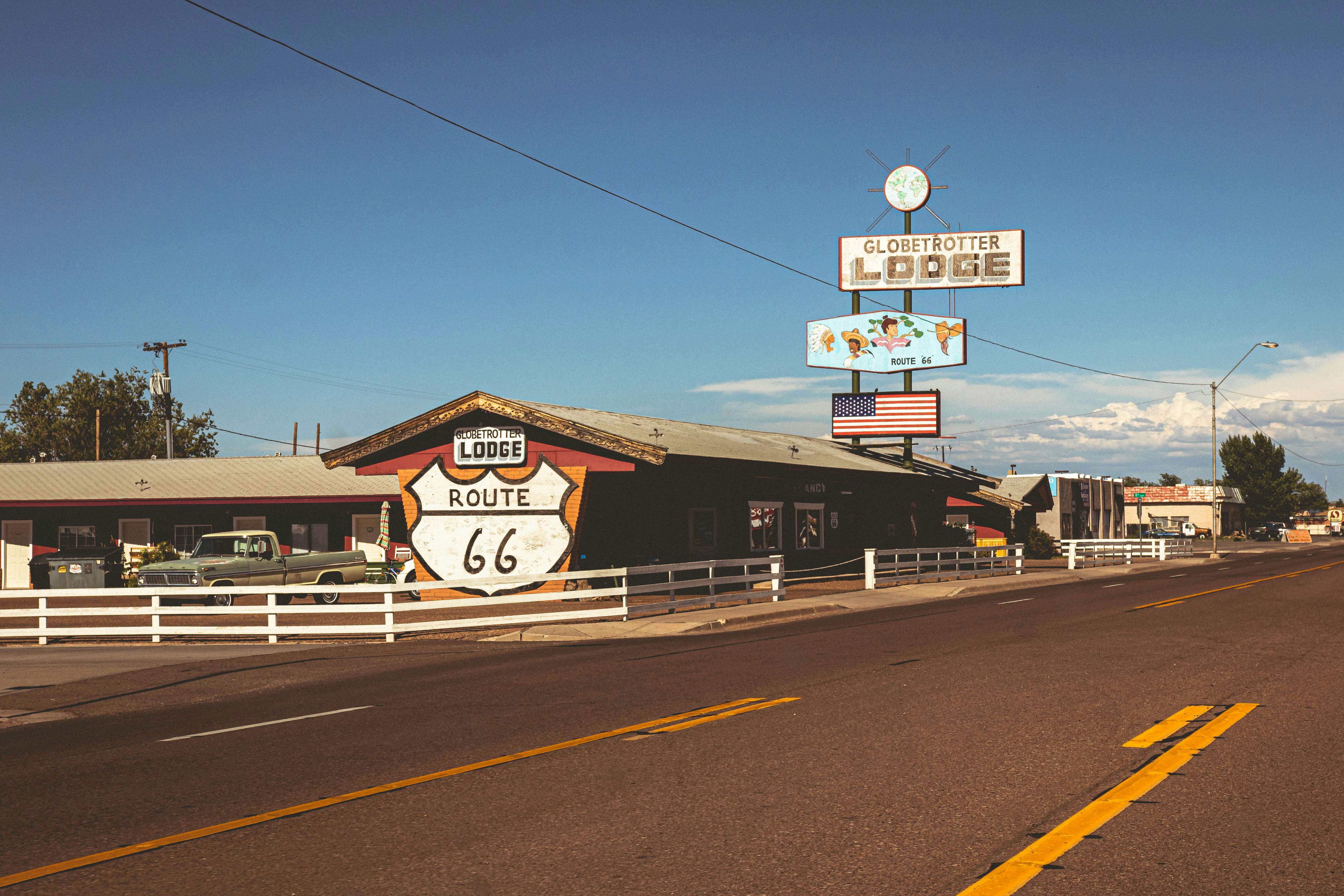
Route 66 is America's original cross-country highway, and its Arizona stretch preserves the longest unbroken original section still open to traffic.
Neon-lit diners, vintage motor courts, and hand-painted signs line the road through Seligman, Kingman, and Oatman, where wild burros wander the main street.
The 191-bend Oatman Highway climbs through the Black Mountains into the Mojave Desert - a rolling time capsule of mid-century road culture.
How does it rate
CrowdsRomanceCash RequiredDangerAccessibilityWhy you should go
A rolling time capsule of neon diners, vintage motels and small towns that built the American road-trip myth.
Why you shouldn't go
Long, flat and repetitive between towns; the nostalgia is the main draw, not the scenery.
Plan your visit
Best time to visitApril-June or September-October, avoiding August's 100°F+ heat and monsoon flash floods.Best time of dayLate afternoon, when low light warms the desert and neon signs start switching on.Getting thereFly into Phoenix or Las Vegas, then drive to Kingman or Topock to pick up the historic alignment.Entry costFree; just fuel, food and motels along the wayTime needed3-7 daysBookingBook ahead →Insider tip — Stop in Seligman, the town credited with saving Route 66, and time Oatman for midday to see the wild burros on Main Street.


More from The World
-
How a score is built
One score out of 100, five criteria behind it
Every place is rated 1–5 on each of the criteria below, then combined into a single score out of 100. It's calculated by us, the same way every time — not an average of traveller reviews or social votes.
Crowds
How many people you'll be sharing it with, and at what time of day.
Romance
How well it suits a couple, a proposal, or a quiet moment together.
Cash required
Entry fees, permits, guides, rentals — what it actually costs to do it.
Danger
Physical risk involved, from a slippery viewpoint to genuine hazard.
Accessibility
How far off the beaten path it is, and how hard it is to actually reach.

