-
 #192 /100
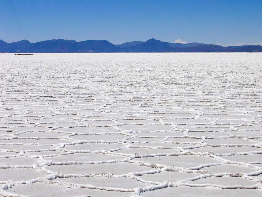
The Salar de Uyuni is the world's largest salt flat, covering 10,582 square kilometres of the Bolivian altiplano at 3,656 metres above sea level.
When covered by a thin layer of water after the rainy season, it becomes a perfect mirror reflection of the sky and one of the most surreal landscapes on earth.
How does it rate
CrowdsRomanceCash RequiredDangerAccessibilityWhy you should go
The mirror effect during the wet season, when the salt flat reflects the sky with perfect fidelity, creates photographs that look like they belong in a dream.
Why you shouldn't go
The wet season (January to March) that creates the famous mirror effect also brings heavy rains; the dry season offers a stark but less photogenic white expanse.
Plan your visit
Best time to visitDecember-April (wet season) for the mirror effect, dry season for easier accessBest time of daySunrise or sunset for the reflection and colourGetting thereFly to Uyuni via La PazEntry costGuided tour ~$100-150/dayTime needed1-3 daysInsider tip — Visit just after rain for the famous mirror effect; the wet season (Jan-Apr) is when it is most reliable -
 #291 /100
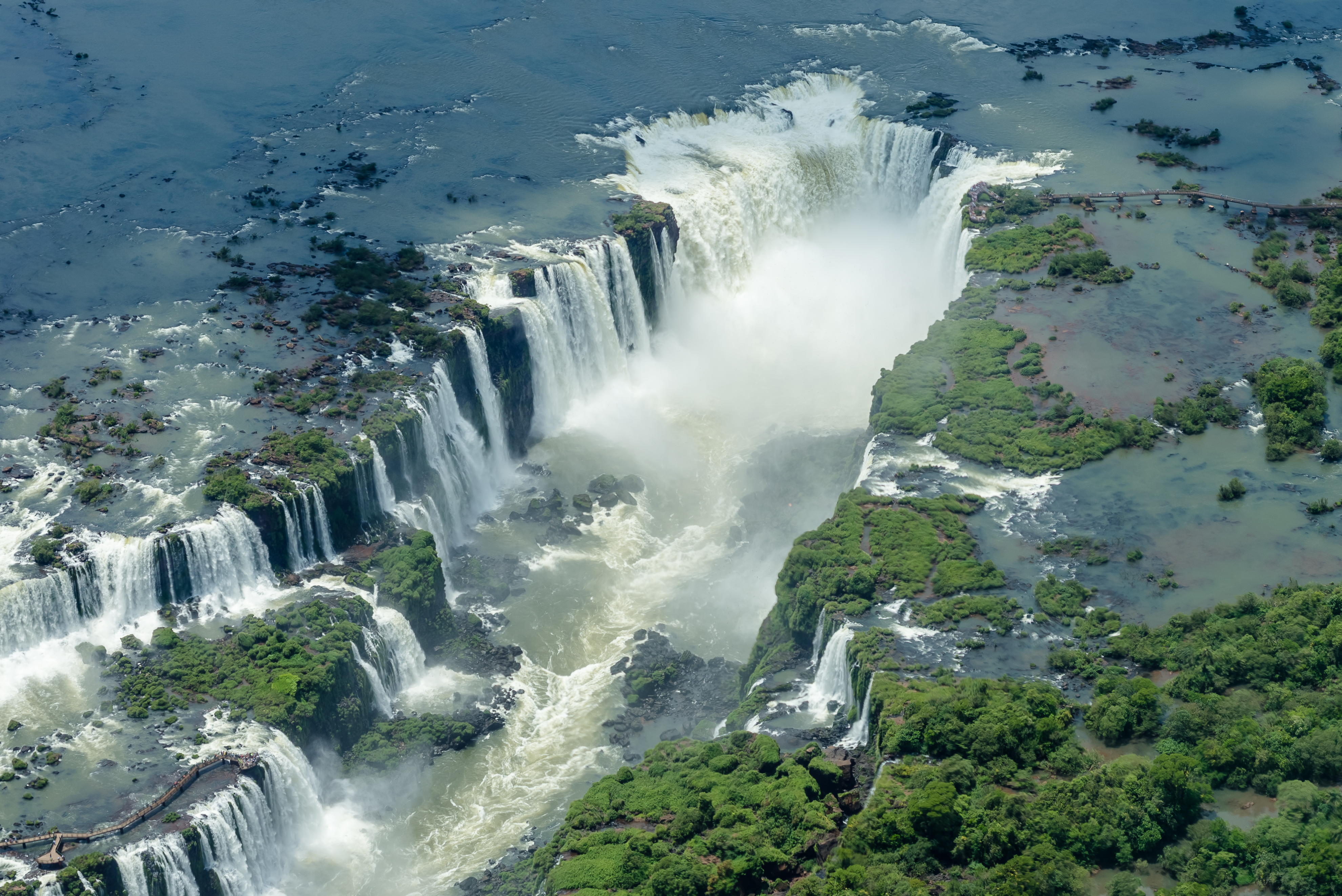
Iguazu Falls straddles the border between Argentina and Brazil and is wider than Victoria Falls and taller than Niagara, making it arguably the world's most spectacular waterfall system.
The 275 separate cascades thunder over a 2.
7-kilometre arc in the subtropical jungle of both countries' national parks.
How does it rate
CrowdsRomanceCash RequiredDangerAccessibilityWhy you should go
The sheer scale and number of cascades, accessible via elevated walkways that take you directly above and beside the falls, makes Iguazu one of nature's great spectacles.
Why you shouldn't go
The falls are best seen from both the Argentine and Brazilian sides, which requires a border crossing; the Argentine side walkways can close due to flooding.
Plan your visit
Best time to visitApril-June or September-NovemberBest time of dayMorning for rainbowsGetting thereFly to Puerto IguazuEntry cost~$30 park entryTime neededFull dayInsider tip — Visit both the Argentine and Brazilian sides; Argentina gets you closer, Brazil gives the panorama -
 #391 /100
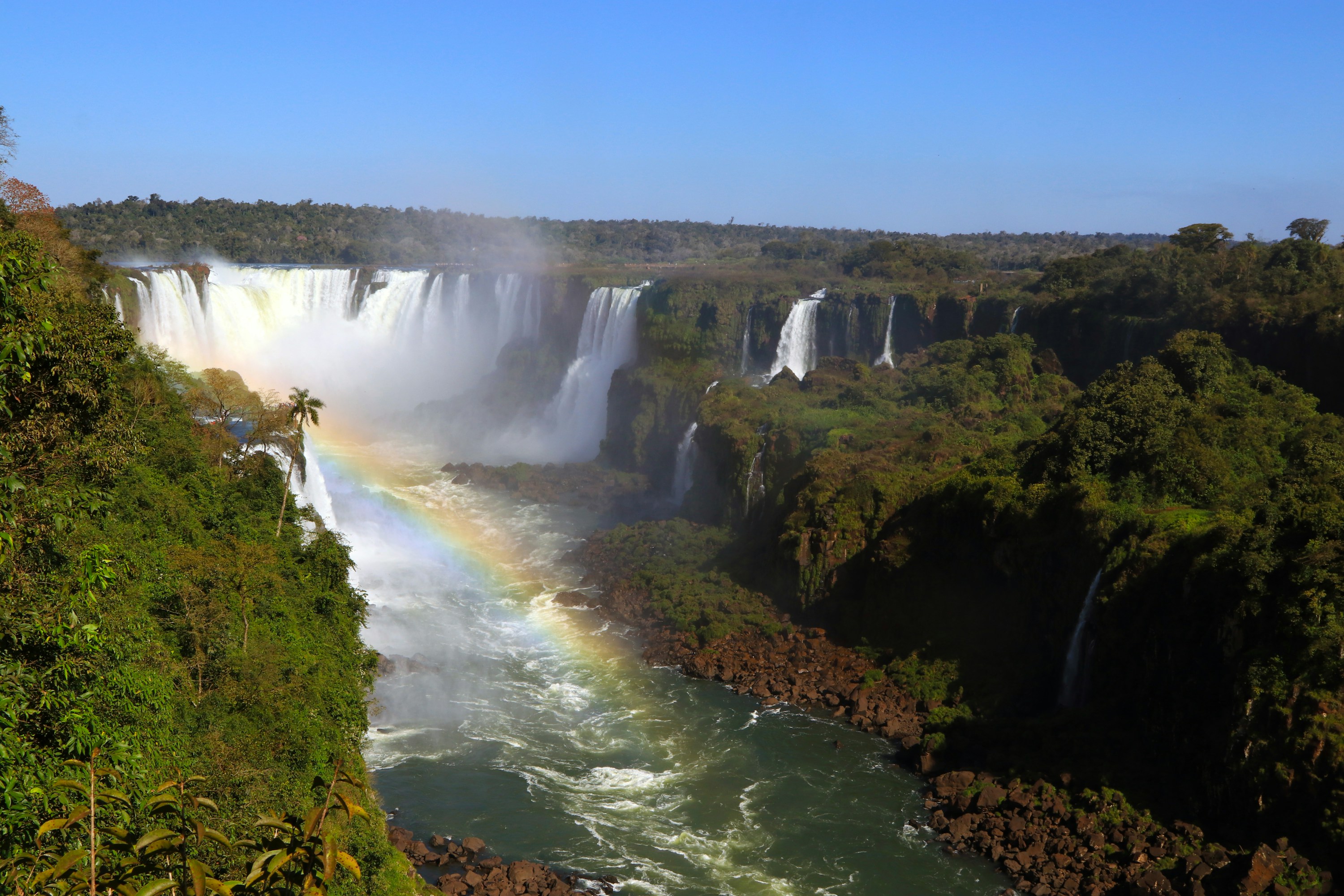
The Brazilian side of Iguaçu Falls trades Argentina's up-close catwalks for one long panoramic circuit, sweeping across nearly the entire 2.
7km curtain of over 250 individual falls at once.
A short walkway leads out to a platform inside the spray of the Devil's Throat, with boat trips for those who want to get soaked.
It's compact enough to see in half a day, unlike the sprawling park across the border.
How does it rate
CrowdsRomanceCash RequiredDangerAccessibilityWhy you should go
One sweeping panoramic walkway takes in almost the entire 2.7km curtain of falls in a single visit.
Why you shouldn't go
The shuttle bus and viewing platforms queue up fast by mid-morning in high season.
Plan your visit
Best time to visitApril-September (dry season) for clearer views; wetter months bring more dramatic flow.Best time of dayEarly morning, before the tour buses arrive.Getting thereFly to Foz do Iguaçu (IGU); 25-30 min taxi/bus to the park entrance, then the park's own shuttle bus to the falls circuit.Entry cost~R$130 (~US$24) entry; boat trips extraTime needed3-4 hoursBookingBook ahead →Insider tip — Take the elevator at the end of the walkway to the upper overlook for the full-panorama view, and catch the park's first shuttle to beat the tour-bus crowds. -
 #490 /100
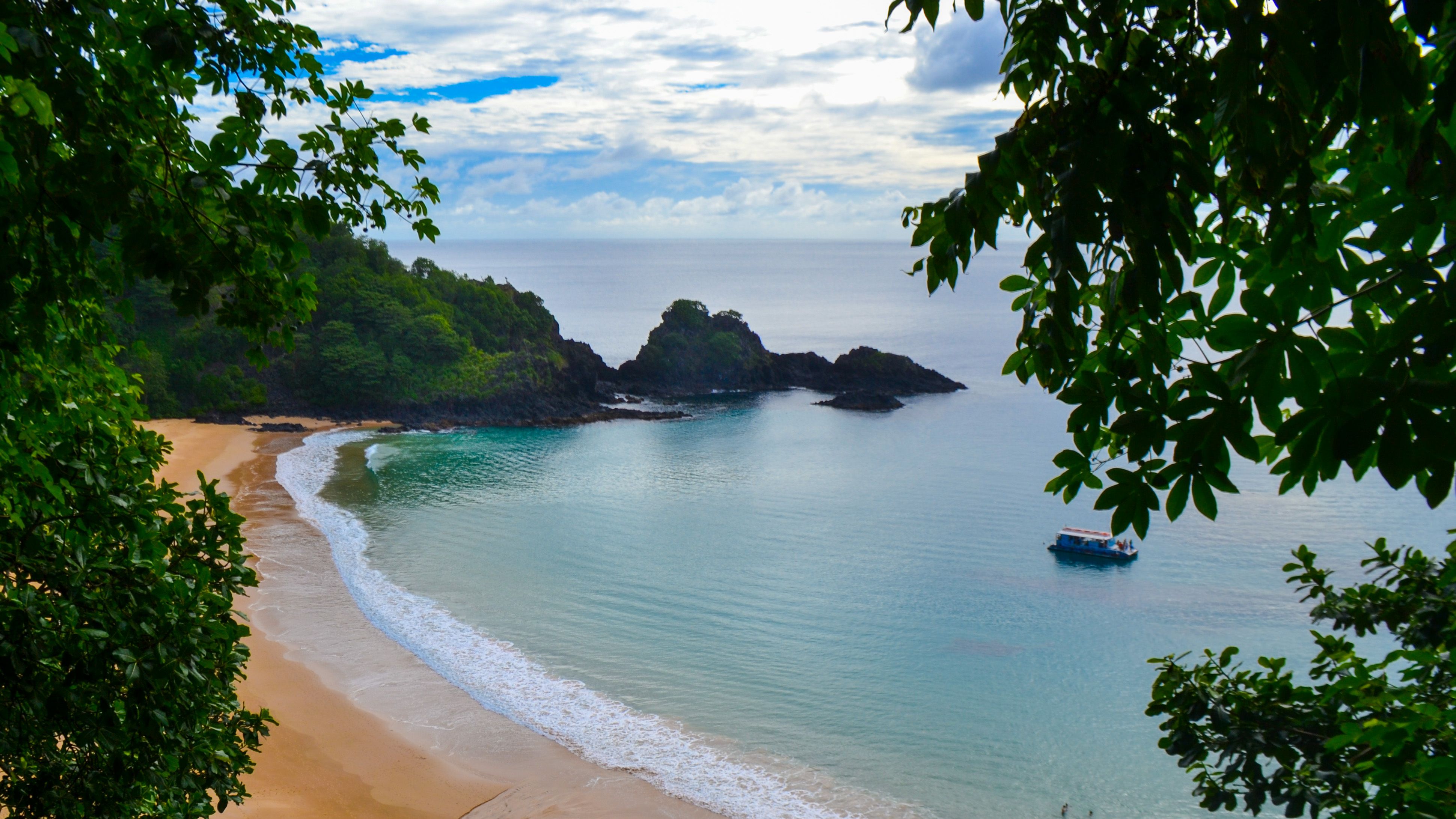
Tucked beneath sheer cliffs on Fernando de Noronha and reachable only by a steep ladder cut into the rock (or by boat), this beach has topped "world's best beach" rankings for good reason.
Turquoise water, sea turtles visible from the shore, and a protected marine park setting mean it stays close to pristine.
The remoteness that makes it special also caps how many people can visit each day.
How does it rate
CrowdsRomanceCash RequiredDangerAccessibilityWhy you should go
Repeatedly voted the world's most beautiful beach, with clear water and visible sea turtles just offshore.
Why you shouldn't go
Only reachable by a steep cliff ladder or a boat transfer, and the island itself is expensive and visitor-capped.
Plan your visit
Best time to visitSeptember-December for the calmest, clearest water.Best time of dayMorning, before the wind picks up and while the ladder queue is short.Getting thereFly to Fernando de Noronha via Recife or Natal; the beach is a short drive plus the cliff ladder from the island's main road.Entry costIncluded in the island's mandatory environmental preservation fee, charged per day.Time neededHalf a day.Insider tip — Snorkel gear rented in Vila dos Remedios pays off here - the reef right off the sand has some of the island's best visibility. -
 #590 /100
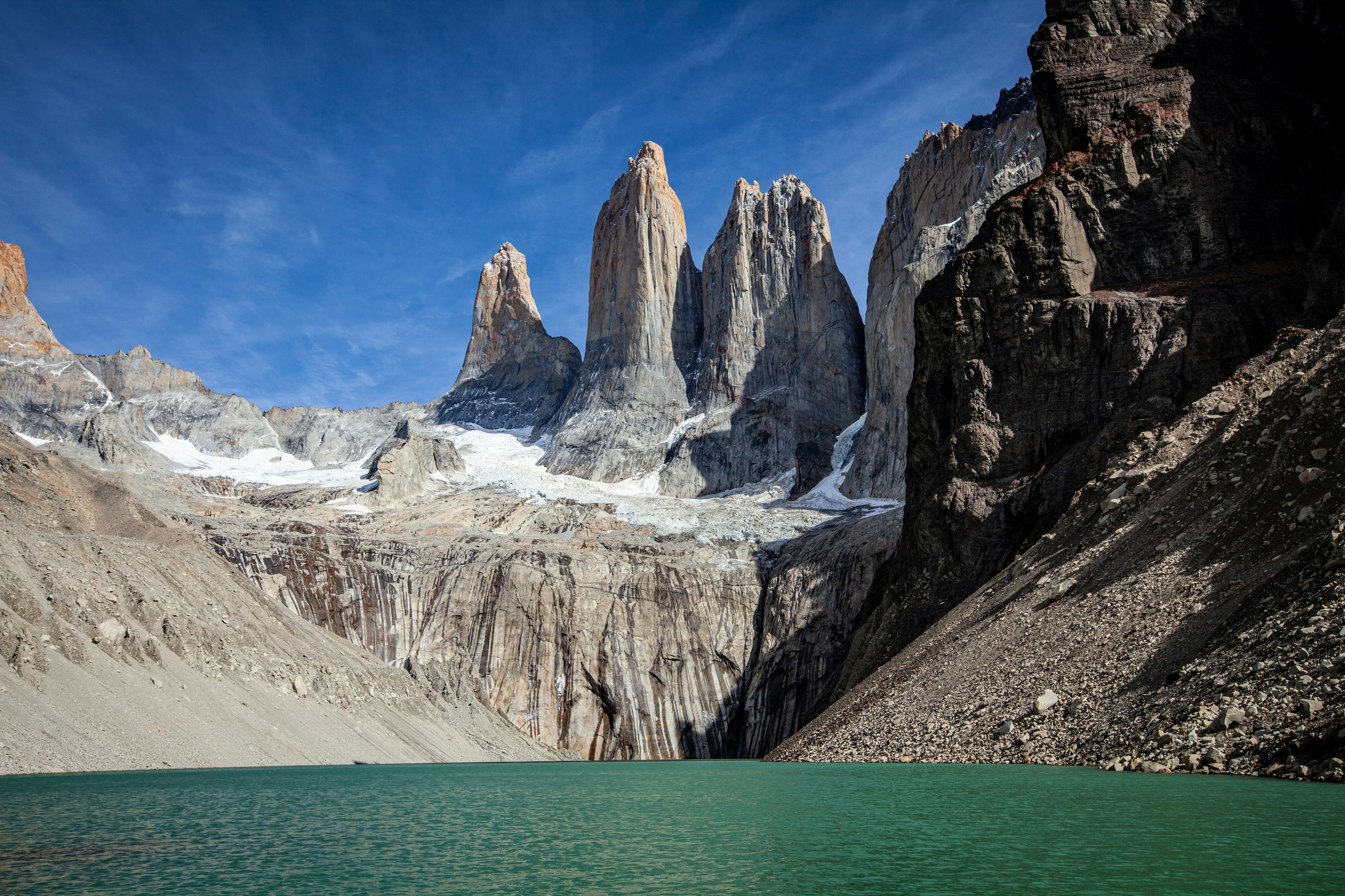
Three granite towers punch straight up out of Chilean Patagonia, reflected in turquoise glacial lakes that change colour with the light.
The full W trek links the towers with glaciers, wind-battered forests and the vivid blue of the Grey Glacier over several days.
Even a single day at the base-of-the-towers viewpoint delivers one of South America's most dramatic landscapes.
How does it rate
CrowdsRomanceCash RequiredDangerAccessibilityWhy you should go
Three granite spires over turquoise glacial lakes - Patagonia's single most iconic view.
Why you shouldn't go
Patagonian wind is relentless and can shut down trails or make photography genuinely difficult.
Plan your visit
Best time to visitNovember-March, the Southern Hemisphere summer.Best time of dayEarly morning, when the wind is calmest and the towers often clear of cloud.Getting thereFly to Punta Arenas, bus to Puerto Natales, then park shuttle to Torres del Paine.Entry costPark entry fee, roughly $35-45 for foreign visitors.Time needed3-5 days for the W trek; 1 day for the base viewpointBookingBook ahead →Insider tip — Base yourself near the park for a pre-dawn start on the Base Towers trail - the final viewpoint is worth reaching before the day's cloud builds. -
 #6
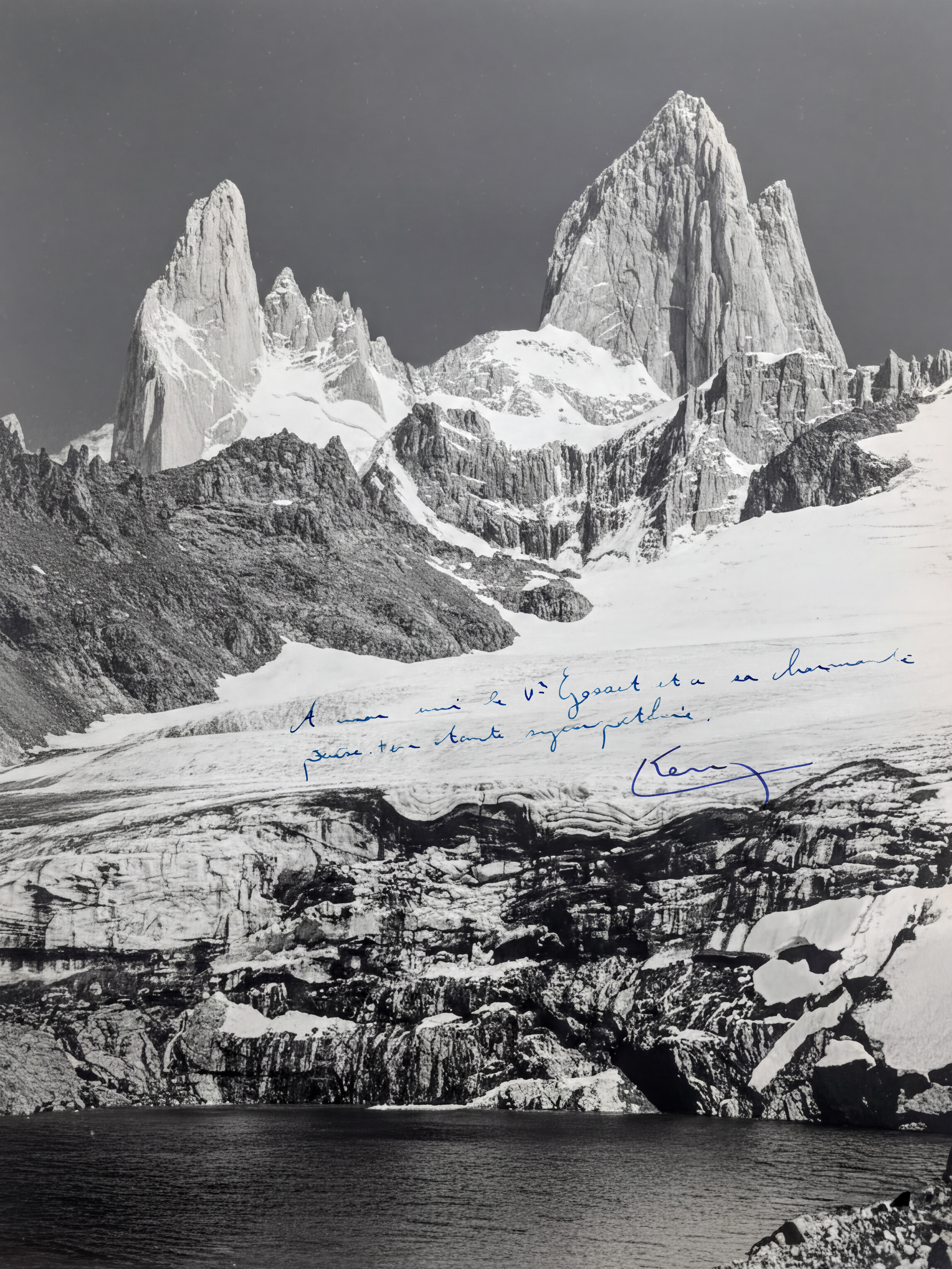
#6Mount Fitz Roy is a serrated granite peak on the border of Argentina and Chile in Patagonia, rising 3,405 metres above the Patagonian steppe.
Its distinctive jagged silhouette, often wreathed in cloud, inspired the Patagonia clothing brand logo and is considered one of the most technically challenging climbs in the world.
How does it rate
CrowdsRomanceCash RequiredDangerAccessibilityWhy you should go
The view of Fitz Roy reflected in Laguna de los Tres, with the jagged granite towers rising above the surrounding ice field, is one of the most dramatic mountain scenes in South America.
Why you shouldn't go
The classic Laguna de los Tres viewpoint requires a strenuous 22-kilometre return hike with 1,300 metres of elevation gain; the peak is notoriously cloud-covered.
Plan your visit
Best time to visitDecember-February (Southern Hemisphere summer) for best weather oddsBest time of daySunrise for the "fire" effect when the peak turns redGetting thereFly to El Calafate, then bus to El ChaltenEntry costFree, no permits neededTime neededFull day hike (~10hrs round trip)Insider tip — The famous red sunrise glow depends on clear skies; the peak is often cloud-covered, so budget extra days if you can -
 #788 /100
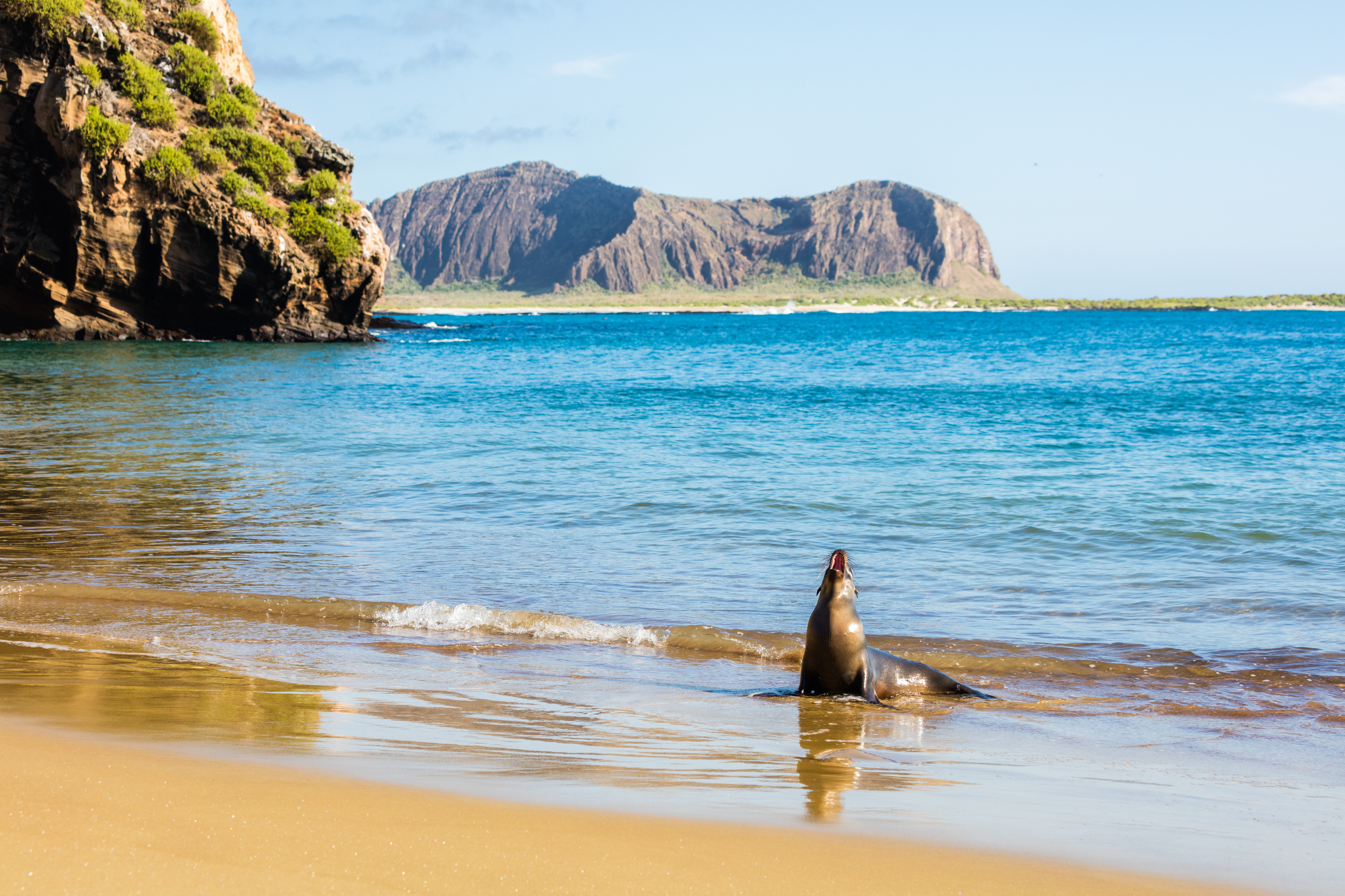
Six hundred miles off the Ecuadorian coast, the Galápagos archipelago is a living laboratory of evolution where wildlife shows no fear of humans.
Charles Darwin's observations here inspired his theory of natural selection, and today visitors can snorkel with sea lions and walk alongside giant tortoises.
How does it rate
CrowdsRomanceCash RequiredDangerAccessibilityWhy you should go
Nowhere else on earth can you get so close to such diverse and fearless wildlife; the experience of snorkelling alongside marine iguanas is unlike anything else.
Why you shouldn't go
The Galápagos is one of the most expensive travel destinations in Latin America, and strict visitor regulations limit where you can go and what you can do.
Plan your visit
Best time to visitJune-November for wildlife activity and cooler seasBest time of dayMorning for wildlife viewingGetting thereFly to Baltra or San Cristobal via Guayaquil or QuitoEntry cost$200 park entry fee plus cruise/tour costsTime needed5+ daysInsider tip — A licensed naturalist guide is required by law and makes a huge difference to what you see -
 #888 /100
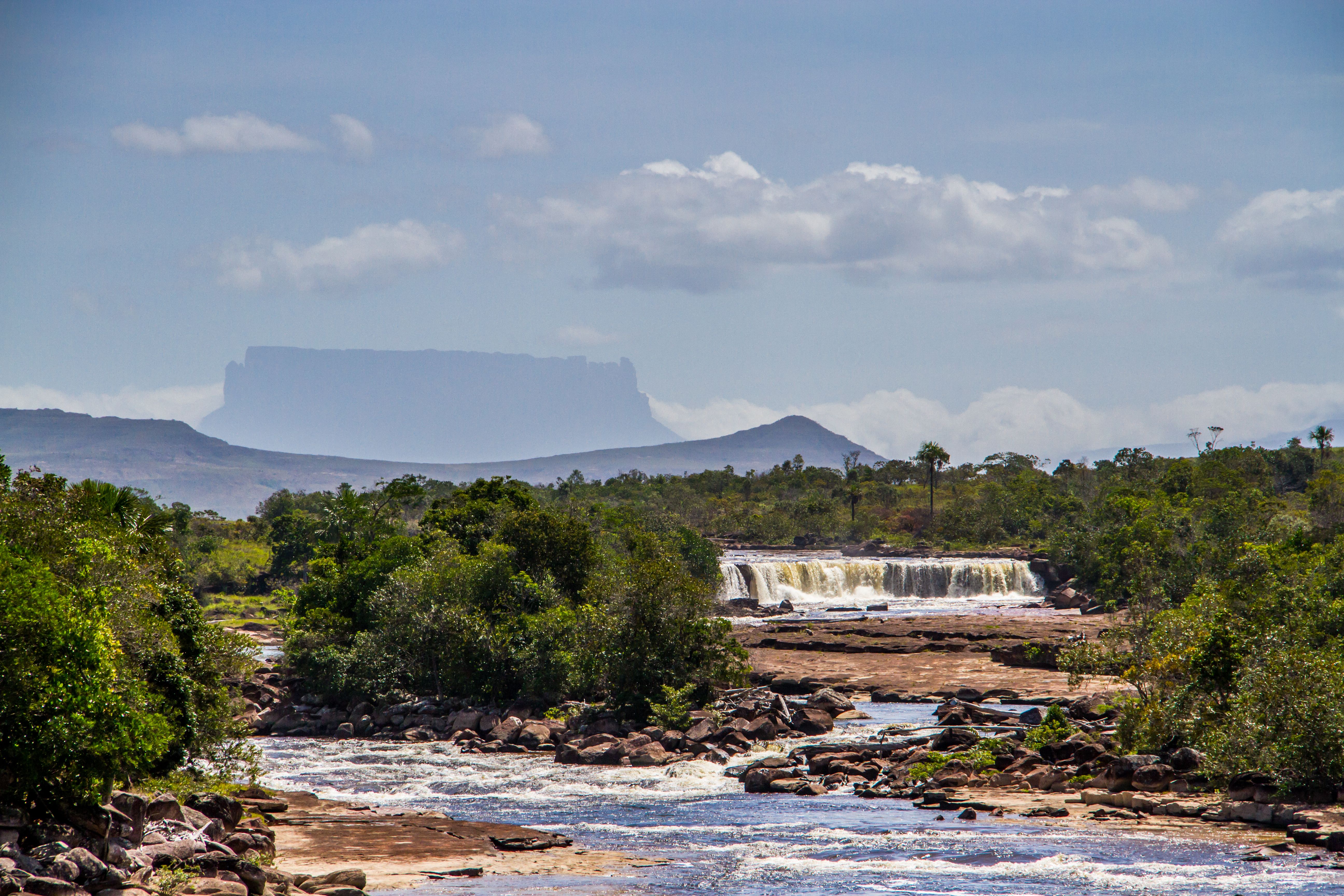
Water drops 979 metres off a sheer tabletop mountain in the middle of remote Venezuelan jungle, making this the tallest waterfall on Earth by a wide margin.
The fall is so tall that much of the water disperses into mist before ever reaching the pool below.
Reaching it means days of river travel by dugout canoe through Canaima National Park, so the sheer remoteness is part of what keeps the view unspoiled.
How does it rate
CrowdsRomanceCash RequiredDangerAccessibilityWhy you should go
The tallest waterfall on Earth, dropping nearly a kilometre off an isolated jungle tabletop mountain.
Why you shouldn't go
There's no road access at all - reaching the base requires days of canoe travel and real logistics.
Plan your visit
Best time to visitJune-November, the wet season, when water volume is highest.Best time of dayMorning, before afternoon cloud typically obscures the tepui's summit.Getting thereFly to Canaima, then travel by dugout canoe up the Carrao and Churun rivers (multi-day trip).Entry costIncluded in multi-day guided tour packages; no independent access.Time needed3-5 days round trip from CanaimaInsider tip — Go in the wet season - in the dry months the river can run too low for canoes to reach the base at all. -
 #987 /100
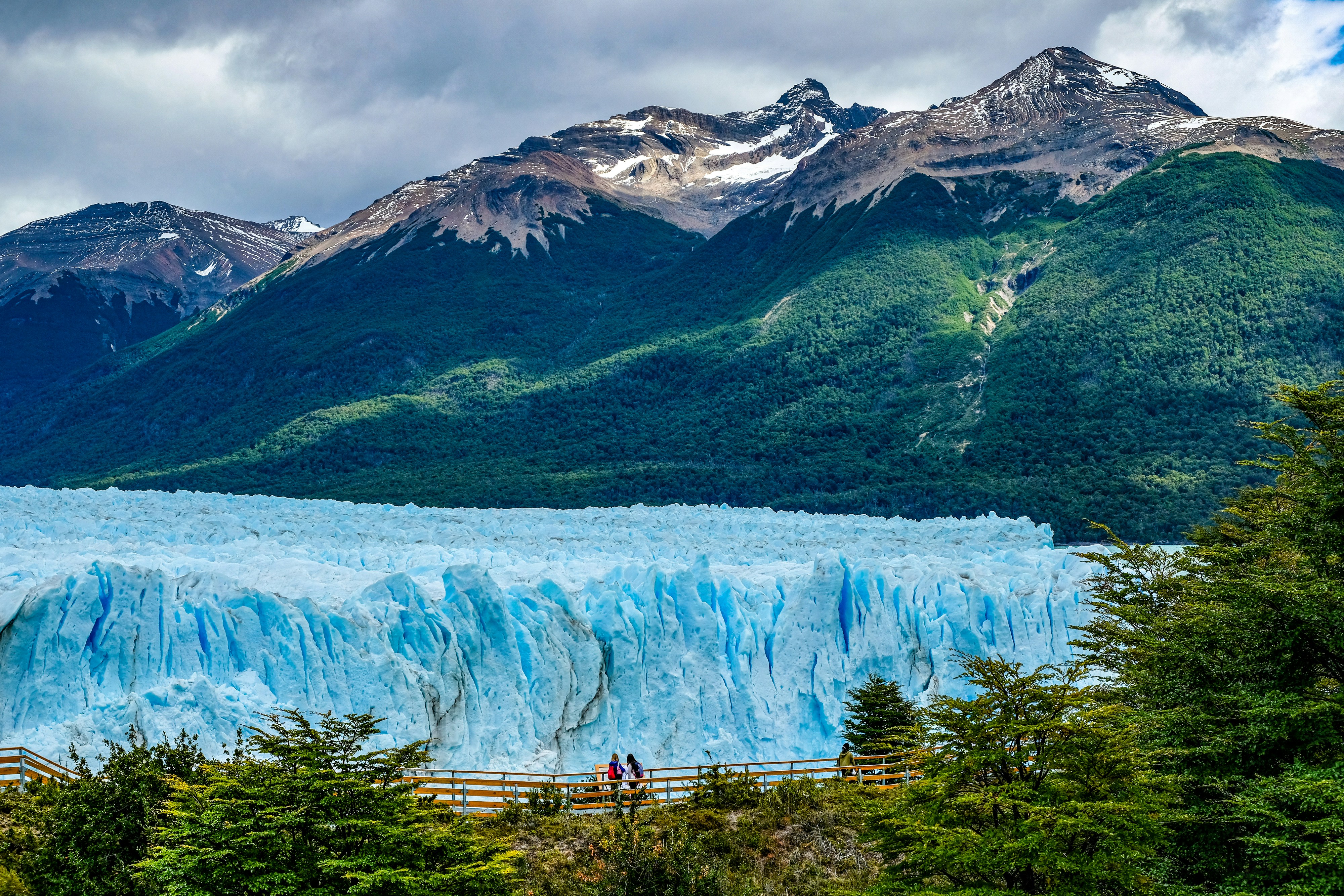
A massive tidewater glacier advancing into Lago Argentino, calving house-sized chunks of ice with a thunderous crack several times a day.
One of the few glaciers on Earth still growing, its brilliant blue ice face and extensive boardwalk system make it Patagonia's signature sight.
How does it rate
CrowdsRomanceCash RequiredDangerAccessibilityWhy you should go
A colossal advancing glacier calving house-sized ice chunks with a thunderous crack, several times a day.
Why you shouldn't go
Very popular, so viewing platforms get crowded in peak season; park entrance fees are steep; weather can obscure views.
Plan your visit
Best time to visitNovember–March (Southern Hemisphere summer) for the most stable weather and longest daylight.Best time of dayAny time of day works, though morning light often shows the ice at its bluest.Getting thereFly to El Calafate, then roughly an 80km (1.5-hour) drive to Los Glaciares National Park.Entry costARS national park entrance fee (~$25 USD equivalent); optional boat tours and ice trekking $80–250 UTime needed4–6 hours including travel from El Calafate.Insider tip — Book an ice-trekking tour to actually walk on the glacier — the boardwalks are free but only offer distant views. Bring layers; the wind off the ice is cold even in summer. -
 #1086 /100
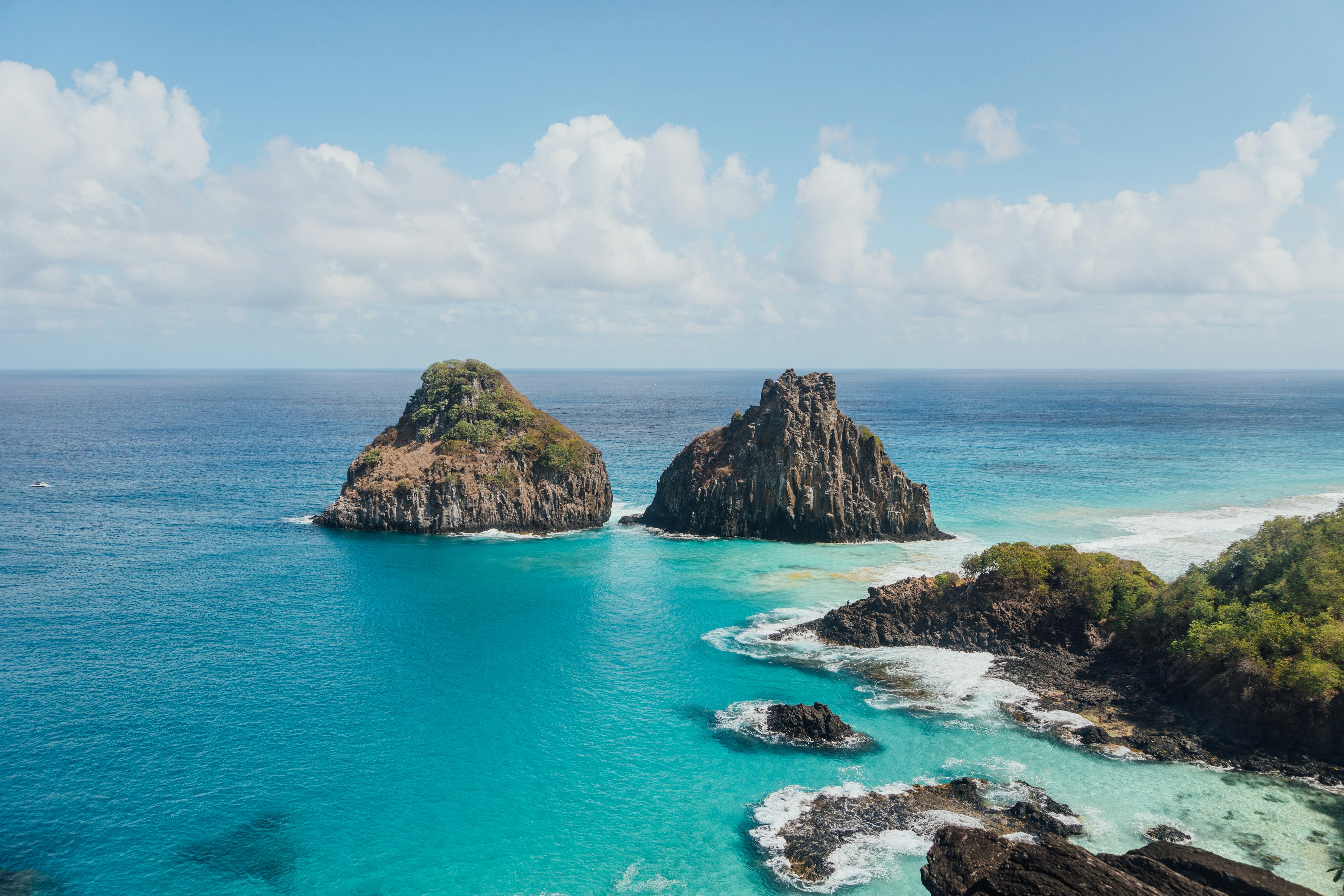
A volcanic archipelago 350km off Brazil's coast, this is regularly ranked among the world's best beaches, with clear water that reveals reef sharks and sea turtles from the shoreline.
A strict daily visitor cap and environmental tax keep the beaches close to empty even in high season.
Morro Dois Irmaos, twin volcanic peaks rising from the sea, anchor the view from almost every beach.
How does it rate
CrowdsRomanceCash RequiredDangerAccessibilityWhy you should go
Regularly ranked among the world's best beaches, kept nearly empty by a strict daily visitor cap.
Why you shouldn't go
A mandatory environmental tax plus limited flights make this one of the most expensive beach trips in Brazil.
Plan your visit
Best time to visitAugust-December, the dry season, for the clearest water.Best time of dayMorning, for calm water and the best snorkelling visibility.Getting thereFly via Recife or Natal; only small aircraft serve the island's single airstrip.Entry costEnvironmental preservation tax charged per day, plus a separate national park fee for some beaches.Time needed4-5 daysInsider tip — Book flights and accommodation well ahead - the daily visitor cap means the island sells out during Brazilian holiday periods. -
 #1186 /100
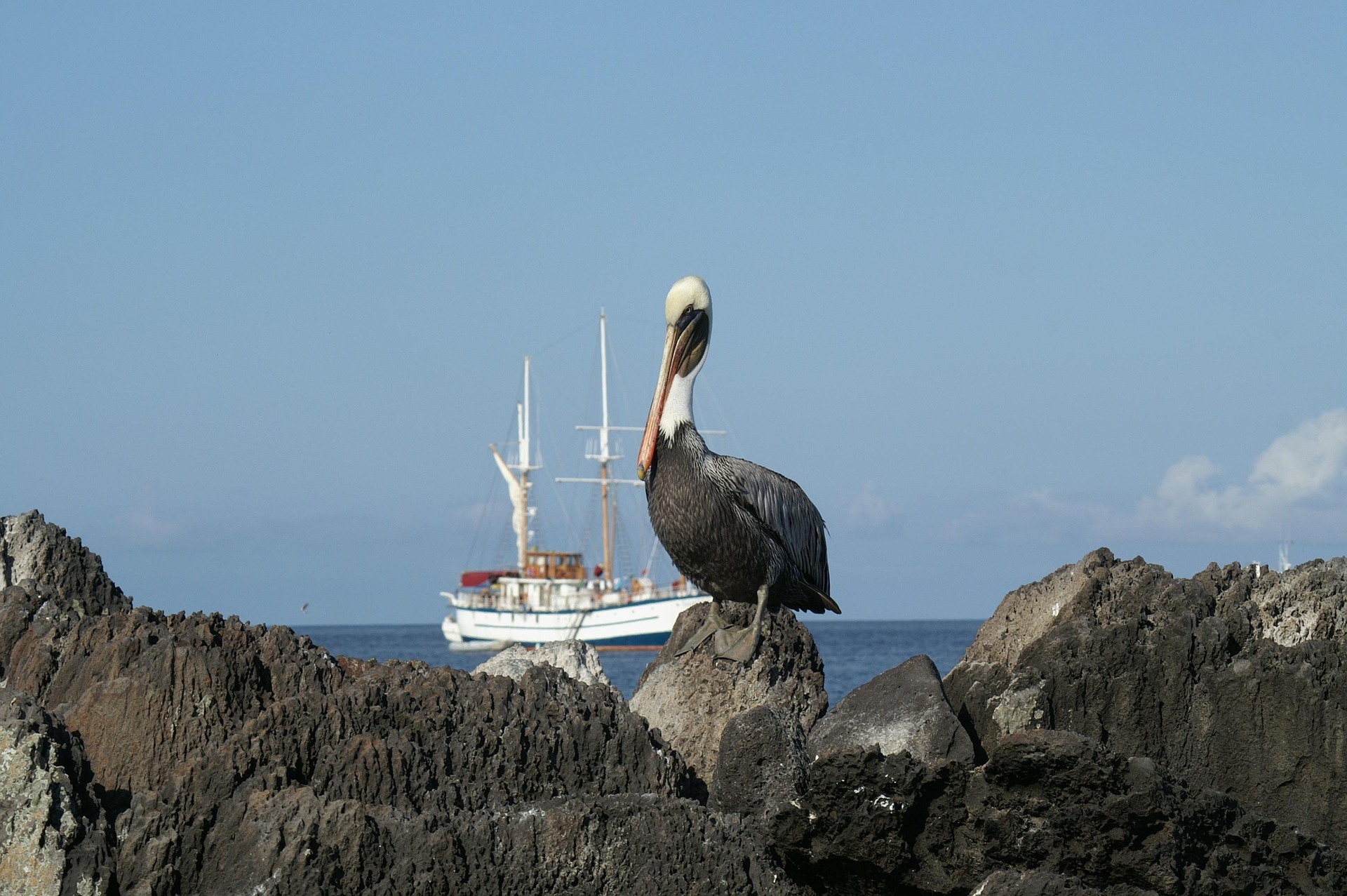
A small-ship cruise through the Galapagos archipelago, landing daily by dinghy on islands where sea lions, marine iguanas, and blue-footed boobies show no fear of visitors.
Charles Darwin's living laboratory looks much as it did when he arrived, thanks to strict limits on visitor numbers and permitted routes.
Snorkeling brings penguins and hammerhead sharks within arm's reach.
Each island differs sharply from the last in wildlife and landscape.
How does it rate
CrowdsRomanceCash RequiredDangerAccessibilityWhy you should go
Close, fearless encounters with sea lions, iguanas, and giant tortoises found nowhere else on Earth.
Why you shouldn't go
Strict permit limits keep prices high, and itineraries are fixed months ahead with little flexibility.
Plan your visit
Best time to visitYear-round destination; June-November for calmer seas and marine wildlife, December-May for warmer water.Best time of dayEarly morning landings, before the heat builds and animals are most active.Getting thereFly to Quito or Guayaquil, then a short flight to Baltra or San Cristobal to board the ship.Entry costIndicative $500-$1,500pp per day depending on ship classTime needed5-8 night cruiseInsider tip — Choose an 8-day itinerary over a 5-day one to reach the outer islands with the best wildlife; pack reef-safe sunscreen only, as regular sunscreen is banned in the marine reserve. -
 #1285 /100
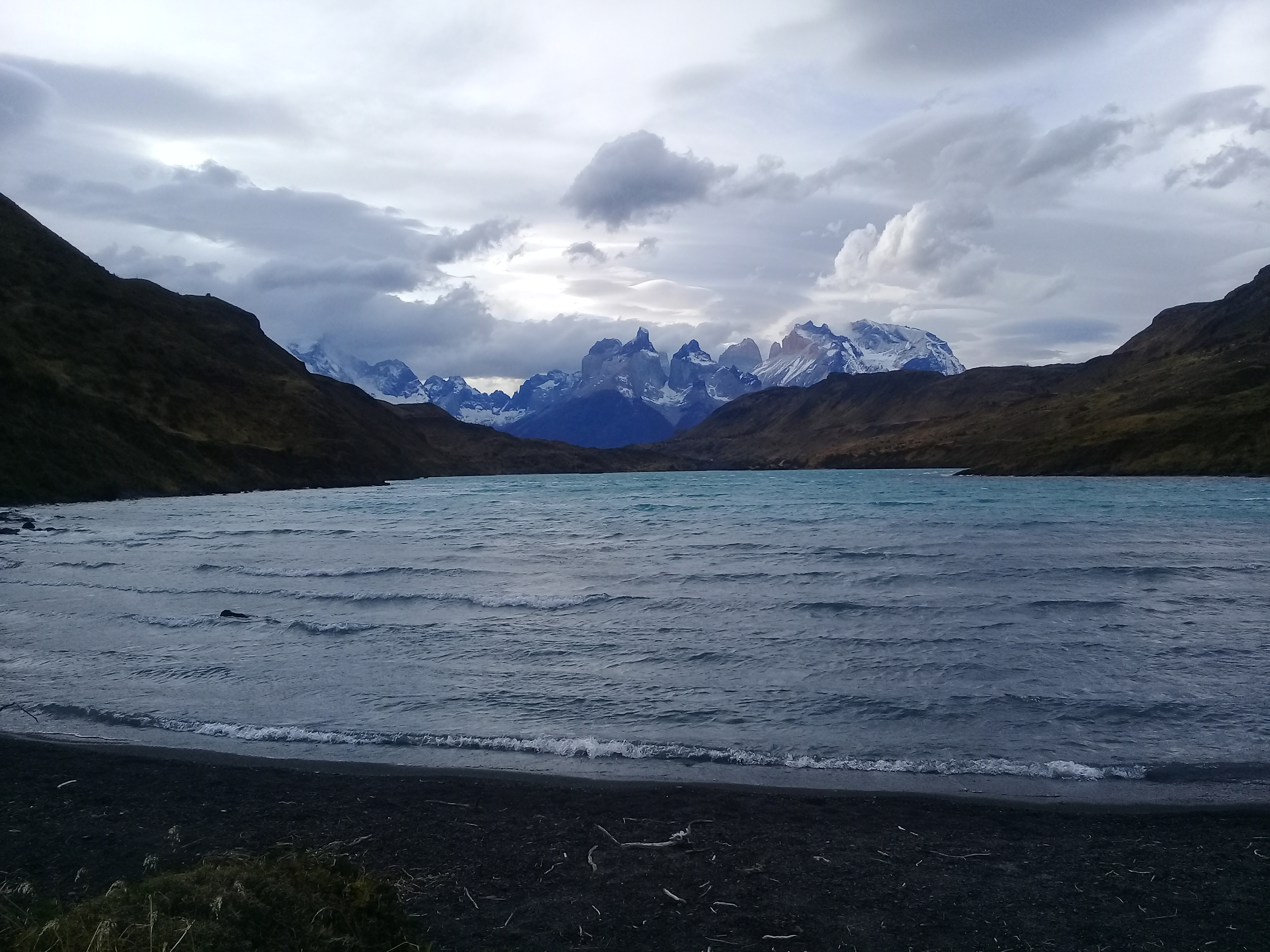
A 4-5 day traverse of Torres del Paine's signature sights: the granite Torres themselves, the sheer Cuernos horns, French Valley's hanging glaciers, and Grey Glacier's blue ice.
Refugios and campsites break the route into manageable days, though Patagonian wind can turn brutal without warning.
The reward is one of the most consistently spectacular multi-day trails in South America, from lenga forest to turquoise glacial lakes.
How does it rate
CrowdsRomanceCash RequiredDangerAccessibilityWhy you should go
Four straight days of the Cuernos, Grey Glacier and the Torres themselves without a single dull stretch.
Why you shouldn't go
Notorious Patagonian wind and rain can stall a day's hike entirely, and refugio spots must be booked far ahead.
Plan your visit
Best time to visitNovember-March (Southern Hemisphere summer), when trails and refugios are open.Best time of dayEarly morning at the Base Torres viewpoint, before afternoon cloud hides the towers.Getting thereFly to Punta Arenas; bus (about 3-5 hours) to Puerto Natales, then a shuttle to the park.Entry costPark entry about $49 USD; refugio and camping packages from roughly $600-1,500.Time needed4-5 daysBookingBook ahead →Insider tip — Book refugios the moment the season opens (around April-May) - popular ones sell out for peak months first. -
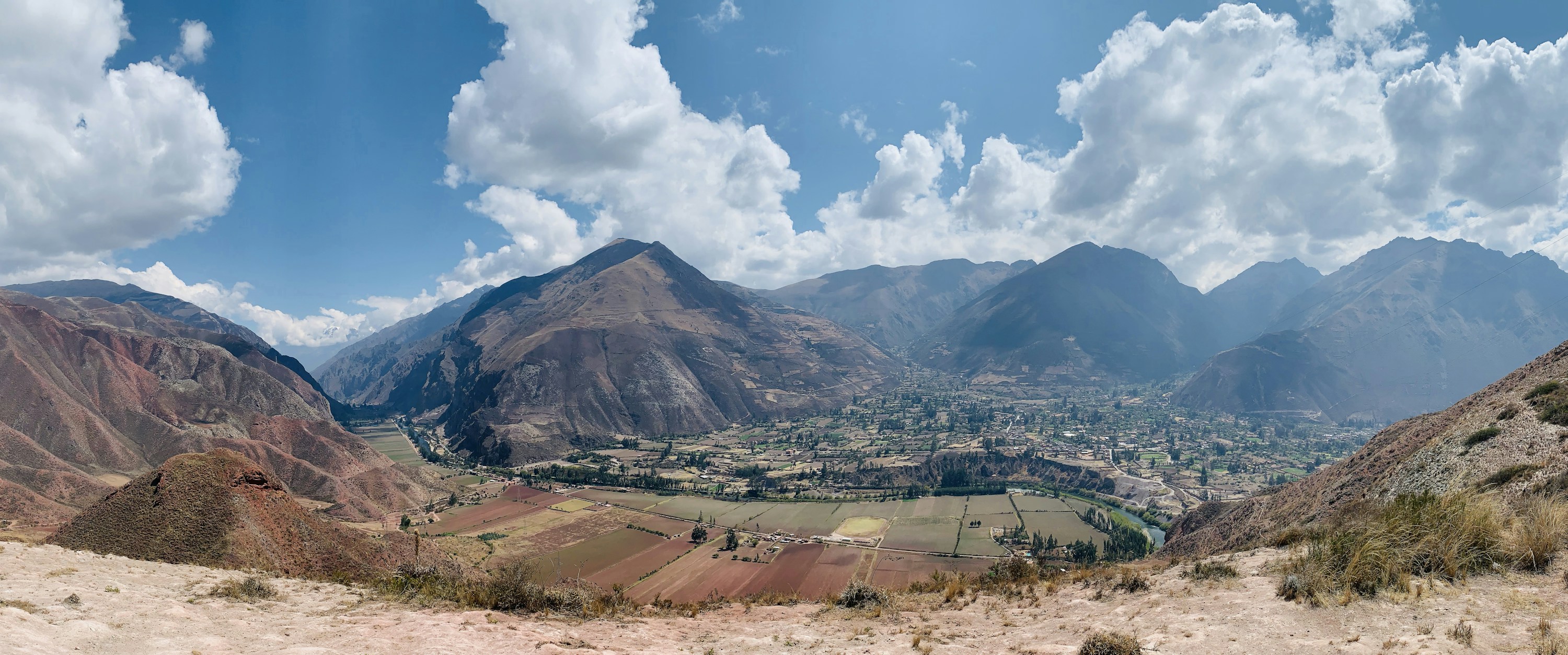 #1383 /100
Strung along the Urubamba River between Cusco and Machu Picchu, the Sacred Valley was the Inca empire's farming heartland and still works the same terraced hillsides.
In a day you can walk the Pisac ruins above their market, climb Ollantaytambo's fortress terraces, and see the circular agricultural bowl at Moray.
Lower and gentler than Cusco, it rewards a slower, multi-stop visit.
How does it rate
CrowdsRomanceCash RequiredDangerAccessibilityWhy you should go
Four or five distinct Inca sites and living Andean villages within one easy valley.
Why you shouldn't go
Seeing it properly means several separate entry tickets and a full day of driving between stops.
Plan your visit
Best time to visitApril-October, dry season; Pisac's market is liveliest on SundaysBest time of dayMorning, before afternoon cloud builds over the mountainsGetting there40-60 min by road from Cusco to Pisac or Urubamba; most visitors join a tour or hire a driverEntry costBoleto turistico parcial ~S/70 covers Pisac, Ollantaytambo, Chinchero, Moray; Maras extra ~$8Time needed1-2 daysInsider tip — Base yourself overnight in Ollantaytambo rather than day-tripping from Cusco - it's the only Inca town still inhabited on its original foundations, and you get the ruins to yourself at opening time. -
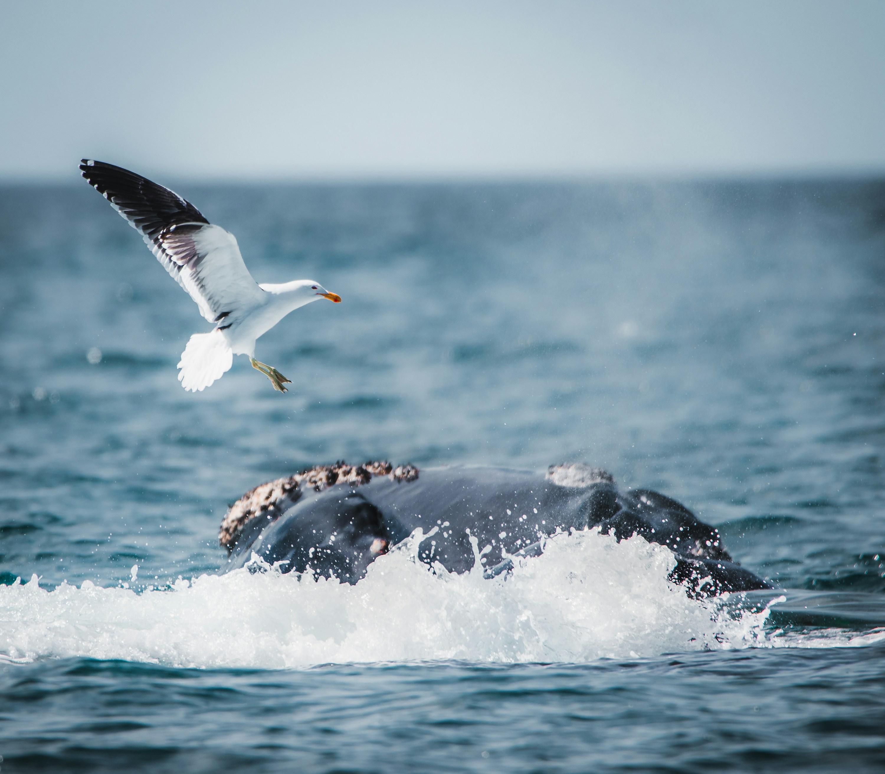 #1483 /100
Peninsula Valdes juts into the South Atlantic off Argentine Patagonia and holds one of the continent's great wildlife spectacles: southern right whales calving close to shore, orcas that beach themselves hunting sea lion pups, and colonies of elephant seals and penguins.
A UNESCO site reached from Puerto Madryn, it's linked by unpaved roads between viewing points.
Sightings are seasonal, so timing matters.
How does it rate
CrowdsRomanceCash RequiredDangerAccessibilityWhy you should go
Southern right whales come close enough to watch from small boats or even the shore, in season.
Why you shouldn't go
Wildlife is seasonal and not guaranteed outside the main months - check the calendar before booking.
Plan your visit
Best time to visitJune-December for whales (peak Sept-Nov); Oct-Nov also for orca hunting behaviorBest time of dayMorning boat trips tend to have calmer water and more active whalesGetting thereFly to Trelew or Puerto Madryn, then 1-1.5hr drive onto the peninsulaEntry costReserve entrance fee ~$20-30; whale-watching boat trips separate, ~$70-100Time neededFull day; two days to cover more viewing pointsInsider tip — Book a boat trip from Puerto Piramides itself rather than a day tour from Puerto Madryn - you get more time on the water and less time on the bus. -
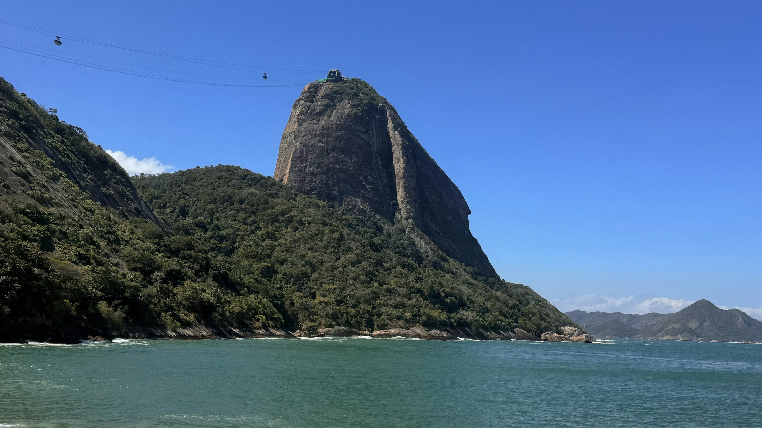 #1583 /100
A two-stage cable car, the bondinho, carries visitors from Praia Vermelha up over the forested Morro da Urca to the bare granite summit of Pão de Açúcar, 396 metres above Guanabara Bay.
From the top, Rio unfolds in full: Copacabana's curve, Christ the Redeemer on Corcovado, and the bay's scattering of islands.
It's one stop, one ride, and one of the most complete views of the city available anywhere.
How does it rate
CrowdsRomanceCash RequiredDangerAccessibilityWhy you should go
One cable car ride delivers one of the most complete views of Rio available anywhere in the city.
Why you shouldn't go
Tickets are pricey for a return cable-car ride, and the view disappears entirely on overcast days.
Plan your visit
Best time to visitYear-round; clearest views June-September, avoid rainy Jan-March afternoons.Best time of dayLate afternoon into sunset, for golden light over the bay.Getting thereIn Rio's Urca neighbourhood; taxi or bus from Copacabana or Ipanema (about 20 min) to the Praia Vermelha cable car station.Entry costCable car round-trip ~R$110-205 (~US$20-35)Time needed2-3 hoursBookingBook ahead →Insider tip — Book the sunset time slot online in advance - it sells out first, and the light over the bay is the main reason to go. -
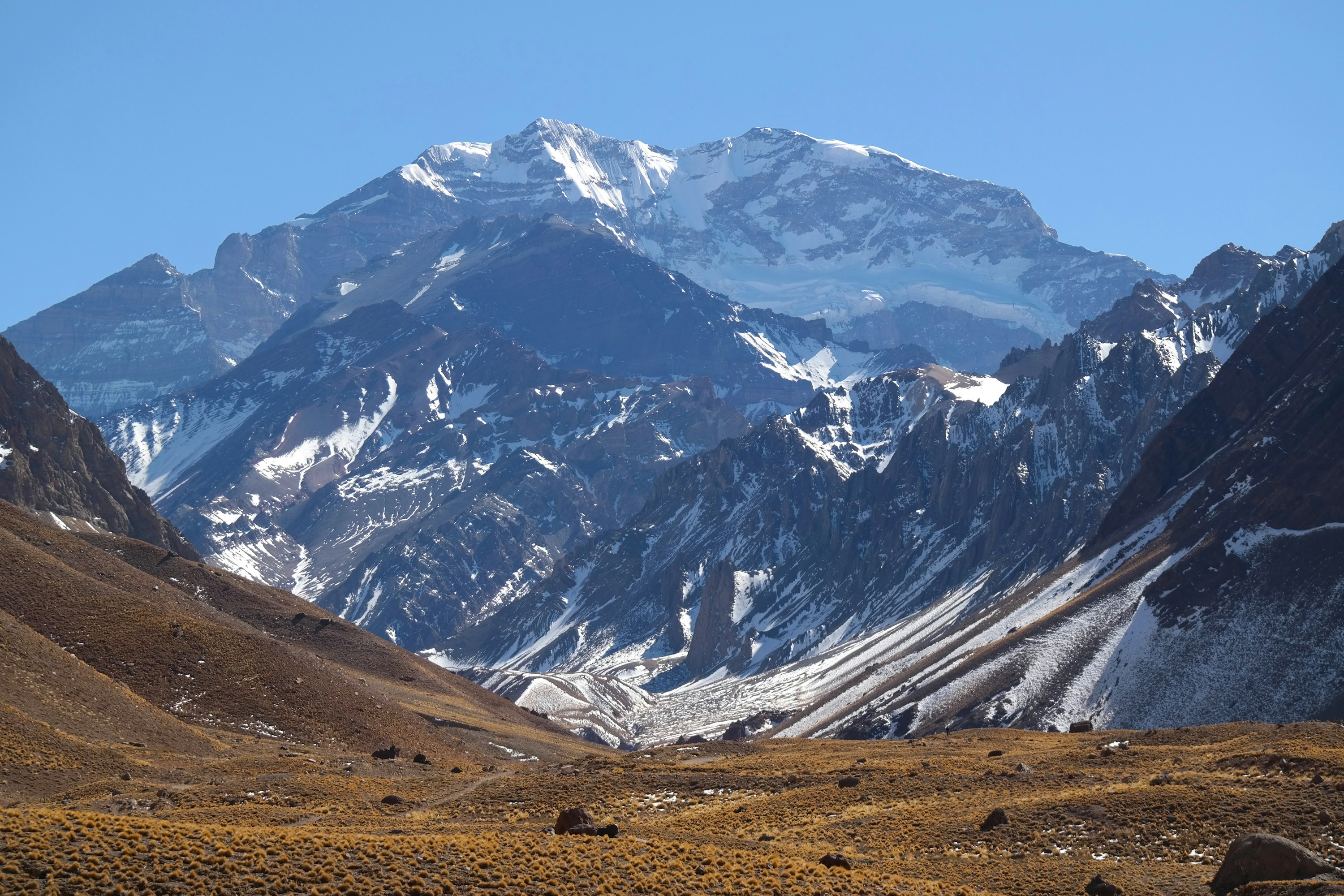 #1682 /100
Aconcagua rises 6,961 metres in Mendoza Province, the highest peak in both the Western and Southern Hemispheres and one of the Seven Summits.
Serious climbers spend two to three weeks on the standard Normal Route to the summit, but the mountain rewards a much shorter visit too: a half-day trek from the Horcones trailhead reaches Laguna de los Horcones, a glacial lake with a full view of the south face and glacier.
Aconcagua Provincial Park protects the surrounding high-altitude terrain.
How does it rate
CrowdsRomanceCash RequiredDangerAccessibilityWhy you should go
The highest mountain outside the Himalayas, viewable up close on an easy half-day trek without any climbing gear.
Why you shouldn't go
Summiting is a serious high-altitude expedition; most visitors only see the mountain from the valley trails below.
Plan your visit
Best time to visitDecember-March (Southern Hemisphere summer), when the park and climbing routes are openBest time of dayMorning, before afternoon wind picks up in the high valleyGetting thereFly to Mendoza, then about 3 hours by road to the Horcones entrance near Puente del IncaEntry costPark entry fee for the day-trek zone, a few thousand ARS; multi-week climbing permits cost several hTime neededHalf a day for the Laguna de los Horcones trek; 2-3 weeks for a summit expeditionInsider tip — The Confluencia trek (one day further in than Horcones) gets you a far closer view of the south face for only a little more effort. -
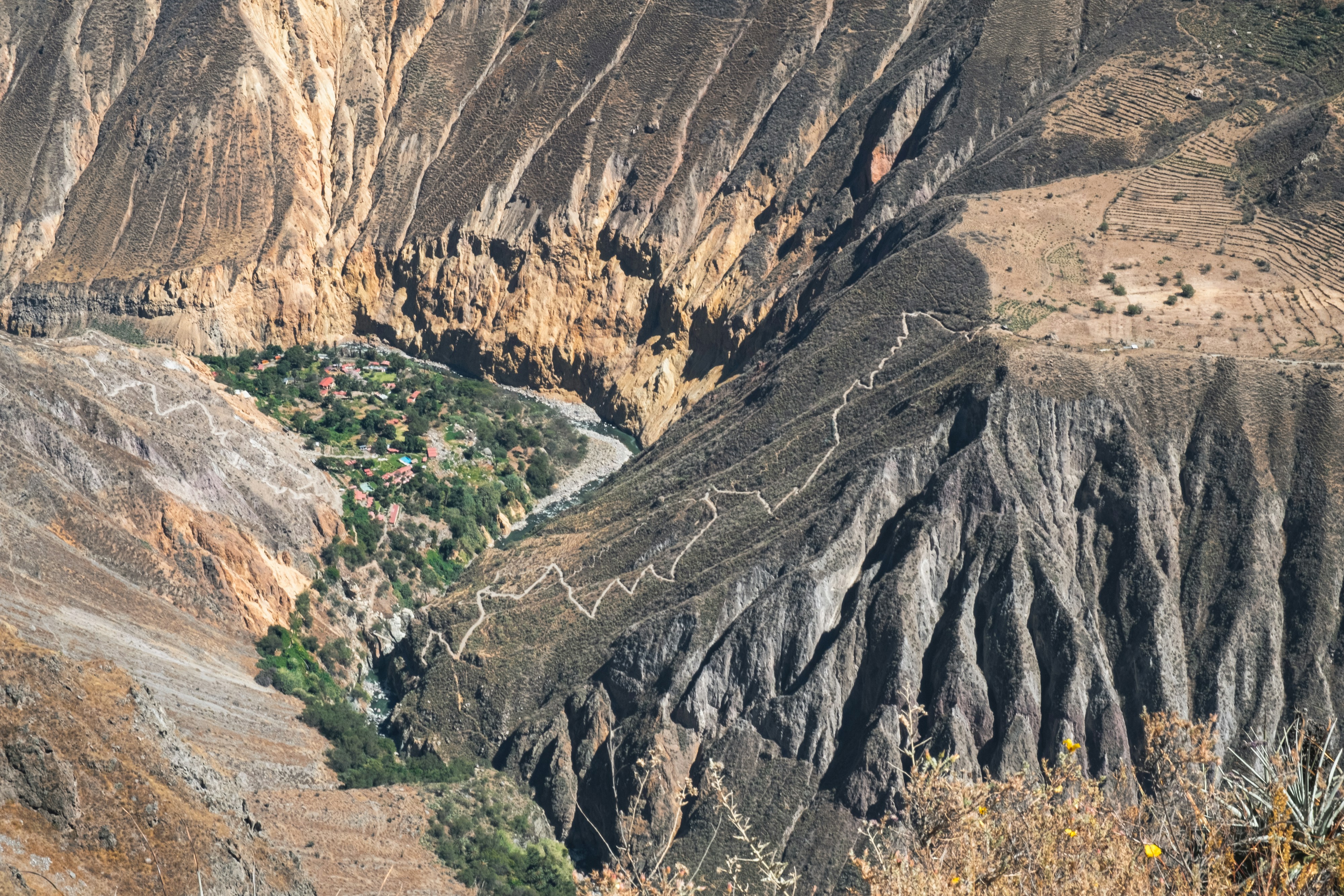 #1782 /100
One of the world's deepest canyons slices through the Peruvian Andes, its terraced walls farmed by local communities for centuries before the Incas ever arrived.
Andean condors ride the morning thermals at Cruz del Condor, often gliding within metres of the viewpoint's edge.
Traditional villages along the canyon rim still weave and dress in pre-Columbian styles rarely seen elsewhere in Peru.
How does it rate
CrowdsRomanceCash RequiredDangerAccessibilityWhy you should go
Wild Andean condors gliding at eye level from a canyon-rim viewpoint, most mornings.
Why you shouldn't go
Condor sightings are common but not guaranteed - a bad-weather morning can mean an empty sky.
Plan your visit
Best time to visitMay-November, the dry season, for reliable condor flights.Best time of dayEarly morning, 8-10am, when thermals bring the condors up to the rim.Getting thereDrive from Arequipa (about 3-4 hours) to the canyon; most visitors join an organised tour.Entry costTourist ticket (boleto turistico) required, around $25.Time needed2 days, including an overnight in the canyonInsider tip — Stay overnight in Cabanaconde rather than day-tripping from Arequipa - the condor flights are best seen before the day-trip buses arrive. -
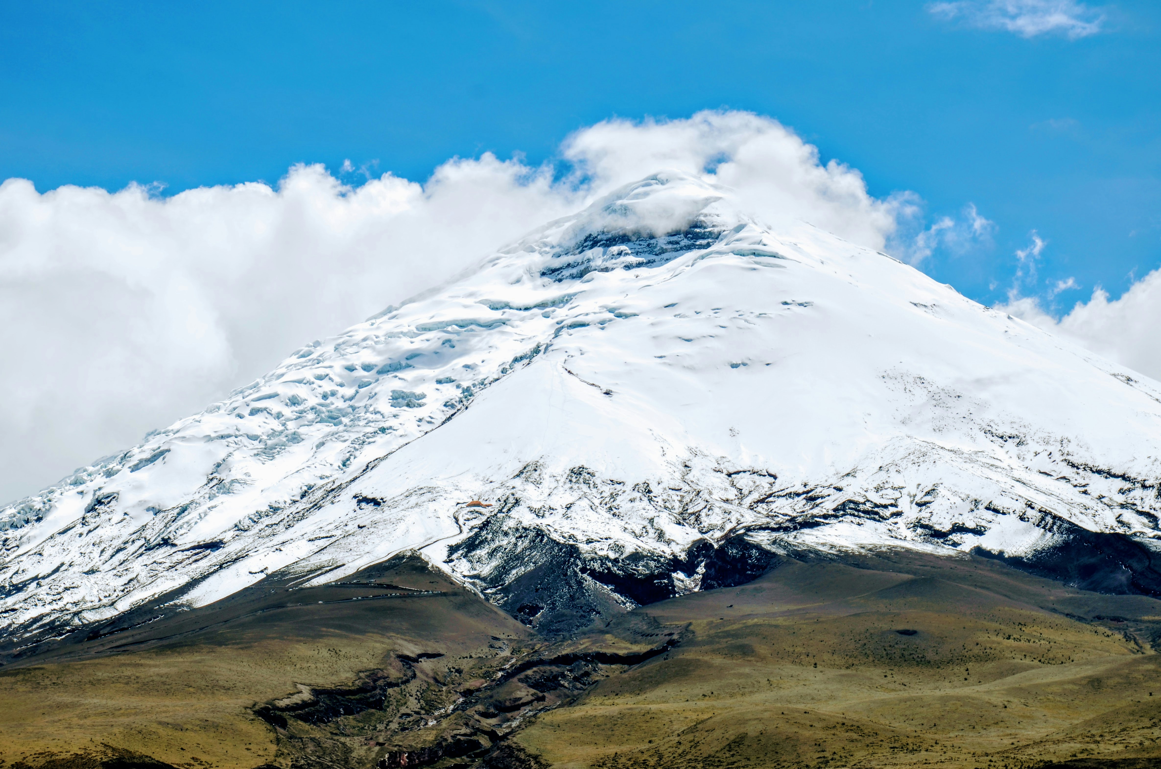 #18
#18One of the world's highest active volcanoes, a near-symmetrical glacier-capped cone rising over 5,800 metres above the Andean paramo grasslands south of Quito.
Most visitors don't summit - that requires technical mountaineering and acclimatisation - but a hike or horseback ride to the refuge at around 4,800 metres gets close enough to stand at the glacier's edge, with wild llamas often grazing the surrounding slopes.
Its perfect-cone silhouette is one of the most recognisable mountain shapes in South America.
How does it rate
CrowdsRomanceCash RequiredDangerAccessibilityWhy you should go
A near-perfectly symmetrical glacier-capped volcanic cone, reachable on a day hike from Quito without technical climbing.
Why you shouldn't go
Altitude sickness is a real risk even on the day-hike route, given the refuge sits close to 4,800 metres.
Plan your visit
Best time to visitJune-September or December-January for the clearest views of the summit.Best time of dayMorning, before afternoon cloud typically obscures the cone.Getting thereA 1.5-2 hour drive south from Quito to Cotopaxi National Park.Entry costNational park entry around USD10-12; guided day tours from Quito run USD60-90.Time neededA full day.Insider tip — Spend a night at altitude in nearby Quito or a park-adjacent lodge before the hike - even the moderate refuge trail is noticeably harder without a day or two of acclimatisation. -
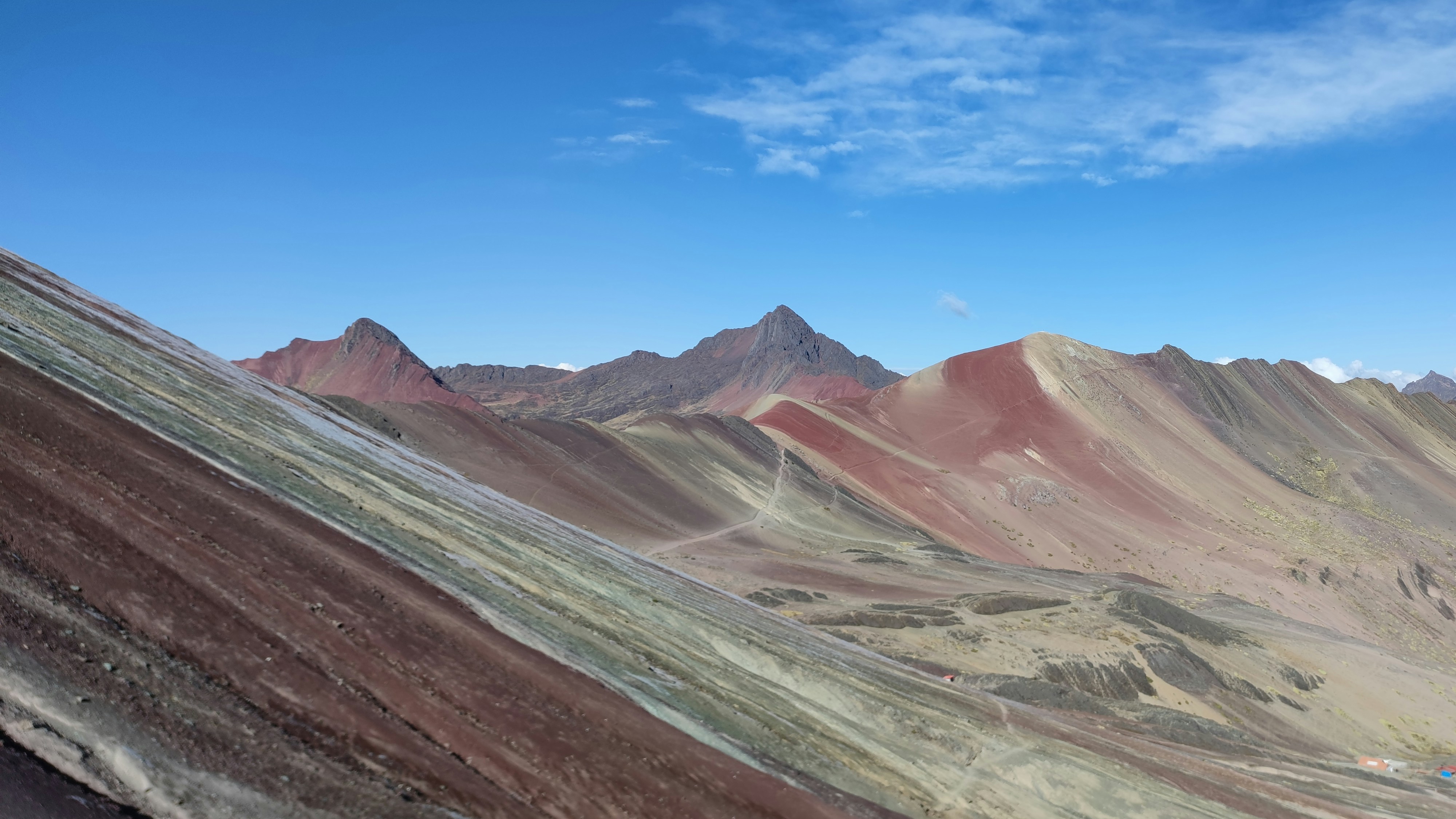 #1981 /100
Mineral bands of red, gold, turquoise and lavender stripe this Andean ridge, exposed by erosion after centuries of livestock trampling stripped the surface soil.
Sitting above 5,000 metres, the colours are more vivid in person than in most photos, especially just after rain.
Its rapid rise from local secret to must-see spot in under a decade has brought heavy foot traffic to a genuinely fragile landscape.
How does it rate
CrowdsRomanceCash RequiredDangerAccessibilityWhy you should go
Naturally striped mineral bands across an entire mountainside, unlike anywhere else nearby.
Why you shouldn't go
The altitude (over 5,000m) makes the short final walk far harder than it looks, and crowds start early.
Plan your visit
Best time to visitMay-September, the dry season, for the clearest colour and driest trail.Best time of dayEarly morning departure (around 3am from Cusco) to beat both crowds and afternoon cloud.Getting thereDrive roughly 3 hours from Cusco, then a 1-2 hour hike (or horse) to the viewpoint.Entry costCommunity entry fee, around $10-15, usually included in tour prices.Time neededFull day, including transport from CuscoInsider tip — Spend a day or two acclimatising in Cusco first - altitude sickness at 5,000m ruins more visits here than bad weather does. -
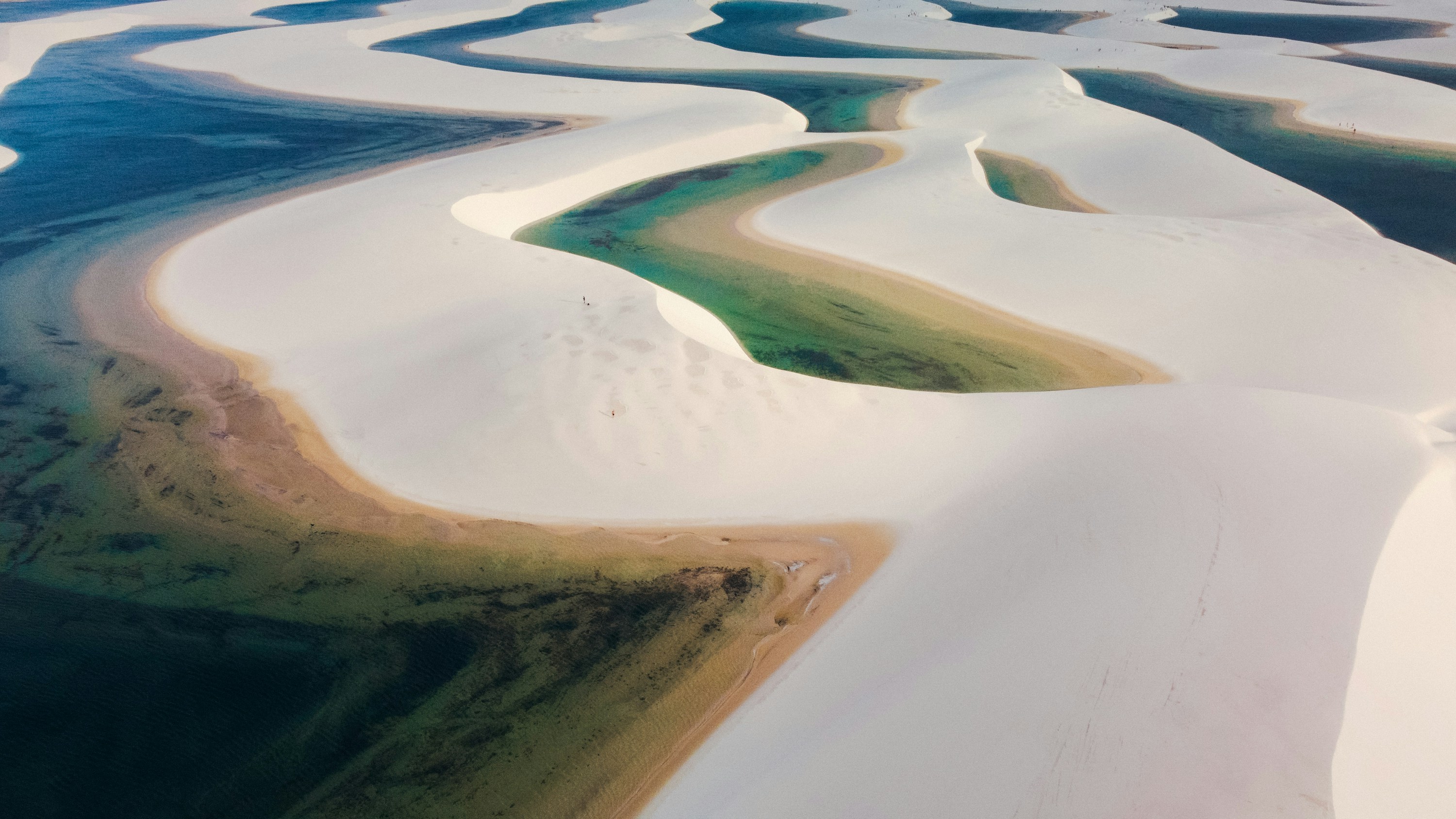 #20
#20Rated #20 of 43
Lençóis Maranhenses National Park, Brazil
#lençóismaranhensesnationalpark ◆ Natural Features81 /100Despite the name, this isn't a desert: seasonal rains fill the valleys between hundreds of square kilometres of white dunes with clear turquoise lagoons, usually June to September.
Outside that window, the dunes stretch out bone-dry and empty.
Reaching the interior means a 4x4 or a walk across shifting sand from the gateway town of Barreirinhas, but the landscape has no real equivalent on the Brazilian coast.
How does it rate
CrowdsRomanceCash RequiredDangerAccessibilityWhy you should go
Turquoise rainwater lagoons threaded through pure white dunes, found nowhere else on the coast.
Why you shouldn't go
The lagoons only hold water roughly June-September; visit outside that window and it's just dry sand.
Plan your visit
Best time to visitJune-September, when rains fill the dune lagoons for swimming.Best time of dayEarly morning, for cooler sand and softer light before the midday heat.Getting thereFly to São Luís, then about a 4-hour transfer to Barreirinhas; onward by 4x4 or boat into the dune field.Entry costFree to enter the park; guided 4x4/boat tours from Barreirinhas cost extraTime neededFull day, or 2-3 days to see multiple dune areasInsider tip — Base yourself in Barreirinhas rather than São Luís, and get out to Lagoa Azul or Lagoa Bonita early, before the midday sun flattens the colour. -
 #21
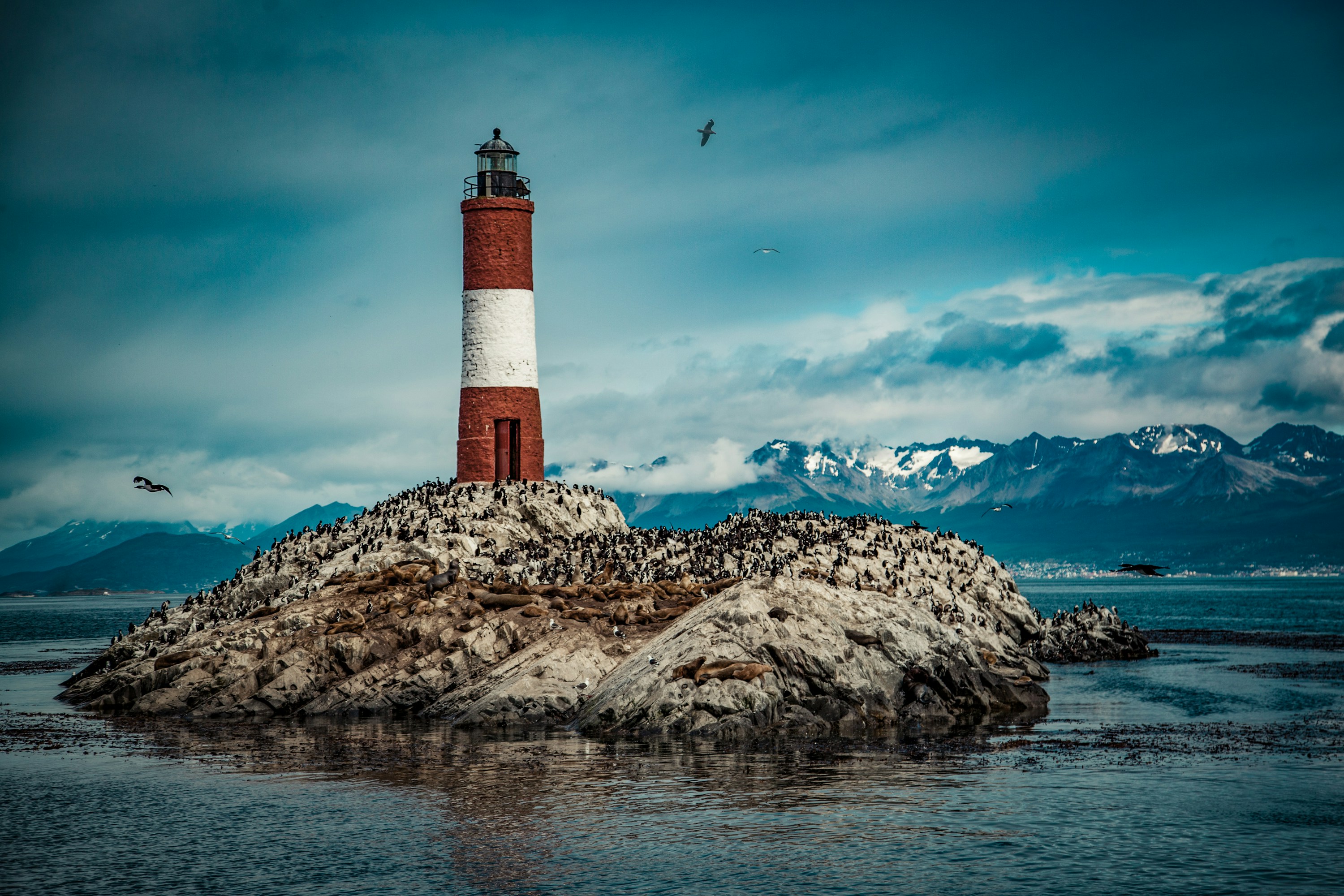
#21Marketed as the southernmost city in the world, Ushuaia sits on the Beagle Channel in Tierra del Fuego, snow-capped peaks rising directly behind its harbour.
It is the main departure point for Antarctica cruises, and shorter boat trips from the same harbour pass the red-and-white Les Eclaireurs lighthouse and islands crowded with sea lions, cormorants and penguins.
Tierra del Fuego National Park lies a short drive west for subantarctic forest and coastal trails.
How does it rate
CrowdsRomanceCash RequiredDangerAccessibilityWhy you should go
The launch point for Antarctica, with wildlife-rich boat trips on the Beagle Channel available even for a day visit.
Why you shouldn't go
Weather is genuinely unpredictable year-round, and Antarctica cruises themselves cost thousands of dollars.
Plan your visit
Best time to visitNovember-March (Southern Hemisphere summer) for mildest weather and Antarctica cruise seasonBest time of dayMorning boat departures for calmer Beagle Channel watersGetting thereFly to Ushuaia (Malvinas Argentinas Airport) from Buenos Aires, about 3.5 hoursEntry costFree to walk the town; Beagle Channel boat trips from ~$60-100; Antarctica cruises from several thouTime needed2-3 days, longer if joining an Antarctica cruiseInsider tip — Book a half-day Beagle Channel boat trip even if skipping Antarctica - it reaches the lighthouse and sea lion colonies for a fraction of the cost. -
 #2280 /100
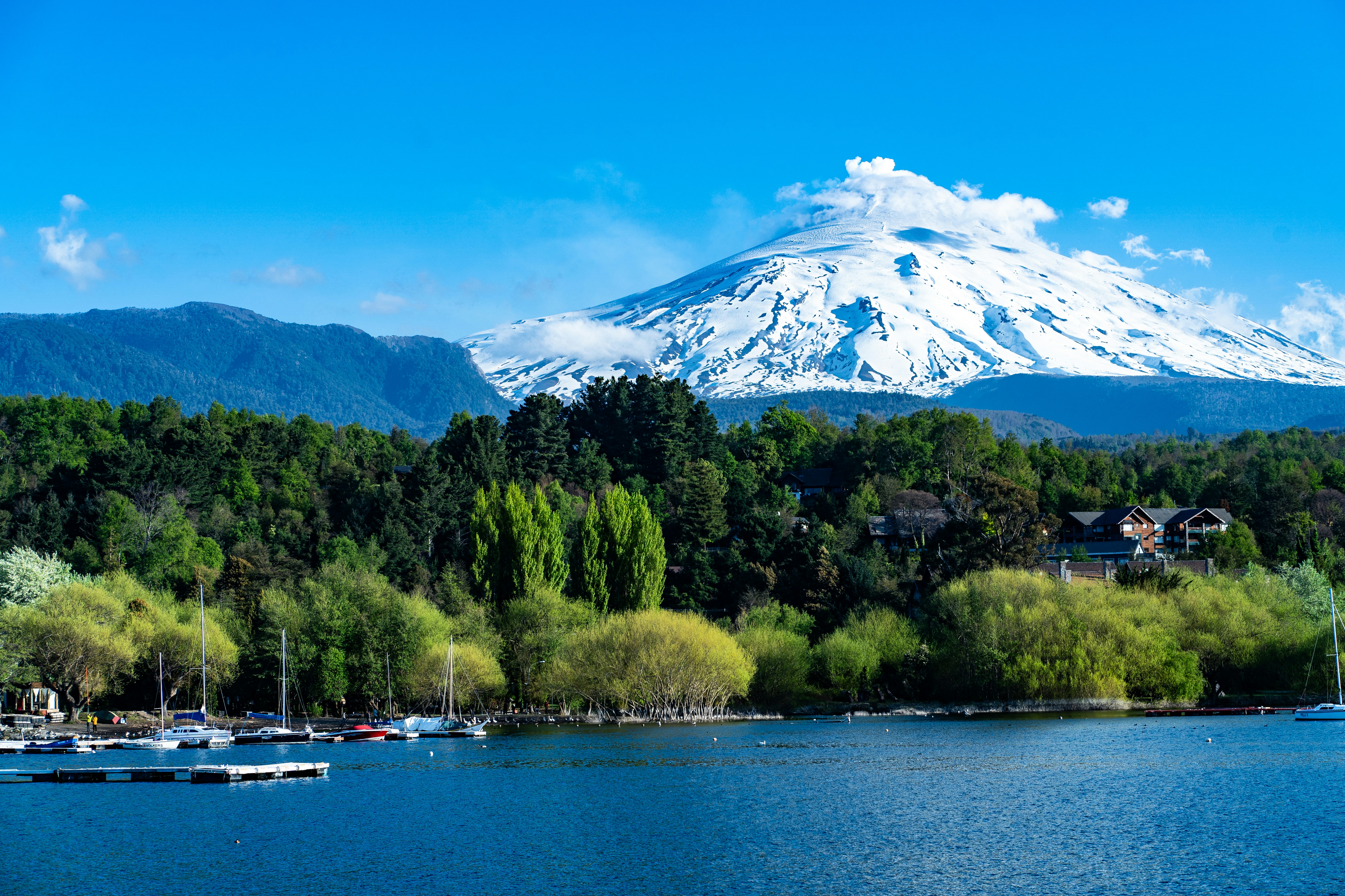
One of South America's most active volcanoes, a near-perfect snow-capped cone above the lakeside town of Pucon, with a permanently active lava lake sometimes visible glowing from the crater rim on clear nights.
A full-day guided climb in crampons reaches the summit for a look directly into the smoking crater, while at night the volcano's silhouette glowing faintly red is visible from town.
Ski slopes cover its lower flanks in winter, an unusual pairing of active volcanism and alpine sport.
How does it rate
CrowdsRomanceCash RequiredDangerAccessibilityWhy you should go
A near-perfect active volcanic cone with a summit crater you can climb to and, on clear nights, watch glow from town.
Why you shouldn't go
The summit climb is a genuinely strenuous full-day trek in crampons, and eruptive activity periodically closes it entirely.
Plan your visit
Best time to visitDecember-March (Southern Hemisphere summer) for the best summit-climbing conditions.Best time of dayEarly morning start for the summit climb; after dark from Pucon for the glow, if activity is visible.Getting thereFly to Temuco, then a 1-hour drive to Pucon, the main base town.Entry costGuided summit climb tours typically run USD150-200 per person, gear included.Time neededA full day for the summit climb.Insider tip — Check with local guides on current crater visibility before booking - during periods of higher activity, tours turn back before the true summit. -
 #2380 /100
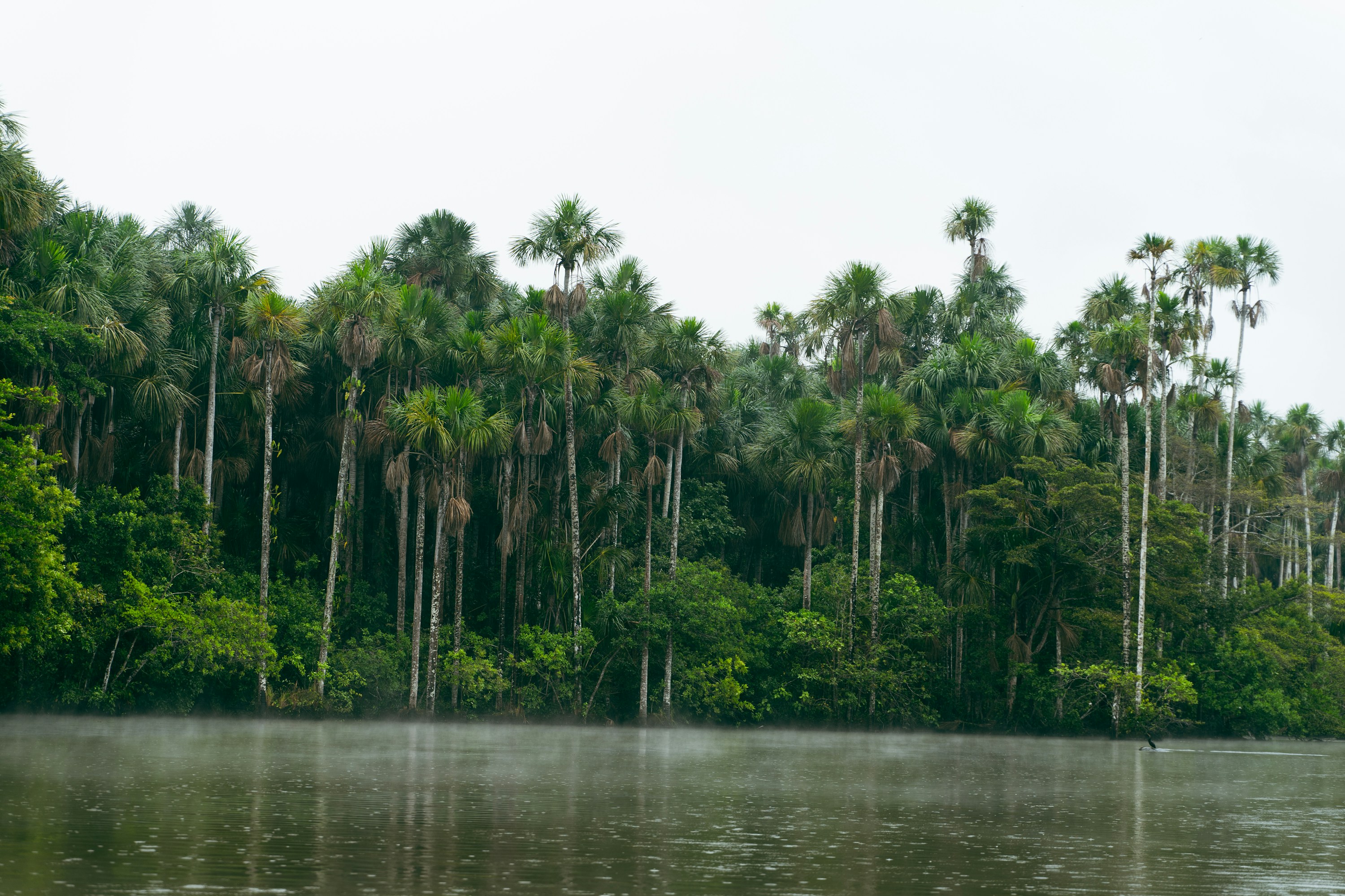
Tambopata protects lowland Amazon rainforest in southeastern Peru, reached by boat from Puerto Maldonado.
Jungle lodges put visitors within reach of oxbow lakes, giant otters, and one of the Amazon's largest macaw clay licks, where hundreds of parrots gather at dawn.
Guided walks and night boat rides turn up a density of wildlife hard to match elsewhere in Peru, though it costs real time and money to reach.
How does it rate
CrowdsRomanceCash RequiredDangerAccessibilityWhy you should go
One of the Amazon's best macaw clay licks, plus genuinely high odds of otters, caimans and monkeys.
Why you shouldn't go
Getting to the good lodges means a flight to Puerto Maldonado plus hours by boat, and it isn't cheap.
Plan your visit
Best time to visitMay-October (dry season) for easier trails and reliable clay-lick activityBest time of dayDawn for the macaw clay lick; dusk and after dark for caiman and nocturnal wildlifeGetting thereFly to Puerto Maldonado, then 1-4 hours by boat depending on the lodgeEntry costReserve entry fee ~$20-30; lodge packages from roughly $250 for 3 daysTime needed3-4 days including travelInsider tip — Stay at least three nights - the clay licks aren't guaranteed daily, and lodges further upriver see far less boat traffic than those near Puerto Maldonado. -
 #2479 /100
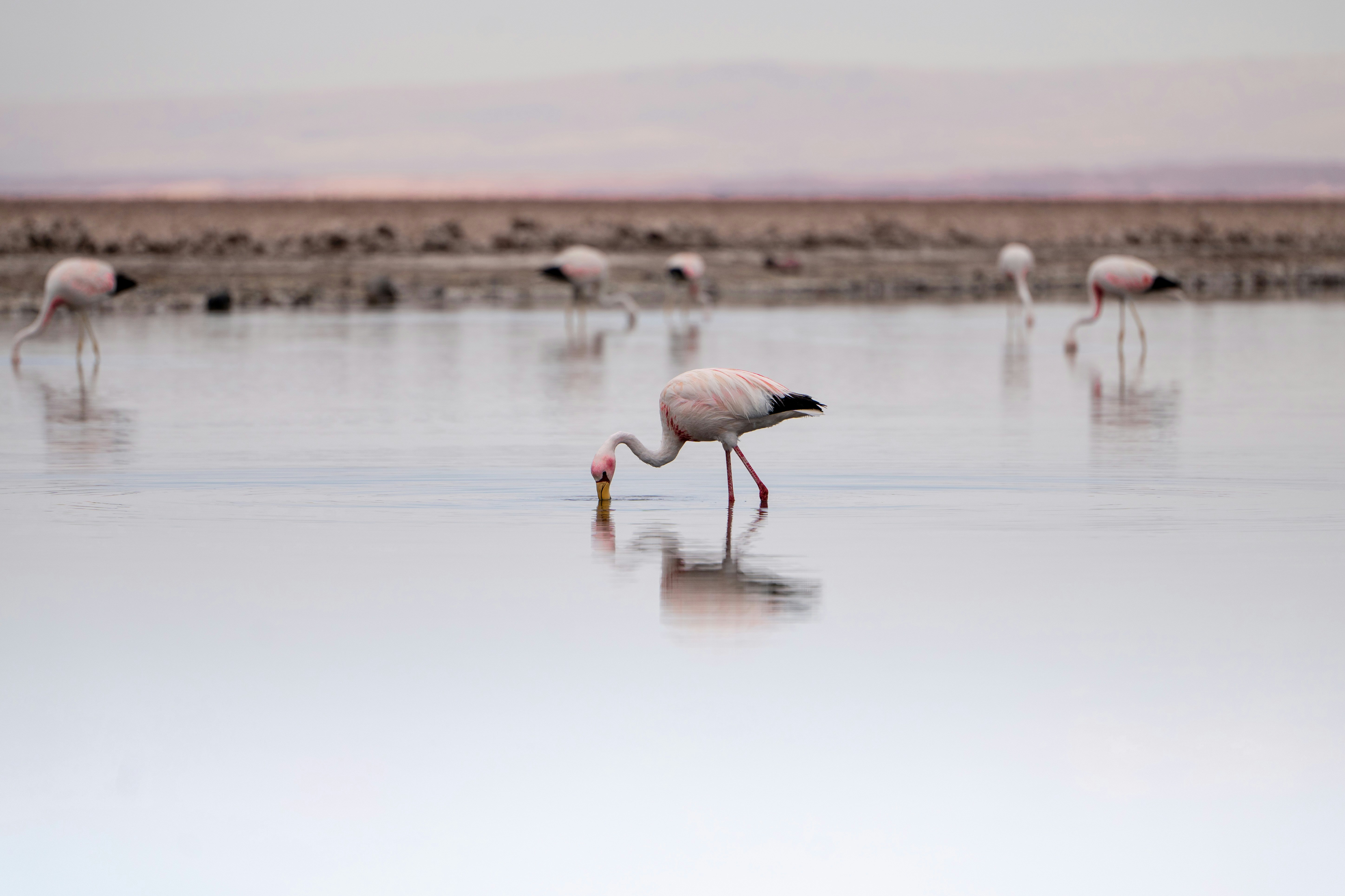
A vast basin of white salt crust and brine lagoons mirrors the Andes, with flamingo colonies wading in mineral-pink pools.
Otherworldly geology in the driest non-polar desert on Earth, with almost no vegetation, cracked salt crust underfoot, and only the wind and distant volcanoes for company.
How does it rate
CrowdsRomanceCash RequiredDangerAccessibilityWhy you should go
Vast white salt basin with flamingo-pink brine lagoons in the world's driest desert.
Why you shouldn't go
Extremely remote with sparse facilities; requires high-altitude driving; intense sun and altitude exposure.
Plan your visit
Best time to visitOctober–April (dry season) for flamingo breeding activity; winter rain can close roads.Best time of daySunrise and sunset for the strongest color shifts on the lagoons.Getting thereFly to Calama, then 1.5–2 hour drive south from San Pedro de Atacama.Entry costGuided tours $50–80 USD per person, includes reserve entry fee.Time neededHalf day to full day with a guide.Insider tip — Book with a local guide who knows the safe salt-crust routes; bring sunscreen, a hat, and high-SPF lip balm, and acclimatize in San Pedro (2,400m) before heading out. -
 #2579 /100
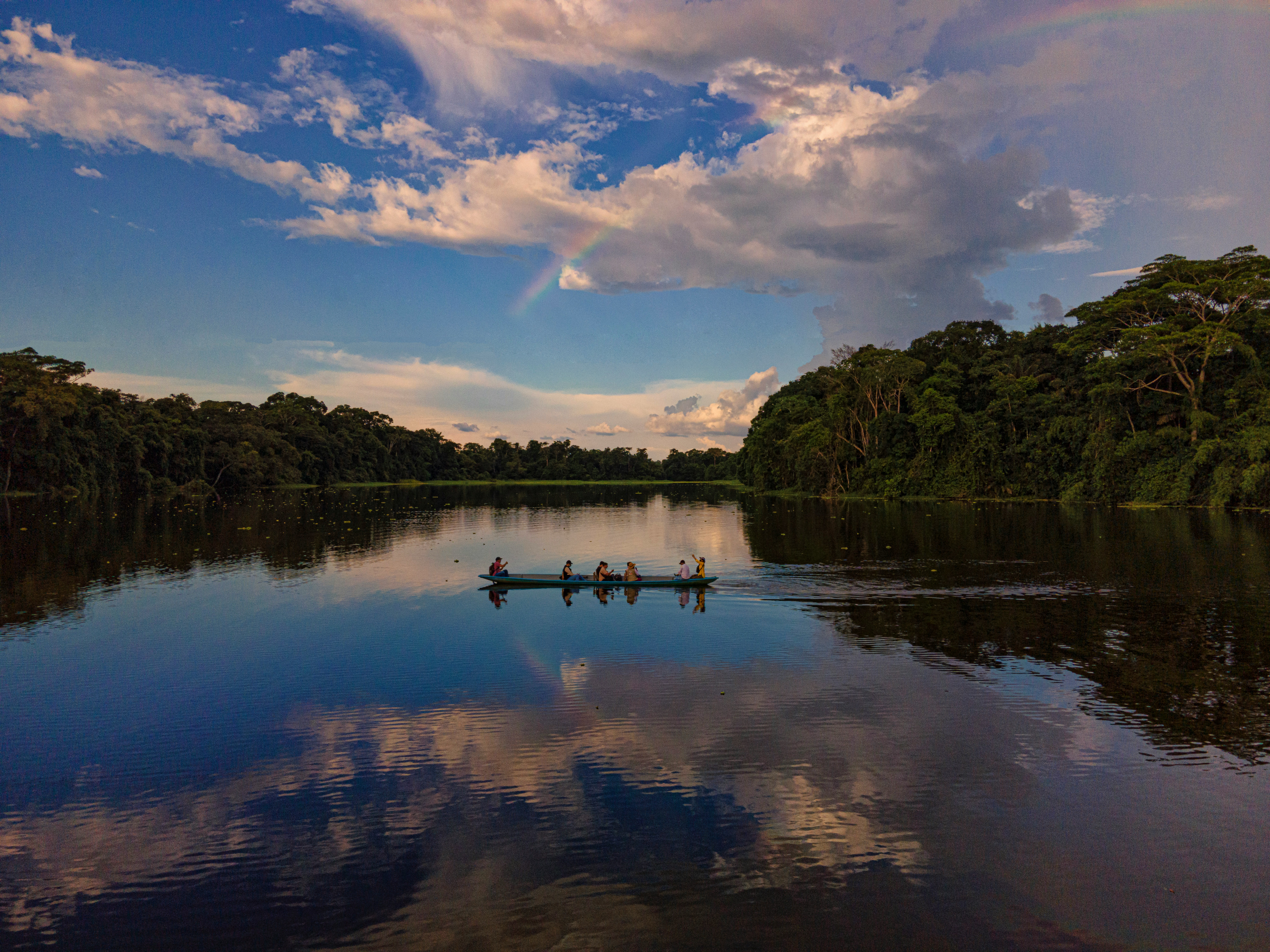
Deep in the Ecuadorian Amazon, Yasuní is one of the most biodiverse places on the planet, home to more tree species in a single hectare than in all of North America, alongside jaguars, giant otters, harpy eagles and several uncontacted indigenous groups.
Jungle lodges reached by dugout canoe offer guided hikes, canopy towers and night paddles where caiman eyes reflect torchlight across blackwater lagoons.
How does it rate
CrowdsRomanceCash RequiredDangerAccessibilityWhy you should go
Among the most biodiverse places on Earth, reached only by river and largely untouched.
Why you shouldn't go
Remote access means multi-day lodge stays are expensive and require significant travel time.
Plan your visit
Best time to visitDecember–February and June–August, the drier seasons, for easier trail walking.Best time of dayDawn canoe trips, when wildlife is most active before the heat sets in.Getting thereFly from Quito to Coca, then several hours by motorized canoe to a jungle lodge.Entry costMulti-day lodge packages typically €400-900+ including transport, food and guiding.Time needed3–5 days.Insider tip — Choose a lodge with an indigenous-run canopy tower — the platform views over the unbroken jungle canopy are the trip's highlight. -
 #2679 /100
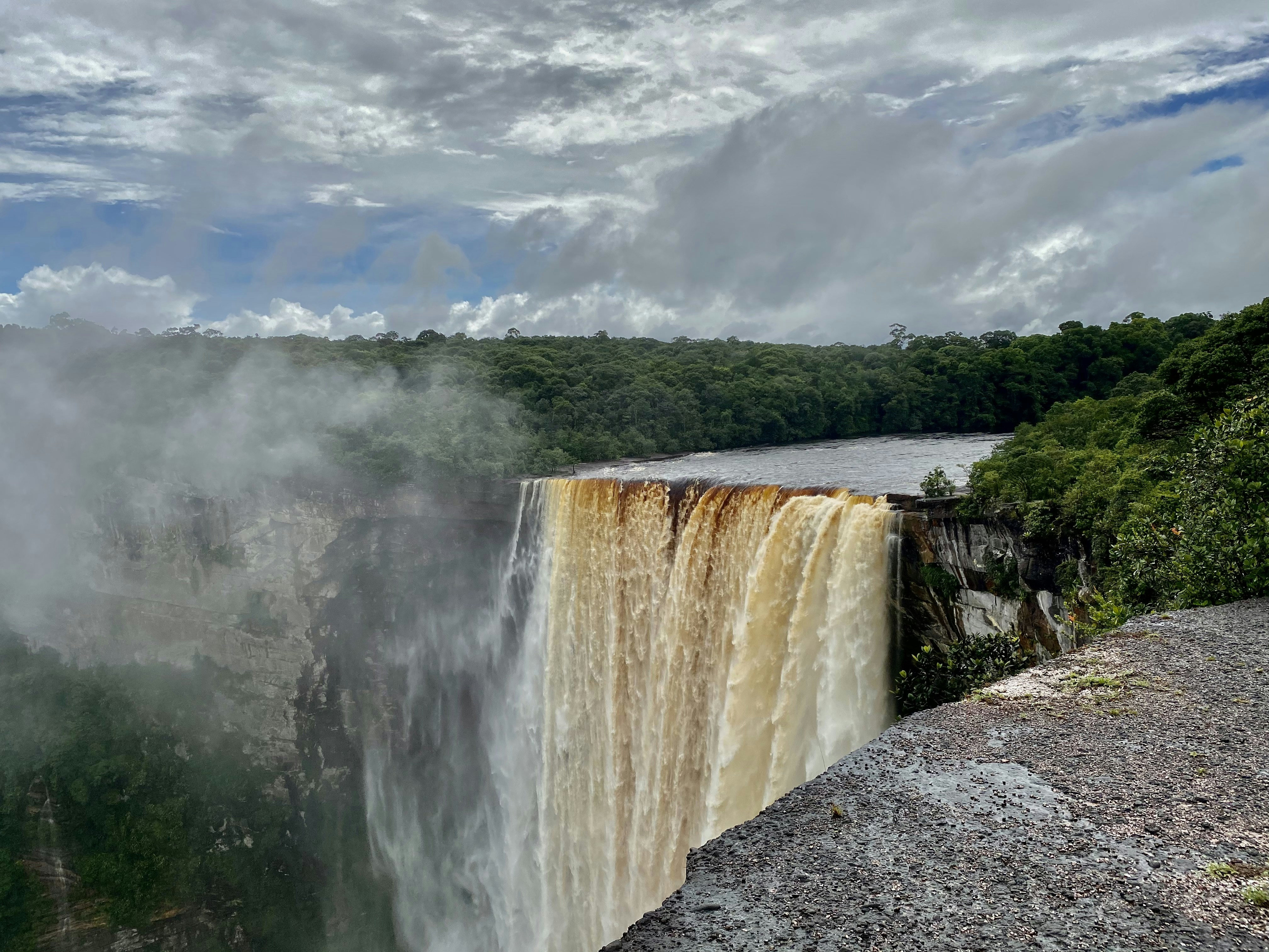
A single, uninterrupted drop of 226 metres - about four times the height of Niagara - sends the Potaro River over a sandstone cliff into pristine Guyanese rainforest.
Unlike most waterfalls of this scale, it sits inside a protected national park with almost no development and few visitors, so the viewpoints are typically empty.
Rainbow-coloured mist rises from the base most mornings when the light is right.
How does it rate
CrowdsRomanceCash RequiredDangerAccessibilityWhy you should go
One of the world's most powerful single-drop waterfalls, viewed with almost no other visitors around.
Why you shouldn't go
Access is limited to small charter flights, which makes a visit genuinely expensive for what it is.
Plan your visit
Best time to visitMay-August or December-January, the wetter months, for maximum water flow.Best time of dayMorning, for the best chance of mist rainbows and clear flight conditions.Getting thereSmall charter flight from Georgetown (about 45 minutes); no road access to the falls.Entry costIncluded in the charter flight/tour package; no separate entry fee at the falls.Time neededFull day trip from GeorgetownInsider tip — Book the earliest available flight of the day - afternoon cloud over the escarpment can cancel later charters entirely. -
 #2779 /100
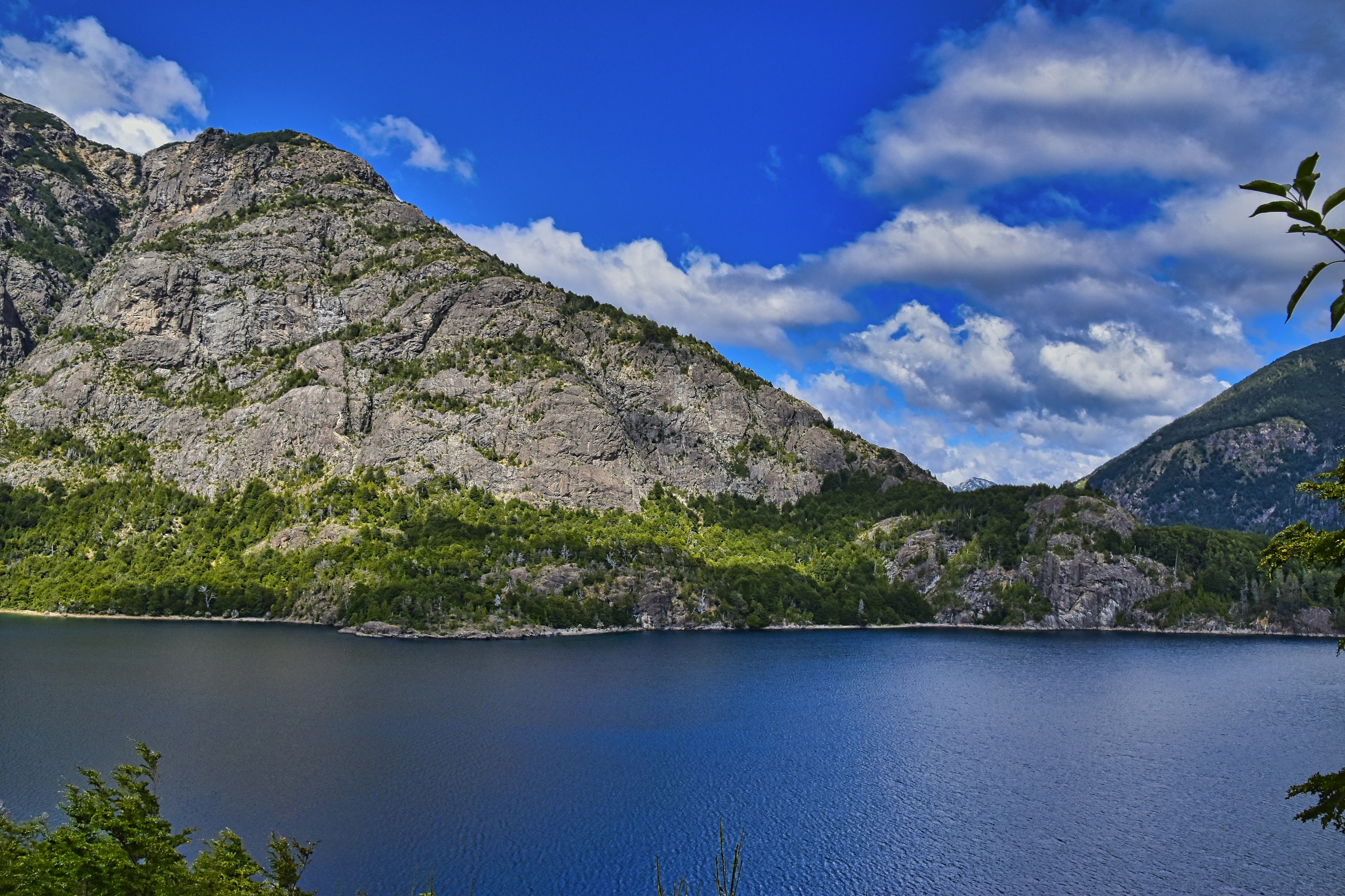
San Carlos de Bariloche sits on the shore of Nahuel Huapi Lake in Argentine Patagonia, a Swiss-styled town backed by the Andes and a gateway to a national park of forested peaks and turquoise lakes.
Chocolate shops line the Centro Cívico, while the Circuito Chico drive and the Cerro Campanario cable car reach panoramic viewpoints over the lake district.
It doubles as a ski base in winter and a hiking and mountain-biking hub in summer.
How does it rate
CrowdsRomanceCash RequiredDangerAccessibilityWhy you should go
A lake-and-mountain town that works as both a Patagonian hiking base and a genuine destination in its own right.
Why you shouldn't go
Peak ski season (July) and summer school holidays (January) both bring heavy crowds and inflated prices.
Plan your visit
Best time to visitDecember-March for hiking and lake activities; July-August for skiing at Cerro CatedralBest time of dayLate afternoon at Cerro Campanario for lake views before sunsetGetting thereFly to Bariloche (San Carlos de Bariloche Airport) from Buenos Aires, about 2 hoursEntry costFree to explore town; Cerro Campanario cable car and national park activities charge separatelyTime needed3-4 daysInsider tip — Drive the Circuito Chico in the early morning to have the lakeside viewpoints to yourself before tour buses fill the pull-offs. -
 #2878 /100
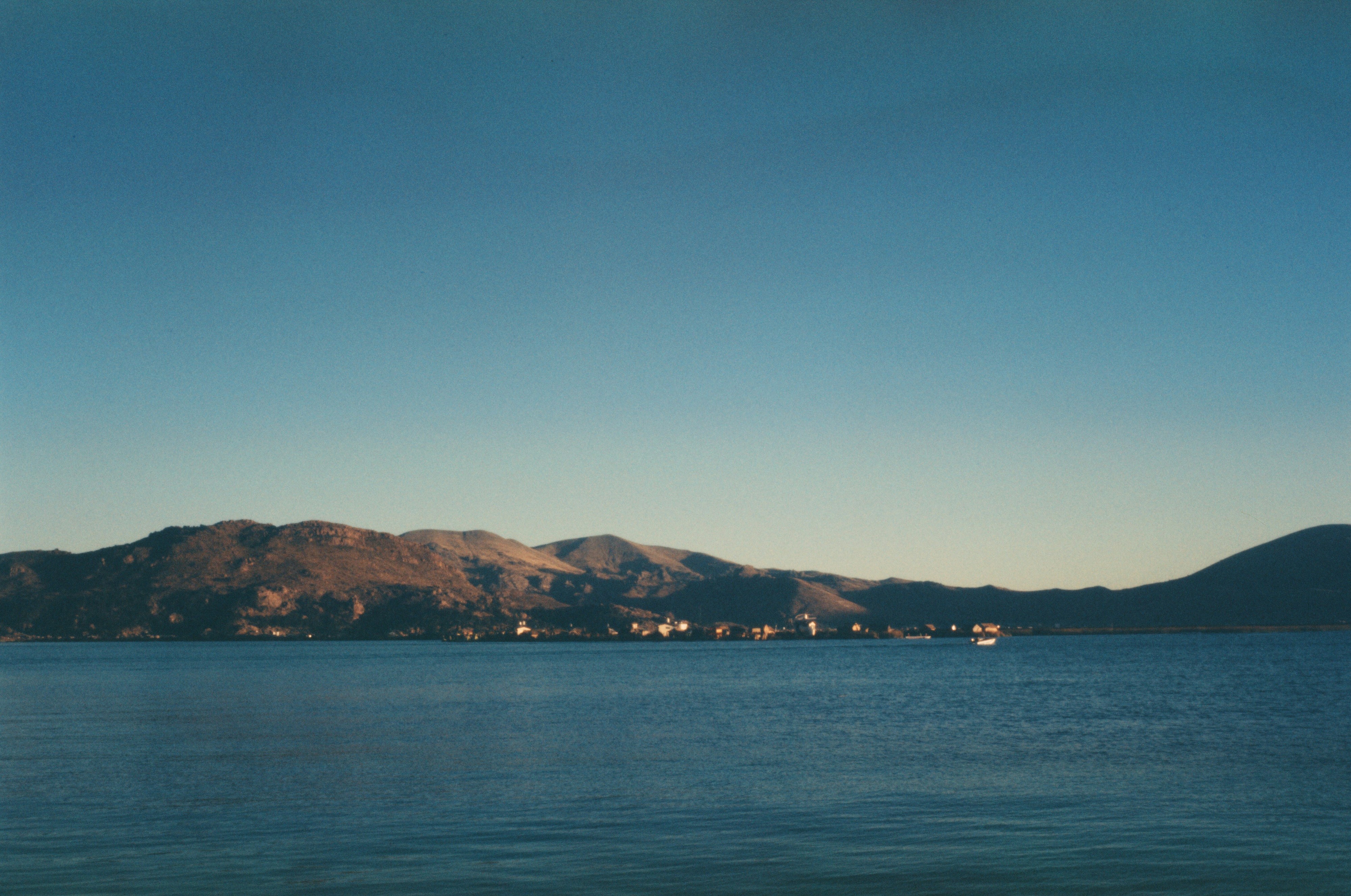
The world's highest navigable lake stretches across the Bolivia-Peru border at 3,812m, its cobalt water dotted with the Uros people's hand-woven reed islands.
Traditional wooden boats still work the shallows beneath distant snow-capped peaks.
Copacabana's lakeside promenade and Isla del Sol's Inca ruins give it real cultural depth beyond the scenery, though the altitude takes a day or two to adjust to.
How does it rate
CrowdsRomanceCash RequiredDangerAccessibilityWhy you should go
A cobalt-blue Andean lake with floating reed islands found nowhere else on Earth.
Why you shouldn't go
Thin air at 3,800m leaves many visitors breathless for the first day or two.
Plan your visit
Best time to visitMay-October (dry season) for clear skies and calm water.Best time of dayEarly morning, when the lake is glassy and boat traffic is light.Getting thereFly to La Paz or Juliaca; bus to Copacabana (Bolivia) or Puno (Peru), then boat to the islands.Entry costFree to view; boat tours and island visits charge separately.Time needed1-2 daysInsider tip — Stay overnight on Isla del Sol rather than day-tripping - sunset and sunrise over the lake from the island are far better than anything from the mainland shore. -
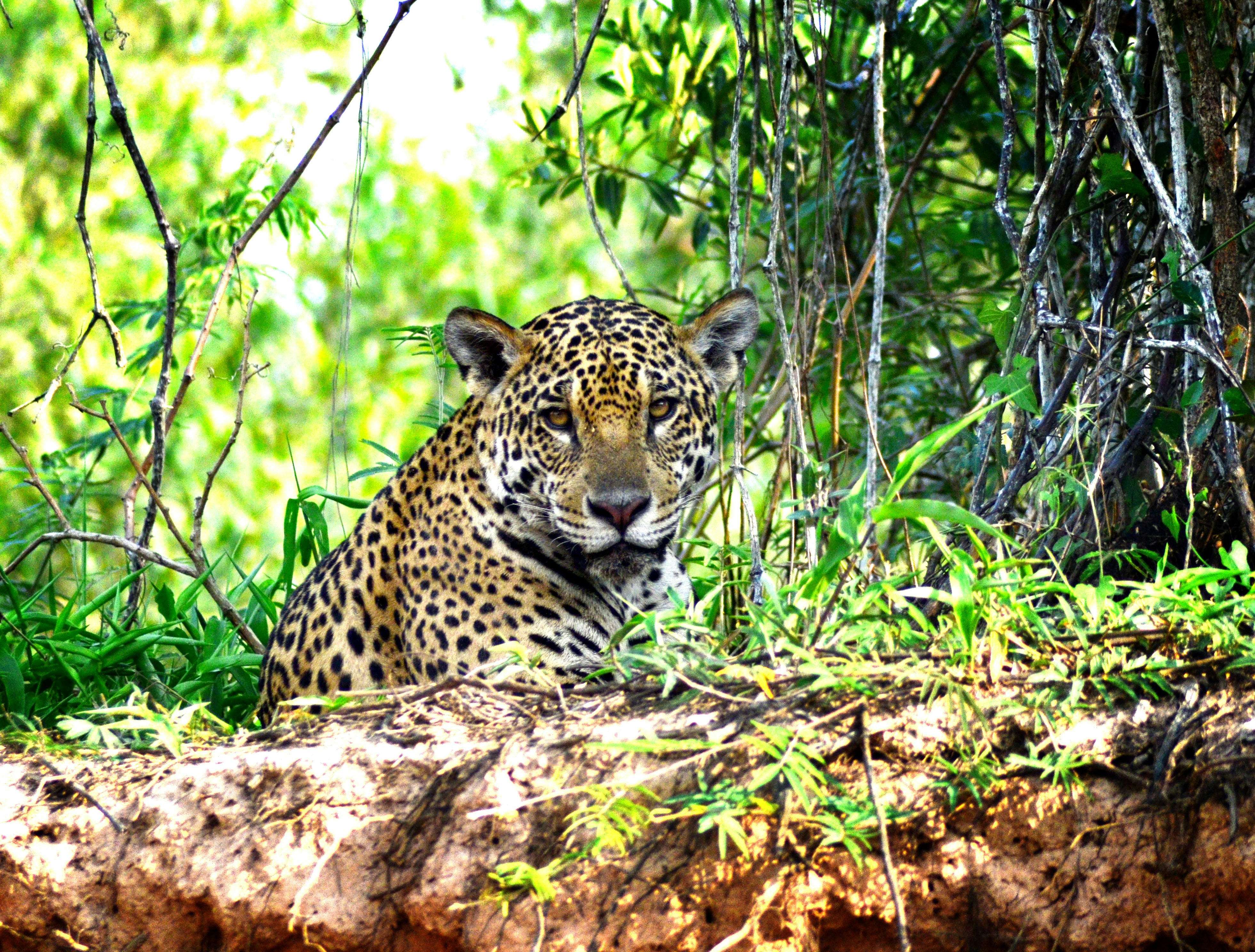 #2978 /100
The world's largest tropical wetland, a mosaic of rivers, lagoons, and gallery forest holding the highest concentration of jaguars, caimans, capybaras, and macaws anywhere in South America.
Guided boat and jeep safaris reveal wildlife far more reliably than the denser Amazon rainforest.
How does it rate
CrowdsRomanceCash RequiredDangerAccessibilityWhy you should go
The world's largest tropical wetland, with the best jaguar-spotting odds and birdlife anywhere in South America.
Why you shouldn't go
Wet season (November–March) brings biting insects and flooded roads; remote lodges require real travel time.
Plan your visit
Best time to visitJune–September (dry season) for concentrated wildlife around shrinking waterholes.Best time of dayEarly morning and late afternoon safaris, when animals are most active.Getting thereFly to Cuiabá, then a 2–4 hour drive south on the Transpantaneira road to lodges.Entry costAll-inclusive lodge packages run roughly $150–300 USD per day.Time needed3–5 days minimum.Insider tip — Book a lodge with guides experienced specifically in jaguar tracking along the Cuiabá or Três Irmãos rivers. Bring binoculars, a telephoto lens, and anti-malarial precautions as advised by a travel clinic. -
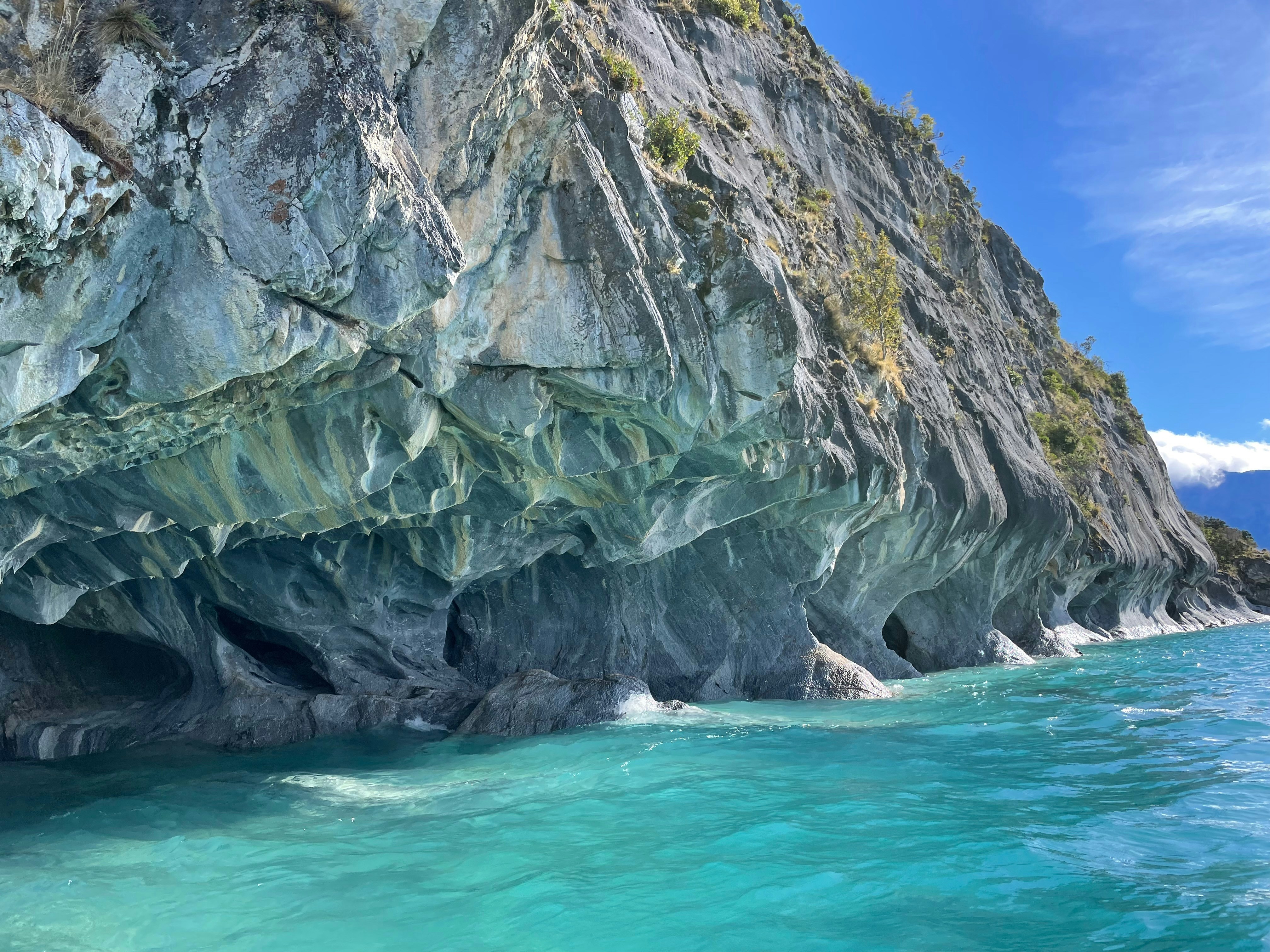 #3078 /100
A labyrinth of marble caverns carved by wave action into a peninsula on Lake General Carrera, forming swirled chambers and arches in white, grey, and cobalt blue.
Accessible only by small boat, with the water's color and the marble's pattern shifting dramatically with the season and light.
How does it rate
CrowdsRomanceCash RequiredDangerAccessibilityWhy you should go
Swirling marble caverns carved into a lake peninsula, with cathedral-like chambers reachable only by boat.
Why you shouldn't go
Access depends on lake conditions and can be cancelled in high winds; the remote location adds significant travel time and cost.
Plan your visit
Best time to visitDecember–February for the lake's lowest water levels, when the caves and swirling patterns are most vivid.Best time of dayMidday sun lights the interior of the caves best; the water is often calmer in early morning.Getting thereDrive the Carretera Austral to Puerto Río Tranquilo, then a short boat tour to the caves.Entry costGuided boat tours roughly CLP 25,000–35,000 (~$28–40 USD).Time needed1.5–2 hours.Insider tip — Go early to avoid afternoon winds that can churn up the lake and cancel tours. A kayak tour, where available, gets you closer to the rock than the larger tour boats. -
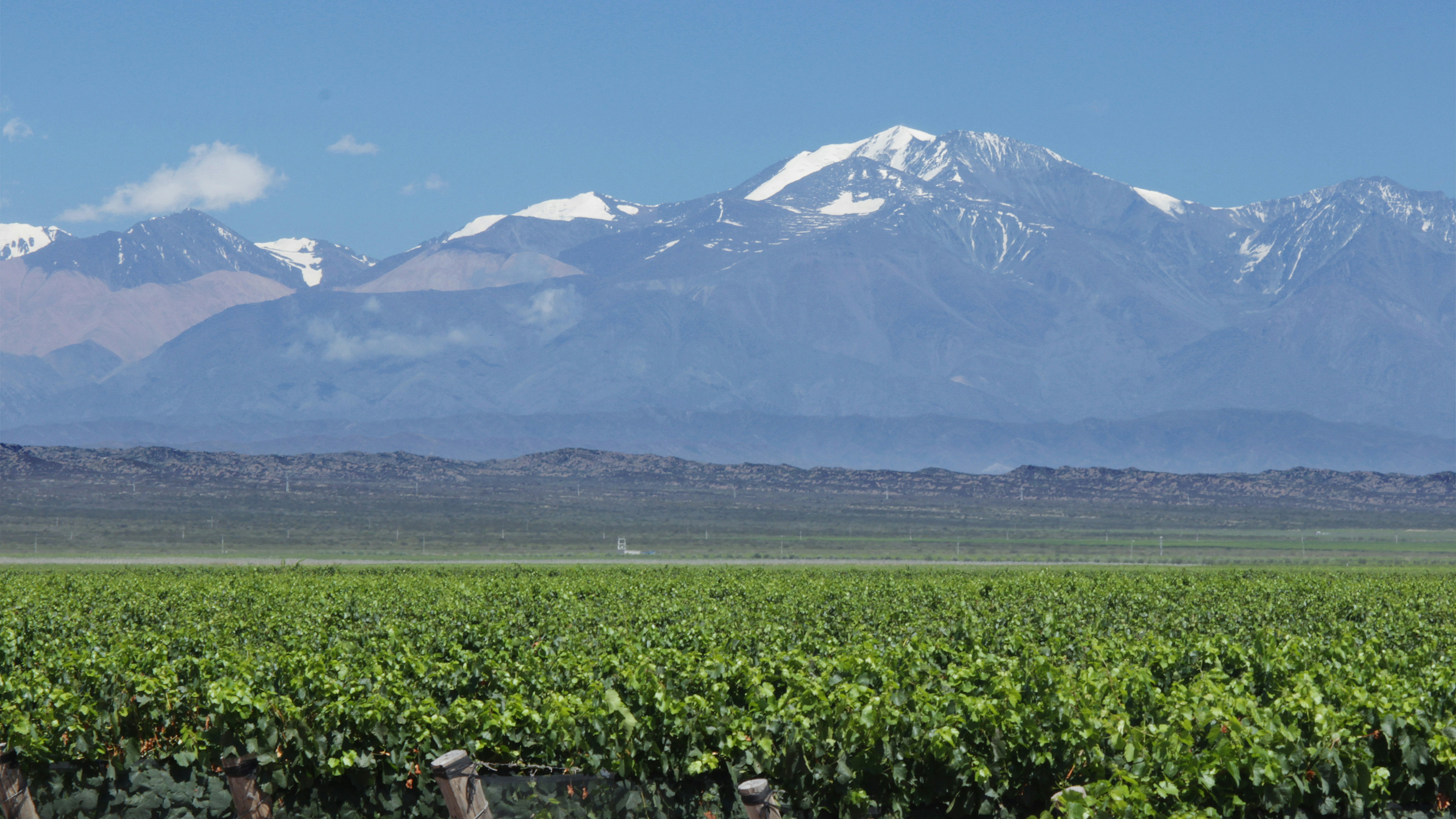 #3177 /100
Argentina's premier wine region sits in the high-altitude desert at the foot of the Andes, where Malbec, transformed from a minor French grape into Argentina's signature wine, thrives in vineyards that often frame snow-capped peaks directly behind their rows.
Many bodegas pair tastings with Andean views and asador barbecue lunches.
How does it rate
CrowdsRomanceCash RequiredDangerAccessibilityWhy you should go
High-desert Malbec vineyards at the foot of the Andes, Argentina's signature wine grown against snow-capped peaks.
Why you shouldn't go
Mendoza's high altitude and dry climate mean strong sun exposure, and distances between bodegas are longer than in denser wine regions.
Plan your visit
Best time to visitMarch-April for harvest season (Argentina's autumn, opposite the Northern Hemisphere).Best time of dayLate afternoon, when the Andes behind the vineyards catch alpenglow light.Getting thereFly into Mendoza's Governor Francisco Gabrielli Airport, then a rental car or organised tour to the surrounding bodegas.Entry costTastings typically run USD10-30 per bodega; some include a paired lunch.Time neededA full day for a bodega tour.Insider tip — Book a bodega with an on-site asador lunch, a genuine Mendoza tradition that pairs Malbec with slow-grilled Argentine beef. -
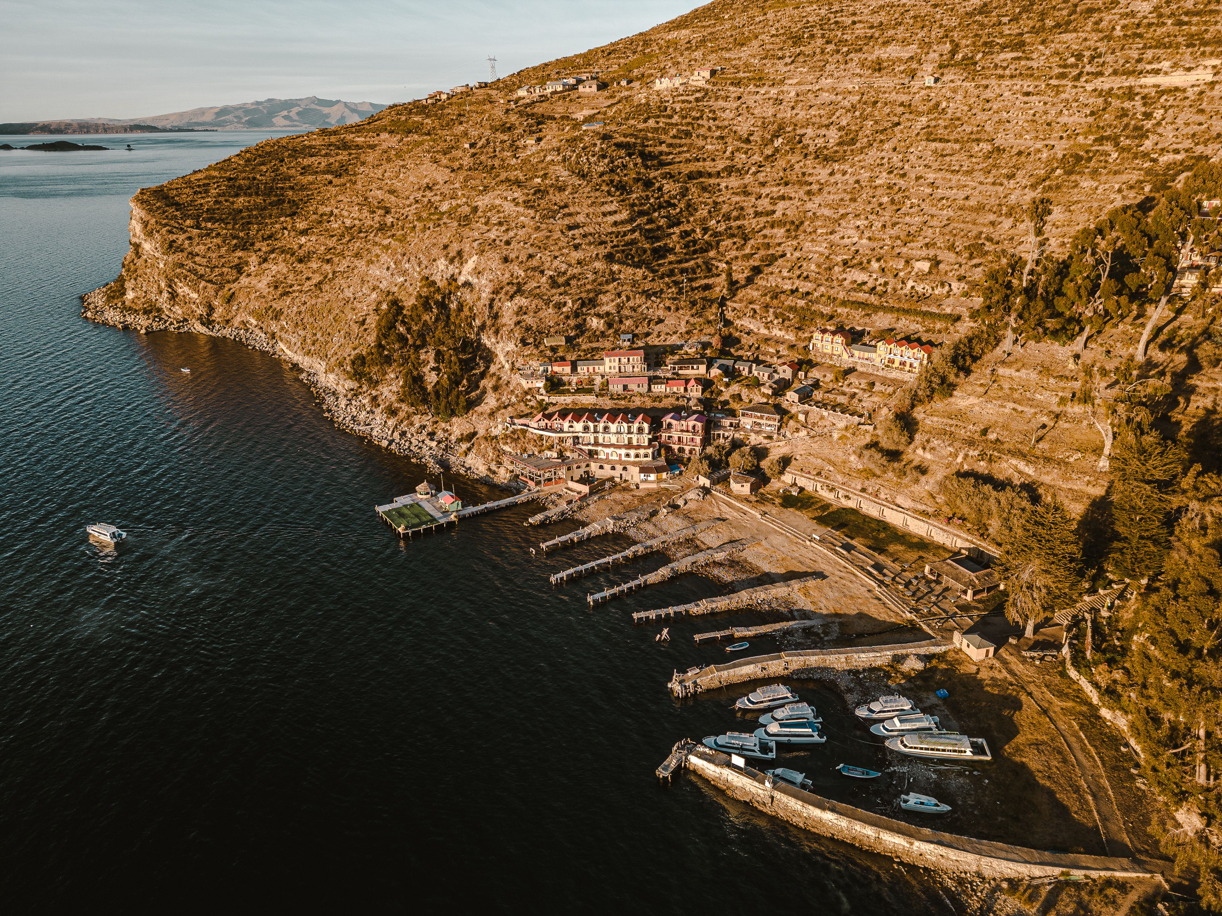 #3277 /100
Bolivia's most sacred island sits in the middle of Lake Titicaca, the birthplace of the sun in Inca mythology and home to ruins that predate the Inca themselves.
No cars or paved roads cross it — Inca-era stone paths link small villages, terraced hillsides and ancient sites like the Chinkana labyrinth.
At over 3,800 meters, the walk between villages rewards visitors with some of the clearest lake and mountain views in South America.
How does it rate
CrowdsRomanceCash RequiredDangerAccessibilityWhy you should go
A car-free sacred island on Lake Titicaca with Inca ruins and some of Bolivia's most dramatic lake views.
Why you shouldn't go
High altitude and steep stone paths make the walk between villages genuinely tiring without acclimatization.
Plan your visit
Best time to visitMay–September (dry season) for clear skies and firmer trails.Best time of dayMorning, before afternoon winds pick up on the lake crossing.Getting thereBoat from Copacabana (about 1.5–2.5 hours) to Yumani or Challapampa village.Entry costSmall community entry fees (a few bolivianos) at village checkpoints.Time neededFull day, or overnight to see both ends of the island.Insider tip — Stay overnight in Yumani rather than day-tripping — the island empties out after the afternoon boats leave, and sunset over the lake is worth it. -
 #3377 /100
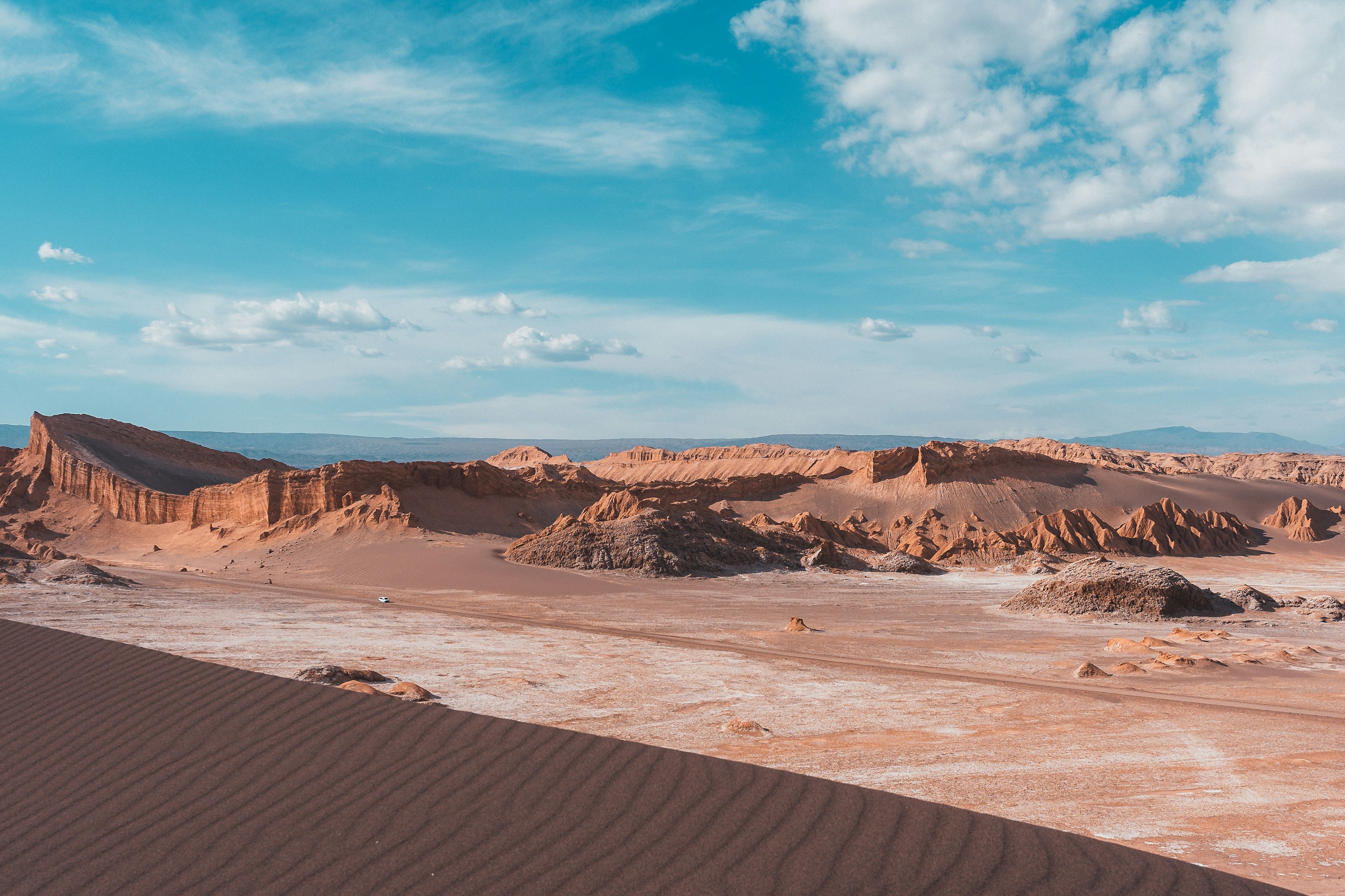
Wind and ancient salt deposits have carved this stretch of the Atacama Desert into ridges, dunes and a natural amphitheatre that genuinely resembles a lunar landscape, 13km from San Pedro de Atacama inside the Los Flamencos National Reserve.
At sunset the salt-crusted rock turns deep red and violet, drawing every tour van in town to the same handful of viewpoints.
By day it's simply one of the driest, starkest places on Earth.
How does it rate
CrowdsRomanceCash RequiredDangerAccessibilityWhy you should go
Sunset turns the salt ridges and dunes a deep red that genuinely looks otherworldly.
Why you shouldn't go
Every tour and rental car in San Pedro converges on the same viewpoints for the same sunset window.
Plan your visit
Best time to visitYear-round (desert climate); clearest skies May-August.Best time of dayLate afternoon into sunset.Getting thereFly to Calama, then about 1.5 hours to San Pedro de Atacama; the valley is a further 13km by rental car or tour van.Entry cost~CLP 8,000-11,000 (~US$10) reserve entrance, per personTime needed2-3 hoursInsider tip — Skip the packed main viewpoint and walk 10 minutes further along the ridge for the same sunset colour with far fewer people. -
 #3474 /100
A collapsed volcanic caldera holds this startlingly turquoise-green crater lake, its color shifting with the light and mineral content of the water below.
A rim trail circles the crater edge with views down to the lake and out across the Andean highlands, while a steep path descends to the shoreline for those who want to kayak or simply stand at the water's edge.
How does it rate
CrowdsRomanceCash RequiredDangerAccessibilityWhy you should go
A vivid turquoise crater lake at nearly 4,000 meters, with a rim trail and highland views.
Why you shouldn't go
High altitude makes the rim hike strenuous, and the descent-then-climb-back-up to the shore is tiring.
Plan your visit
Best time to visitJune–September for clearer skies and better visibility of the lake's color.Best time of dayMorning, before clouds typically roll in over the crater by early afternoon.Getting thereAbout 3.5 hours' drive from Quito via Latacunga, on the Quilotoa Loop route.Entry costSmall community entry fee, around $2.Time neededHalf a day, or longer if hiking the full crater rim.Insider tip — Hike counter-clockwise around the rim — it fronts the best lake views earlier and saves the steepest climb for when you're warmed up. -
 #3574 /100
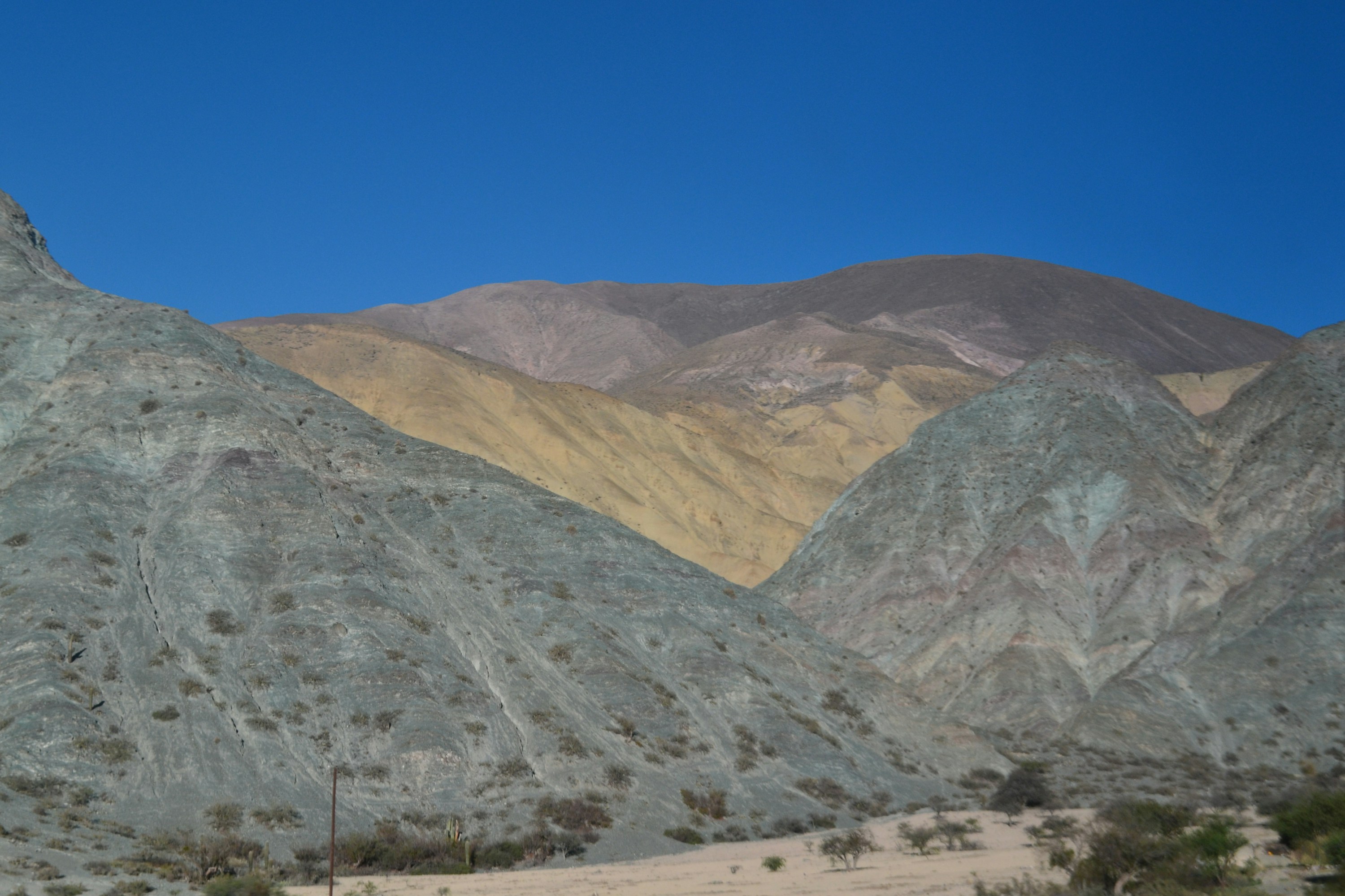
This 155-kilometre gorge in Argentina's arid northwest has been a travel corridor since long before the Inca, its adobe villages and banded red-and-ochre rock now UNESCO-listed.
Purmamarca sits beneath the striped Cerro de los Siete Colores, while Humahuaca and Tilcara keep colonial churches and pre-Columbian ruins within walking distance.
It rewards slow travel along Ruta 9, not a single stop.
How does it rate
CrowdsRomanceCash RequiredDangerAccessibilityWhy you should go
Multicolored mountain geology and centuries-old adobe villages, without the crowds of Salta's sights.
Why you shouldn't go
It's remote - a long drive or bus ride from Salta, and services thin out fast outside the main villages.
Plan your visit
Best time to visitApril-October (dry season); winter nights are cold at this altitudeBest time of dayLate afternoon, when low sun deepens the colors in the rockGetting thereFly to Salta or San Salvador de Jujuy, then drive or bus north on Ruta Nacional 9Entry costFree to drive through and visit villages; some sites charge small entry feesTime needed1-2 daysInsider tip — Stop in Tilcara rather than only Purmamarca - its pre-Inca pucara hilltop fort ruins get a fraction of the visitors. -
 #3673 /100
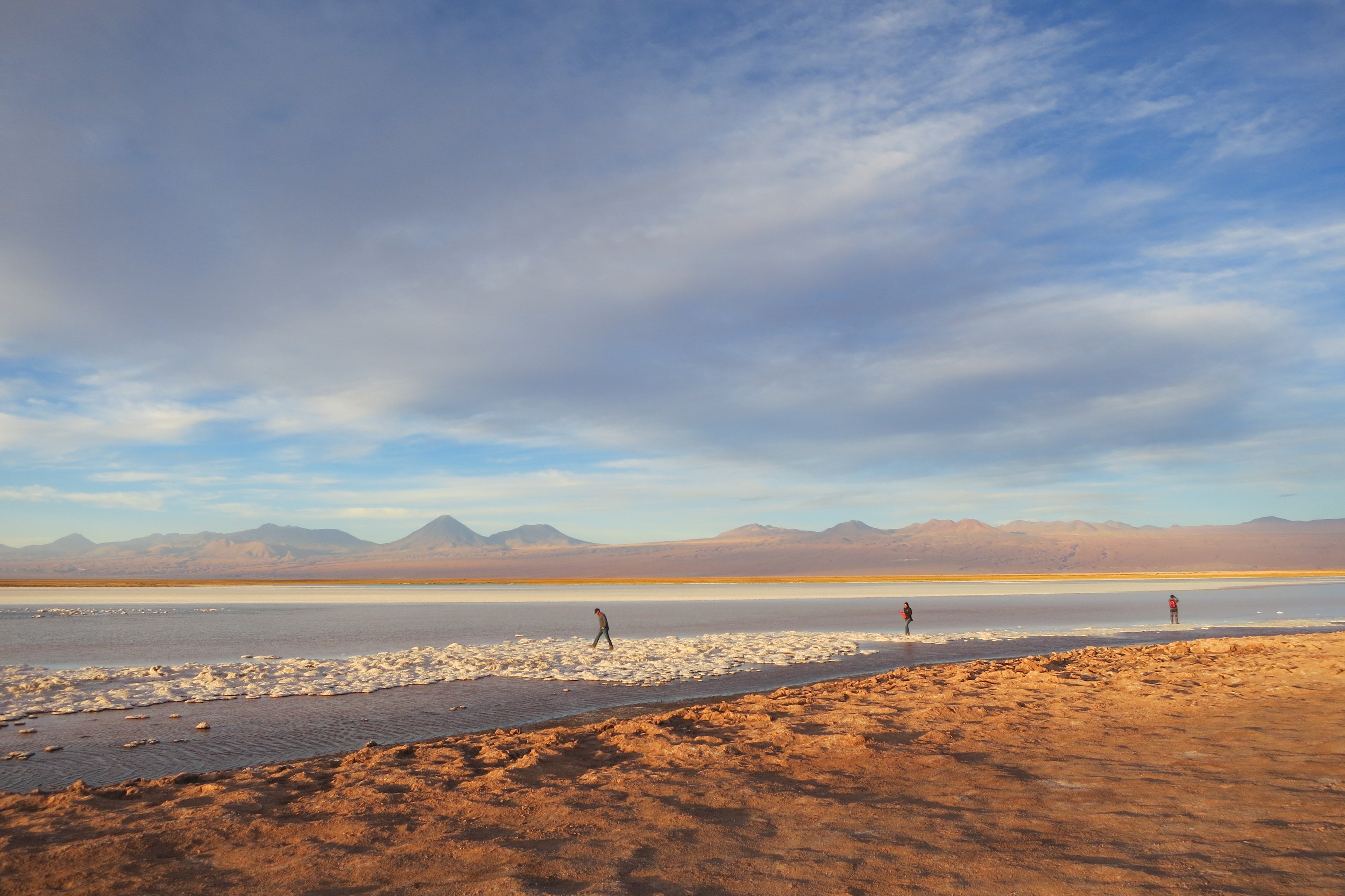
A hypersaline lagoon in the Atacama salt flat, dense enough with dissolved minerals that swimmers float effortlessly, Dead Sea-style.
Ringed by pale salt crust and distant volcanoes, it's a strange, buoyant swim in one of the driest places on Earth, best paired with a freshwater rinse straight after.
How does it rate
CrowdsRomanceCash RequiredDangerAccessibilityWhy you should go
A hypersaline lagoon where you float effortlessly, ringed by salt crust and desert emptiness.
Why you shouldn't go
Popular with tour groups despite the remote setting; the salt water stings any small cuts or irritates eyes; strong midday sun.
Plan your visit
Best time to visitOctober–April (dry season); visit outside the busiest midday tour window if possible.Best time of dayLate afternoon for softer light and slightly thinner crowds.Getting thereTours depart from San Pedro de Atacama, roughly a 40-minute drive.Entry costIncluded in guided tour price, typically $40–60 USD.Time needed3–4 hours including transport.Insider tip — Bring a swimsuit and old clothes — the brine is hard on fabric. Freshwater rinse-off pools are available right next to the lagoon. -
 #3772 /100
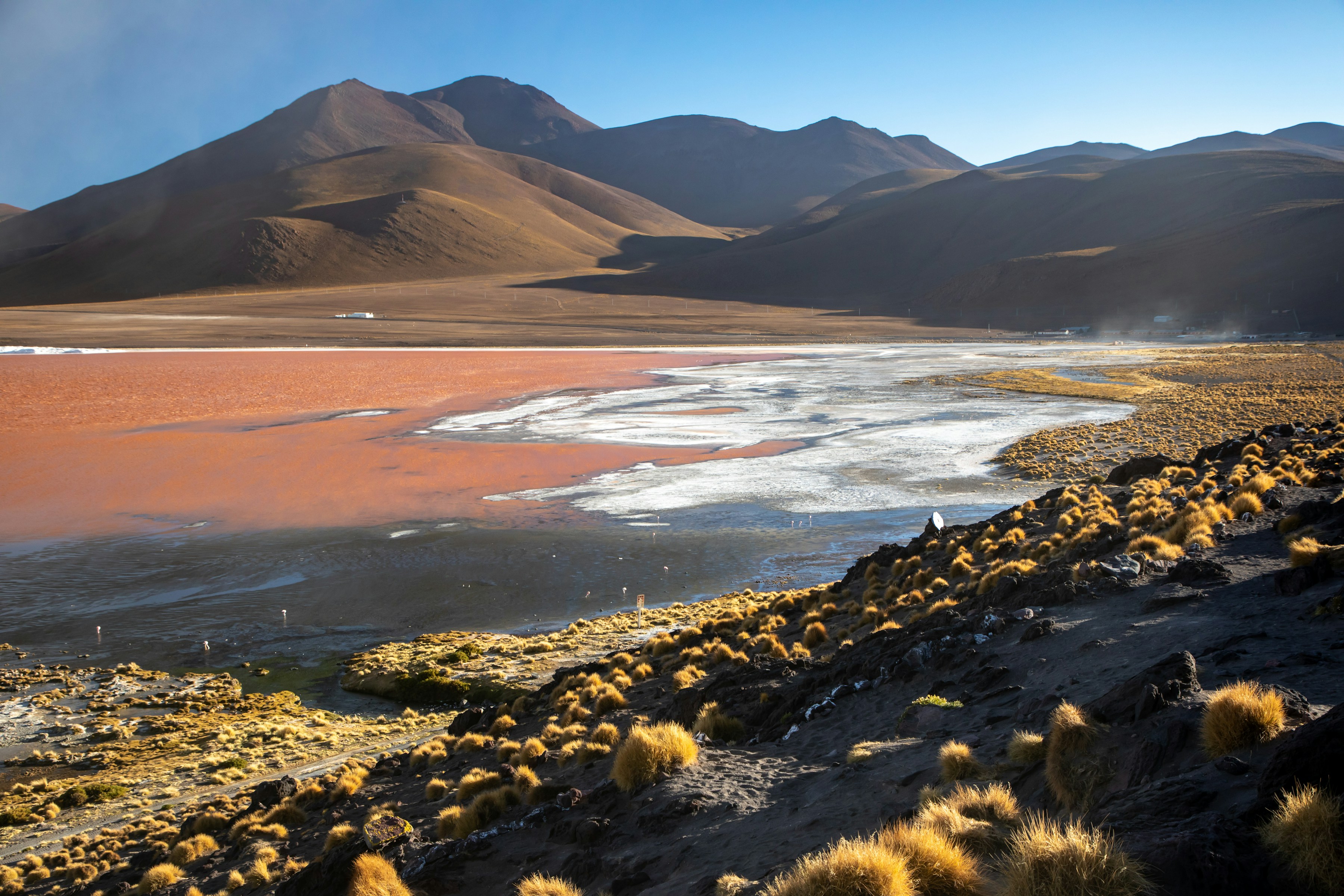
High on the Bolivian Altiplano near the Chilean border, this shallow lake turns a vivid blood-red from algae and mineral sediment, its shores dotted with borax islands and thousands of James's flamingos feeding in the mineral-rich water.
At over 4,200 meters altitude, the surrounding landscape is a stark, otherworldly desert of volcanoes, geysers and rock formations typically visited as part of a multi-day Uyuni salt-flat circuit.
How does it rate
CrowdsRomanceCash RequiredDangerAccessibilityWhy you should go
A vivid red high-altitude lake packed with flamingos, deep in Bolivia's most surreal desert landscape.
Why you shouldn't go
Extreme altitude (over 4,200m) causes altitude sickness for many visitors without acclimatization.
Plan your visit
Best time to visitMay–October (dry season) for the clearest roads and skies.Best time of daySunrise, when calm water gives the sharpest reflections and flamingos are most active.Getting thereReached via a multi-day 4x4 tour typically starting from Uyuni, usually on day 2 or 3.Entry costIncluded in multi-day Uyuni salt-flat tour packages, typically $150-250 total.Time neededHalf a day as part of a longer circuit.Insider tip — Spend at least one night at altitude in Uyuni before setting out — arriving already partially acclimatized makes the route far more comfortable. -
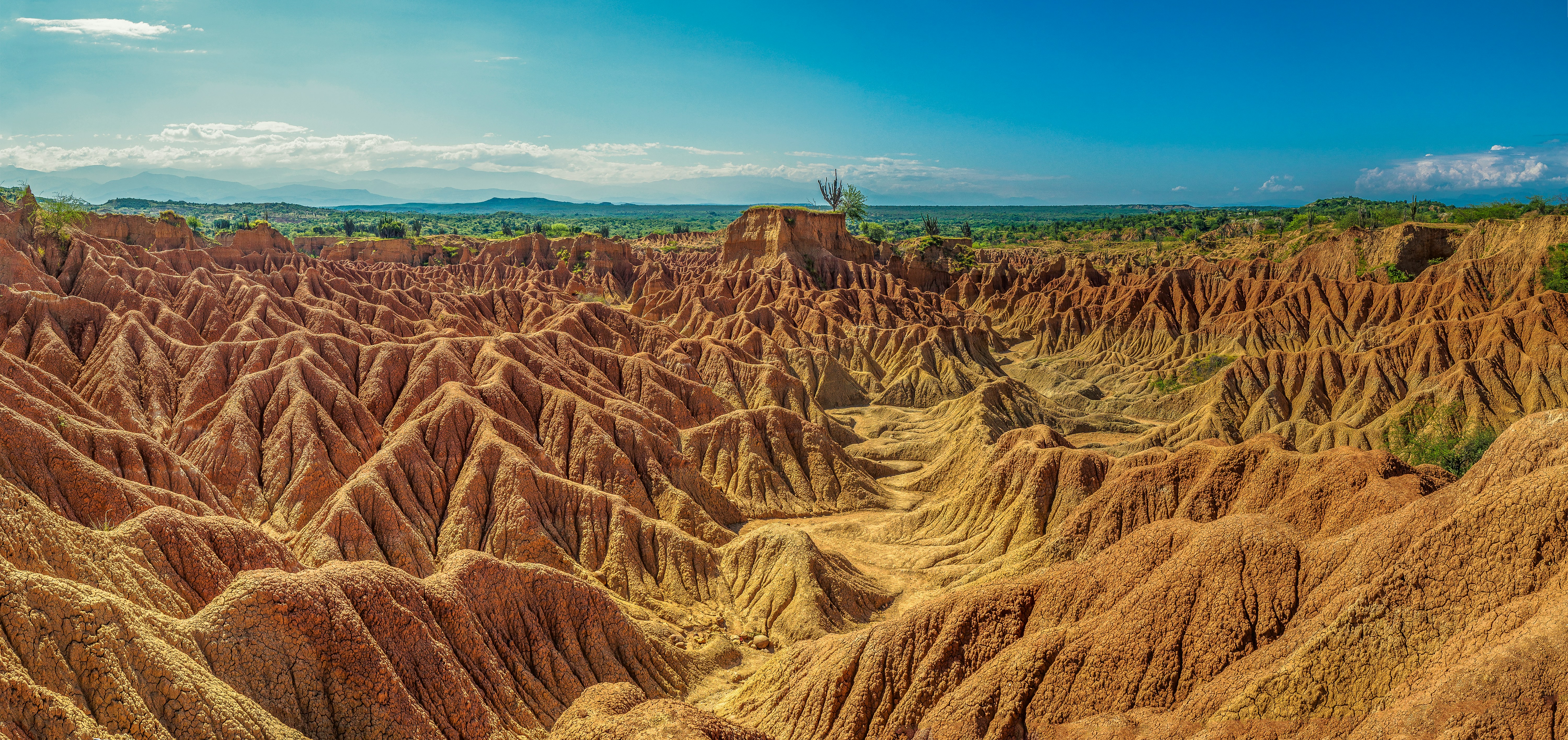 #3869 /100
A dry tropical forest turned badlands, its grey and red-clay canyons carved into labyrinths of eroded pinnacles that look more like Utah than South America.
Split into a red zone (Cuzco) and a grey zone (Los Hoyos), it's one of the best stargazing spots in Colombia thanks to an astronomical observatory built specifically to take advantage of its clear, unpolluted skies.
Walking trails wind between the formations without requiring any technical hiking experience.
How does it rate
CrowdsRomanceCash RequiredDangerAccessibilityWhy you should go
Grey and red badland canyons that look transplanted from the American Southwest, with some of Colombia's clearest night skies.
Why you shouldn't go
There's very little shade and no real infrastructure between the two colour zones, and midday heat is intense.
Plan your visit
Best time to visitDecember-March or July-August (Colombia's dry seasons).Best time of dayLate afternoon light on the red-clay Cuzco zone, or after dark at the observatory.Getting thereFly or bus to Neiva, then a 30-40 minute drive or shared taxi to the desert entrance villages.Entry costFree to enter; observatory stargazing sessions cost a small fee.Time neededA full day, or overnight for stargazing.Insider tip — Book the night-time observatory session at Hoyos - it's inexpensive and pairs the desert's badland scenery with genuinely excellent telescope views. -
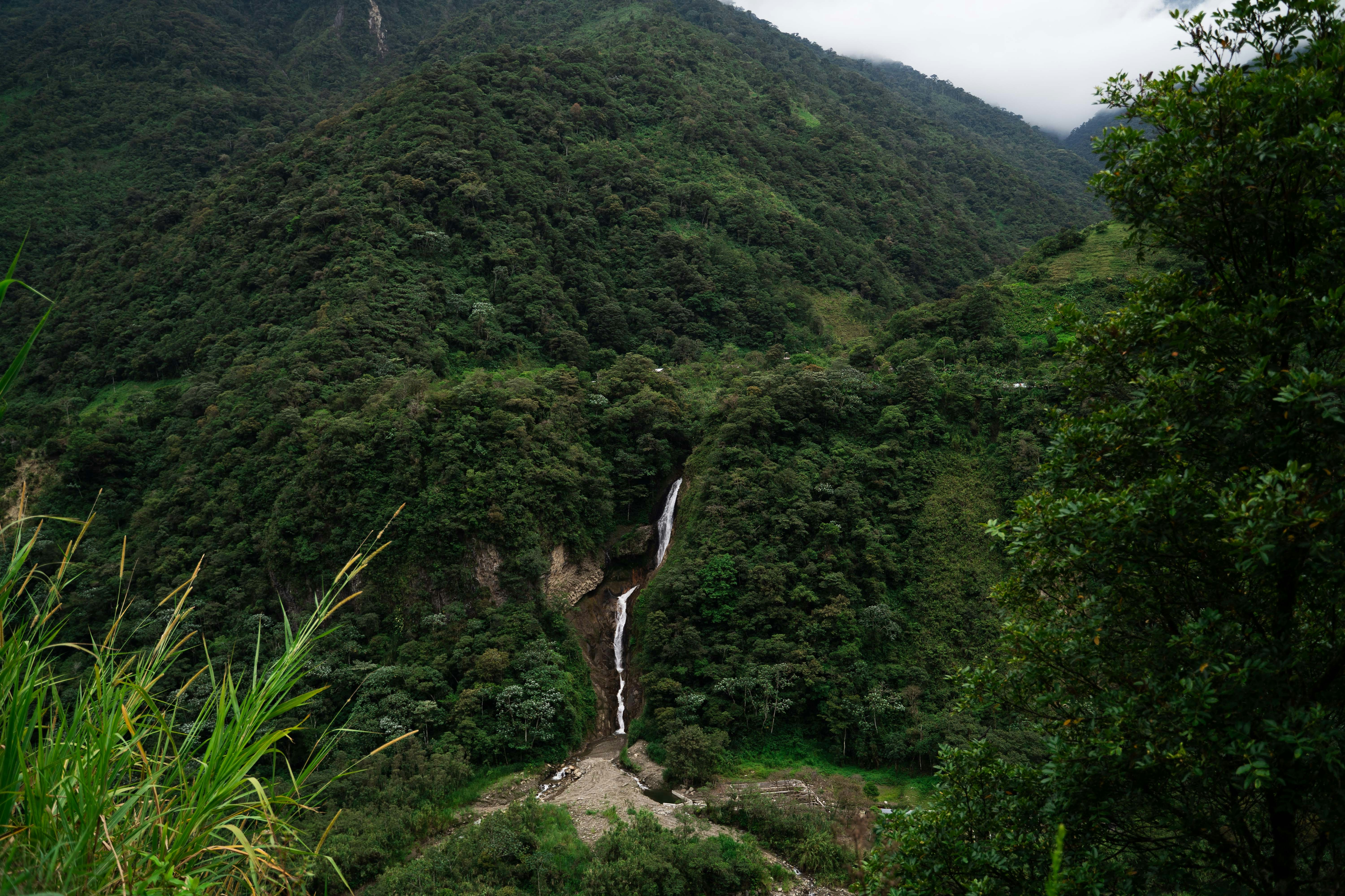 #3968 /100
Wedged in a valley at the foot of the active Tungurahua volcano, Baños has built a reputation as Ecuador's adventure-sports hub, with canyoning, white-water rafting, mountain biking and Andes-edge zip-lining all based out of town.
The 'Route of the Waterfalls' cycling or driving route strings together a dozen cascades, including Pailón del Diablo's thundering drop into a narrow gorge.
How does it rate
CrowdsRomanceCash RequiredDangerAccessibilityWhy you should go
Ecuador's adventure-sports base, with waterfalls, canyoning and zip-lining packed into one valley.
Why you shouldn't go
The town sits directly below an active volcano, which occasionally forces evacuations during eruptions.
Plan your visit
Best time to visitOctober–January for the driest weather and clearest volcano views.Best time of dayMorning for outdoor activities, before afternoon cloud and rain typically build.Getting thereAbout 3.5 hours' drive or bus from Quito.Entry costActivities vary widely, from free-to-view waterfalls to $30-80 for guided adventure sports.Time needed2–3 days.Insider tip — Rent a bike and ride the Waterfalls Route yourself rather than joining a tour — downhill-heavy, well-signed and far cheaper. -
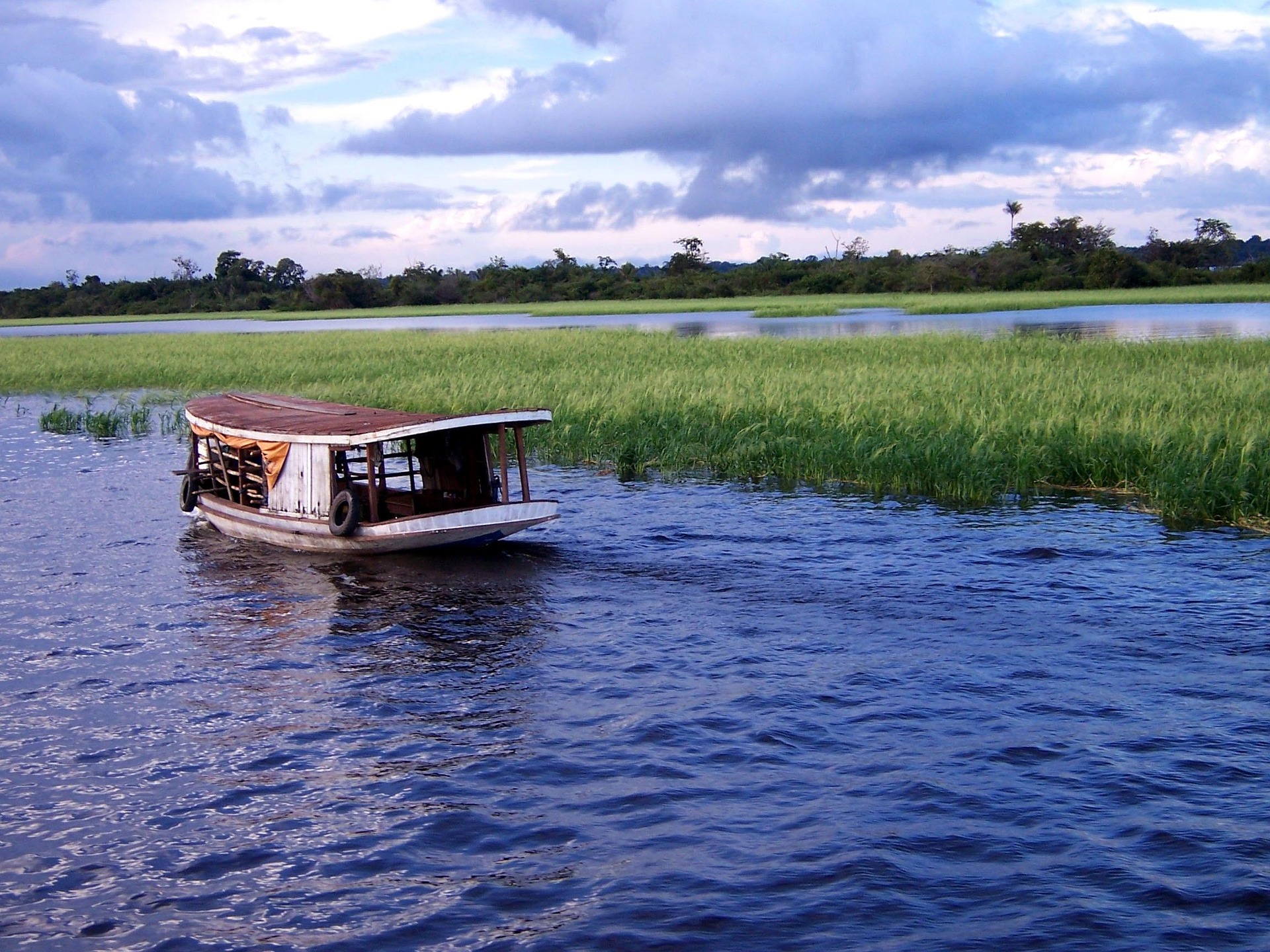 #4068 /100
A slow river cruise from Iquitos into the Peruvian Amazon, where guided skiff excursions reveal pink river dolphins, caimans, and a canopy full of macaws.
Days follow the rainforest's rhythm: dawn birdwatching, midday heat, and night walks for nocturnal wildlife.
Small riverboats reach tributaries larger vessels can't, guided by locals from villages along the route.
It's a wildlife trip first, with river sunsets as a scenic bonus.
How does it rate
CrowdsRomanceCash RequiredDangerAccessibilityWhy you should go
Close encounters with pink river dolphins, caimans, and rainforest wildlife most visitors never reach independently.
Why you shouldn't go
Humidity, insects, and basic medical access mean this suits travellers comfortable with genuine remoteness.
Plan your visit
Best time to visitYear-round destination; June-October (low water) for walking trails, December-May for flooded-forest boat access.Best time of dayDawn and dusk, when birds and monkeys are most active along the riverbanks.Getting thereFly to Lima, then on to Iquitos; riverboats embark from Iquitos port or nearby Nauta.Entry costIndicative $1,500-$4,000pp for a 4-7 night cruise, meals includedTime needed4-7 night cruiseInsider tip — Bring long sleeves, strong insect repellent, and binoculars; ask for an early skiff slot, as wildlife retreats once the sun is high. -
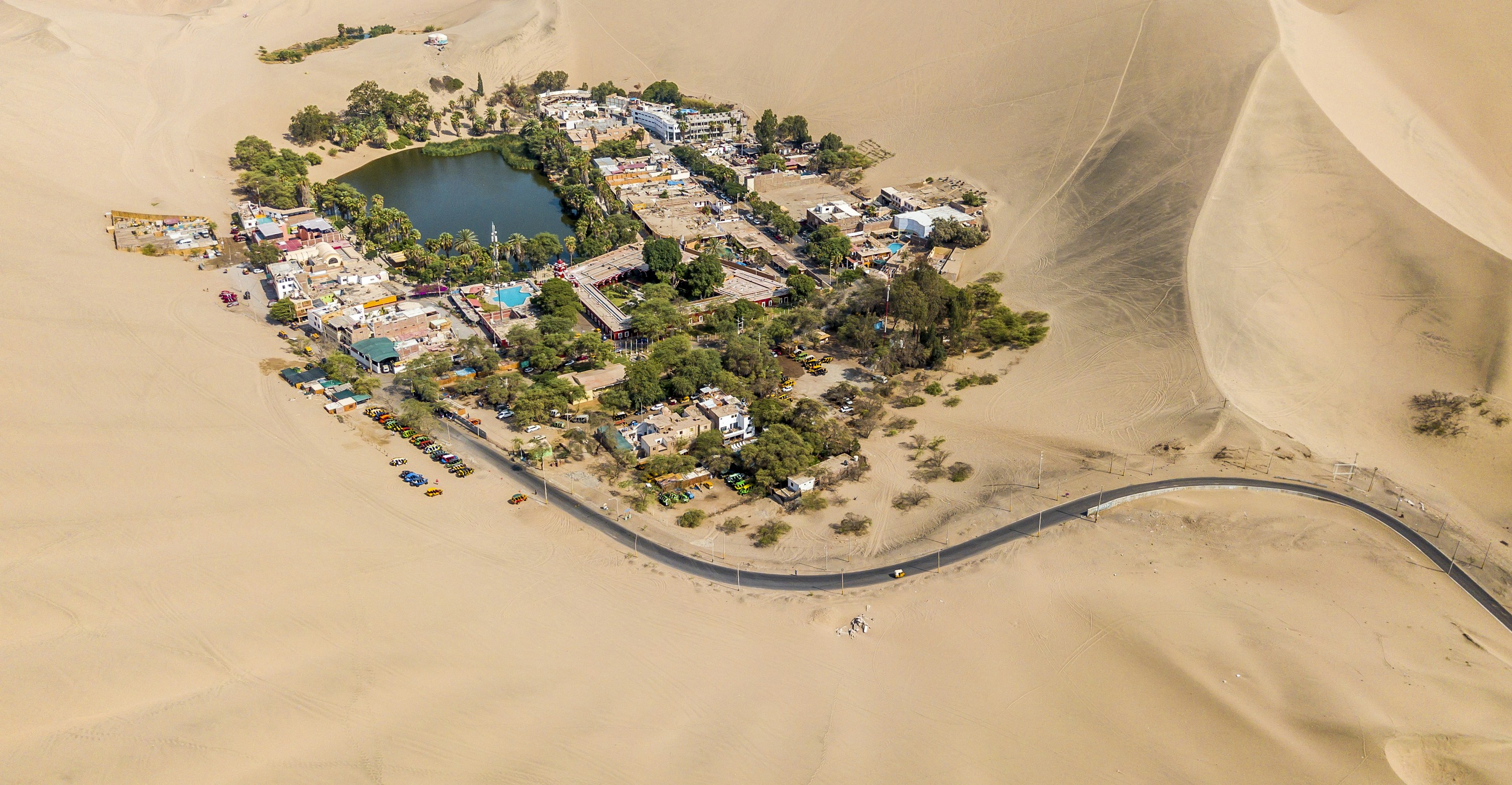 #4166 /100
Huacachina is a small palm-ringed lagoon swallowed by towering sand dunes on the edge of the Peruvian desert, a short detour off the Pan-American Highway.
The village is just a few streets and a handful of hostels around the lagoon; dune buggies and sandboarding on the surrounding dunes are the real draw.
It's a loud, high-energy stop rather than a place with much depth.
How does it rate
CrowdsRomanceCash RequiredDangerAccessibilityWhy you should go
High-speed dune buggy rides and sandboarding on genuinely huge dunes, right at the edge of town.
Why you shouldn't go
It's a small, thin destination built almost entirely around one activity - don't expect much beyond it.
Plan your visit
Best time to visitYear-round; afternoons are hot, so many tours run at sunsetBest time of dayLate afternoon into sunset, when the heat eases and buggy tours runGetting there3.5hr bus or drive south from Lima to Ica, then a 10-min taxi to HuacachinaEntry costSmall desert access fee (~S/4); buggy and sandboarding tours from ~S/40-100Time neededHalf a day to overnightInsider tip — Book the buggy tour through your hostel rather than street touts - prices are similar but the vehicles and guides are more reliably maintained. -
 #4265 /100
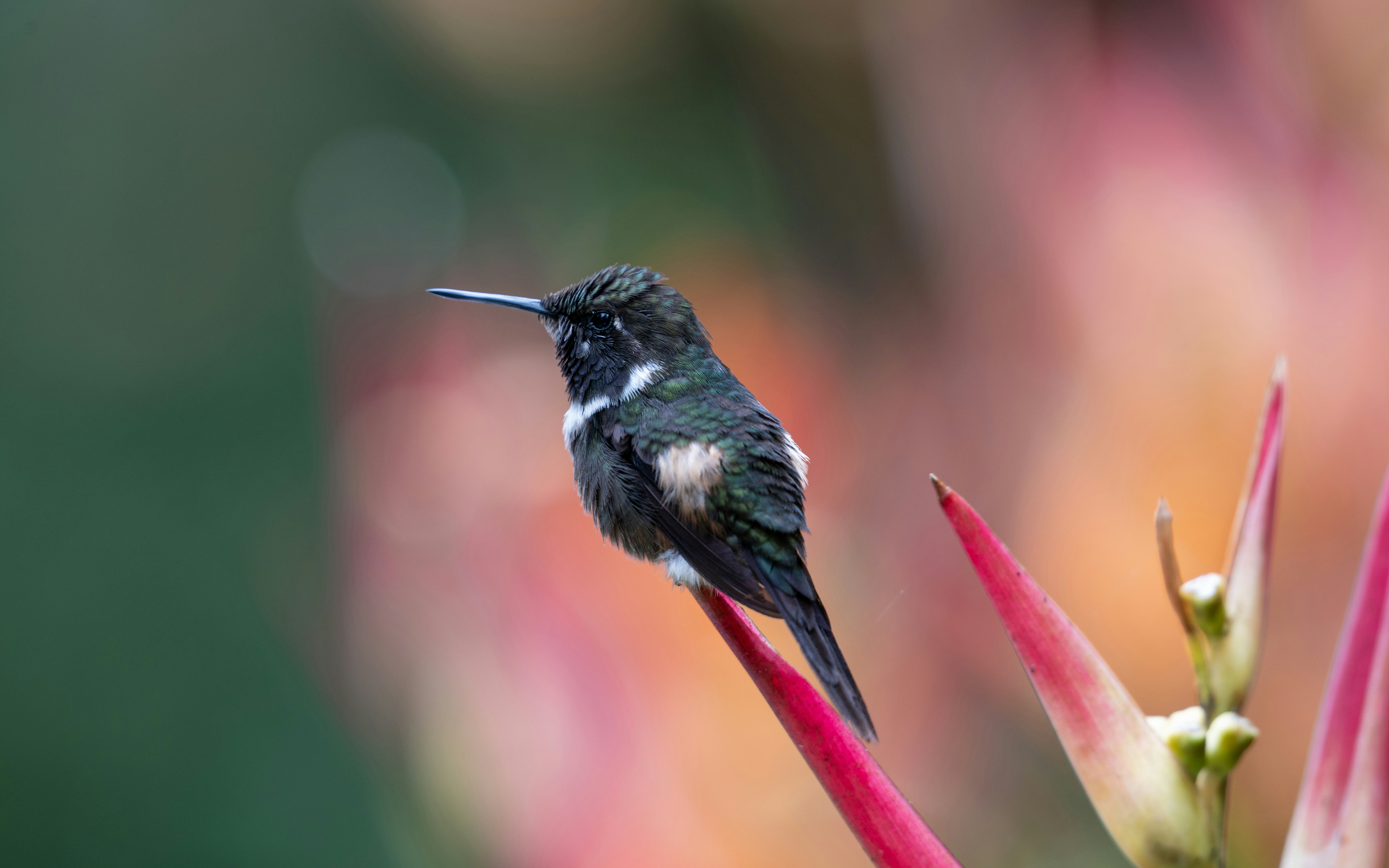
An hour's drive from Quito, Mindo drops into misty cloud forest thick with orchids, hummingbirds and over 500 recorded bird species, making it one of Ecuador's top birdwatching destinations without the remoteness of the Amazon.
Canopy zip-lines, tubing down the Mindo River and butterfly farms round out a more moderate adventure-tourism scene, geared as much toward wildlife-watching as adrenaline.
How does it rate
CrowdsRomanceCash RequiredDangerAccessibilityWhy you should go
Serious cloud-forest birdwatching — over 500 species — just an hour from Quito.
Why you shouldn't go
Frequent cloud cover and rain are part of the ecosystem's name and can limit visibility.
Plan your visit
Best time to visitJune–September for drier weather; birdwatching is good year-round.Best time of dayEarly morning, when hummingbird feeders and forest birds are most active.Getting thereAbout 1.5–2 hours' drive from Quito.Entry costReserve entries typically $5-10; guided birdwatching tours from $25.Time needed1–2 days.Insider tip — Visit a hummingbird feeder reserve first thing in the morning — activity drops off noticeably by mid-morning. -
 #43
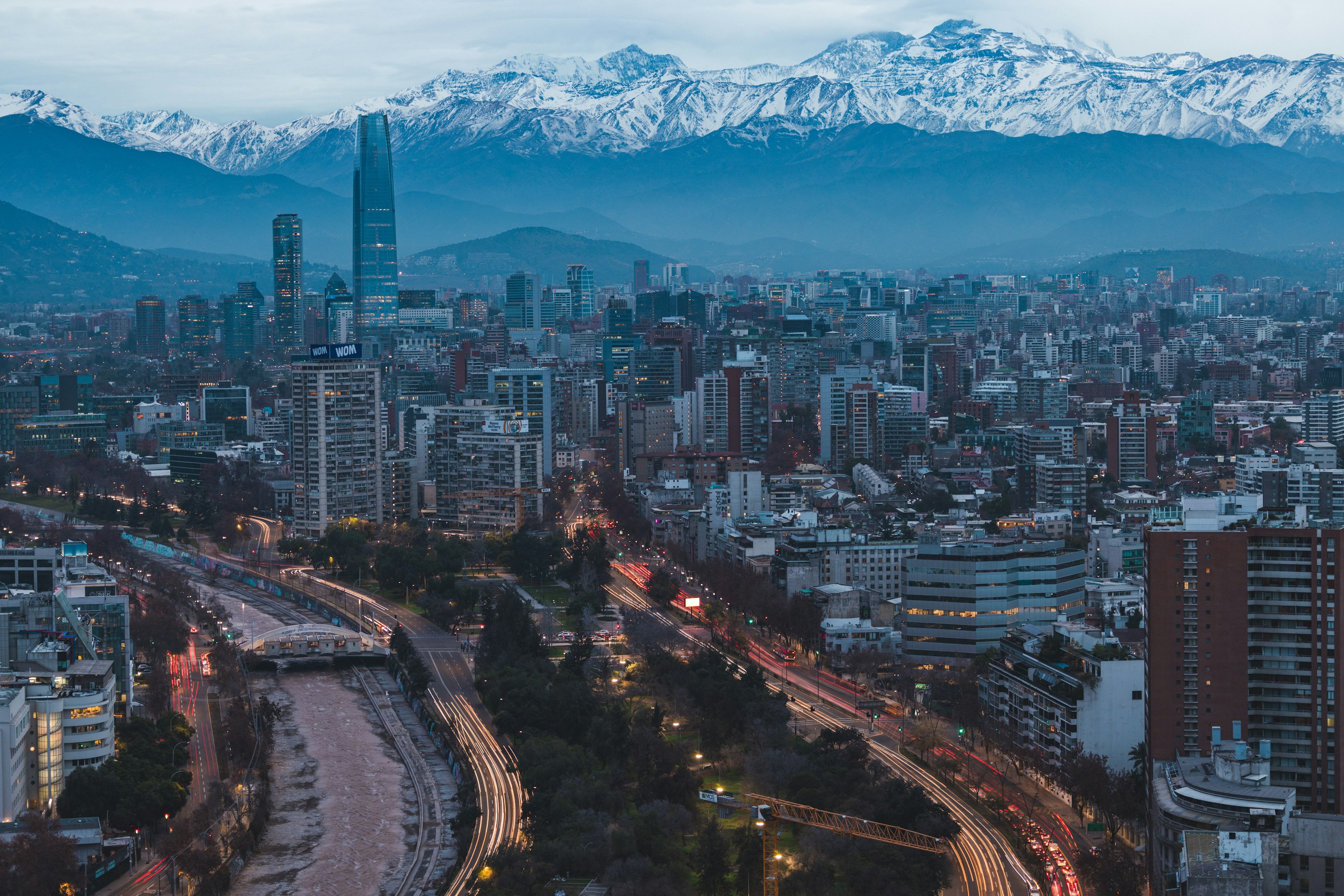
#43Chile's capital sits in a wide valley with the snow-capped Andes rising directly behind its skyline, a backdrop few capitals can match on a clear day.
The colonial core around Plaza de Armas, the funicular up Cerro San Cristóbal, and the restaurants of Bellavista give it a couple of solid days' worth of things to do.
Most travellers treat it as a stopover before Atacama or Patagonia rather than a destination itself.
How does it rate
CrowdsRomanceCash RequiredDangerAccessibilityWhy you should go
The Andes rise straight up behind the skyline, one of the most dramatic urban backdrops in South America.
Why you shouldn't go
Winter smog inversions can hide the mountain view for days, and most visitors only stay a night or two.
Plan your visit
Best time to visitOctober-April, for clearer skies and warmer weather; winter (Jun-Aug) brings smog inversions.Best time of dayClear mornings, for the best Andes visibility before afternoon haze builds.Getting thereArturo Merino Benítez International Airport (SCL) is Chile's main international gateway; the metro reaches most of the centre.Entry costFree to explore the city; Cerro San Cristóbal funicular ~CLP 3,000Time needed1-2 daysInsider tip — Take the funicular, not the cable car, up Cerro San Cristóbal in late afternoon - it's cheaper and the summit holds the light longer.


More from South America
-


More Natural Wonders spots
-
How a score is built
One score out of 100, five criteria behind it
Every place is rated 1–5 on each of the criteria below, then combined into a single score out of 100. It's calculated by us, the same way every time — not an average of traveller reviews or social votes.
Crowds
How many people you'll be sharing it with, and at what time of day.
Romance
How well it suits a couple, a proposal, or a quiet moment together.
Cash required
Entry fees, permits, guides, rentals — what it actually costs to do it.
Danger
Physical risk involved, from a slippery viewpoint to genuine hazard.
Accessibility
How far off the beaten path it is, and how hard it is to actually reach.

