-
 #192 /100
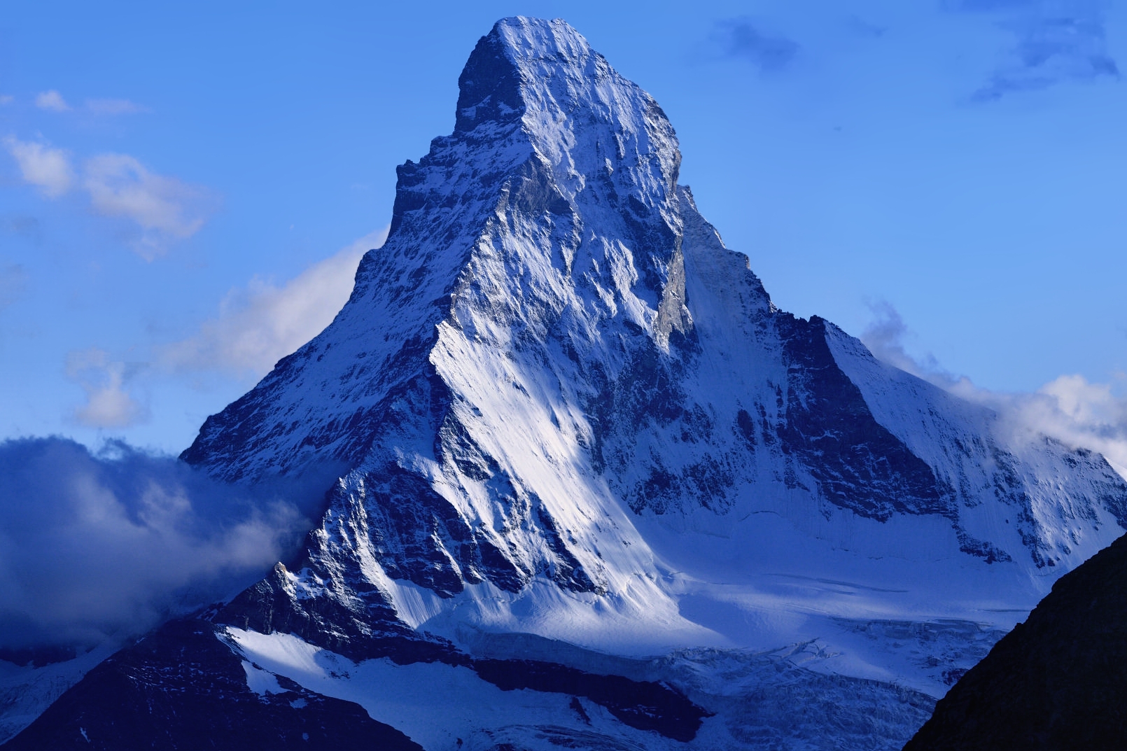
The Matterhorn's near-perfect pyramidal peak has made it one of the most recognised mountains in the world and the symbol of the Swiss Alps.
Rising 4,478 metres above the car-free village of Zermatt, it is reflected in the Riffelsee lake during clear summer mornings.
How does it rate
CrowdsRomanceCash RequiredDangerAccessibilityWhy you should go
The Matterhorn's symmetrical profile is spectacular from every angle and the reflection in the Riffelsee on a calm morning is one of the great Alpine photographs.
Why you shouldn't go
The mountain is notoriously cloud-covered; visiting Zermatt can be expensive and clear views are never guaranteed.
Plan your visit
Best time to visitJune-September for hiking, winter for snowBest time of daySunrise or sunset for alpenglow on the peakGetting thereTrain to Zermatt, a car-free villageEntry costFree to view; cable cars extraTime needed1-2 daysInsider tip — The reflection shot at Stellisee lake needs an early, still morning; go before 7am -
 #290 /100
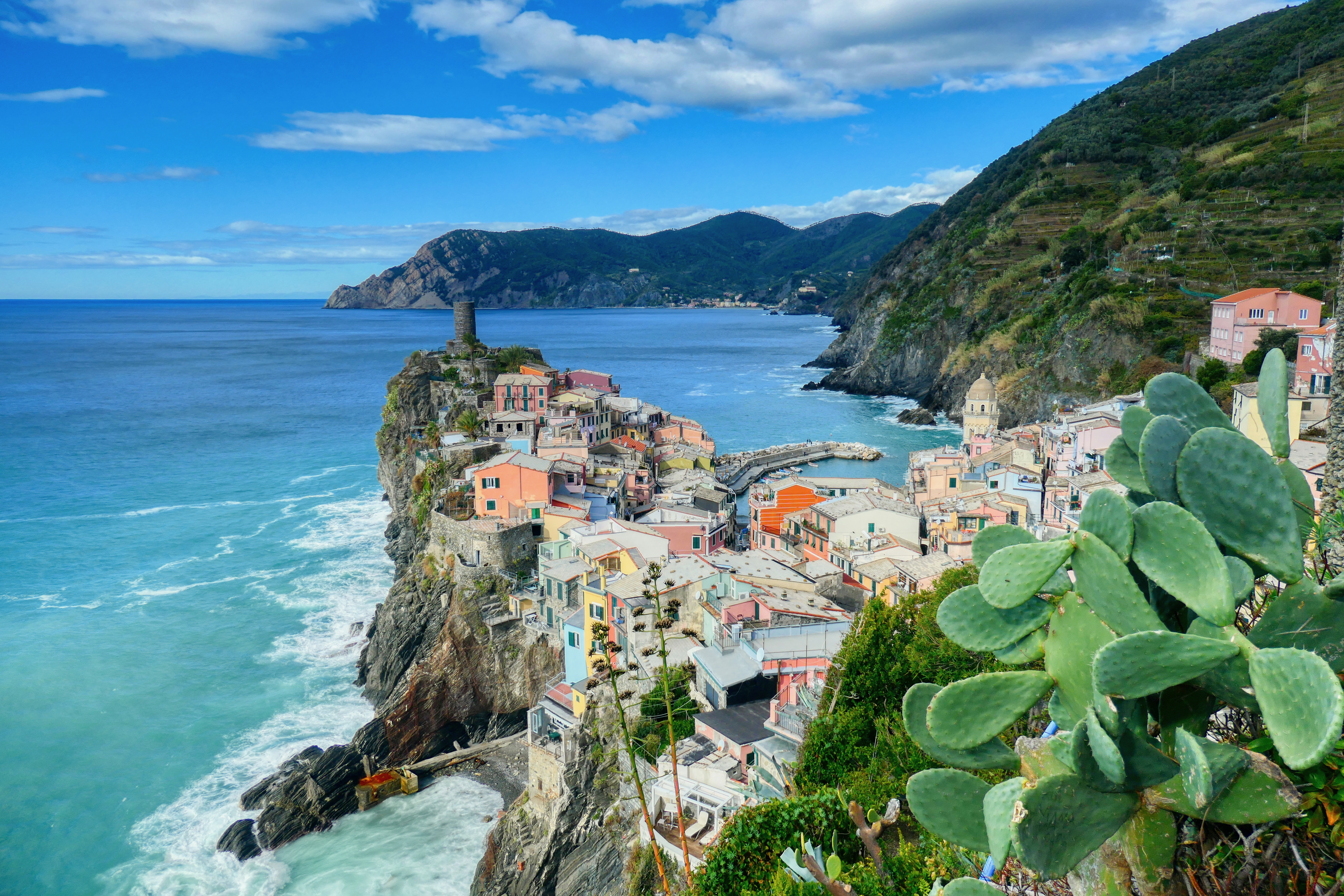
Cinque Terre is a string of five centuries-old fishing villages clinging to the cliffs of the Italian Riviera, connected by scenic hiking trails above the Ligurian Sea.
Manarola, Vernazza, Corniglia, Monterosso, and Riomaggiore tumble down their respective cliff faces in a cascade of colourful buildings.
How does it rate
CrowdsRomanceCash RequiredDangerAccessibilityWhy you should go
The views from the hillside hiking trails above each village, with the colourful houses tumbling down to the sea far below, are among Italy's most beautiful.
Why you shouldn't go
Cinque Terre has become very crowded and the trails between villages are sometimes restricted due to landslip damage; accommodation in the villages is very limited and expensive.
Plan your visit
Best time to visitApril-June or September-OctoberBest time of dayLate afternoon for the coloured houses in warm lightGetting thereTrain from La Spezia or Pisa, connects all 5 villagesEntry costCinque Terre Card ~EUR18 (trains + trails)Time needed2-3 daysInsider tip — Manarola's viewpoint at dusk is the most photographed spot; get there early to claim a spot on the wall -
 #388 /100
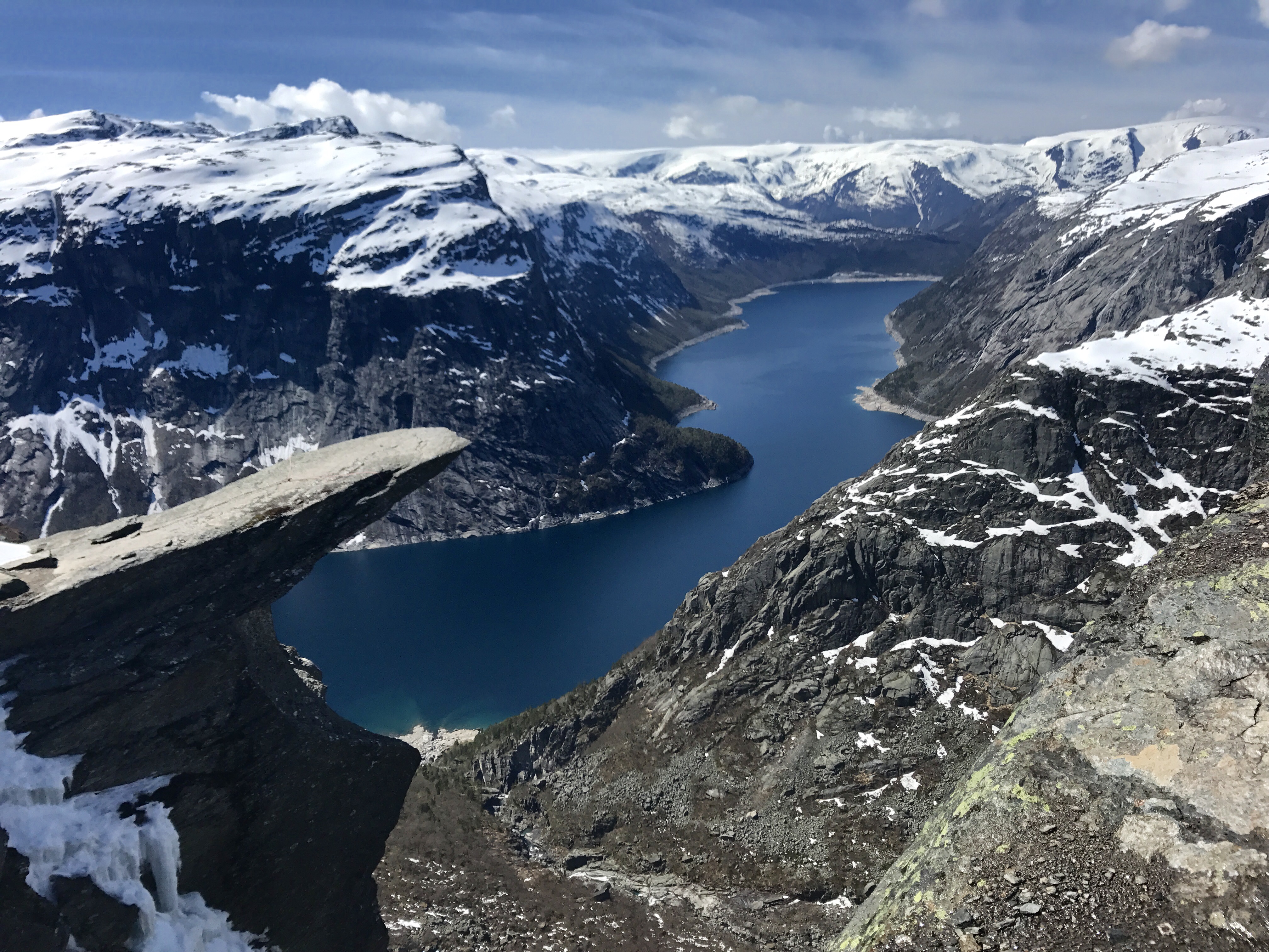
Trolltunga, meaning Troll's Tongue, is a spectacular horizontal rock formation that juts 700 metres above Lake Ringedalsvatnet in western Norway.
The 27-kilometre return hike to reach it passes through some of Norway's most dramatic fjord landscape, ascending over 1,000 metres in elevation.
How does it rate
CrowdsRomanceCash RequiredDangerAccessibilityWhy you should go
The view from the edge of Trolltunga, with the lake far below and Norwegian mountains stretching to the horizon, is one of Scandinavia's most dramatic vistas.
Why you shouldn't go
The hike is 27 kilometres return with 1,000 metres of elevation gain and takes 10-12 hours; the trail is only open from June to September and weather can change rapidly.
Plan your visit
Best time to visitJune-September (trail closed/dangerous outside this window)Best time of dayEarly morning start essential; it is a long hikeGetting there~4-5hr drive from Bergen to Skjeggedal trailheadEntry costFree; parking fee appliesTime needed10-12 hours round trip hikeInsider tip — Start by 6am; this is a genuinely strenuous full-day hike, not a quick photo stop -
 #487 /100
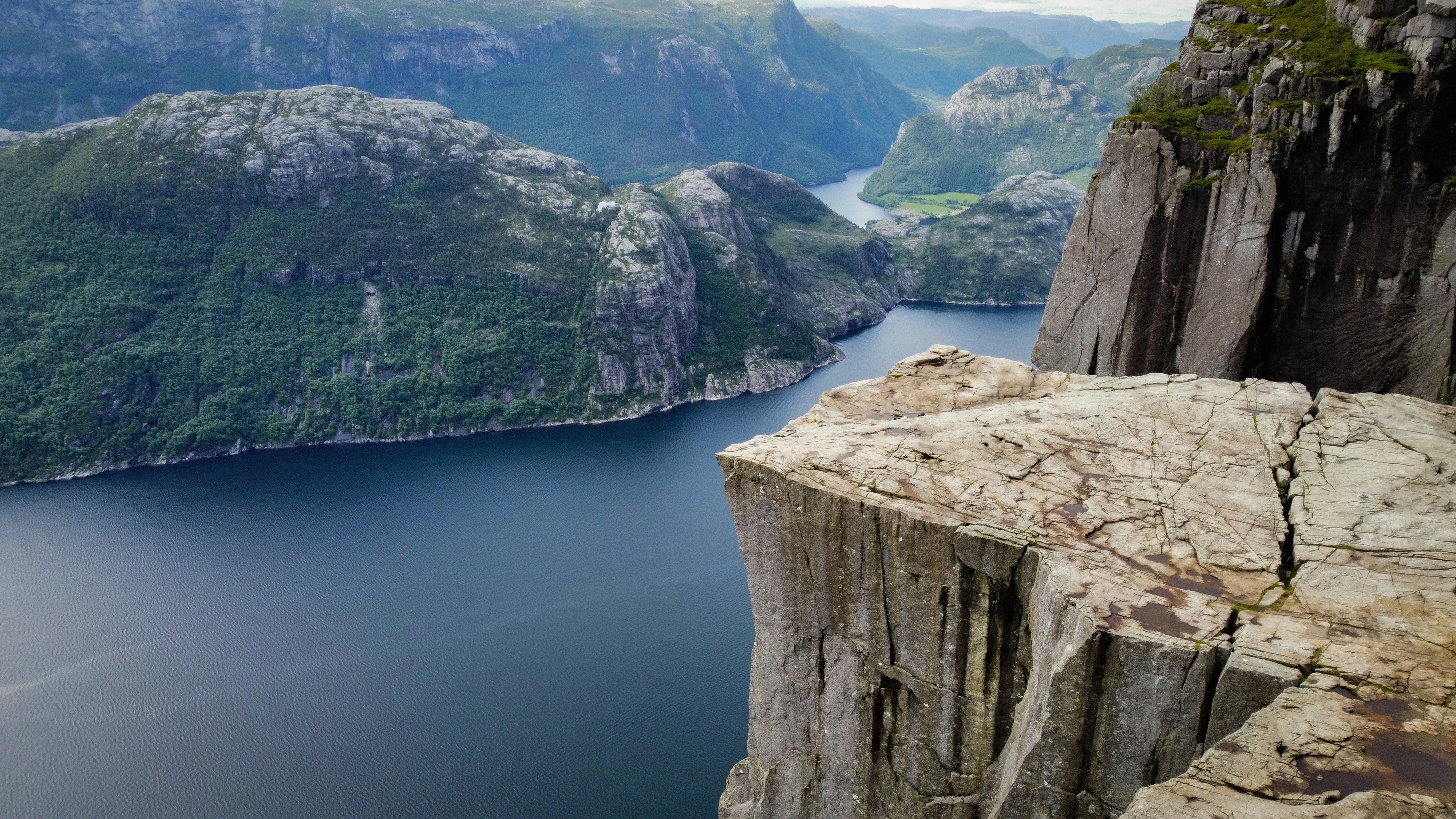
A flat granite plateau juts out 604 metres above the Lysefjord, ending in a sheer drop with the fjord stretching away beyond it.
The hike climbs around 350 metres over four kilometres, steep and rocky in places but manageable for most reasonably fit walkers in a few hours.
Nothing about the scale of the drop registers properly until you are standing at the edge of it.
How does it rate
CrowdsRomanceCash RequiredDangerAccessibilityWhy you should go
A flat-topped cliff 604 metres straight above a fjord, reachable on a half-day hike.
Why you shouldn't go
There's no railing at the edge, and the plateau gets genuinely crowded in peak summer.
Plan your visit
Best time to visitMay-September, when the trail is snow-free.Best time of dayEarly morning or evening, avoiding the midday tour-group peak.Getting thereFerry from Stavanger to Tau, then bus or drive to the Preikestolen trailhead.Entry costFree hike; parking fee at the trailhead.Time needed4-5 hours round tripInsider tip — Start the hike before 8am - by midday the summit plateau is packed with cruise-ship tour groups from Stavanger. -
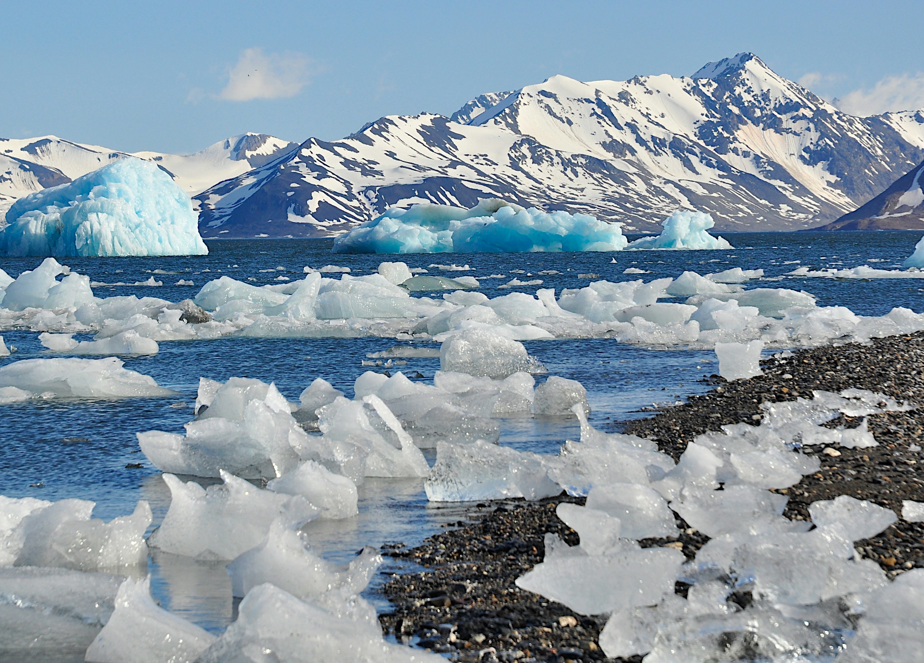 #587 /100
Svalbard is a remote Norwegian archipelago deep in the Arctic Ocean, roughly 60% covered by glaciers and home to more polar bears than people.
Longyearbyen, the main settlement, is the base for dog-sledding, snowmobiling and boat trips past calving glaciers and drifting sea ice, with the midnight sun in summer and polar night and northern lights in winter.
Almost everything beyond town requires an armed guide, which shapes the whole experience.
How does it rate
CrowdsRomanceCash RequiredDangerAccessibilityWhy you should go
Genuine Arctic wilderness - glaciers, polar bears and sea ice - reachable on a scheduled flight, not an expedition.
Why you shouldn't go
Expensive and logistically restrictive: guided tours are compulsory for almost anything outside Longyearbyen.
Plan your visit
Best time to visitApril-August for midnight sun and easier travel; November-February for northern lights and polar night.Best time of daySeason matters more than time of day - summer light is near-constant, winter darkness is too.Getting thereDirect flights from Oslo or Tromsø to Longyearbyen, around 3 hours from Oslo.Entry costNo entry fee; guided excursions typically 500-3000+ NOK per person per day.Time needed4-7 daysInsider tip — Book glacier or fjord boat trips a season ahead in summer - the small tour operators sell out before the ice starts breaking up. -
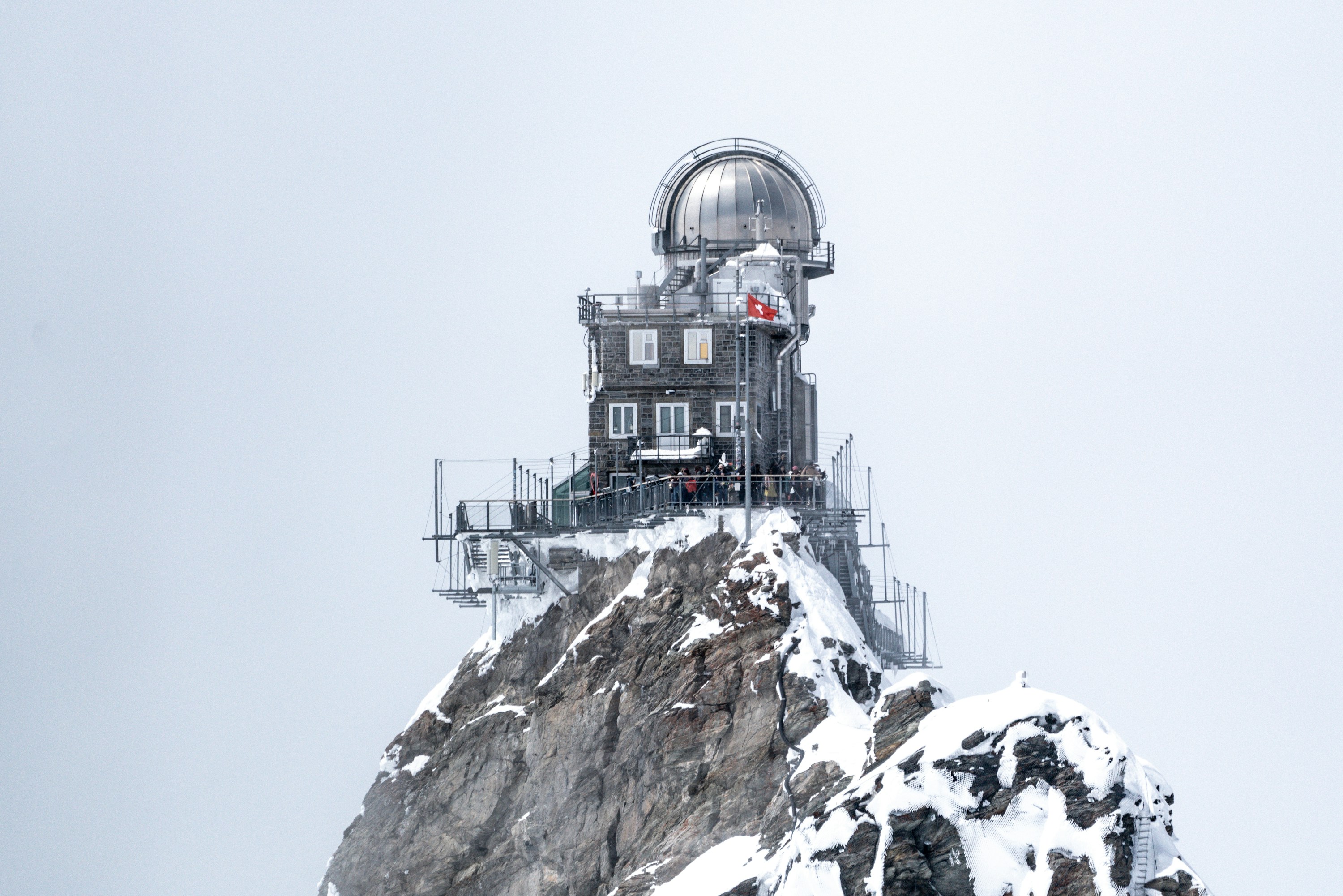 #687 /100
A cogwheel railway climbs through solid rock to a saddle between the Eiger and Mönch, 3,454 metres up, where the "Top of Europe" station opens onto the Aletsch Glacier, the largest ice stream in the Alps.
An ice palace, observation deck, and snow terrace fill out the visit, though thin air and shifting weather can erase the view without warning.
How does it rate
CrowdsRomanceCash RequiredDangerAccessibilityWhy you should go
The Alps' most complete high-altitude experience reachable entirely by train, glacier included.
Why you shouldn't go
Among the most expensive single excursions in Switzerland, and cloud can close in and erase the view with no refund.
Plan your visit
Best time to visitMay–October for the clearest weather; book the mandatory seat reservation well ahead in summer.Best time of dayFirst train of the day, before cloud typically builds up over the peaks by midday.Getting thereTrain from Interlaken Ost via Grindelwald or Lauterbrunnen/Wengen to Jungfraujoch; no road access.Entry costRound-trip train from Interlaken roughly CHF 220–260 depending on season.Time neededHalf a dayBookingBook ahead →Insider tip — Sit on the right-hand side of the train from Interlaken for the best glacier views on the way up. -
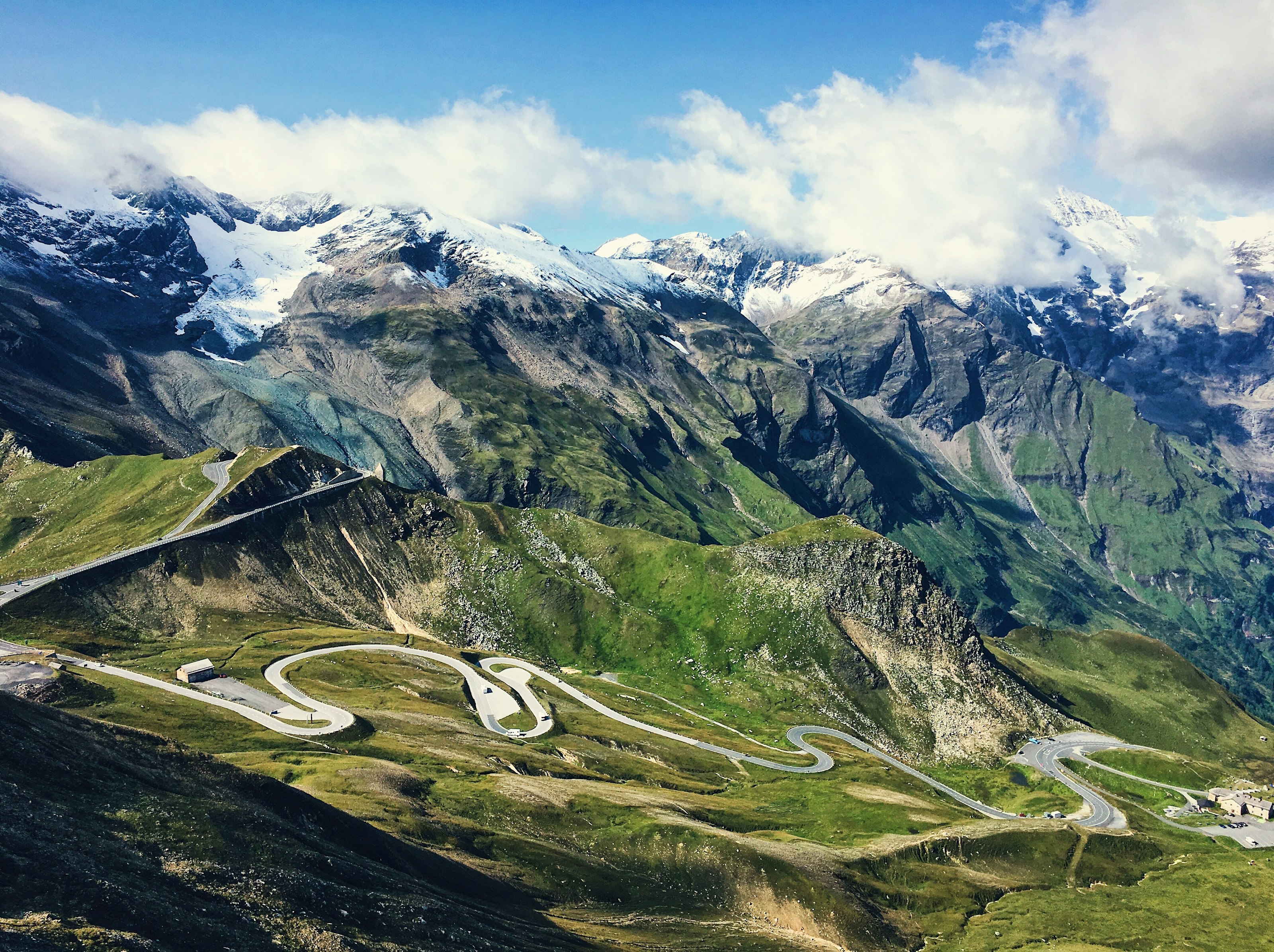 #784 /100
The Grossglockner High Alpine Road climbs through 36 hairpin bends to over 2,500 metres, threading past Austria's highest peak and ending at a viewpoint over the Pasterze, the country's largest glacier.
Marmots and ibex are a common sight along the route, and a dozen or so panoramic pull-offs give reason to stop every few kilometres.
The road is only open from May to October, closing once snow makes the high pass impassable.
How does it rate
CrowdsRomanceCash RequiredDangerAccessibilityWhy you should go
Few drives anywhere put a country's highest peak and largest glacier both directly in view from the road itself.
Why you shouldn't go
It's a toll road only open in warmer months, and hairpin after hairpin makes it a slow, deliberate drive rather than a scenic shortcut.
Plan your visit
Best time to visitJune–September, when the road is fully open and snow has cleared from the pass.Best time of dayMorning, for clear visibility before afternoon cloud builds around the peaks.Getting thereFly to Salzburg; roughly 1.5-hour drive south to the road's northern entrance near Fusch.Entry costToll charged per vehicle.Time neededHalf a dayInsider tip — Stop at the Kaiser-Franz-Josefs-Höhe viewpoint for the best direct view of the Pasterze glacier and the Grossglockner summit. -
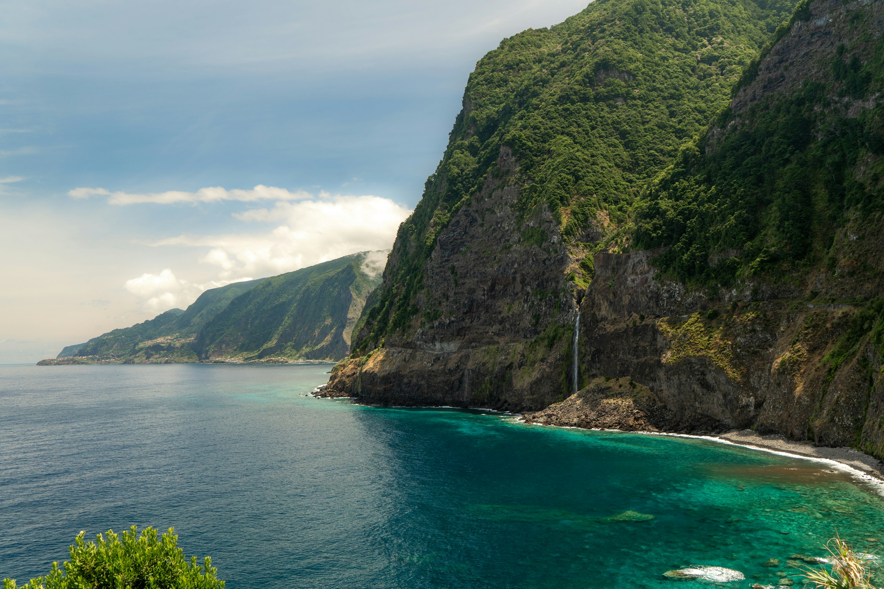 #8
#8A volcanic island in the mid-Atlantic nicknamed the "floating garden," Madeira packs cloud forest, terraced vineyards, and sea cliffs over 500 metres tall into an area smaller than greater London.
A 19th-century irrigation network of levadas laces the interior with walking trails through laurel forest and past hidden waterfalls, while a glass skywalk cantilevers out over Cabo Girão, one of Europe's highest sea cliffs.
How does it rate
CrowdsRomanceCash RequiredDangerAccessibilityWhy you should go
Levada trails, laurel forest, and dramatic cliffs pack in more landscape variety than an island this size should have.
Why you shouldn't go
Terrain is steep throughout the interior; reaching the best trails and viewpoints generally requires a rental car.
Plan your visit
Best time to visitApril–October for reliably dry trails; the mild year-round climate also suits winter breaks.Best time of dayMorning, before afternoon cloud typically rolls in over the higher levadas and viewpoints.Getting thereFly directly to Madeira Airport near Funchal; a rental car is the practical way to reach most levadas and viewpoints.Entry costFree to hike most levadas; Cabo Girão skywalk and cable cars charge a small fee.Time needed3–5 daysInsider tip — Levada do Caldeirão Verde is one of the most rewarding walks — start early to beat tour groups and have the waterfall to yourself. -
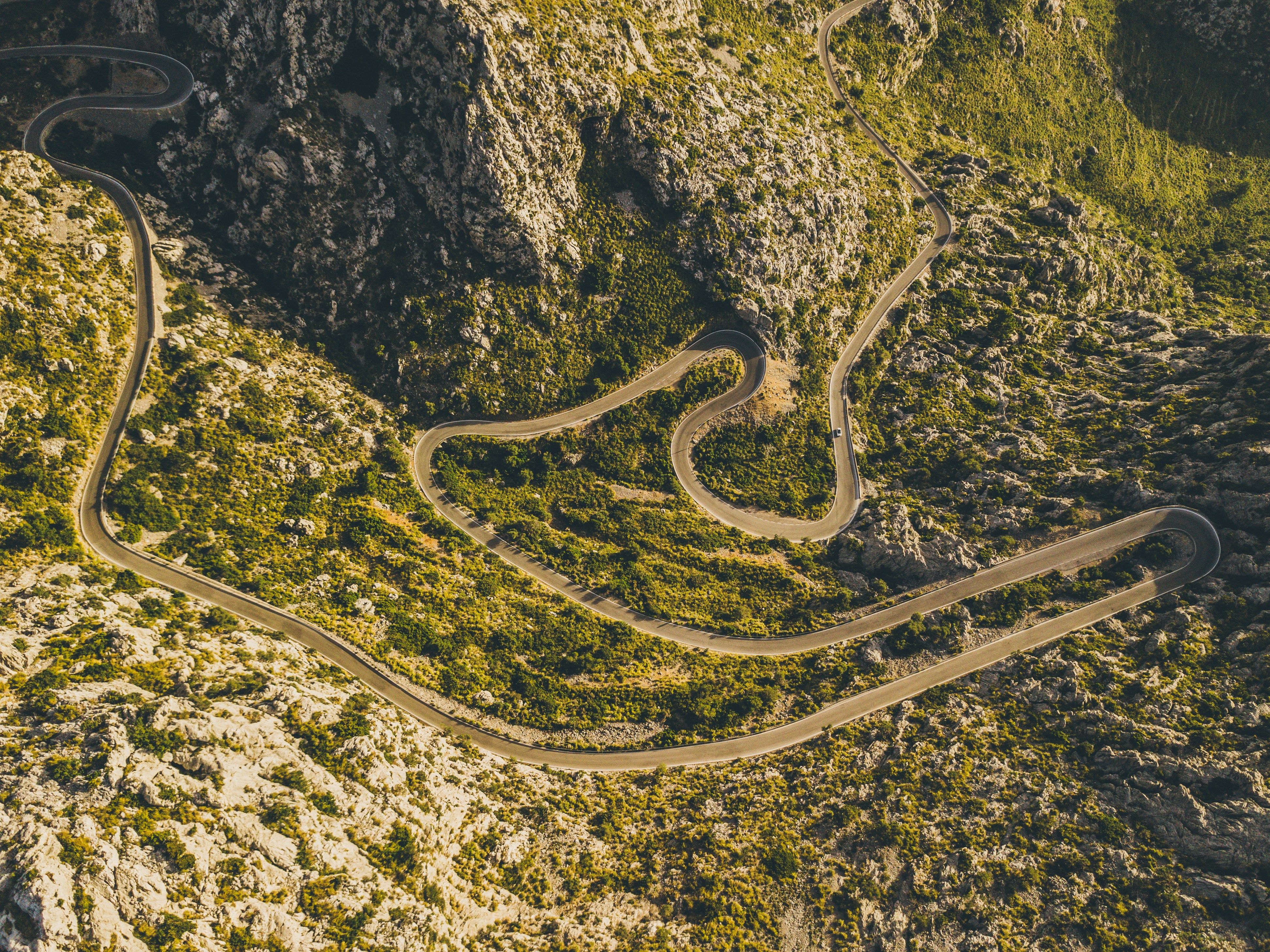 #9
#9Rated #9 of 32
Serra de Tramuntana Cycling Route, Spain
#serradetramuntanacyclingroute ◆ Cycling Tours81 /100The Sa Calobra climb switchbacks up 26 hairpins through the limestone Serra de Tramuntana, including a spiralling loop where the road passes beneath itself, before dropping to a hidden cove on Mallorca's northwest coast.
Wider routes through the range link terraced olive groves, the monastery at Lluc and the ridge-top village of Deia.
The road is a pilgrimage climb for road cyclists and one of Europe's most celebrated stretches of tarmac.
How does it rate
CrowdsRomanceCash RequiredDangerAccessibilityWhy you should go
A legendary hairpin climb through dramatic limestone mountains that road cyclists travel the world to ride.
Why you shouldn't go
Narrow, exposed switchbacks shared with tour buses and cars make the descent genuinely dangerous.
Plan your visit
Best time to visitApr-May or Sep-Oct, avoiding summer heat and the busiest cycling-season crowds.Best time of dayEarly morning start, both for cooler temperatures and lighter traffic on the hairpins.Getting thereFly to Palma de Mallorca; drive or ride roughly 90 minutes to the Coll dels Reis start point.Entry costFree to ride; road bike rental from EUR20-30/dayTime neededHalf a day for the climb and descentInsider tip — Descend to Sa Calobra cove for a swim before the climb back up, and start at dawn to have the famous spiral hairpin free of tour coaches. -
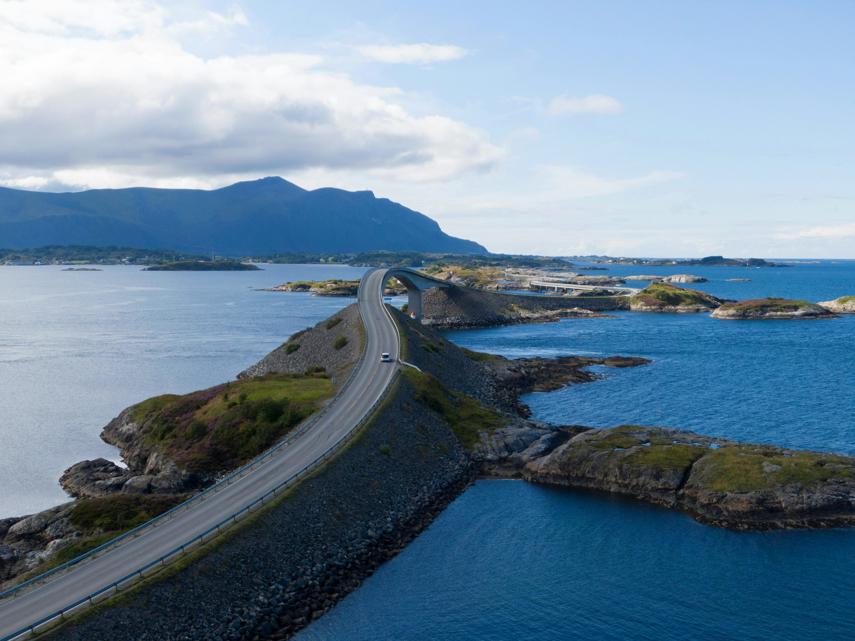 #1081 /100
The Atlantic Road links a scatter of skerries and islets off Norway's west coast on an 8km run of bridges and causeways, built to look like it dives straight into the sea.
The Storseisundet Bridge is the famous shot, but the whole stretch is a slow, low-lying drive between open ocean on both sides, with fishing hamlets and pull-offs for scrambling over the rocks.
Storms send waves over the road, which locals treat as a spectator sport in autumn.
How does it rate
CrowdsRomanceCash RequiredDangerAccessibilityWhy you should go
A short, genuinely dramatic stretch of road that seems to disappear into the open Atlantic.
Why you shouldn't go
Over almost as soon as it starts - eight kilometres, no detours, done in half an hour without stops.
Plan your visit
Best time to visitSummer for calm seas and long light; autumn storms for waves breaking over the causeways.Best time of dayGolden hour, when the low sun catches the bridge and open water on both sides.Getting thereFly to Kristiansund; a 30-40 minute drive on Route 64 to the road's western end at Kårvåg.Entry costFree; no tolls on the road itself.Time needed1-2 hours including stopsInsider tip — Park at the Storseisundet Bridge viewpoint and walk out onto the older, disused sections of road for an angle on the bridge that most drivers miss. -
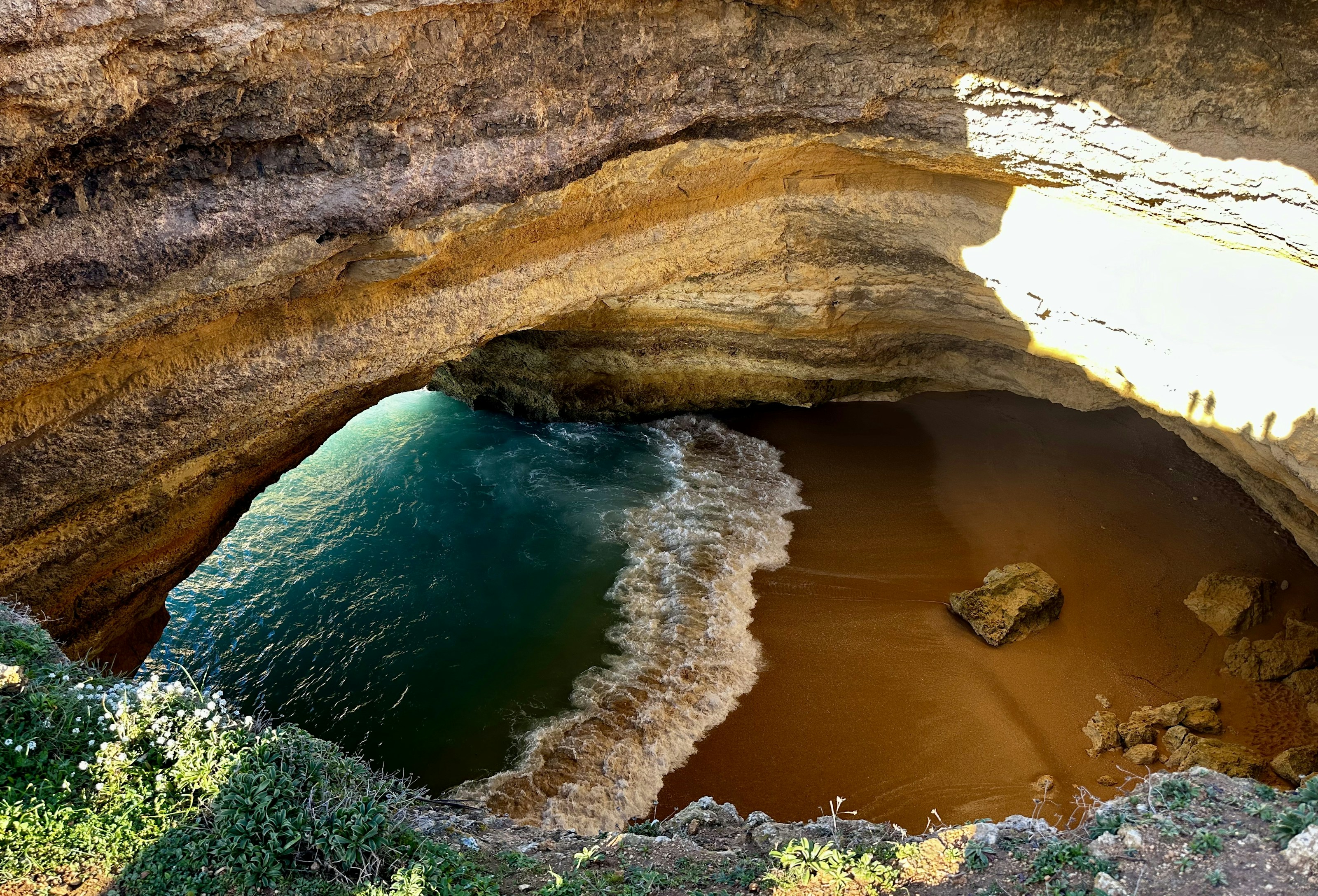 #1180 /100
A domed sandstone chamber on the Algarve coast with its own crescent of beach and a circular hole in the roof that drops a column of sunlight onto the sand.
It can only be reached from the water, by kayak, paddleboard or tour boat, since swimming across from the neighbouring beach is now restricted.
How does it rate
CrowdsRomanceCash RequiredDangerAccessibilityWhy you should go
Sunlight falling through the roof onto a private beach inside a cave, reachable only from the sea.
Why you shouldn't go
Boats queue nose to tail in high season, and landing inside the cave is no longer permitted.
Plan your visit
Best time to visitMay-June or September for calm water without the August armadaBest time of dayAround midday, when the sun drops straight through the roof openingGetting thereBoat or kayak from Benagil or Praia da Marinha, 30 minutes east of PortimaoEntry costKayak hire around EUR 25; boat tours from EUR 20Time needed2-3 hoursInsider tip — Take a kayak rather than a boat tour - kayaks can still slip inside the cave when the larger boats have to hold offshore. -
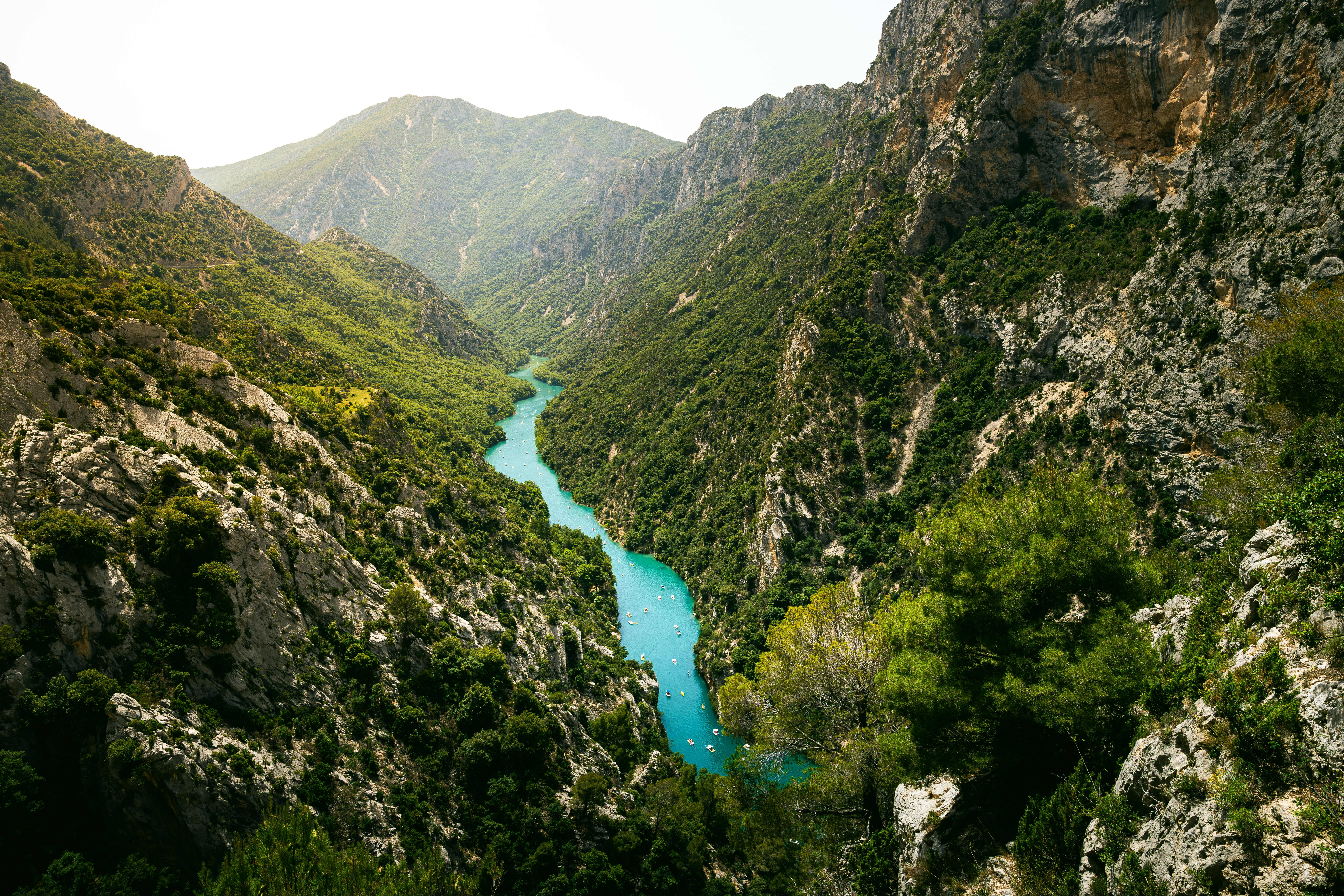 #1280 /100
Europe's deepest canyon plunges 700 meters, with the turquoise Verdon River winding through limestone walls below.
Scenic clifftop drives, hiking trails, and kayaking routes make it one of France's most dramatic natural landscapes, far quieter than the Côte d'Azur an hour south.
How does it rate
CrowdsRomanceCash RequiredDangerAccessibilityWhy you should go
Europe's deepest canyon with a turquoise river far below, stunning clifftop drives, and adventure sports.
Why you shouldn't go
Summer weekends bring heavy traffic; some viewpoints have poor parking; the rim road is narrow and winding.
Plan your visit
Best time to visitMay–June or September for pleasant weather and fewer tourists.Best time of dayMorning light softens the canyon walls; sunset along the rim road is dramatic.Getting thereFly to Nice, 2.5–3 hour drive northwest to Castellane; rental car essential.Entry costFree for rim drives; kayak tours €25–50 per person.Time neededFull day for the rim drive; 2 days to add kayaking.Insider tip — Drive the Corniche Sublime road slowly — it's narrow with sheer drops. Rent a kayak at Lac de Sainte-Croix, at the canyon's mouth, for a different perspective. -
 #1380 /100
A roughly 170km hut-to-hut circuit around the Mont Blanc massif through France, Italy and Switzerland, climbing about 10,000m of ascent past glaciers, alpine lakes and larch forest.
Val Ferret and the Aiguilles Rouges give some of the best full-on views of Mont Blanc's summit.
Most walkers take 7-11 days, staying in refuges that range from rustic to modernised.
Huts fill fast in July and August.
How does it rate
CrowdsRomanceCash RequiredDangerAccessibilityWhy you should go
Circling the entire Mont Blanc massif on foot, with a fresh angle on the summit from a different valley each day.
Why you shouldn't go
Popular refuges get overbooked in peak summer and demi-pension prices have climbed sharply since 2022.
Plan your visit
Best time to visitMid-June to mid-September, when high passes are snow-free and refuges are open.Best time of dayEarly morning starts to clear passes before afternoon thunderstorms build.Getting thereFly to Geneva; bus or train (about 1-1.5 hours) to Chamonix, the trek's usual start and end point.Entry costNo park fee; refuge demi-pension runs roughly EUR50-80 (CHF60-100 in Switzerland) a night.Time needed7-11 daysInsider tip — Reserve refuges as soon as booking opens (often January) for July-August dates, and pack layers - weather turns fast at altitude. -
 #1479 /100
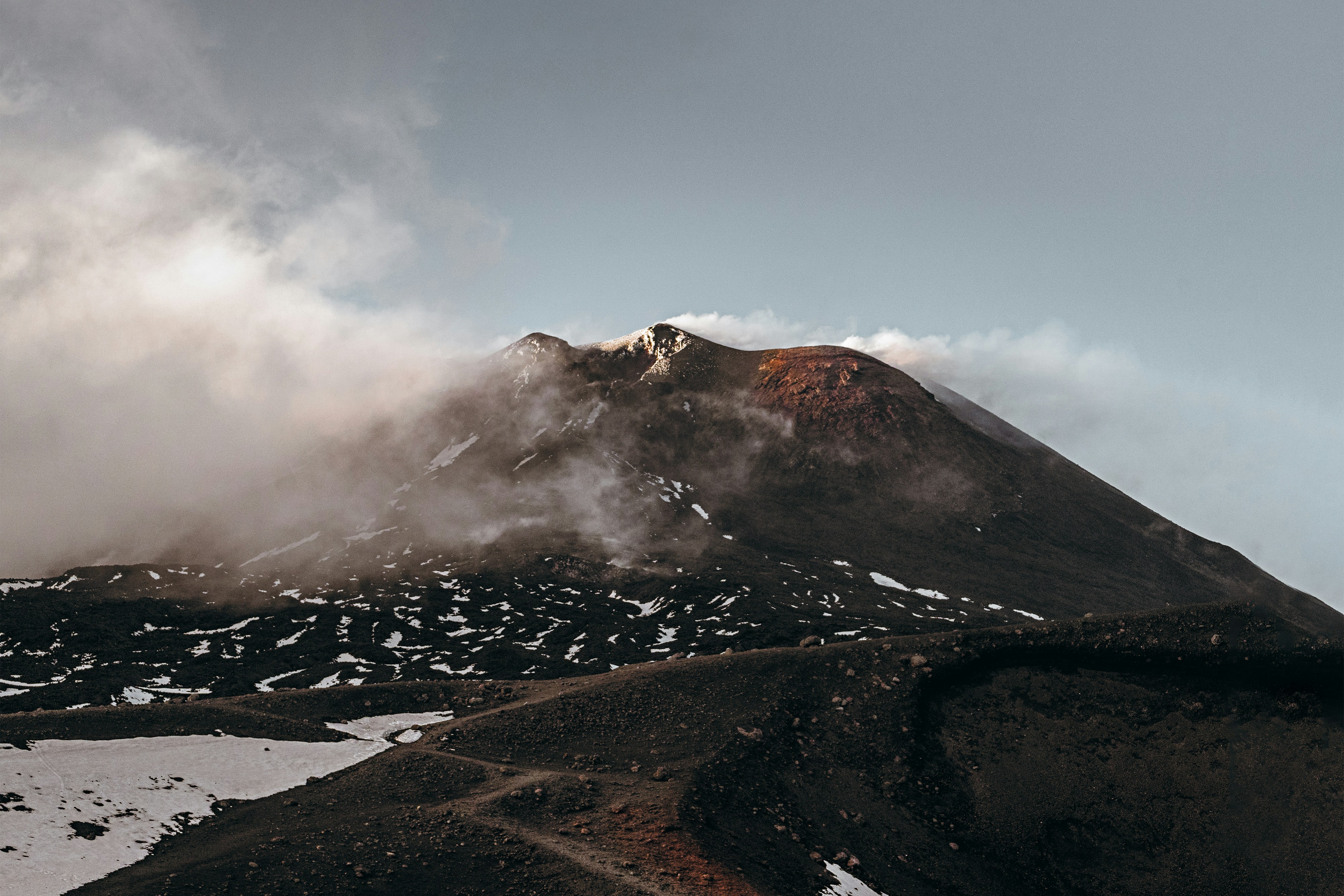
Europe's tallest and most active volcano, looming over Sicily's east coast and erupting regularly enough that lava flows are a near-yearly event visible from Catania on clear nights.
Cable cars and 4x4 tours climb partway up its barren, ash-grey upper slopes, where guided hikes reach steaming craters and fields of hardened lava from past eruptions.
Vineyards ring its lower slopes, producing distinctive wines grown in volcanic soil, a striking contrast to the desolation higher up.
How does it rate
CrowdsRomanceCash RequiredDangerAccessibilityWhy you should go
Europe's most active volcano, with guided hikes reaching steaming craters and lava fields on its upper slopes.
Why you shouldn't go
Eruptions and ash activity periodically close the upper trails and cable car with little notice, so plans need flexibility.
Plan your visit
Best time to visitMay-June or September for stable weather; the summit can close in poor conditions any time of year.Best time of dayMorning, for clearer summit visibility before afternoon cloud typically rolls in.Getting thereFly to Catania; a 1-1.5 hour drive to the Rifugio Sapienza cable car station on the south side.Entry costCable car plus jeep tour to the craters runs around EUR65-70.Time neededHalf a day.BookingBook ahead →Insider tip — Book the guided upper-crater jeep tour rather than stopping at the cable car's midpoint - the higher craters are where the volcano actually looks otherworldly. -
 #15
#15Rated #15 of 32
Loire Valley Chateaux Cycling Route, France
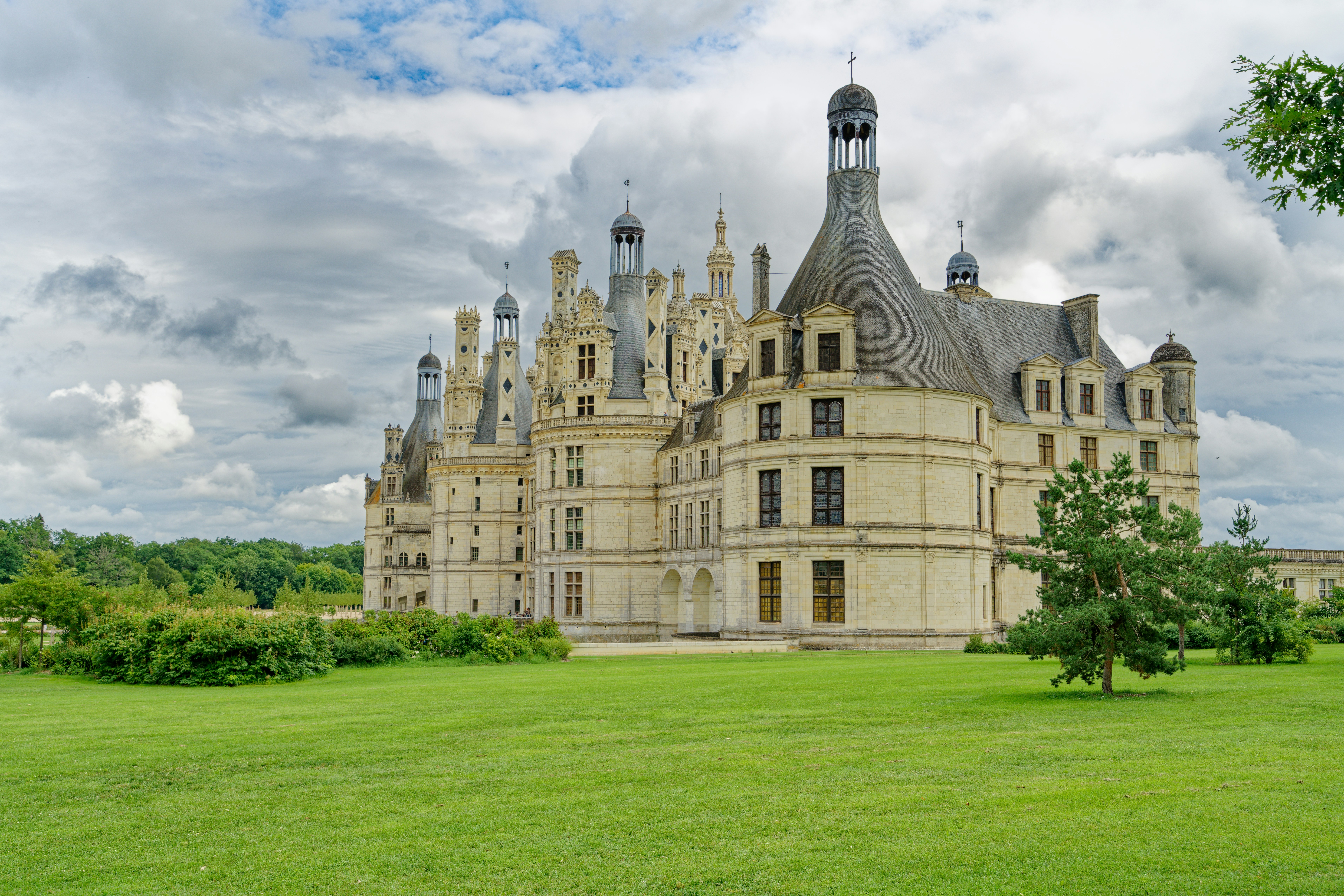
#loirevalleychateauxcyclingroute ◆ Cycling Tours79 /100La Loire a Velo's flat, dedicated paths link the Loire Valley's great chateaux, threading past Chambord's fairy-tale turrets, Chenonceau's arches over the Cher and Amboise's clifftop fortress.
Riders pass through stone villages, vineyards and troglodyte cave dwellings carved into tufa cliffs along the way.
Short, modular loops between 10 and 45km make it easy to see one chateau or several in a single day.
How does it rate
CrowdsRomanceCash RequiredDangerAccessibilityWhy you should go
Flat, dedicated paths connect some of Europe's most theatrical castles without ever touching traffic.
Why you shouldn't go
Chateau entry fees add up quickly if you visit more than one or two in a day.
Plan your visit
Best time to visitMay-June or September for mild weather and thinner chateau queues.Best time of dayMorning arrival at each chateau, ahead of coach-tour crowds.Getting thereTrain to Tours or Blois from Paris (about 1.5-2 hours); bike rental available at both stations.Entry costBike rental from EUR15/day; Chambord entry EUR16, Chenonceau EUR16Time needed1-3 days depending on chateaux visitedBookingBook ahead →Insider tip — Ride the Chambord-to-Cheverny loop before 10am to see Chambord's roofline reflected in its still moat before the wind picks up and coaches arrive. -
 #1679 /100
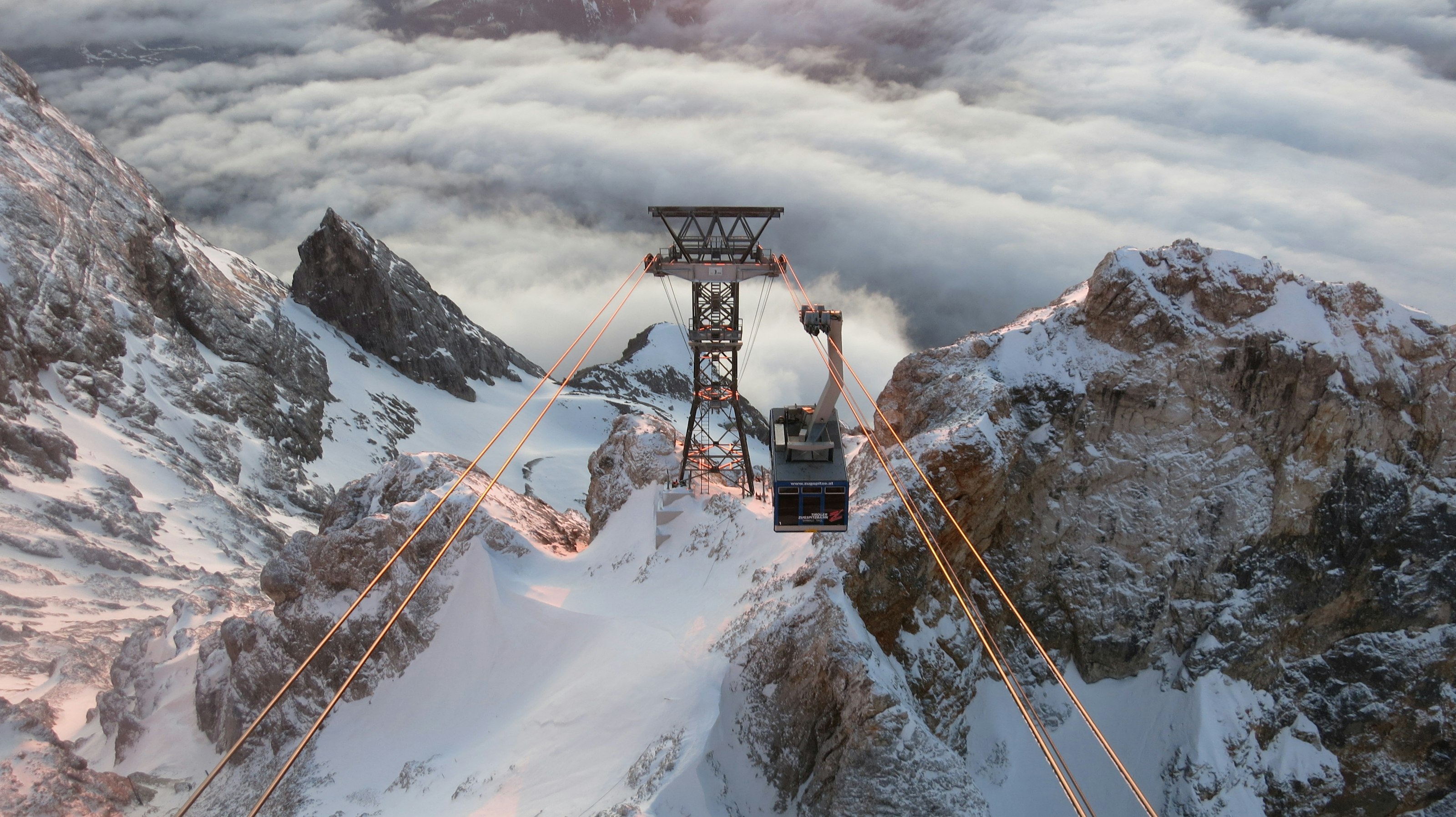
The Zugspitze is Germany's highest peak, and a cable car climbs almost straight from the valley town of Garmisch-Partenkirchen to its summit, where the view on a clear day takes in more than 400 peaks across Germany, Austria, Switzerland, and Italy.
A small glacier survives near the top, along with a ski area that operates into summer, and the border with Austria runs directly across the summit platform.
How does it rate
CrowdsRomanceCash RequiredDangerAccessibilityWhy you should go
Stepping out of a cable car onto a summit with views into four countries, with zero hiking required, is hard to beat.
Why you shouldn't go
Cloud cover rolls in quickly at altitude and can cut the four-country view down to whiteout without warning.
Plan your visit
Best time to visitJune–September for the clearest summit views; winter for skiing.Best time of dayEarly morning, for the clearest air before afternoon cloud builds around the peak.Getting thereFly to Munich; 1.5-hour train or drive to Garmisch-Partenkirchen, then the Zugspitze cable car.Entry costPaid cable car ticket; prices are higher in winter ski season.Time neededHalf a dayInsider tip — Ride up the newer Eibsee cable car and come down via the cogwheel railway (or vice versa) to see the mountain from two different angles. -
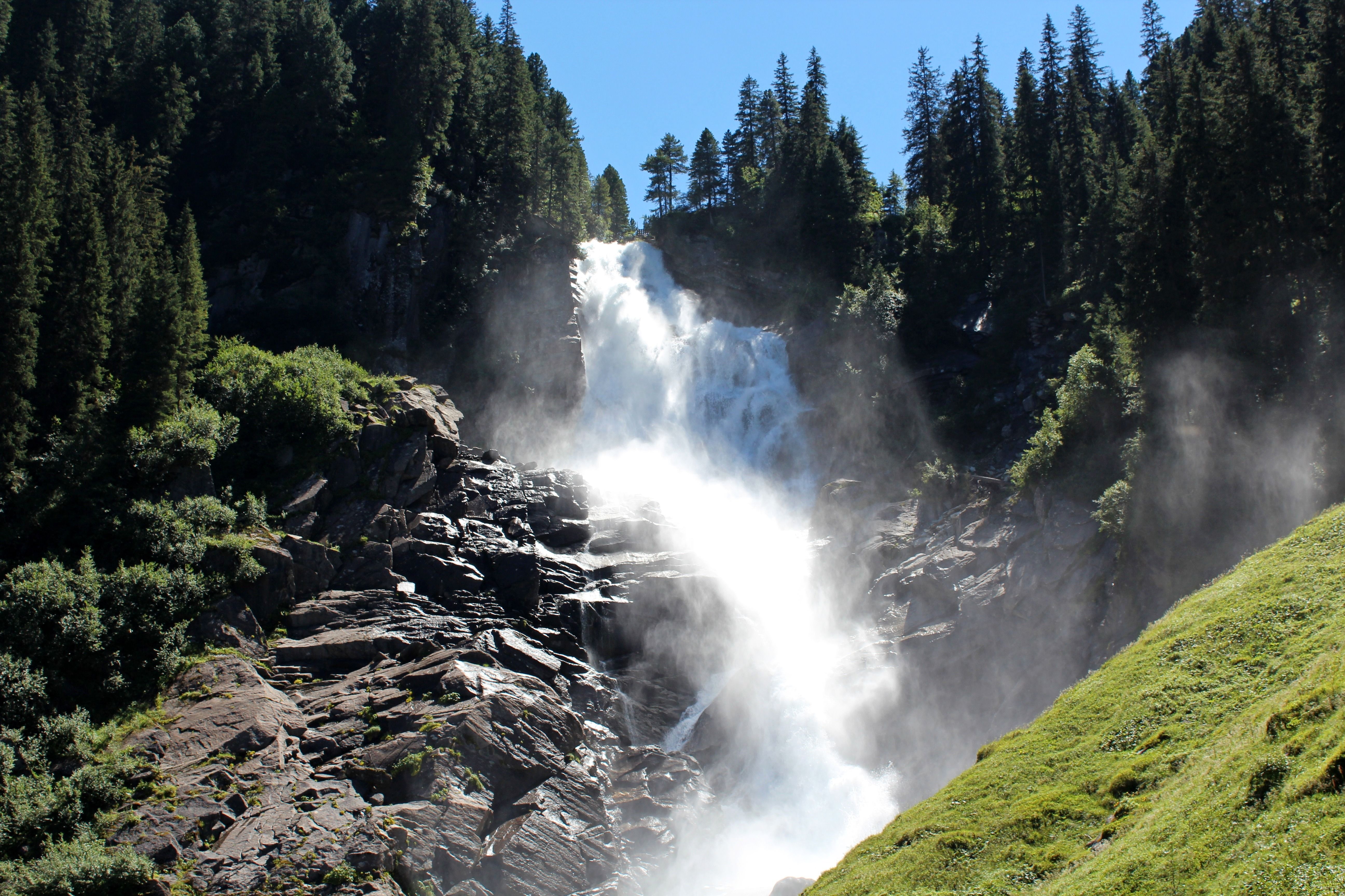 #1779 /100
The Krimml Waterfalls drop 380 metres in three tiers down a forested mountainside in the Hohe Tauern National Park, among the highest waterfalls in Europe.
A well-graded path climbs alongside the falls through spray-cooled air, with viewing platforms at each tier and a small waterfall-themed nature trail for families lower down.
On sunny mornings, rainbows form regularly in the mist at the base of the lower tier.
How does it rate
CrowdsRomanceCash RequiredDangerAccessibilityWhy you should go
Walking right alongside a 380-metre waterfall on a path built specifically to bring you close to each tier is a genuinely dramatic short hike.
Why you shouldn't go
The full path up all three tiers is a real, steady climb, and spray keeps sections of it wet and cool even in summer heat.
Plan your visit
Best time to visitMay–June, when snowmelt gives the falls their fullest flow.Best time of dayMorning, when the sun angle is more likely to catch rainbows in the spray at the lower falls.Getting thereFly to Salzburg; roughly 1.5-hour drive southwest into the Hohe Tauern National Park.Entry costPaid entry to the waterfall trail (Wasserfallweg).Time needed2–3 hours for the full trailInsider tip — The lower tier's viewing platform is the most crowded — continue up to the middle and upper tiers for quieter views and just as much drama. -
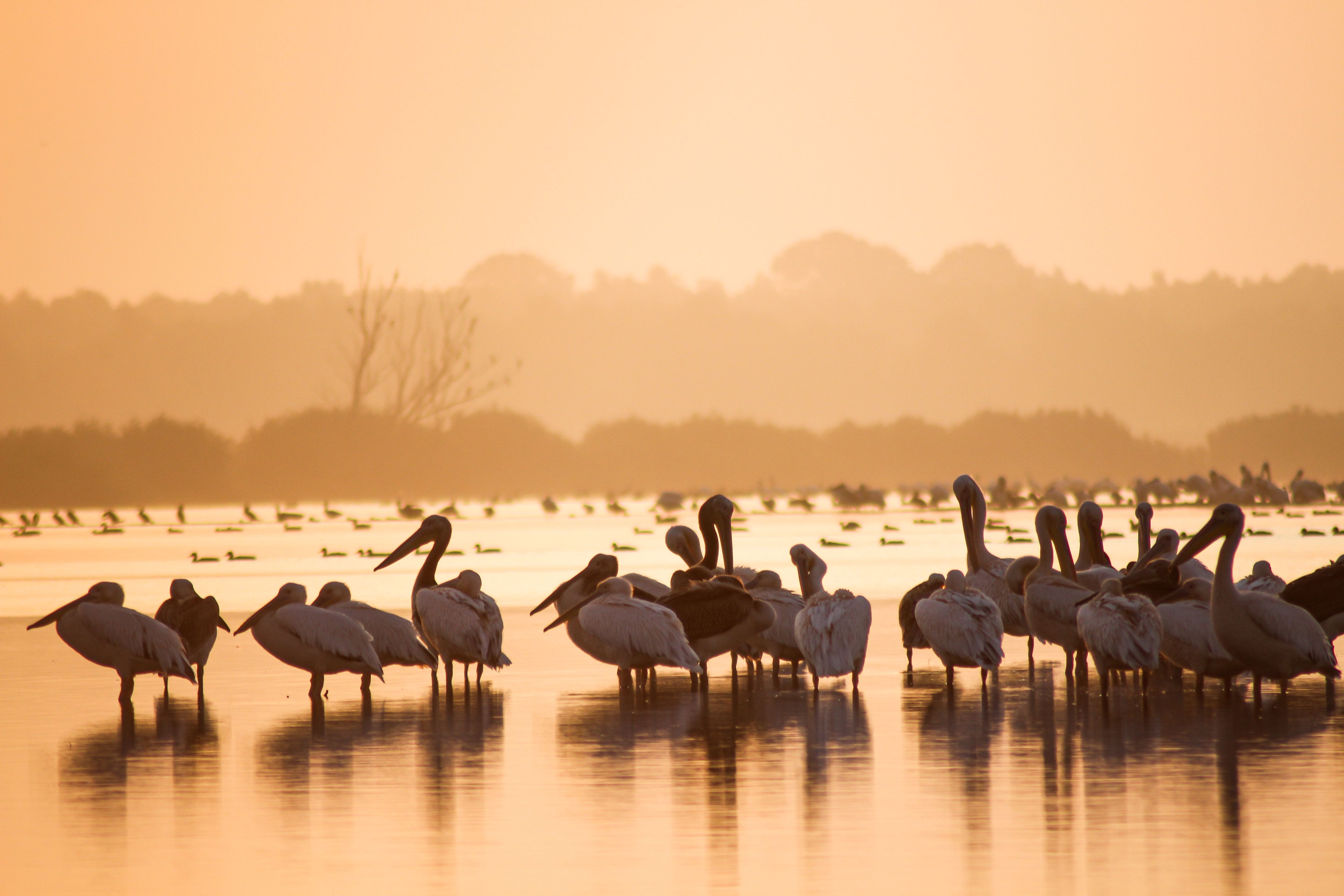 #1878 /100
Europe's largest and best-preserved river delta is a maze of reed-lined channels, lakes and marshland where the Danube meets the Black Sea.
Boat trips glide past pelicans, herons and over 300 other bird species in a UNESCO-protected wilderness.
Traditional fishing villages built on stilts add a lived-in texture to the wildlife-watching, and the sheer scale of untouched wetland is rare anywhere in Europe.
How does it rate
CrowdsRomanceCash RequiredDangerAccessibilityWhy you should go
Untouched wetland wilderness with Europe's richest concentration of birdlife.
Why you shouldn't go
Getting deep into the delta requires a guided boat and more than a day trip to do justice.
Plan your visit
Best time to visitMay–June for peak birdlife and mild weather, before summer heat and mosquitoes.Best time of dayEarly morning, when birds are most active and the water is calm.Getting thereFly or drive to Tulcea, then transfer onto a guided boat into the delta channels.Entry costFree to enter; guided boat tours from around €40 per person.Time neededFull day, or 2–3 days to explore properly.Insider tip — Book a small private boat rather than a large tour vessel — it can reach narrower channels where the wildlife actually is. -
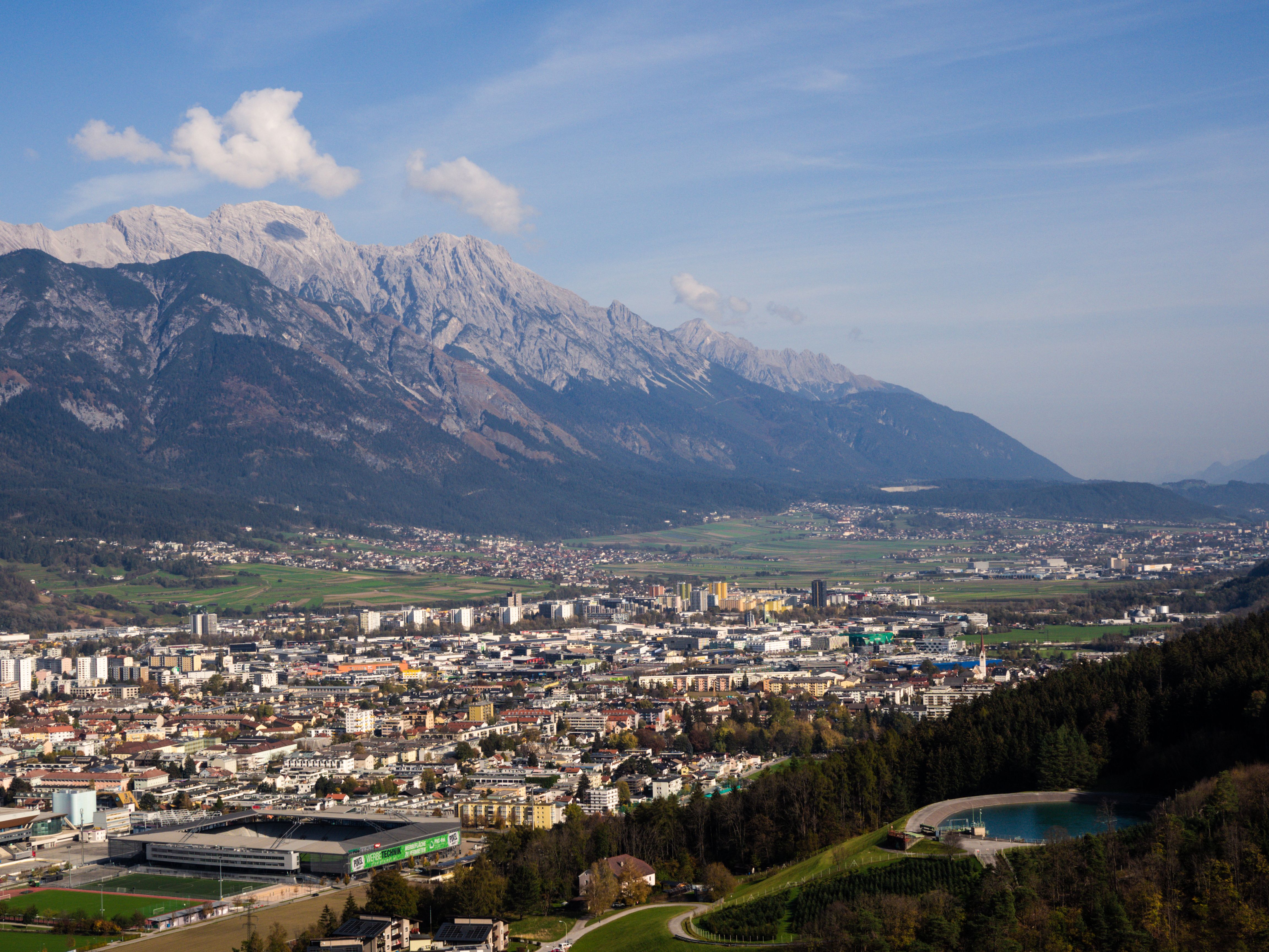 #1978 /100
The Nordkette range rises so steeply above Innsbruck that a cable car runs directly from the edge of the old town to a mountain station above 2,300 metres in under 20 minutes.
From the top, the view takes in the Alpine capital below and rows of peaks stretching into Italy and Germany, and hiking trails and via ferrata routes continue further up the ridge.
How does it rate
CrowdsRomanceCash RequiredDangerAccessibilityWhy you should go
Going from café tables in the old town to a 2,300-metre alpine ridge in under 20 minutes, without leaving the city's public transport, is remarkable.
Why you shouldn't go
The upper station can be windy and much colder than the valley floor, so pack layers even on a warm city day.
Plan your visit
Best time to visitJune–September for hiking; December–March for skiing directly above the city.Best time of dayLate afternoon, for clear light on the peaks and fewer crowds on the cable car.Getting thereFly to Innsbruck; the Nordkettenbahn cable car station is a short walk or tram ride from the old town.Entry costPaid cable car ticket; return fares are cheaper than one-way plus return.Time neededHalf a dayInsider tip — Ride the funicular partway up to Hungerburg first for city views, then transfer to the second cable car stage for the full alpine panorama. -
 #20
#20Rated #20 of 32
Wachau Valley Danube Cycle Path, Austria
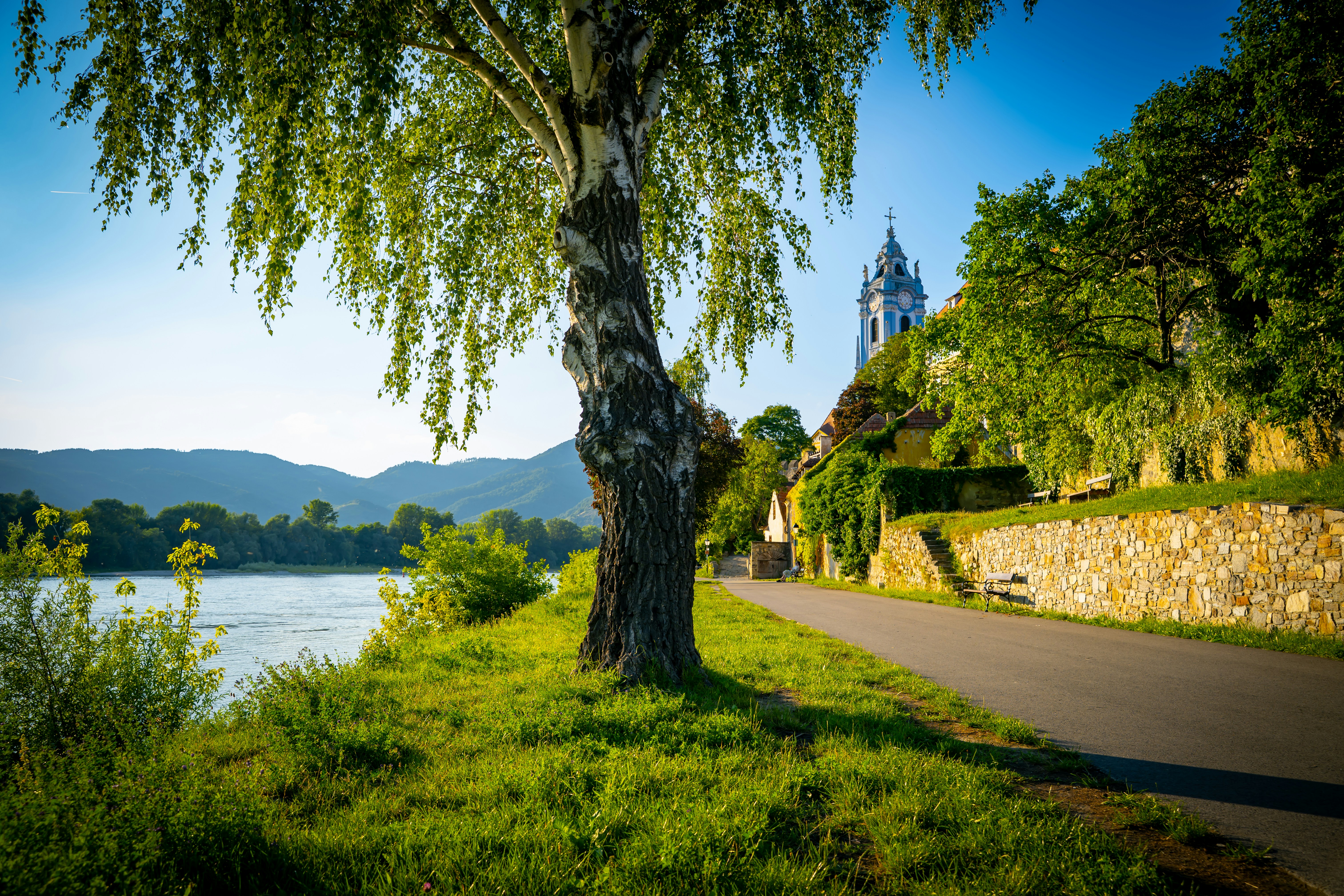
#wachauvalleydanubecyclepath ◆ Cycling Tours76 /100A flat, paved path traces the Danube's south bank through the Wachau, a UNESCO-listed valley of terraced vineyards, apricot orchards and medieval river towns between Melk and Krems.
Riders pass beneath Durnstein's ruined castle, where Richard the Lionheart was once imprisoned, while Melk's baroque abbey looms over the starting point.
The gentle downhill gradient and dedicated bike lane make it an easy half-day ride at any fitness level.
How does it rate
CrowdsRomanceCash RequiredDangerAccessibilityWhy you should go
A flat riverside ride past terraced vineyards, medieval towns and a baroque abbey with almost no effort required.
Why you shouldn't go
Peak summer weekends bring heavy path traffic between the popular towns.
Plan your visit
Best time to visitApril-May for apricot blossom, or September for the wine harvest.Best time of dayMorning start from Melk to reach Krems before lunchtime crowds.Getting thereTrain to Melk or Krems from Vienna (about 1 hour); bike rental available at both stations.Entry costBike rental from EUR15/day; the path itself is freeTime neededHalf a day (3-4 hours)BookingBook ahead →Insider tip — Ride Melk to Krems (downhill, with the current) rather than the reverse, and take the small ferry across the river to see Durnstein's castle ruins from below. -
 #2176 /100
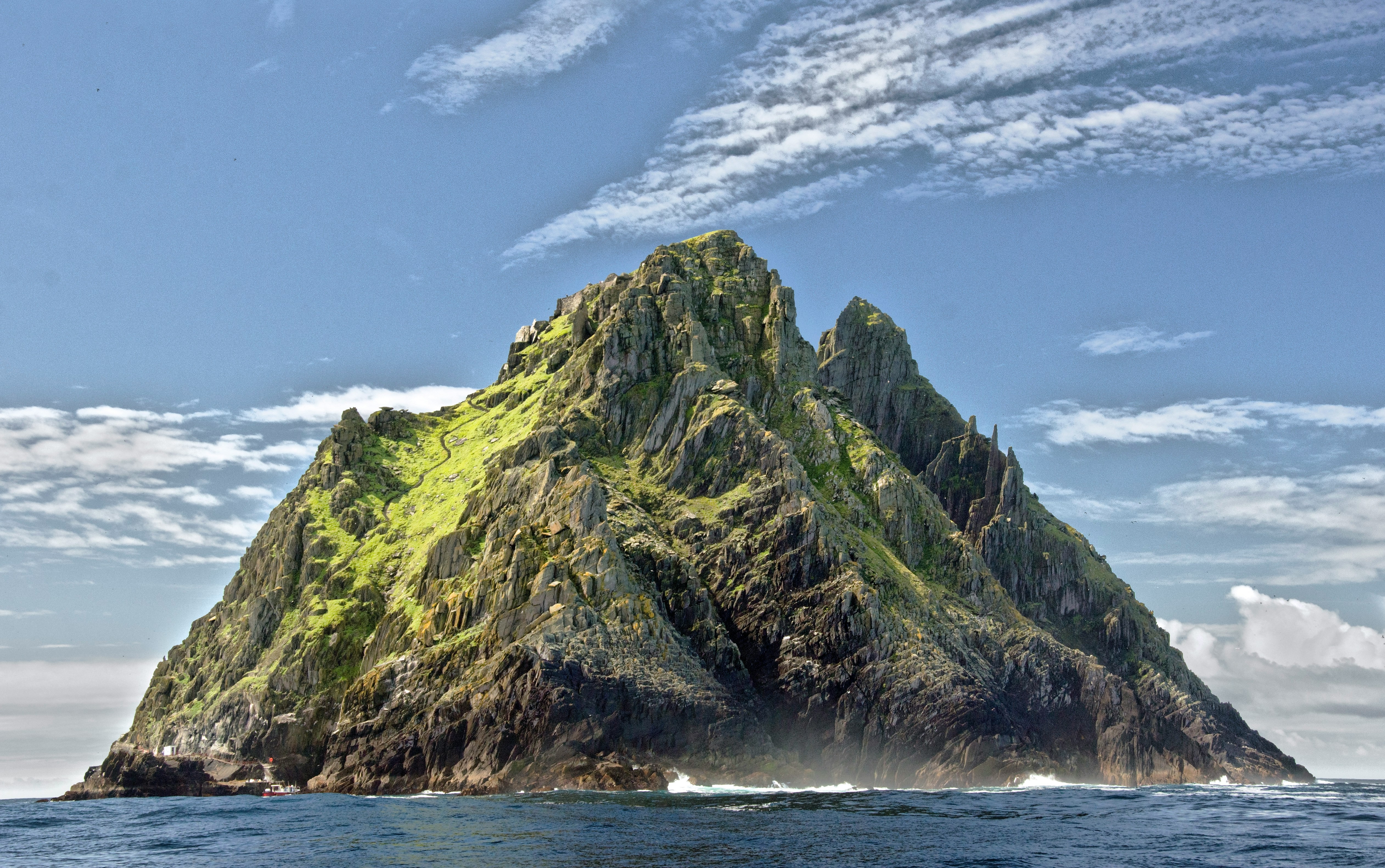
A dramatic rocky island 12km off the Irish coast, home to a 6th-century monastic settlement perched 200 meters above the Atlantic.
Narrow stone stairways climb to beehive-shaped huts where monks lived in near-total isolation for centuries, and the island later appeared in Star Wars.
How does it rate
CrowdsRomanceCash RequiredDangerAccessibilityWhy you should go
A remote monastic island with 1,400-year-old beehive huts on a rocky Atlantic peak.
Why you shouldn't go
Accessible only by boat and weather-dependent; crossings are frequently cancelled; no facilities on the island.
Plan your visit
Best time to visitMay–September, when the licensed boats operate; even then, rough seas cause regular cancellations.Best time of dayMorning departures are more likely to run before afternoon swells build.Getting thereBase in Portmagee or Ballinskelligs; licensed boat tours depart daily in season, weather permitting.Entry costBoat tour roughly €100 per person, including the landing permit.Time neededHalf a day including the boat crossing.Insider tip — Book well ahead — only a small number of licensed boats are permitted to land each day. The climb involves over 600 uneven stone steps with no railings; sturdy footwear is essential. -
 #2276 /100
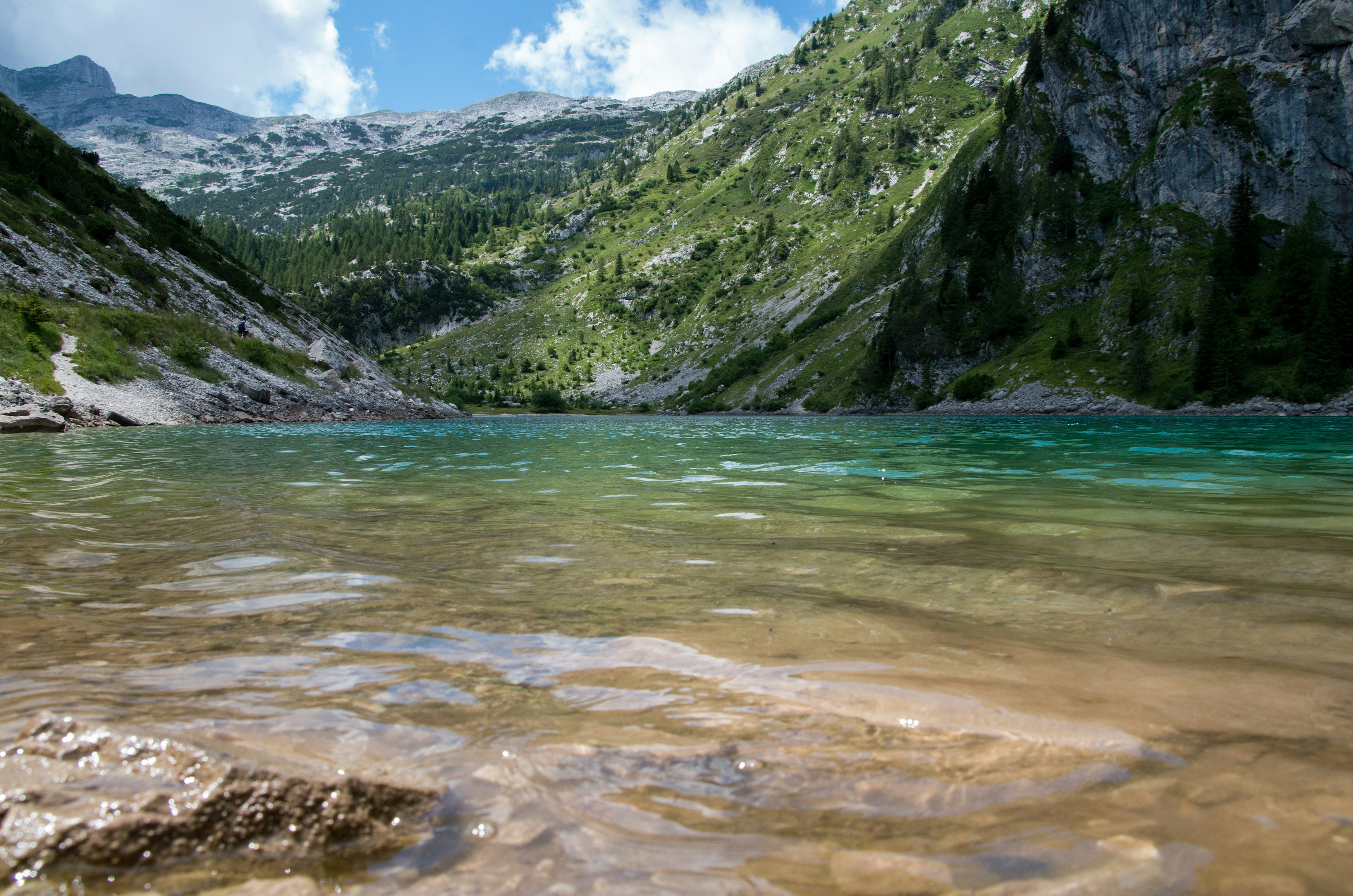
Slovenia's only national park protects nearly the entire Julian Alps range, centered on Mount Triglav, the country's highest peak and a genuine point of national identity.
Beyond the summit trek, the park holds the emerald Soča River valley, dramatic gorges, alpine lakes and the Vršič Pass's hairpin mountain road — the backbone of Slovenia's outdoor-adventure reputation, with hiking, rafting and via ferrata routes for every level.
How does it rate
CrowdsRomanceCash RequiredDangerAccessibilityWhy you should go
Slovenia's entire Julian Alps range in one park, from an iconic summit hike to alpine river valleys.
Why you shouldn't go
Summiting Triglav itself is a serious two-day mountaineering route, not a casual walk.
Plan your visit
Best time to visitJune–September for snow-free trails and mountain hut access.Best time of dayEarly morning starts for any serious hike, to avoid afternoon alpine thunderstorms.Getting thereBase yourself in Bovec or Kranjska Gora, both under 2 hours' drive from Ljubljana.Entry costFree to enter the park; mountain hut stays and guided treks add cost.Time needed2–4 days to see a meaningful cross-section.Insider tip — Drive the Vršič Pass's 50 hairpin bends yourself rather than joining a tour — pullouts at the top have some of the park's best panoramic views. -
 #2374 /100
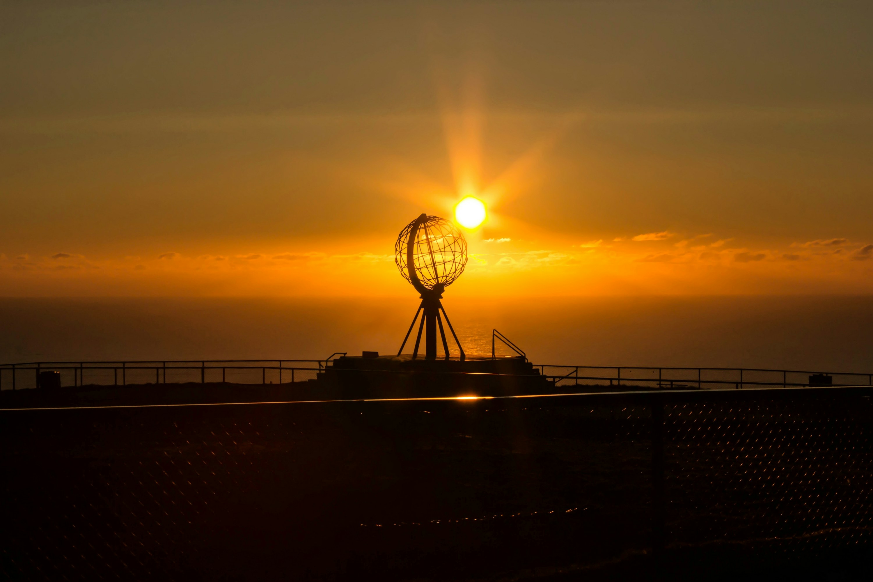
North Cape is a 307-metre cliff on the northern tip of Magerøya island, marketed for two centuries as the northernmost point of mainland Europe - a technicality it doesn't quite hold, but the setting is real.
A visitor centre and a globe monument sit on the plateau above the Barents Sea, with the midnight sun visible from mid-May to late July.
The long, treeless drive across open Arctic tundra is as much a part of it as the cape itself.
How does it rate
CrowdsRomanceCash RequiredDangerAccessibilityWhy you should go
Standing on an Arctic cliff edge at 71°N with the midnight sun still up at midnight.
Why you shouldn't go
Often shrouded in fog or driving rain, and the visitor centre can feel more like a tour-bus terminus than a wild cape.
Plan your visit
Best time to visitMid-May to late July for the midnight sun; clear, calm days are never guaranteed.Best time of dayAround midnight in June-July, when the crowds thin and the sun is still on the horizon.Getting thereFly to Honningsvåg (Nordkapp Airport) or Alta; a 34km drive north from Honningsvåg to the cape.Entry costOutdoor plateau free; visitor centre entry around 320 NOK for adults.Time needed2-3 hoursBookingBook ahead →Insider tip — Walk the short St. Johannes chapel trail below the visitor centre for a quieter view of the cliffs, away from the globe-monument crowds. -
 #2471 /100
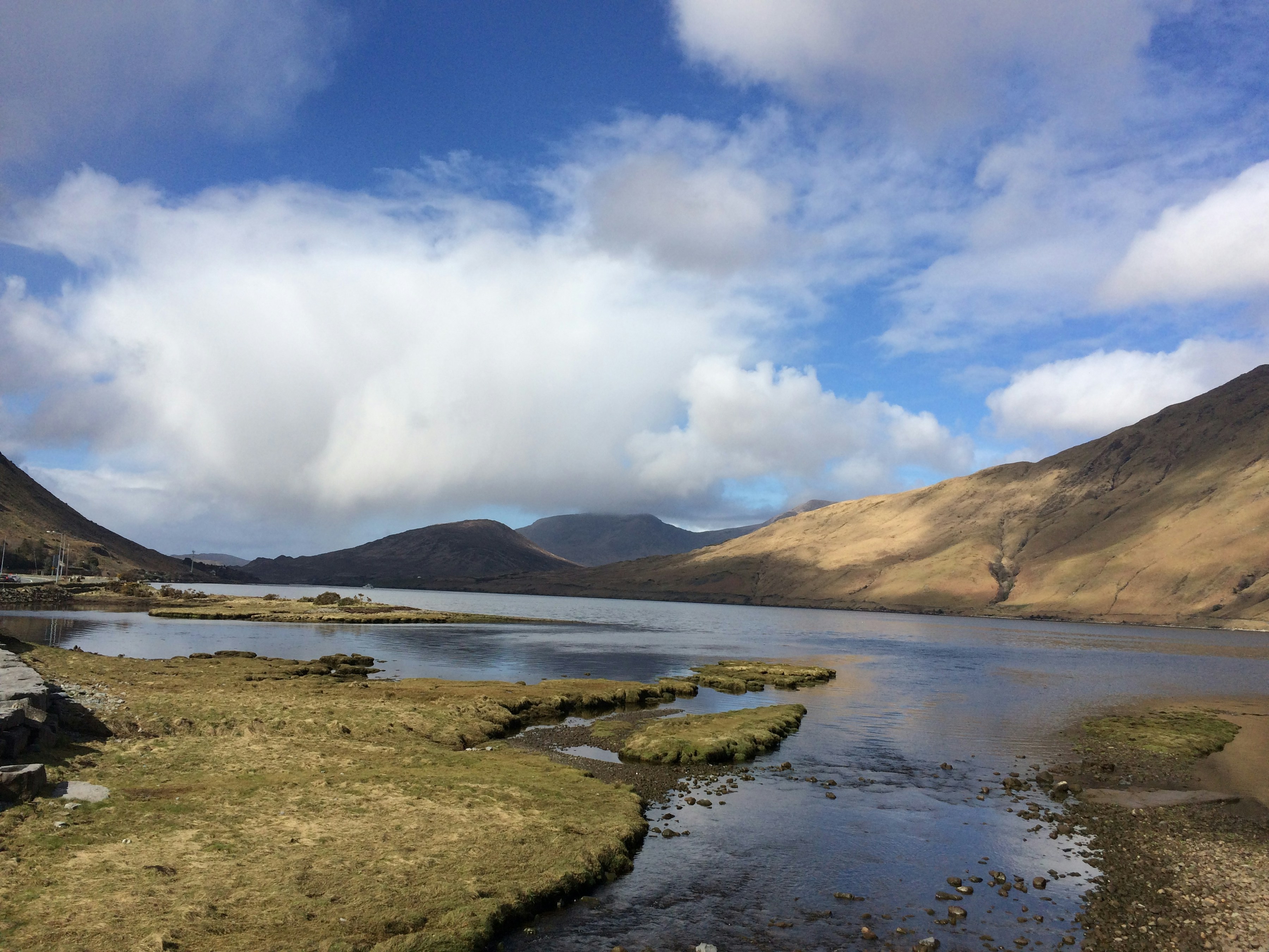
This wild stretch of County Galway packs bog, mountain, lake and rugged Atlantic coastline into one thinly populated region, its landscape barely touched since the days it inspired painters and poets.
Connemara National Park's quartzite peaks, the Sky Road's cliff-edge drive out of Clifden, and Kylemore Abbey beside its own lake are the anchor points, but much of the appeal is simply driving or hiking through empty, dramatic terrain.
How does it rate
CrowdsRomanceCash RequiredDangerAccessibilityWhy you should go
Ireland's wildest, least-crowded landscape — bog, mountain and coastline with barely another car in sight.
Why you shouldn't go
Public transport is sparse; a car is close to essential to see more than one village.
Plan your visit
Best time to visitMay–June or September for good weather without peak-season crowds.Best time of dayLate afternoon, when low light catches the mountains and lakes.Getting thereDrive from Galway city, about 1–1.5 hours to Clifden, the region's main town.Entry costFree to drive and hike; Connemara National Park and Kylemore Abbey each charge small entry fees.Time needed1–2 days.Insider tip — Drive the Sky Road loop out of Clifden at sunset — it's free, takes under an hour, and has better views than several paid attractions. -
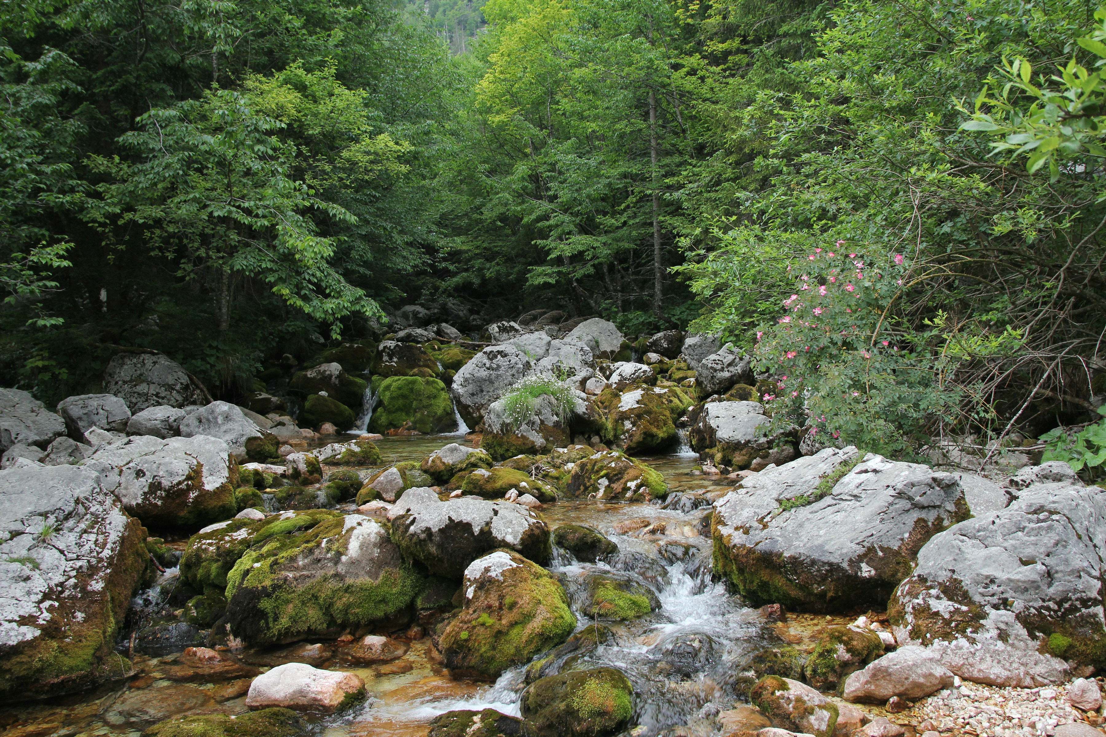 #2570 /100
The Soča River runs an almost unreal emerald-turquoise color through this alpine valley in Slovenia's northwest, framed by the Julian Alps and threaded with World War I trench remnants from the Isonzo Front.
Whitewater rafting, kayaking and canyoning draw travelers to some of Europe's cleanest, coldest alpine water, while quieter trails and the small town of Kobarid offer a slower pace with WWI history layered into the landscape.
How does it rate
CrowdsRomanceCash RequiredDangerAccessibilityWhy you should go
An almost impossibly turquoise alpine river, with world-class rafting and layered WWI history.
Why you shouldn't go
The water is glacier-fed and genuinely cold year-round, even in peak summer.
Plan your visit
Best time to visitJune–September for rafting conditions and warm-enough air temperatures.Best time of dayMidday, when sunlight best brings out the river's turquoise color.Getting thereBase in Bovec or Kobarid, about 2 hours' drive from Ljubljana.Entry costFree to view the river; rafting and canyoning trips typically €40-70.Time needed1–2 days.Insider tip — Visit the Kobarid Museum before rafting — it reframes the valley's WWI trench remnants you'll pass on the water. -
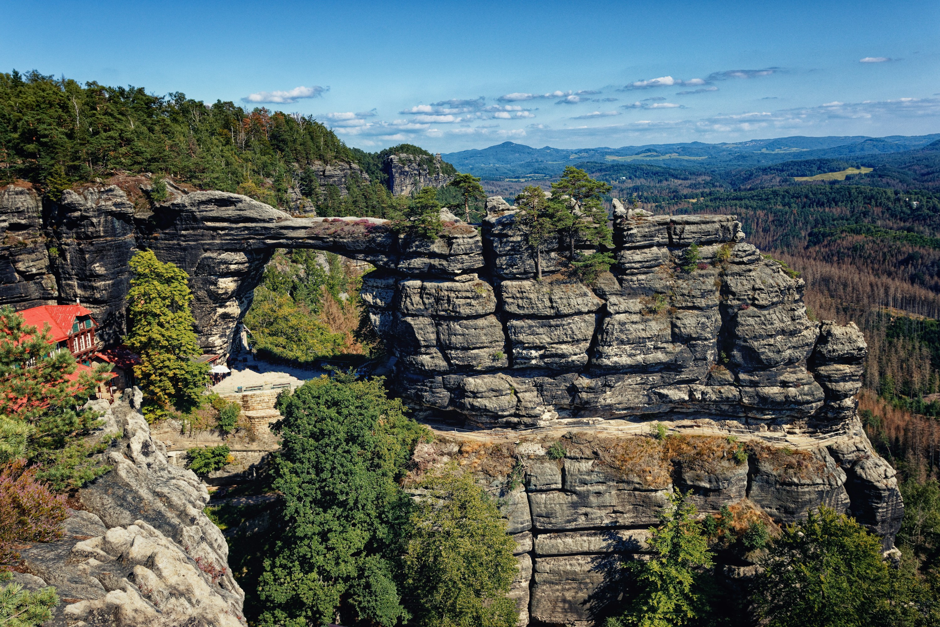 #2670 /100
Pravčická brána is the largest natural sandstone arch in Europe, a 16-metre stone bridge rising from the forested plateau of Bohemian Switzerland National Park near the German border.
Closed to walkers since 1982 to halt erosion, it's instead viewed from three platforms and the 19th-century Sokolí hnízdo chalet built into the rock beneath it.
Reaching it means a steady uphill hike from Hřensko.
How does it rate
CrowdsRomanceCash RequiredDangerAccessibilityWhy you should go
The largest natural sandstone arch in Europe, framed by a historic chalet restaurant built right beneath it.
Why you shouldn't go
The arch itself is off-limits to walk on, and the approach hike is steep enough to rule out a casual visit.
Plan your visit
Best time to visitApril-October for reliable trail conditions; the path can be icy or closed after snow.Best time of dayEarly morning to beat weekend crowds on the narrow viewing platforms.Getting thereTrain or bus to Děčín, then a local bus to Hřensko, followed by a 1-1.5 hour uphill hike (or a longer loop from Mezní Louka).Entry cost75 CZK adult, 25 CZK concession, for the viewpoint areaTime needed3–4 hours round trip including the hikeInsider tip — The classic view is from the lower platform looking up through the arch; climb to the upper terrace by the chalet for the wider valley panorama instead. -
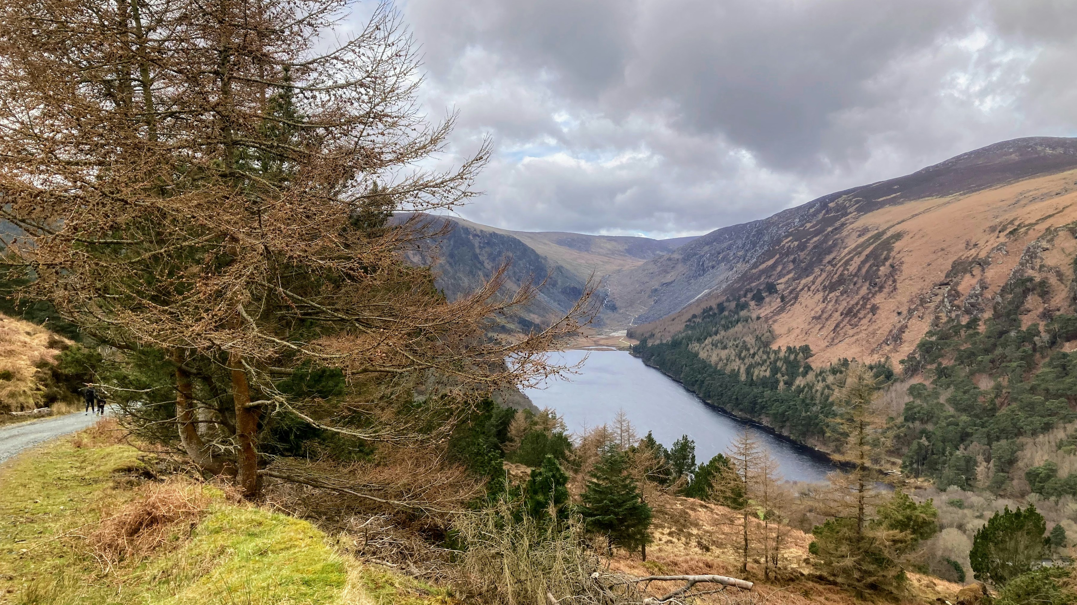 #2769 /100
A glacier-carved valley in the Wicklow Mountains holds two lakes and the ruins of a 6th-century monastic settlement founded by St Kevin, including a remarkably intact round tower.
Trails loop around both lakes and climb into the surrounding hills, from a flat 30-minute stroll to a full afternoon's hike up to the Spinc ridge.
The mix of early-Christian ruins and scenic hiking makes it one of the most complete day trips from Dublin.
How does it rate
CrowdsRomanceCash RequiredDangerAccessibilityWhy you should go
Early-Christian monastic ruins set inside a genuinely scenic glacial valley with real hiking trails.
Why you shouldn't go
Parking fills up fast on weekends and can mean a long walk in from overflow areas.
Plan your visit
Best time to visitApril–October for hiking; autumn for color on the valley slopes.Best time of dayEarly morning to beat coach tours from Dublin.Getting thereDrive about an hour south from Dublin, or take a scheduled tour bus from the city.Entry costFree to enter the valley; parking around €4.Time needed2–4 hours.Insider tip — Skip the crowded lower lake boardwalk and head straight to the upper lake trailhead for quieter walking. -
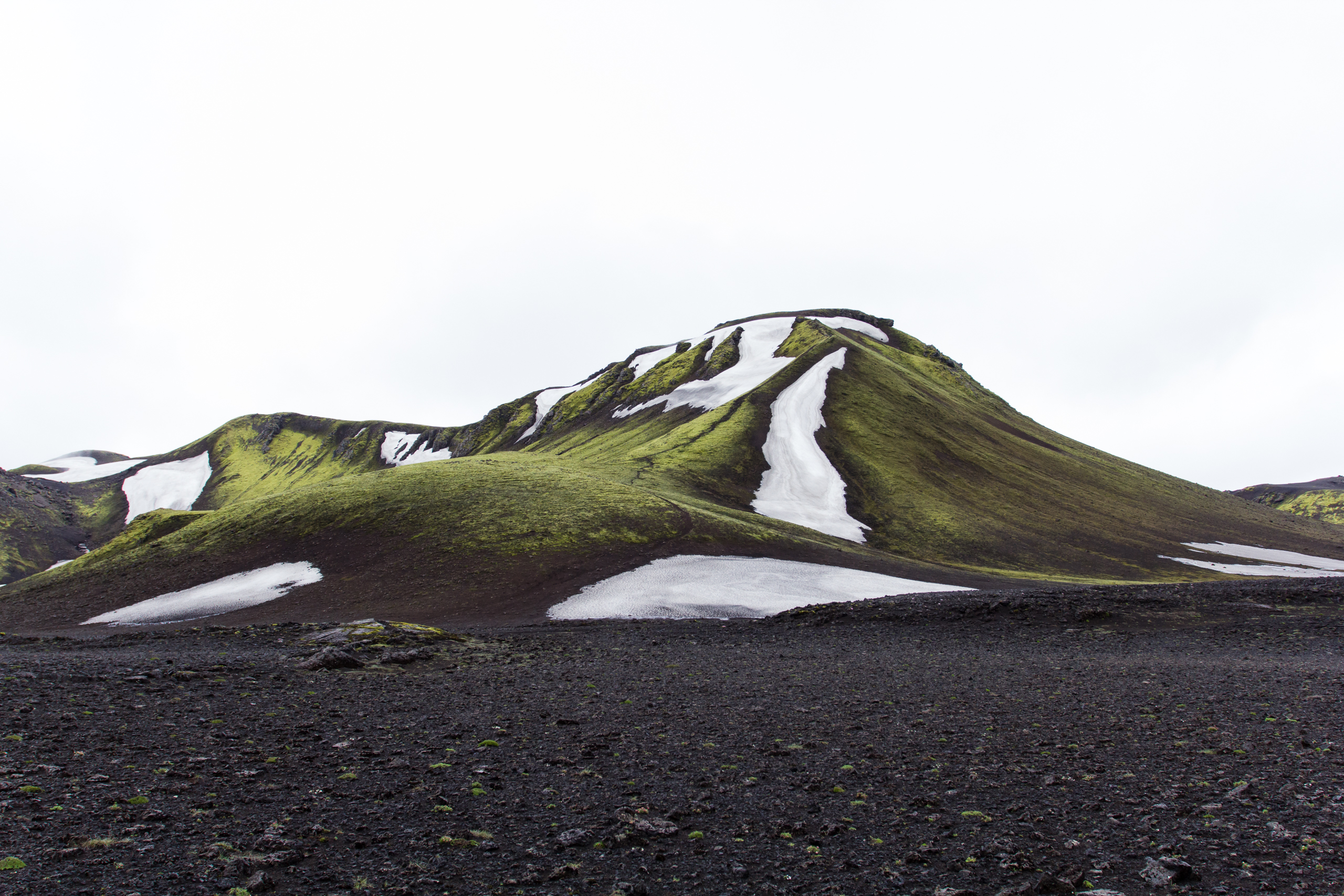 #2868 /100
A 55km highland traverse from the rhyolite hot-spring valley of Landmannalaugar to the birch forest of Thorsmork, crossing black lava fields, steaming fumaroles and glacial river fords along the way.
Colour shifts constantly underfoot, from mineral-streaked mountains to green moss and white snow patches even in summer.
Mountain huts break the route into four days, though camping is also allowed alongside each hut.
How does it rate
CrowdsRomanceCash RequiredDangerAccessibilityWhy you should go
Volcanic highlands that change colour with every ridge, from steaming rhyolite to black ash and green moss.
Why you shouldn't go
Glacial river crossings are cold and can rise fast, and huts for peak weeks book out months in advance.
Plan your visit
Best time to visitLate June to early September, the only window huts are open and rivers are usually fordable.Best time of dayMidday, when meltwater river crossings are shallower than early morning or evening.Getting thereFly to Reykjavik; highland bus (about 4 hours) to the Landmannalaugar trailhead.Entry costHut booking about ISK 15,800/night; camping about ISK 3,400/night.Time needed4 days / 3 nightsBookingBook ahead →Insider tip — Book huts the day reservations open for the following summer - July and August dates go within weeks. -
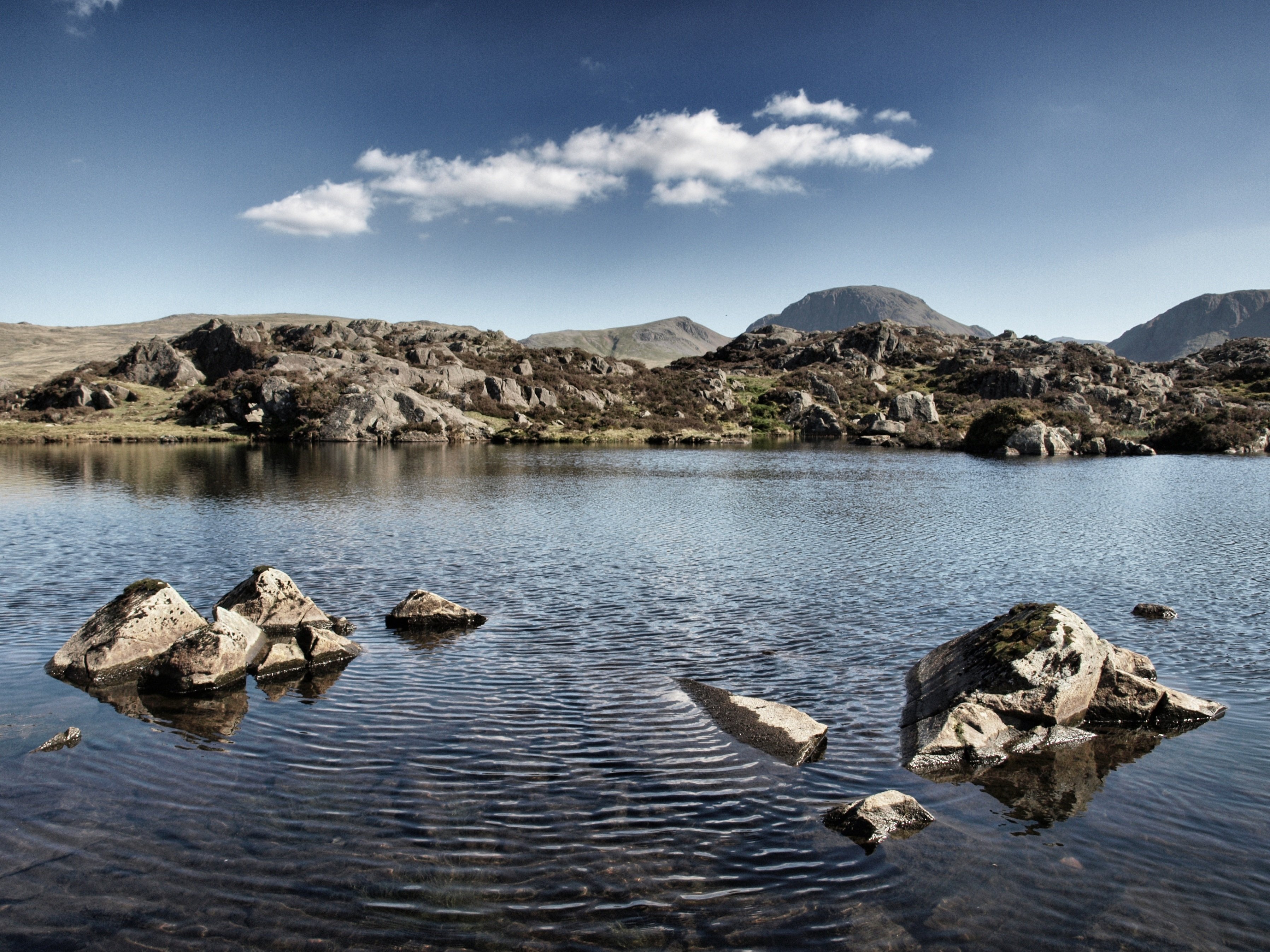 #2968 /100
A small, secluded tarn on the shoulder of Haystacks fell in the Lake District, where guidebook author Alfred Wainwright chose to have his ashes scattered.
Reached only on foot, it offers a quiet, mirror-still pool ringed by fells with none of the crowds of the district's bigger lakes.
How does it rate
CrowdsRomanceCash RequiredDangerAccessibilityWhy you should go
A secluded fell-top tarn on Haystacks, the favorite hill of guidebook legend Alfred Wainwright.
Why you shouldn't go
Requires a genuine hike with real elevation gain; exposed terrain that turns boggy and slippery after rain.
Plan your visit
Best time to visitMay–September for the most reliable weather and longest daylight for the return hike.Best time of dayLate afternoon light picks out the surrounding fells; avoid low cloud, which is common here.Getting thereBase in Buttermere or Keswick; hike from the Honister Pass or Gatesgarth car park (2–3 hours up).Entry costFree; car park fees ~£5–8.Time needed4–5 hours round trip including the summit of Haystacks.Insider tip — Bring a map or GPS — the tarn sits just off the main path and is easy to miss in poor visibility. Combine with the Haystacks summit for classic views over Buttermere. -
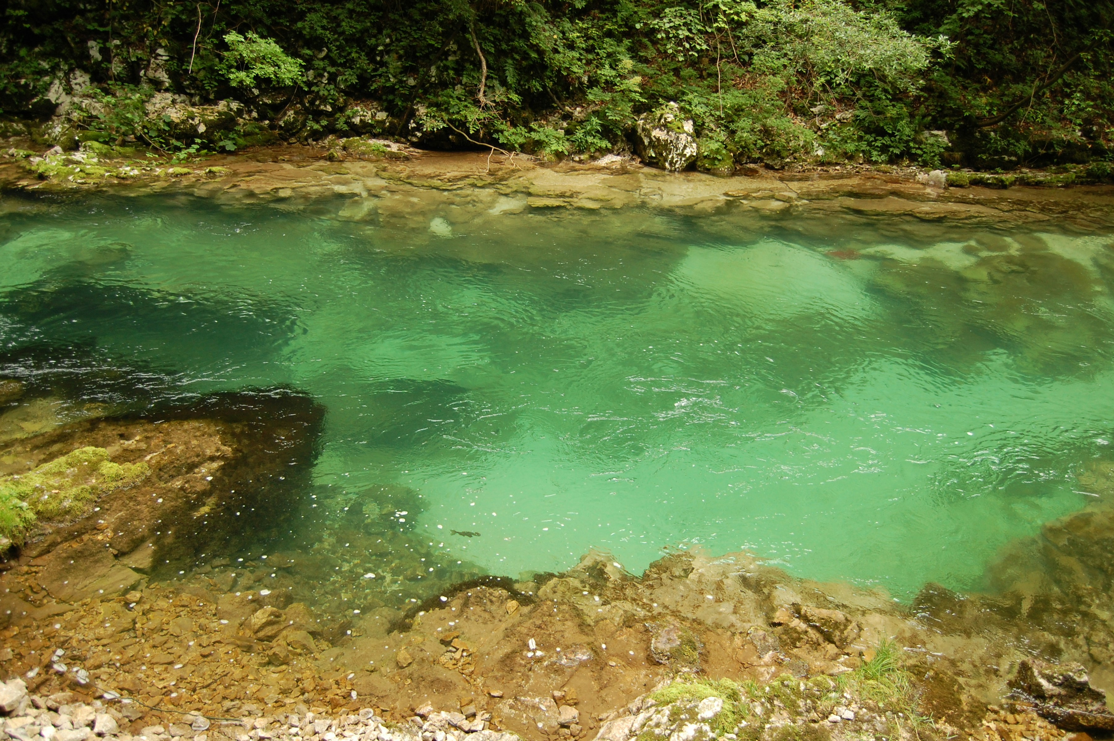 #3067 /100
A wooden walkway clings to the cliff face above the Radovna River as it churns turquoise through this narrow limestone gorge, just a few kilometers from Lake Bled.
The 1.
6-kilometer boardwalk crosses the river repeatedly on small bridges before ending at the Šum Waterfall — an easy, well-engineered walk, but the gorge's tight, dramatic walls make it feel far wilder than its accessibility suggests.
How does it rate
CrowdsRomanceCash RequiredDangerAccessibilityWhy you should go
An easy boardwalk through a genuinely dramatic limestone gorge, minutes from Lake Bled.
Why you shouldn't go
The narrow boardwalk gets congested with foot traffic in peak summer season.
Plan your visit
Best time to visitApril–October, when the gorge walkway is open (closed in winter for safety).Best time of dayEarly morning for the fewest people on the narrow boardwalk.Getting thereAbout 15 minutes' drive or a scenic 4km walk from Lake Bled.Entry costAround €10-12 for adults.Time needed1–2 hours.Insider tip — Walk there from Bled rather than driving — the approach trail along the river is scenic in its own right and avoids the small parking lot's queues. -
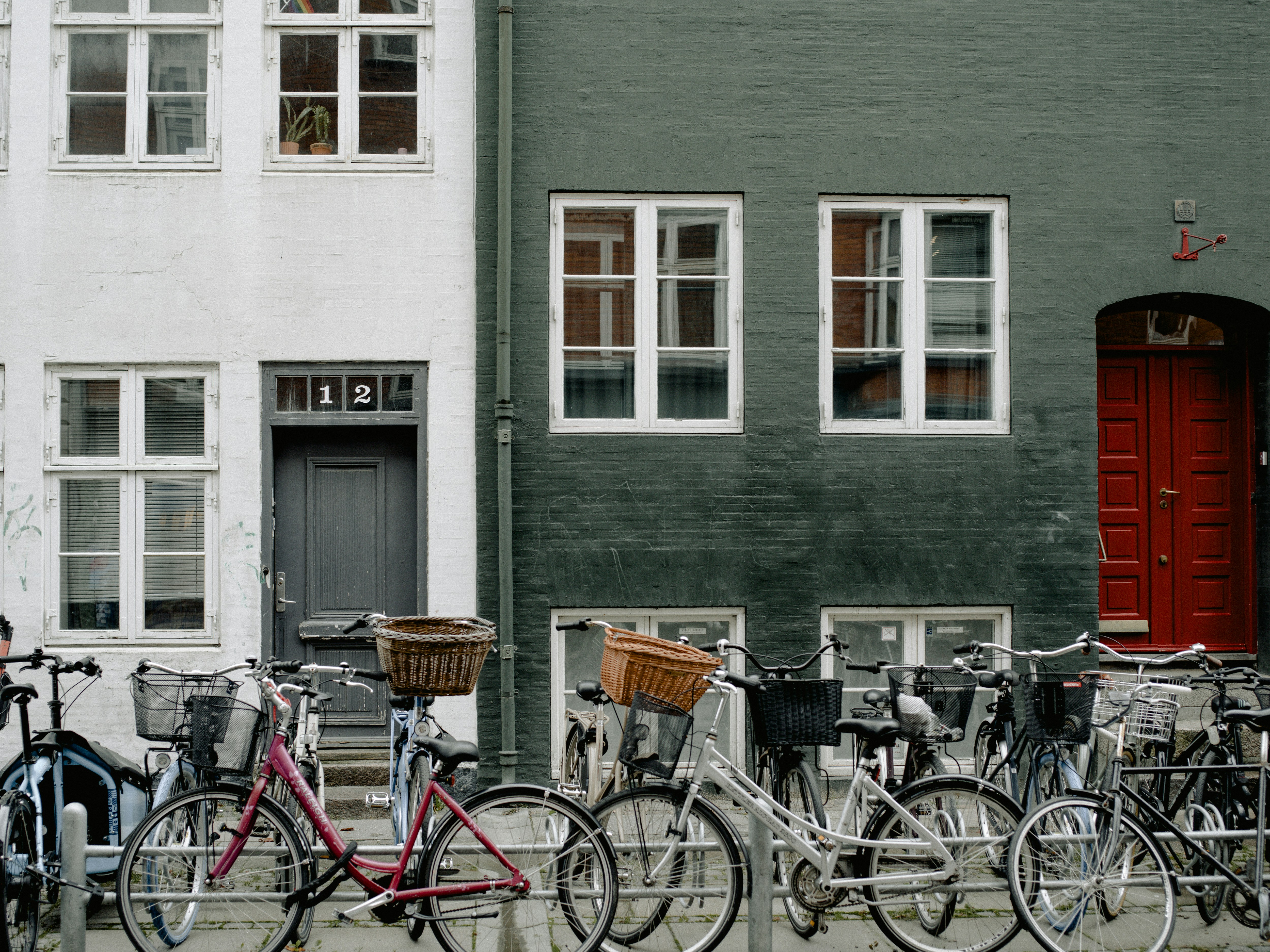 #3166 /100
Copenhagen's 400km network of raised, kerb-separated cycle tracks makes riding the easiest way to see the city, from Nyhavn's canal houses to the harbour baths and Christiania.
Dedicated bicycle bridges and traffic lights timed for cyclists mean two-wheeled traffic genuinely outnumbers cars downtown.
Hotel and station bike rental is everywhere, and the flat terrain suits complete beginners.
How does it rate
CrowdsRomanceCash RequiredDangerAccessibilityWhy you should go
The world's most bike-friendly capital lets you cover its sights on dedicated, car-free lanes.
Why you shouldn't go
Rush-hour lanes are genuinely busy, and unfamiliar riders can feel intimidated by fast local commuters.
Plan your visit
Best time to visitMay-Sep for long daylight hours and mild weather.Best time of dayMid-morning or early afternoon, outside the sharpest commuter rush hours.Getting thereFly into Copenhagen Airport; 15-minute metro to the centre, where rental bikes are available citywide.Entry costBike rental from DKK 100-150/day; many hotels lend bikes freeTime neededHalf a day to explore the centreBookingBook ahead →Insider tip — Follow local etiquette -- signal turns by hand, keep right unless overtaking, and never stop suddenly in the cycle lane, since commuters ride close behind. -
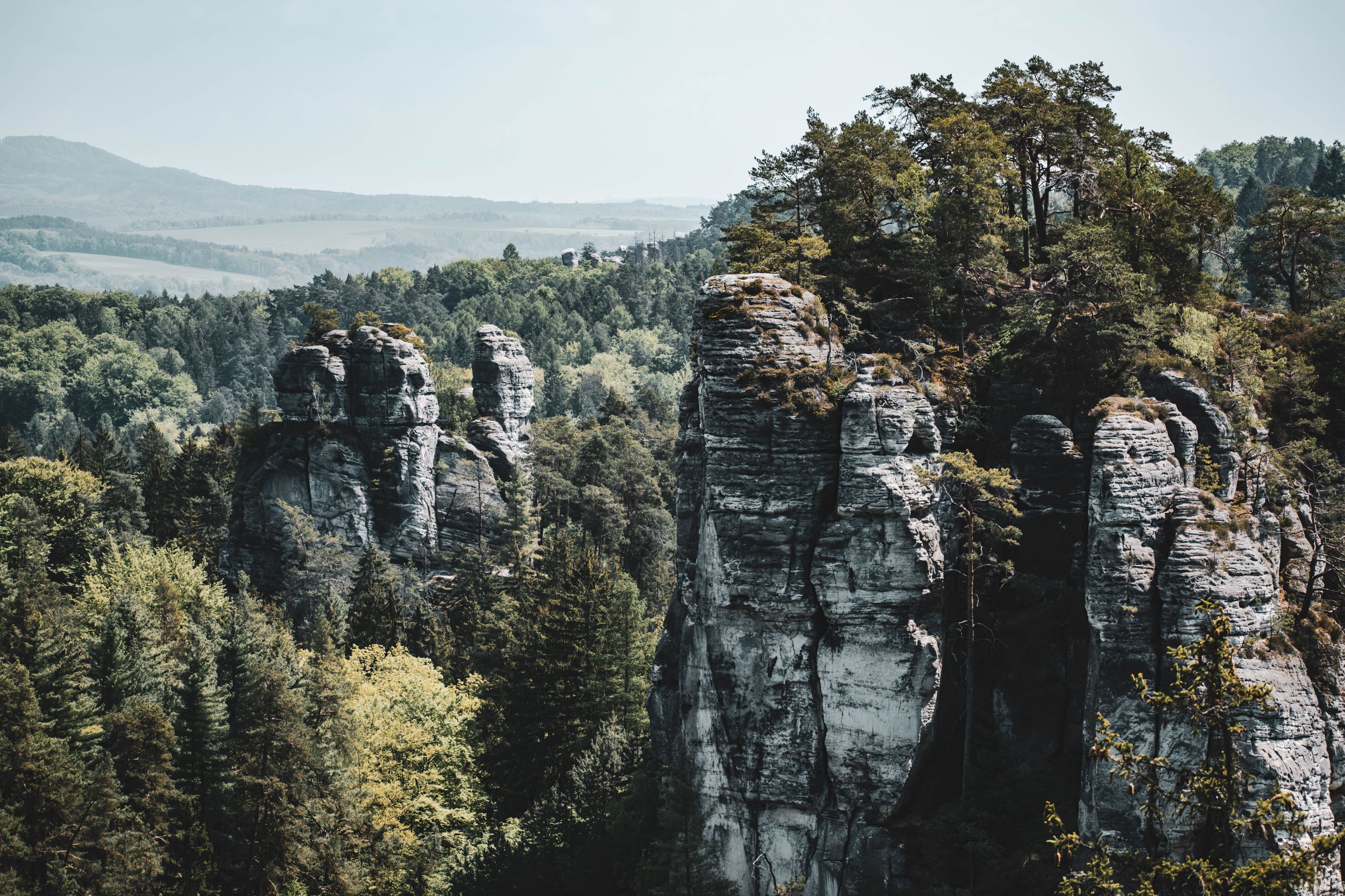 #3260 /100
Český ráj (Bohemian Paradise) is the Czech Republic's oldest protected landscape, a UNESCO Global Geopark of sandstone rock towers, castle ruins and pine forest ninety minutes from Prague.
Its best-known corner, Prachovské skály, threads narrow rock corridors and wooden stairways past viewpoints over layered stone pinnacles, while the twin-peaked ruin of Trosky Castle marks the skyline for miles around.
How does it rate
CrowdsRomanceCash RequiredDangerAccessibilityWhy you should go
A maze of sandstone rock towers and forest trails, with an easy loop suitable for a half-day visit.
Why you shouldn't go
Public transport is patchy; without a car, reaching the best rock formations means a bus to Jičín plus a walk.
Plan your visit
Best time to visitSpring or autumn for cooler hiking temperatures and fewer weekend crowds from Prague.Best time of dayWeekday mornings, especially in the popular Prachovské skály section.Getting thereTrain or bus to Jičín, then a local bus to the Holín-Prachov stop and a short walk to the entrance.Entry cost60 CZK adult, 30 CZK child, for the Prachovské skály reserveTime needed2–4 hours for the main loop, longer for multi-site tripsInsider tip — Take the shorter 1.5km yellow loop if short on time; it hits the best viewpoints without the full 3.5km circuit's narrow squeezes.


More from Europe
-
More Adventure spots
-
How a score is built
One score out of 100, five criteria behind it
Every place is rated 1–5 on each of the criteria below, then combined into a single score out of 100. It's calculated by us, the same way every time — not an average of traveller reviews or social votes.
Crowds
How many people you'll be sharing it with, and at what time of day.
Romance
How well it suits a couple, a proposal, or a quiet moment together.
Cash required
Entry fees, permits, guides, rentals — what it actually costs to do it.
Danger
Physical risk involved, from a slippery viewpoint to genuine hazard.
Accessibility
How far off the beaten path it is, and how hard it is to actually reach.


