-
 #189 /100
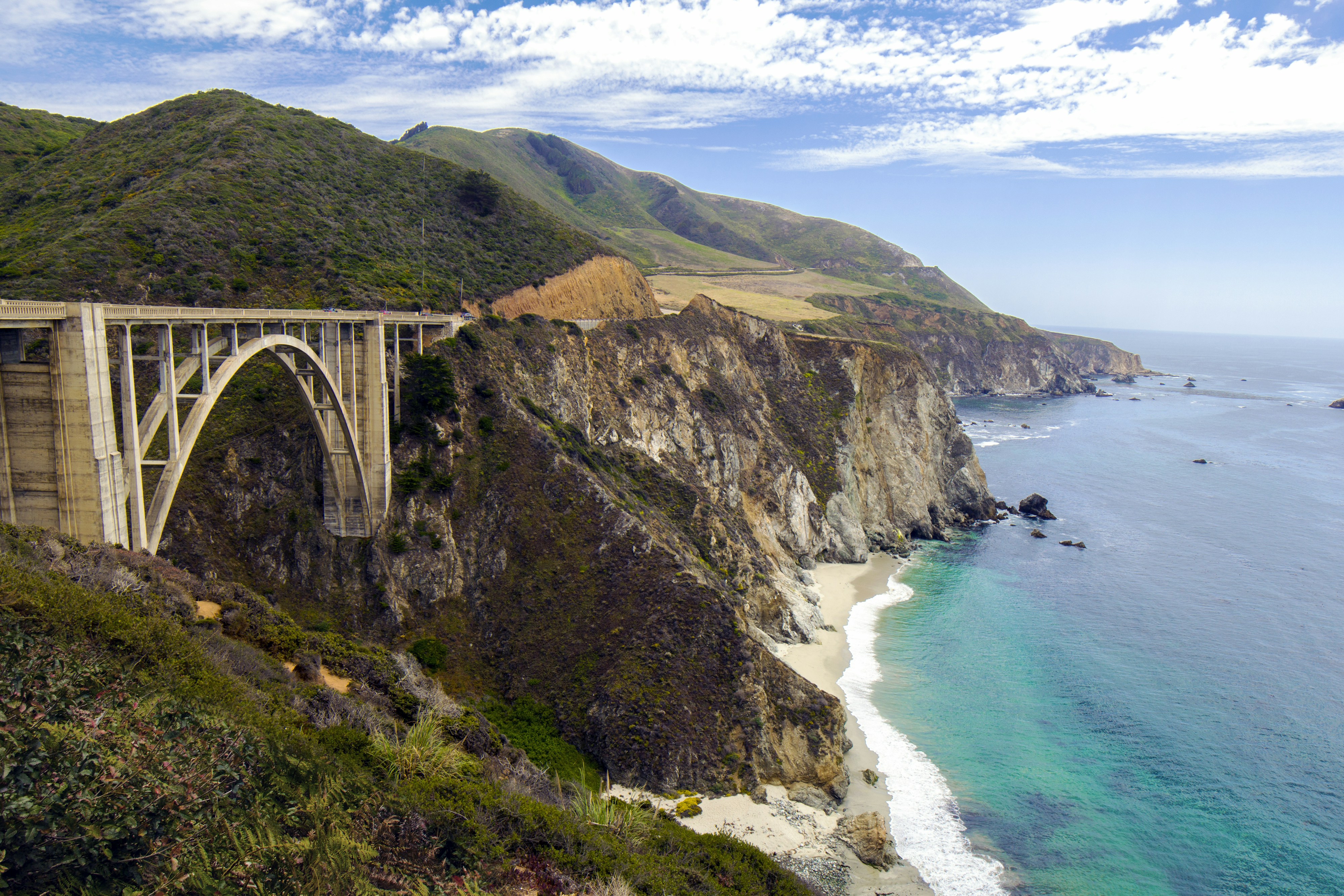
Highway 1 clings to sheer cliffs for 90 miles along this stretch of California coast, with the Pacific crashing against rock hundreds of feet below the road's edge.
Bixby Creek Bridge, one of the most recognisable bridges in the US, arcs across a canyon right beside the highway.
Redwood groves grow almost to the ocean's edge in places, an unusual pairing within a short drive.
How does it rate
CrowdsRomanceCash RequiredDangerAccessibilityWhy you should go
A 90-mile cliffside highway with one of America's most photographed bridges built right into it.
Why you shouldn't go
Highway 1 closes periodically for landslides and storm damage - check road conditions before a trip.
Plan your visit
Best time to visitApril-May or September-October, for clear skies and thinner summer fog.Best time of dayLate afternoon, before coastal fog typically rolls in for the evening.Getting thereSelf-drive Highway 1 from Monterey (north) or San Simeon (south); no public transport covers the route.Entry costFree to drive; some viewpoints and state parks charge small parking fees.Time needed1-2 daysInsider tip — Pull off at the unmarked turnout just south of Bixby Bridge rather than the main viewpoint - it's less crowded and has a cleaner angle on the bridge. -
 #288 /100
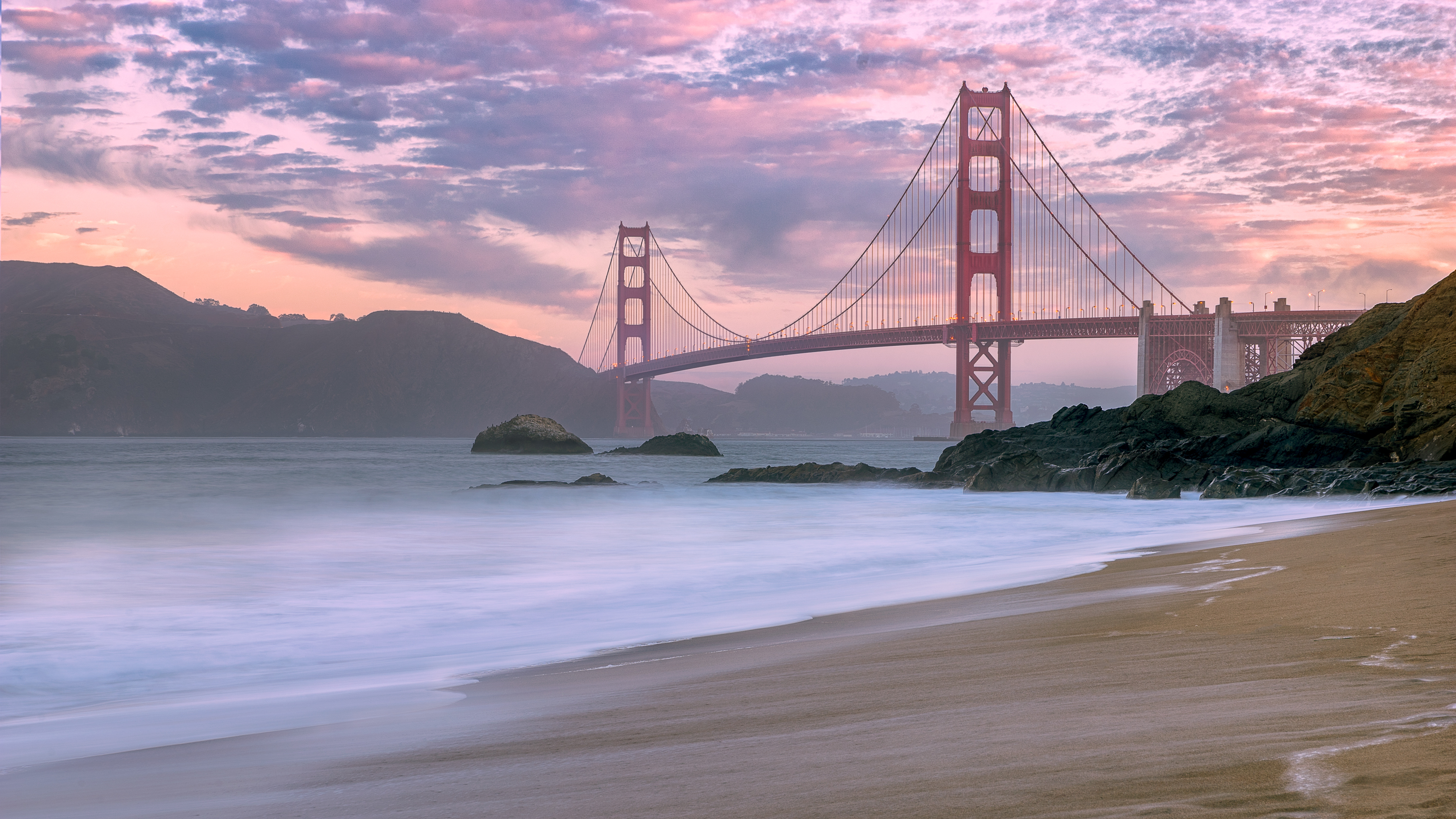
The Golden Gate Bridge has been San Francisco's calling card since 1937: 2.
7km of International Orange suspension bridge strung between the city and the Marin Headlands.
It's that rare landmark that looks better in bad weather - the towers rising out of rolling fog are the classic view.
Walk or cycle the deck, then take it in from Baker Beach, Fort Point or Battery Spencer.
How does it rate
CrowdsRomanceCash RequiredDangerAccessibilityWhy you should go
Iconic from every angle, and completely free to walk, cycle or photograph.
Why you shouldn't go
Summer fog can hide the towers for days, and the wind on the deck is no joke.
Plan your visit
Best time to visitSeptember-October for the clearest skiesBest time of daySunrise from Baker Beach, or whenever the fog is rollingGetting thereMuni bus to the toll plaza, or cycle across from Fisherman's WharfEntry costFree for pedestrians and cyclistsTime needed2-3 hoursInsider tip — Check the fog cam before you go - and if it's socked in, head to Battery Spencer, which often sits above the fog line -
 #387 /100
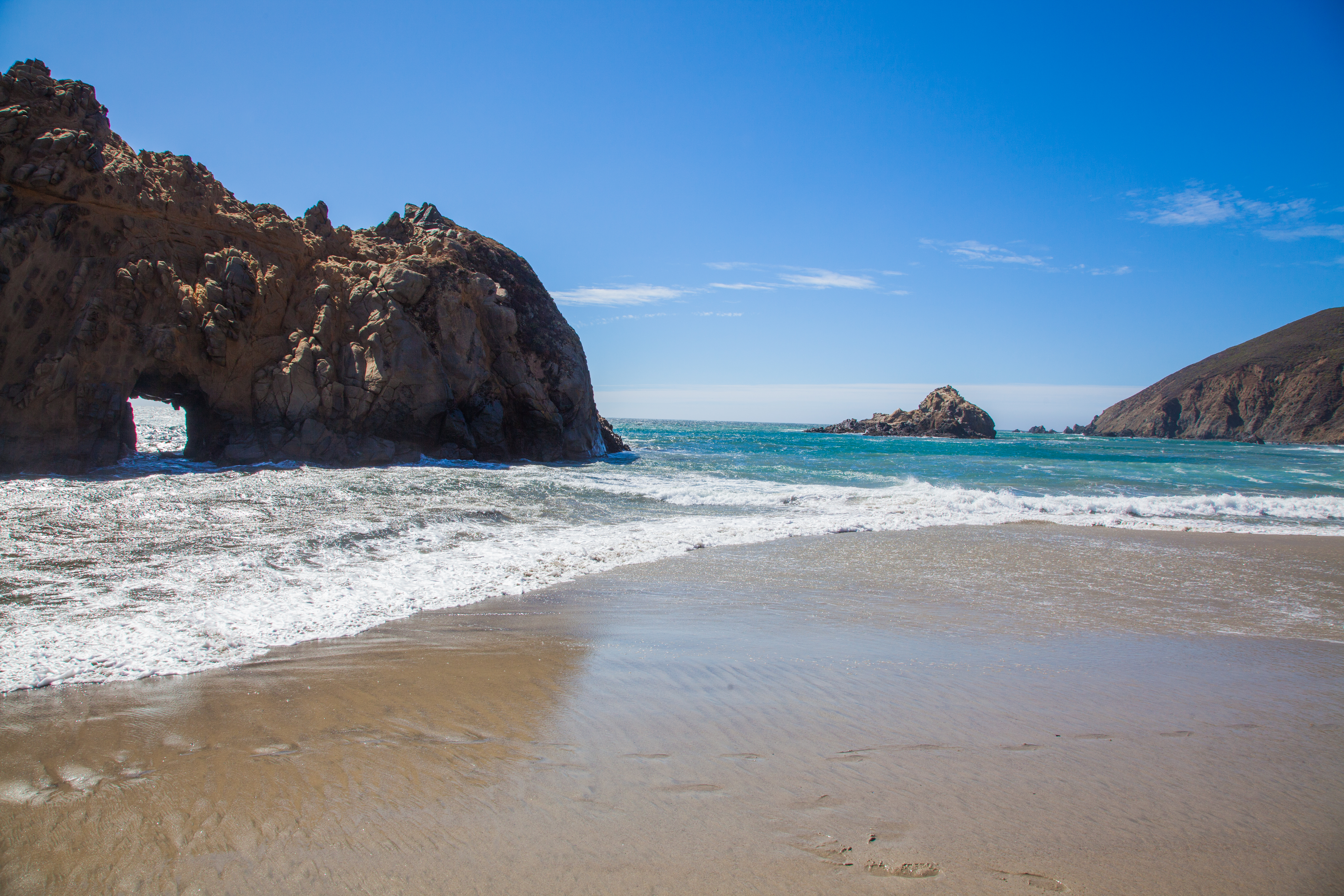
Pfeiffer Beach in Big Sur is a dramatic California coastline beach famous for its purple-tinged sand, caused by manganese garnet washed down from the surrounding hillsides, and for Keyhole Rock — a sea arch through which the setting sun shines in spectacular alignment during November and December.
How does it rate
CrowdsRomanceCash RequiredDangerAccessibilityWhy you should go
The combination of purple sand, dramatic sea stacks, crashing Pacific waves, and the winter Keyhole Rock sunset alignment make Pfeiffer Beach one of California's most unique coastal spots.
Why you shouldn't go
The access road is extremely narrow and closes when the small car park fills; the purple sand only covers part of the beach and the Keyhole Rock sunset alignment only occurs in winter.
Plan your visit
Best time to visitDecember-February for the Keyhole Arch light phenomenonBest time of daySunset, especially in winter when the sun aligns with the archGetting thereUnmarked turnoff on Highway 1, Big SurEntry cost~$12 parking feeTime needed1-2 hoursInsider tip — The purple sand (from manganese garnet) is most visible after rain -
 #486 /100
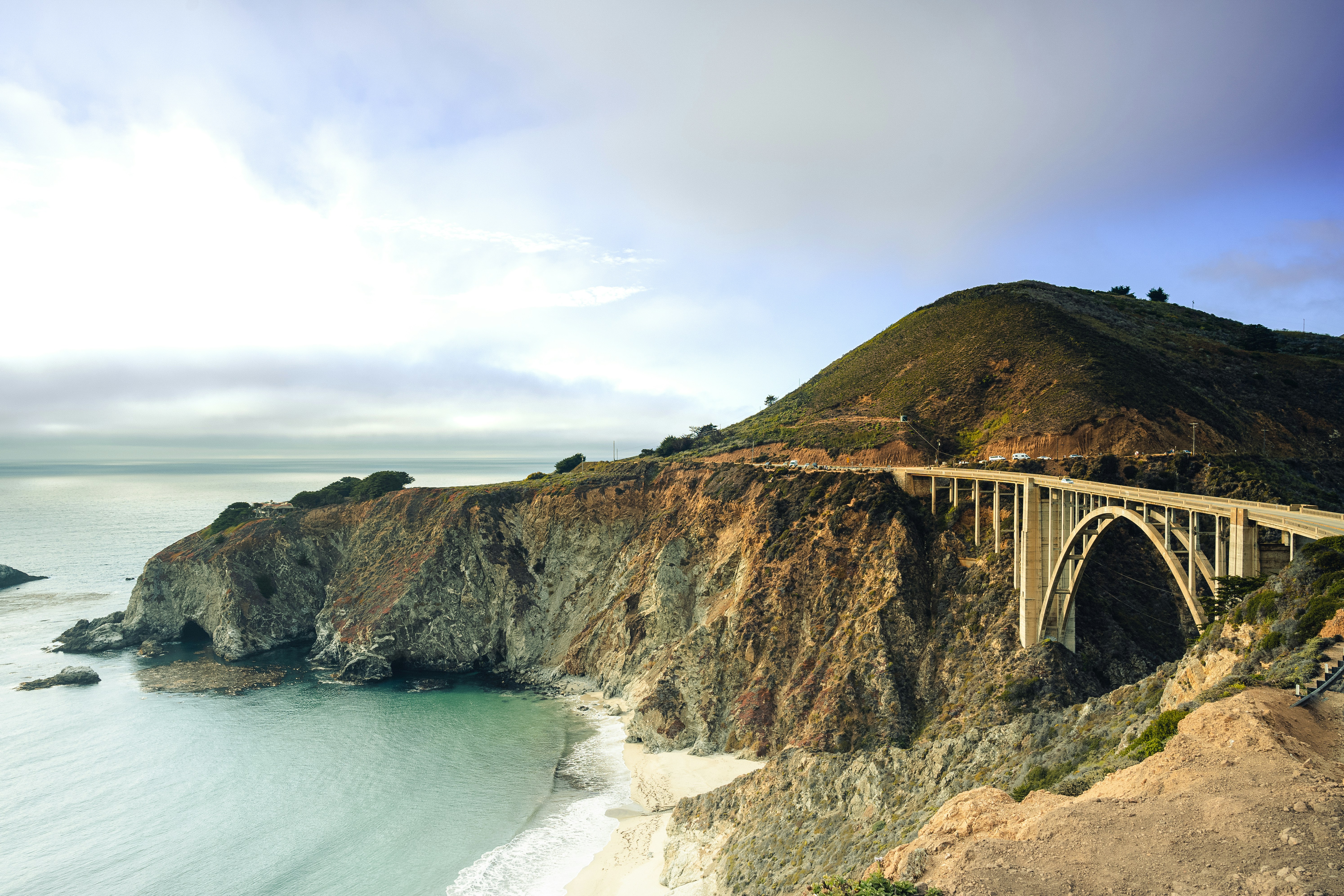
Highway 1 traces roughly 650 miles of California's Pacific edge, from Orange County's beach towns through the cliffs and redwood-backed switchbacks of Big Sur to the rugged Mendocino coast.
Bixby Bridge, McWay Falls, and pullouts over crashing surf make nearly every mile worth slowing for.
The road narrows to a single lane clinging to cliffside in Big Sur, and landslide closures are common enough that checking conditions beforehand is routine.
How does it rate
CrowdsRomanceCash RequiredDangerAccessibilityWhy you should go
Uninterrupted cliffside ocean views, with Big Sur's bridges and redwoods as the centrepiece.
Why you shouldn't go
Landslide closures around Big Sur are frequent and can force lengthy inland detours.
Plan your visit
Best time to visitSeptember-October for clear skies, fewer crowds, and reduced summer coastal fog.Best time of dayLate afternoon light along the Big Sur cliffs, an hour or two before sunset.Getting thereFly into Los Angeles or San Francisco, hire a car, and pick up Highway 1 at either end.Entry costFree to drive; some state park stops charge parking feesTime needed4-5 daysBookingBook ahead →Insider tip — Check Caltrans' QuickMap for landslide closures before you leave, and book Big Sur lodging months ahead - options are limited and fill fast. -
 #584 /100
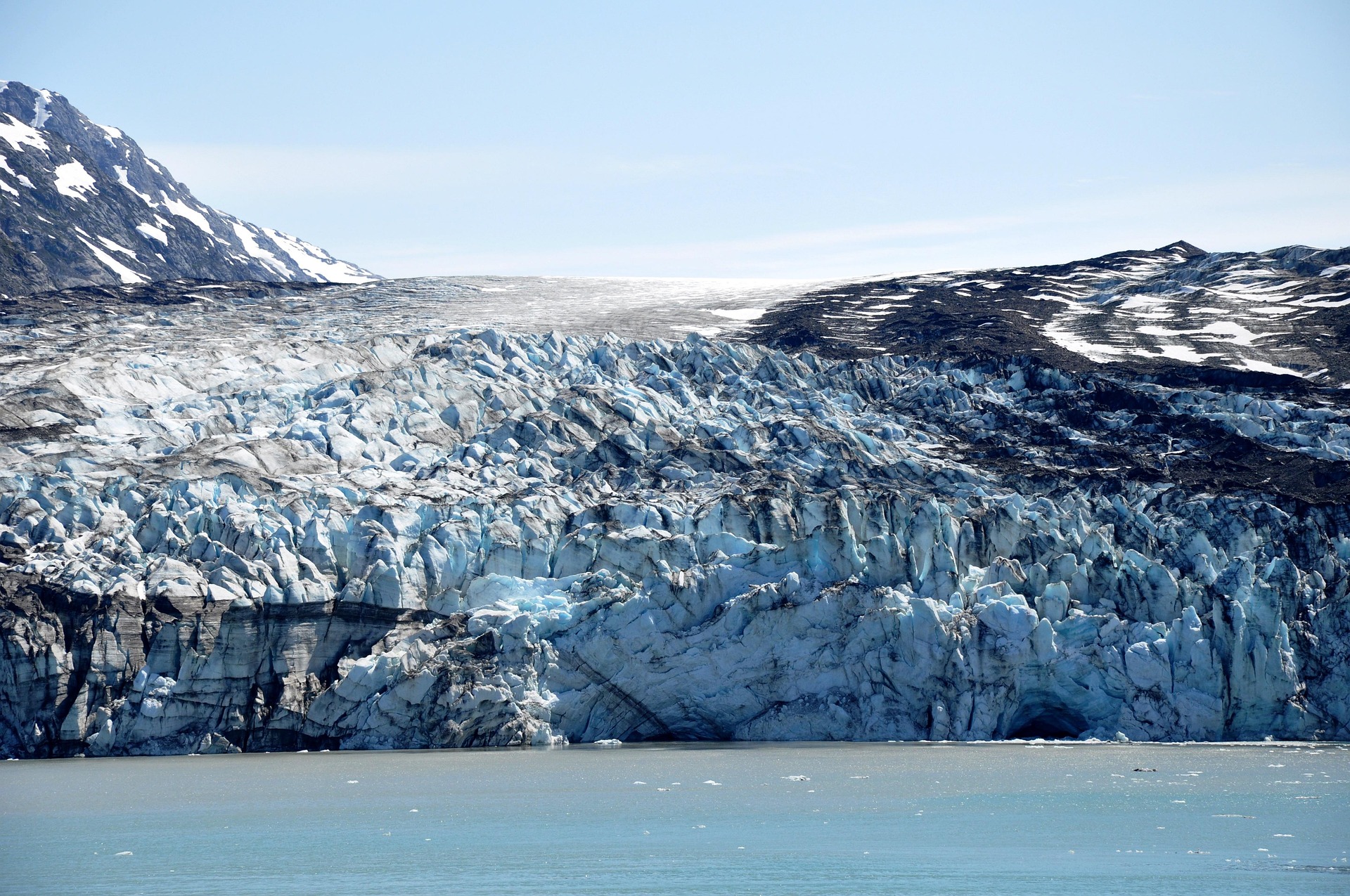
A week-long sail through Southeast Alaska's fjords, where tidewater glaciers calve into the sea and humpback whales breach beside the ship.
Ports like Juneau, Skagway, and Ketchikan mix gold-rush history with float-plane flightseeing over ice fields.
Bald eagles, sea otters, and porpoises are common sightings from the open deck.
Weather shifts fast, turning misty mornings into golden evening light on snow-capped peaks.
How does it rate
CrowdsRomanceCash RequiredDangerAccessibilityWhy you should go
Glaciers, whales, and snow-capped fjords viewed from the deck without a single long-haul flight of your own.
Why you shouldn't go
Cabin prices spike in peak summer weeks and weather can cancel glacier viewing or shore excursions.
Plan your visit
Best time to visitMid-June to July for the longest daylight and best glacier calving; May and September are cheaper.Best time of dayEarly morning, when glacier fjords are calmest and wildlife is most active.Getting thereFly into Seattle or Vancouver; ships depart from downtown cruise terminals, no further transfer needed.Entry costIndicative $3,500-$6,500pp for a 7-night cruise with excursionsTime needed7-night cruiseInsider tip — Book a balcony cabin on the port (left) side sailing northbound from Vancouver for the best glacier and coastline views; bring binoculars for whale spotting and layer clothing for sudden weather changes. -
 #683 /100
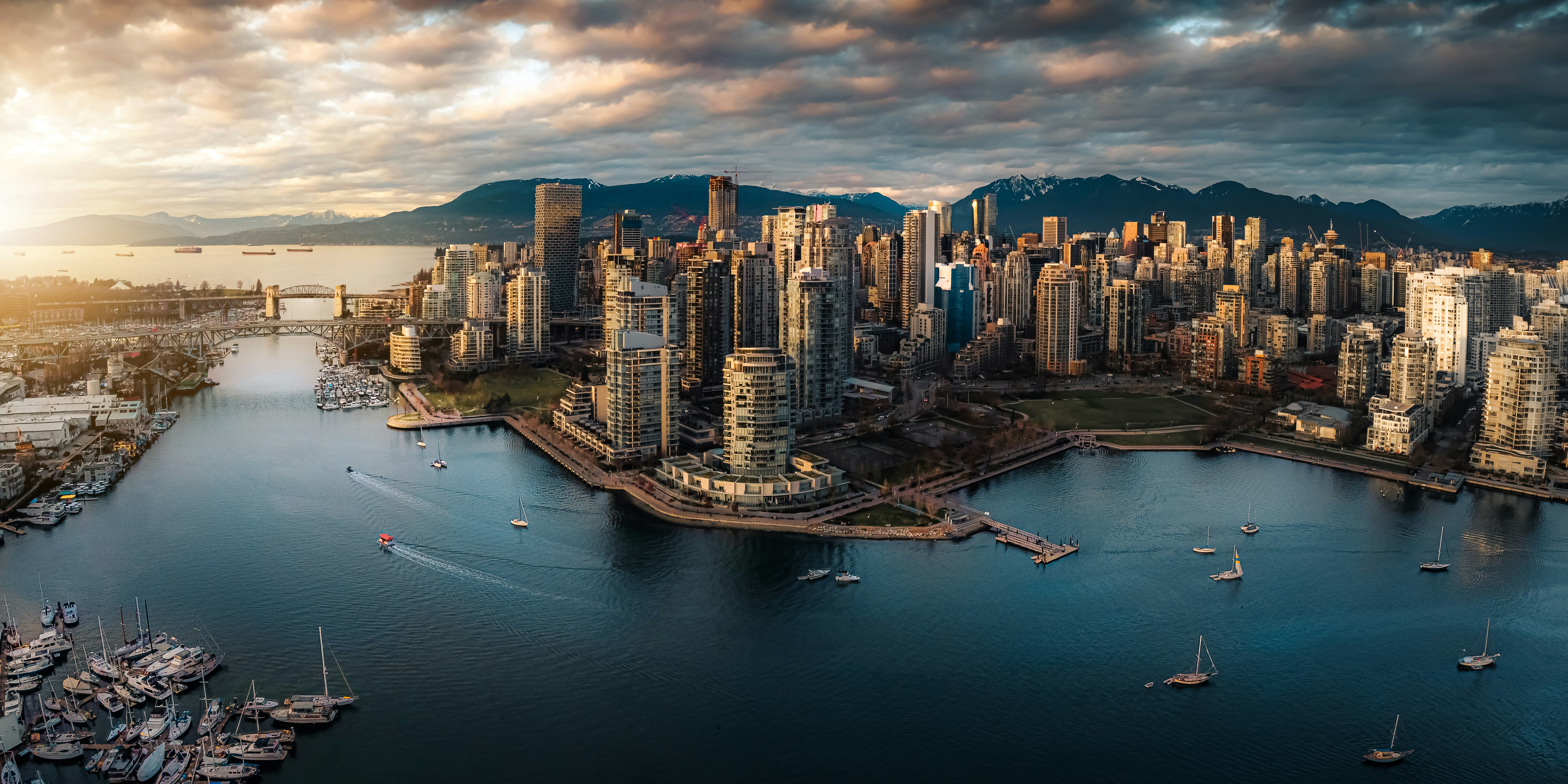
A glass-towered harbour city wedged between the Coast Mountains and the Pacific, where downtown ends abruptly at the seawall and North Shore peaks rise directly across the water.
Stanley Park's rainforest and shoreline path wrap the downtown peninsula, while Granville Island's public market sits a short ferry hop across False Creek.
Vancouver pairs an outdoor-focused lifestyle with skiing, hiking and beaches within a short drive of downtown.
How does it rate
CrowdsRomanceCash RequiredDangerAccessibilityWhy you should go
A compact downtown where mountains, ocean and rainforest are all within walking distance of the office towers.
Why you shouldn't go
One of the most expensive cities in North America for both accommodation and everyday costs.
Plan your visit
Best time to visitJune-September for reliably dry weather; ski season runs December-March on the North Shore mountainsBest time of dayLate afternoon on the seawall for sunset over English BayGetting thereFly into Vancouver International Airport (YVR); the Canada Line train connects the airport to downtown in about 25 minutes.Entry costFree to explore; individual attractions and transit charge separatelyTime needed3-4 daysInsider tip — Rent a bike and ride the Stanley Park seawall counter-clockwise in the early morning before the path fills with pedestrians and tour groups. -
 #780 /100
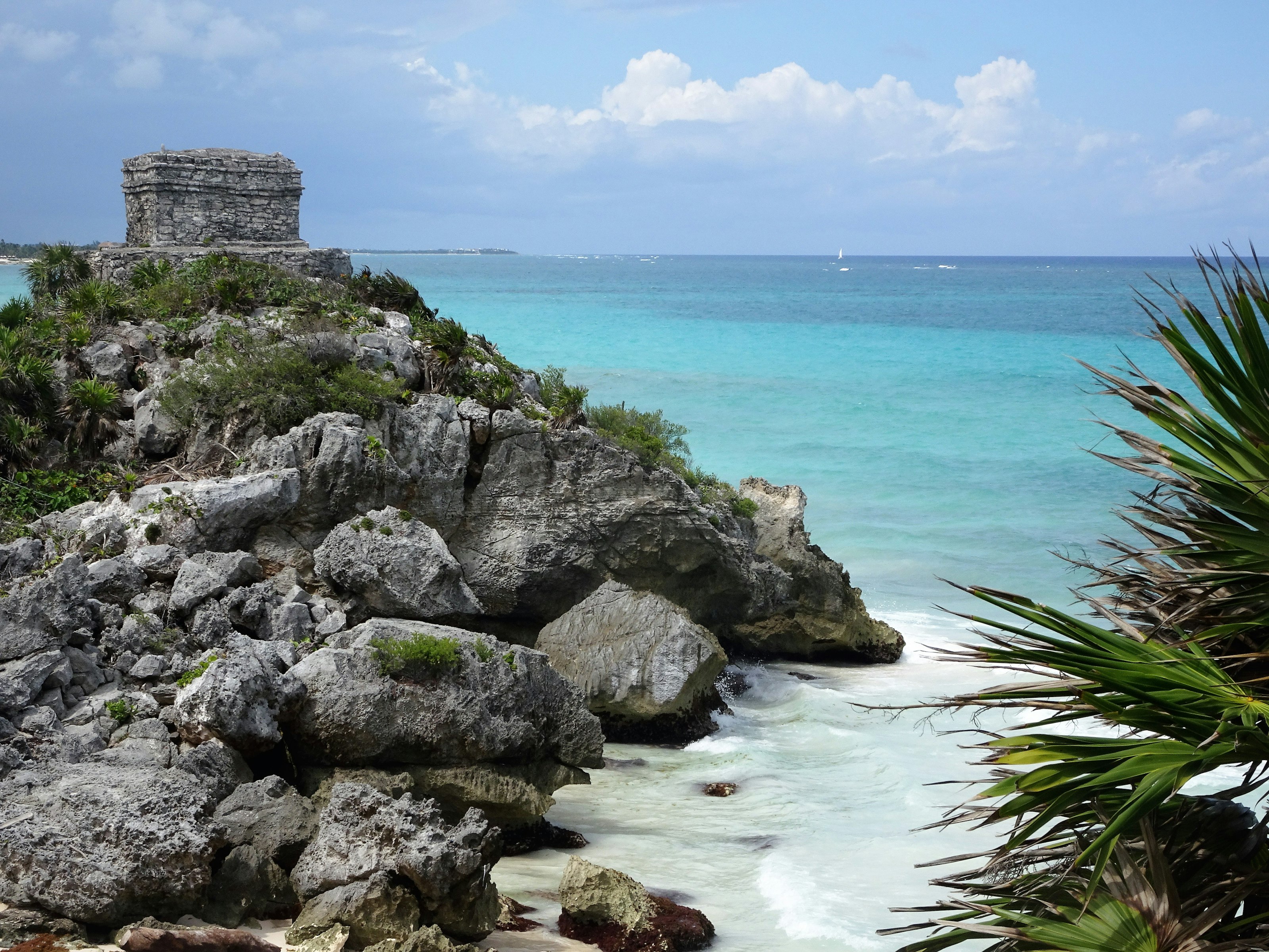
Tulum is the only major Maya city built directly on the coast, its stone temples and watchtowers standing on a low cliff above a beach of white sand and turquoise water.
The site is small compared to Chichén Itzá, but the setting — walled ruins on one side, Caribbean Sea on the other — is unmatched.
Visitors can walk the perimeter path in under an hour, then head down the wooden stairs to swim below the cliffs.
How does it rate
CrowdsRomanceCash RequiredDangerAccessibilityWhy you should go
Nowhere else lets you swim in the Caribbean directly beneath a Maya temple wall.
Why you shouldn't go
It's one of the most crowded ruins in Mexico by mid-morning, with tour buses arriving in a steady stream.
Plan your visit
Best time to visitDecember–April for dry weather, or arrive right at opening to beat the day-trippers.Best time of dayOpening time (8am), before tour groups from Cancún and Playa del Carmen arrive.Getting thereFly to Cancún; 1.5-hour drive or bus south to Tulum town, then a short taxi to the ruins entrance.Entry costPaid entry; parking and shuttle from the visitor centre cost extra.Time needed1–2 hoursInsider tip — Bring swimwear under your clothes — the small beach below the ruins is one of the few places you can swim right at an archaeological site. -
 #877 /100
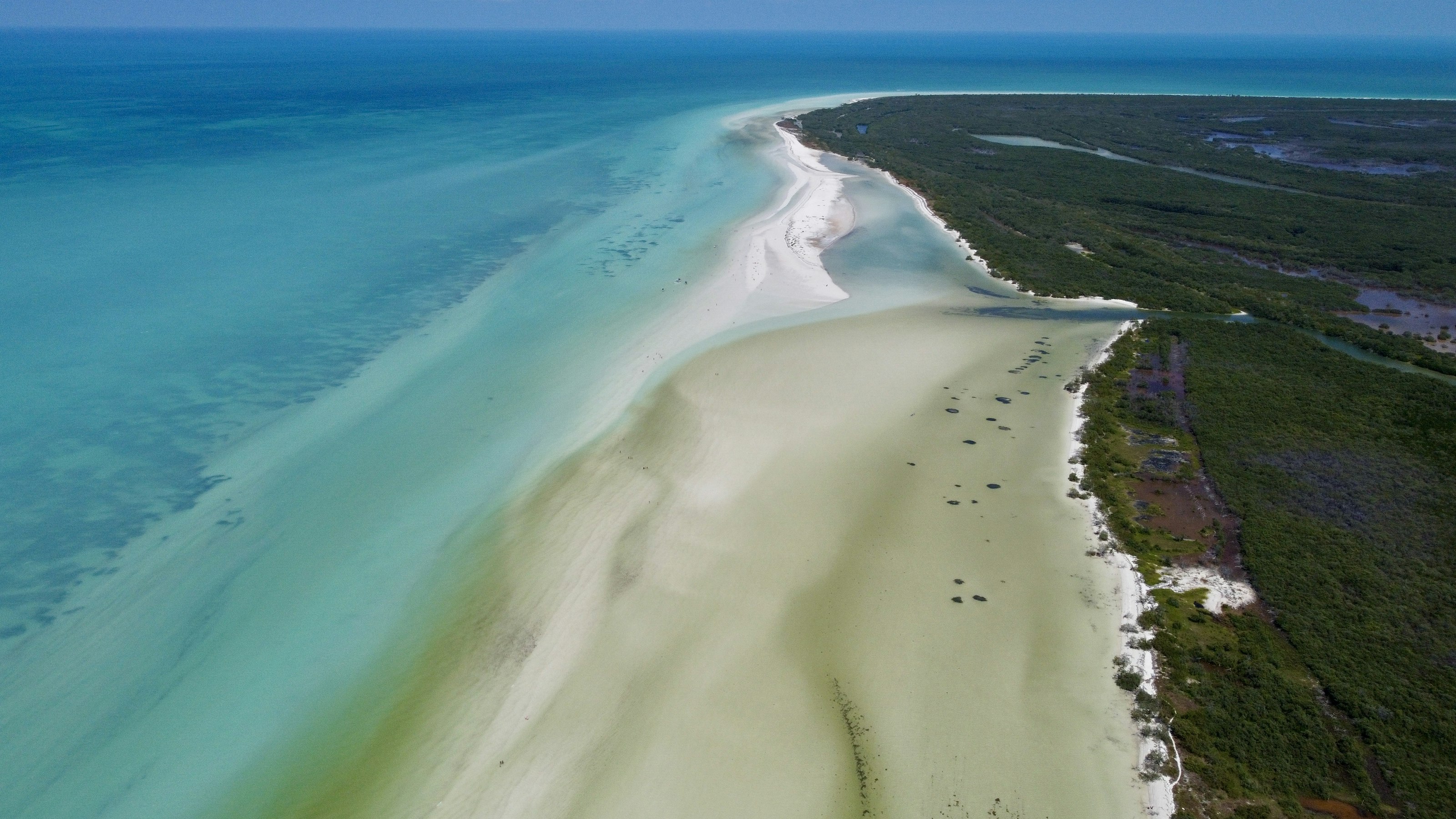
Isla Holbox is a car-free sandbar island off Mexico's Yucatán coast, reached only by boat, with sandy streets, pastel-painted guesthouses, and a slower pace than the resorts of Cancún.
Whale sharks gather in the surrounding waters from roughly June to September, drawing snorkel trips out to swim alongside them, and the island's shallow lagoon glows with bioluminescent plankton on dark nights.
How does it rate
CrowdsRomanceCash RequiredDangerAccessibilityWhy you should go
Snorkelling alongside whale sharks, the largest fish in the ocean, just offshore is a rare and genuinely gentle wildlife encounter.
Why you shouldn't go
It's seasonal — outside whale shark months and without a clear dark sky for bioluminescence, it's a much quieter draw.
Plan your visit
Best time to visitJune–September for whale sharks; new-moon nights any time of year for bioluminescence.Best time of daySunset on the north beach, and after dark (away from lights) for bioluminescent plankton.Getting thereFly to Cancún; 2-hour drive to Chiquilá, then a 20-minute passenger ferry to the island.Entry costFree to explore; whale shark tours and bioluminescence boat trips are paid extras.Time needed2–3 daysInsider tip — Book whale shark tours directly through a licensed local operator at the pier rather than a resort in Cancún — it's cheaper and the boats are smaller. -
 #975 /100
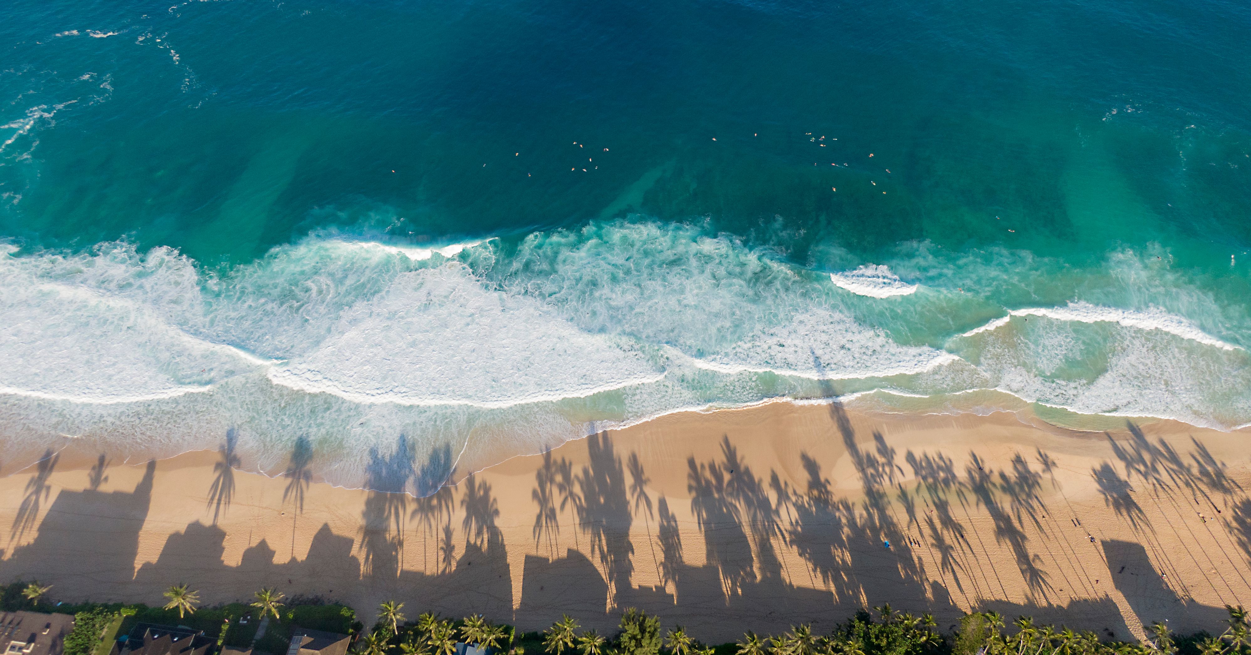
A long, wide stretch of soft white sand on Oahu's windward coast, with the Ko'olau mountain range rising green and jagged directly behind it.
It's popular with locals rather than tour buses, so it stays uncrowded even close to Honolulu, and the water is generally calmer than the island's surf-famous North Shore.
Bellows Beach next door adds a second, quieter option within the same bay.
How does it rate
CrowdsRomanceCash RequiredDangerAccessibilityWhy you should go
Wide white sand backed directly by the jagged Ko'olau range, with far fewer tourists than Oahu's famous North Shore beaches.
Why you shouldn't go
Facilities are basic, and being a local favourite means weekends can bring heavy beach-park traffic.
Plan your visit
Best time to visitApril-October for calmer, warmer water.Best time of dayEarly morning, when the mountains catch the sunrise light.Getting thereFly to Honolulu; a 40-minute drive around the southeast coast to Waimanalo.Entry costFree.Time needed2-3 hours.Insider tip — Bellows Field Beach Park next door is open to the public on weekends and is usually quieter still. -
 #1074 /100
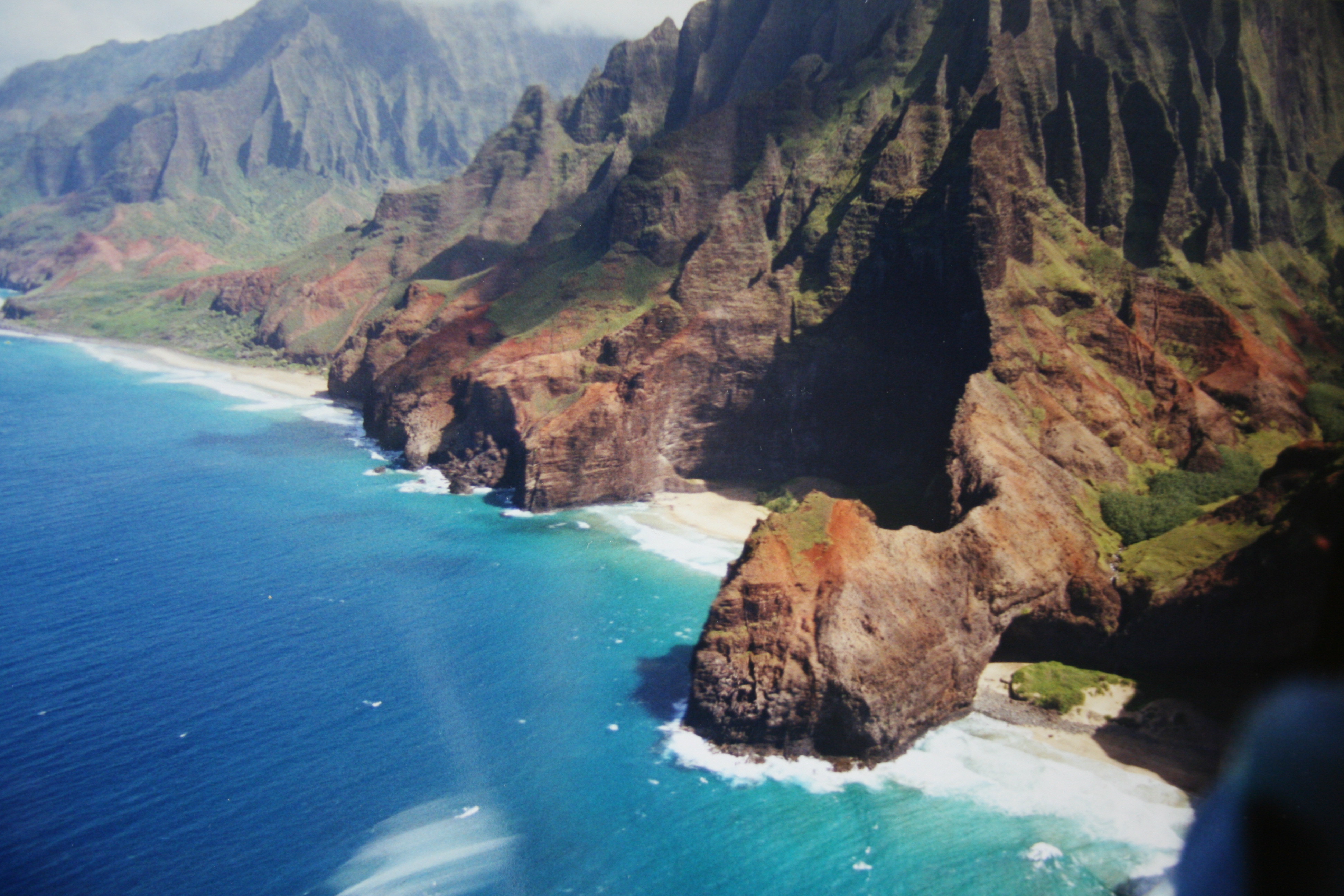
An 11-mile coastal trail along Kauai's Na Pali Coast, climbing in and out of fluted, jungle-green valleys with the Pacific breaking against sea cliffs far below.
The route crosses Hanakapiai Stream, skirts the exposed Crawler's Ledge, and ends at the remote Kalalau Valley and beach.
Permits are required past the two-mile mark and are famously hard to secure, often selling out within seconds of release.
How does it rate
CrowdsRomanceCash RequiredDangerAccessibilityWhy you should go
Sea cliffs, waterfalls and jungle valleys along one of the most dramatic coastlines in the Pacific.
Why you shouldn't go
Crawler's Ledge and several stream crossings turn genuinely dangerous in rain, and permits vanish in seconds.
Plan your visit
Best time to visitMay-September (drier season); stream crossings can become impassable in winter rains.Best time of dayEarly morning start to clear exposed sections before afternoon heat.Getting thereFly to Lihue; drive about an hour to the trailhead at Ke'e Beach, the end of the road.Entry costCamping permit $25/night (Hawaii residents) or $35/night (non-residents).Time needed2-3 days for the full trail; day hikers often turn back at Hanakapiai FallsBookingBook ahead →Insider tip — Permits release exactly 90 days ahead at midnight Hawaii time and go in seconds - have your account and dates ready beforehand. -
 #1174 /100
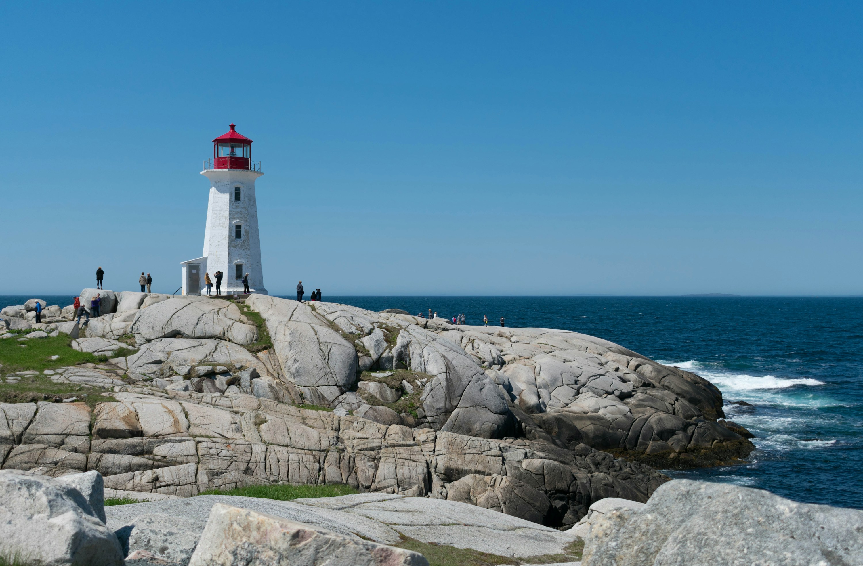
A small fishing village on Nova Scotia's rocky Atlantic coast, built around one of Canada's most recognisable lighthouses, perched on wave-smoothed granite boulders above the open ocean.
The working harbour still holds lobster boats and fish shacks alongside the crowds, and a short walk along the shoreline rocks gives open views out to sea.
Waves can sweep the outer rocks without warning.
How does it rate
CrowdsRomanceCash RequiredDangerAccessibilityWhy you should go
One of the most recognisable lighthouses in Canada, set on open granite rock above the Atlantic, a short drive from Halifax.
Why you shouldn't go
Extremely busy with tour buses in summer, and the smooth rocks nearest the water have caused fatal rogue-wave incidents.
Plan your visit
Best time to visitJune-September for mild weather; arrive outside 10am-4pm to avoid tour bus crowdsBest time of dayEarly morning or early eveningGetting thereFly to Halifax Stanfield International Airport; 45-50 minute drive southwest on Route 333.Entry costFree; parking fee appliesTime needed1-2 hoursInsider tip — Stay on the dark, lichen-covered rock and well back from the water on the ocean side of the lighthouse; the smooth grey granite closer to the surf has swept visitors away in calm-looking conditions. -
 #1272 /100
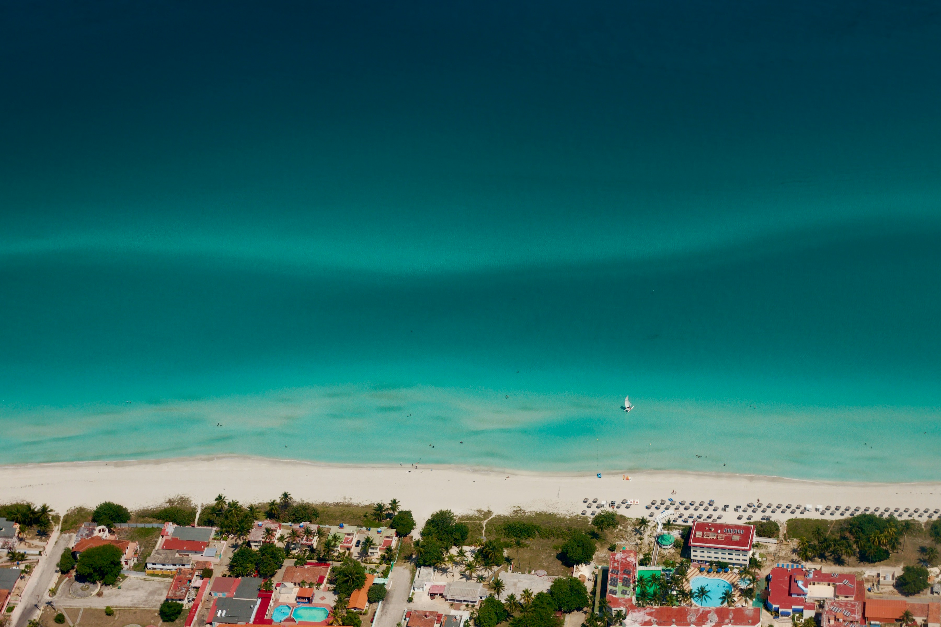
Cuba's premier beach resort stretch runs for roughly 20 kilometers along a narrow peninsula east of Havana, its powder-white sand and calm, clear turquoise water backed by a dense strip of all-inclusive resorts.
It's a more polished, tourist-oriented side of Cuba than Havana or Trinidad, built primarily around sun, sand and watersports rather than culture or history.
How does it rate
CrowdsRomanceCash RequiredDangerAccessibilityWhy you should go
Cuba's most reliable, resort-backed Caribbean beach stretch, with calm, clear water.
Why you shouldn't go
It's the most resort-developed, least distinctly 'Cuban' part of the island, with limited local culture on-site.
Plan your visit
Best time to visitNovember–April, the dry season, for the most reliable sunshine.Best time of dayMorning, before the strongest midday sun and afternoon resort crowds at the water's edge.Getting thereFly directly to Varadero's international airport, or drive about 2.5 hours from Havana.Entry costPublic beach access free; many stretches are attached to all-inclusive resorts.Time needed2–4 days.Insider tip — Head to the public beach access points near the town of Varadero itself, away from resort-fronted sections, for a livelier, more local atmosphere. -
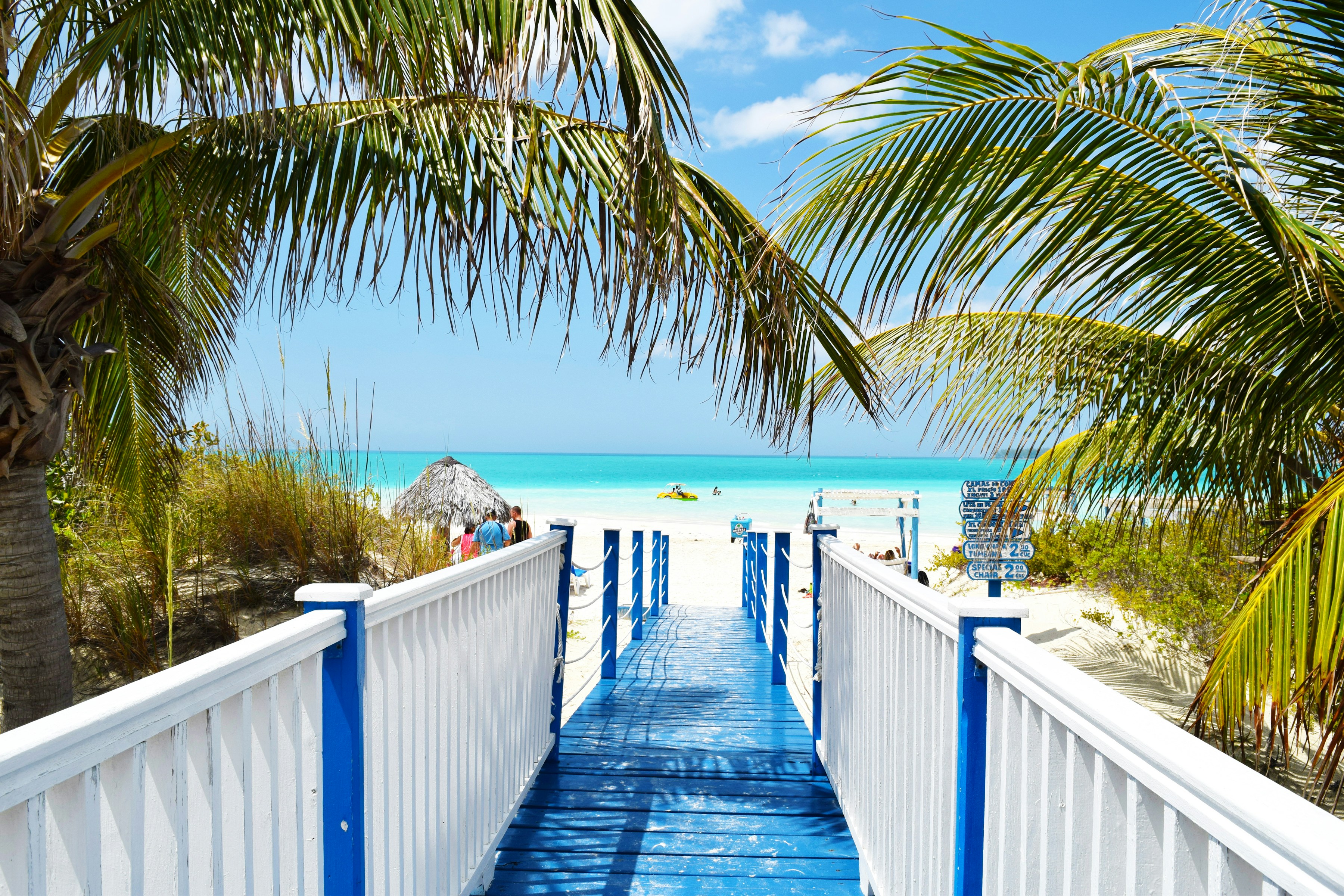 #13
#13A causeway connects this low-lying coral island to the Cuban mainland, its shoreline mixing resort beaches with mangrove lagoons and salt flats that host large flamingo colonies, giving it noticeably more wildlife interest than Varadero's more developed strip.
Birdwatchers come specifically for the flamingos and other wading birds alongside sun-seekers drawn to its calm, shallow waters.
How does it rate
CrowdsRomanceCash RequiredDangerAccessibilityWhy you should go
A resort island with genuine wildlife interest — large flamingo colonies alongside calm Caribbean beaches.
Why you shouldn't go
The causeway and resort development have altered some of the mangrove ecosystem the island depends on.
Plan your visit
Best time to visitNovember–April, the dry season, for reliable weather and peak flamingo numbers.Best time of dayEarly morning for flamingo viewing in the lagoons before the heat of the day.Getting thereFly directly to Jardines del Rey Airport on the island, or drive about 5-6 hours from Havana.Entry costPublic beach access free; most stays are through all-inclusive resorts.Time needed2–4 days.Insider tip — Ask a local guide to take you to the flamingo lagoons on the mainland side of the causeway — resort tours often skip this in favor of beach time. -
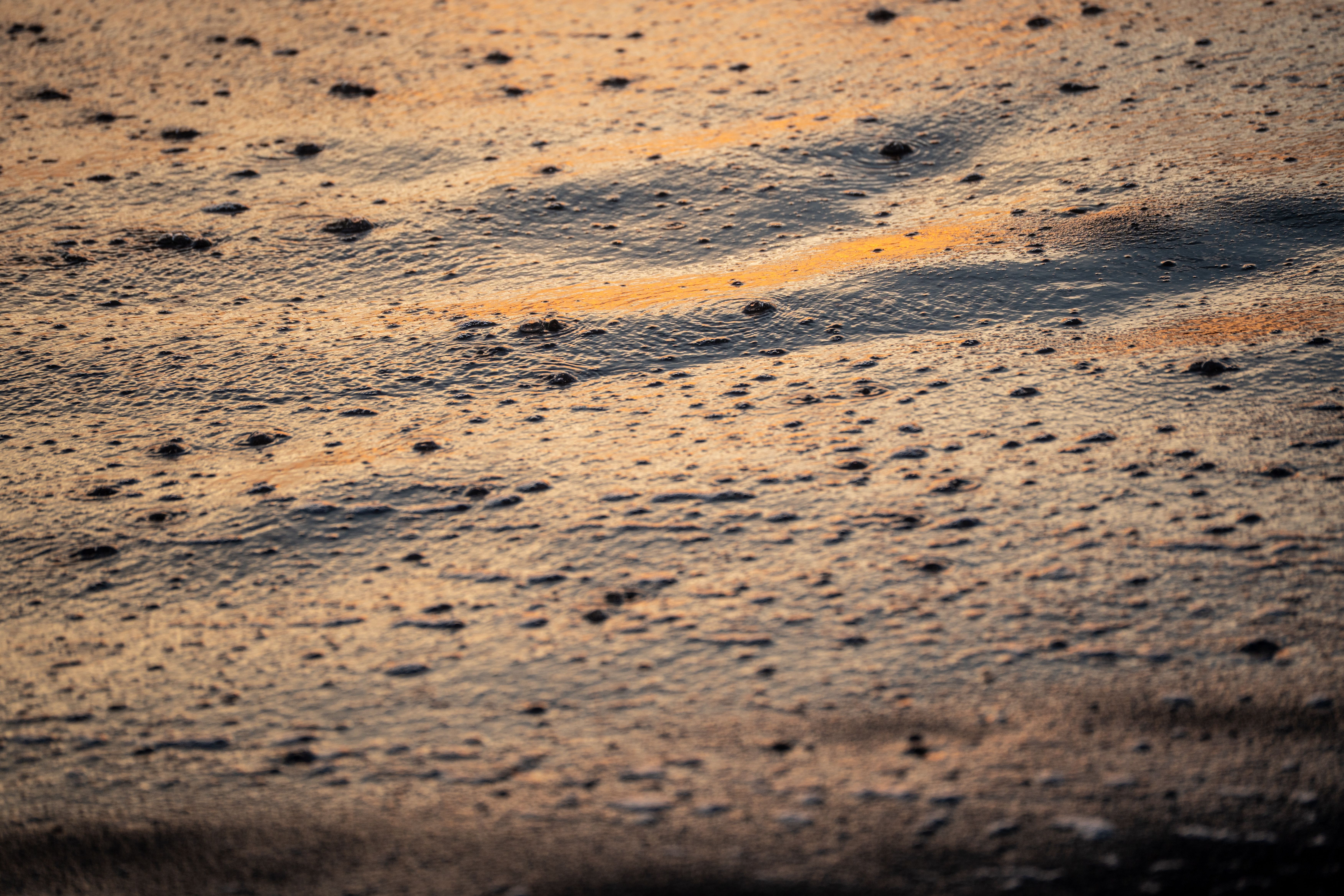 #1465 /100
Guatemala's Pacific coast is defined by volcanic black sand, and Monterrico is its best-known stretch, backed by mangrove canals and a sea-turtle hatchery that releases hundreds of hatchlings each season.
The strong surf and undertow make it a beach for walking and sunset-watching rather than swimming, and boat trips through the adjoining reserve add caimans and waterbirds to the appeal.
How does it rate
CrowdsRomanceCash RequiredDangerAccessibilityWhy you should go
A volcanic black-sand beach with a sea-turtle hatchery and mangrove canals to explore by boat.
Why you shouldn't go
Strong surf and undertow make it unsafe for casual swimming — it's a beach for walking, not wading in.
Plan your visit
Best time to visitNovember–April, the dry season; August–November for peak turtle hatchling releases.Best time of daySunset, when the black sand and surf catch the light, or early morning for the canal boat tours.Getting thereAbout 3 hours by road from Guatemala City or Antigua, via La Avellana and a short boat crossing.Entry costFree beach access; canal boat tours and turtle hatchery visits a few hundred quetzales.Time neededFull day, or overnight.Insider tip — Time a visit around a hatchling release at the tortugario — locals and researchers often let visitors help carry them to the water. -
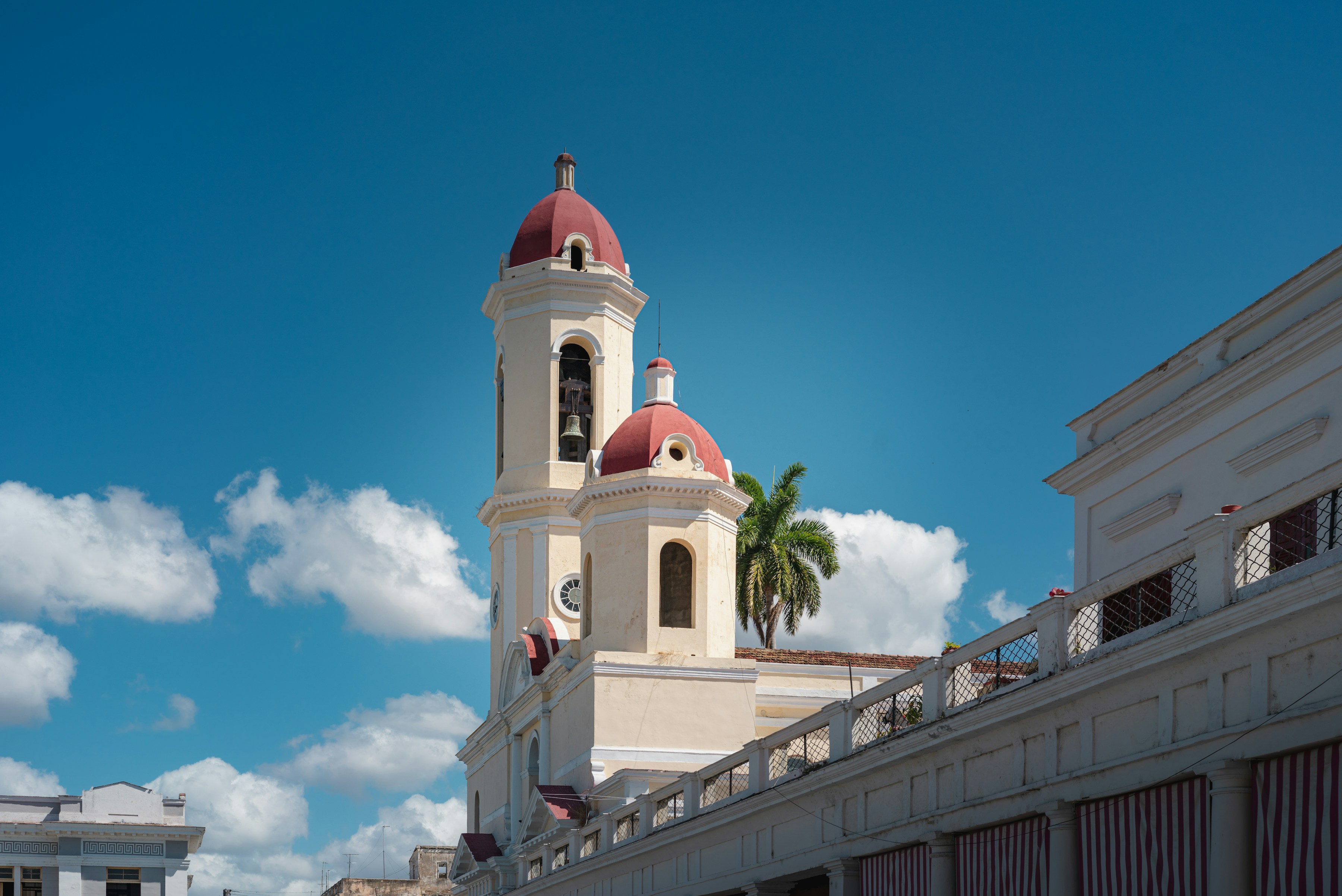 #1562 /100
Founded by French settlers rather than the Spanish, Cienfuegos carries a distinctly different architectural character from the rest of Cuba, its neoclassical Parque José Martí and grand Tomás Terry Theatre earning it the nickname 'Pearl of the South' and UNESCO status.
Set on a wide, protected bay, the city has a more orderly, less weathered feel than Havana's crumbling grandeur, with a genuinely pleasant waterfront Malecón for evening walks.
How does it rate
CrowdsRomanceCash RequiredDangerAccessibilityWhy you should go
Cuba's most orderly, French-influenced colonial city, set on a scenic protected bay.
Why you shouldn't go
It has fewer standout individual attractions than Havana or Trinidad — the appeal is mostly architectural and atmospheric.
Plan your visit
Best time to visitNovember–April, the dry season.Best time of dayEvening along the Malecón, when the bay-front promenade is at its most relaxed.Getting thereAbout 3.5 hours' drive from Havana, or 1.5 hours from Trinidad.Entry costFree to walk; Tomás Terry Theatre entry a small fee.Time needed1 day.Insider tip — Catch a performance at the Tomás Terry Theatre if the schedule allows — one of Cuba's most beautiful 19th-century theaters and rarely crowded. -
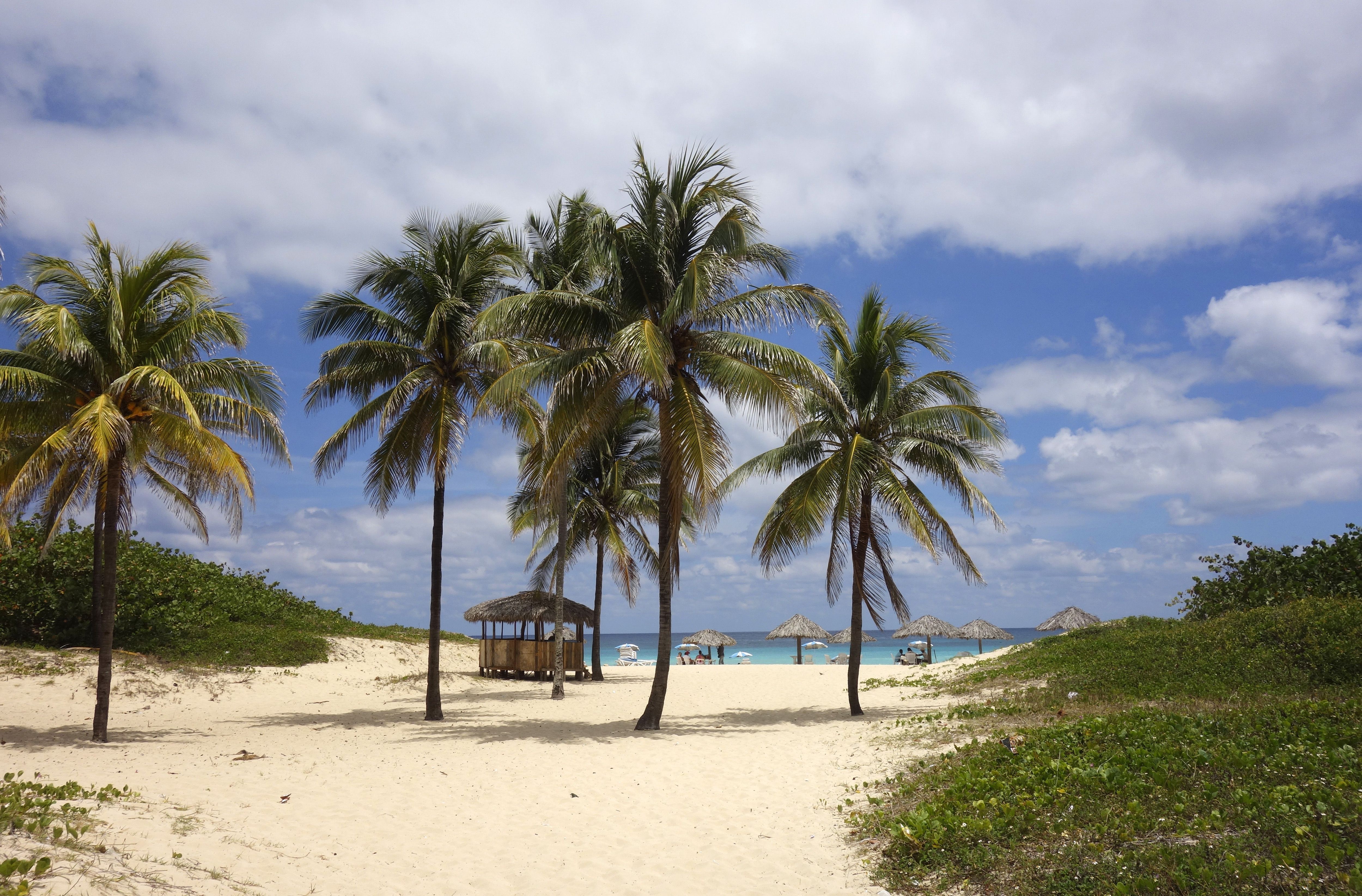 #1660 /100
A string of sandy beaches just 20 minutes east of Havana, Playas del Este is where the capital's own residents go to swim, making it a far more local scene than Cuba's resort-heavy north coast.
Santa María del Mar is the best-known stretch, with warm shallow water, beach shacks selling grilled fish, and none of the all-inclusive walls found at Varadero or Cayo Coco.
It's an easy half-day escape without leaving the Havana area.
How does it rate
CrowdsRomanceCash RequiredDangerAccessibilityWhy you should go
Havana's own beach, a short drive away, with a far more local feel than Cuba's resort coasts.
Why you shouldn't go
Facilities are more basic than at purpose-built resorts, and weekends bring big crowds of Habaneros.
Plan your visit
Best time to visitNovember–April, the dry season, for calm seas and comfortable heat.Best time of dayMorning on weekdays, before Havana day-trippers arrive in the afternoon.Getting thereAbout 25–30 minutes by taxi or local bus east of central Havana.Entry costFree public beach access; sunbed and umbrella rental a few CUC/USD equivalent.Time neededHalf a day.Insider tip — Head slightly east past Santa María del Mar to Boca Ciega for a quieter stretch with the same warm, shallow water.


More from North America
-
More Coastal spots
-
How a score is built
One score out of 100, five criteria behind it
Every place is rated 1–5 on each of the criteria below, then combined into a single score out of 100. It's calculated by us, the same way every time — not an average of traveller reviews or social votes.
Crowds
How many people you'll be sharing it with, and at what time of day.
Romance
How well it suits a couple, a proposal, or a quiet moment together.
Cash required
Entry fees, permits, guides, rentals — what it actually costs to do it.
Danger
Physical risk involved, from a slippery viewpoint to genuine hazard.
Accessibility
How far off the beaten path it is, and how hard it is to actually reach.


