-
 #193 /100
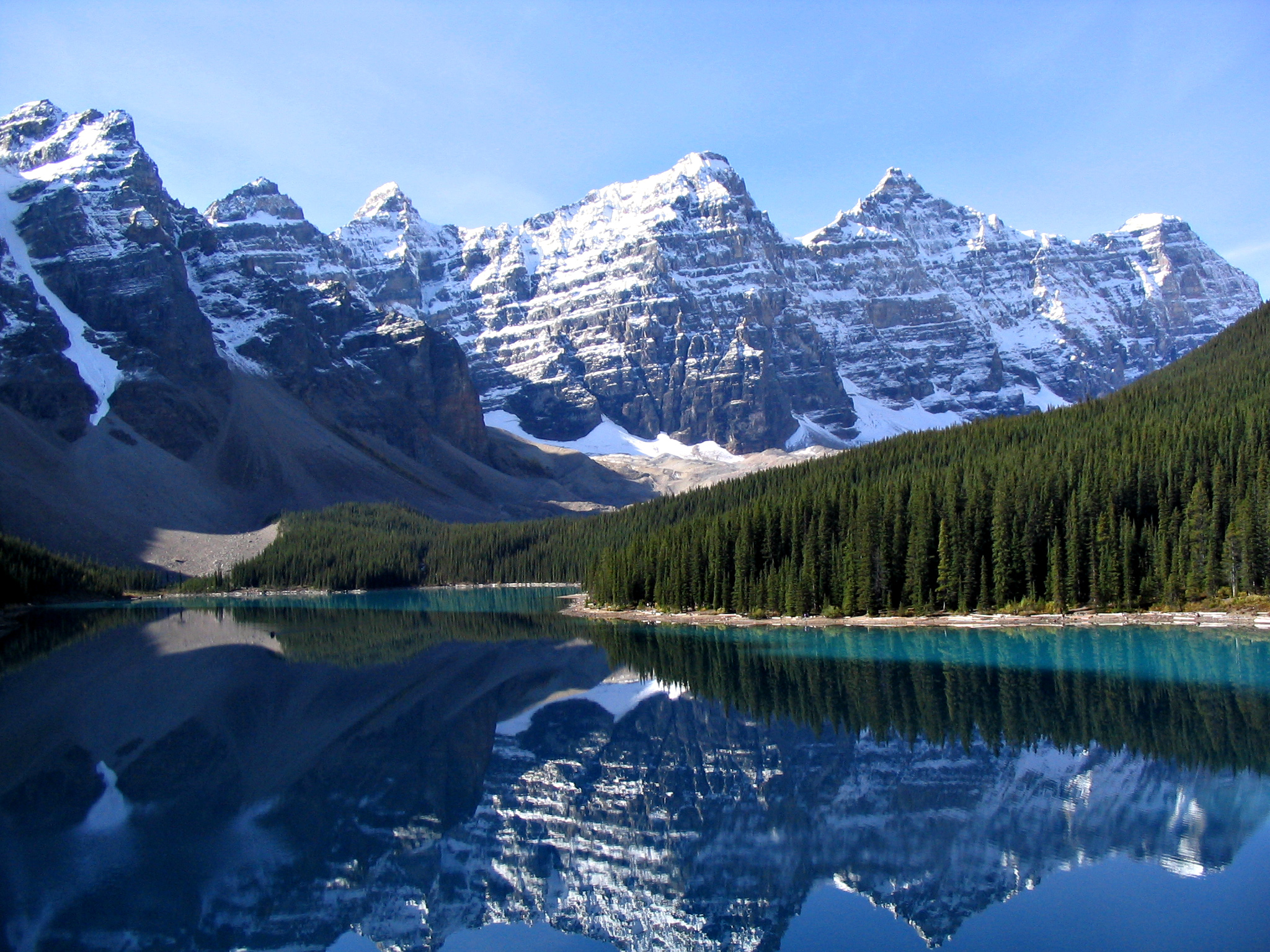
Hidden in the Valley of the Ten Peaks in Banff National Park, Moraine Lake is fed by glacial meltwater that gives it its extraordinary turquoise colour.
The classic view from the Rockpile overlook, with the lake reflecting the surrounding peaks, appeared on the Canadian twenty-dollar bill.
How does it rate
CrowdsRomanceCash RequiredDangerAccessibilityWhy you should go
The colour of the water is genuinely unbelievable in person and the surrounding ring of jagged peaks makes it one of the most dramatic lake settings in the world.
Why you shouldn't go
Access to Moraine Lake is now heavily controlled; visitors must book a shuttle bus in advance as private vehicles are prohibited.
Plan your visit
Best time to visitLate June-early July when the lake is at its bluestBest time of dayEarly morning, before the wind ripples the waterGetting thereShuttle bus required from Lake Louise in peak seasonEntry costFree; shuttle fare appliesTime needed2-3 hoursInsider tip — Arrive at first light; the Rockpile Trail view is why it was on the old Canadian $20 bill -
 #293 /100
Established in 1885, Banff is Canada's oldest national park and one of the world's most spectacular.
Turquoise lakes, ancient glaciers, hot springs, abundant wildlife, and the postcard town of Banff itself make this an unmissable destination in the Canadian Rockies.
How does it rate
CrowdsRomanceCash RequiredDangerAccessibilityWhy you should go
The combination of turquoise glacial lakes, dramatic mountain scenery, and easy accessibility makes Banff one of the most photogenic national parks on earth.
Why you shouldn't go
Banff becomes very crowded in summer and key sites like Moraine Lake and Lake Louise require advance shuttle booking.
Plan your visit
Best time to visitJune-SeptemberBest time of dayEarly morning for wildlife and calm waterGetting there~1.5hr drive from CalgaryEntry costPark pass ~$10/dayTime needed3+ daysInsider tip — Get to Moraine Lake or Lake Louise before 7am in July/August or the parking lots fill and close -
 #3
#3Rated #3 of 49
Yellowstone National Park, the United States
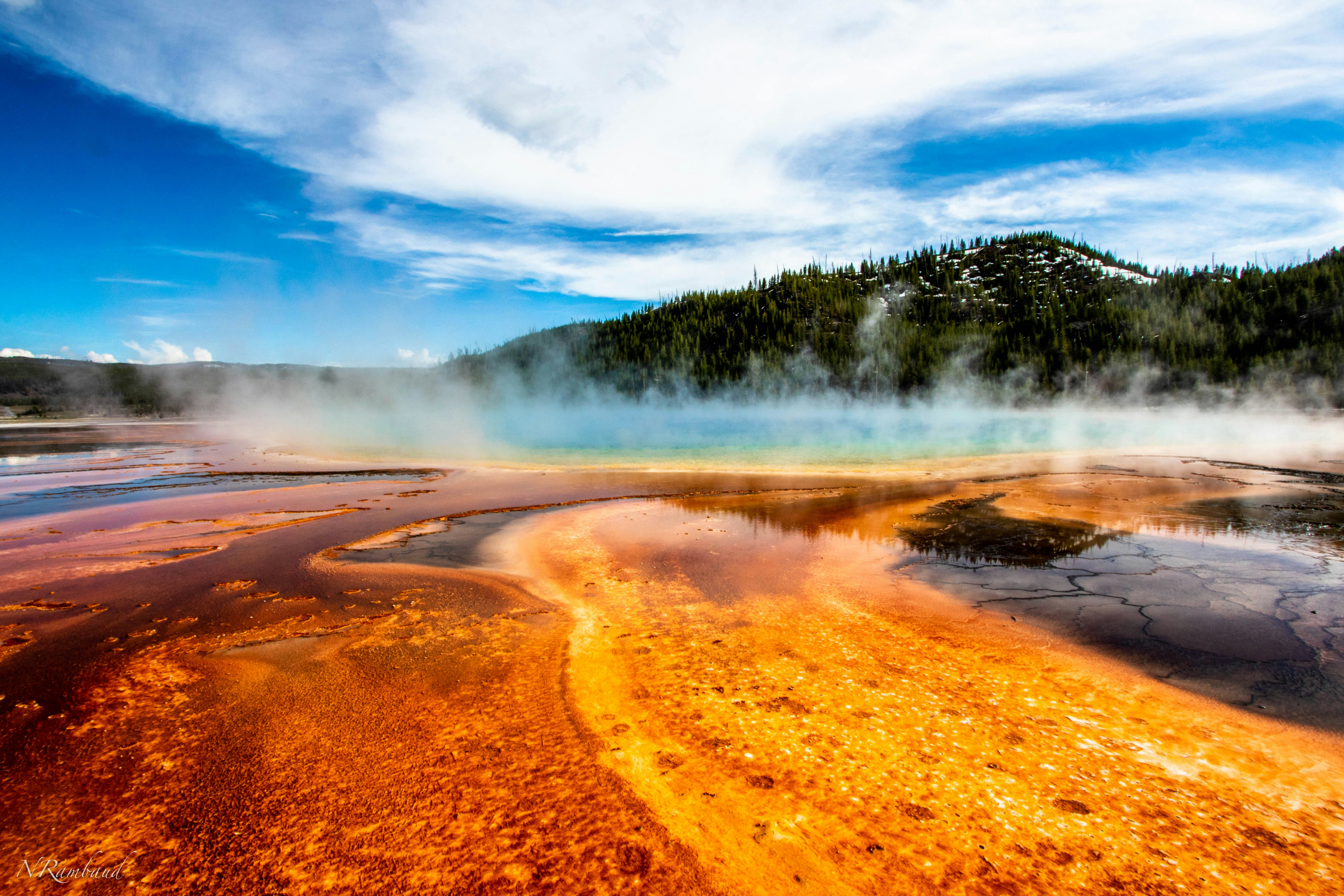
#yellowstonenationalpark ◆ National Parks93 /100Yellowstone is the world's first national park and still its strangest, sitting atop a supervolcano that surfaces as thousands of geysers, hot springs, and mudpots.
Old Faithful erupts on a near-hourly schedule, while the Grand Prismatic Spring's rainbow colours come from heat-loving bacteria.
Beyond the geothermal basins, the park holds free-roaming bison, elk, wolves, and grizzly bears across nearly 9,000 square kilometres of forest and canyon.
How does it rate
CrowdsRomanceCash RequiredDangerAccessibilityWhy you should go
Nowhere else combines a supervolcano's geysers and hot springs with free-roaming bison, wolves, and grizzly bears in one park.
Why you shouldn't go
Peak summer brings gridlock traffic and packed boardwalks at the famous geyser basins.
Plan your visit
Best time to visitLate May-June or September for wildlife and thinner crowds; many roads close in winter.Best time of dayEarly morning for wildlife viewing and quieter geyser basins before tour buses arrive.Getting thereFly to Jackson Hole or Bozeman; 1.5-3 hour drive to the nearest park entrance.Entry cost$35 per vehicle, valid 7 daysTime needed3+ daysInsider tip — Watch Old Faithful from the Observation Point trail above the boardwalk to skip the crowd at ground level. -
 #492 /100
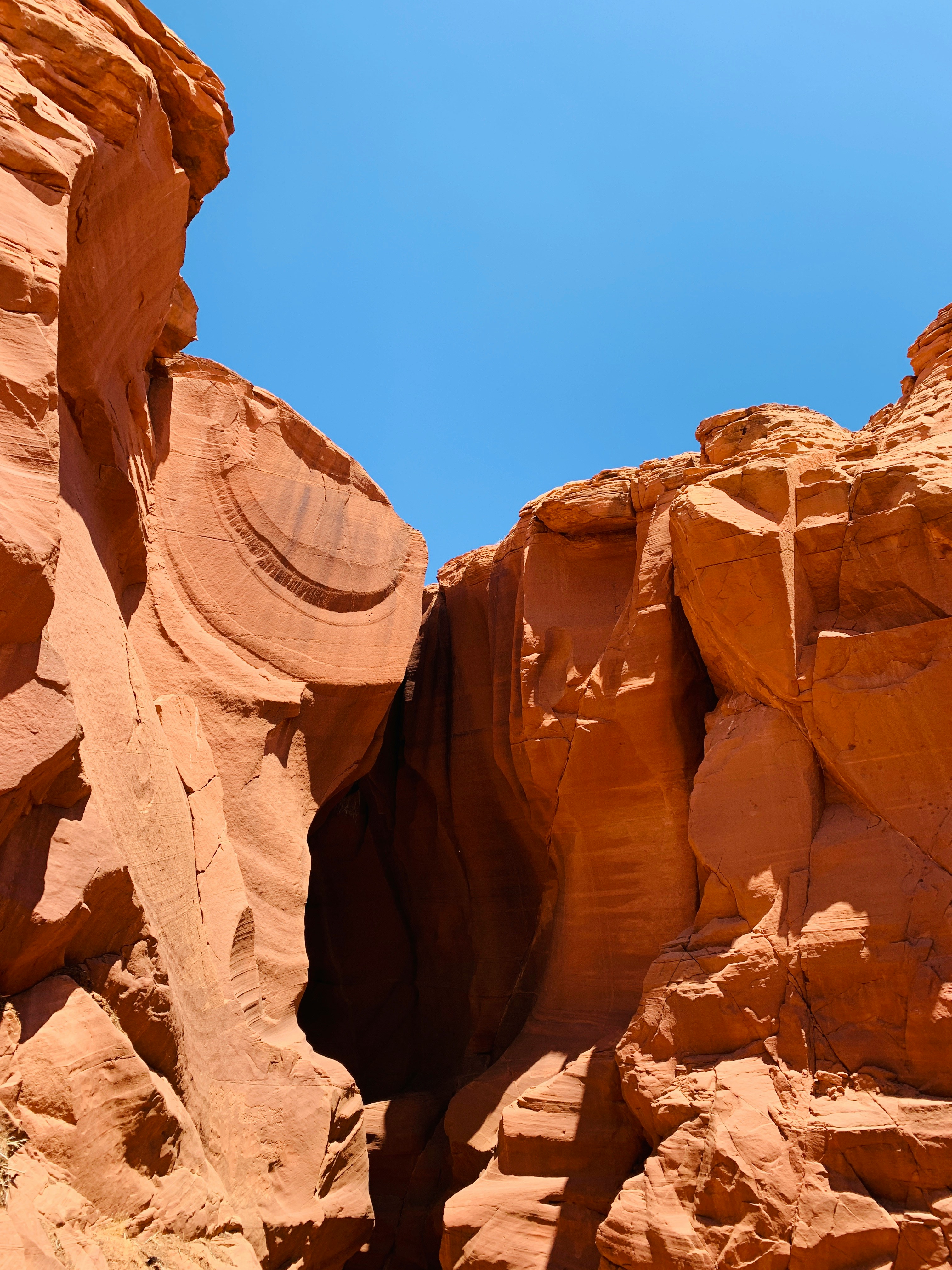
A slot canyon on Navajo land near Page, carved by flash floods into smooth, fluted sandstone walls that narrow to a few feet apart overhead.
Around midday, shafts of sunlight drop through the openings above and light the orange rock from within.
Access is only with a Navajo guide on a timed walk through either Upper or Lower Antelope, and the canyon closes without warning whenever rain threatens upstream.
How does it rate
CrowdsRomanceCash RequiredDangerAccessibilityWhy you should go
The canyon is a unique natural wonder, offering incredible photo opportunities with its light beams and swirling rock formations.
Why you shouldn't go
It requires a guided tour, which limits exploration and can be pricey, and it often feels crowded due to its popularity.
Plan your visit
Best time to visitMarch-October for visible light beamsBest time of dayMidday for the famous light beamsGetting thereNear Page, Arizona; guided tour onlyEntry costGuided tour ~$50-100Time needed1.5-2 hoursInsider tip — Only accessible via a Navajo-guided tour; book weeks ahead in summer -
 #591 /100
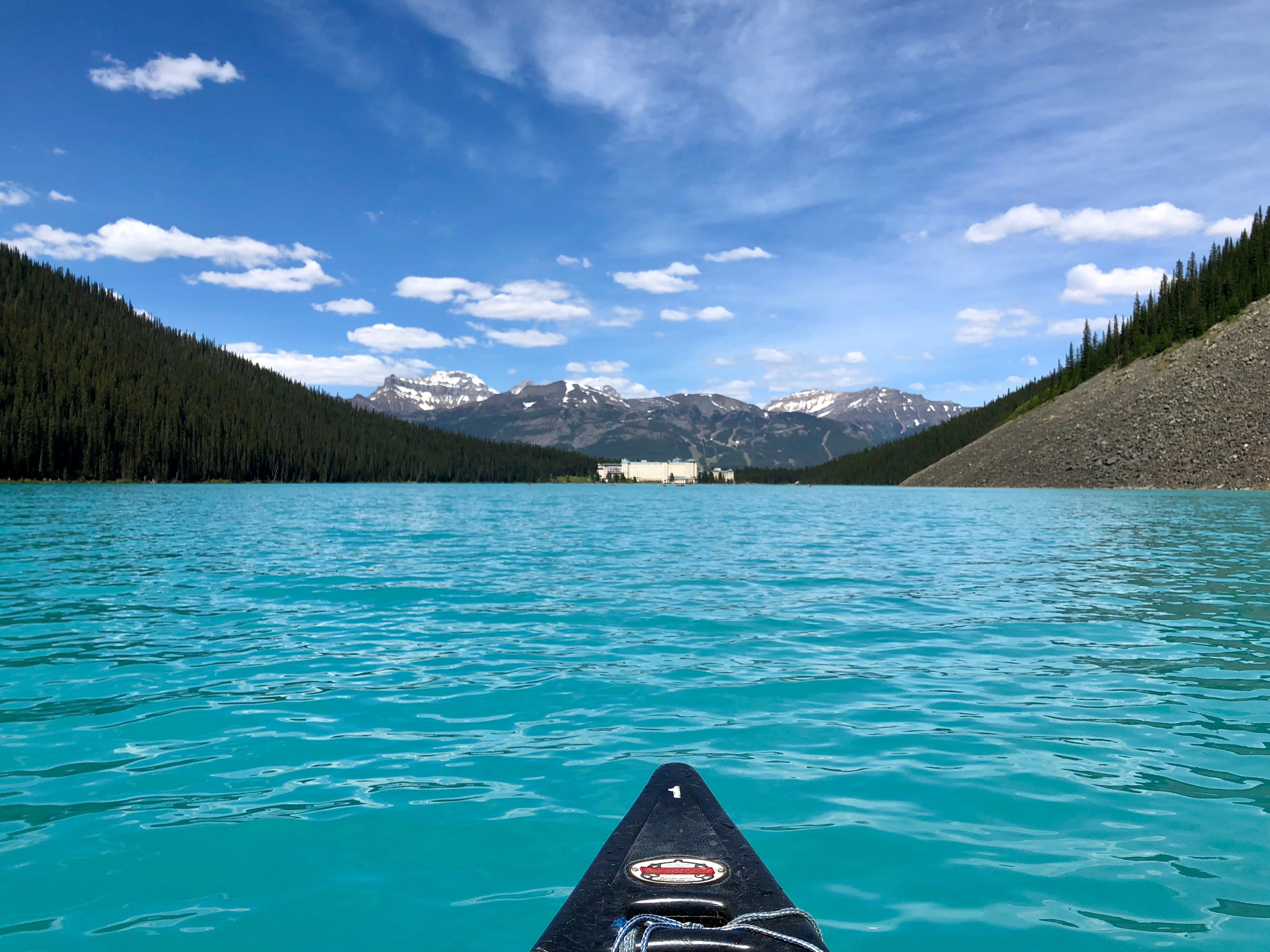
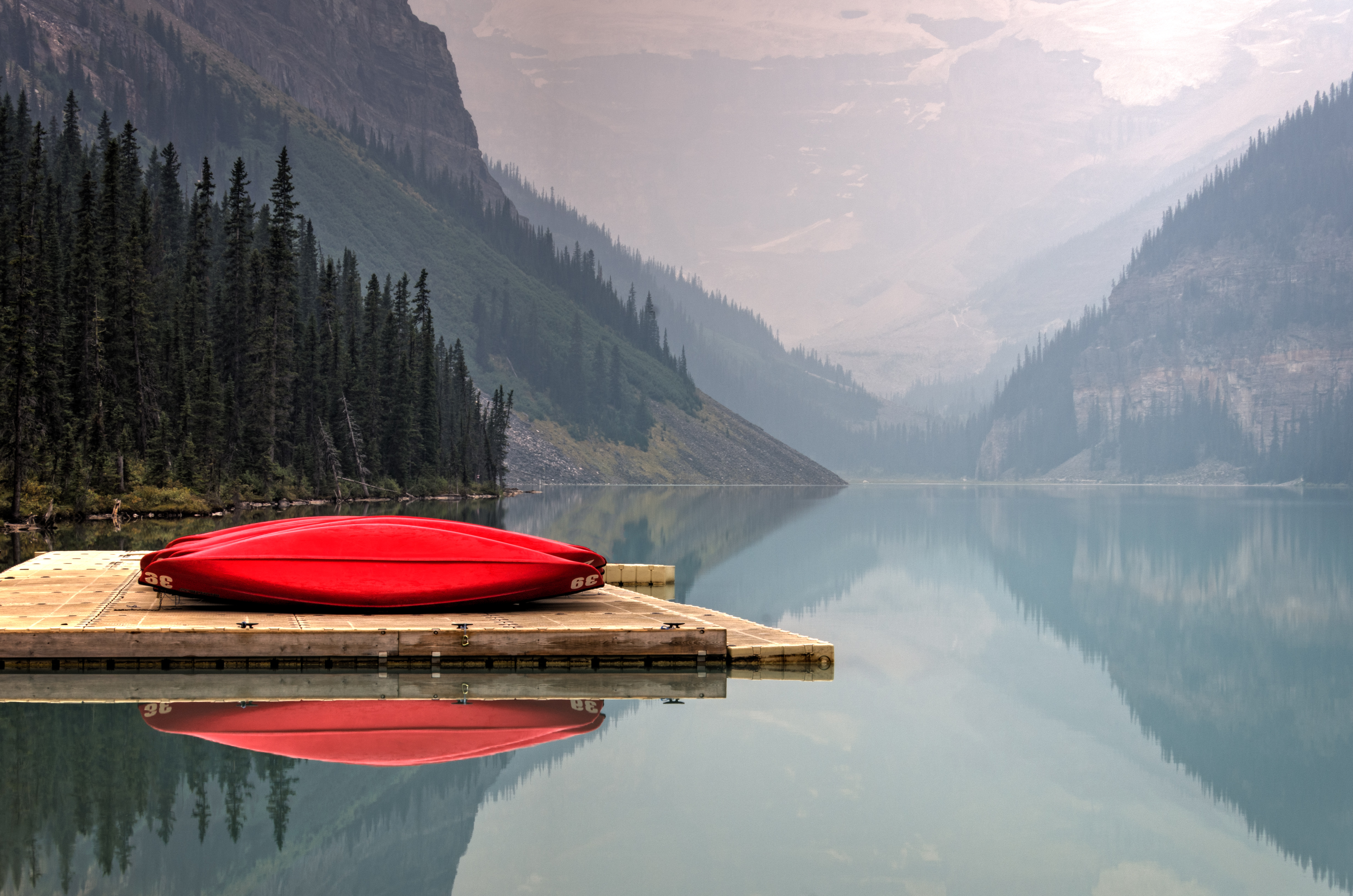
Lake Louise is the Canadian Rockies at their most theatrical: a milky turquoise lake framed by pine-clad ridges, with Victoria Glacier hanging at the far end and the famous red canoes gliding out from the boathouse dock.
The colour is real, glacial rock flour in the meltwater, and it shifts with every hour of light.
Easy lakeshore paths and grand teahouse hikes ring the water.
How does it rate
CrowdsRomanceCash RequiredDangerAccessibilityWhy you should go
One of the most photogenic lakes on Earth, with turquoise water, red canoes and glacier views in one frame.
Why you shouldn't go
Summer parking fills before sunrise and the shoreline gets extremely busy through the middle of the day.
Plan your visit
Best time to visitJune-September for open water; late September for golden larchesBest time of dayDawn, before the car park fills and the water is still glassyGetting thereFly to Calgary; 2-hour drive, then park-and-ride shuttle in summerEntry costBanff park pass about CA$11/day; canoe rental extraTime neededHalf a dayBookingBook ahead →Insider tip — Book the Parks Canada shuttle online weeks ahead - by mid-morning in July the lot is full and drop-ins are turned away -
 #691 /100
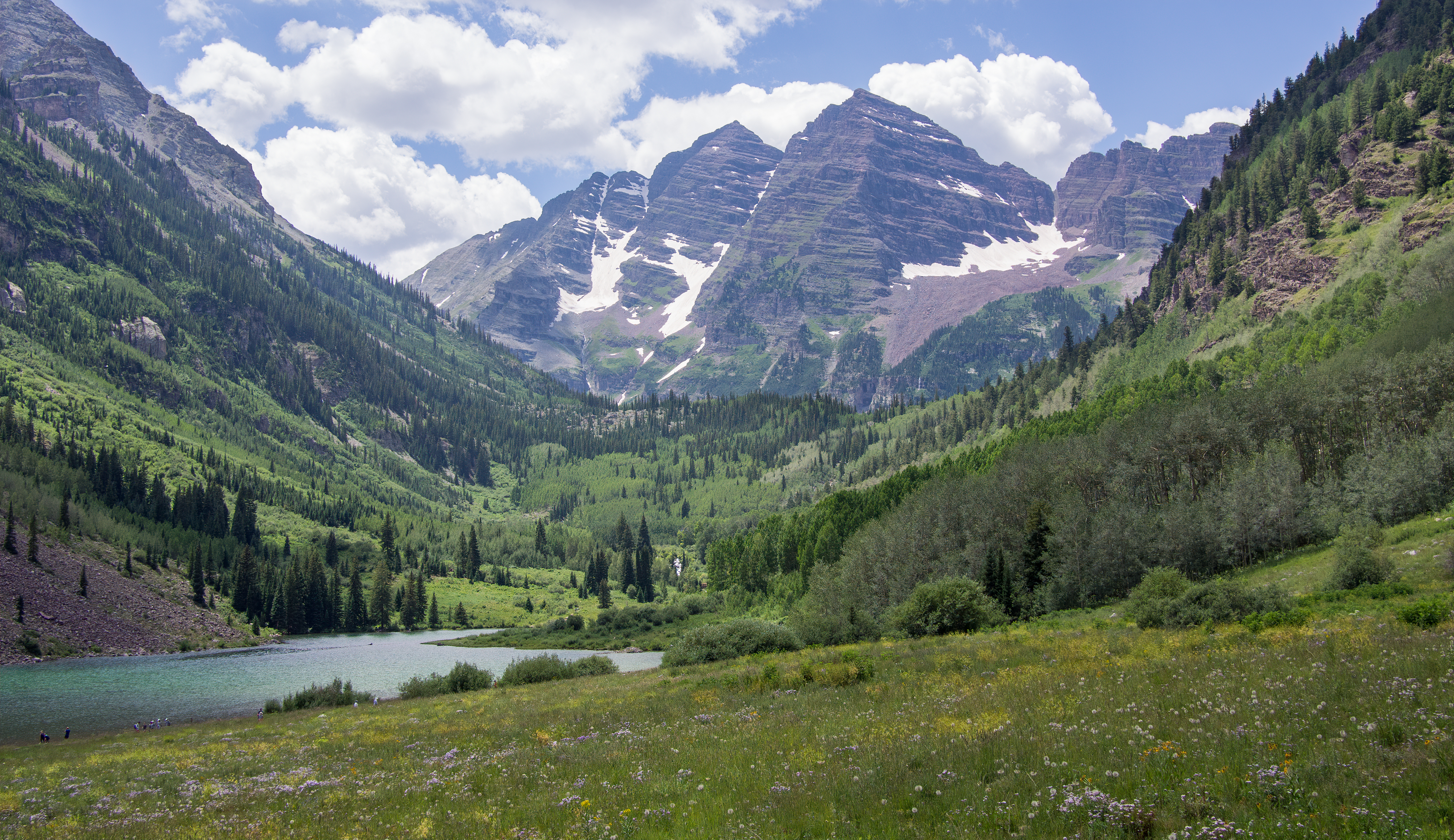
The Maroon Bells are two peaks — Maroon Peak and North Maroon Peak — in the Elk Mountains of Colorado, rising to 4,317 and 4,273 metres respectively.
The reflection of the burgundy-coloured peaks in the still waters of Maroon Lake, particularly in autumn when the surrounding aspen trees turn gold, is one of the classic sights of the American Rockies.
How does it rate
CrowdsRomanceCash RequiredDangerAccessibilityWhy you should go
The autumn reflection of the Maroon Bells in Maroon Lake, with the aspens turning gold around the shoreline, is one of the great landscape photographs of the American West.
Why you shouldn't go
Access by private vehicle is restricted and requires a shuttle bus from Aspen; the autumn season brings the most colour but also the most visitors.
Plan your visit
Best time to visitLate September for aspen gold, or July for wildflowersBest time of daySunrise for the reflection in Maroon Lake before wind picks upGetting thereShuttle bus required from Aspen Highlands in peak seasonEntry costShuttle/entry fee ~$10-16Time needed2-3 hoursInsider tip — Early shuttle reservations sell out; book ahead for the classic still-water reflection shot -
 #791 /100
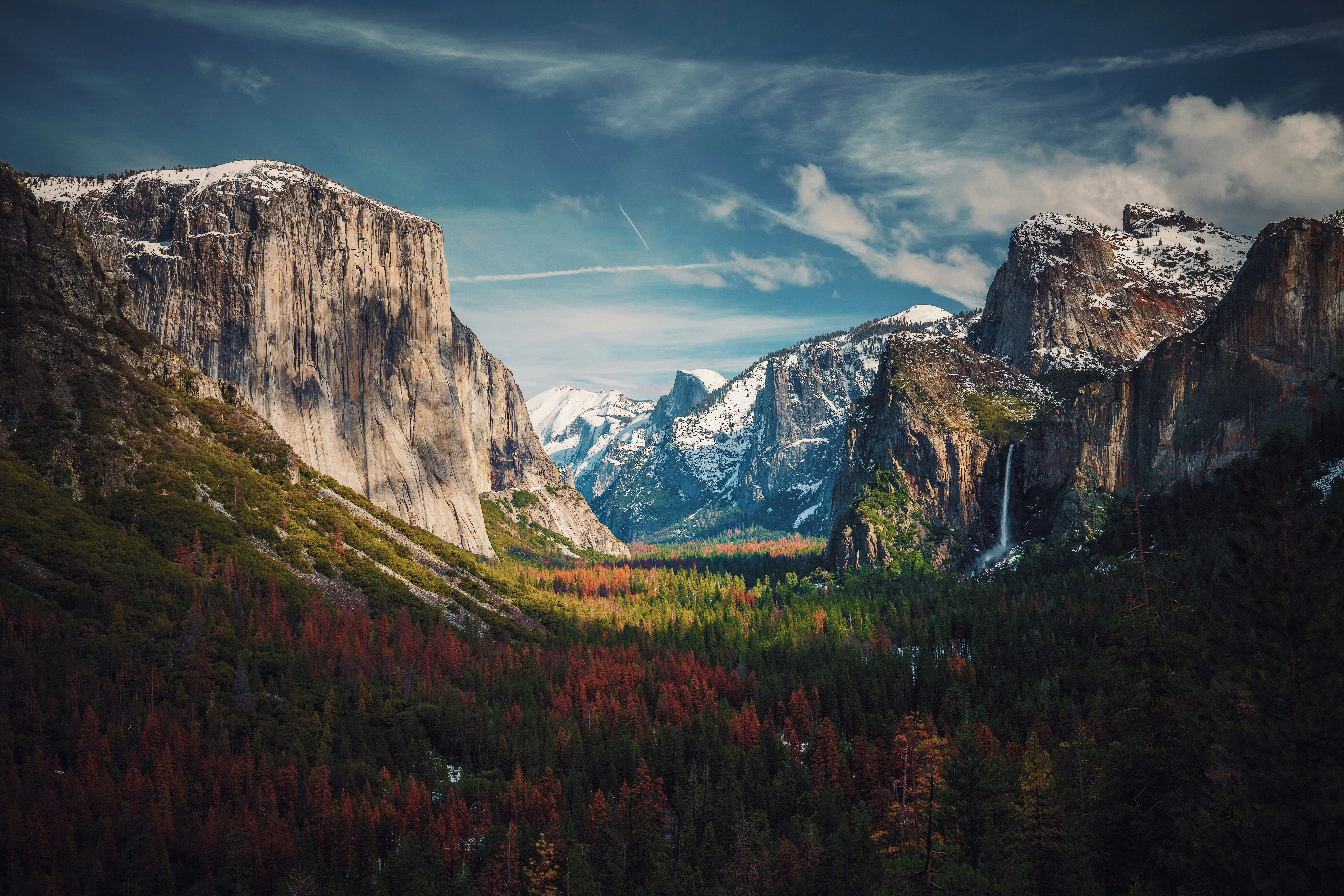
Yosemite Valley is a granite gorge cut by glaciers, with El Capitan and Half Dome rising thousands of feet above the valley floor and waterfalls dropping straight off the rim.
Beyond the valley, the park holds giant sequoia groves, alpine meadows, and high-country lakes reached by the seasonal Tioga Road.
It's one of the birthplaces of American rock climbing, and climbers on El Capitan's face are visible from the valley floor with binoculars.
How does it rate
CrowdsRomanceCash RequiredDangerAccessibilityWhy you should go
Few places pack granite cliffs, giant sequoias, and waterfalls into one valley visible from a single viewpoint.
Why you shouldn't go
Yosemite Valley's roads gridlock in summer, and a timed-entry reservation is often required.
Plan your visit
Best time to visitMay-June for waterfalls at full flow, or September for thinner crowds.Best time of daySunrise at Tunnel View for the valley before the roads fill up.Getting thereFly to Fresno or San Francisco; roughly 2.5-4 hour drive to the valley.Entry cost$35 per vehicle, valid 7 daysTime needed2-3 daysInsider tip — Book the free valley shuttle instead of driving once inside the park - parking fills by mid-morning. -
 #891 /100
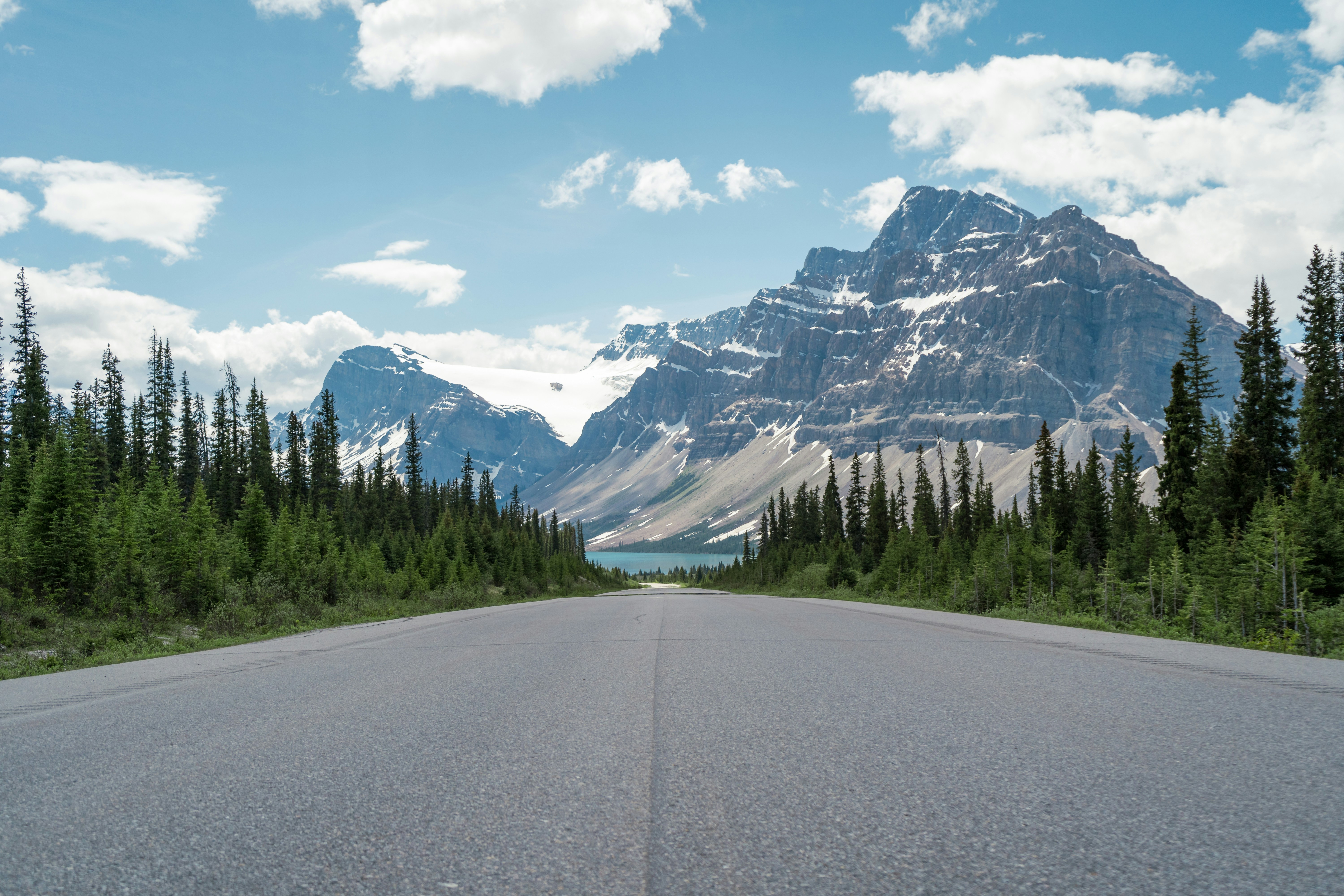
The Icefields Parkway runs 232 kilometres between Lake Louise and Jasper through the Canadian Rockies, tracing the Continental Divide past turquoise lakes, hanging glaciers, and the vast Columbia Icefield.
Peyto Lake's overlook and the Athabasca Glacier, reachable on foot or by ice-explorer vehicle, are signature stops, while roadside pullouts deliver mountain views throughout.
Bears and bighorn sheep often appear near the road at dawn and dusk.
How does it rate
CrowdsRomanceCash RequiredDangerAccessibilityWhy you should go
Turquoise glacial lakes and hanging glaciers visible almost continuously for the entire drive.
Why you shouldn't go
Requires a Parks Canada pass, and summer traffic clogs the popular pullouts and Athabasca Glacier lot.
Plan your visit
Best time to visitLate June through September, when the road is clear of snow and ice and all viewpoints are open.Best time of dayEarly morning for calm lake reflections and the best chance of spotting wildlife.Getting thereFly into Calgary, drive to Lake Louise, and pick up Highway 93 north toward Jasper.Entry costParks Canada day pass required, around CAD 22 per adultTime needed1 day drive, 2-3 with stops and hikesBookingBook ahead →Insider tip — Stop at Peyto Lake in early morning before tour buses fill the viewpoint, and check Parks Canada's site for wildlife closures before setting off. -
 #990 /100
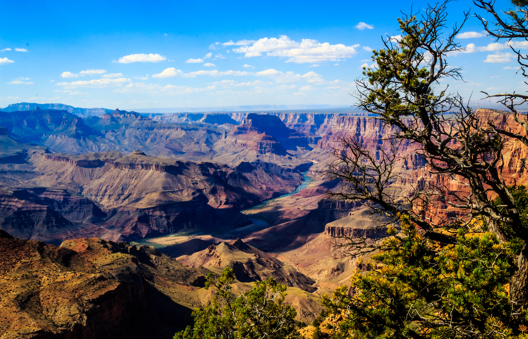
The Grand Canyon is one of the world's great natural wonders — 446 kilometres long, up to 29 kilometres wide, and over 1,800 metres deep, carved over millions of years by the Colorado River.
The layered bands of red rock reveal two billion years of geological history and glow with extraordinary colour at sunrise and sunset.
How does it rate
CrowdsRomanceCash RequiredDangerAccessibilityWhy you should go
The scale of the Grand Canyon is simply incomprehensible until you stand at the rim; the light at golden hour transforms the canyon into something that seems to glow from within.
Why you shouldn't go
The South Rim is very crowded and the most dramatic inner canyon viewpoints require strenuous and potentially dangerous hikes in extreme heat.
Plan your visit
Best time to visitMarch-May or September-NovemberBest time of daySunrise or sunset for the canyon's changing coloursGetting thereFly to Phoenix or Las Vegas, then drive (~3.5-4.5hrs to South Rim)Entry cost~$35/vehicle park entryTime needed1-2 daysInsider tip — The South Rim has the easiest access; go for sunset specifically at Hopi Point -
 #1089 /100
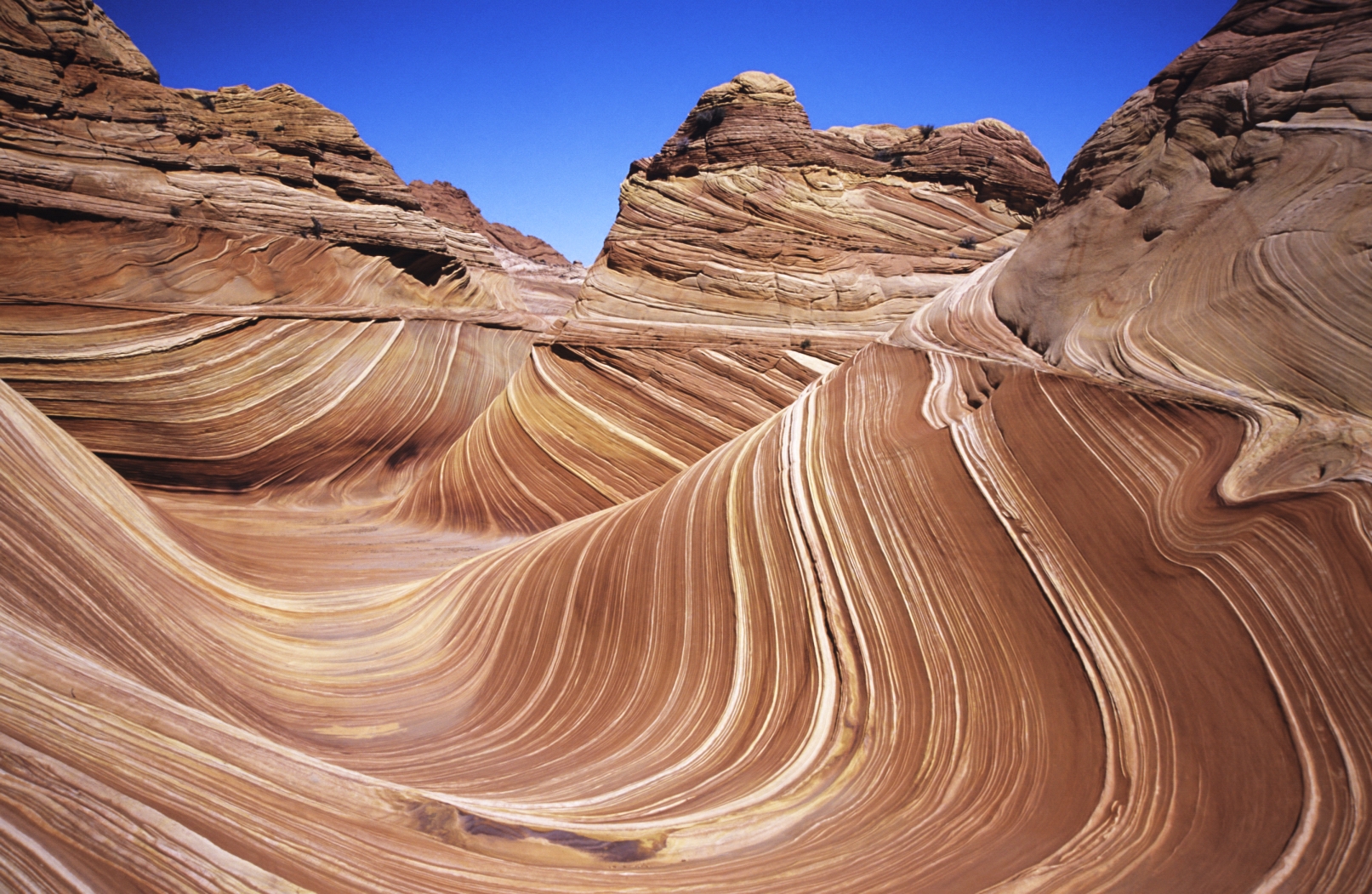
The Wave is a sandstone rock formation in the Coyote Buttes area of the Paria Canyon-Vermilion Cliffs Wilderness in Arizona, famous for its colourful, undulating forms created by 190-million-year-old Jurassic sand dunes.
The swirling bands of red, orange, and pink sandstone make it one of the world's most extraordinary geological formations.
How does it rate
CrowdsRomanceCash RequiredDangerAccessibilityWhy you should go
The Wave's swirling, almost liquid-looking sandstone surface is genuinely unlike anything else on earth; photographed in good light it is one of nature's most abstract landscapes.
Why you shouldn't go
Entry is strictly limited by lottery — only 64 people per day are permitted — and most applicants do not win; the terrain requires navigation skills and has no trail markers.
Plan your visit
Best time to visitMarch-May or September-NovemberBest time of dayMidday for the light bringing out the sandstone coloursGetting thereRemote trailhead near Kanab, Utah; permit requiredEntry costPermit lottery, small feeTime needed5-6 hours round trip hikeInsider tip — Permits are extremely limited via a daily lottery; apply months ahead online -
 #1189 /100
Horseshoe Bend is the Colorado River's most famous U-turn: a sheer 300-metre drop to an emerald river looping around a sandstone butte.
The overlook delivers one of the American Southwest's great views for a 15-minute walk from the car park.
There's no railing along most of the rim, which keeps the vertigo, and the adrenaline, honest.
How does it rate
CrowdsRomanceCash RequiredDangerAccessibilityWhy you should go
A world-class canyon panorama for almost no effort - 15 minutes from car to rim.
Why you shouldn't go
Midday heat is fierce, the rim is largely unfenced, and you'll share sunset with hundreds of tripods.
Plan your visit
Best time to visitMarch-May or September-November for cooler desert weatherBest time of dayLate afternoon, when the sun drops behind the bend and lights the riverGetting thereFly to Page or drive from Flagstaff; US-89 car park, then a 1.2km walkEntry costUS$10 per vehicle parkingTime needed1-2 hoursInsider tip — Bring a wide lens or use panorama mode - the full horseshoe doesn't fit a normal frame from the rim -
 #12
#12Rated #12 of 49
Grand Teton National Park, the United States
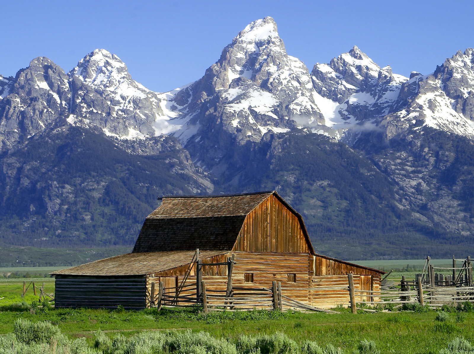
#grandtetonnationalpark ◆ National Parks88 /100The Teton Range rises abruptly and without foothills from the flat valley floor of Jackson Hole, creating one of the most dramatic mountain frontages in the Americas.
Below it, the Snake River, a chain of glacial lakes and open sagebrush flats hold moose, elk, bison and both black and grizzly bears.
Trails range from flat lakeshore loops to serious alpine climbs within the same few miles of road.
How does it rate
CrowdsRomanceCash RequiredDangerAccessibilityWhy you should go
The Tetons rising directly from the valley floor create an unobstructed mountain wall that produces some of America's most dramatic landscape photographs.
Why you shouldn't go
Wildlife watching opportunities are excellent but not guaranteed; the park is large and distances between key viewpoints are significant.
Plan your visit
Best time to visitJune-SeptemberBest time of daySunrise at Schwabacher Landing or Oxbow Bend for reflectionsGetting thereFly to Jackson Hole AirportEntry costPark pass ~$35/vehicleTime needed2-3 daysInsider tip — Oxbow Bend at dawn gives the classic Teton reflection shot, especially with autumn colour -
 #1387 /100
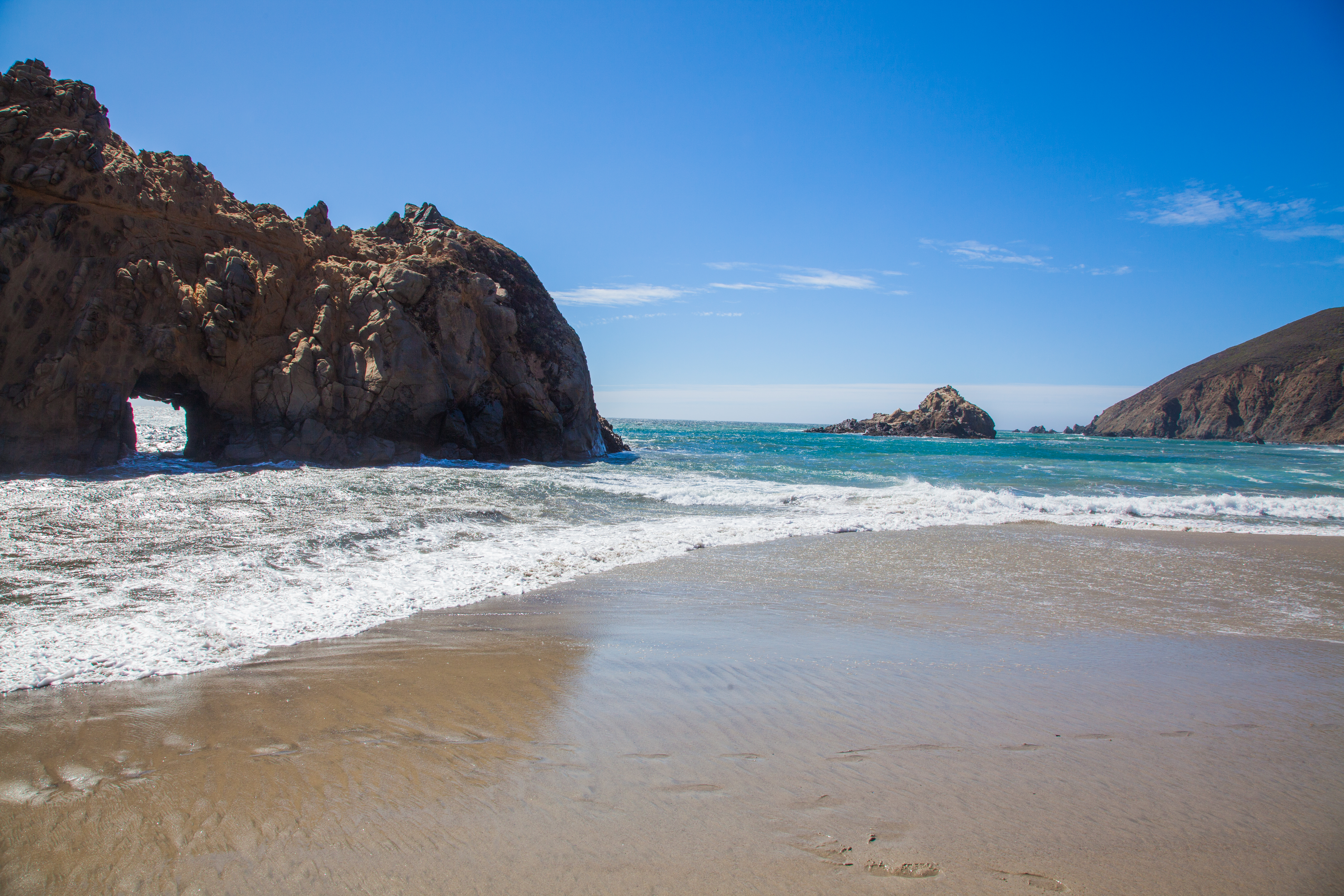
Pfeiffer Beach in Big Sur is a dramatic California coastline beach famous for its purple-tinged sand, caused by manganese garnet washed down from the surrounding hillsides, and for Keyhole Rock — a sea arch through which the setting sun shines in spectacular alignment during November and December.
How does it rate
CrowdsRomanceCash RequiredDangerAccessibilityWhy you should go
The combination of purple sand, dramatic sea stacks, crashing Pacific waves, and the winter Keyhole Rock sunset alignment make Pfeiffer Beach one of California's most unique coastal spots.
Why you shouldn't go
The access road is extremely narrow and closes when the small car park fills; the purple sand only covers part of the beach and the Keyhole Rock sunset alignment only occurs in winter.
Plan your visit
Best time to visitDecember-February for the Keyhole Arch light phenomenonBest time of daySunset, especially in winter when the sun aligns with the archGetting thereUnmarked turnoff on Highway 1, Big SurEntry cost~$12 parking feeTime needed1-2 hoursInsider tip — The purple sand (from manganese garnet) is most visible after rain -
 #1487 /100
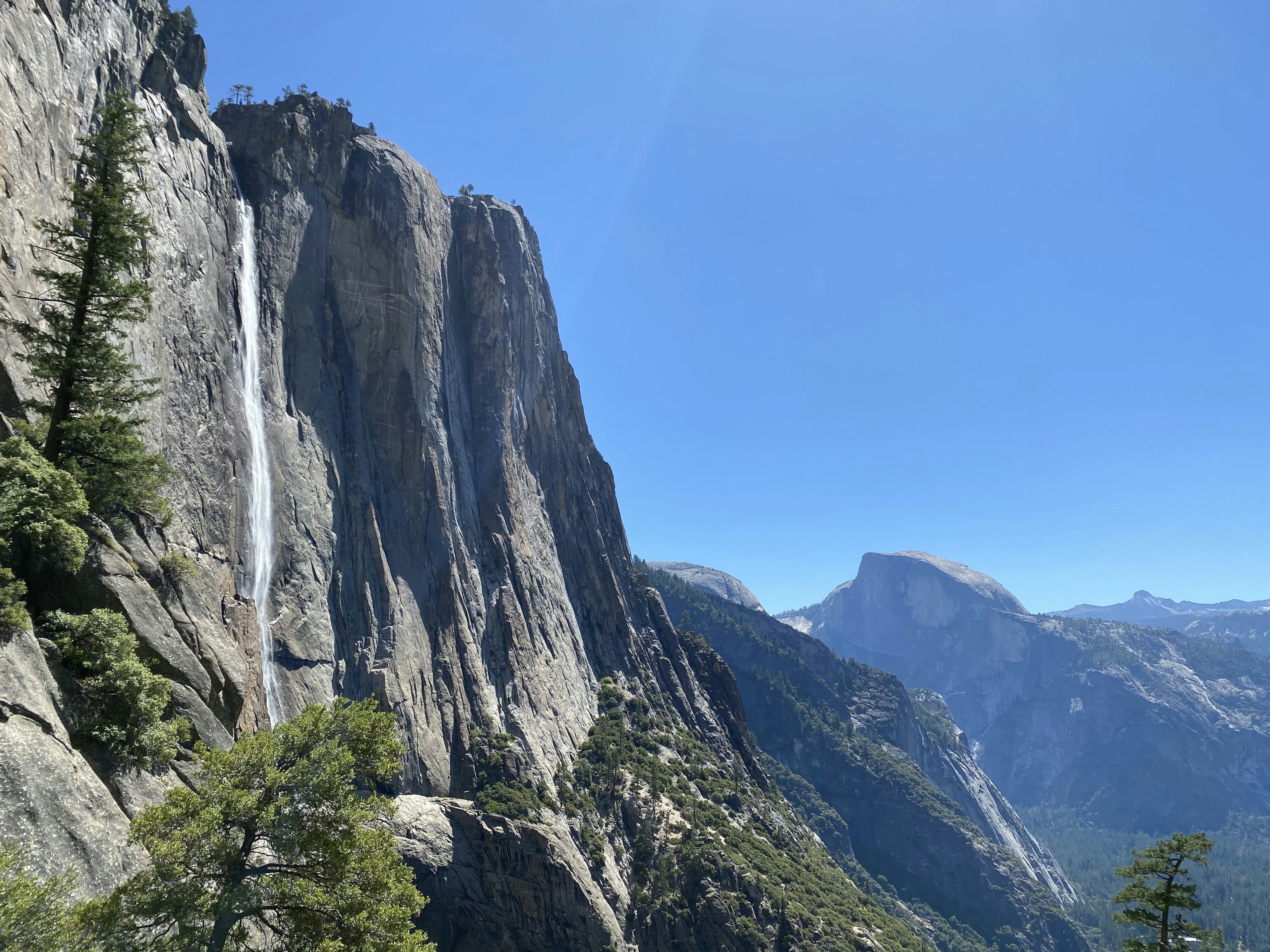
North America's tallest waterfall drops in three tiers down a granite cliff face in Yosemite Valley, at its thunderous peak each spring when snowmelt sends it roaring.
By late summer it can slow to a trickle or vanish entirely, so timing genuinely changes what you see.
The valley floor meadow below offers an open, unobstructed view, with El Capitan and Half Dome in sight at the same time.
How does it rate
CrowdsRomanceCash RequiredDangerAccessibilityWhy you should go
North America's tallest waterfall, framed by two of Yosemite's other icons in a single shot.
Why you shouldn't go
The falls often dry up completely by late summer - arrive in the wrong month and there's nothing to see.
Plan your visit
Best time to visitApril-June, during peak snowmelt; often dry by August-October.Best time of dayMorning, before Yosemite Valley's parking and crowds peak.Getting thereFly to Fresno or San Francisco; drive into Yosemite Valley (no rail or bus to the park itself).Entry costYosemite National Park entry fee; the falls viewpoint itself is free.Time needed1-2 hours from the valley floorBookingBook ahead →Insider tip — Check the park's waterfall flow reports online before visiting - timing a trip around peak snowmelt matters more here than at almost any other major waterfall. -
 #1587 /100
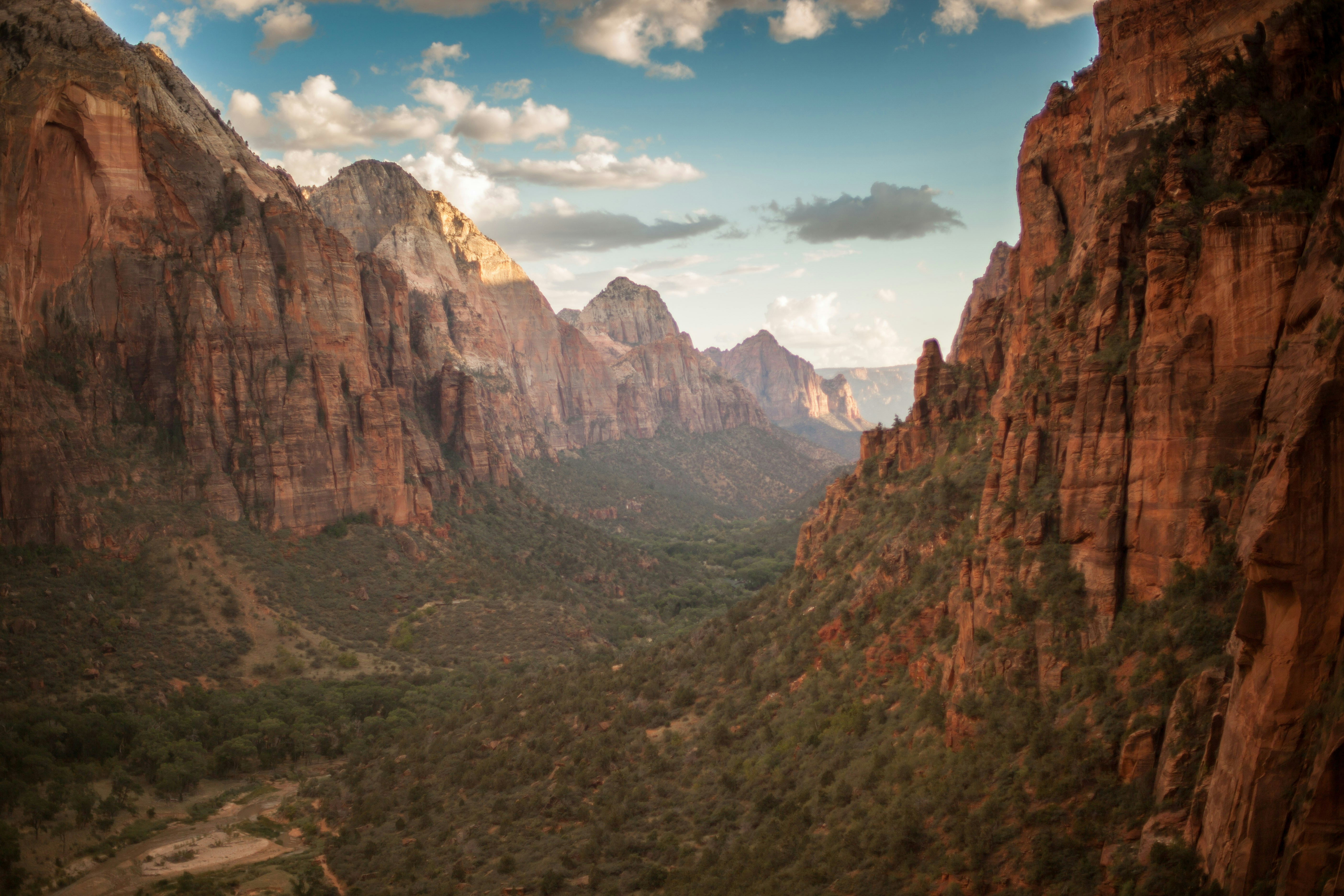
Zion's main canyon is a half-mile-deep slot of red and cream sandstone carved by the Virgin River, with the Narrows letting visitors wade upriver between walls that close in overhead.
The valley floor is reached only by a free shuttle in peak season, keeping the canyon quieter than the crowded parking lots suggest.
Angels Landing's chained final pitch is the park's signature scramble, but most of the canyon is accessible on flat paved trails.
How does it rate
CrowdsRomanceCash RequiredDangerAccessibilityWhy you should go
A narrow, towering sandstone canyon you can wade straight up the middle of via the Virgin River.
Why you shouldn't go
Angels Landing needs a lottery permit, and summer flash-flood risk can close the Narrows without notice.
Plan your visit
Best time to visitApril-May or September-October, avoiding summer flash-flood season and winter Narrows closures.Best time of dayEarly morning shuttle to beat both the heat and the crowds at the canyon trailheads.Getting thereFly to Las Vegas; roughly 2.5 hour drive to the park entrance at Springdale.Entry cost$35 per vehicle, valid 7 daysTime needed1-2 daysInsider tip — Rent canyoneering shoes and a walking stick in Springdale before hiking the Narrows - the river rocks are slick. -
 #1687 /100
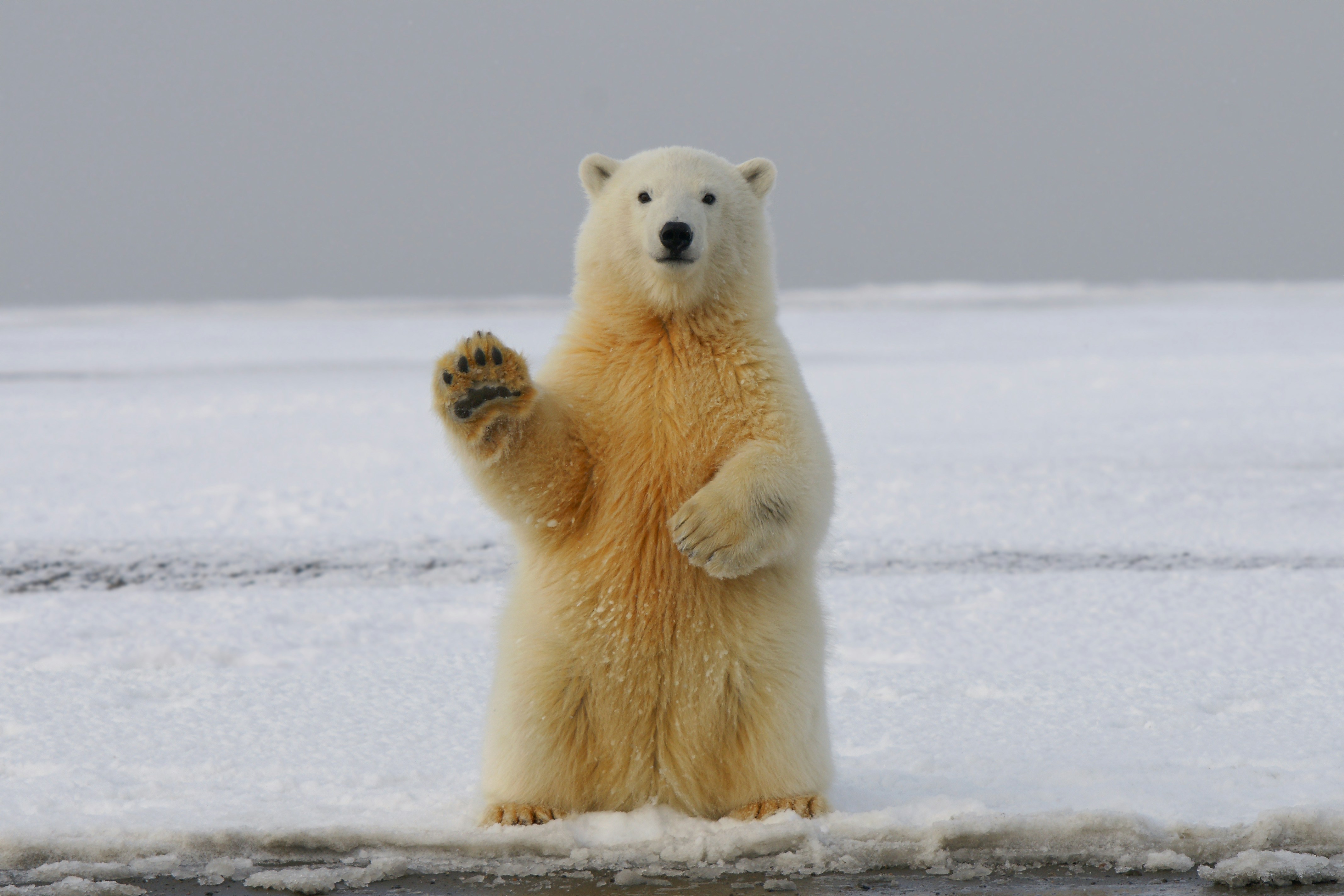
A sub-Arctic town on the Hudson Bay coast known as the polar bear capital of the world, where bears gather each autumn waiting for the sea ice to freeze.
Specially built tundra vehicles bring visitors safely within metres of wild bears, and the same stretch of coast offers beluga whale watching in summer and reliable northern lights viewing in winter.
No road connects Churchill to the rest of Manitoba.
How does it rate
CrowdsRomanceCash RequiredDangerAccessibilityWhy you should go
The most reliable place on Earth to see wild polar bears up close, from the safety of a purpose-built tundra vehicle.
Why you shouldn't go
Only reachable by plane or a two-day train; peak-season tours routinely cost thousands of dollars.
Plan your visit
Best time to visitLate October to mid-November for polar bears; July-August for beluga whales; Jan-March for auroraBest time of dayDaylight hours for bear viewing; clear, moonless nights for the northern lightsGetting thereFly from Winnipeg (about 2 hours) or take the 2-day VIA Rail train; no roads connect Churchill to the rest of Manitoba.Entry costTundra buggy tours from around CA$400/day; multi-day packages often CA$3,000+Time needed3-5 days for a bear-viewing tripBookingBook ahead →Insider tip — Book tundra buggy tours many months ahead for the first two weeks of November, when bear numbers along the coast are highest; shoulder-season dates are cheaper but far less certain. -
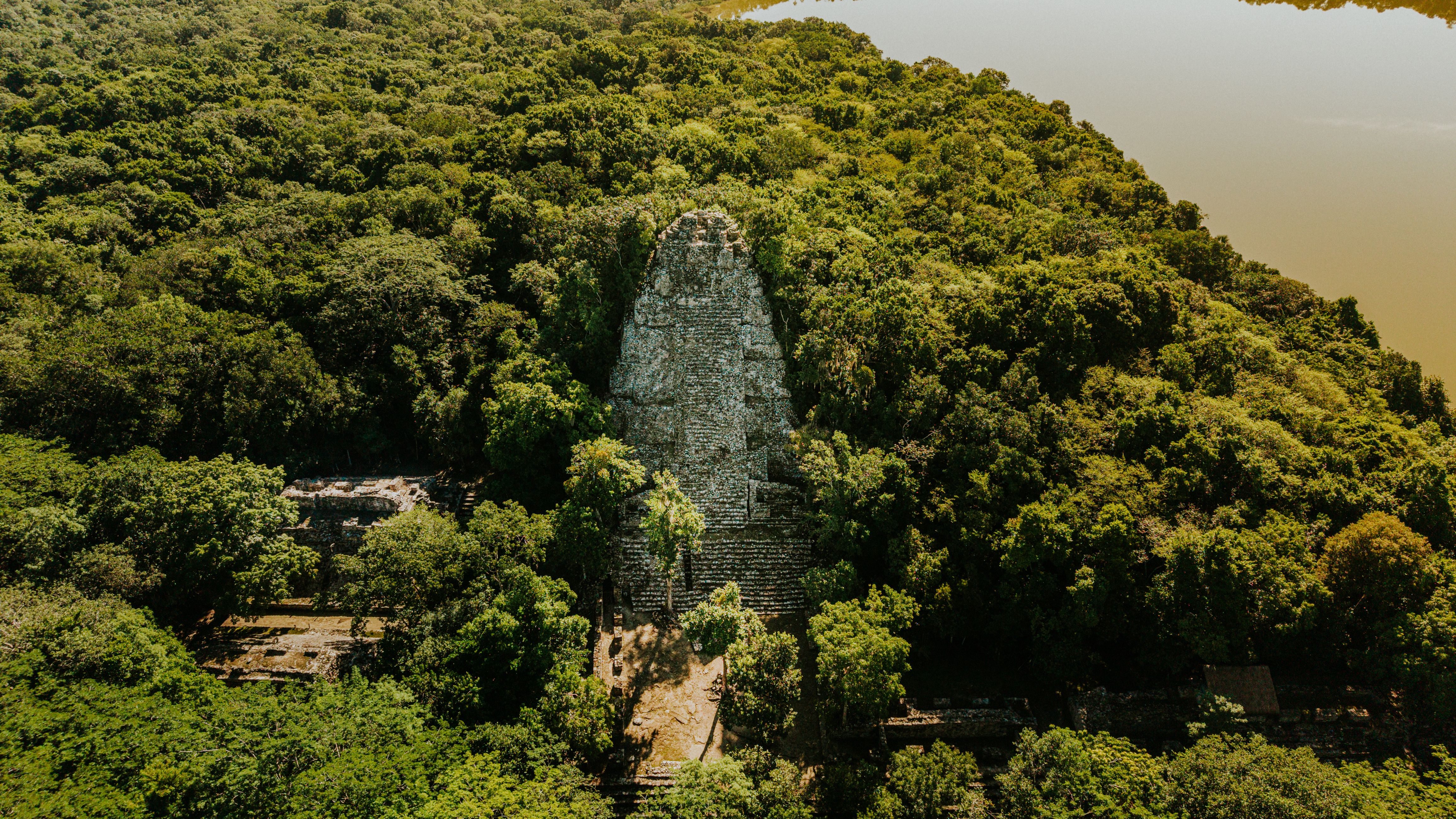 #1786 /100
Towering limestone pyramids rise straight out of dense rainforest canopy at this former Maya city-state, once home to an estimated 90,000 people at its peak around 800 CE.
Howler monkeys and toucans fill the surrounding jungle, and climbing Temple IV at dawn puts visitors above the canopy to watch other temple roofs emerge from mist.
Far less restored than Mexico's Chichen Itza, Tikal feels genuinely like a lost city rather than a manicured park.
How does it rate
CrowdsRomanceCash RequiredDangerAccessibilityWhy you should go
Maya pyramids rising straight out of jungle canopy, with a genuinely spectacular sunrise view from Temple IV.
Why you shouldn't go
Reaching the site requires a flight or long drive to the remote Petén region, adding real travel time.
Plan your visit
Best time to visitNovember–April, the dry season, for easier jungle trail conditions.Best time of daySunrise from Temple IV, above the canopy before day-trip crowds arrive.Getting thereFly to Flores, then about 1 hour's drive to the park entrance.Entry costAround Q150 (~€18) for standard entry, plus extra for the sunrise access permit.Time neededFull day, or a sunrise-to-sunset day for the complete site.Insider tip — Pay the extra sunrise-access fee and enter before official opening — the pre-dawn canopy view from Temple IV is worth arranging in advance. -
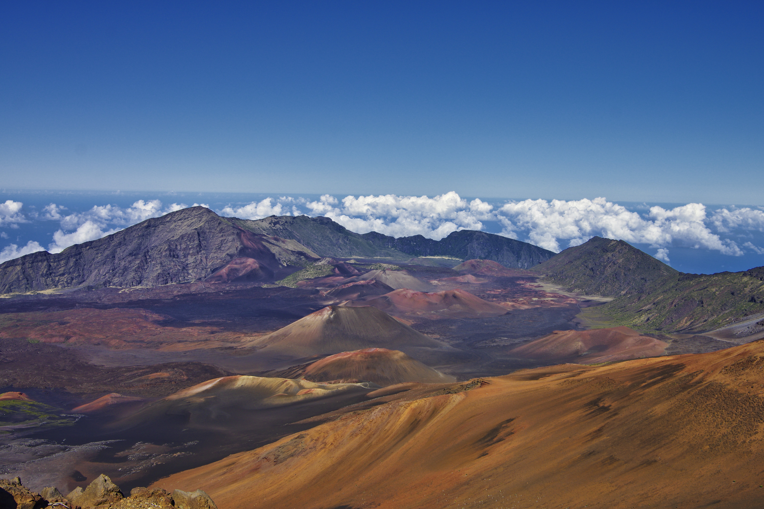 #1885 /100
Haleakala's summit on Maui sits at 3,055 metres above sea level, placing it above the clouds for one of the world's most famous sunrise experiences.
The volcanic crater contains a moonlike landscape of cinder cones and lava flows extending 11 kilometres across and 800 metres deep.
How does it rate
CrowdsRomanceCash RequiredDangerAccessibilityWhy you should go
Watching the sun rise above the clouds from the summit crater rim is a spiritual experience; the volcanic landscape below and clouds stretching to the horizon are genuinely awe-inspiring.
Why you shouldn't go
Sunrise viewing requires an advance reservation, you must drive up before 3am, and the summit is bitterly cold even in Hawaiian summer.
Plan your visit
Best time to visitYear-roundBest time of daySunrise (needs advance reservation) or sunsetGetting there~1.5-2hr drive from Kahului, MauiEntry costPark entry ~$30/vehicle, sunrise reservation ~$1 extraTime neededHalf dayInsider tip — Book the sunrise reservation weeks ahead; it sells out, and bring warm layers, it is near freezing at the summit -
 #19
#19Rated #19 of 49
Valley of Fire State Park, the United States
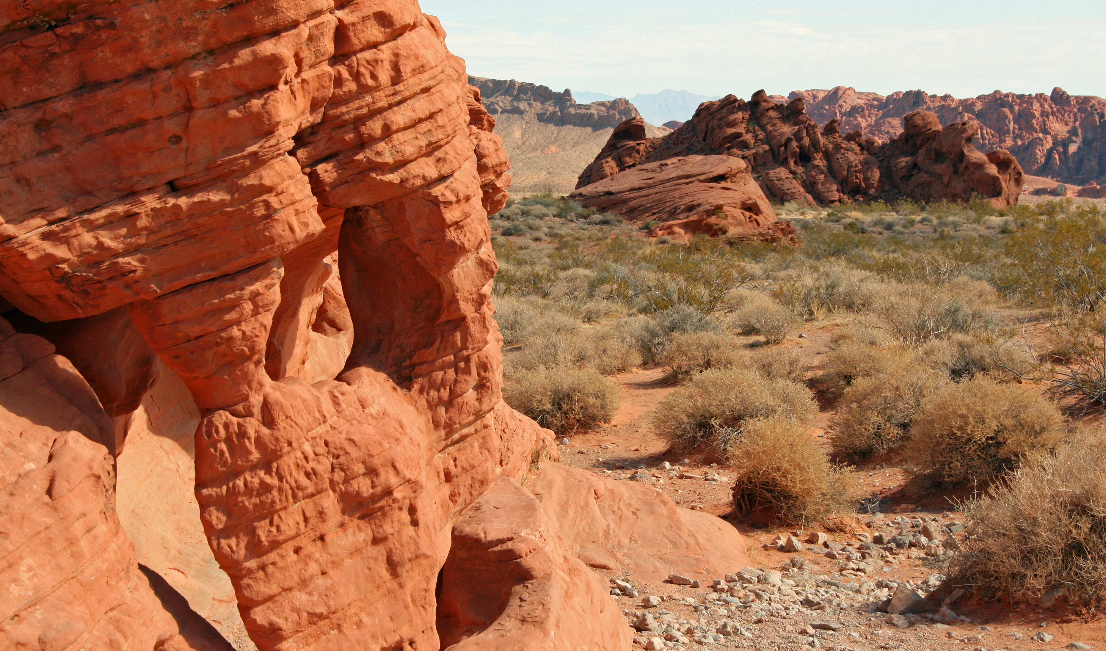
#valleyoffirestatepark ◆ National Parks84 /100The Valley of Fire State Park is Nevada's oldest and largest state park, containing extraordinary formations of bright red Aztec sandstone created from sand dunes 150 million years ago.
The intensely coloured rock glows with particular brilliance at sunrise and sunset when it appears almost to be lit from within.
How does it rate
CrowdsRomanceCash RequiredDangerAccessibilityWhy you should go
The vivid red sandstone formations, particularly at golden hour, create a landscape of extraordinary colour intensity; Wave Rock and Elephant Rock are among the most dramatic formations.
Why you shouldn't go
The park is in the Mojave Desert and temperatures exceed 40 degrees Celsius in summer; it is most accessible as a day trip from Las Vegas but there is limited accommodation within the park.
Plan your visit
Best time to visitOctober-April, avoiding extreme summer heatBest time of daySunrise or sunset when the red sandstone glowsGetting there~1hr drive from Las VegasEntry cost~$15/vehicleTime neededHalf dayInsider tip — Fire Wave formation is the most photographed spot in the park and best lit in late afternoon -
 #20
#20Rated #20 of 49
Alaska Inside Passage Cruise, the United States
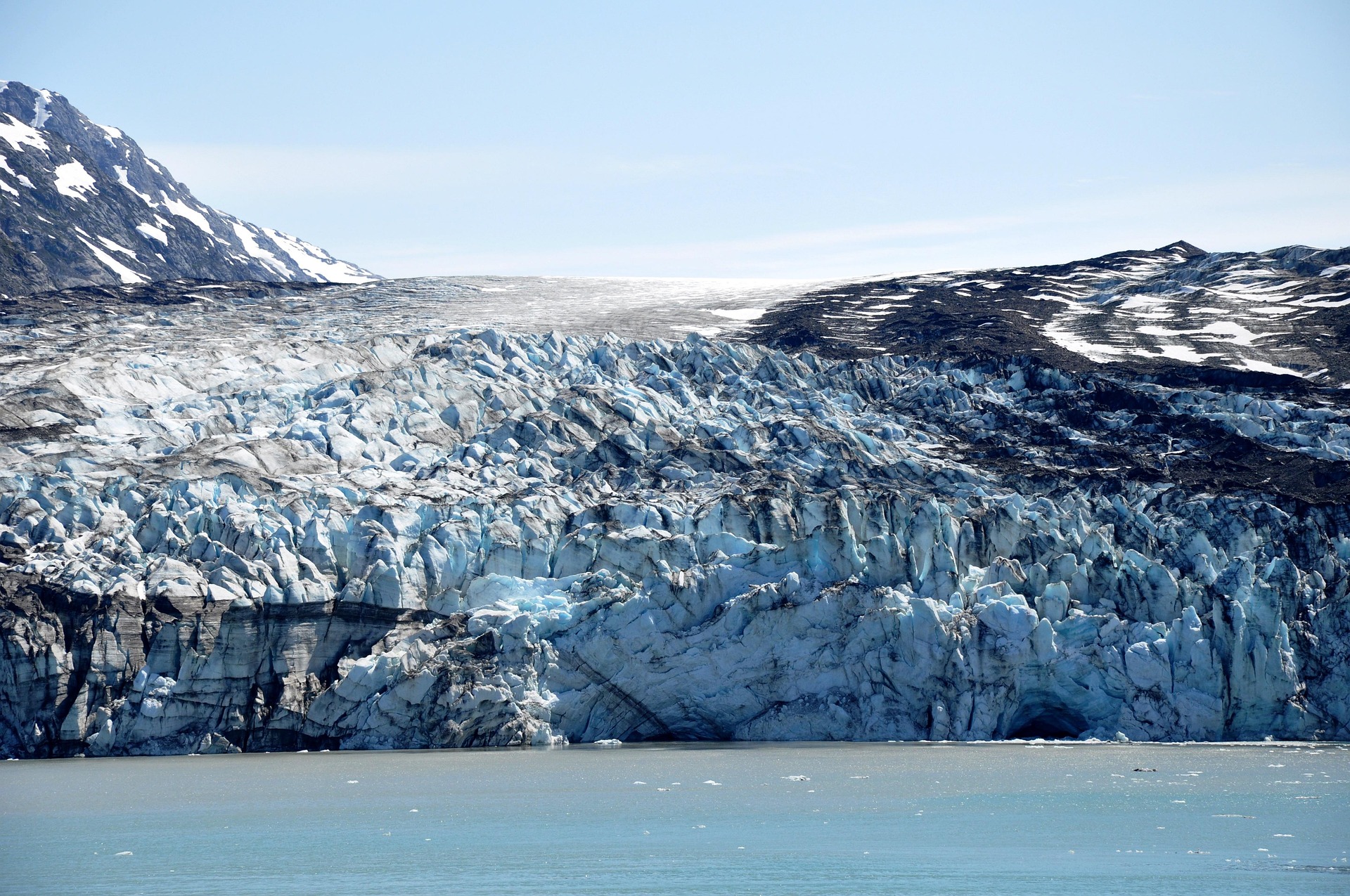
#alaskainsidepassagecruise ◆ Cruises84 /100A week-long sail through Southeast Alaska's fjords, where tidewater glaciers calve into the sea and humpback whales breach beside the ship.
Ports like Juneau, Skagway, and Ketchikan mix gold-rush history with float-plane flightseeing over ice fields.
Bald eagles, sea otters, and porpoises are common sightings from the open deck.
Weather shifts fast, turning misty mornings into golden evening light on snow-capped peaks.
How does it rate
CrowdsRomanceCash RequiredDangerAccessibilityWhy you should go
Glaciers, whales, and snow-capped fjords viewed from the deck without a single long-haul flight of your own.
Why you shouldn't go
Cabin prices spike in peak summer weeks and weather can cancel glacier viewing or shore excursions.
Plan your visit
Best time to visitMid-June to July for the longest daylight and best glacier calving; May and September are cheaper.Best time of dayEarly morning, when glacier fjords are calmest and wildlife is most active.Getting thereFly into Seattle or Vancouver; ships depart from downtown cruise terminals, no further transfer needed.Entry costIndicative $3,500-$6,500pp for a 7-night cruise with excursionsTime needed7-night cruiseInsider tip — Book a balcony cabin on the port (left) side sailing northbound from Vancouver for the best glacier and coastline views; bring binoculars for whale spotting and layer clothing for sudden weather changes. -
 #21
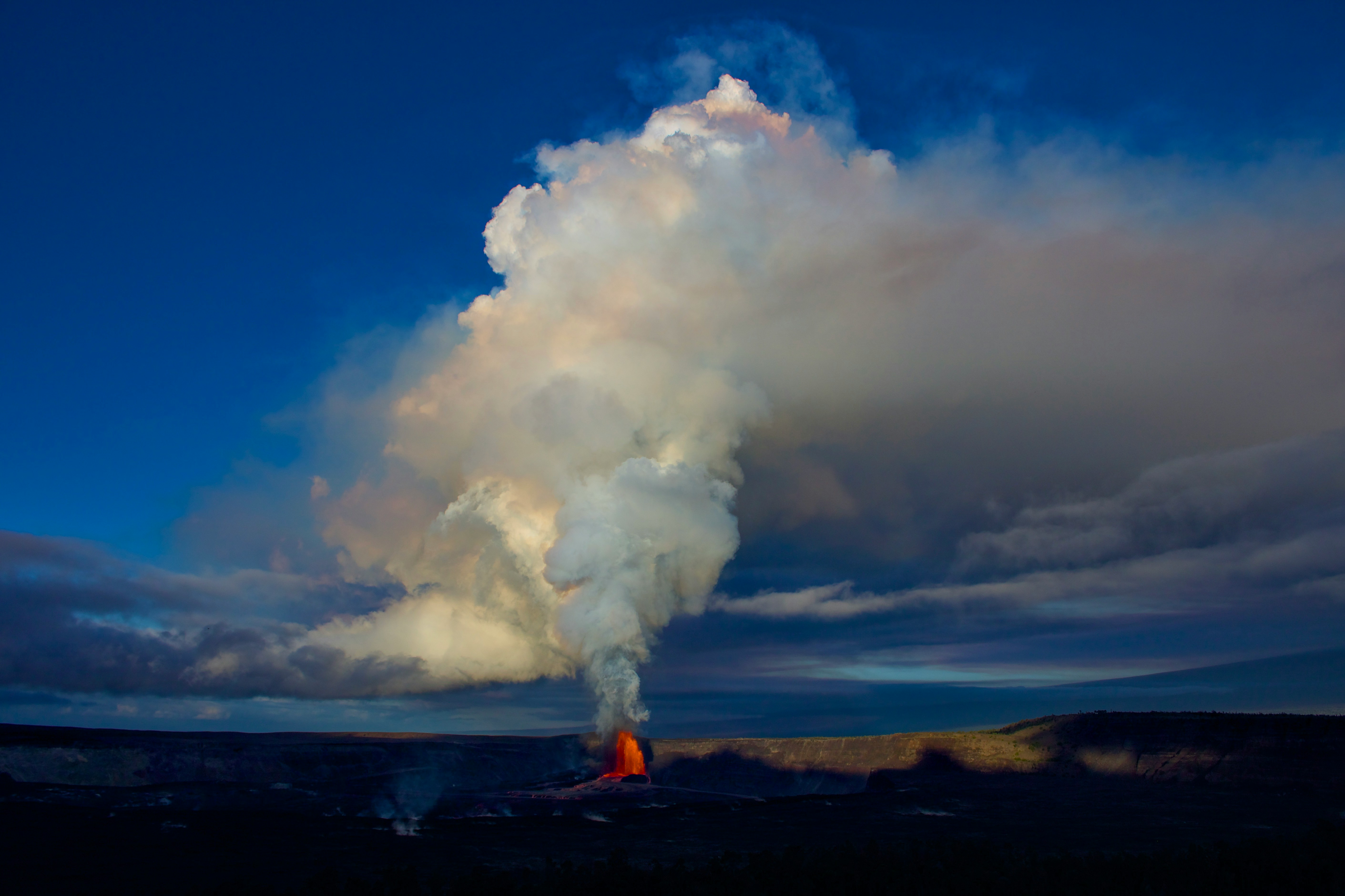
#21One of the world's most active volcanoes, its summit caldera in Hawaii Volcanoes National Park glowing orange against the night sky whenever the current eruption cycle is active.
Well-maintained overlooks and short walking trails let visitors watch the lava lake safely from a respectful distance, while the surrounding park holds steaming vents, lava tube caves, and stark black rock deserts.
Activity is unpredictable, so what's visible changes from month to month, and current status is checked constantly by staff and visitors alike.
How does it rate
CrowdsRomanceCash RequiredDangerAccessibilityWhy you should go
A glowing lava lake visible from safe, easily reached overlooks inside a national park - no technical hiking required.
Why you shouldn't go
Activity is unpredictable and can pause for months at a time, so there's no guarantee of visible lava on any given trip.
Plan your visit
Best time to visitYear-round, but check current eruption status before booking, since visible activity comes and goes.Best time of dayAfter dark, when the glow from the caldera is most dramatic against the night sky.Getting thereFly to Hilo; a 45-minute drive to Hawaii Volcanoes National Park.Entry costNational park entry around USD30 per vehicle (valid 7 days).Time neededHalf a day.BookingBook ahead →Insider tip — Check the USGS Hawaiian Volcano Observatory site before you go - it gives daily updates on whether the crater currently has visible lava. -
 #2283 /100
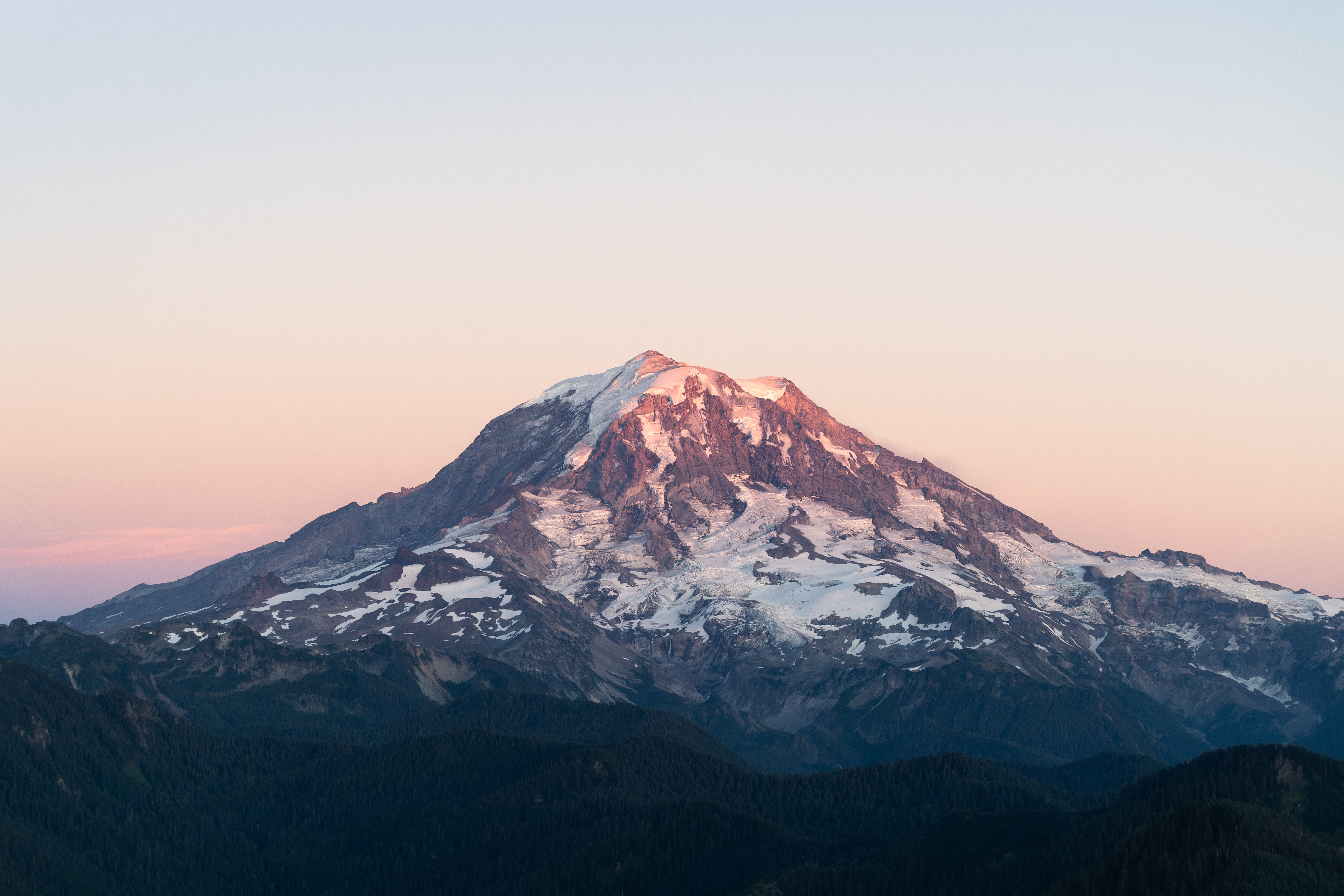
Mount Rainier is an active stratovolcano rising 4,392 metres above the Puget Sound lowlands of Washington State, making it the most topographically prominent peak in the contiguous United States.
In summer, its slopes are carpeted with wildflower meadows and it is reflected in the lakes of Paradise and Reflection Lakes.
How does it rate
CrowdsRomanceCash RequiredDangerAccessibilityWhy you should go
The wildflower meadows around Paradise in midsummer, with the glacier-clad volcano rising above, offer some of the most beautiful subalpine scenery in America.
Why you shouldn't go
Mount Rainier is frequently obscured by cloud or fog and the park roads close from October to May due to snow; summit attempts require technical mountaineering skills.
Plan your visit
Best time to visitJuly-September (wildflower season, most trails snow-free)Best time of daySunrise from Reflection Lakes for a mirror image of the peakGetting there~1.5-2hr drive from SeattleEntry costPark entry ~$30/vehicleTime neededFull dayInsider tip — Reflection Lakes needs a calm, windless morning; check conditions before making the early drive -
 #2383 /100
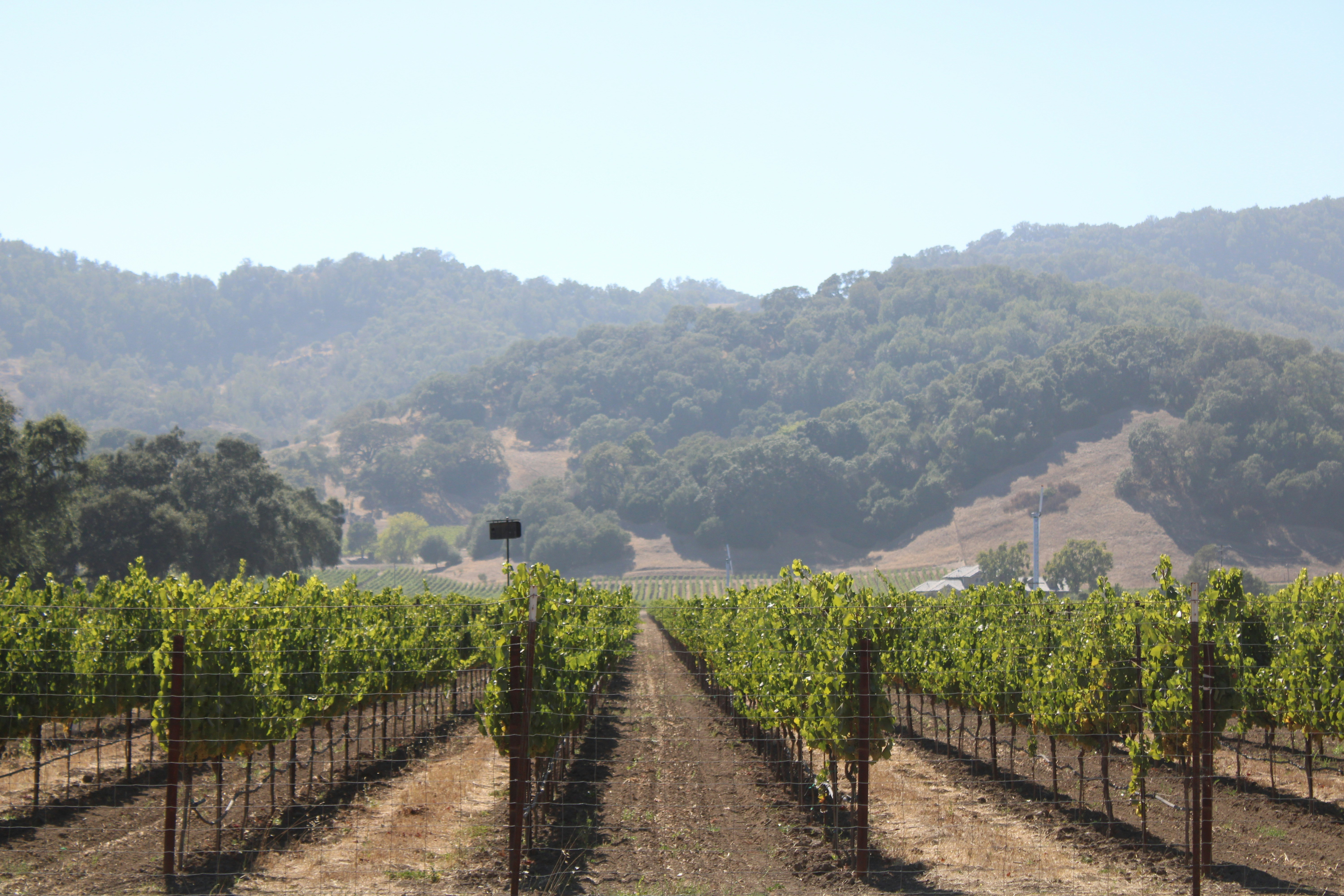
An hour north of San Francisco, Napa Valley packs over 400 wineries into a 30-mile stretch of the Mayacamas and Vaca mountain ranges, from grand chateau-style estates to small family vineyards.
Cabernet Sauvignon put the valley on the world wine map after it beat top French labels at the 1976 Judgment of Paris blind tasting.
How does it rate
CrowdsRomanceCash RequiredDangerAccessibilityWhy you should go
400-plus wineries across 30 miles of valley, the American wine region that famously beat France's best in a blind tasting.
Why you shouldn't go
Tasting fees and restaurant prices are among the highest of any wine region in the world, and summer weekends get heavily booked.
Plan your visit
Best time to visitSeptember-October, during harvest season when vineyards are at their most active and photogenic.Best time of dayLate afternoon, when golden light hits the valley's vine rows and hillsides.Getting thereFly into San Francisco or Oakland, then a roughly 1-1.5 hour drive north to the valley.Entry costTasting fees typically run USD40-75 per winery, waived with a bottle purchase at some.Time neededA full day for a few wineries, or several for a proper wine country trip.Insider tip — Book tastings in advance at smaller family wineries, which often require appointments and offer a far less rushed experience than the big-name estates. -
 #2483 /100
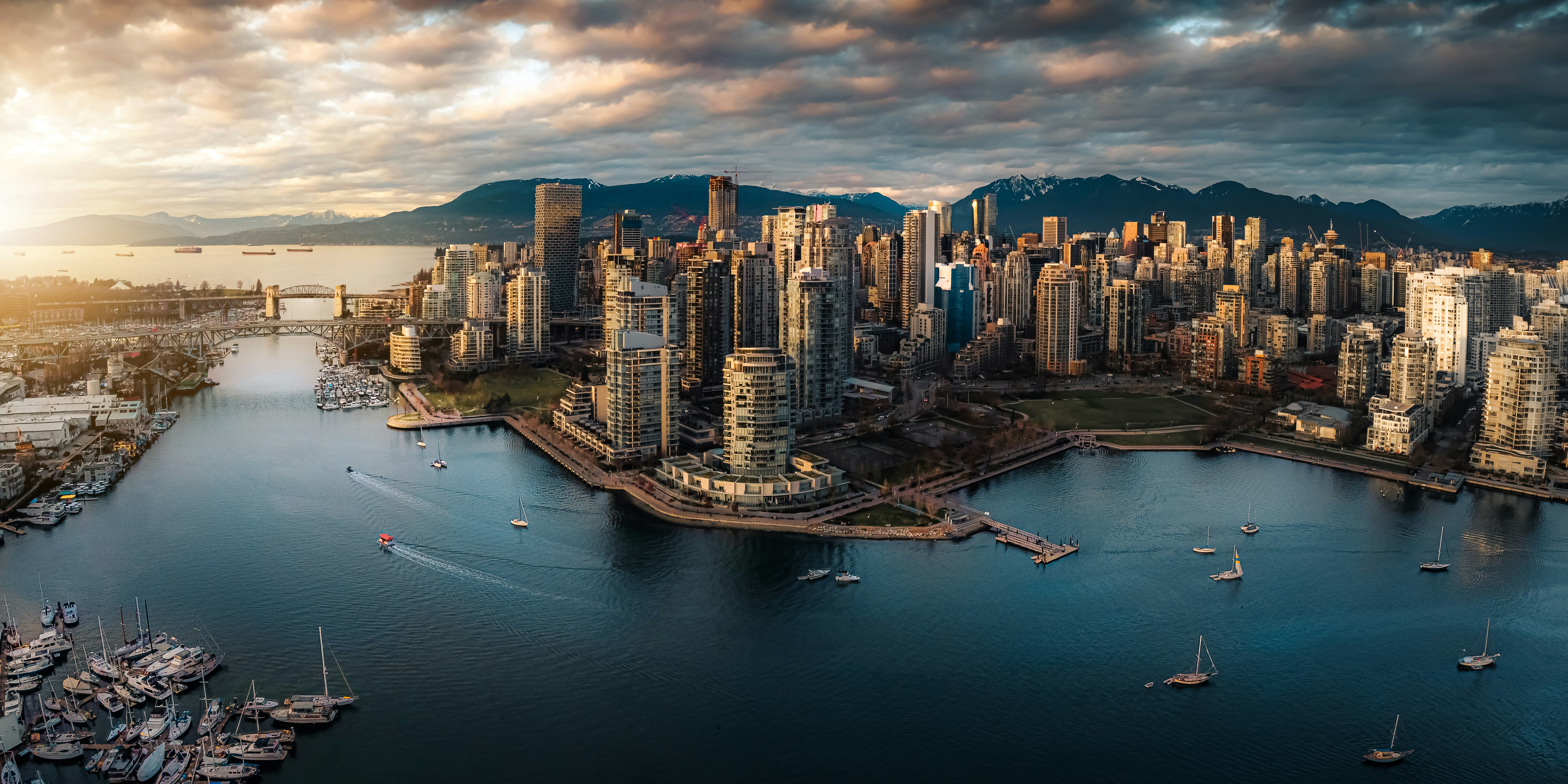
A glass-towered harbour city wedged between the Coast Mountains and the Pacific, where downtown ends abruptly at the seawall and North Shore peaks rise directly across the water.
Stanley Park's rainforest and shoreline path wrap the downtown peninsula, while Granville Island's public market sits a short ferry hop across False Creek.
Vancouver pairs an outdoor-focused lifestyle with skiing, hiking and beaches within a short drive of downtown.
How does it rate
CrowdsRomanceCash RequiredDangerAccessibilityWhy you should go
A compact downtown where mountains, ocean and rainforest are all within walking distance of the office towers.
Why you shouldn't go
One of the most expensive cities in North America for both accommodation and everyday costs.
Plan your visit
Best time to visitJune-September for reliably dry weather; ski season runs December-March on the North Shore mountainsBest time of dayLate afternoon on the seawall for sunset over English BayGetting thereFly into Vancouver International Airport (YVR); the Canada Line train connects the airport to downtown in about 25 minutes.Entry costFree to explore; individual attractions and transit charge separatelyTime needed3-4 daysInsider tip — Rent a bike and ride the Stanley Park seawall counter-clockwise in the early morning before the path fills with pedestrians and tour groups. -
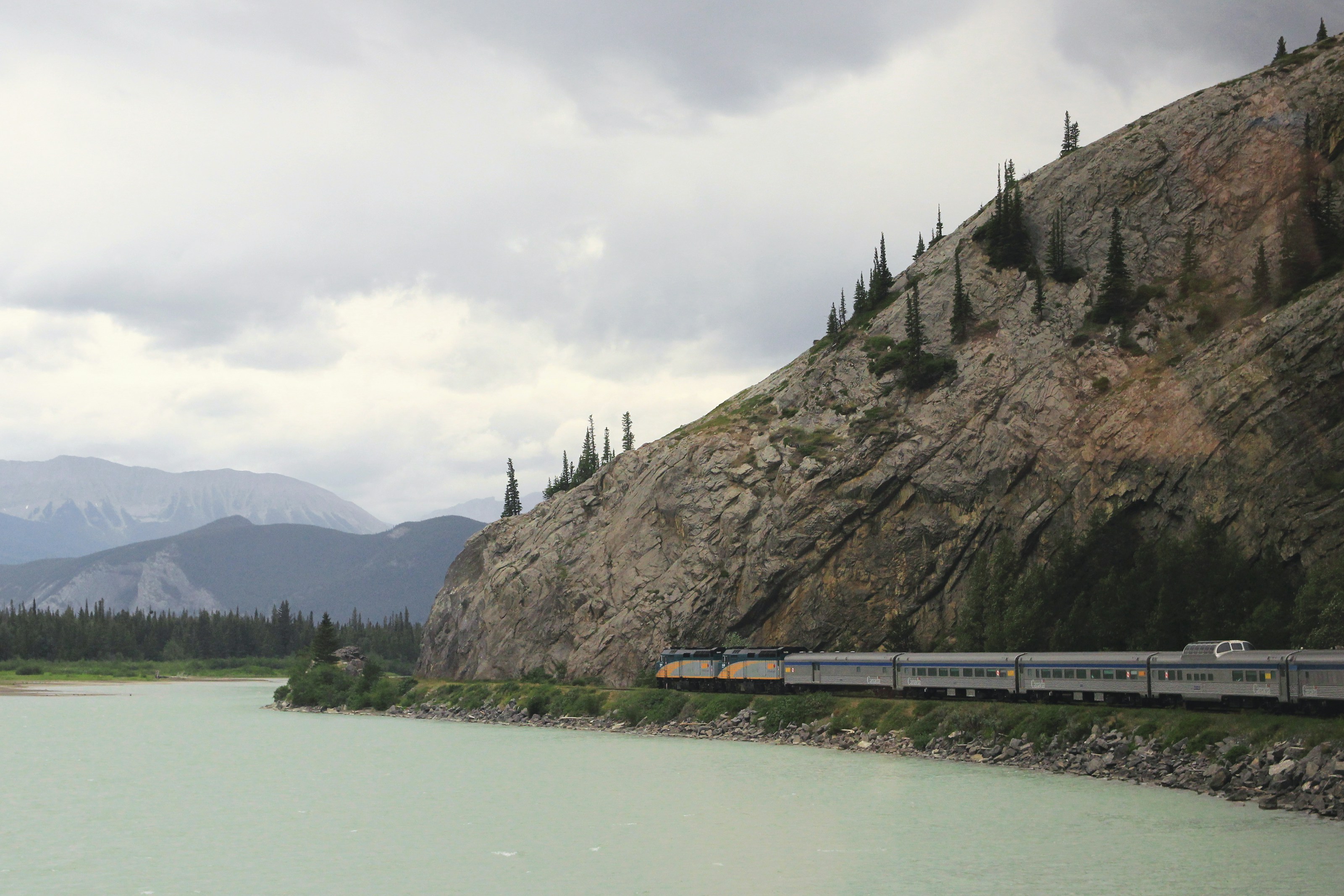 #2580 /100
VIA Rail's transcontinental flagship crosses Canada in four days aboard 1950s stainless-steel dome cars, from Toronto through the Canadian Shield and prairies into the Rockies at Vancouver.
Glass-domed Park cars let passengers watch scenery from above the roofline, and Prestige cabins include their own bathroom and picture windows.
The appeal is less one view than the sheer, unhurried scale of the country passing by.
How does it rate
CrowdsRomanceCash RequiredDangerAccessibilityWhy you should go
Four days aboard vintage stainless-steel dome cars crossing Canada coast to coast, from the Canadian Shield to the Rockies.
Why you shouldn't go
A sleeper cabin costs as much as a short-haul flight, and the multi-day prairie stretch feels repetitive to some travellers.
Plan your visit
Best time to visitMay-October for the longest daylight hours over the Rockies stretch near Jasper.Best time of dayAfternoon through Jasper and the Rockies, timed for daylight on the most dramatic mountain stretch.Getting thereBoard at Toronto's Union Station or Vancouver's Pacific Central Station, both downtown and reachable by transit from the airport.Entry costSleeper cabins from around CAD 1,500 one-way; Economy seating from about CAD 500.Time needed4 days, 4 nights end to end (Toronto-Vancouver).BookingBook ahead →Insider tip — Book a Prestige cabin on the west-facing side for sunset light over the Rockies on the final approach into Vancouver, and spend as much time as you're allowed in the glass-domed Park car at the rear of the train. -
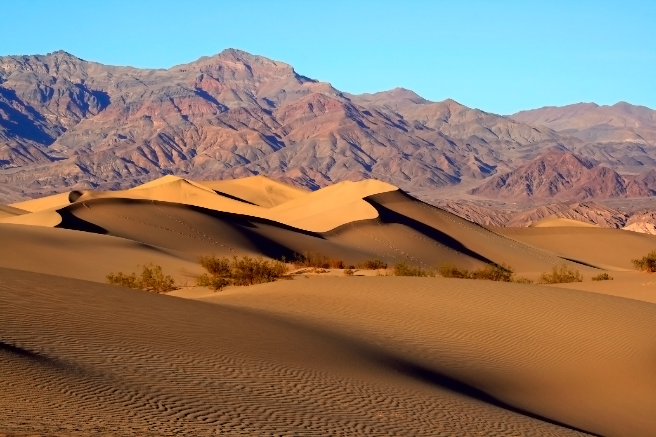 #2680 /100
Death Valley National Park in California and Nevada is the lowest, driest, and hottest place in North America, where summer temperatures regularly exceed 50 degrees Celsius.
Yet within its 13,600 square kilometres lies extraordinary scenery — from the salt flats of Badwater Basin to the colourful Artist's Palette hills and the vast sand dunes of Mesquite Flat.
How does it rate
CrowdsRomanceCash RequiredDangerAccessibilityWhy you should go
The Mesquite Flat sand dunes at sunrise, the salt hexagons of Badwater Basin, and the multicoloured mineral hills of Artist's Palette create a desert landscape of extraordinary variety.
Why you shouldn't go
Death Valley lives up to its name in summer when it is simply dangerous; temperatures above 45 degrees Celsius make outdoor exploration genuinely life-threatening.
Plan your visit
Best time to visitNovember-March, avoiding lethal summer heatBest time of daySunrise or sunset for colour on the salt flats and dunesGetting there~2hr drive from Las VegasEntry cost~$30/vehicle park entryTime needed1-2 daysInsider tip — Zabriskie Point at sunrise and Mesquite Flat Dunes at sunset are the two classic combo shots -
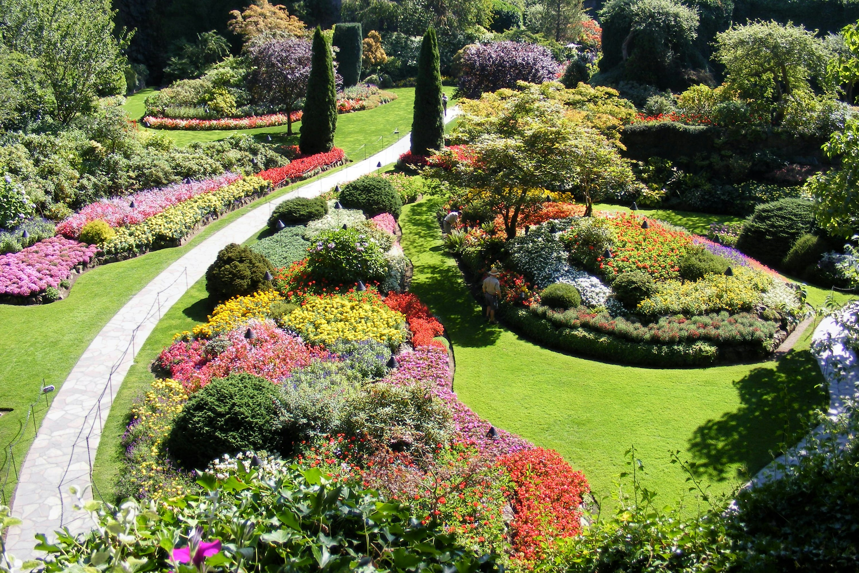 #2780 /100
A former limestone quarry on Vancouver Island transformed over a century into 22 hectares of themed display gardens, from a sunken formal garden to Japanese and Italian sections.
The National Historic Site draws more than a million visitors a year and stays in bloom nearly year-round, with fireworks and illuminated evening walks through the summer season.
How does it rate
CrowdsRomanceCash RequiredDangerAccessibilityWhy you should go
Century-old quarry-turned-garden with themed sections in bloom for most of the year, including summer illumination and fireworks nights.
Why you shouldn't go
Ticketed and busy with tour buses at midday in peak summer; only reachable by car or organized tour from Victoria.
Plan your visit
Best time to visitLate spring through summer for peak bloom; December for the holiday light displaysBest time of dayEarly morning or the last two hours before closing to avoid tour groupsGetting thereFly to Victoria International Airport; 25-minute drive north to Brentwood Bay, or take a seasonal ferry directly to the gardens' own dock.Entry costAdult ~CA$40-43 in summer, less in shoulder seasons; free for children under 5Time needed2-3 hoursBookingBook ahead →Insider tip — Start at the Sunken Garden overlook near the entrance, then work anti-clockwise through the Japanese and Italian gardens before the tour bus groups arrive mid-morning. -
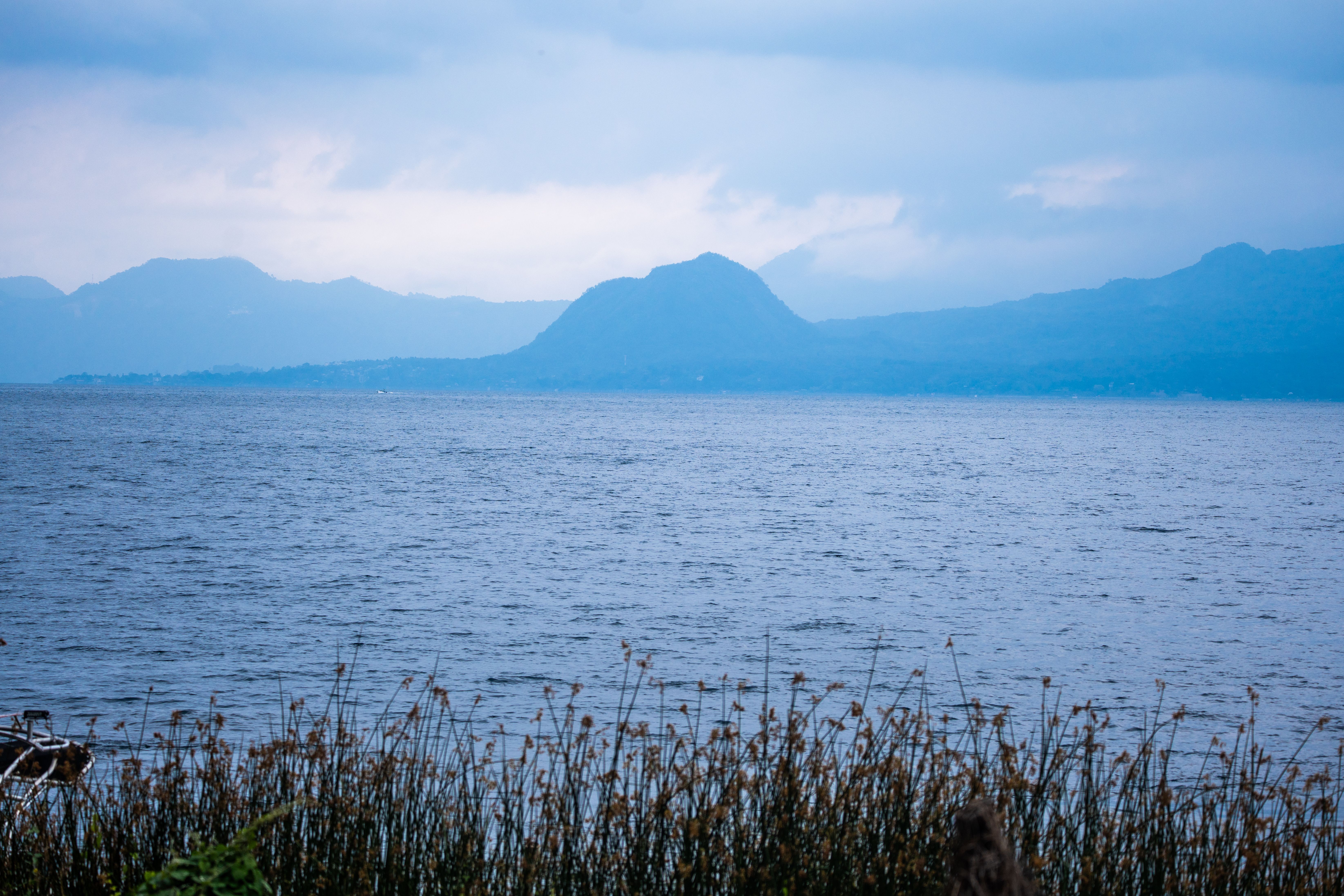 #2879 /100
Ringed by three volcanoes and a dozen distinct Maya villages, each with its own dialect, dress and market traditions, Lake Atitlán fills a volcanic caldera with water famously described by Aldous Huxley as almost too beautiful.
Boats shuttle between lakeside towns like laid-back Panajachel, spiritual San Marcos and traditional Santiago Atitlán, each offering a genuinely different pace and character rather than interchangeable lake stops.
How does it rate
CrowdsRomanceCash RequiredDangerAccessibilityWhy you should go
A volcano-ringed lake surrounded by a dozen distinct Maya villages, each with its own character and traditions.
Why you shouldn't go
Boat schedules between villages are informal and can mean unpredictable waits, especially after dark.
Plan your visit
Best time to visitNovember–April, the dry season, for the clearest volcano views.Best time of dayEarly morning, when the lake is calmest and volcano reflections are sharpest.Getting thereAbout 3 hours' drive from Guatemala City or Antigua to Panajachel, the main lakeside hub.Entry costFree to visit; boat taxis between villages typically Q10-25 (~€1-3) each.Time needed2–4 days.Insider tip — Base yourself in a quieter village like San Marcos or San Pedro rather than busier Panajachel, and boat into Pana only for supplies or connections. -
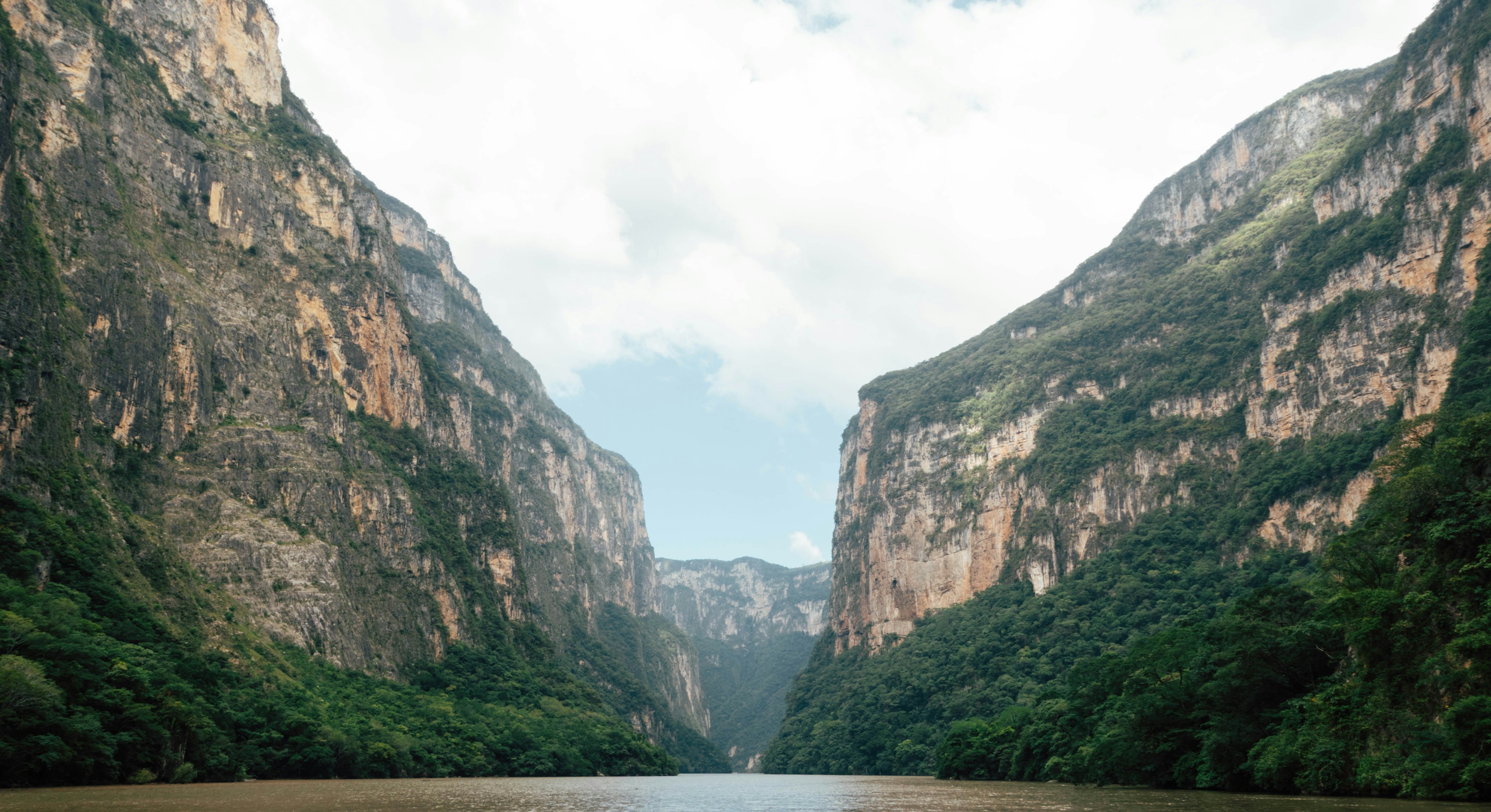 #2979 /100
Sheer limestone walls rise up to 1,000 metres above the Grijalva River in this dramatic Chiapas canyon, explored almost entirely by boat.
Crocodiles bask on the riverbanks and spider monkeys move through trees clinging to the cliff face, visible at close range from the water.
A formation locally called the Christmas Tree - moss and mineral deposits forming a tree-like shape on the rock wall - is the trip's signature stop.
How does it rate
CrowdsRomanceCash RequiredDangerAccessibilityWhy you should go
A boat ride beneath 1,000-metre limestone cliffs, past crocodiles and spider monkeys.
Why you shouldn't go
The boats are open and fast - bring something to protect cameras and belongings from spray.
Plan your visit
Best time to visitNovember-April, the dry season, for the clearest water and best wildlife viewing.Best time of dayEarly morning, when wildlife is most active and the water is calmest.Getting thereBoats depart from Chiapa de Corzo, a short drive from Tuxtla Gutierrez.Entry costBoat tour ticket, typically $10-15 per person.Time needed2 hoursInsider tip — Sit near the front of the boat for the clearest photos of the Christmas Tree formation and the closest wildlife sightings. -
 #3079 /100
Hierve el Agua is a set of mineral-rich springs in the hills outside Oaxaca that have calcified over thousands of years into cliffside formations resembling frozen waterfalls.
Two natural infinity pools sit right at the cliff edge, letting swimmers look out over the valley below.
The site is far quieter than Mexico's beach and pyramid destinations, reachable only by a bumpy mountain road.
How does it rate
CrowdsRomanceCash RequiredDangerAccessibilityWhy you should go
Swimming in a natural infinity pool at a cliff edge that looks like a petrified waterfall is unlike anything else in Mexico.
Why you shouldn't go
The access road is rough and the pools' water level can drop noticeably in the dry season.
Plan your visit
Best time to visitNovember–April, dry season, for the fullest pools and easiest road access.Best time of dayMid-morning, arriving before tour groups from Oaxaca City build up through the afternoon.Getting thereFly to Oaxaca City; roughly 1.5–2-hour drive southeast on mostly unpaved mountain roads.Entry costSmall community entry fee, paid locally.Time needed2–3 hoursInsider tip — Combine the trip with the mezcal villages of Santiago Matatlán and San Baltazar Chichicápam along the same road. -
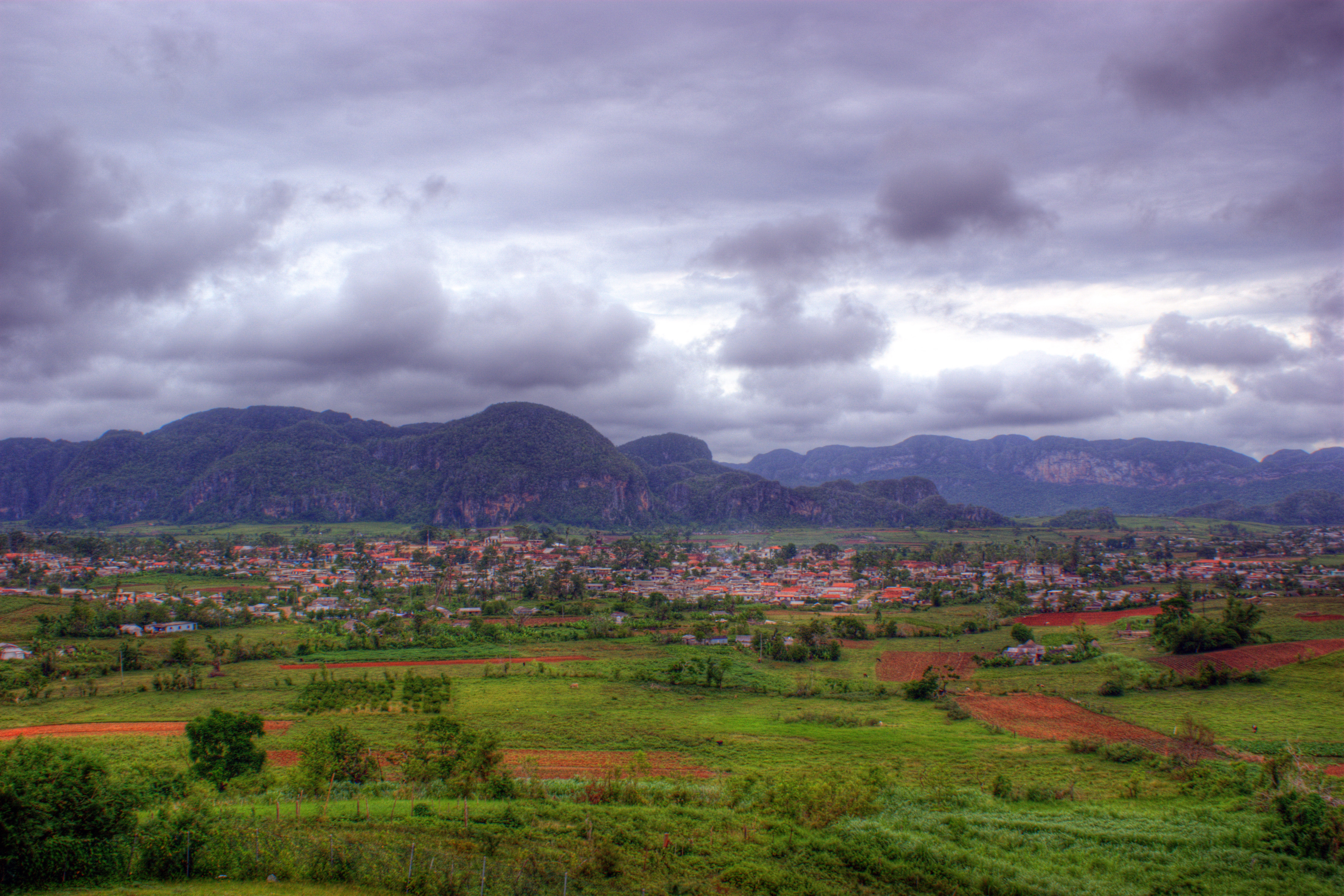 #3178 /100
The Vinales Valley is a UNESCO World Heritage landscape in western Cuba, where massive limestone mogotes rise dramatically from the flat valley floor like green-covered fortresses.
The traditional tobacco farms, red earth roads, royal palm trees, and brilliant blue skies make it one of the Caribbean's most distinctive landscapes.
How does it rate
CrowdsRomanceCash RequiredDangerAccessibilityWhy you should go
The combination of the dramatic mogote karst landscape, the red earth, the royal palms, and the traditional farming methods creates a landscape of extraordinary beauty and cultural richness.
Why you shouldn't go
Vinales requires either a guided excursion from Havana or independent travel which can be challenging to arrange; the valley itself is fairly compact and can be covered in a day.
Plan your visit
Best time to visitNovember-April (dry season)Best time of daySunrise, when mist settles between the limestone mogotesGetting there~2.5-3hr drive from HavanaEntry costFree to viewTime neededFull dayInsider tip — Climb to the Los Jazmines viewpoint hotel terrace for the classic wide shot over the whole valley -
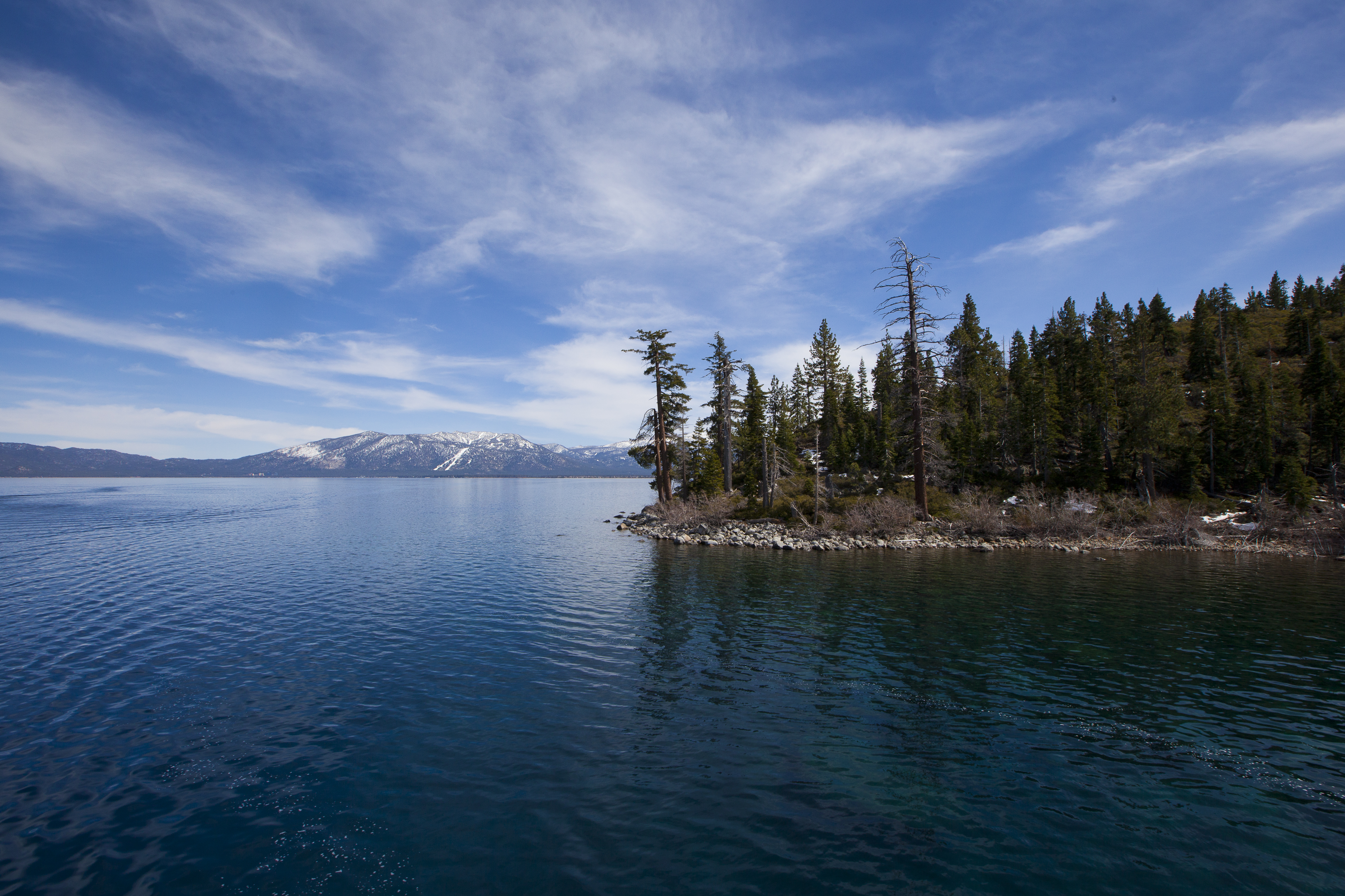 #3278 /100
Lake Tahoe straddles the border between California and Nevada in the Sierra Nevada mountains, its remarkable clarity allowing visibility to a depth of over 20 metres.
Surrounded by ski resorts, pine forests, and granite peaks, it offers spectacular hiking and water sports in summer and world-class skiing in winter.
How does it rate
CrowdsRomanceCash RequiredDangerAccessibilityWhy you should go
The clarity of Lake Tahoe's water and the surrounding mountain scenery make it one of the most beautiful alpine lakes in North America; the sunsets across the lake are spectacular.
Why you shouldn't go
The lake is heavily developed on both the California and Nevada shores; traffic congestion and parking can be severe during summer weekends.
Plan your visit
Best time to visitJune-September for swimming/hiking, Dec-March for skiingBest time of daySunrise for calm, mirror-like waterGetting there~1hr drive from Reno, ~3.5hrs from San FranciscoEntry costFree; some beaches charge for parkingTime needed2-3 daysInsider tip — Emerald Bay viewpoint is the most photographed spot on the lake; get there early for parking in summer -
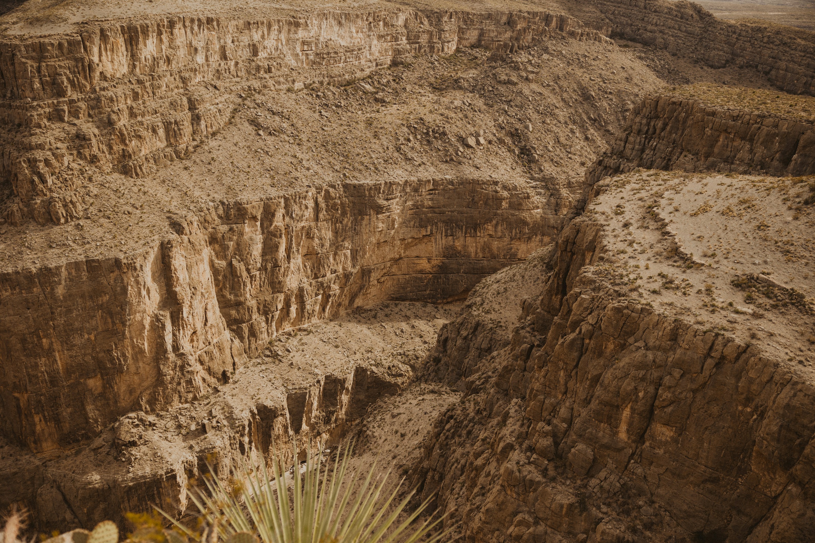 #3378 /100
Mexico's Copper Canyon is actually a network of canyons in the Sierra Madre Occidental, several deeper than the Grand Canyon, cut by rivers through pine forest and red rock.
The main way to see it is the Chepe train, which crosses 37 bridges and passes through 86 tunnels on its way between the desert lowlands and the pine-covered rim.
Small Rarámuri (Tarahumara) communities still live within the canyon system.
How does it rate
CrowdsRomanceCash RequiredDangerAccessibilityWhy you should go
The Chepe train ride itself, crossing dozens of bridges and tunnels along the canyon rim, is as much the experience as the views.
Why you shouldn't go
It's a long way from anywhere — reaching the canyon takes a full day of travel each way from most starting points.
Plan your visit
Best time to visitOctober–April, avoiding summer's heat and rainy season.Best time of dayMorning departures on the Chepe train give the best light along the canyon rim.Getting thereFly to Chihuahua or Los Mochis, then take the Chepe train, which runs between both cities through the canyon.Entry costTrain tickets and lodge stays are the main costs; viewpoints themselves are free.Time needed2–3 daysInsider tip — Book a seat on the right-hand side heading from Los Mochis to Chihuahua for the best canyon views. -
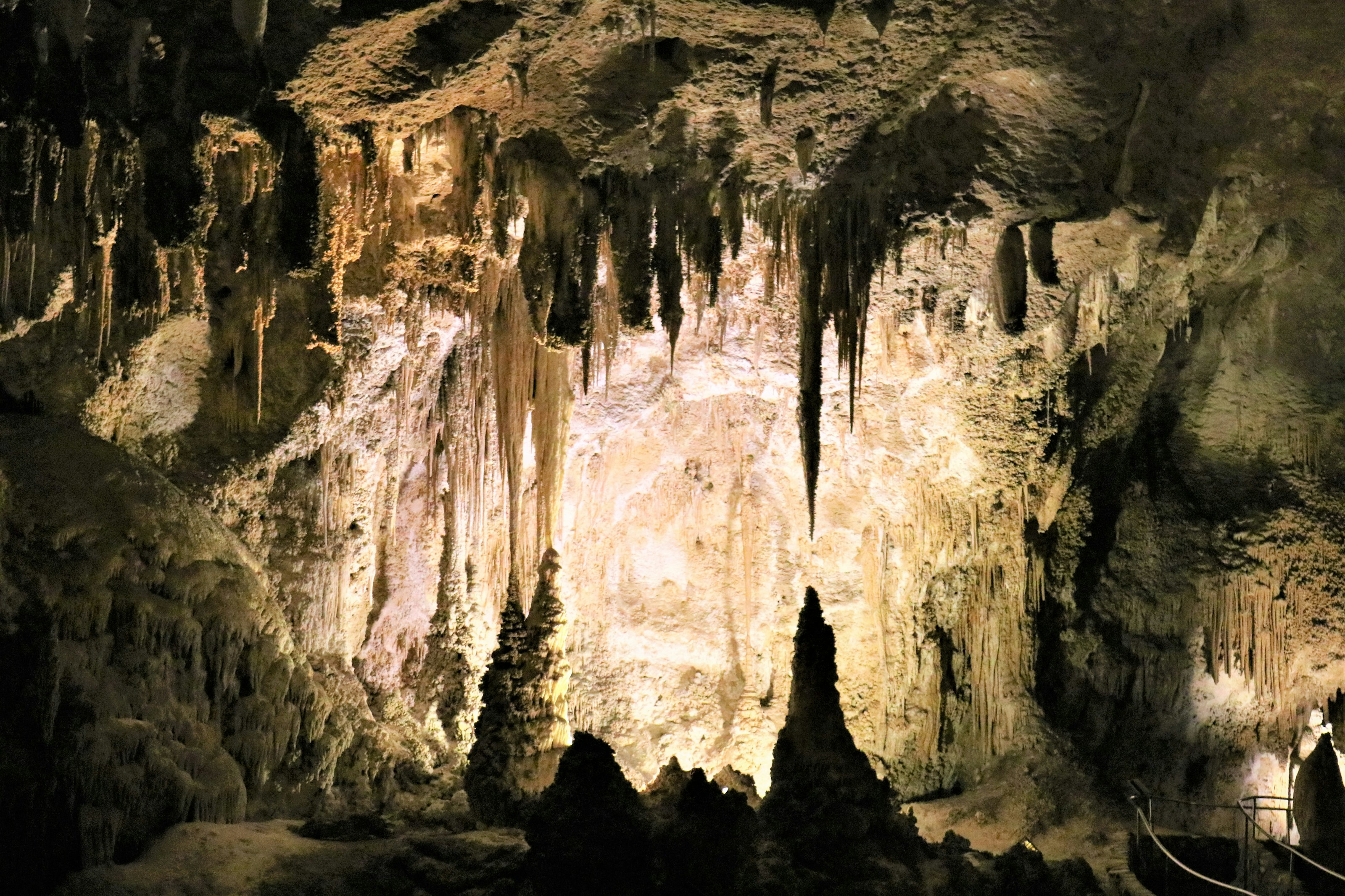 #3477 /100
A limestone system under the New Mexico desert whose Big Room is among the largest cave chambers on earth, roofed by a ceiling of stalactites.
You can descend 230 metres on foot through the Natural Entrance or drop straight down by lift.
On summer evenings, hundreds of thousands of Brazilian free-tailed bats spiral out of the mouth at dusk.
How does it rate
CrowdsRomanceCash RequiredDangerAccessibilityWhy you should go
The Big Room is on a scale that photographs genuinely struggle to convey.
Why you shouldn't go
It is a long drive from anywhere, and entry times have to be reserved in advance.
Plan your visit
Best time to visitMay-October, while the evening bat flight programme is runningBest time of dayEnter mid-morning, then stay above ground for the bat flight at sunsetGetting thereDrive from Carlsbad, New Mexico, about 40 minutes; nearest airports are El Paso or RoswellEntry costUSD 15 per adult, valid three days, plus a small reservation feeTime neededHalf a dayBookingBook ahead →Insider tip — Walk in through the Natural Entrance instead of taking the lift - the switchback descent into the dark is the best part of the whole visit. -
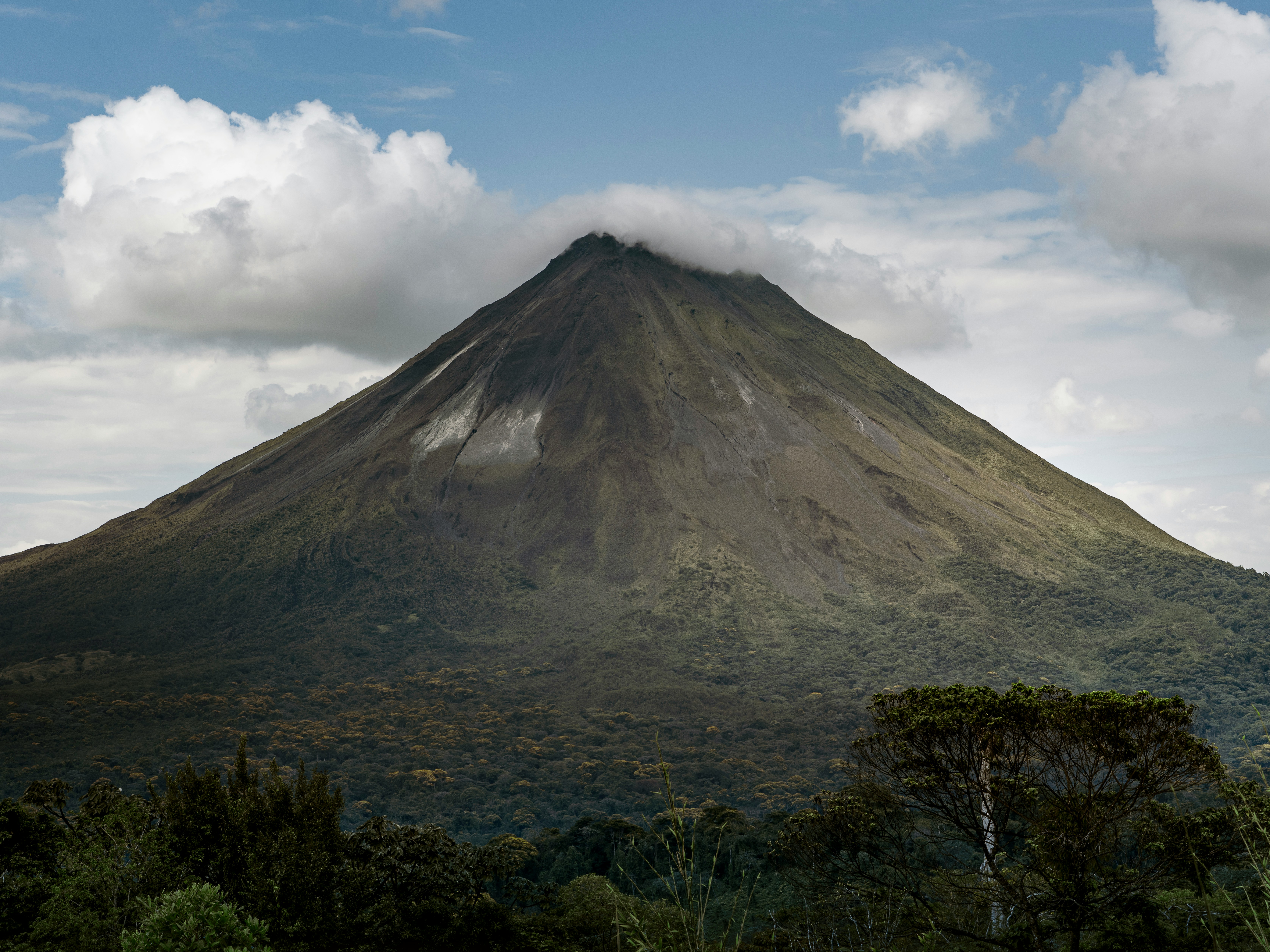 #3576 /100
A textbook-perfect conical volcano rising above the rainforest near La Fortuna, dormant since 2010 but still ringed by the geothermal hot springs its decades of activity created.
Hiking trails through the surrounding national park pass old lava fields from the 1968 eruption, while dozens of resorts built around natural hot spring rivers make soaking with a volcano view the region's signature activity.
It's become one of Costa Rica's most popular honeymoon and romantic-getaway destinations for exactly that reason.
How does it rate
CrowdsRomanceCash RequiredDangerAccessibilityWhy you should go
A perfect conical volcano viewed from natural hot spring pools - one of Costa Rica's most popular romantic getaways.
Why you shouldn't go
The summit is frequently shrouded in cloud, and many hot spring resorts are priced steeply for what's essentially a heated river.
Plan your visit
Best time to visitDecember-April (dry season) for the best odds of a cloud-free cone.Best time of dayLate afternoon into evening, soaking in hot springs as the light fades over the volcano.Getting thereA 3-4 hour drive from San Jose, or a shorter flight to Fortuna's local airstrip.Entry costNational park entry around USD15; hot springs resorts range from USD40 to USD100+ per person.Time neededA full day, or longer as part of a La Fortuna stay.Insider tip — Skip the priciest resort hot springs and try the free public hot river near Tabacon for the same volcanic-heated water at no cost. -
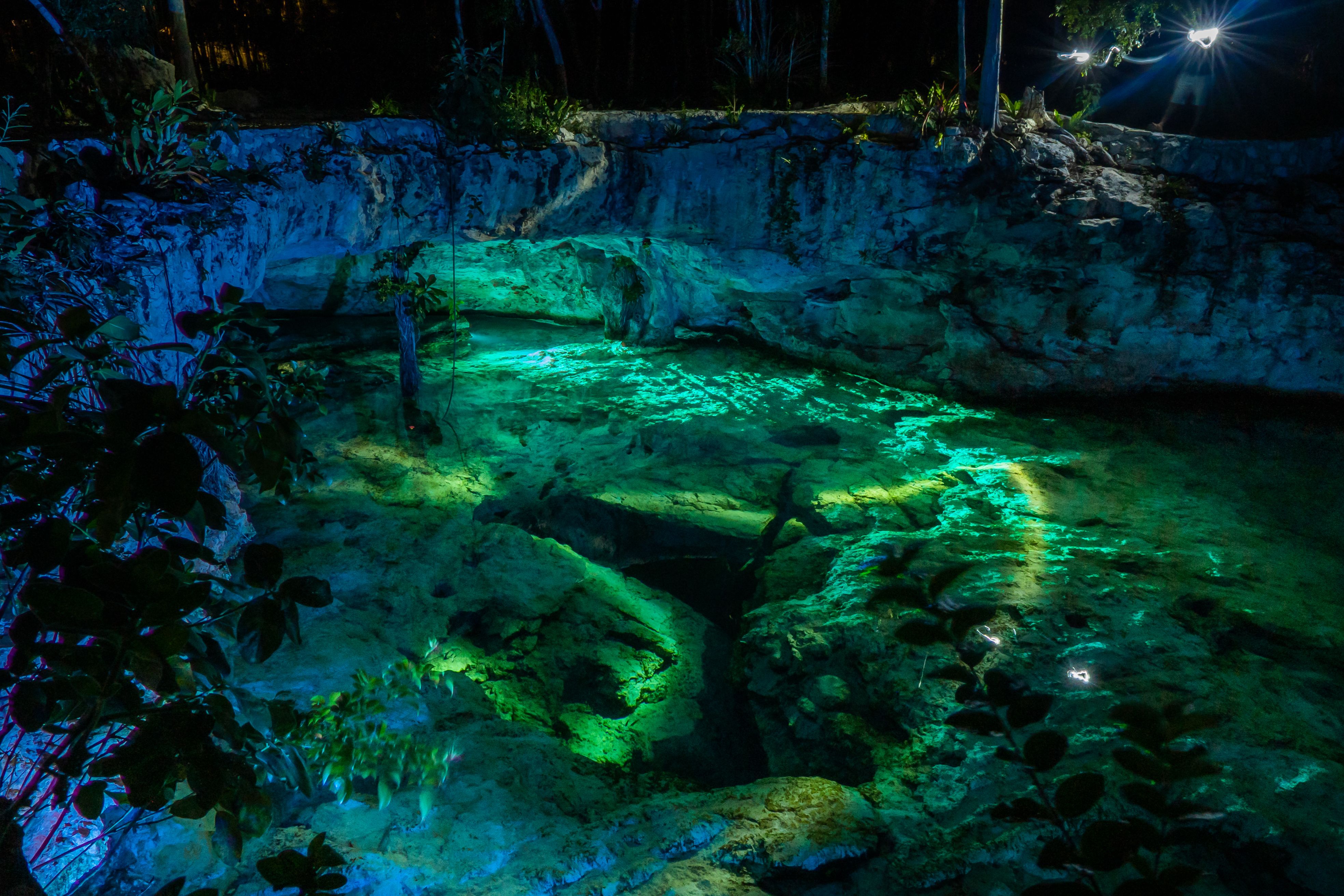 #3676 /100
A limestone sinkhole near Tulum with startlingly clear freshwater, shallow turquoise pools giving way to dramatic cave passages hung with stalactites.
Turtles and small fish glide beneath snorkelers in water so clear it barely seems real, especially deeper into the cavern sections.
How does it rate
CrowdsRomanceCash RequiredDangerAccessibilityWhy you should go
Crystal-clear cenote with cavern passages and stalactites, a short bike ride from Tulum.
Why you shouldn't go
Gets very crowded by mid-morning, especially in high season; sunscreen is banned to protect the water, so bring reef-safe or none.
Plan your visit
Best time to visitDecember–April for the clearest water and driest weather.Best time of dayOpening time (8am) for the fewest people and calmest water.Getting there4km from Tulum town center; reachable by bike, taxi, or colectivo van.Entry costMXN $300 (~$18) entry fee.Time needed1.5–2 hours.Insider tip — Bring your own snorkel gear (rentals are limited and pricier on-site). The cave sections near the back are the highlight — most visitors never swim past the open pool. -
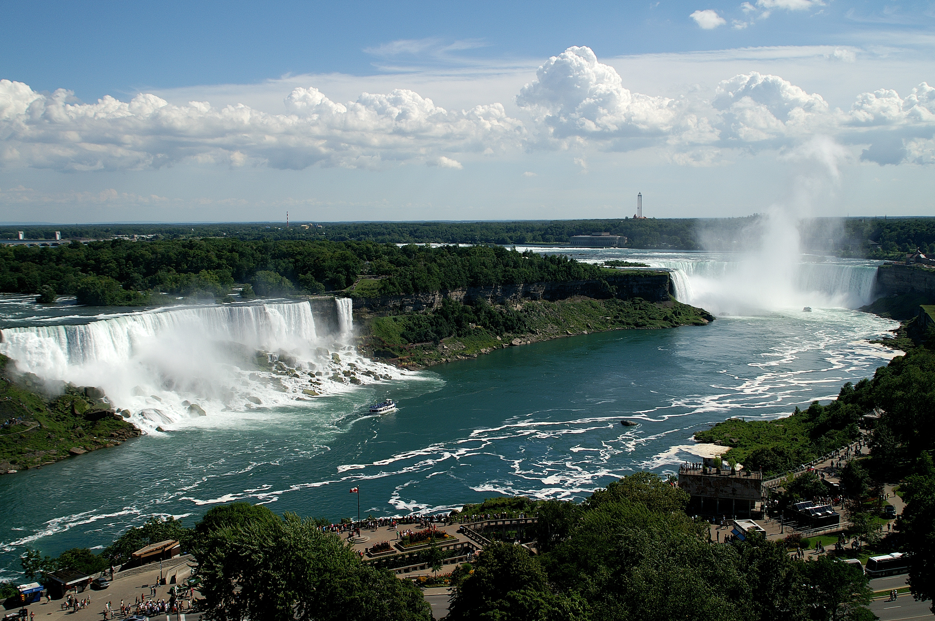 #3775 /100
Niagara Falls sits on the border between Ontario and New York State and comprises three waterfalls: the Horseshoe Falls, the American Falls, and the Bridal Veil Falls.
The Canadian side offers the most dramatic panoramic view of the Horseshoe Falls, which at 57 metres tall and 670 metres wide is the most powerful waterfall in North America.
How does it rate
CrowdsRomanceCash RequiredDangerAccessibilityWhy you should go
The volume of water thundering over Horseshoe Falls from the Canadian viewing platform is genuinely awe-inspiring; boat trips take you to within metres of the falling water.
Why you shouldn't go
The surrounding town of Niagara Falls on the Canadian side is extremely tacky and touristy; the falls themselves are not particularly tall compared to some rivals.
Plan your visit
Best time to visitMay-September for warm weather, winter for ice formationsBest time of dayEvening for the illumination and seasonal fireworksGetting there~1.5hr drive from TorontoEntry costFree to view; boat tours ~$30Time neededHalf dayInsider tip — The Canadian side has the better view of Horseshoe Falls; cross over if coming from the US side -
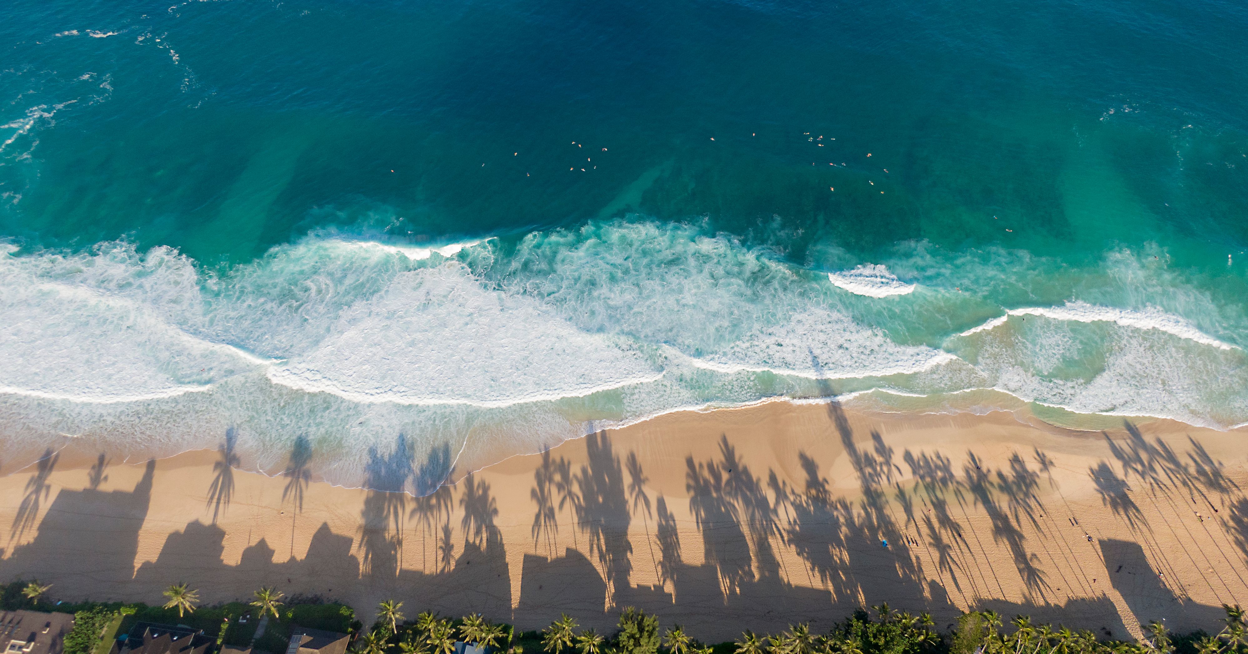 #3875 /100
A long, wide stretch of soft white sand on Oahu's windward coast, with the Ko'olau mountain range rising green and jagged directly behind it.
It's popular with locals rather than tour buses, so it stays uncrowded even close to Honolulu, and the water is generally calmer than the island's surf-famous North Shore.
Bellows Beach next door adds a second, quieter option within the same bay.
How does it rate
CrowdsRomanceCash RequiredDangerAccessibilityWhy you should go
Wide white sand backed directly by the jagged Ko'olau range, with far fewer tourists than Oahu's famous North Shore beaches.
Why you shouldn't go
Facilities are basic, and being a local favourite means weekends can bring heavy beach-park traffic.
Plan your visit
Best time to visitApril-October for calmer, warmer water.Best time of dayEarly morning, when the mountains catch the sunrise light.Getting thereFly to Honolulu; a 40-minute drive around the southeast coast to Waimanalo.Entry costFree.Time needed2-3 hours.Insider tip — Bellows Field Beach Park next door is open to the public on weekends and is usually quieter still. -
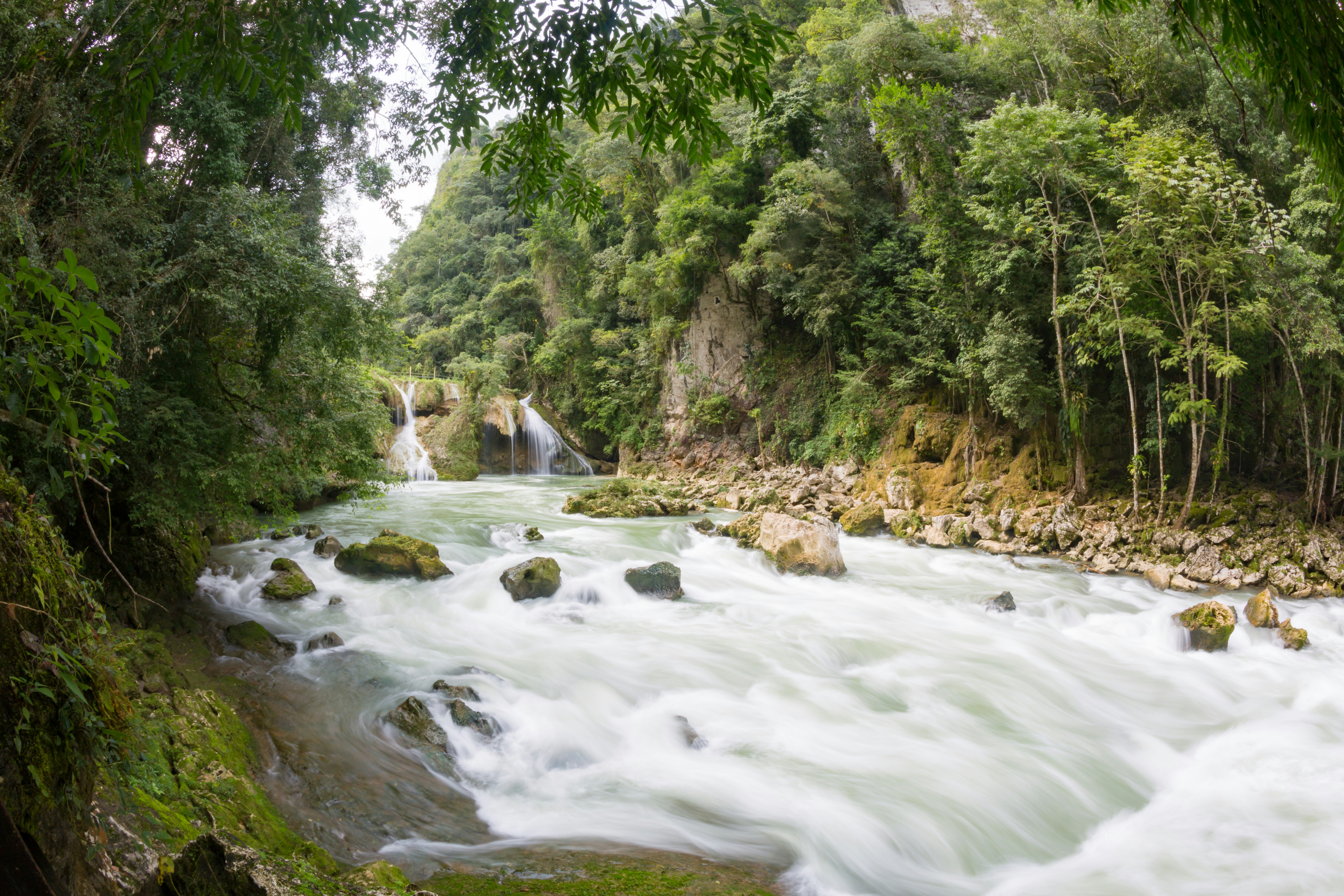 #3974 /100
A series of turquoise limestone pools cascades down a natural stone bridge above the rushing Cahabón River, which vanishes underground beneath the pools before reemerging downstream.
Swimming from one pool to the next, framed by dense jungle on all sides, feels remote in a way that matches the effort of reaching it — the last stretch of road is famously rough.
A steep viewpoint hike above gives the classic aerial view of the stacked terraces.
How does it rate
CrowdsRomanceCash RequiredDangerAccessibilityWhy you should go
Stacked turquoise swimming pools on a natural stone bridge above a river that vanishes underground.
Why you shouldn't go
The final approach road is notoriously rough, and the site itself is remote from major towns.
Plan your visit
Best time to visitNovember–April, the dry season, when the river is clearer and pools less silty.Best time of dayMorning, before day-trip crowds from Lanquín arrive.Getting thereAbout 1 hour by rough road from the town of Lanquín, itself several hours from Guatemala City or Antigua.Entry costAround Q50 (~€6) entry fee.Time neededFull day.Insider tip — Climb to the El Mirador viewpoint first thing in the morning before swimming — the classic aerial photo is best in early, angled light. -
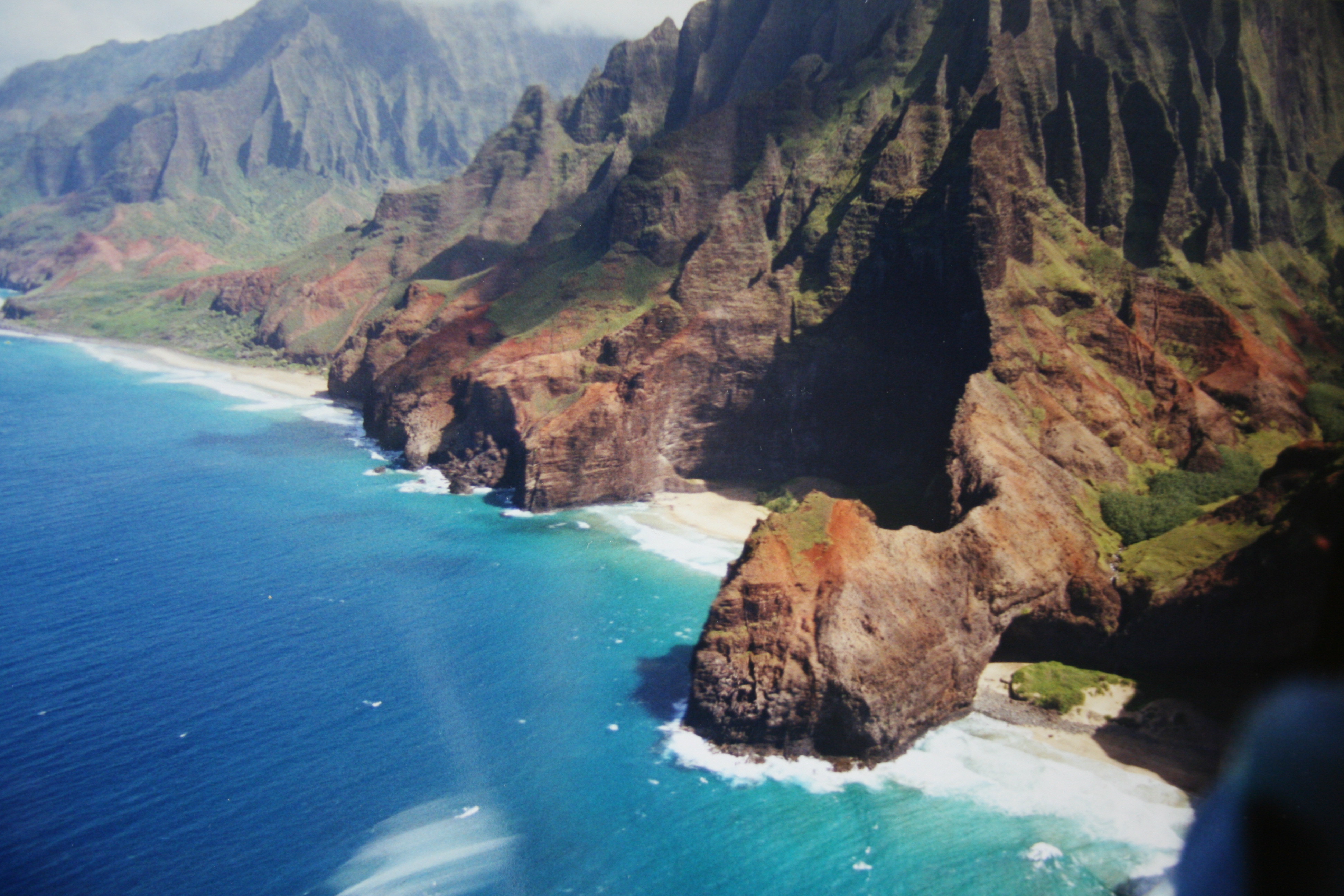 #4074 /100
An 11-mile coastal trail along Kauai's Na Pali Coast, climbing in and out of fluted, jungle-green valleys with the Pacific breaking against sea cliffs far below.
The route crosses Hanakapiai Stream, skirts the exposed Crawler's Ledge, and ends at the remote Kalalau Valley and beach.
Permits are required past the two-mile mark and are famously hard to secure, often selling out within seconds of release.
How does it rate
CrowdsRomanceCash RequiredDangerAccessibilityWhy you should go
Sea cliffs, waterfalls and jungle valleys along one of the most dramatic coastlines in the Pacific.
Why you shouldn't go
Crawler's Ledge and several stream crossings turn genuinely dangerous in rain, and permits vanish in seconds.
Plan your visit
Best time to visitMay-September (drier season); stream crossings can become impassable in winter rains.Best time of dayEarly morning start to clear exposed sections before afternoon heat.Getting thereFly to Lihue; drive about an hour to the trailhead at Ke'e Beach, the end of the road.Entry costCamping permit $25/night (Hawaii residents) or $35/night (non-residents).Time needed2-3 days for the full trail; day hikers often turn back at Hanakapiai FallsBookingBook ahead →Insider tip — Permits release exactly 90 days ahead at midnight Hawaii time and go in seconds - have your account and dates ready beforehand. -
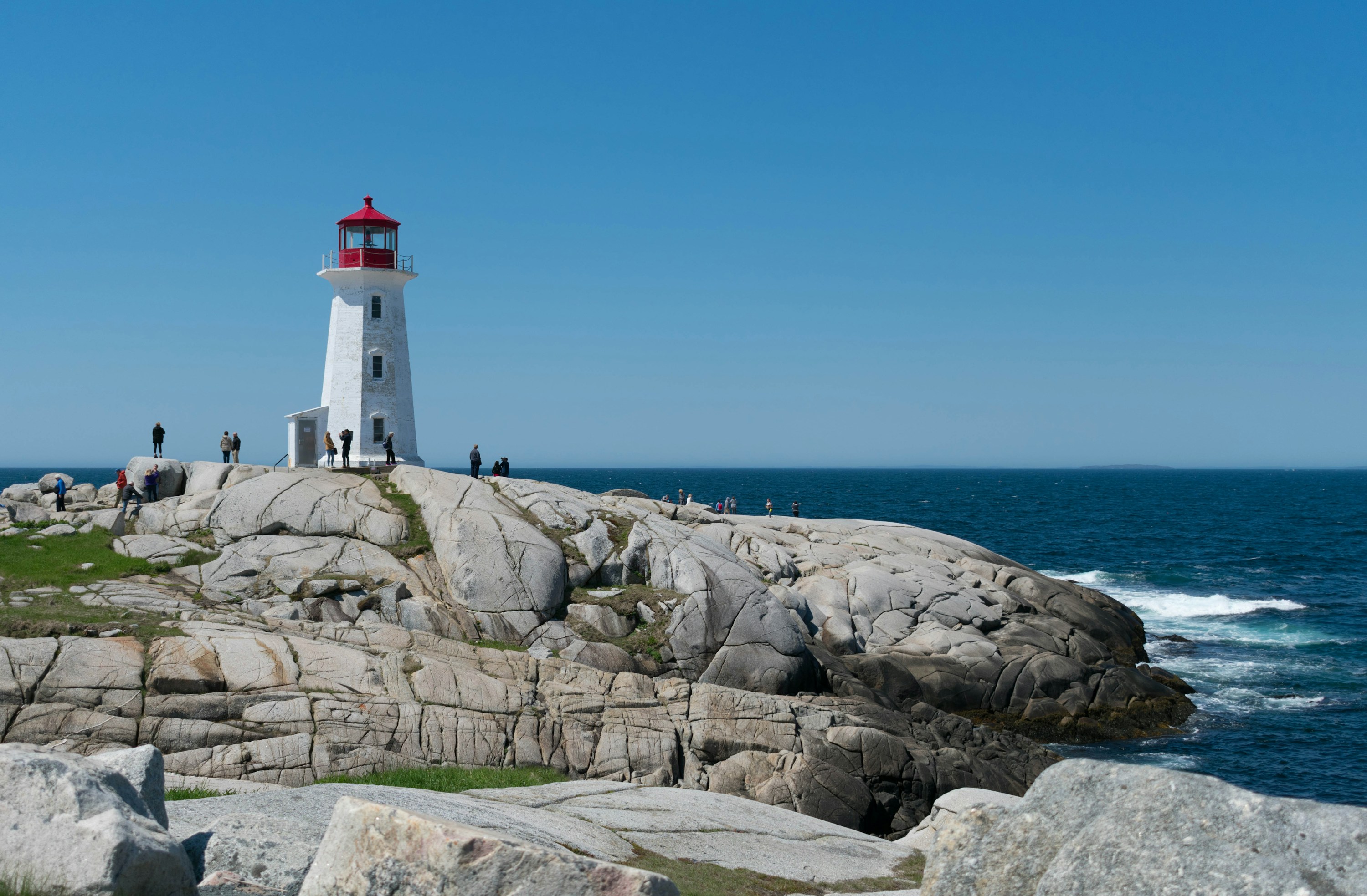 #4174 /100
A small fishing village on Nova Scotia's rocky Atlantic coast, built around one of Canada's most recognisable lighthouses, perched on wave-smoothed granite boulders above the open ocean.
The working harbour still holds lobster boats and fish shacks alongside the crowds, and a short walk along the shoreline rocks gives open views out to sea.
Waves can sweep the outer rocks without warning.
How does it rate
CrowdsRomanceCash RequiredDangerAccessibilityWhy you should go
One of the most recognisable lighthouses in Canada, set on open granite rock above the Atlantic, a short drive from Halifax.
Why you shouldn't go
Extremely busy with tour buses in summer, and the smooth rocks nearest the water have caused fatal rogue-wave incidents.
Plan your visit
Best time to visitJune-September for mild weather; arrive outside 10am-4pm to avoid tour bus crowdsBest time of dayEarly morning or early eveningGetting thereFly to Halifax Stanfield International Airport; 45-50 minute drive southwest on Route 333.Entry costFree; parking fee appliesTime needed1-2 hoursInsider tip — Stay on the dark, lichen-covered rock and well back from the water on the ocean side of the lighthouse; the smooth grey granite closer to the surf has swept visitors away in calm-looking conditions. -
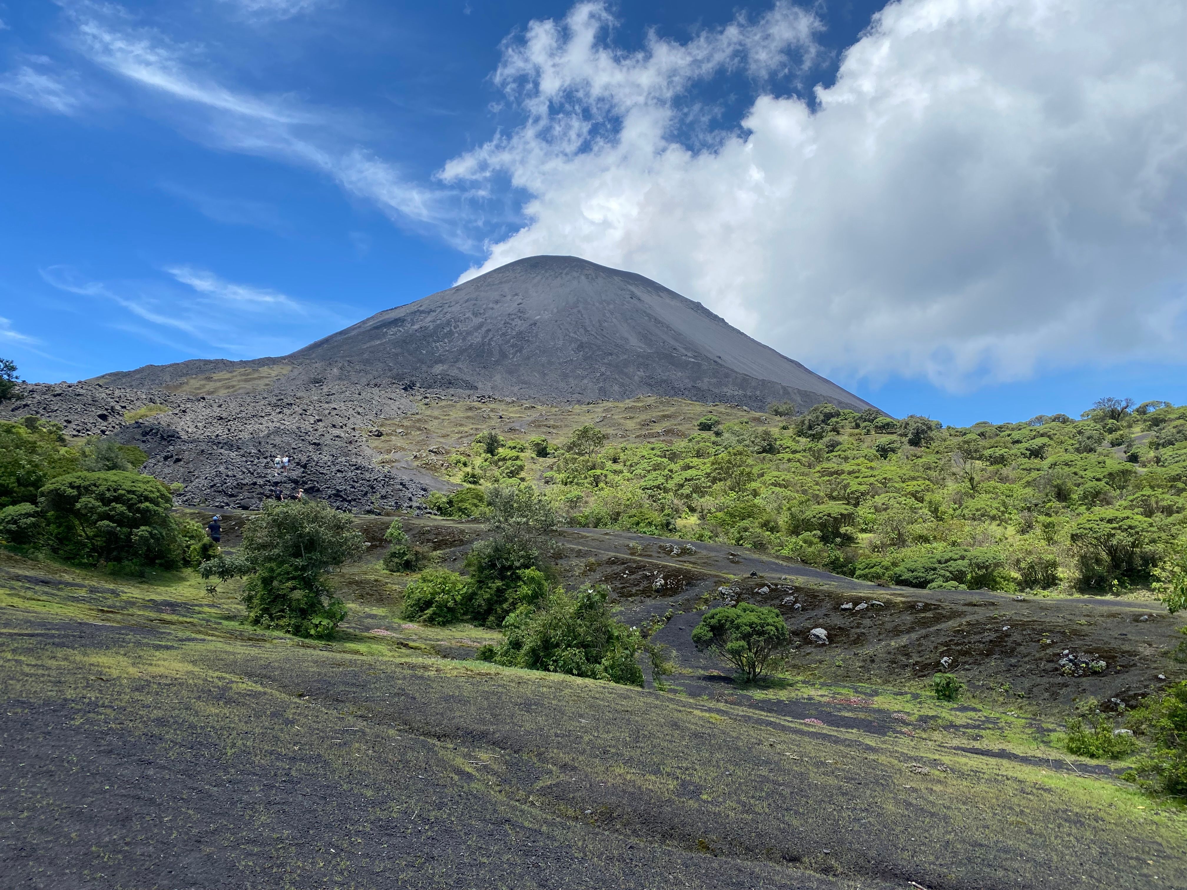 #4270 /100
One of Central America's most accessible active volcanoes, a manageable half-day hike from Antigua across hardened black lava fields that are still warm underfoot in places.
Depending on current activity, guides lead visitors close enough to roast marshmallows over volcanic heat vents, with views back over Antigua's valley and, on clear days, neighbouring Volcan de Fuego's periodic ash plumes.
It's a genuinely approachable volcano experience that doesn't require technical climbing gear.
How does it rate
CrowdsRomanceCash RequiredDangerAccessibilityWhy you should go
A moderate half-day hike across still-warm lava fields, close enough to roast marshmallows over volcanic heat.
Why you shouldn't go
The hike is dusty, steep in places, and current safe distance from the crater varies with activity levels.
Plan your visit
Best time to visitNovember-April (dry season) for clearer trails and views.Best time of dayLate afternoon, timed to reach the lava fields for sunset over the valley.Getting thereA 1-1.5 hour drive from Antigua to the trailhead village of San Francisco de Sales.Entry costGuided tours from Antigua typically run USD15-25 per person, including park entry.Time neededHalf a day.Insider tip — Buy marshmallows in Antigua before you go - vendors at the trailhead charge a steep markup for the same bag. -
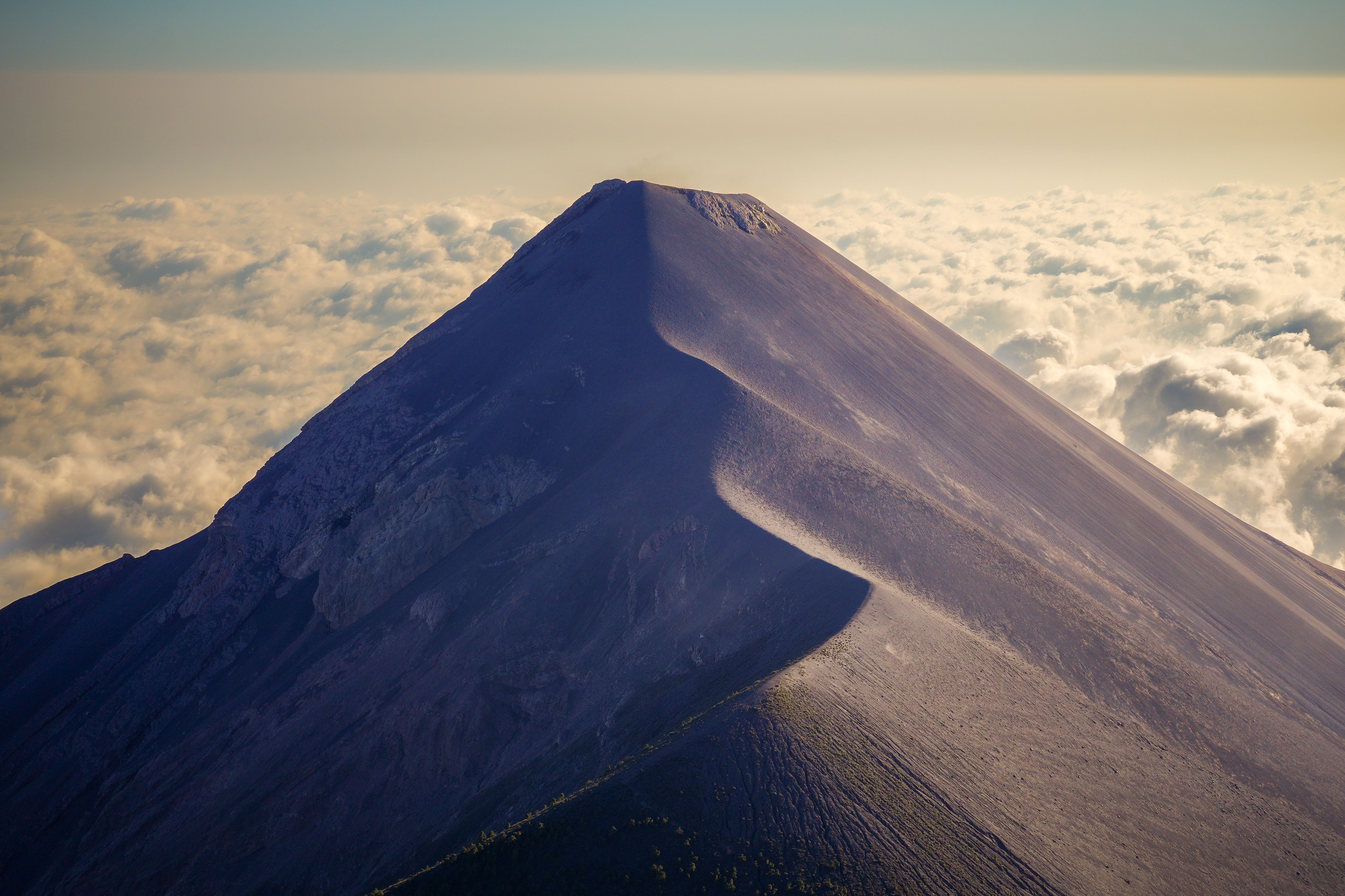 #4368 /100
A steep overnight trek up this dormant volcano rewards climbers with a front-row camp beside its base, facing directly at neighboring Fuego, one of Central America's most active volcanoes, erupting with visible lava and ash several times an hour after dark.
The climb is genuinely strenuous, gaining nearly 1,500 meters over loose scree, but reaching the summit at dawn for views over a sea of clouds is one of Guatemala's most rewarding treks.
How does it rate
CrowdsRomanceCash RequiredDangerAccessibilityWhy you should go
An overnight trek to camp directly across from an actively erupting volcano, visible after dark.
Why you shouldn't go
The steep, strenuous climb and cold overnight camp temperatures require real physical preparation.
Plan your visit
Best time to visitNovember–April, the dry season, for clearer skies and better Fuego visibility.Best time of dayAfter sunset at base camp, when Fuego's eruptions become clearly visible in the dark.Getting thereTour operators collect trekkers from Antigua for the drive to the trailhead.Entry costGuided overnight treks typically Q400-700 (~€48-84), including camping gear.Time needed2 days, 1 night.Insider tip — Pack far warmer clothing than Antigua's climate suggests — nighttime temperatures at the high-altitude base camp regularly drop below freezing. -
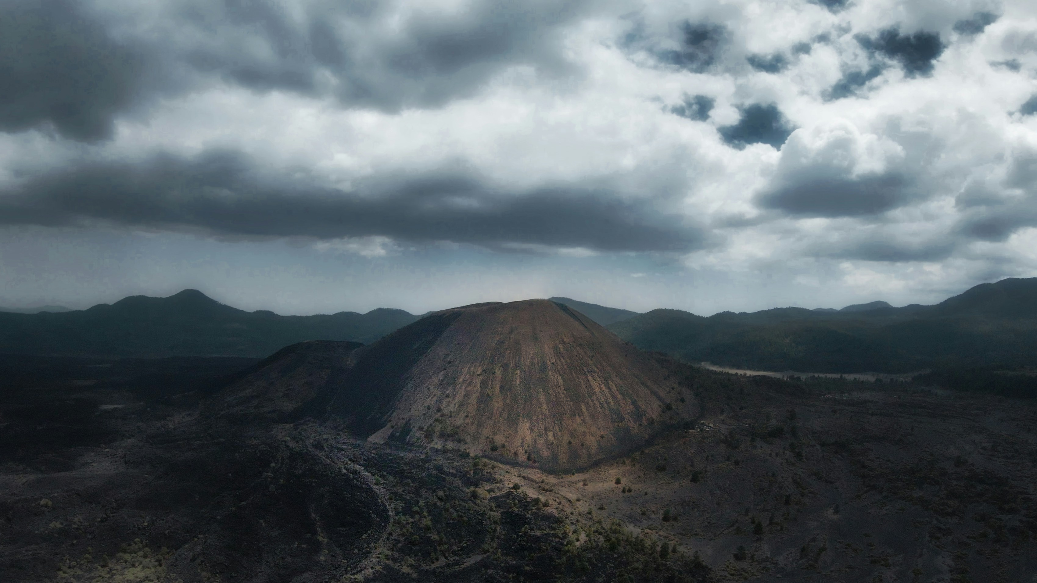 #4468 /100
A cinder cone volcano that famously erupted from a level cornfield in 1943, growing to over 400 metres within a decade and burying two villages under lava - one of the few volcanoes in the world whose entire life cycle has been documented from birth.
The half-buried bell tower of San Juan Parangaricutiro's church still protrudes from the hardened lava field, an eerie, singular sight.
Horseback rides across the black lava field to the church ruins, followed by a hike up the cinder cone itself, make for a genuinely unusual full day out.
How does it rate
CrowdsRomanceCash RequiredDangerAccessibilityWhy you should go
The only volcano whose entire birth and growth was scientifically documented - and a church tower still rising from its lava field.
Why you shouldn't go
It's a fairly remote day trip from Mexico City or Guadalajara, and the summit hike across loose cinder is tiring.
Plan your visit
Best time to visitNovember-April (dry season) for firmer trail conditions.Best time of dayMorning, to allow a full day for the horseback ride and cinder-cone hike combined.Getting thereA 3.5-4 hour drive from Guadalajara or Morelia to the town of Angahuan, the main trailhead.Entry costHorse rental and guide typically cost around 400-600 MXN per person.Time neededA full day.Insider tip — Hire a local Purepecha guide in Angahuan rather than booking ahead online - it directly supports the community whose ancestors were displaced by the eruption. -
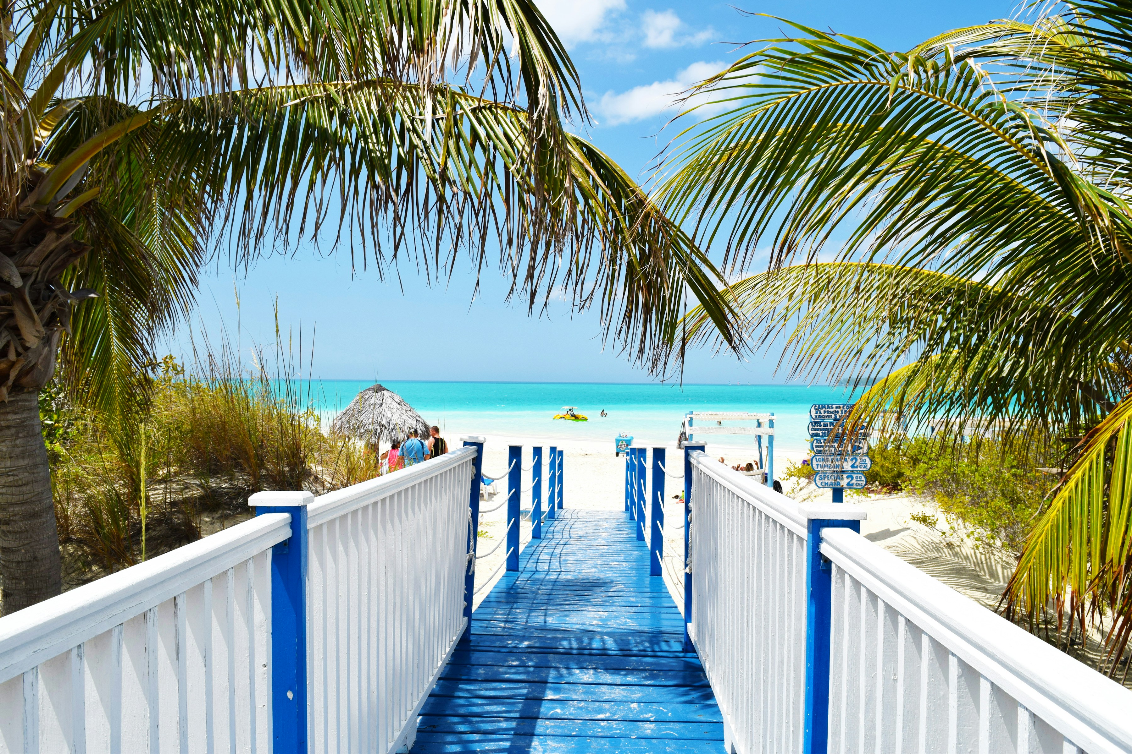 #45
#45A causeway connects this low-lying coral island to the Cuban mainland, its shoreline mixing resort beaches with mangrove lagoons and salt flats that host large flamingo colonies, giving it noticeably more wildlife interest than Varadero's more developed strip.
Birdwatchers come specifically for the flamingos and other wading birds alongside sun-seekers drawn to its calm, shallow waters.
How does it rate
CrowdsRomanceCash RequiredDangerAccessibilityWhy you should go
A resort island with genuine wildlife interest — large flamingo colonies alongside calm Caribbean beaches.
Why you shouldn't go
The causeway and resort development have altered some of the mangrove ecosystem the island depends on.
Plan your visit
Best time to visitNovember–April, the dry season, for reliable weather and peak flamingo numbers.Best time of dayEarly morning for flamingo viewing in the lagoons before the heat of the day.Getting thereFly directly to Jardines del Rey Airport on the island, or drive about 5-6 hours from Havana.Entry costPublic beach access free; most stays are through all-inclusive resorts.Time needed2–4 days.Insider tip — Ask a local guide to take you to the flamingo lagoons on the mainland side of the causeway — resort tours often skip this in favor of beach time. -
 #4665 /100
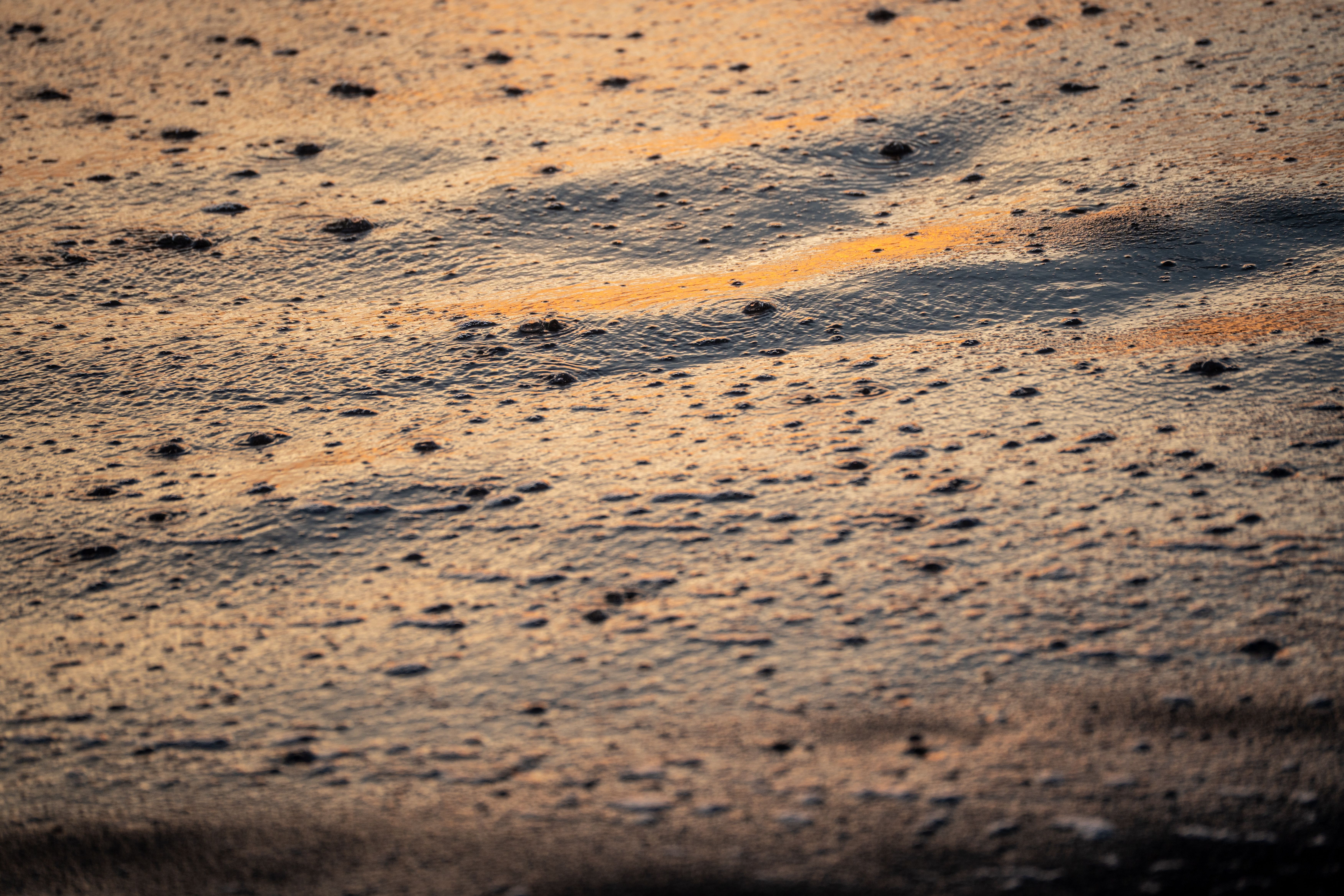
Guatemala's Pacific coast is defined by volcanic black sand, and Monterrico is its best-known stretch, backed by mangrove canals and a sea-turtle hatchery that releases hundreds of hatchlings each season.
The strong surf and undertow make it a beach for walking and sunset-watching rather than swimming, and boat trips through the adjoining reserve add caimans and waterbirds to the appeal.
How does it rate
CrowdsRomanceCash RequiredDangerAccessibilityWhy you should go
A volcanic black-sand beach with a sea-turtle hatchery and mangrove canals to explore by boat.
Why you shouldn't go
Strong surf and undertow make it unsafe for casual swimming — it's a beach for walking, not wading in.
Plan your visit
Best time to visitNovember–April, the dry season; August–November for peak turtle hatchling releases.Best time of daySunset, when the black sand and surf catch the light, or early morning for the canal boat tours.Getting thereAbout 3 hours by road from Guatemala City or Antigua, via La Avellana and a short boat crossing.Entry costFree beach access; canal boat tours and turtle hatchery visits a few hundred quetzales.Time neededFull day, or overnight.Insider tip — Time a visit around a hatchling release at the tortugario — locals and researchers often let visitors help carry them to the water. -
 #47
#47Rated #47 of 49
Napa Valley Wine Country Cycling Route, the United States
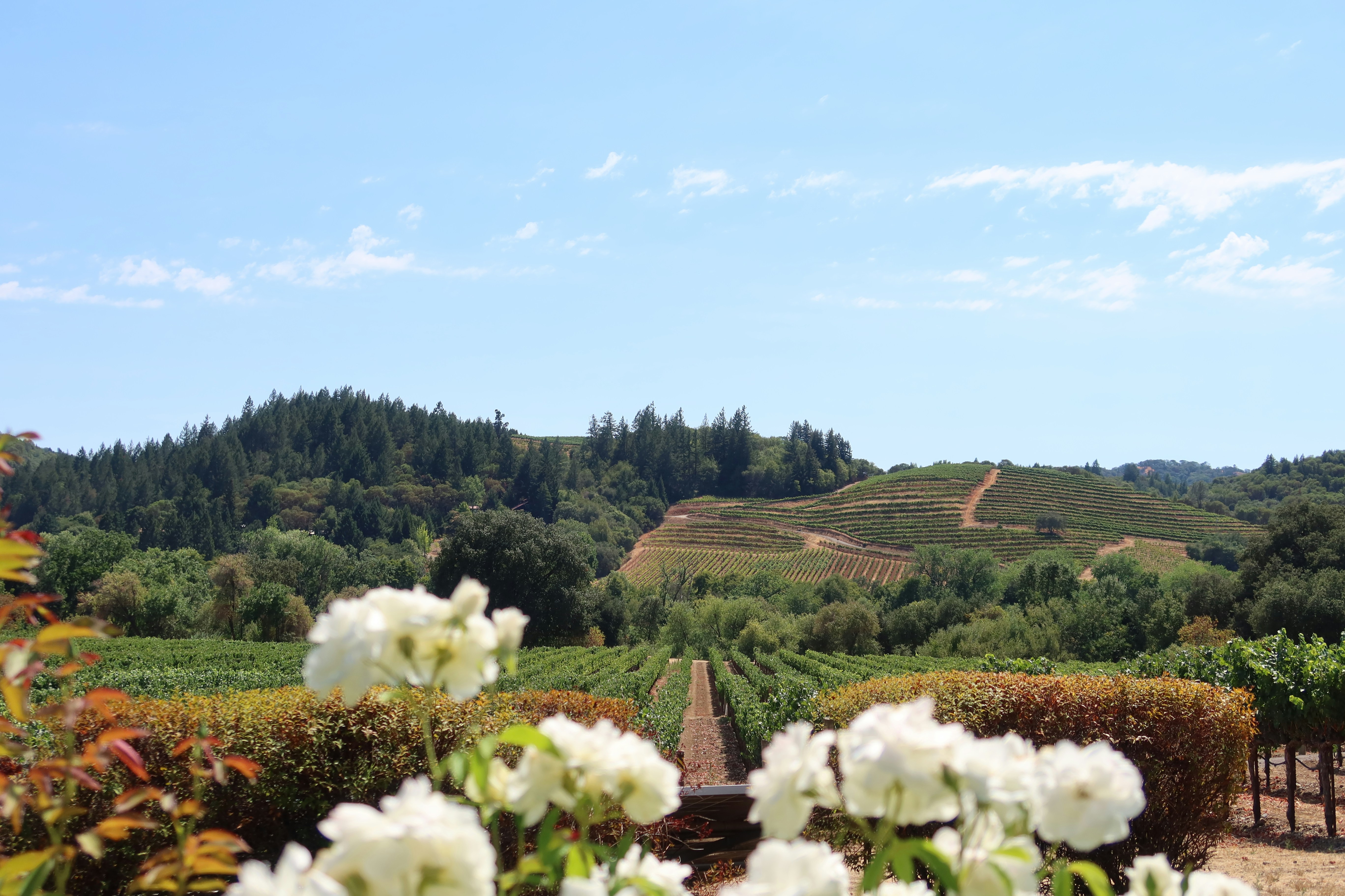
#napavalleywinecountrycyclingroute ◆ Cycling Tours62 /100The paved Vine Trail runs 12.
5 miles between downtown Napa and Yountville, weaving past manicured vineyard rows, stone wineries and oak-dotted hills.
Quieter backroads through Carneros add rolling, sheep-grazed vistas that turn yellow with wild mustard flowers each spring.
The route is flat enough for casual riders, with tasting rooms, bakeries and picnic stops built into most itineraries.
How does it rate
CrowdsRomanceCash RequiredDangerAccessibilityWhy you should go
Flat, paved trail through postcard vineyard scenery with wine-tasting stops built into the ride.
Why you shouldn't go
Summer weekend traffic on shared vineyard roads can be heavy, and tasting and rental costs add up fast.
Plan your visit
Best time to visitMar-May for mustard-flower bloom, or Sep-Oct for harvest colour.Best time of dayMorning, before afternoon heat and before tasting-room crowds peak.Getting thereFly to San Francisco or Oakland; drive or shuttle roughly 1 hour to downtown Napa.Entry costBike rental from USD 60-90/day; tastings extraTime neededHalf a day to a full dayBookingBook ahead →Insider tip — Ride the car-free Vine Trail itself, then loop back on quieter Carneros backroads instead of the busy Silverado Trail for winery views without traffic. -
 #4858 /100
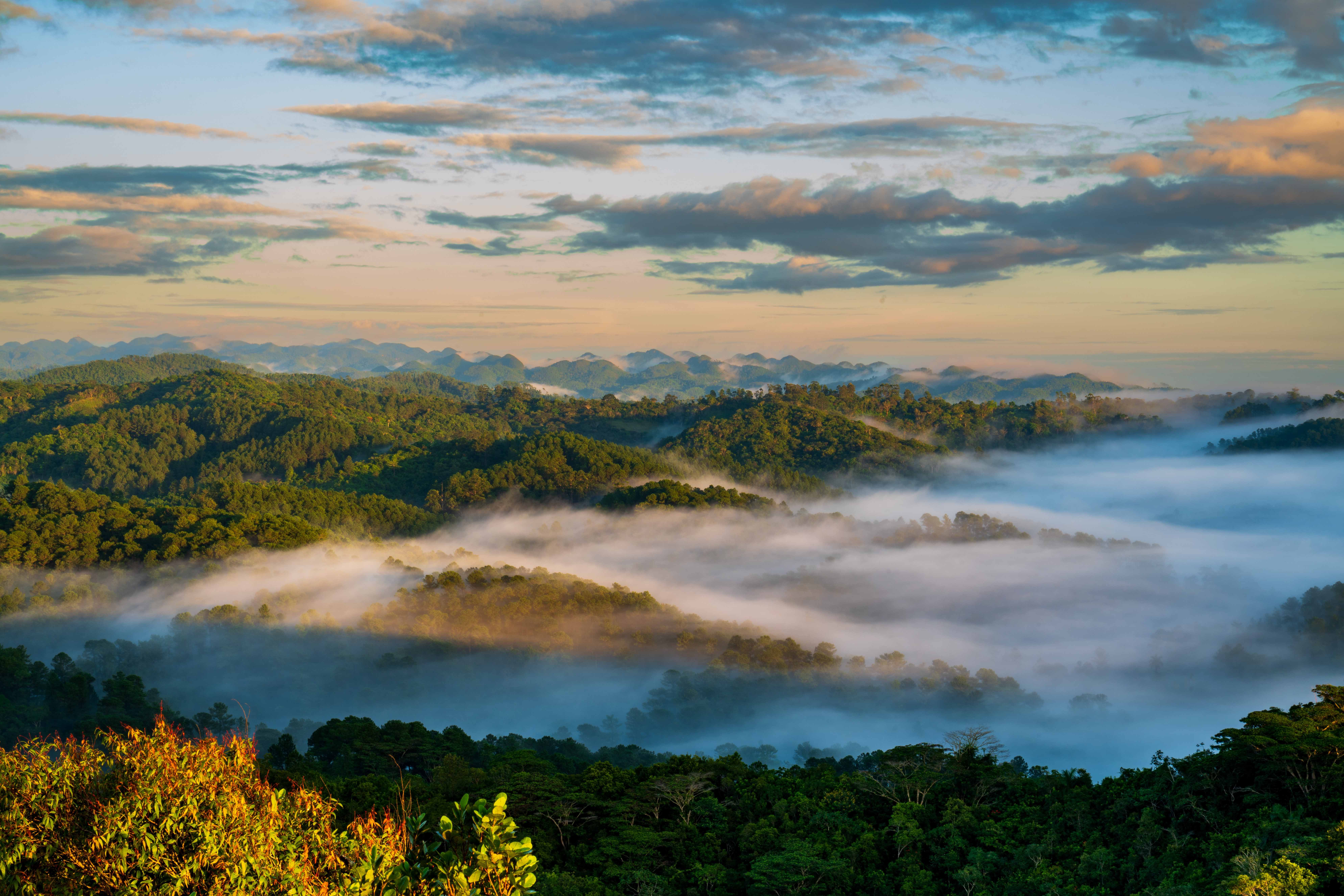
A mountain nature reserve in the Escambray range above Trinidad, Topes de Collantes offers a cooler, greener contrast to Cuba's coastal scenery, with hiking trails leading to waterfalls, natural swimming pools and coffee plantations tucked into the hills.
Caburní Falls is the reserve's best-known hike, a steep trail down to a swimmable waterfall pool, while the area's coffee-growing history adds a working-landscape element beyond pure scenery.
How does it rate
CrowdsRomanceCash RequiredDangerAccessibilityWhy you should go
A cool, green mountain reserve above Trinidad, with waterfall hikes most visitors skip entirely.
Why you shouldn't go
Trail conditions can be rough and poorly signed, making a local guide worthwhile.
Plan your visit
Best time to visitNovember–April, the dry season, for easier trail conditions.Best time of dayMorning start for the Caburní Falls hike, to allow a full day round trip.Getting thereAbout 45 minutes' drive from Trinidad into the Escambray mountains.Entry costSmall reserve entry fee, plus optional guide fees.Time neededFull day.Insider tip — Hire a local guide in Trinidad rather than attempting the Caburní Falls trail solo — signage is minimal and guides know the safer route down. -
 #49
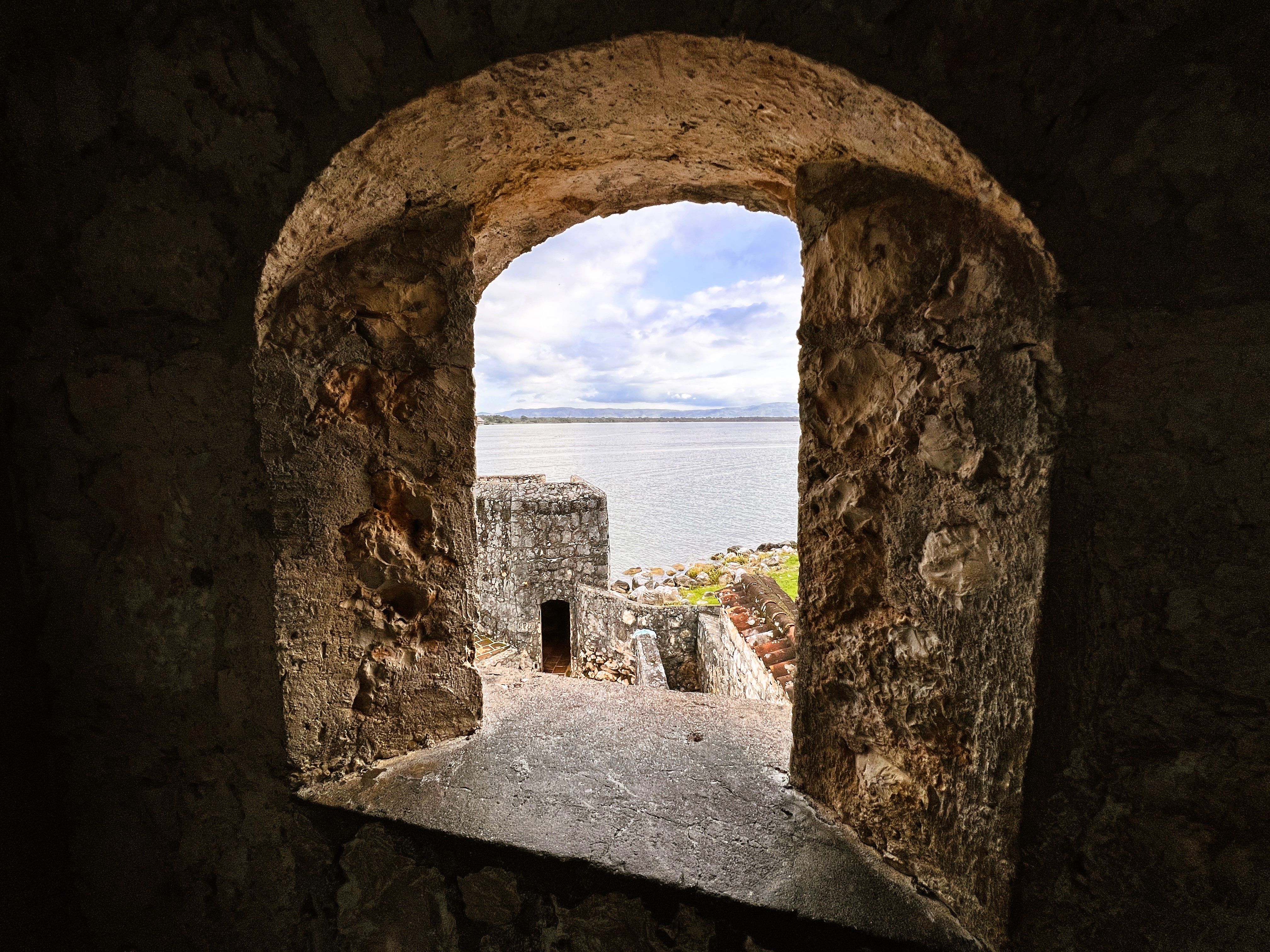
#49Boats gliding along this river between Lake Izabal and the Caribbean pass through a dramatic limestone gorge draped in jungle, hot sulfur springs bubbling right at the waterline, and Castillo de San Felipe, a Spanish colonial fort built to guard against pirates raiding the river route inland.
The mix of jungle scenery, warm-water swimming and colonial history along one boat journey gives it a quieter character than Guatemala's more famous ruins.
How does it rate
CrowdsRomanceCash RequiredDangerAccessibilityWhy you should go
A jungle-walled river gorge with hot springs and a colonial fort, seen almost entirely by boat.
Why you shouldn't go
It's a more diffuse, boat-dependent experience than a single defined sight, best suited to unhurried travelers.
Plan your visit
Best time to visitNovember–April, the dry season, for calmer river conditions.Best time of dayMorning boat departure, for the coolest temperatures and best wildlife spotting along the banks.Getting thereAbout 4-5 hours' drive from Guatemala City to the town of Rio Dulce, then by boat.Entry costBoat tours typically Q100-200 (~€12-24); Castillo de San Felipe entry a small additional fee.Time needed1–2 days.Insider tip — Stop at the hot sulfur springs directly on the riverbank partway through the boat trip — many tours skip it unless you specifically ask.


More from North America
-


More Natural Wonders spots
-
How a score is built
One score out of 100, five criteria behind it
Every place is rated 1–5 on each of the criteria below, then combined into a single score out of 100. It's calculated by us, the same way every time — not an average of traveller reviews or social votes.
Crowds
How many people you'll be sharing it with, and at what time of day.
Romance
How well it suits a couple, a proposal, or a quiet moment together.
Cash required
Entry fees, permits, guides, rentals — what it actually costs to do it.
Danger
Physical risk involved, from a slippery viewpoint to genuine hazard.
Accessibility
How far off the beaten path it is, and how hard it is to actually reach.

